August 28, 2025 Thursday Evening Update
Quiet Atlantic tropics until second week of September
August 2025 was the 28th-warmest August in the 132-year national record (1895–2026), at 73.4°F against a 1991–2020 normal of 73.1°F (+0.3°F).
August 2025 was the 27th-driest August in the 132-year national record (1895–2026), at 2.3in against a 1991–2020 normal of 2.7in (-0.3in).
NOAA/NCEI Climate at a Glance, contiguous United States. This is the observed record for the month, not a score of anything said in this piece — the forecast ledger begins 2026-08-17 and cannot reach earlier posts.

2025 Season to Date: 6 named storms, 1 hurricanes, and 1 majors | ACE = 40 ACE of Erin: 32.2 (140-knots maximum wind)
Thursday Evening Tropical Update
Ensembles with low chance of a TS/hurricane through 10-days but better chances into mid-September
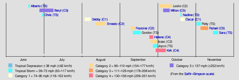
Remember from last year 2024 — the season started off slow but picked up into mid-September with multiple significant hurricanes. Since ocean temperatures are cooler this year, I’d expect “average” rather than above average activity to finish up the season. Timeline from last year with a loaded second half to the season.
Evening Frontal Boundary Chart
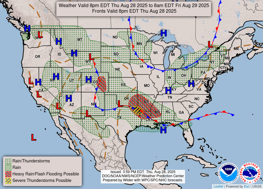
Heaviest rain and storms along a frontal boundary from north Texas into Louisiana as yet another coastal stationary front drapes across the Gulf coast
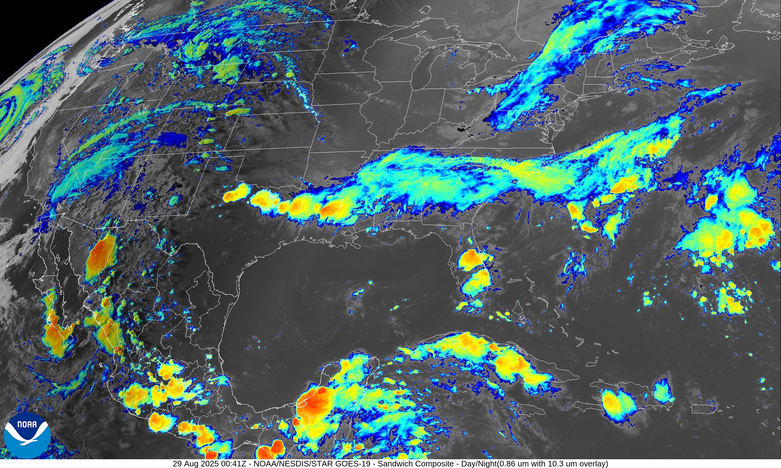
USA Satellite Image
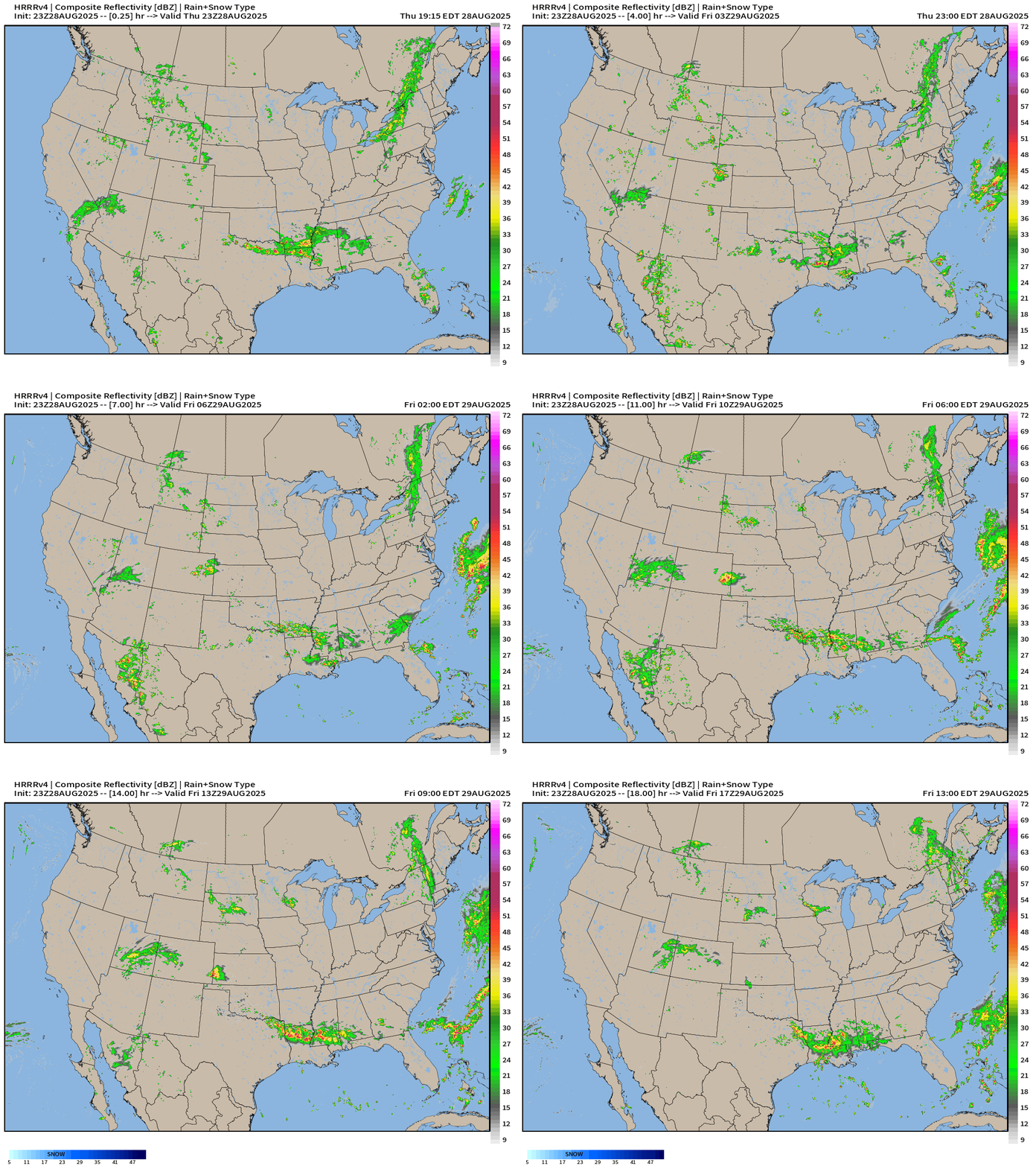
HRRR Simulated Radar Next 18-hours | through 1 PM Friday
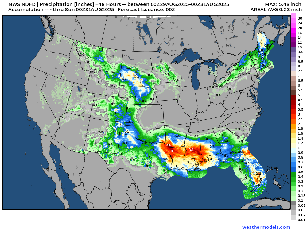
Rainfall Next 48-hours | NWS NDFD
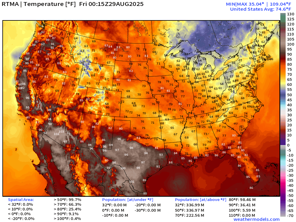
Current Temperatures | 8:15 PM ET | RTMA
Temperature Anomaly | 8:15 PM ET | RTMA
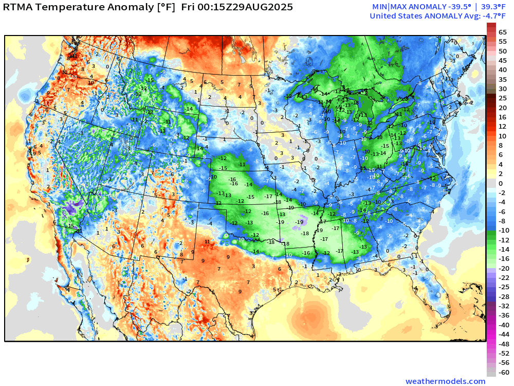
Lower 48 temperature anomaly is -4.7°F below normal
Atlantic Basin | ECMWF 18z | Precipitable Water Next 6-days
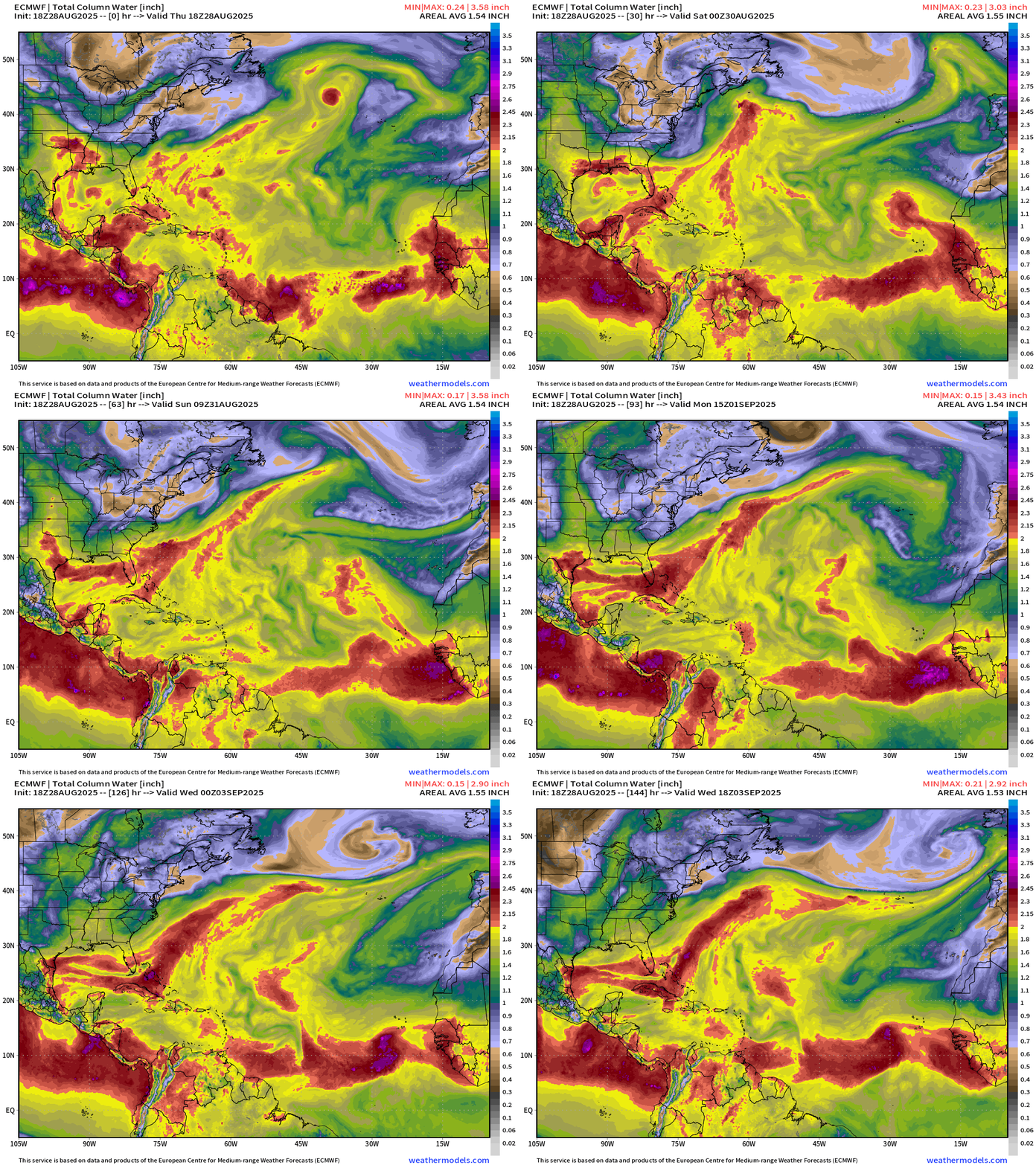
2-inches of PWAT (red color) necessary for tropical convection and development … keeping an eye on the frontal boundary from the Gulf coast to off Florida and Carolinas into the Atlantic.
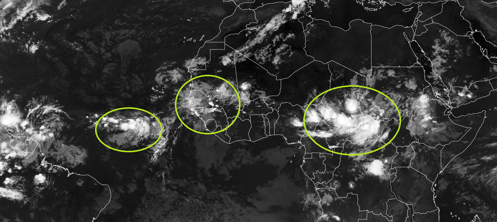
Tropical wave that comes off Africa on Sunday looks more promising in this ECMWF 18z cycle (20% chance from NHC)
Vorticity next 6-days
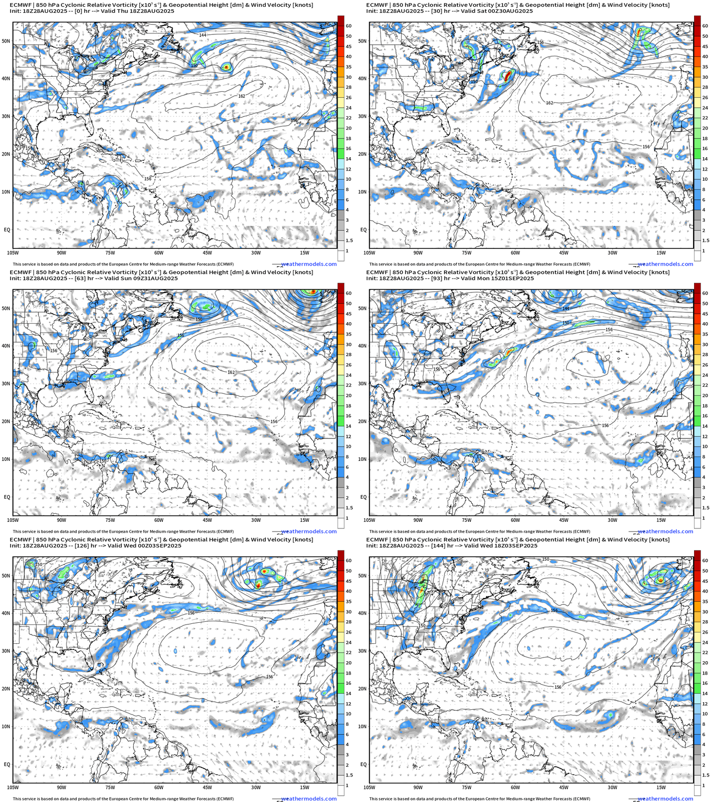
The subtropical high is strong and in charge for the next 6-days = fast moving trade winds and tropical waves. Decent spin with the wave this weekend … we’ll see how it responds to the otherwise hostile background (dry air)
ECMWF AIFS 12z | 500 mb Height Anomaly Next 10-days
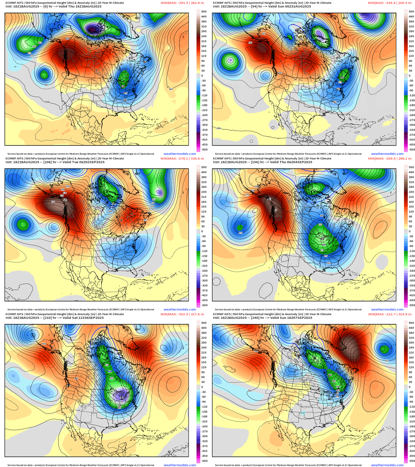
AIFS is consistent in developing a powerful series of troughs into next weekend centered upon the Great Lakes. This is going to get chilly — and as the calendar moves toward Fall — snowy fast … this pattern heading into November would be bullish on cold winter.
Strong ridging moves from western to central Canada — leaving the door wide open for cooler air out of Canada to plunge into the eastern U.S. and it might be staying awhile. Quite the sequence of negative height anomaly (troughs) over the Midwest leading to well below normal temperatures for first 2-weeks of September. Imagine if this pattern was in December of January — it would be brutally cold across the Midwest and Northeast.
Week 1 Temperature Anomaly | ECMWF EPS 12z | Aug 29 - Sep 3
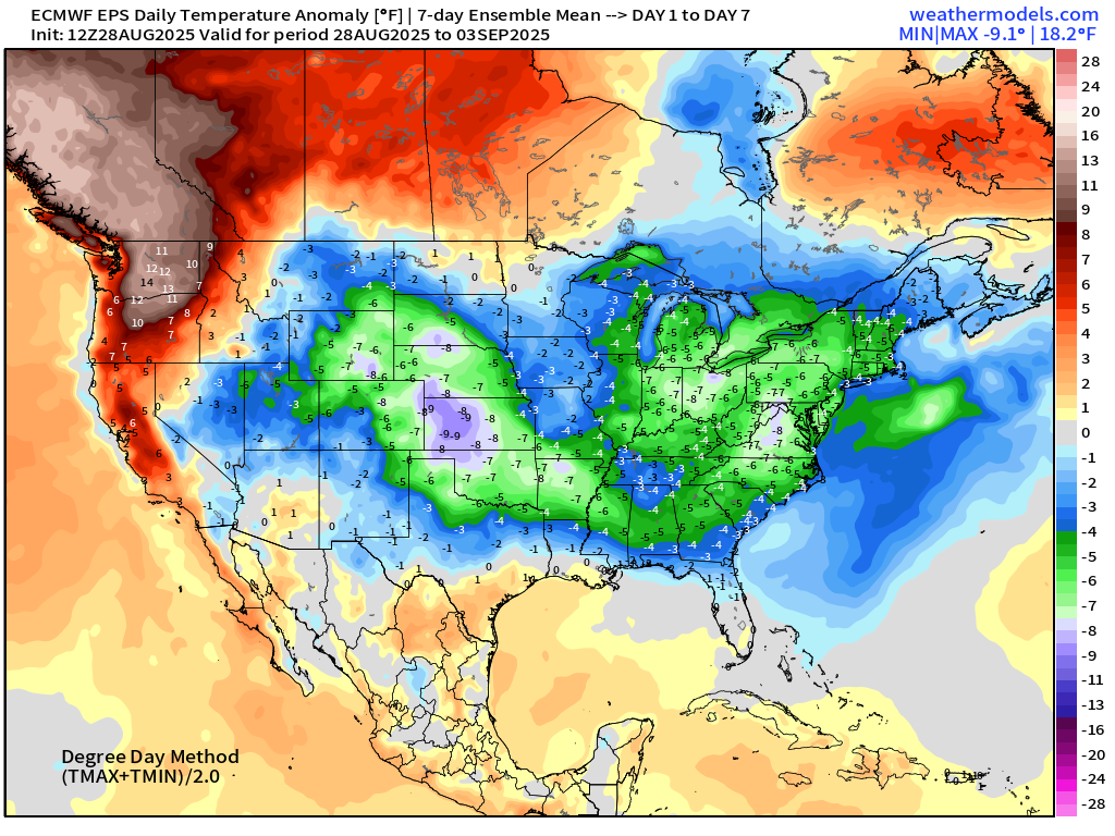
Well below normal temperatures across the central U.S. to Great Lakes and Northeast into final week of August.
Week 2 Temperature Anomaly | ECMWF EPS 12z | Sept 4 - 10
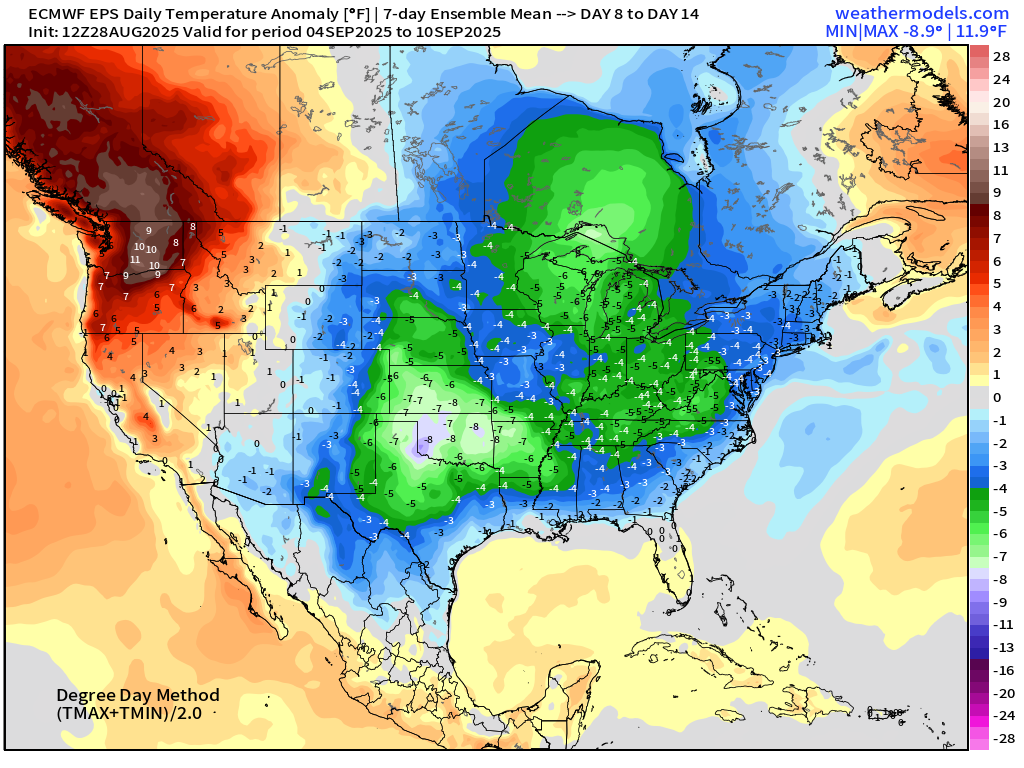
Continued strong signal for much below normal from central U.S. into the Midwest and Great Lakes.
Low Temperatures on Friday
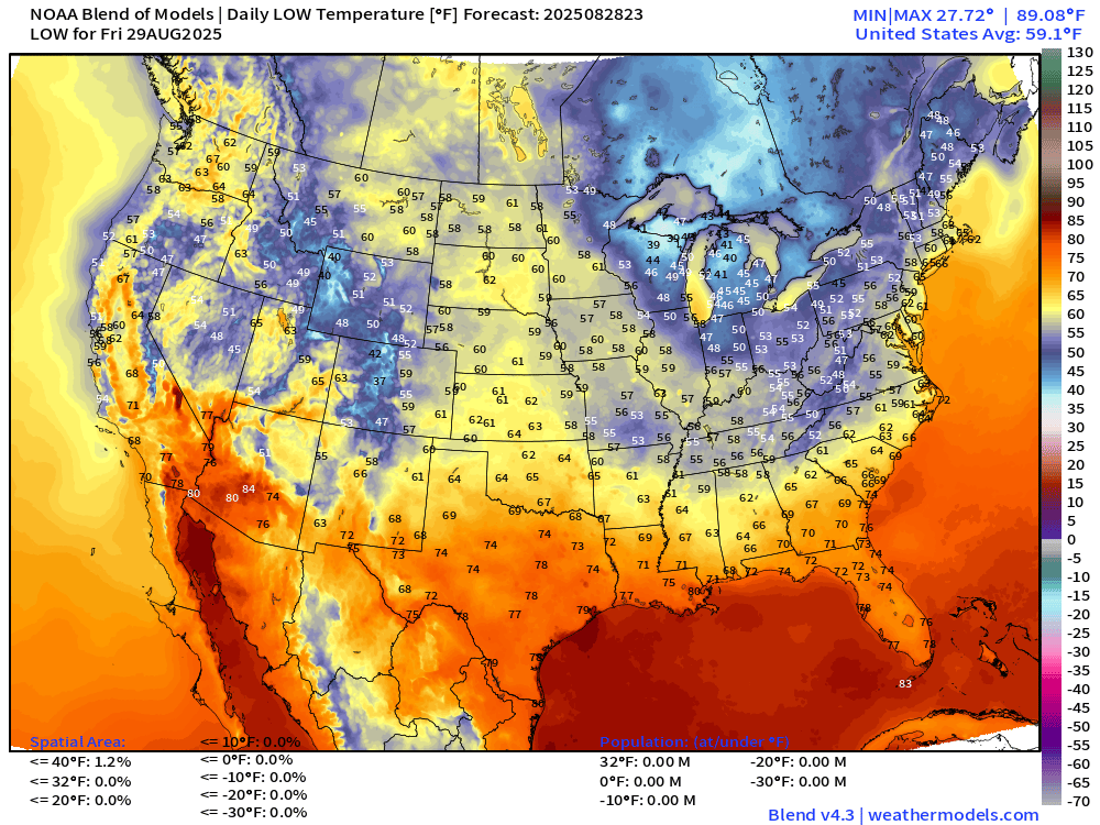
Chilly morning again across the Great Lakes in the 30s! 40s into Indy and Chicago and Detroit. 50s dip into North Georgia.
High Temperatures on Friday
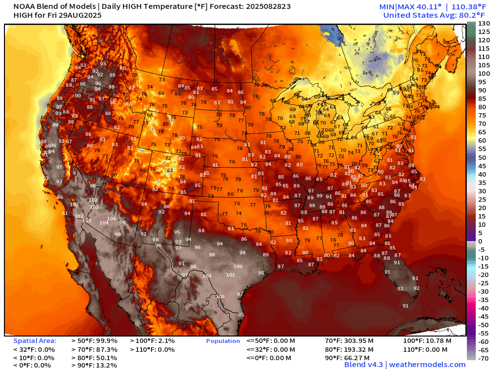
66 million at/above 90°F but only 13% of real estate confined to the Southeast, Washington State, Texas, and Florida.
ECMWF 12-Days Integrated Vapor Transport | 12z cycle
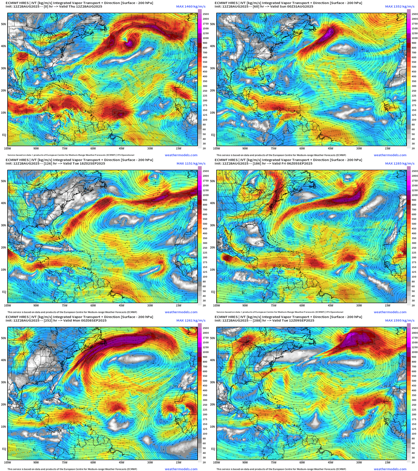
Zooming out to Africa for Days 5-12
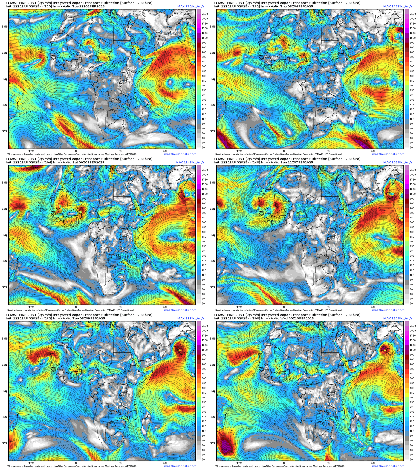
Wave at Day 12 leaves Africa at higher latitude over cool (< 26°C) water … poof!
African Easterly Waves develop and emerge out of Ethiopia and head westward through Nigeria and reach the coast in 5-6 days. Many are vigorous over-land circulations with closed lows similar to a MCS that you may see in the U.S. Midwest.
The predictability of wave exit off Africa is low especially after Day 7 — so plenty of variety from cycle to cycle on the latitude and intensity of African Easterly Waves as they reach the Atlantic.
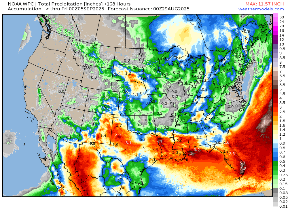
NOAA WPC Precipitation Next 7-days
Atlantic Basin Outlook | 8 PM ET Update
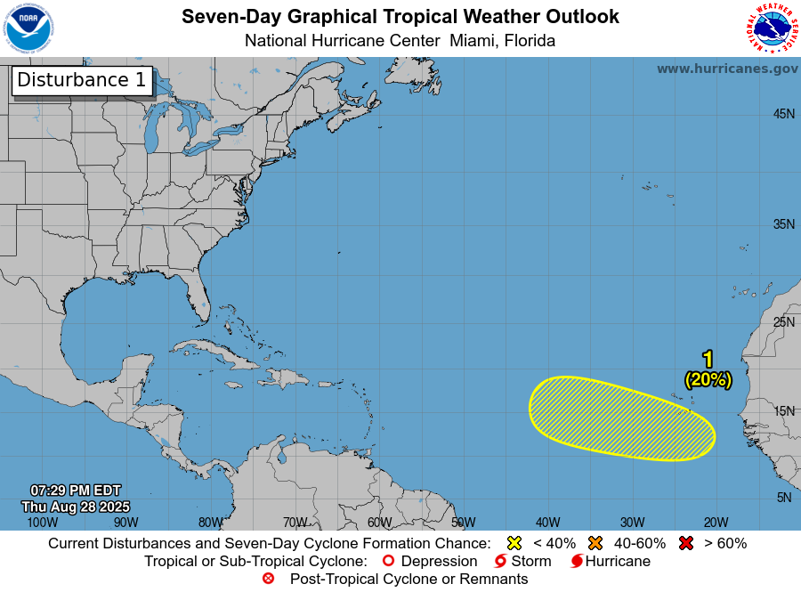
NHC watching the wave over Africa to emerge this Sunday … 20% chance once it gets over the Atlantic.
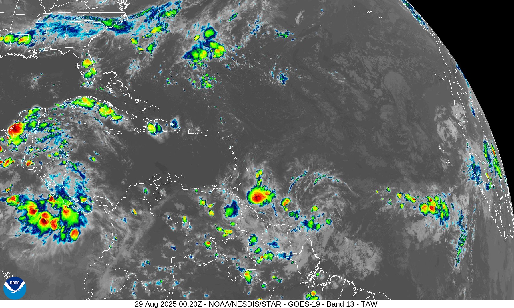
Atlantic Satellite Imagery | Infrared
ECMWF SST and Anomaly
Snapshot SST and Anomaly from ECMWF 12z shows a LOT of blue and green (and purple) across the entire western Atlantic from Bahamas to off Newfoundland. Of course, it’s the actual SST that matters — but I see 25°C instead of 29.5°C so that’s a lot of “fuel” removed from the ocean surface for future storms. The ocean may not recover to pre-Erin heat content near the surface (top 50 meters).
NOAA Tropical Surface Analysis | 12z
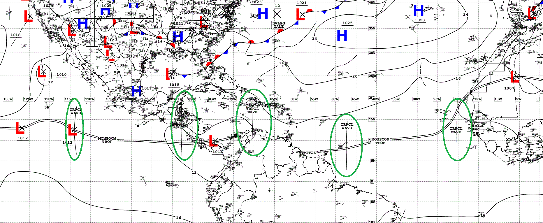
Atlantic Tropical Waves = 4
Eastern Atlantic Visible Satellite
ECMWF EPS 18z Ensemble | Active Cyclone Tracks Through 6-days
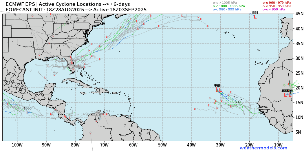
Ensembles picking up on near coastal action from Gulf to off Southeast U.S. coast with frontal boundary
ECMWF EPS 12z Ensemble | Active Cyclone Tracks Through 10-days
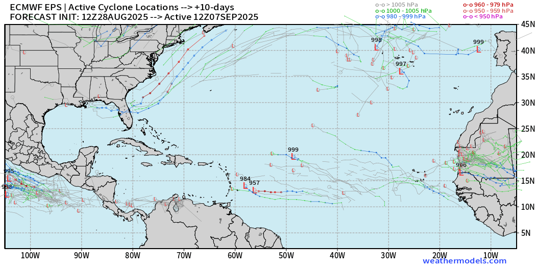
A few waves develop but low chance (10%)
ECMWF EPS 12z Ensemble | Active Cyclone Tracks Through 15-days
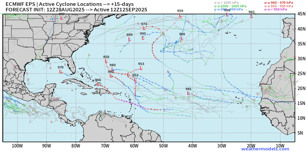
A few more waves showing up with TS/H all over the place — 20% to 30%.
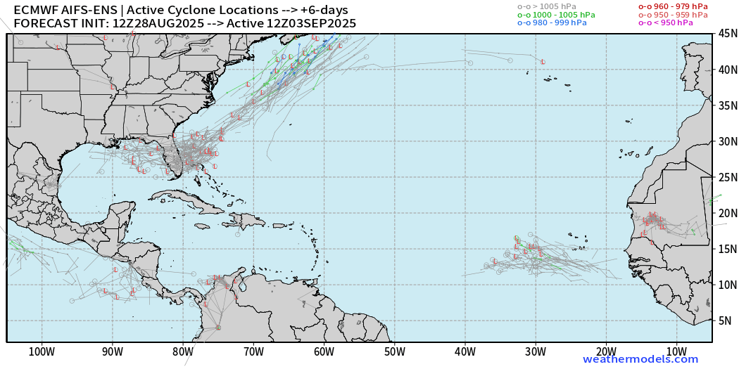
ECMWF AIFS-Ensemble | A.I. Trained 12Z | Active Tracks at Day 6
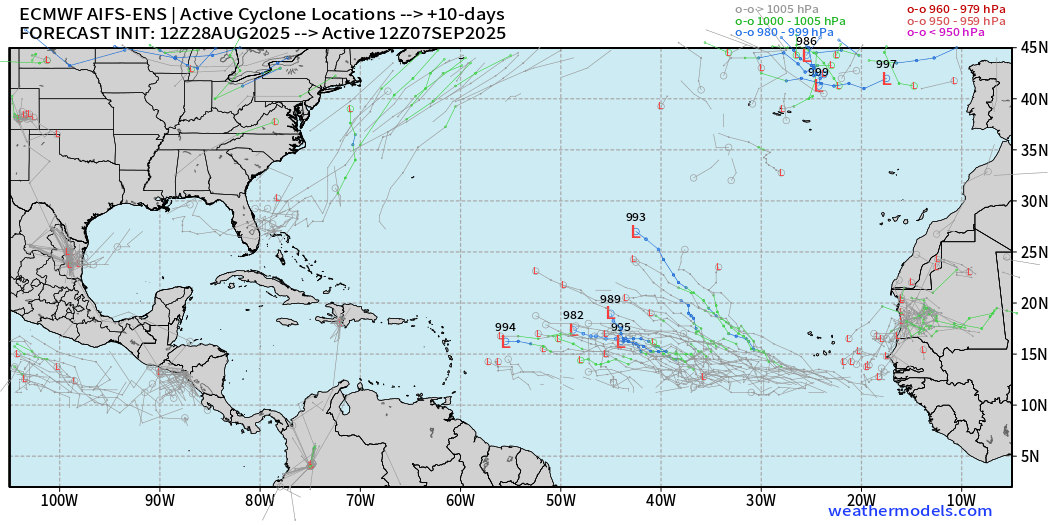
ECMWF AIFS-Ensemble | A.I. Trained 12Z | Active Tracks at Day 10
ECMWF AIFS-Ensemble | A.I. Trained 12Z | Active Tracks at Day 15
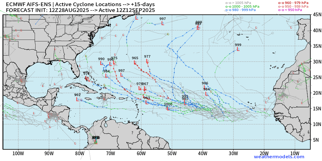
We will wait until the 10-15 day range for our next burst of “potential” storm activity in the tropical Atlantic.
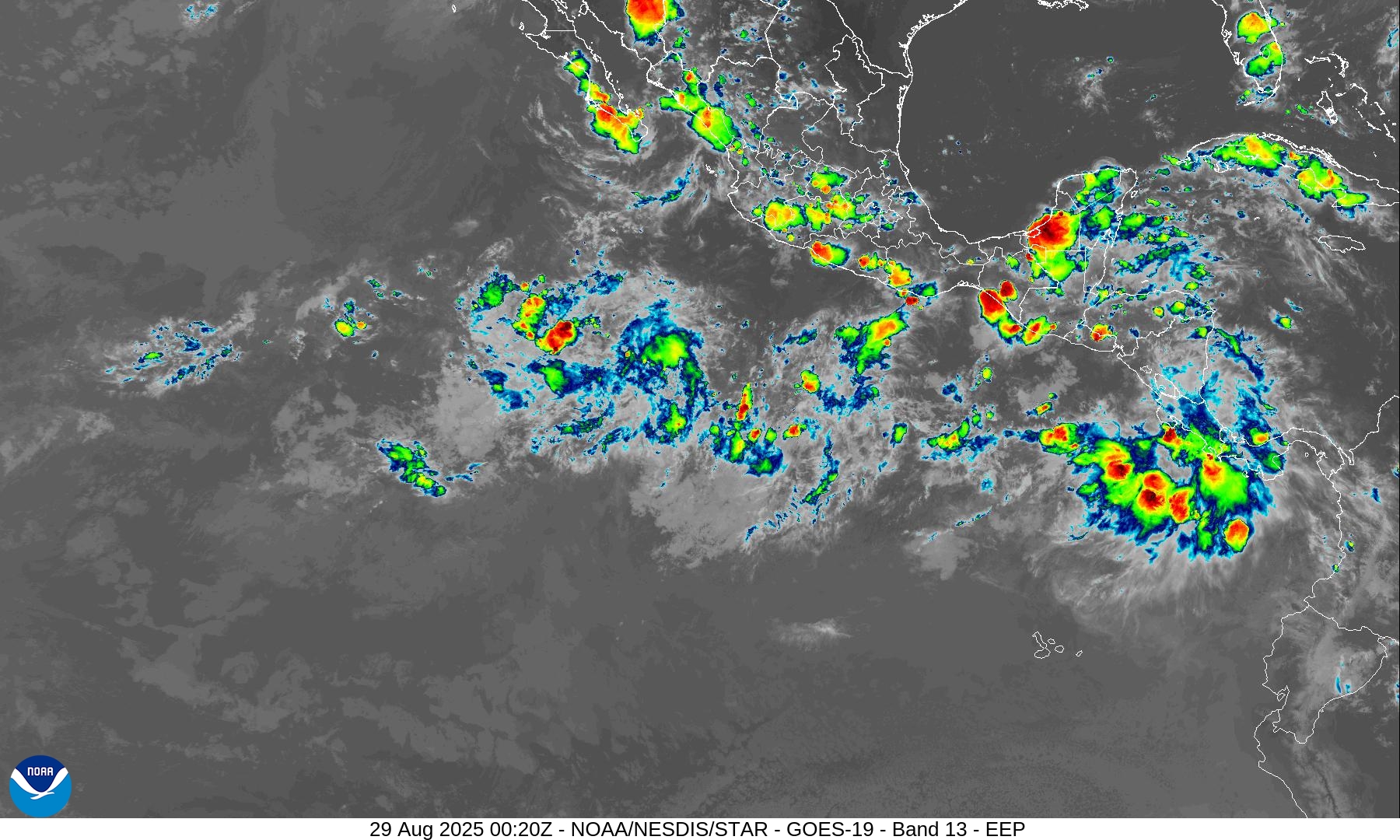
Eastern Pacific Tropical Update
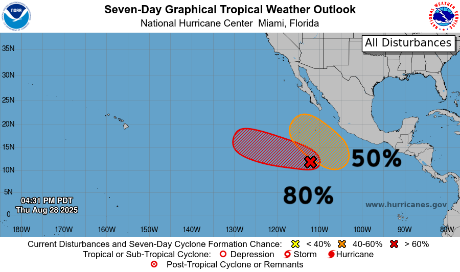
Area of disturbed weather south of Mexico with 80% chance of development — but the IR satellite does not look impressive.
Western Pacific Tropical Update
Tropical Depression 20W named — will head into Vietnam in next 36-hours.
Maps sourced from weathermodels.com designed and innovated by yours truly! Please subscribe there for real-time access to the newest maps, charts from all of the weather models including ECMWF.
- Milepost
- 717 · laid 2025-08-29T01:14:39.835000Z
- Source
- https://weather.substack.com/p/august-28-2025-thursday-evening-update
- Digest
- 51d28f4f05fac8ba0cfffbef45ae5af5c08d5f7cb5bb35199b0f00e7d12f2557
- Machine
- JSON