August 25, 2025 Monday Weather Update
Taste of early fall for eastern US while tropics go quiet
August 2025 was the 28th-warmest August in the 132-year national record (1895–2026), at 73.4°F against a 1991–2020 normal of 73.1°F (+0.3°F).
August 2025 was the 27th-driest August in the 132-year national record (1895–2026), at 2.3in against a 1991–2020 normal of 2.7in (-0.3in).
NOAA/NCEI Climate at a Glance, contiguous United States. This is the observed record for the month, not a score of anything said in this piece — the forecast ledger begins 2026-08-17 and cannot reach earlier posts.

2025 Season to Date: 6 named storms, 1 hurricanes, and 1 majors | ACE = 38 ACE of Erin: 32.2 (140-knots maximum wind)
Monday Morning Tropical Update
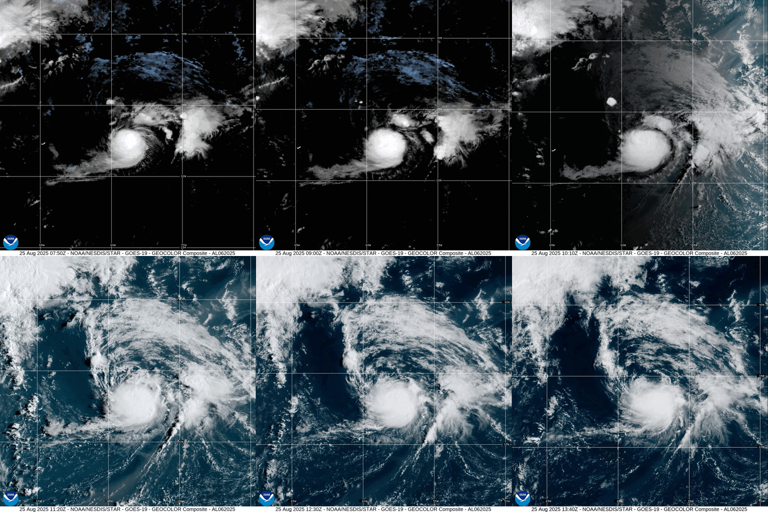
Tropical Storm Fernand (06L) remains poorly organized but has a burst of convection against vertical wind shear.
Ensembles remain largely quiet through 2-weeks but we will watch for anything unusual to pop up
Moisture in the Southwest associated with the monsoon will fire afternoon thunderstorms.
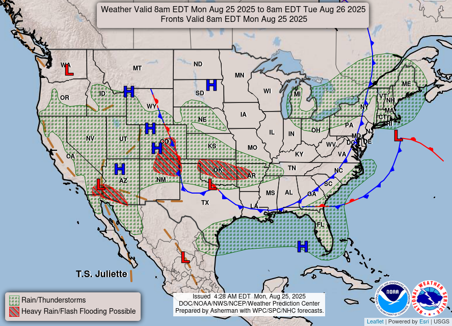
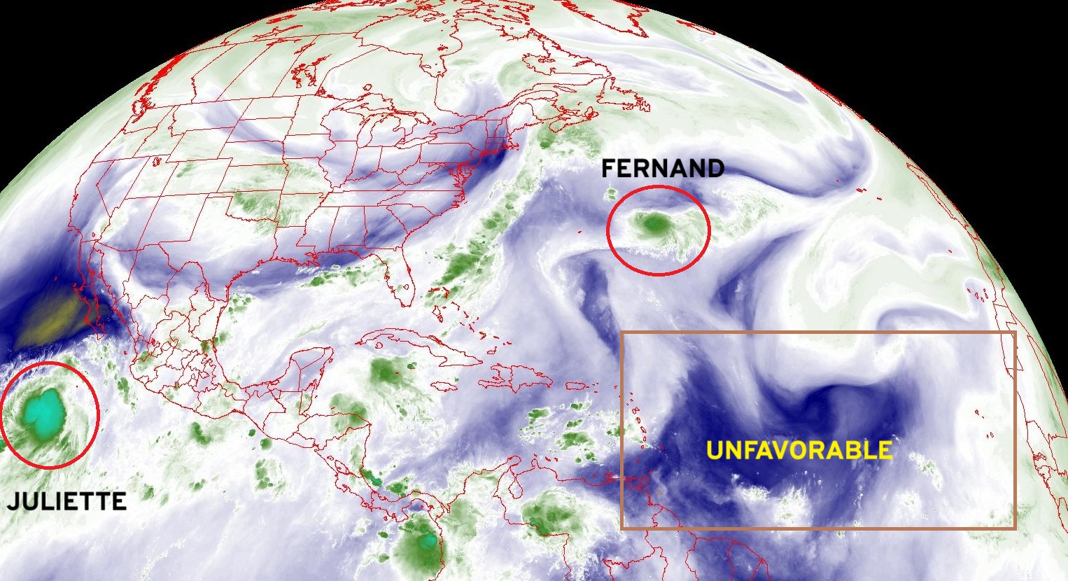
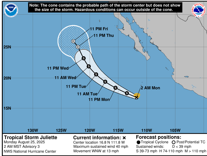
Highly unfavorable conditions in the Main Development Region (MDR) with dust, wind shear, and dry air shutting down the tropical waves. Tropical Storm Fernand is well outside the tropics and may find a brief window of low wind shear to intensify to near hurricane strength. Tropical Storm Juliette finally developed in the Eastern Pacific after several weeks of inactivity.
USA Satellite Image
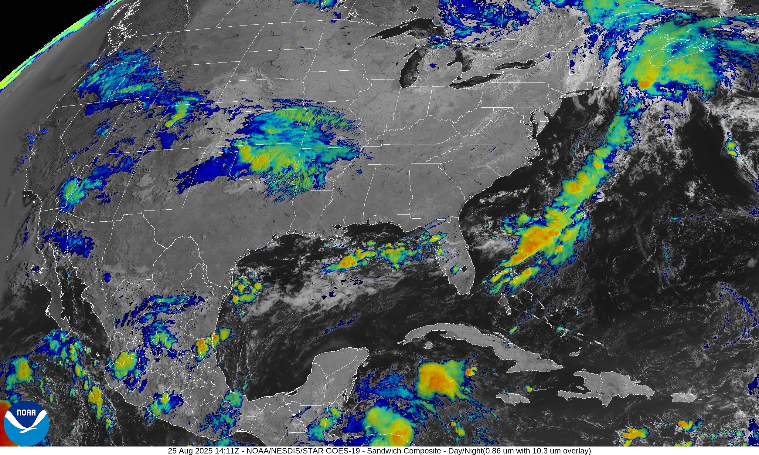
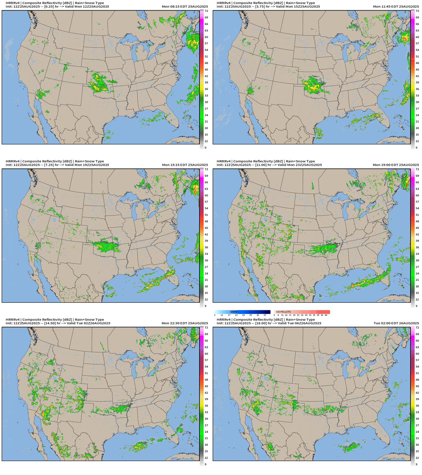
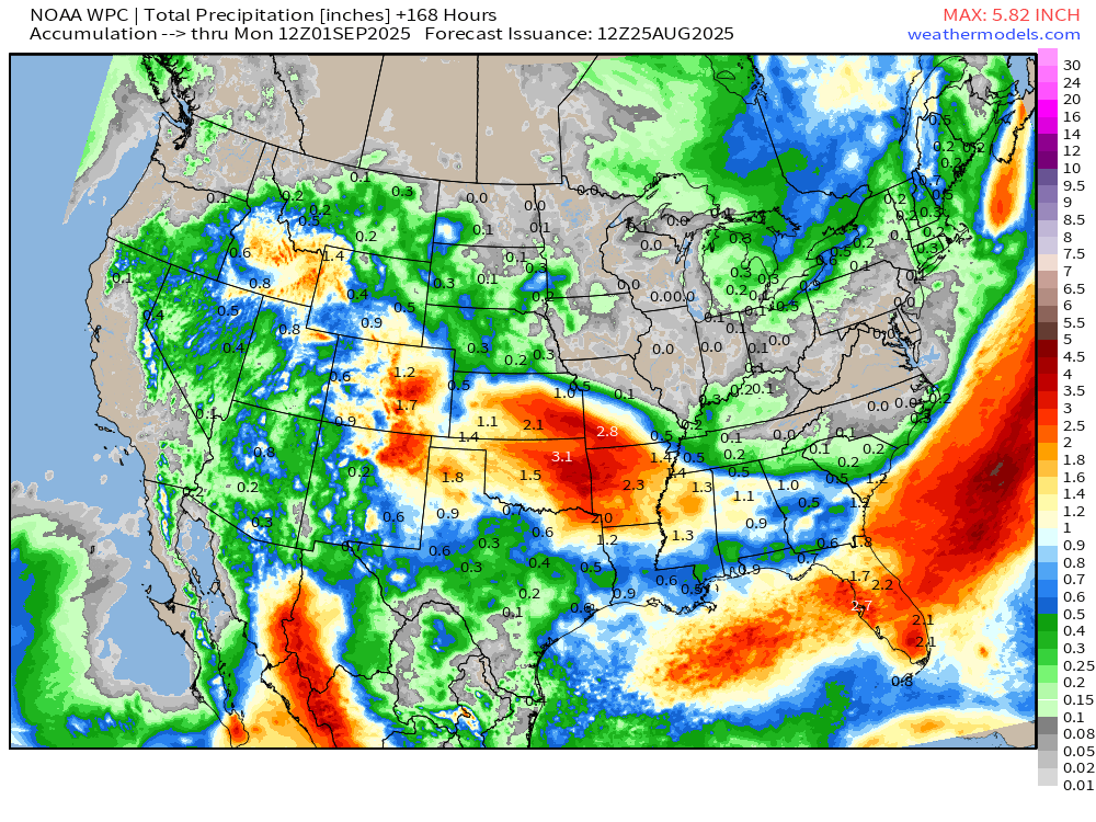
Rain showers in Kansas and Oklahoma will drift ESE and fade into the continental dry air spreading across the eastern U.S. from Canada.
Simulated Radar through Tuesday 2 AM ET
Monsoon showers could be quite heavy across the desert Southwest including Yuma, Las Vegas, and Phoenix.
ECMWF 06z | Precipitation Type and MSLP next 6-days
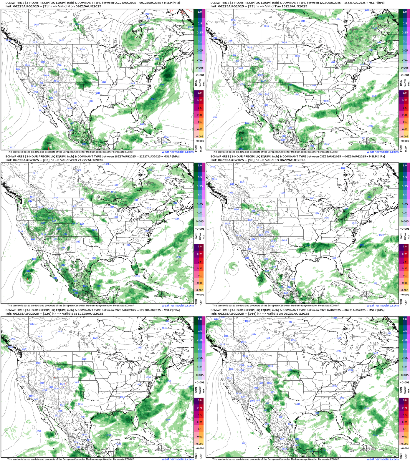
Generally northwesterly flow out of Canada will sweep multiple fronts through the eastern U.S. and bring bouts of showers as a rather cool “early fall” weather pattern takes hold this week.
Polar Vortex | Tropopause Potential Temperature next 6-days
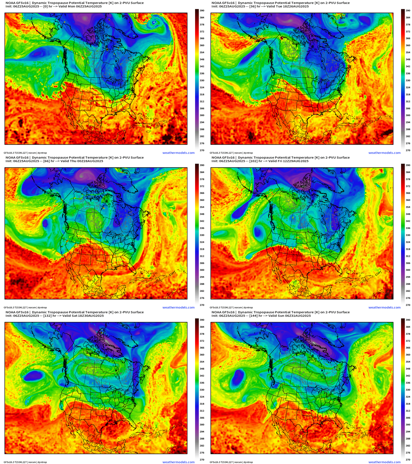
Blue = cool “polar vortex” influenced air breaks off into the Great Lakes and Northeast intermittently mixed with Pacific “warm sector” air from storm systems forced to go up and over the ridge stuck over Western Canada. Cool pattern!
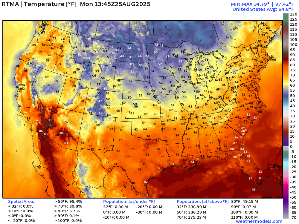
Current Temperatures | 9:45 AM ET | RTMA
Temperature Anomaly | 9:45 AM ET | RTMA
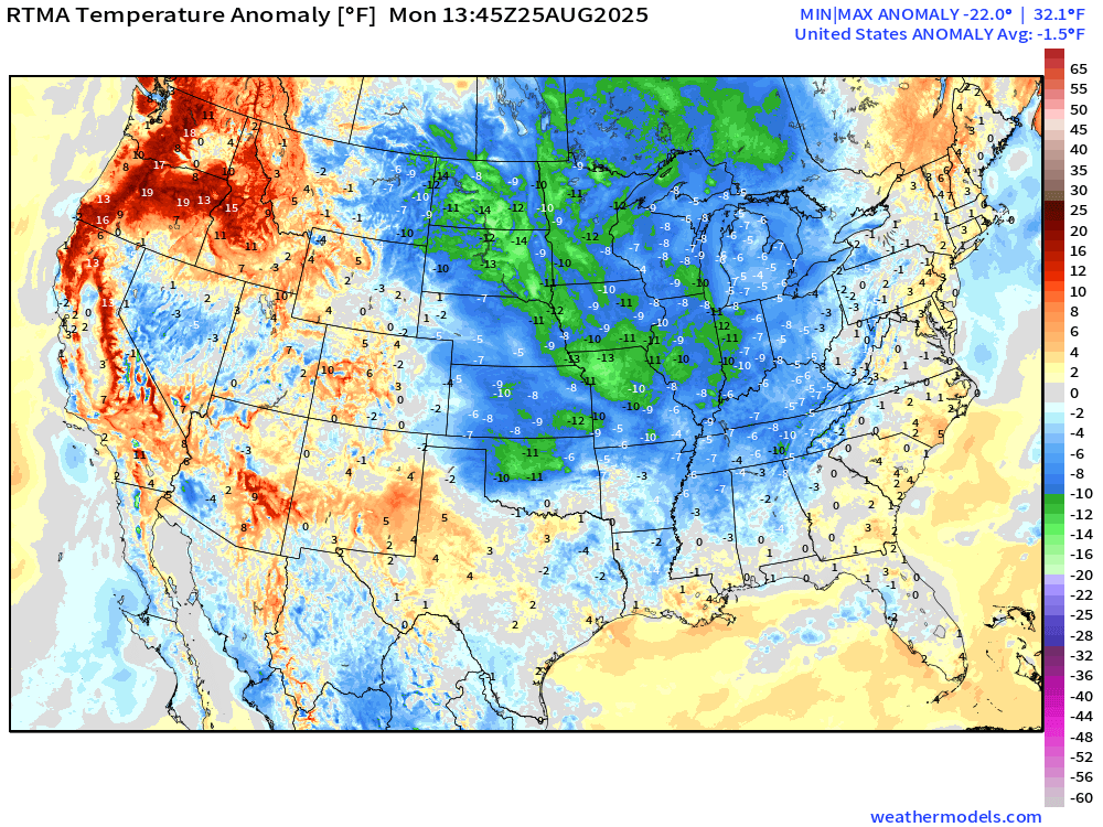
Lower 48 temperature anomaly is -1.5°F below normal
Atlantic Basin | ECMWF 06z | Precipitable Water Next 6-days
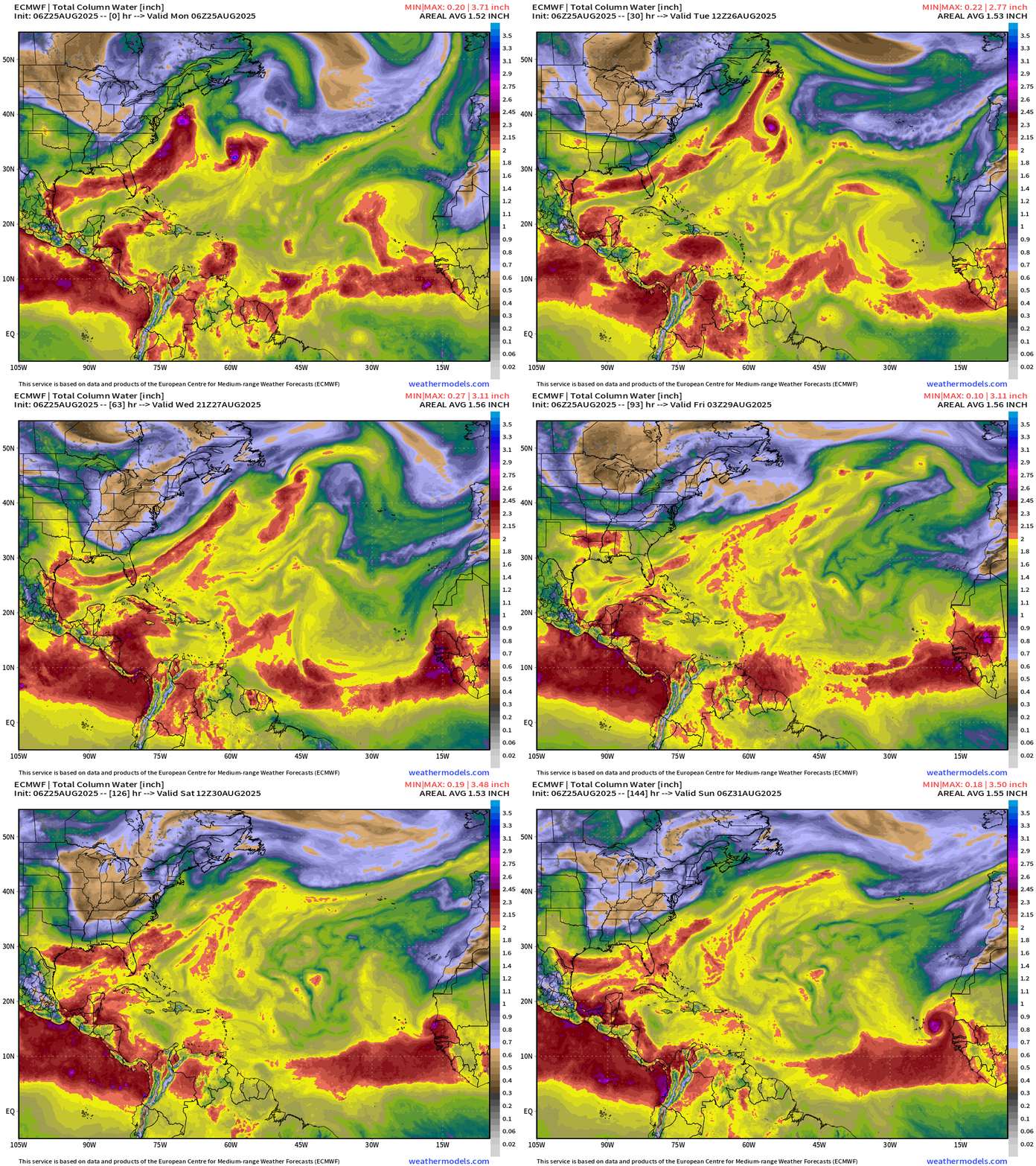
Tropical Storm Fernand merges with a midlatitude frontal boundary in 2-3 days well in the north Atlantic.
Interesting tropical wave comes off Africa this weekend but at a high latitude over cooler water likely will limit intensification. The rest of the Atlantic is shut down until further notice.
ECMWF AIFS 06z | 500 mb Height Anomaly Next 10-days
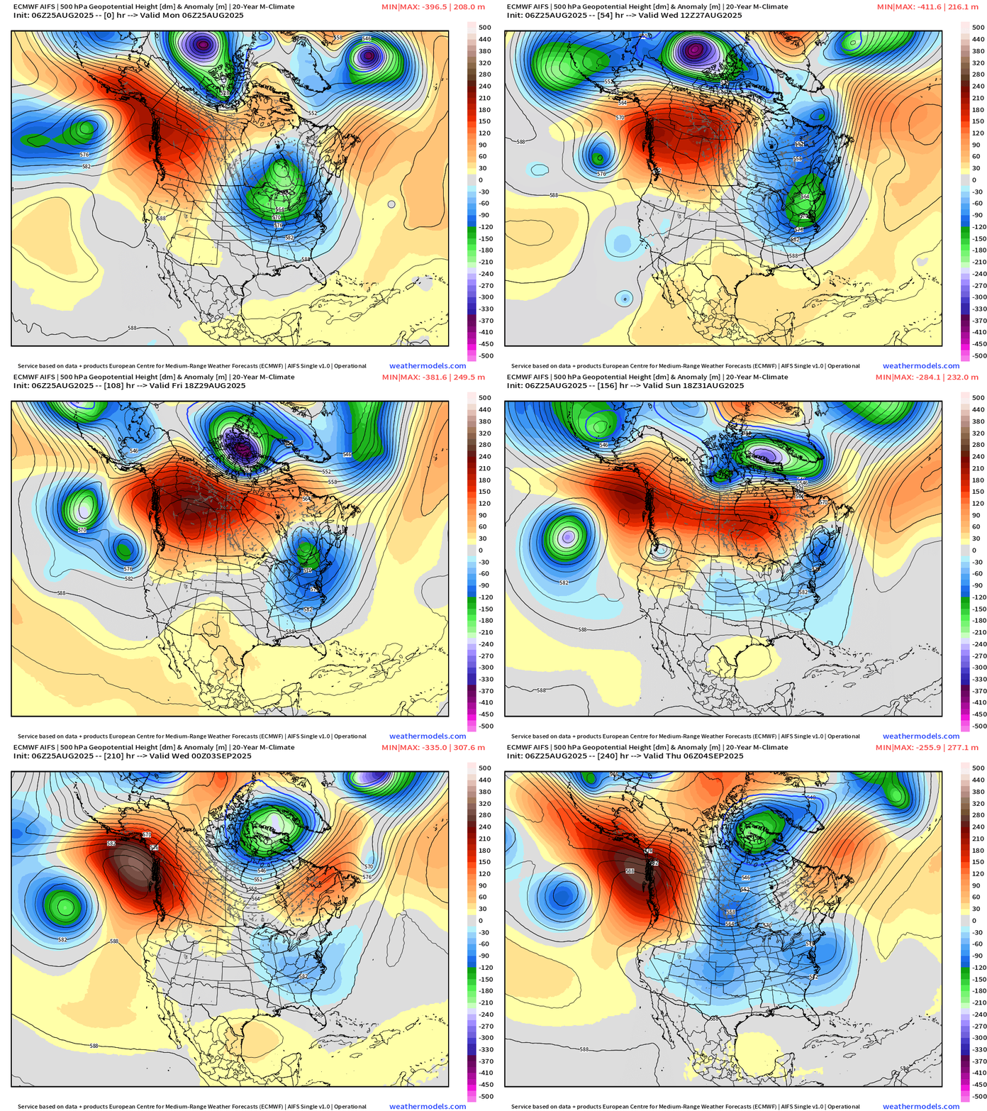
Here come the troughs!
Strong ridging moves from western to central Canada — leaving the door wide open for cooler air out of Canada to plunge into the eastern U.S. and it might be staying awhile. This might be it for summer — meaning no more 90s for many locations.
Week 1 Temperature Anomaly | ECMWF EPS 12z | Aug 25 - 31
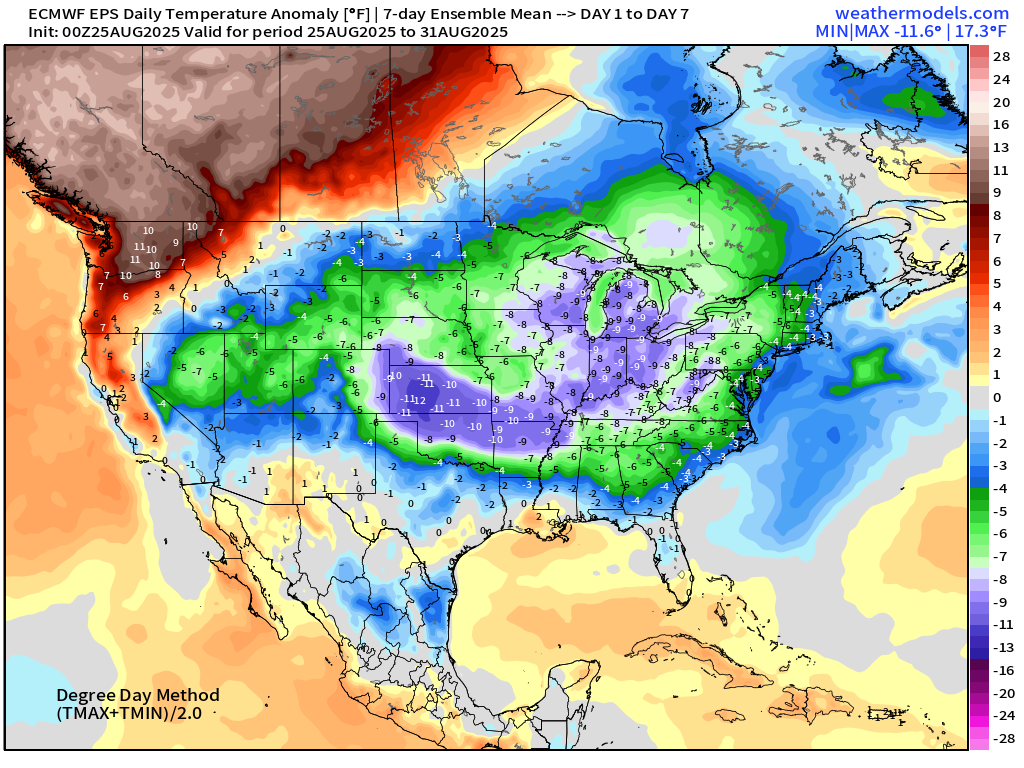
Well below normal temperatures across the central U.S. into final week of August.
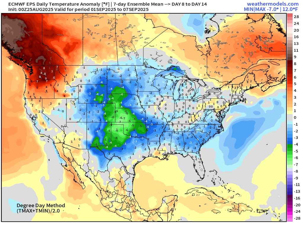
Week 2 Temperature Anomaly | ECMWF EPS 12z | Sept 01 - 07
High Temperatures on Monday
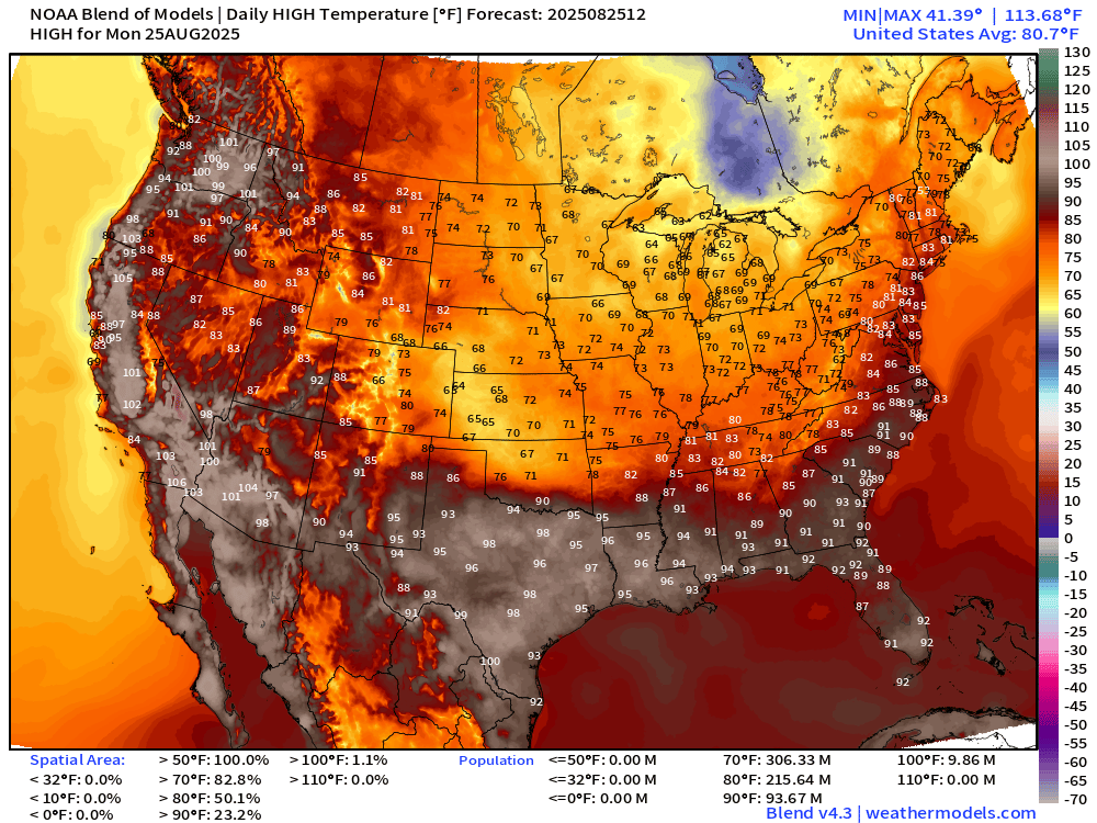
94 million at/above 90°F — and that number will be heading downward day after day into September. Only in the 60s and 70s across the central Plains including Kansas and Oklahoma under clouds and rain.
High Temperature Anomaly Monday
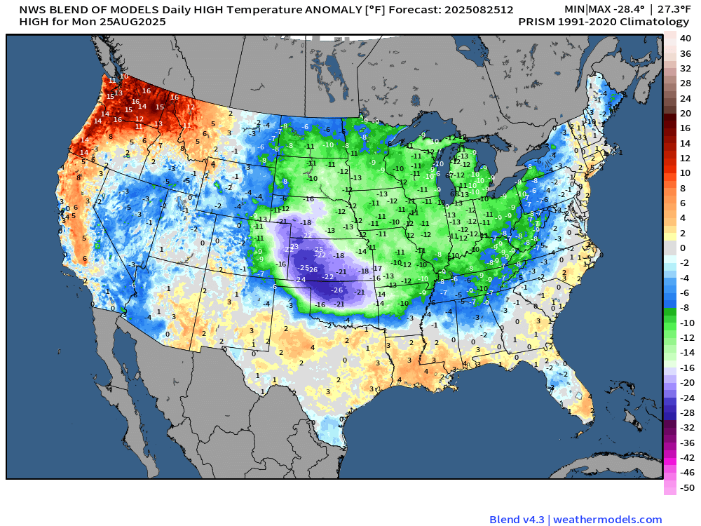
Highs 20°F to 25°F below normal in the plains … and 13°F below normal from Kanasa City and Omaha to Milwaukee, Chicago, and Detroit.
Low Temperatures on Tuesday
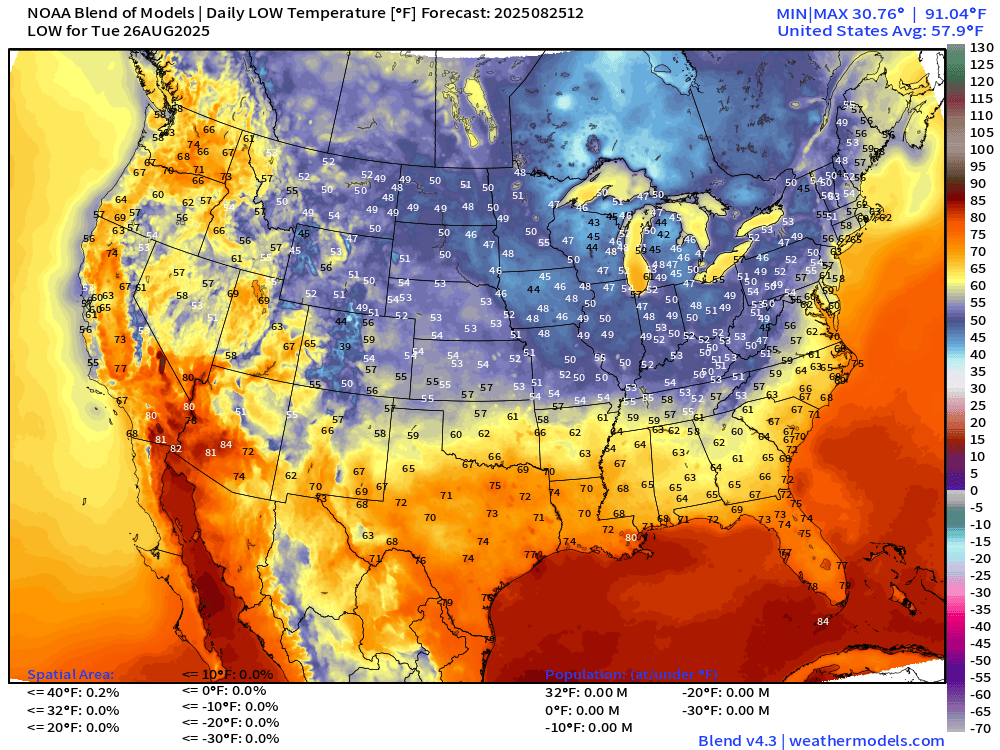
40s popping up in the Great Lakes — chilly! 50s into Nashville, and lower 60s to central Georgia. Very nice!
High Temperatures on Tuesday
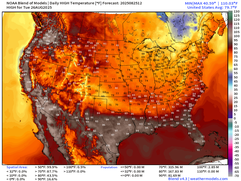
Only 82 million at/above 90°F — heading downward. Aside from some abnormal heat in the Western U.S. we’re quite comfortable for vast majority of the Lower 48.
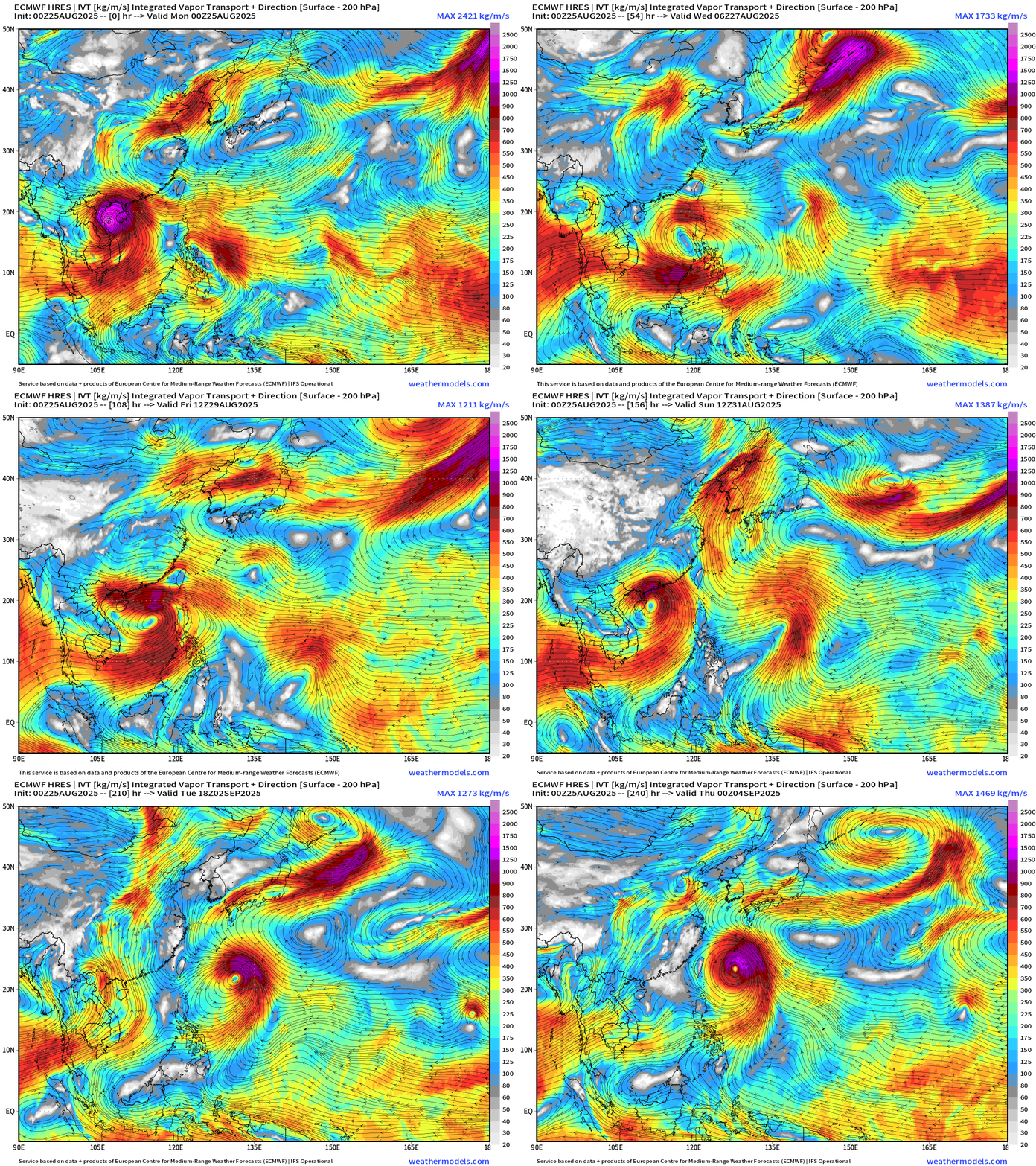
ECMWF 10-Days Integrated Vapor Transport | 00z cycle
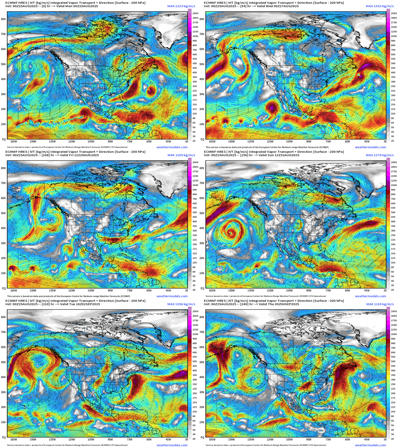
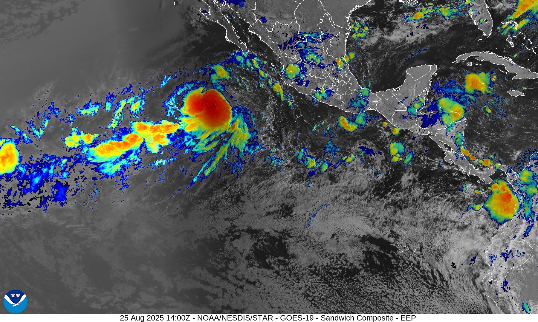
A bunch of little circulations in the monsoon trough / ITCZ along the central Pacific equator around 15°N — pretty cool. Only Juliette (10E) seems to have found the right location for development into a Tropical Storm.
Gulf, Caribbean and MDR of Atlantic is shut down — through September 4th.
NOAA WPC Precipitation Next 7-days
Atlantic Basin Outlook | 8 PM ET Update
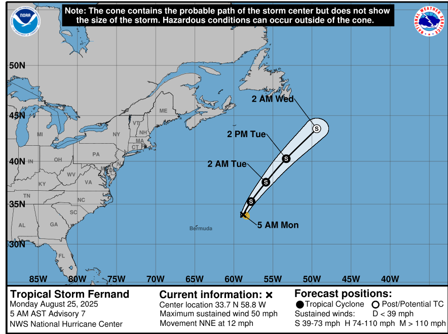
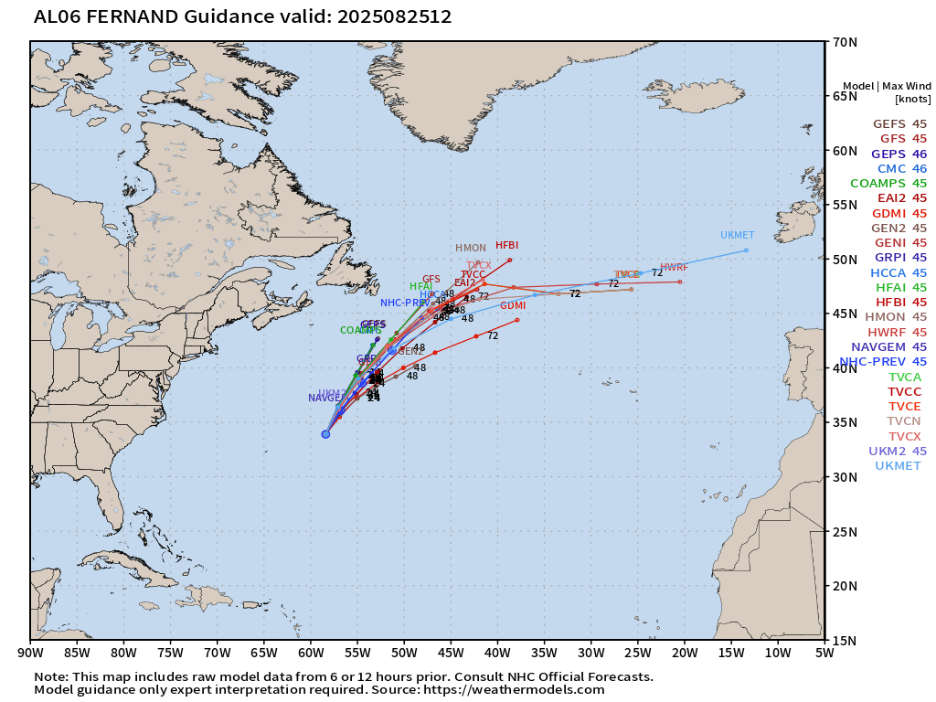
Tropical Storm Fernand (06L) — 50 mph
Outside chance it could become a hurricane in 48-hours before beginning the process of merging with the middle latitudes frontal boundary.
Fernand is battling wind shear but has a nice sustained blob of convection.
Fernand will become post-tropical by early Wednesday
ATCF Spaghetti |12z Interpolated Models
Atlantic Satellite Imagery | GeoColor and Infrared
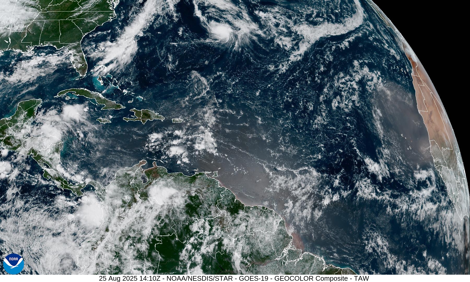
Dust coming off coast of NW Africa into the Atlantic — contributing to the negative environment. Also, we need to consider the impacts of massive Hurricane Erin on the tropical atmosphere — it will take 2-3 weeks to recover the moisture and overcome subsidence.
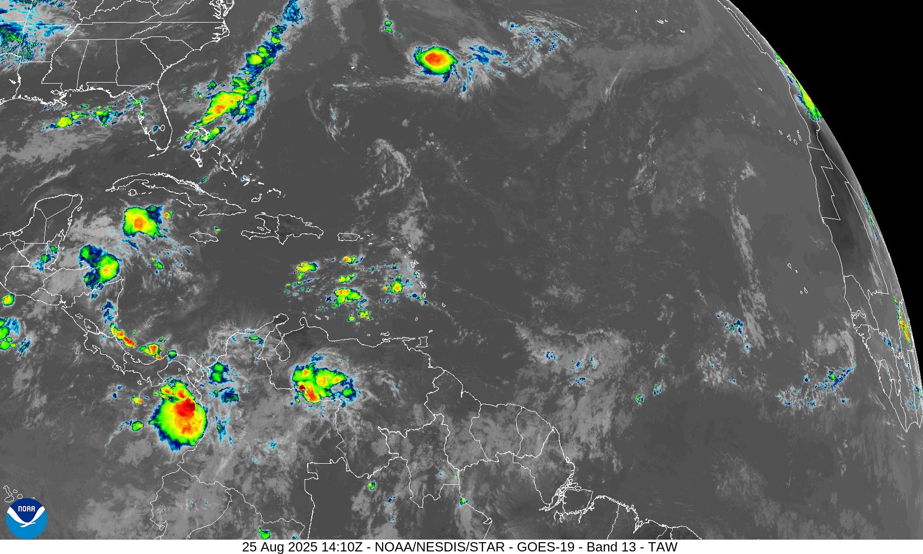
Invest 99L entered the Caribbean and went “poof” as the vertical wind shear shredder wiped out most convection.
NASA GEOS-5 00z | 8-day Dust
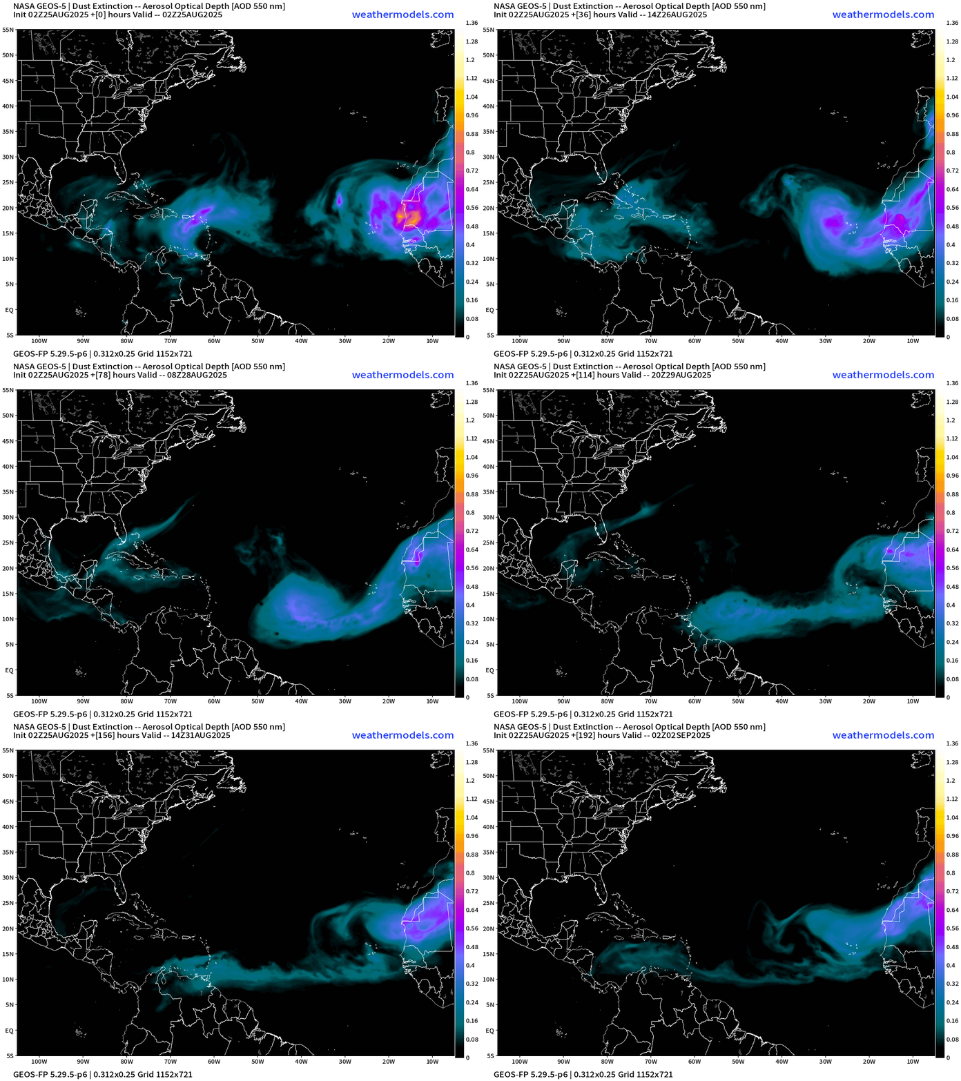
High prevalence of dust is unusual for late August — we should largely be done with strong plumes.
ECMWF SST and Anomaly
3-Day SST change over Western Atlantic is substantial — cooling from Erin … wiping out the highest SST warm pool through mixing from below.
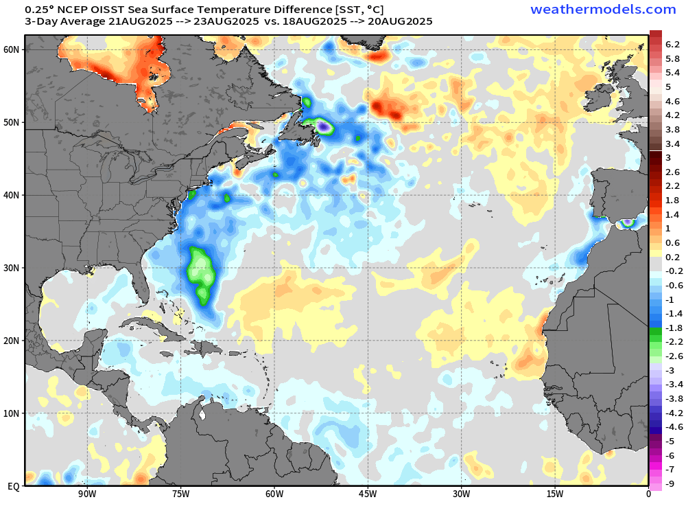
Snapshot SST and Anomaly from ECMWF 00z shows a LOT of blue and green across the entire western Atlantic from Bahamas to off Newfoundland. Of course, it’s the actual SST that matters — but I see 27°C instead of 29.5°C so that’s a lot of “fuel” removed from the ocean surface for future storms. The ocean may not recover to pre-Erin heat content near the surface (top 50 meters).
NOAA Tropical Surface Analysis | 06z
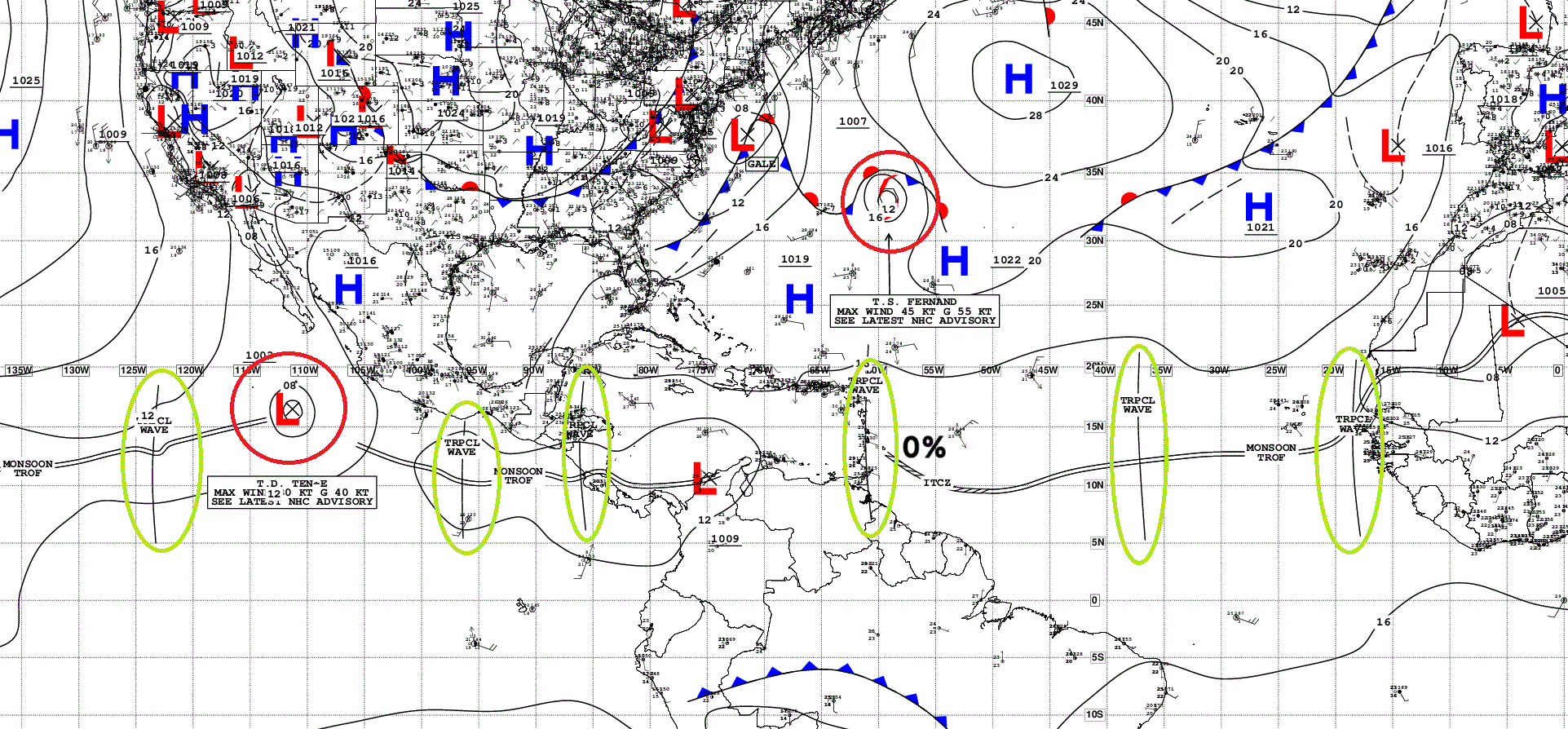
Atlantic Tropical Waves = 4 but none showing sustained or organized convection.
Eastern Atlantic Visible Satellite
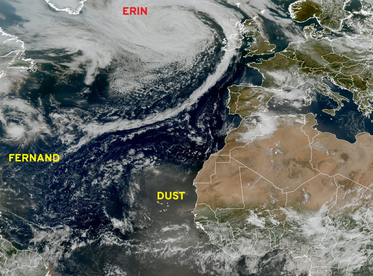
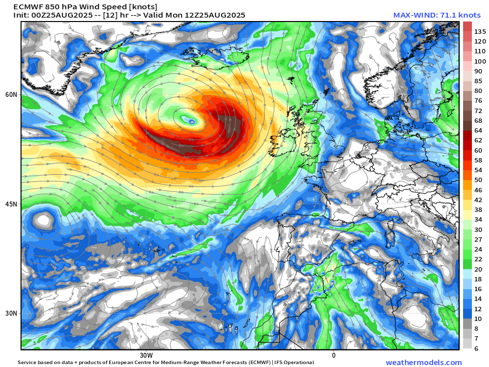
Monster post-tropical Erin is sending a frontal band through Ireland as the main “warm seclusion” cyclone hangs back south of Iceland. It regained “hurricane force” winds but is now occluded and decaying (slowly).
ECMWF EPS 00z Ensemble Cyclone Tracks Through 15-days
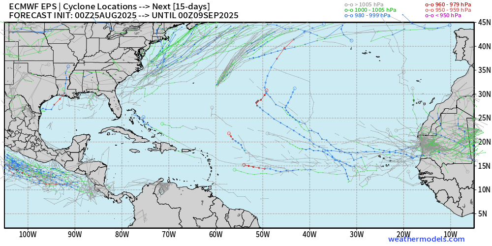
Might be some activity (10%) coming off Africa that develops in 12-14 days — so into the second week of September.
ECMWF AIFS-Ensemble | A.I. Trained 06Z | All Tracks at 12 and 15 days
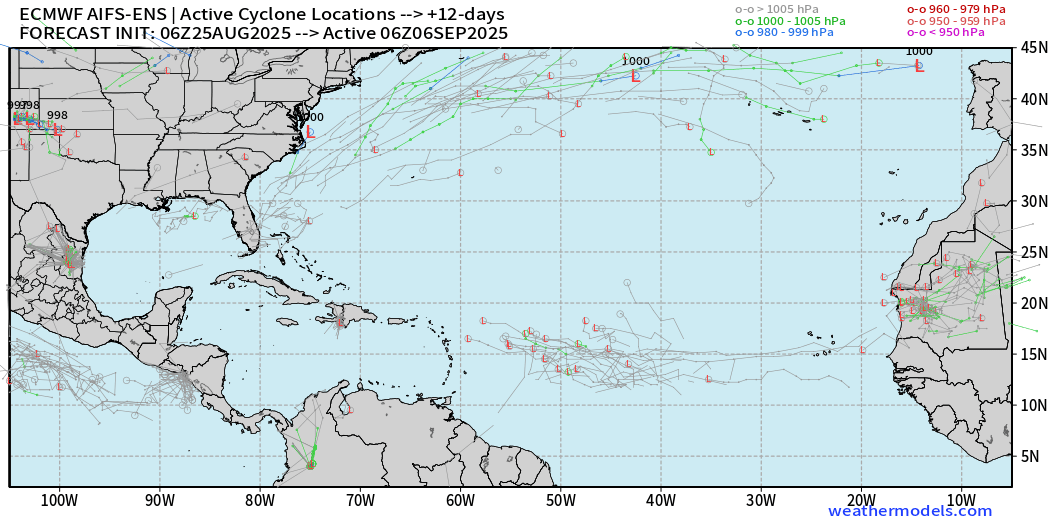
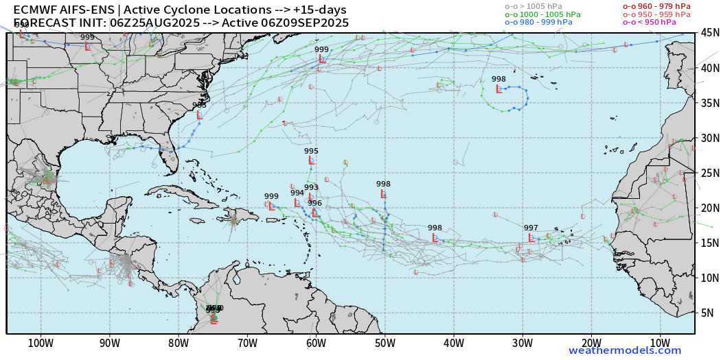
We can wait until the 12-15 day range for our next burst of “potential” storm activity in the tropical Atlantic.
Eastern Pacific Tropical Update
Juliette is underway — expected to reach near hurricane strength but not affect land — move over cooler water and decay by Thursday

Western Pacific Tropical Update
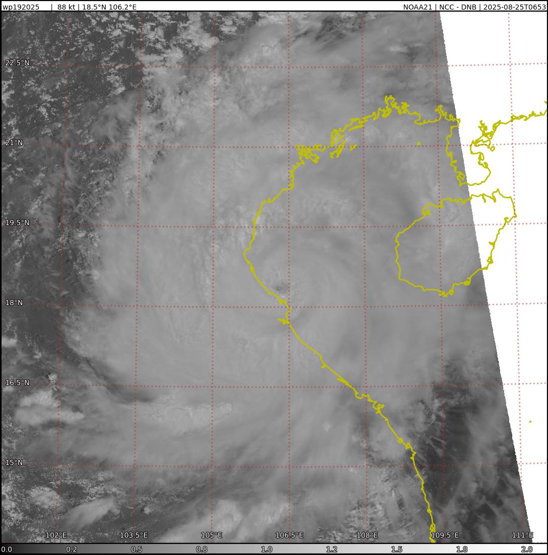
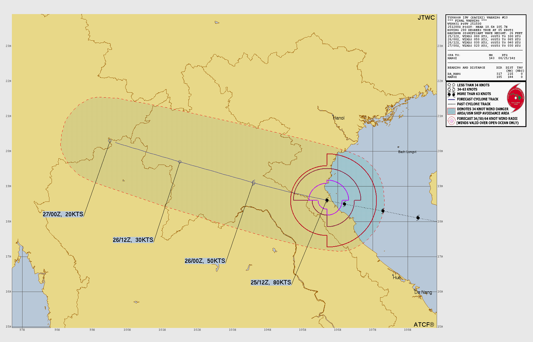
Typhoon Kajiki (19W) made landfall in Vietnam at 85-95 knots … quite powerful storm!
Impressive banding and eye with Kajiki prior to landfall earlier Monday.
Maps sourced from weathermodels.com designed and innovated by yours truly! Please subscribe there for real-time access to the newest maps, charts from all of the weather models including ECMWF.
- Milepost
- 713 · laid 2025-08-25T15:22:56.686000Z
- Source
- https://weather.substack.com/p/august-25-2025-monday-weather-update
- Digest
- ca2cbf08bc64f380e5b2fb750fc0fcd880893ec6cc41bef5852f0df16723f8c4
- Machine
- JSON