August 21, 2025 Thursday Evening Weather Update
Taste of fall: cooler weather on the way into next week
August 2025 was the 28th-warmest August in the 132-year national record (1895–2026), at 73.4°F against a 1991–2020 normal of 73.1°F (+0.3°F).
August 2025 was the 27th-driest August in the 132-year national record (1895–2026), at 2.3in against a 1991–2020 normal of 2.7in (-0.3in).
NOAA/NCEI Climate at a Glance, contiguous United States. This is the observed record for the month, not a score of anything said in this piece — the forecast ledger begins 2026-08-17 and cannot reach earlier posts.

2025 Season to Date: 5 named storms, 1 hurricanes, and 1 majors | ACE = 34
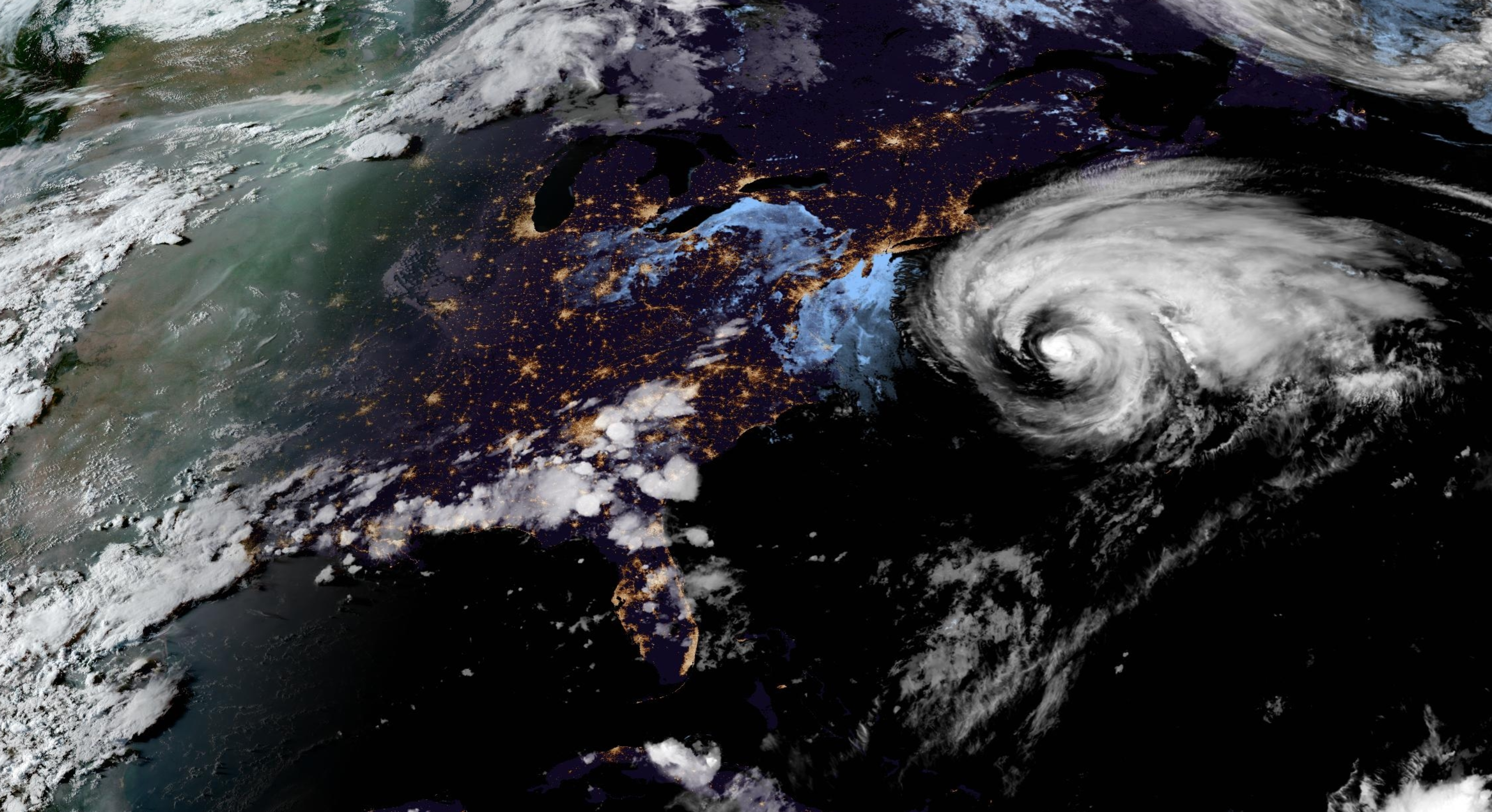
Thursday Evening Tropical Update
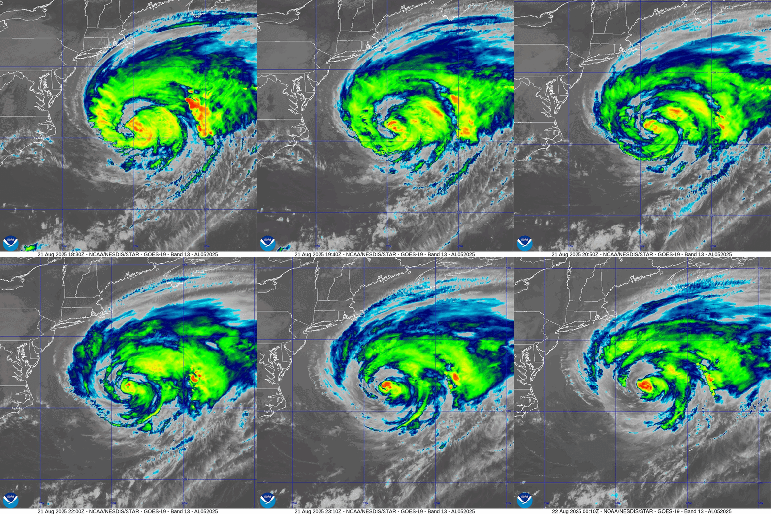
Hurricane Erin is pulling away from the East Coast of the U.S. but maintaining strong Category 2 winds + massive gale and TS force wind field.
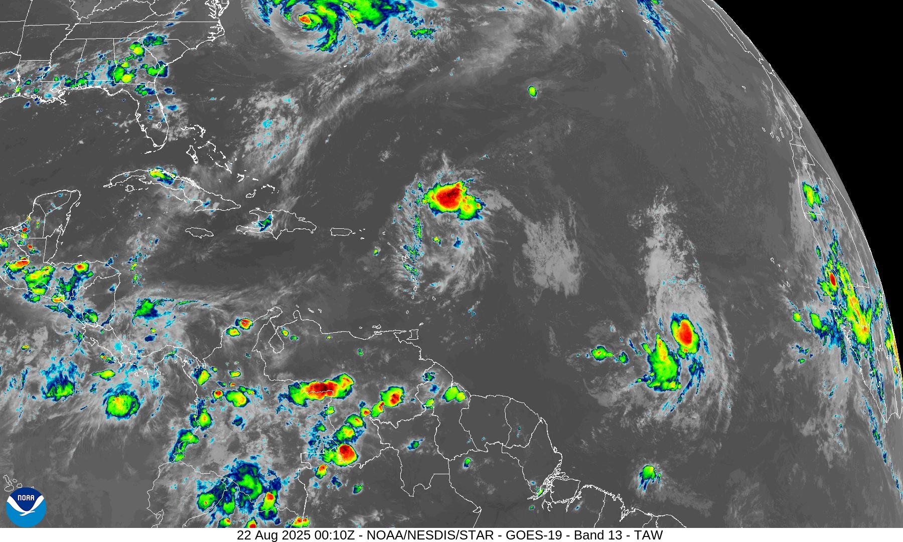
Tropical wave moving west at lower latitude in MDR (Invest 99L) still showing sustained convection (40% chance of development) — and a low-level circulation will trigger advisories on Fernand perhaps this evening yet.
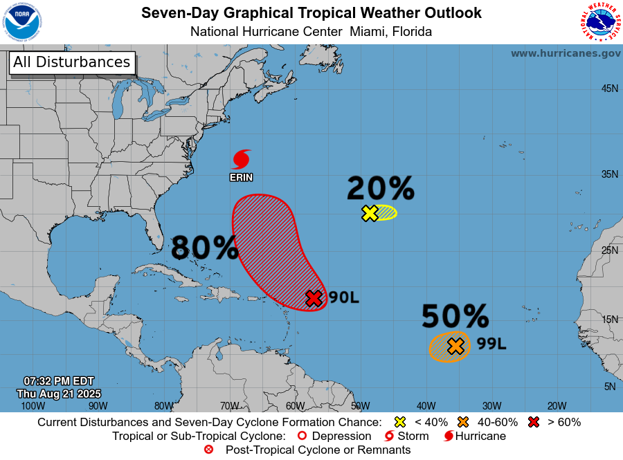
Tropical wave (80%) northeast of the Leeward Island will likely become a tropical depression by this weekend
Next week — ensemble suites continue to show the Atlantic going DEAD quiet into first week of September.
A taste of fall will arrive as a trough and Canadian cold front clear out much of the eastern Lower 48 with dry + cool air into next week. Gone will be the highs in the 80s and 90s replaced with 60s and 70s. More like football weather!
Behind Erin is Invest 90L — which will probably get Gabrielle — but playing the tropical storm name game is tricky with Invest 99L on the precipice of being Fernand.
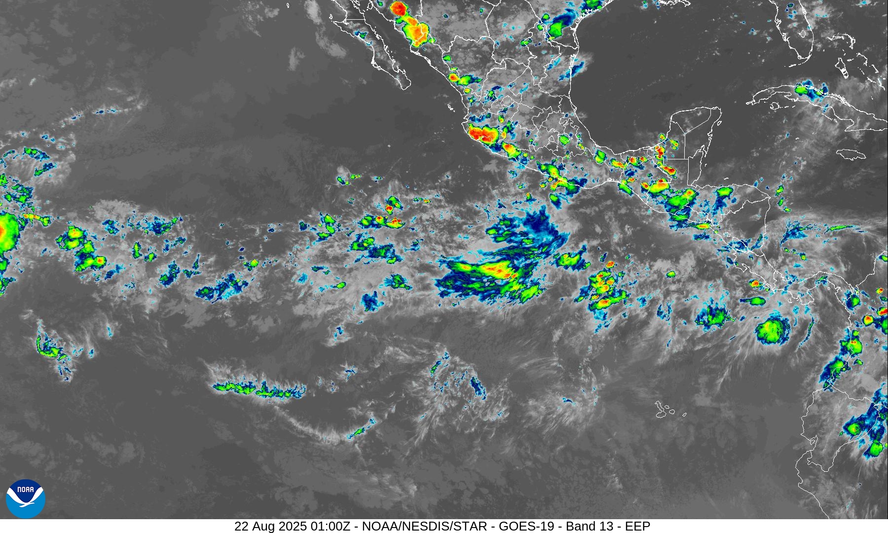
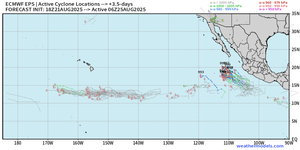
A system in the Eastern Pacific off Mexico will likely develop this weekend. It’s been two weeks since Ivo (09E) — next name is Juliette.
Hurricane Erin is still generating deep-convection within inner-core and has sprawling — galaxy
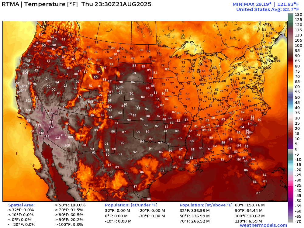
Current Temperatures | 7:30 PM ET | RTMA
Temperature Anomaly | 7:30 PM ET | RTMA
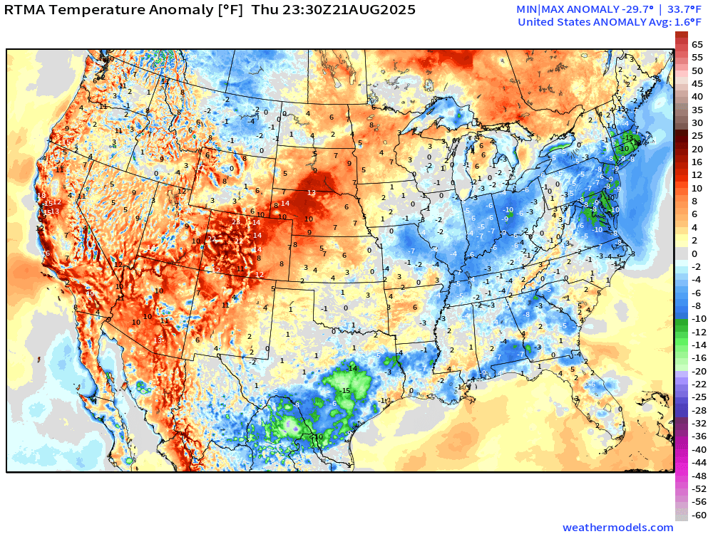
Lower 48 temperature anomaly is +1.6°F above normal
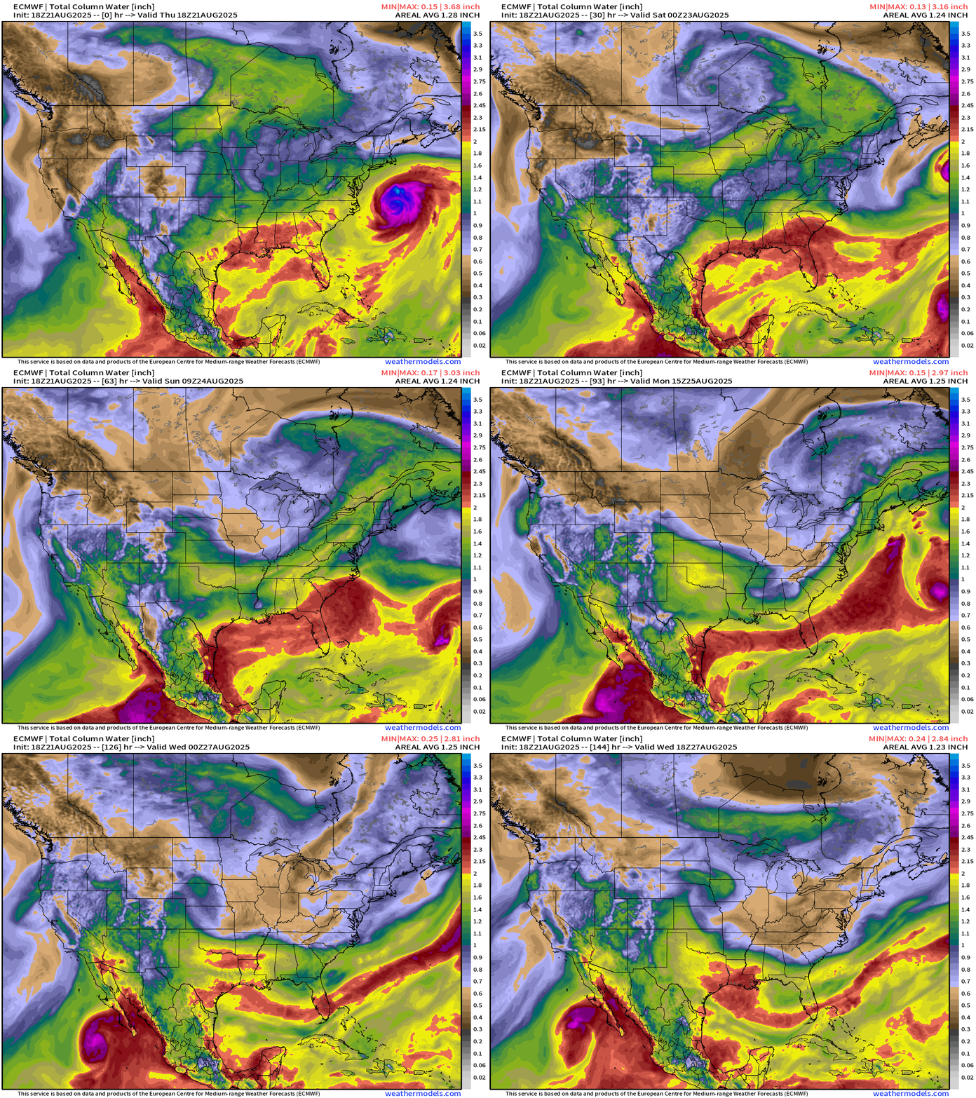
Atlantic Basin | ECMWF 18z | Precipitable Water Next 6-days
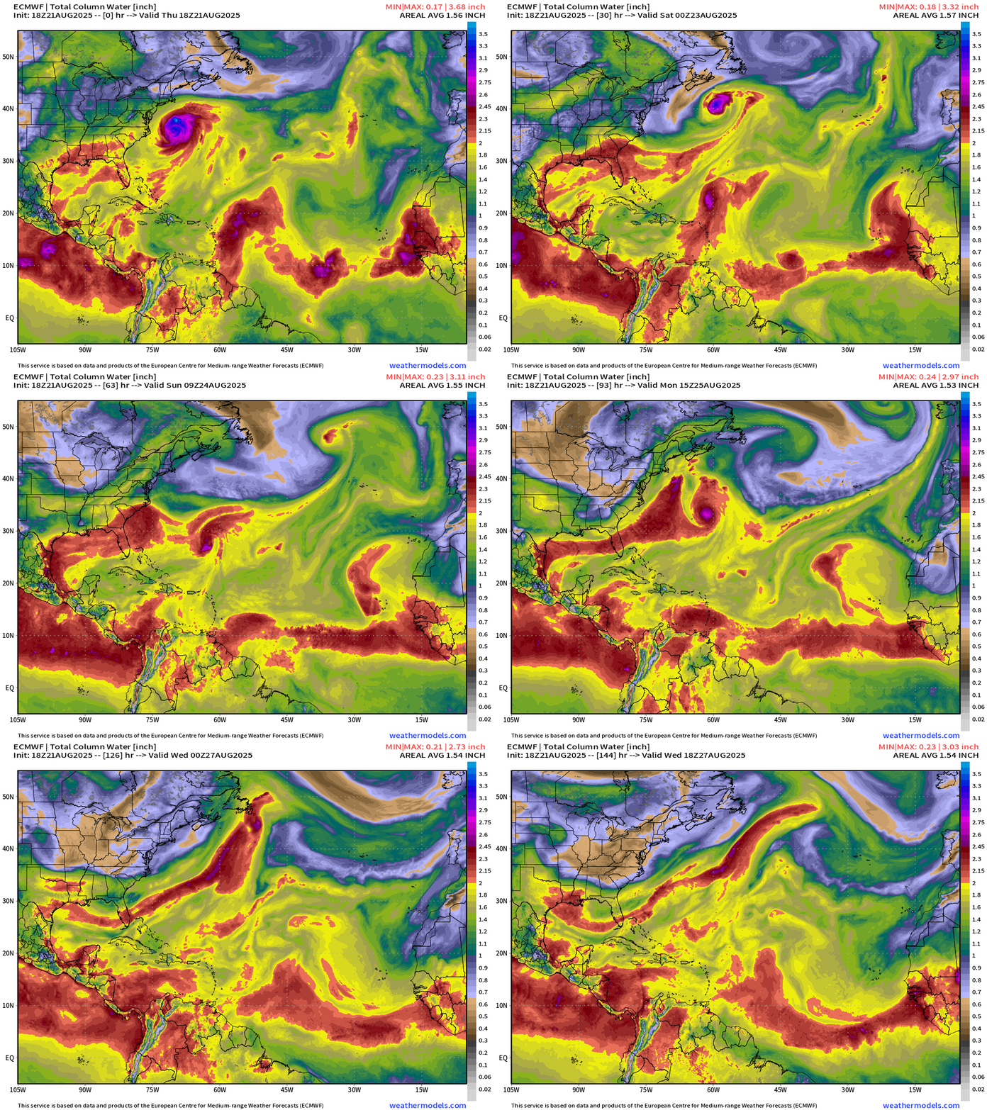
Invest 90L (80% chance) becomes a storm and heads north before combining with the frontal boundary behind Erin — could briefly become a 80-knot hurricane
Small but vigorous Invest 99L (50% chance) could briefly become a storm on a westward track into the Caribbean graveyard. No further intensification after 1-2 days.
ECMWF AIFS 18z | 500 mb Height Anomaly Next 10-days
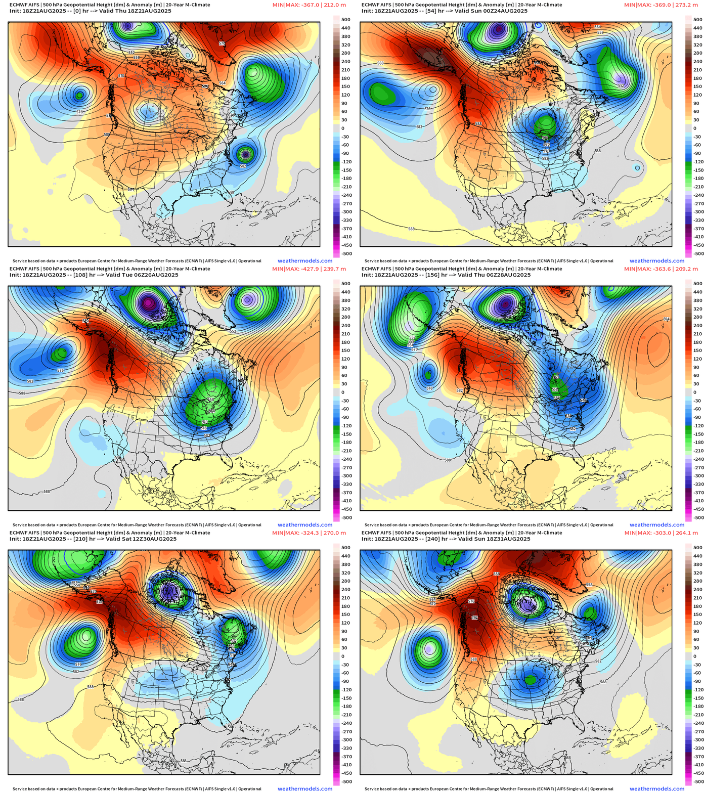
Into weekend: Strong Canadian trough plunges through the Great Lakes and Northeast bringing much cooler air into the Lower 48 behind it … taste of fall.
Next week: continued northerly flow out of Canada as the “polar vortex” intensifies over the Arctic.
Week 1 Temperature Anomaly | ECMWF EPS 12z
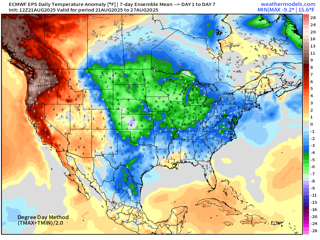
Well below normal temperatures across the central U.S. into final week of August.
Week 2 Temperature Anomaly | ECMWF EPS 12z | Aug 28 - Sep 03
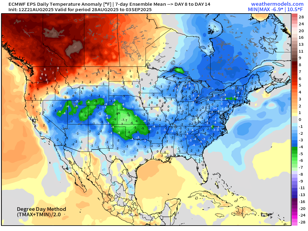
Heat dome in western Canada vs. cooler trough across the Midwest and Northeast U.S. into early September.
Forecast High Temperatures Next 8-days | Blend of Models
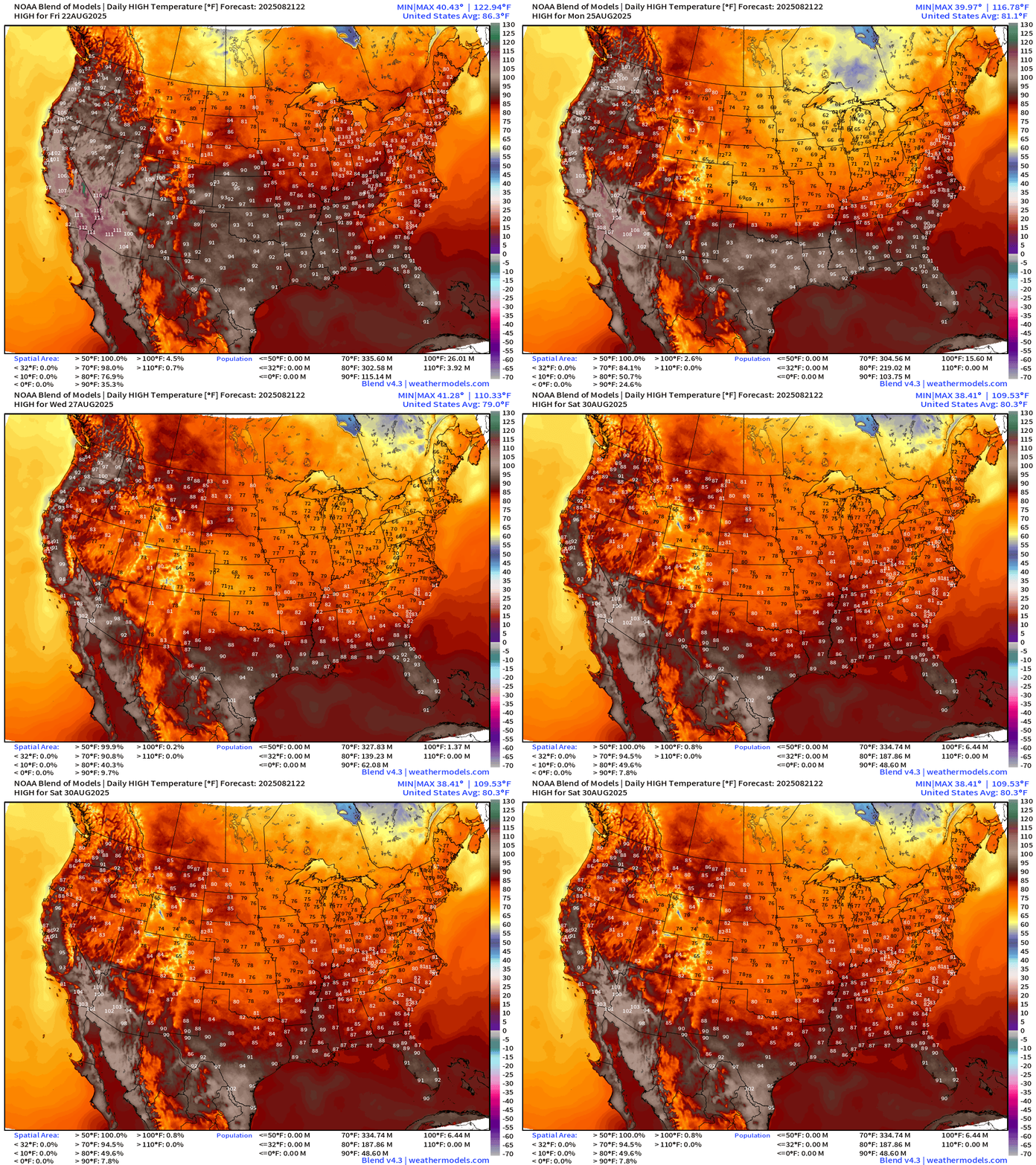
Refreshing 60s and 70s replace 80s and 90s into next week.
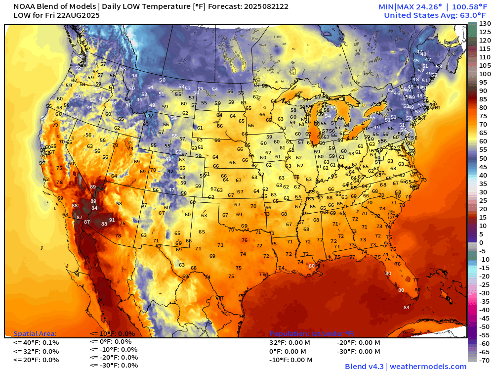
Low Temperatures Friday Morning
High Temperatures on Friday
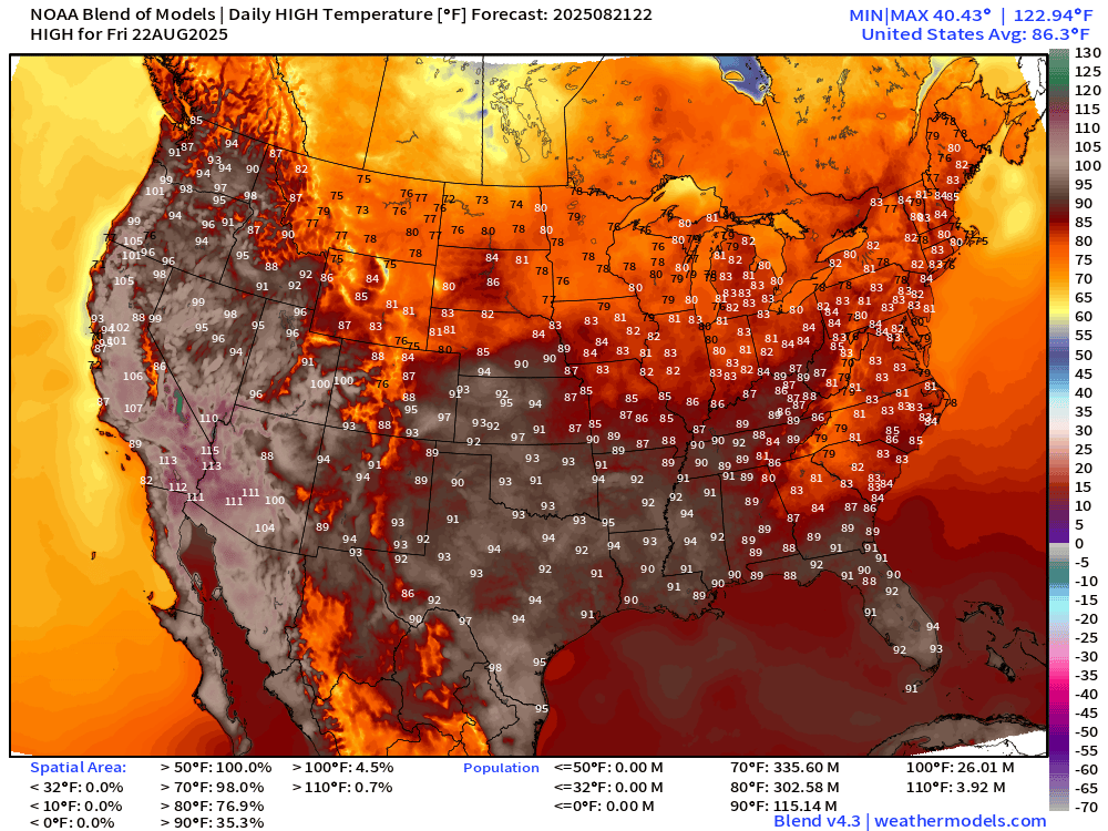
Very hot across the Southwest and California. 90s in Texas and Florida … 115 million at least 90°F
Back to Tropics —> Atlantic Basin
ECMWF 18z | Next 6-days of Vorticity
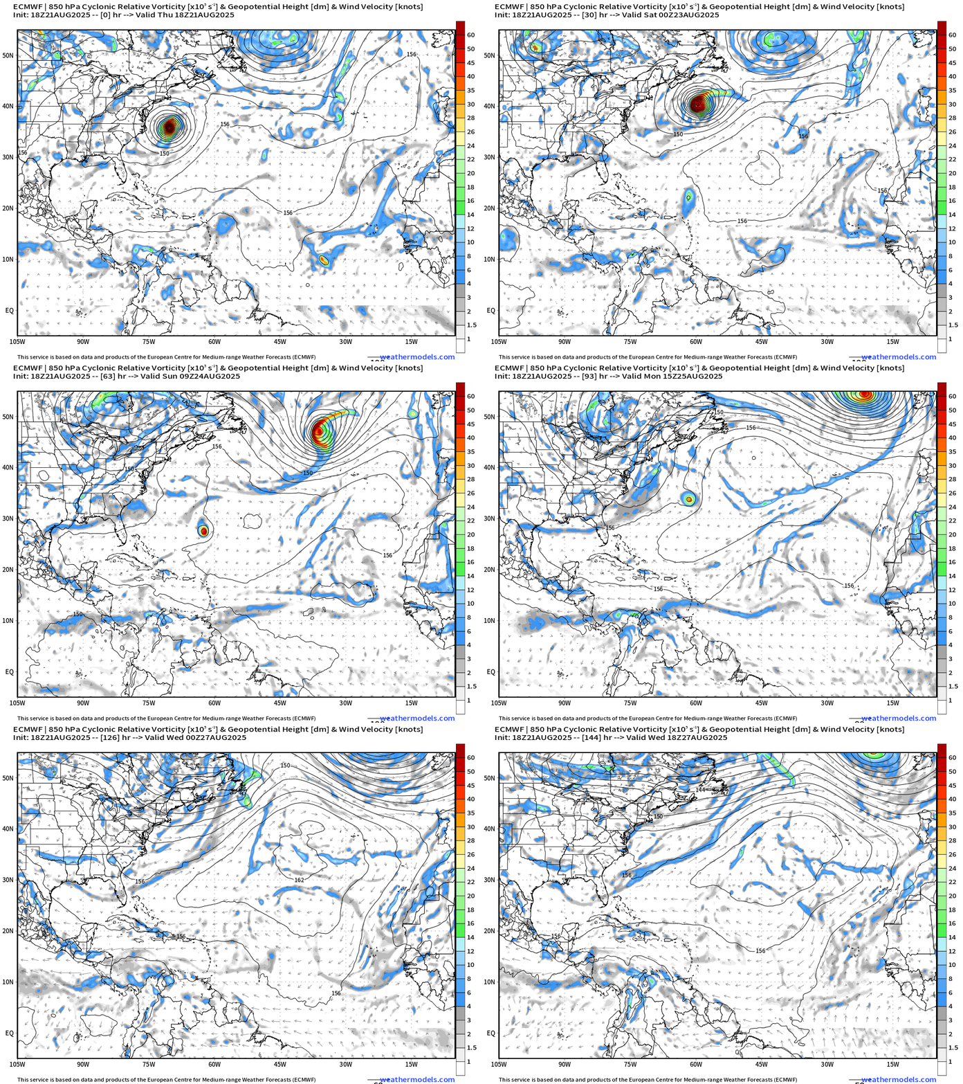
Invest 90L heads east of Bermuda — bet it becomes a hurricane.
Invest 99L opens up soon — so if it is named, needs to be in the next 12-24 hours.
ECMWF 10-Days Integrated Vapor Transport | 12z cycle
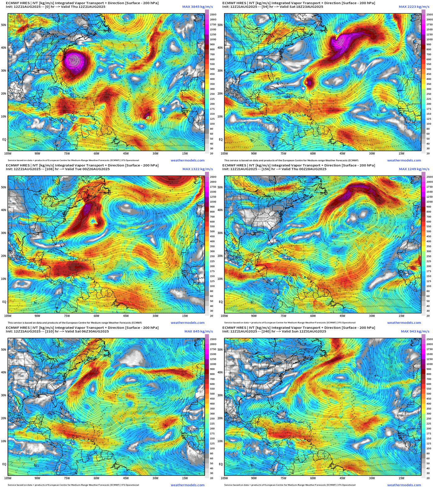
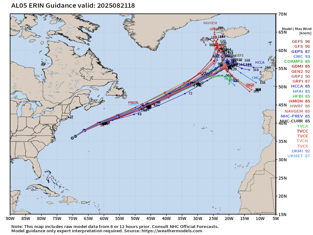
Massive Erin undergoes “extratropical transition” in the central north Atlantic early next week and may affect U.K. or western Europe with some wind/rain as a “post tropical” cyclone. The post-tropical version of Erin may be “major hurricane force” with central pressure in the 948 - 952 mb range — very intense for late August in the North Atlantic extratropics.
Thereafter, next week looks DEAD quiet across the Atlantic basin … but every African easterly wave needs to be watched into the peak of the season.
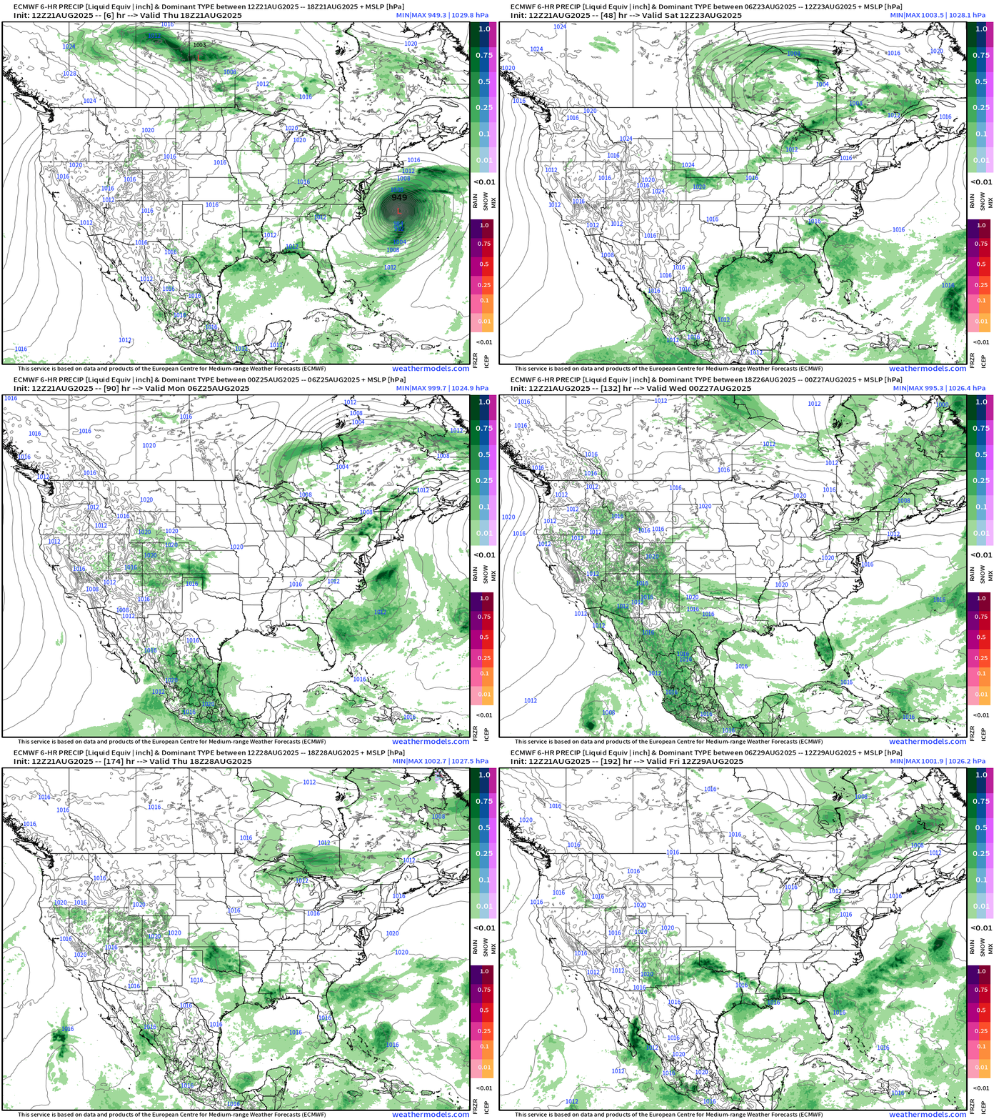
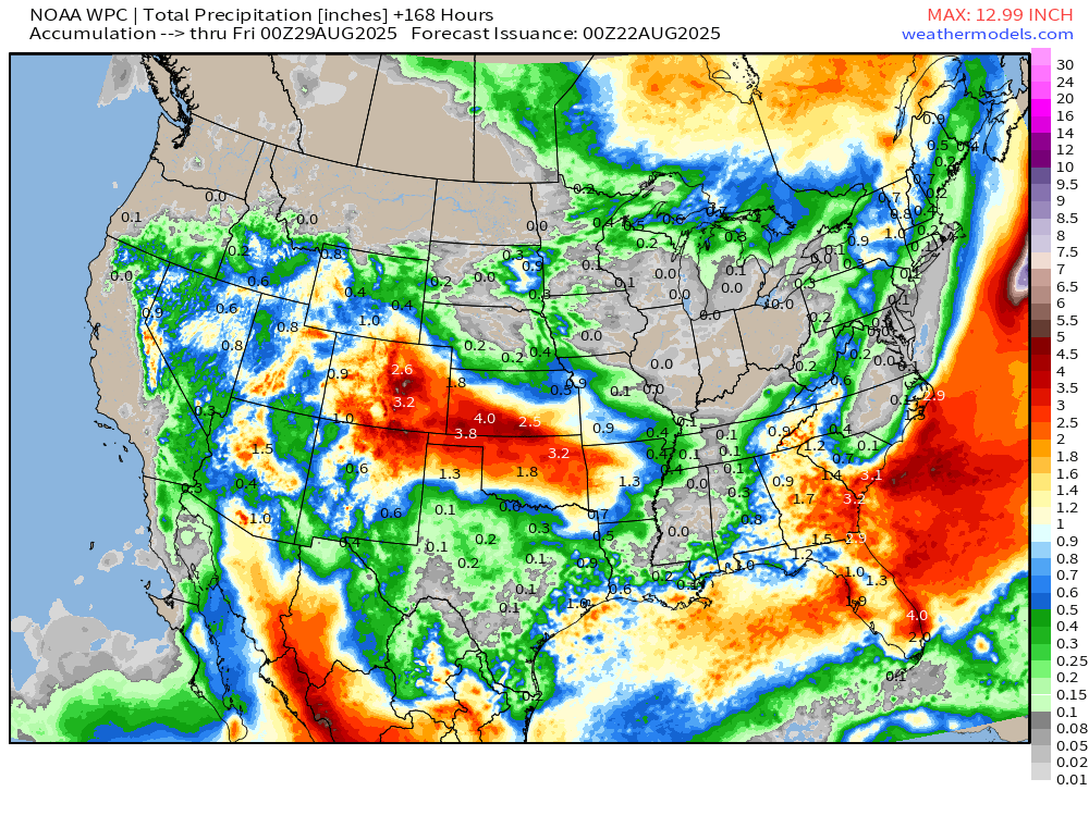
Lower 48 Precipitation for next 8-days |
Precipitation total next 48-hours
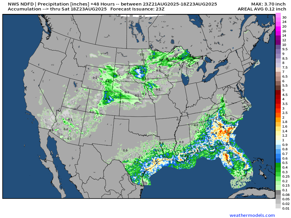
NOAA WPC Precipitation Next 7-days
Atlantic Basin Outlook | 8 PM ET Update
Hurricane Erin | Category 2 100 mph Winds| MSLP: 952 mb
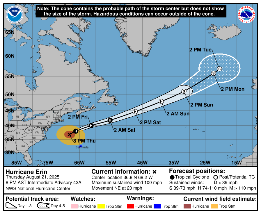
90th Percentile in size — tropical storm force winds > 500 n miles across
NHC: A pair of ASCAT passes from a few hours ago confirmed Erin's large size with its associated tropical-storm-force winds extending nearly 500 n mi across. In fact, comparing Erin with other systems around the same intensity and in similar locations over the past couple of decades indicates that it is around the 90th percentile in size.
ATCF Spaghetti | 18z Interpolated Models
Massive Wind Field of Erin
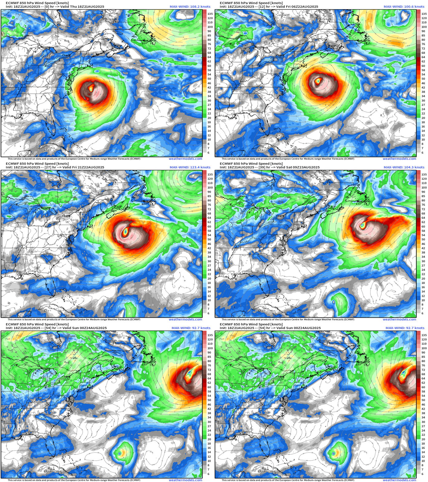
Invest 90L and Invest 99L
Atlantic Satellite Imagery | Infrared
Water Vapor
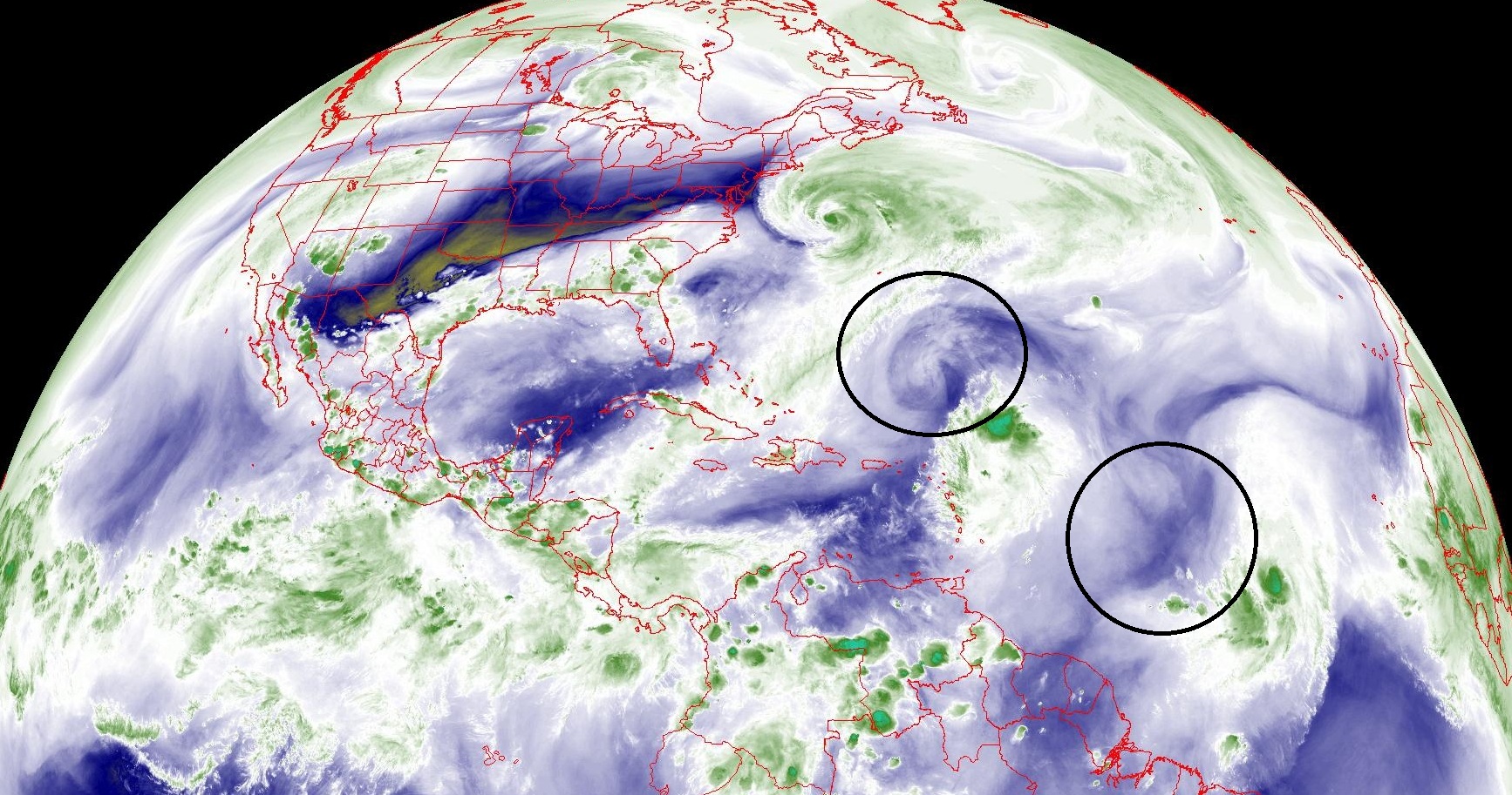
Wind shear from mid-level troughs stops tropical storm formation — tips over / tilts the vortex — prevents surface circulation (fire/spark) from connecting to the chimney
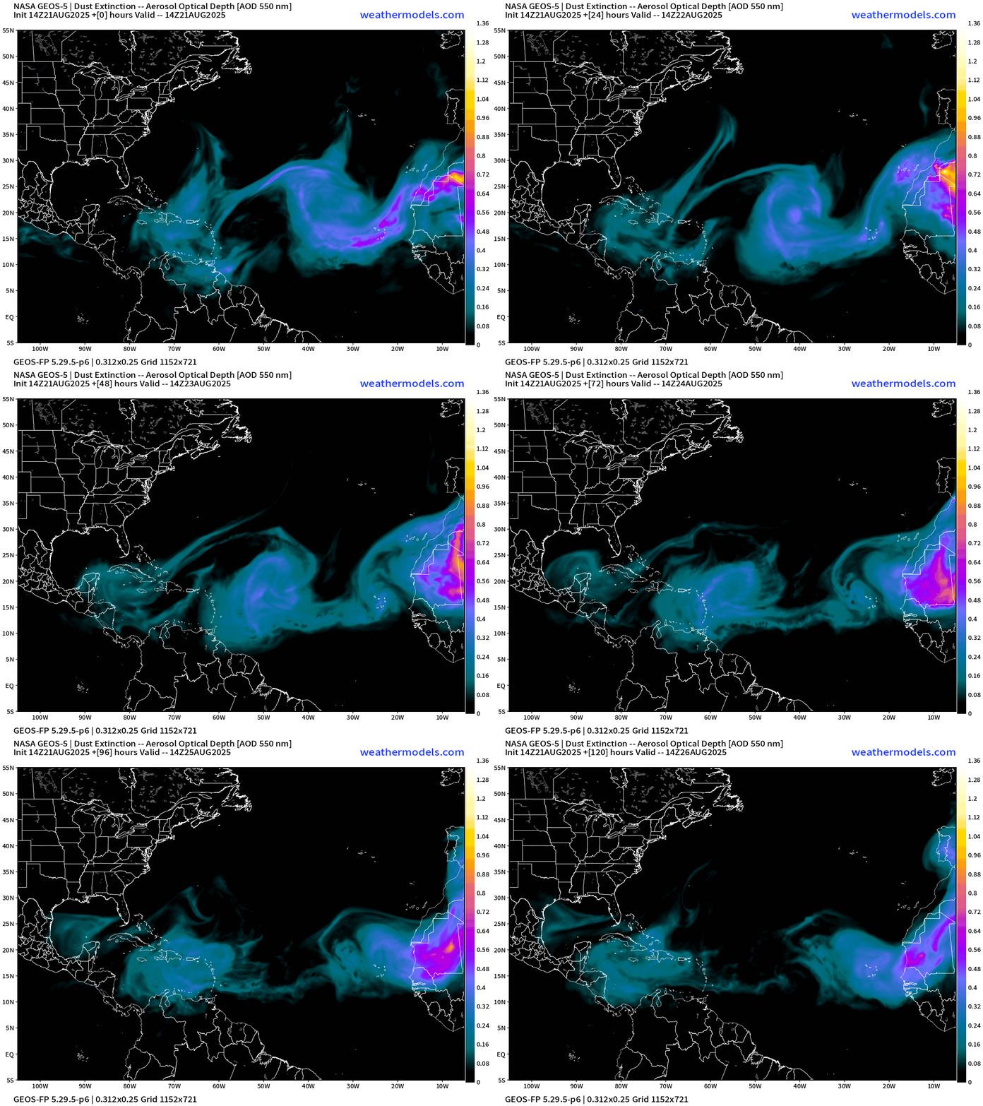
NASA GEOS-5 12z | 5-day Dust
ECMWF SST and Anomaly
Note the cold anomaly from the wake of Erin —> upwelling from the slower movement east of the Bahamas.
NOAA Tropical Surface Analysis | 18z
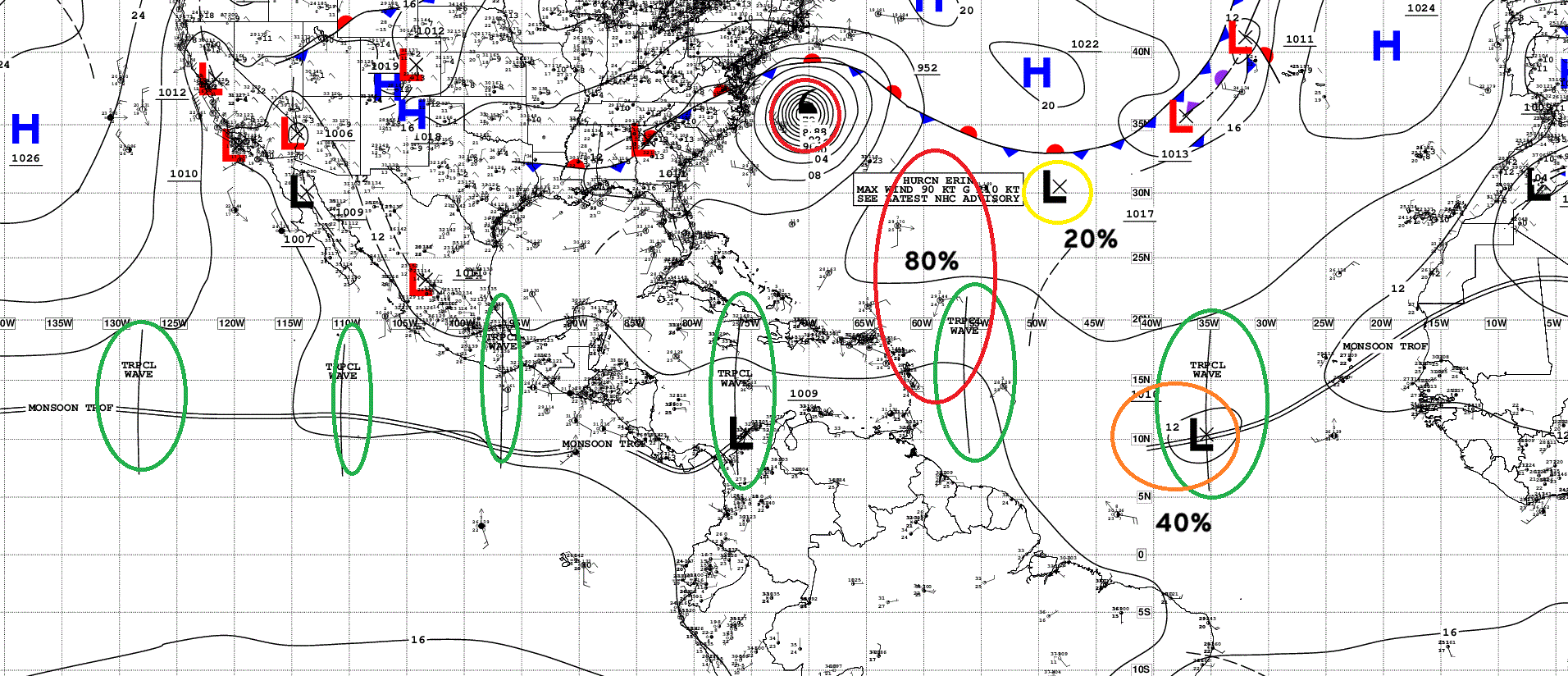
Atlantic Tropical Waves = 3 including 90L, 99L and Hurricane Erin
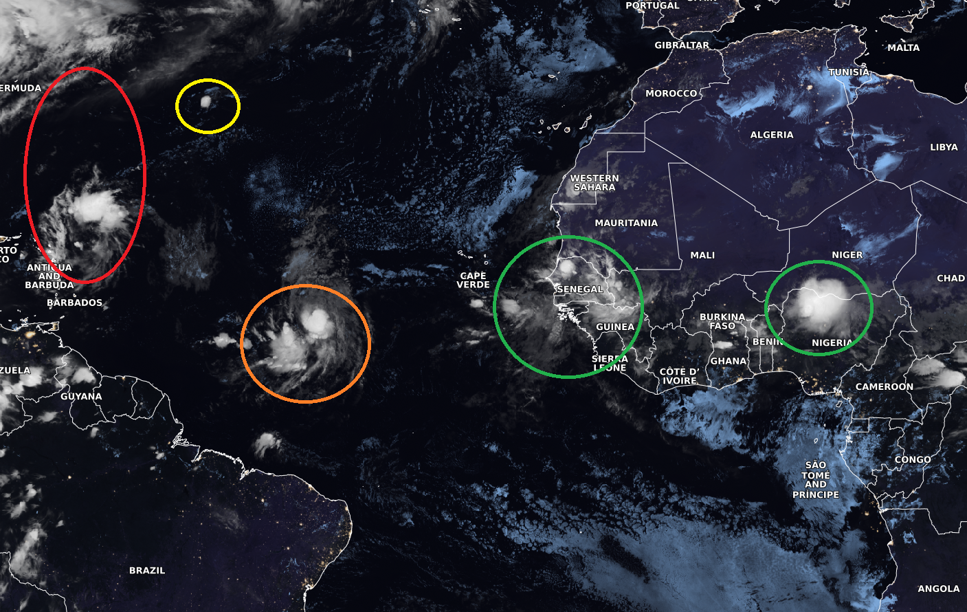
Satellite Image of African Easterly Waves
ECMWF AIFS-Ensemble | A.I. Trained 12Z | All Tracks at 15 days
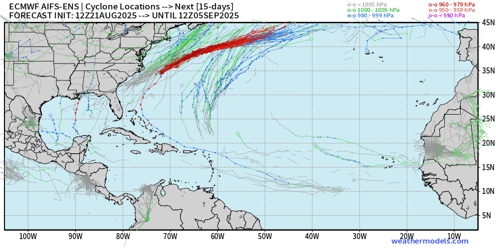
Also much quieter Atlantic into September 5th. Fine with me!
Eastern Pacific Tropical Update
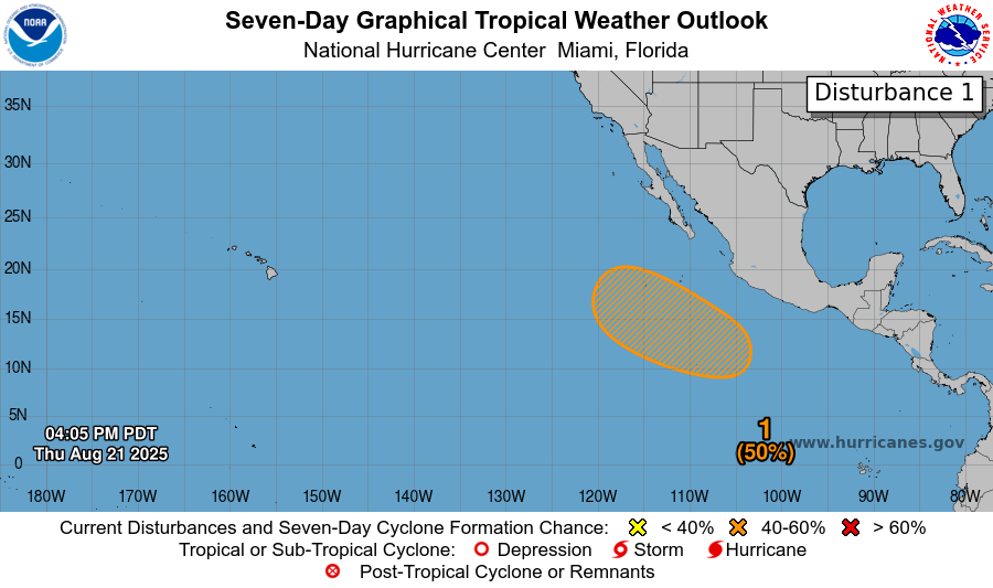
Next storm will be named Juliette — 10E — this weekend!
Maps sourced from weathermodels.com designed and innovated by yours truly! Please subscribe there for real-time access to the newest maps, charts from all of the weather models including ECMWF.
- Milepost
- 711 · laid 2025-08-22T01:16:24.782000Z
- Source
- https://weather.substack.com/p/august-21-2025-thursday-evening-weather
- Digest
- 442d1bb113f3268e2f5201a7572fba41137292ab4e438a4714e9f25ae3938414
- Machine
- JSON