August 16, 2025 Erin Undergoing Eyewall Replacement
Earlier Saturday, Erin reached Category 5
August 2025 was the 28th-warmest August in the 132-year national record (1895–2026), at 73.4°F against a 1991–2020 normal of 73.1°F (+0.3°F).
August 2025 was the 27th-driest August in the 132-year national record (1895–2026), at 2.3in against a 1991–2020 normal of 2.7in (-0.3in).
NOAA/NCEI Climate at a Glance, contiguous United States. This is the observed record for the month, not a score of anything said in this piece — the forecast ledger begins 2026-08-17 and cannot reach earlier posts.

2025 Season to Date: 5 named storms, 1 hurricanes, and 1 majors [ERIN +1]
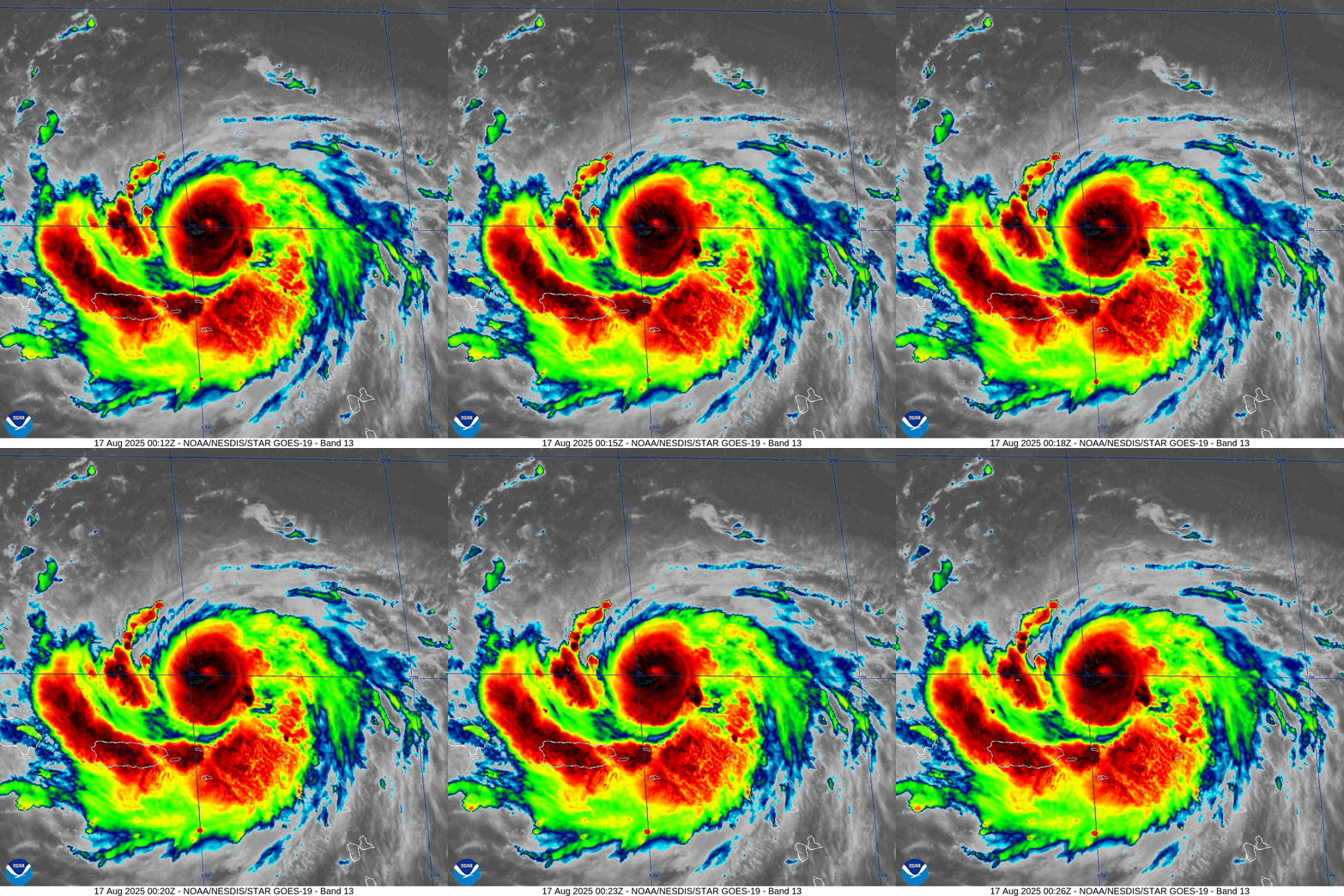
Saturday Evening Tropical Update
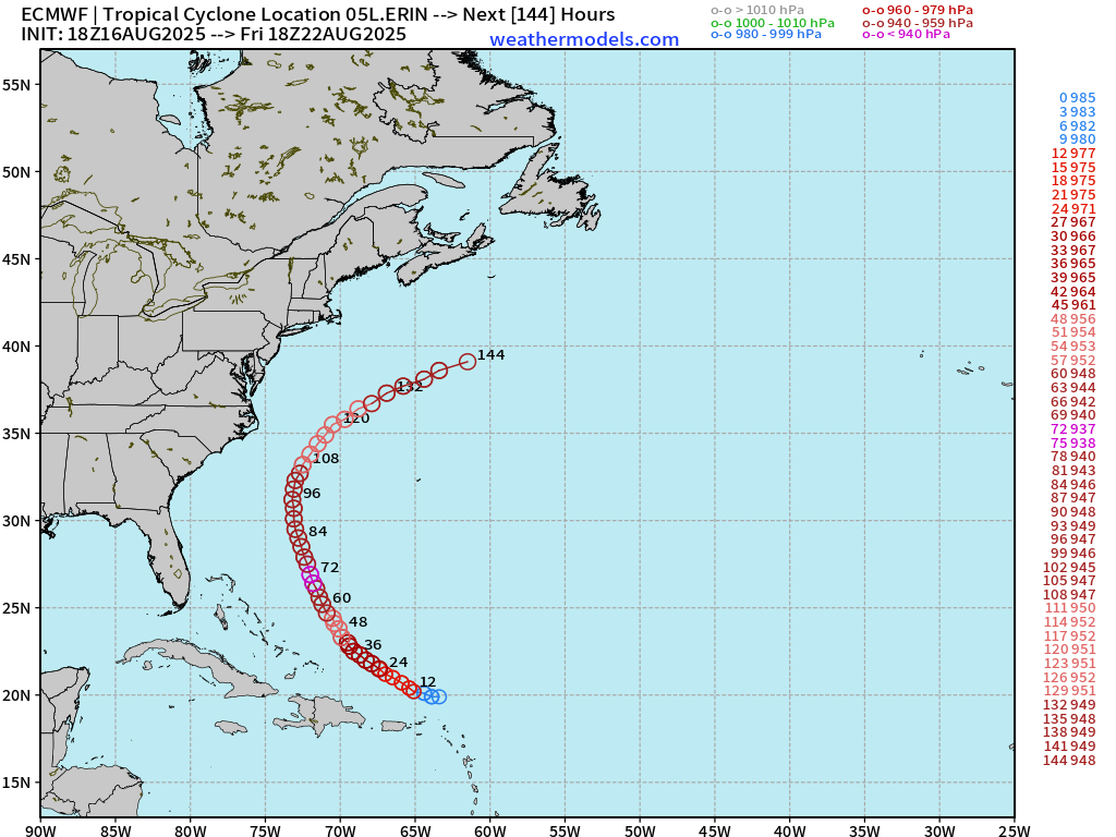
No change to the track forecast reasoning: Erin will turn NW and gain latitude before taking a right turn out to sea well off the North Carolina coast.
Currently, Erin is hugging the 20°N latitude line & heading almost due westward.
ECMWF 18z | Precipitable Water Next 6-days
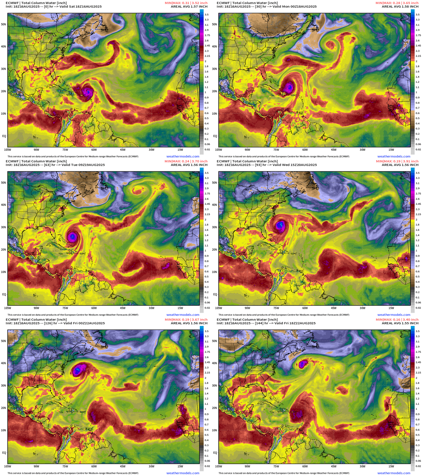
My favorite parameter: through the next 6-days:
The furthest west that Erin should make is 73°W longitude with a sharper turn to the north in 3 days at 25°N latitude. While the ECMWF 18z didn’t initialize the small inner-core of Erin very well, the model has been quite accurate in predicting the westward slide of Erin.
Initial MSLP in the model is 985 mb (biased 50 mb too high) but drops to 937 mb in 72-hours suggesting the storm will become a LOT larger and the central pressure in the 9-km model will be easier to resolve.
Most recent ECMWF 18z track for Erin
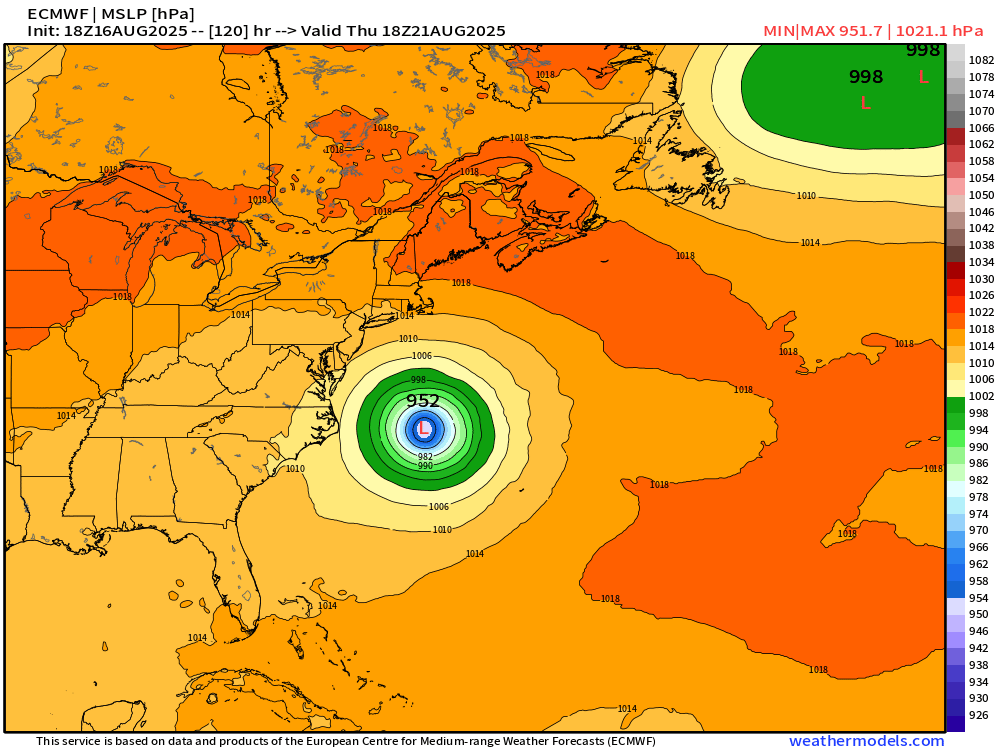
Pressure of 952 mb in 5-days (Thursday afternoon) due east of North Carolina … and well west of Bermuda. Splits the uprights!
Next 6-days of Vorticity
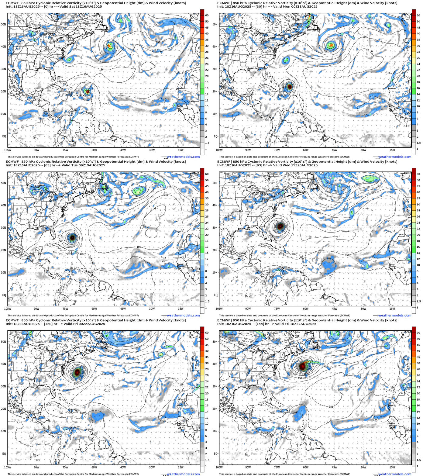
Another wave that emerged off Africa heads westward through the MDR but does not develop — remaining diffuse and weak through 6-days. NHC has a 20% yellow hatching to watch in this coming week.
Atlantic Basin Outlook
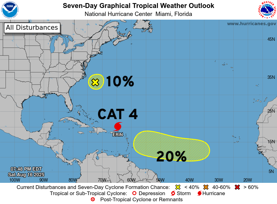
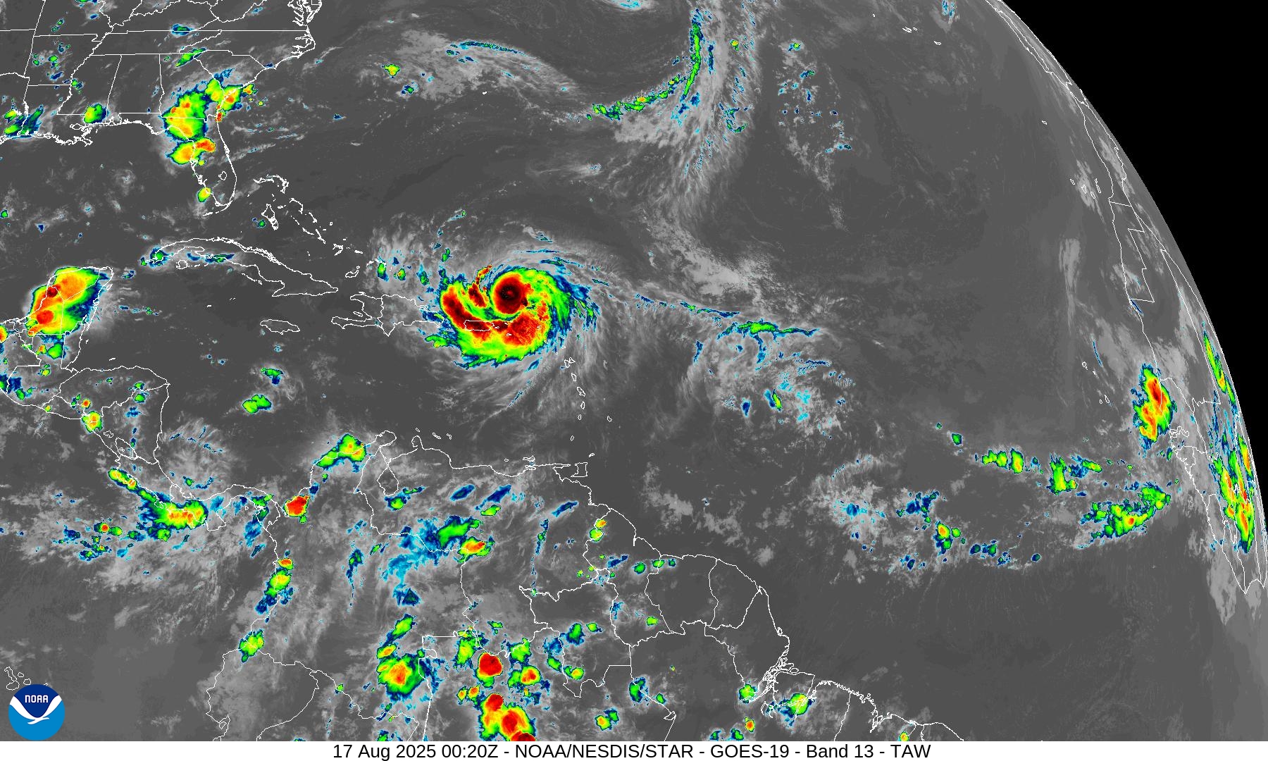
Category 4 Hurricane Erin
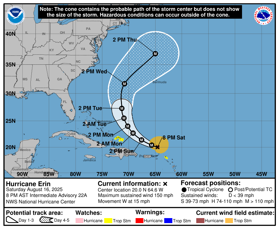
NHC forecast maintains major hurricane status throughout the 5-day forecast, and it will become more MASSIVE in size. NHC discussion (5 PM):
Although Erin is a somewhat compact hurricane now, the models are in
strong agreement that the system will grow in size over the next
several days. In fact, by the middle of next week, Erin is forecast
to at least double or triple in size, which will result in rough
ocean conditions over the western Atlantic.
ATCF Spaghetti | 18z Interpolated Models
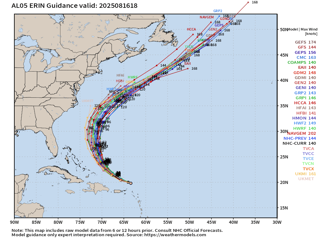
Some spread at 4-5 days as the parabolic track curves out to sea.
Atlantic Satellite Imagery | Infrared
NOAA Tropical Surface Analysis | 18z
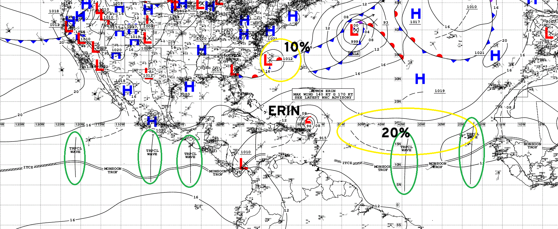
Atlantic Tropical Waves = 2 + Major Hurricane Erin
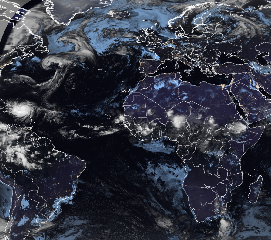
Large View of Atlantic
Africa Wave Train
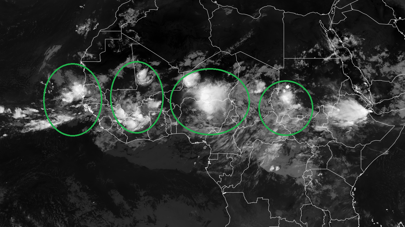
Plenty of “seedlings” lined up across tropical Africa … Erin is the first real success story.
Maps sourced from weathermodels.com designed and innovated by yours truly! Please subscribe there for real-time access to the newest maps, charts from all of the weather models including ECMWF.
- Milepost
- 705 · laid 2025-08-17T00:51:54.377000Z
- Source
- https://weather.substack.com/p/august-16-2025-erin-undergoing-eyewall
- Digest
- 4722b92b64dd00313da0eef96cdb0503837f64b07dd04701f403f8b798049123
- Machine
- JSON