August 12, 2025 Tuesday Tropical Storm Erin
Erin remains weak but should intensify into a hurricane by Thursday
August 2025 was the 28th-warmest August in the 132-year national record (1895–2026), at 73.4°F against a 1991–2020 normal of 73.1°F (+0.3°F).
August 2025 was the 27th-driest August in the 132-year national record (1895–2026), at 2.3in against a 1991–2020 normal of 2.7in (-0.3in).
NOAA/NCEI Climate at a Glance, contiguous United States. This is the observed record for the month, not a score of anything said in this piece — the forecast ledger begins 2026-08-17 and cannot reach earlier posts.

2025: 5 named storms, 0 hurricanes, and 0 majors
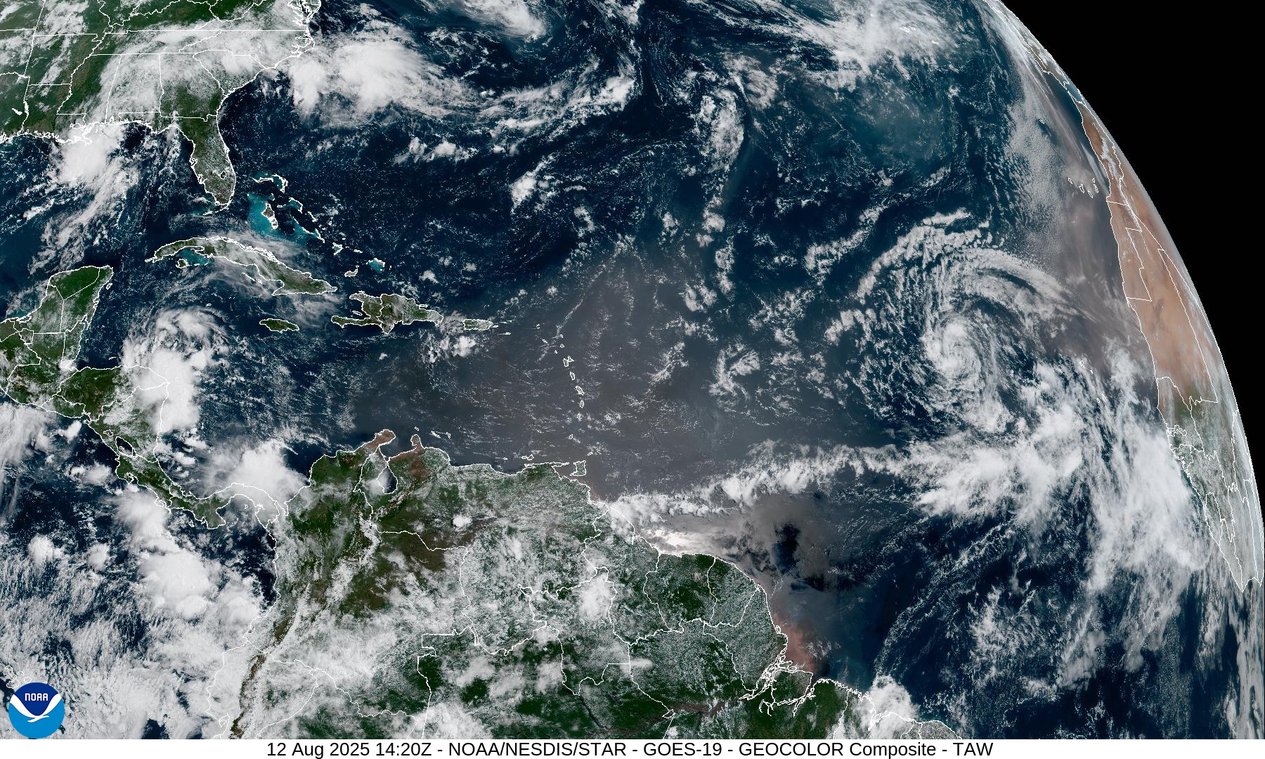
Monday Evening Tropical Update
Tropical Storm Erin (05L) over the eastern Atlantic
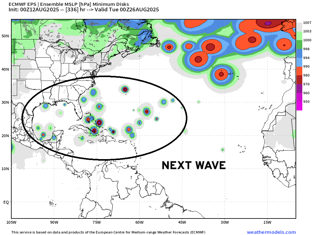
Additional tropical waves are following Erin — at lower latitudes, so more concerning if one of these “catches fire” in the MDR or down the road in the Caribbean, Bahamas, or Gulf of Mexico.
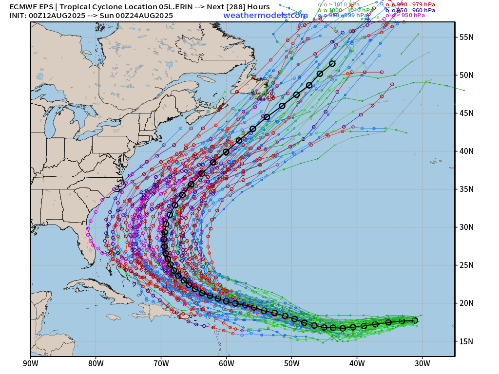
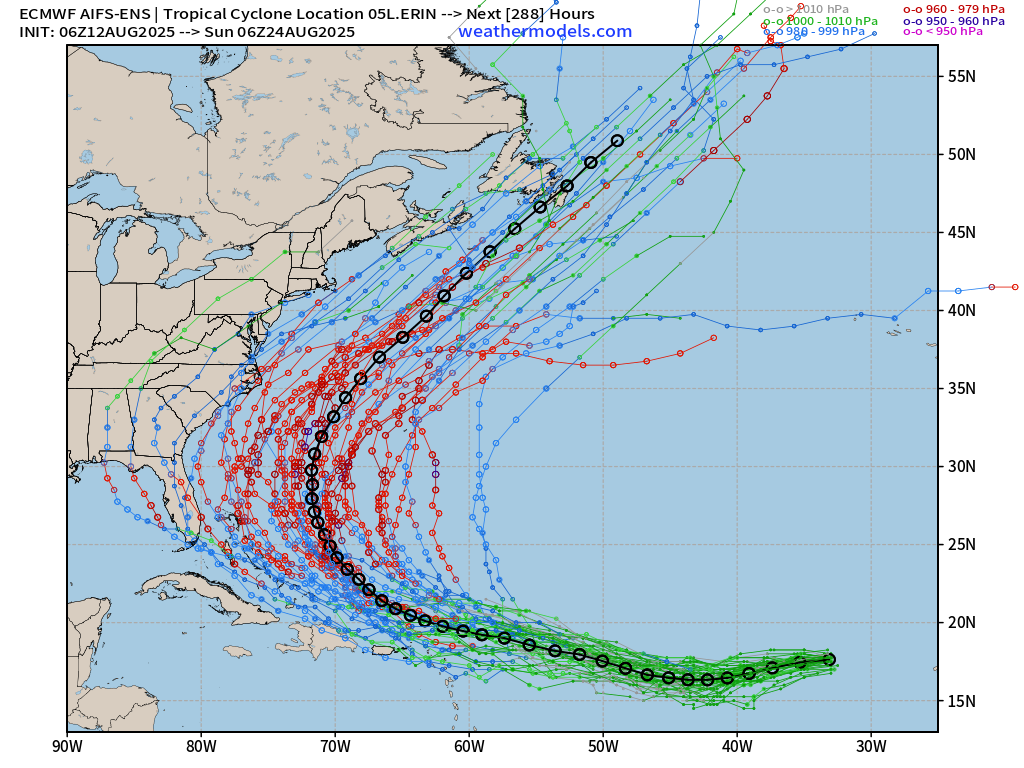
It is too soon to discount — or pinpoint — USA landfall impacts from Erin (05L) but based upon current model guidance — the chance RIGHT NOW remains low < 10%.
Weather model errors are > 300 miles at Days 7-10+ for tropical storms and hurricanes so that is a HUGE cone to be drawn on any map points. However, as the Lower 48 comes into view of Erin in the next few days, our models will become more confident/certain on the eventual outcome — so we should know on Thursday what will happen.
ECMWF 06z | Precipitable Water Next 6-days
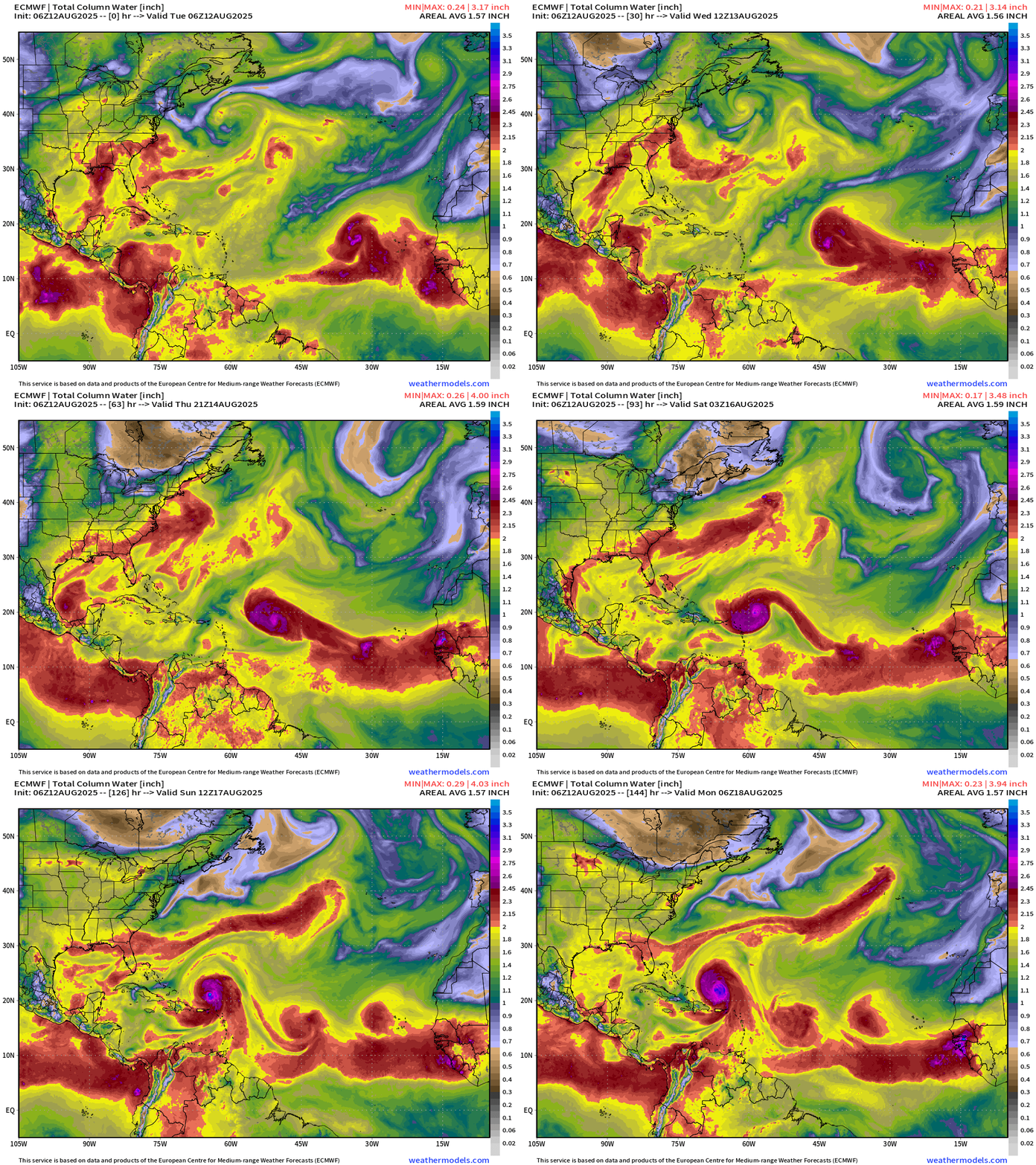
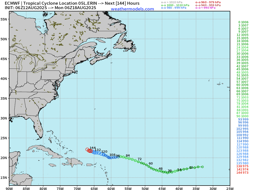
My favorite parameter: through the next 6-days from most recent 06z forecast —> Erin dips southward and then WNW w/973 mb pressure (Category 2) east of the Bahamas. Two more tropical waves are following Erin.
Ridge strength at Day 8 — 588-590 dm
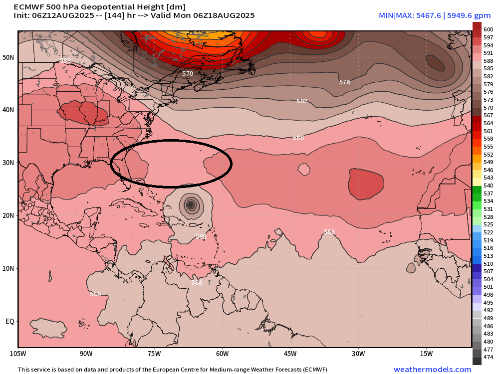
Hurricanes are out of balance with the surrounding tropical environment and want to escape (head poleward). However, ridging in the subtropics usually prevents northward movement but instead a WNW drift — slowly gaining latitude over many days.
We’ll be watching the intensity of the subtropical ridge to the north of Erin — with 588-590 dm matching the outermost closed contour of the circulation to match up with the Bermuda High / subtropical ridge.
ECMWF 00Z | Integrated Vapor Transport Next 12-days | Atlantic Basin
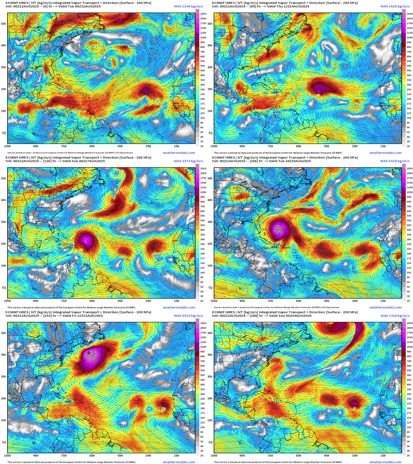
+Moisture transport vectors from the 12z flagship solution. The ECMWF 00z control shows a East Coast “close call” similar to Erin (2001) almost 25-years ago BUT another system on its heels that would be westward moving as the ridge builds behind Erin. More waves come off Africa into Week 2 (August 22)
ECMWF 00z Simulated Satellite | Water Vapor
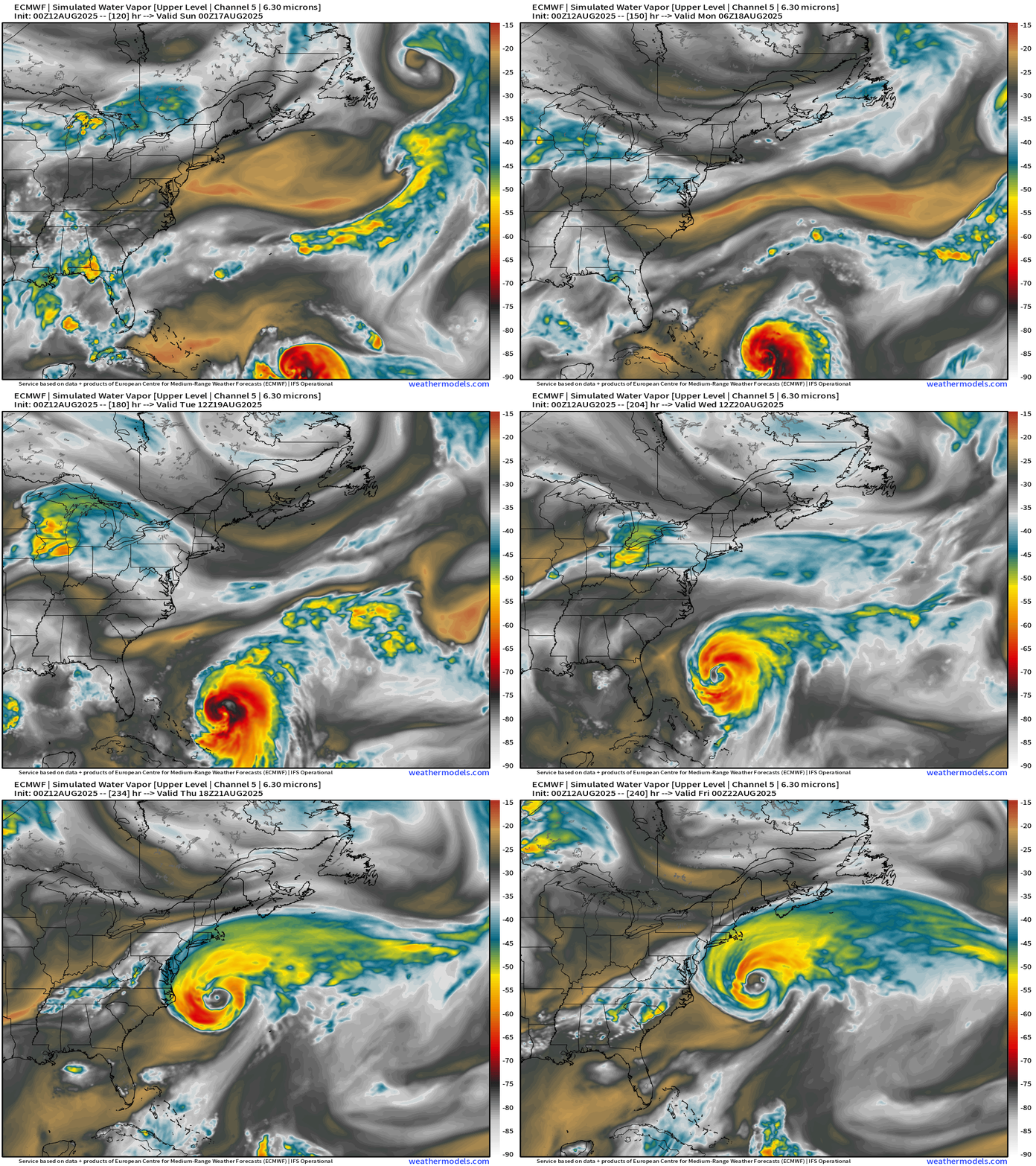
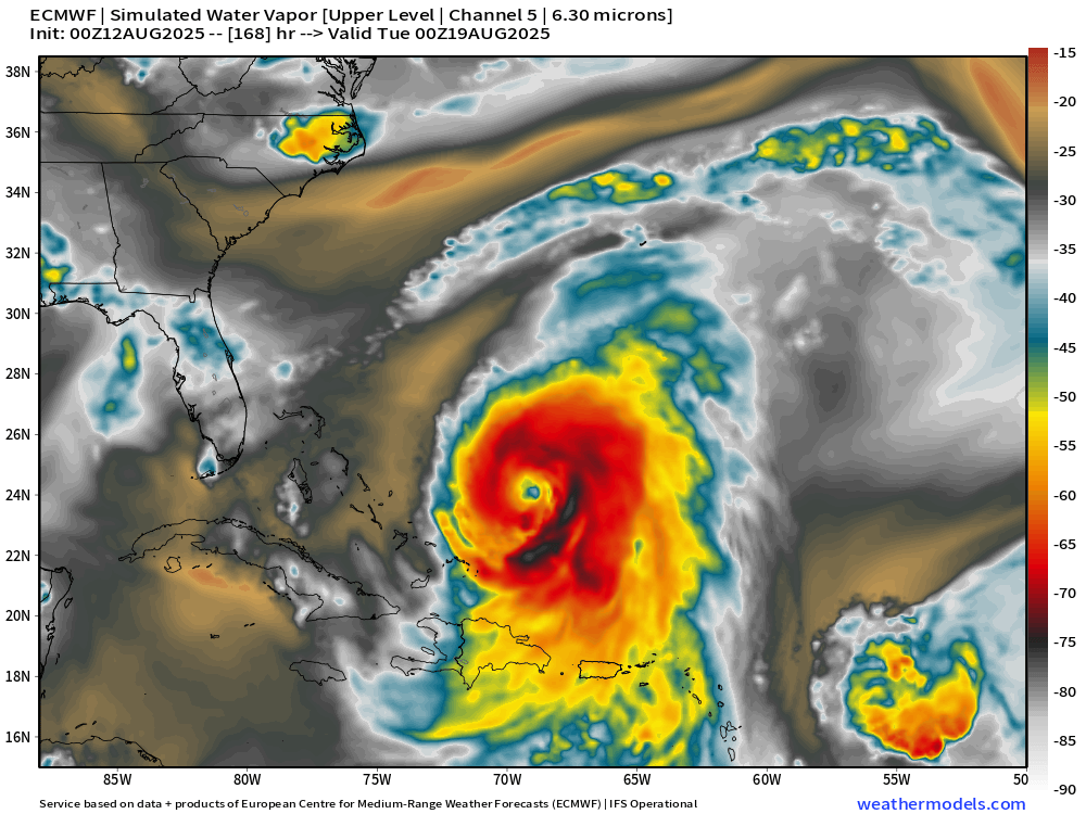
The middle latitude circulation —> troughs are coming off North America constantly — and it seems likely that Erin will easily break through a weakness in the subtropical ridging to recurve northward. Once it reaches the latitude off the Carolinas, dry air + impacts of jet stream / trough will expand the wind field drastically —> massive system off the East Coast. At Day 7: Erin should be near its initial peak intensity of Category 4+
Atlantic Basin Outlook
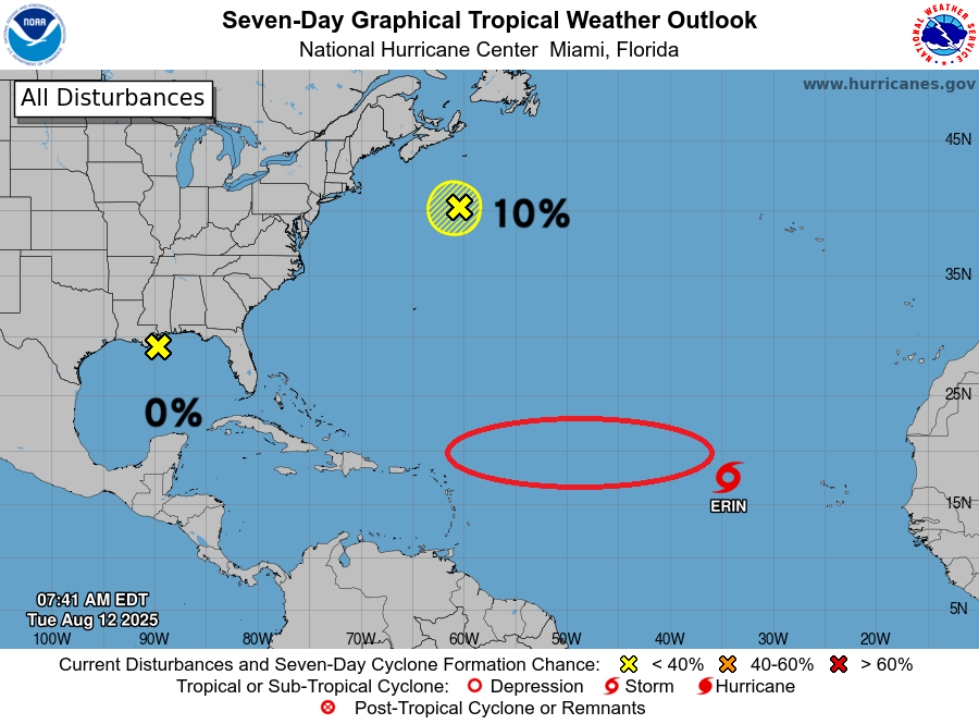
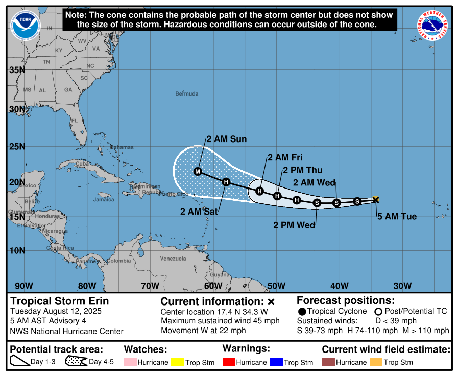
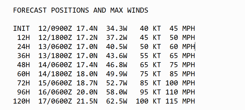
Tropical Storm Erin (05L) up to 95 knots (almost major hurricane) in 4-days
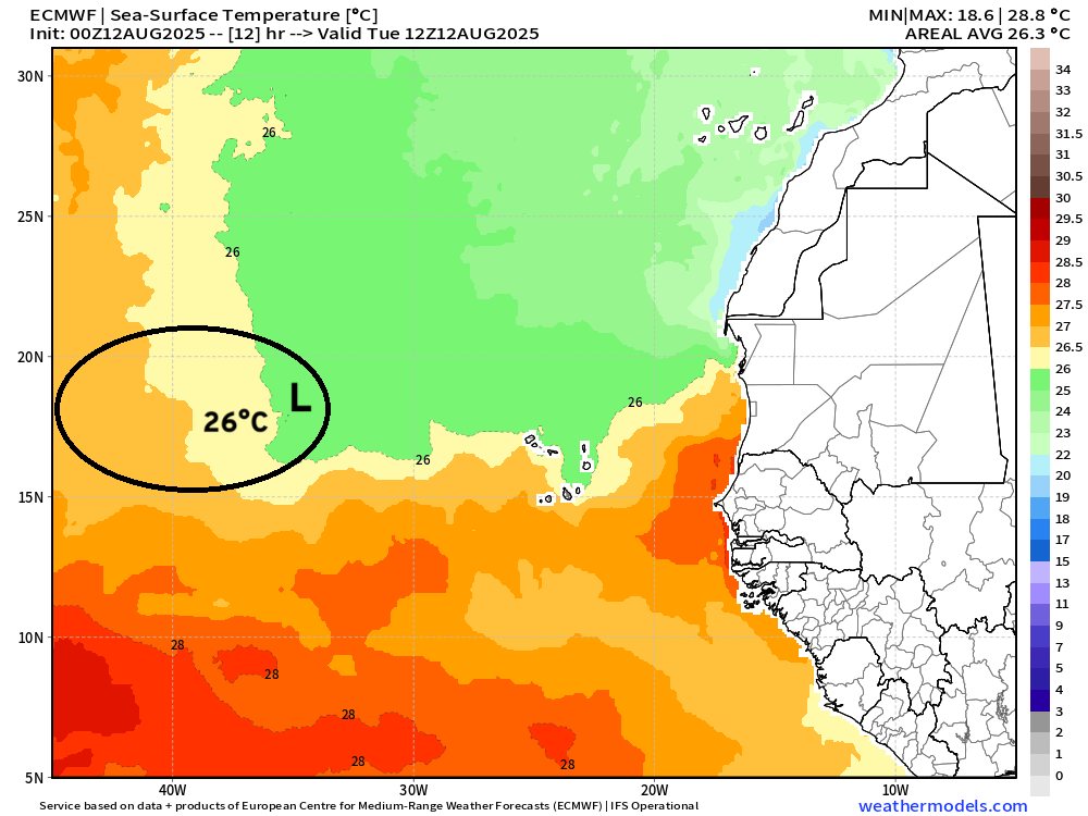
Erin will be moving quickly over warm water soon > 26°C
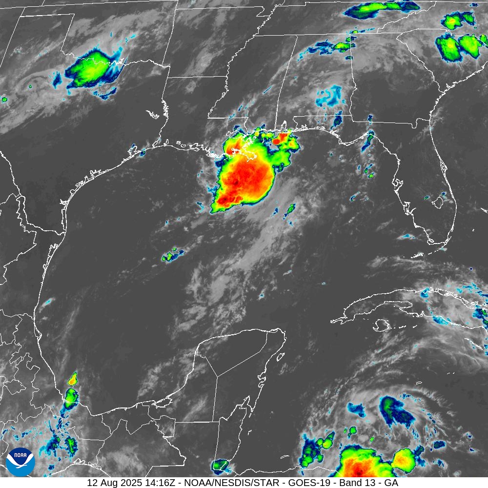
Atlantic Satellite Imagery | Infrared
Trough in Gulf is firing showers but no development expected (0%)
Tropical Storm Erin | Low level swirl
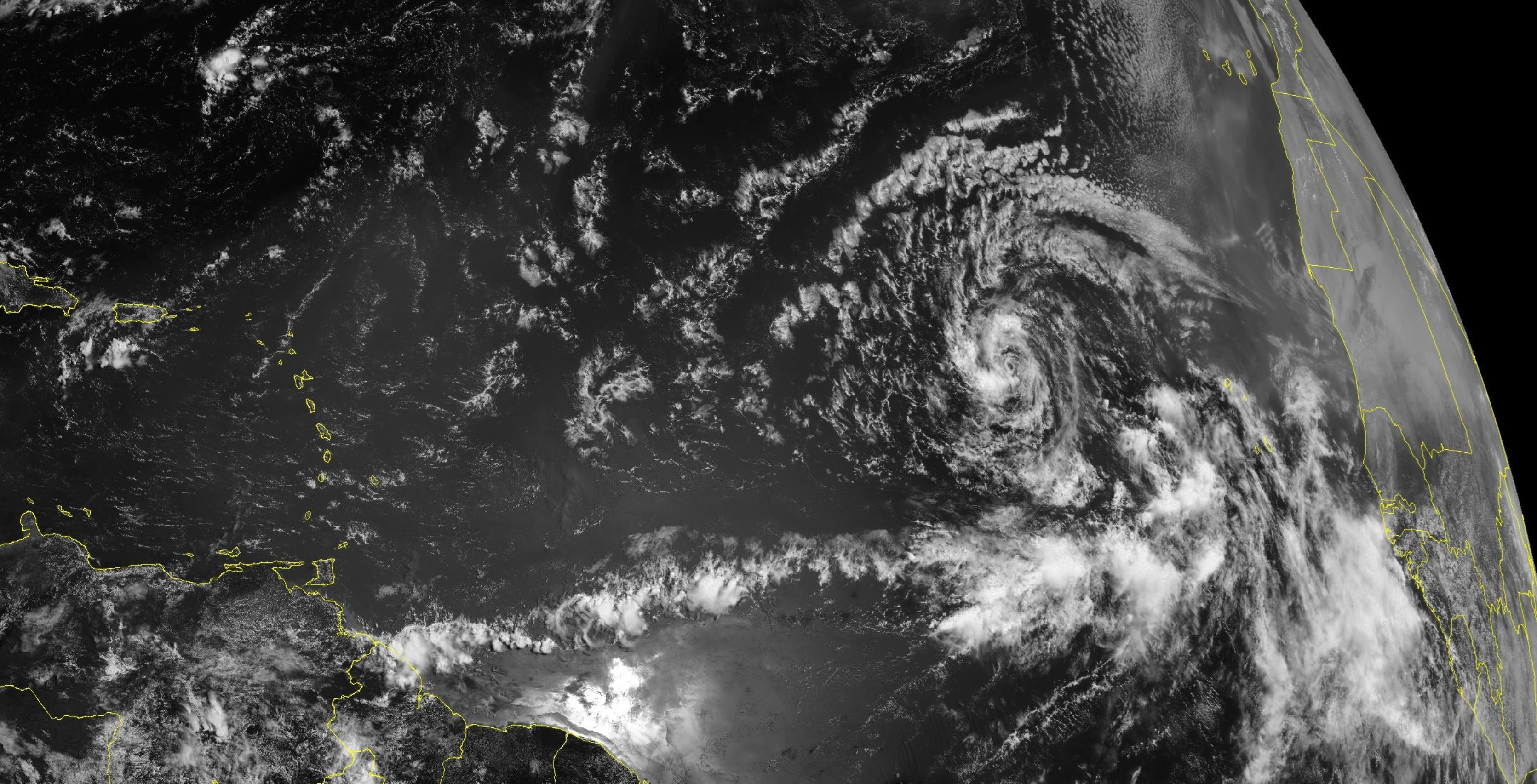
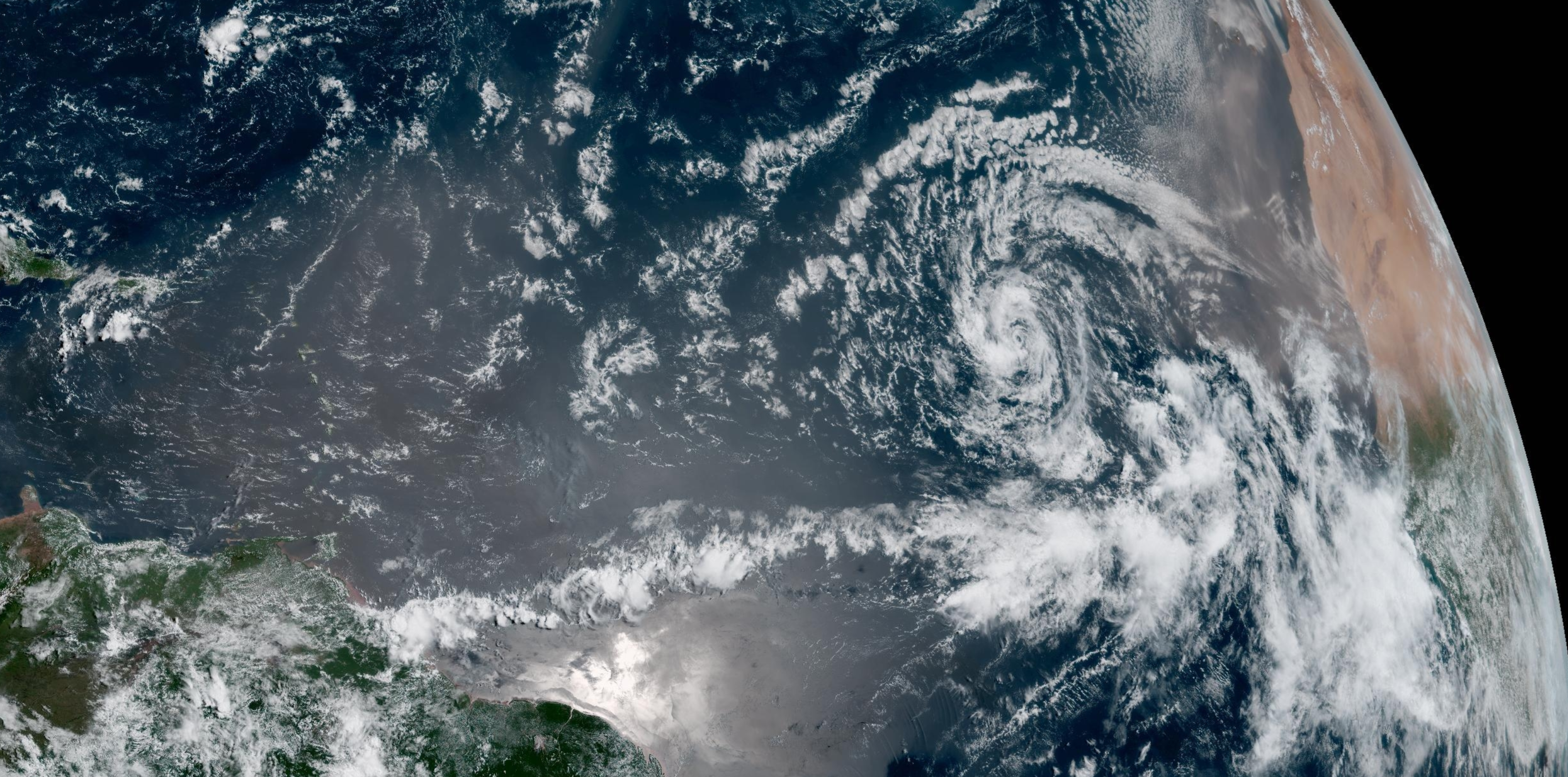
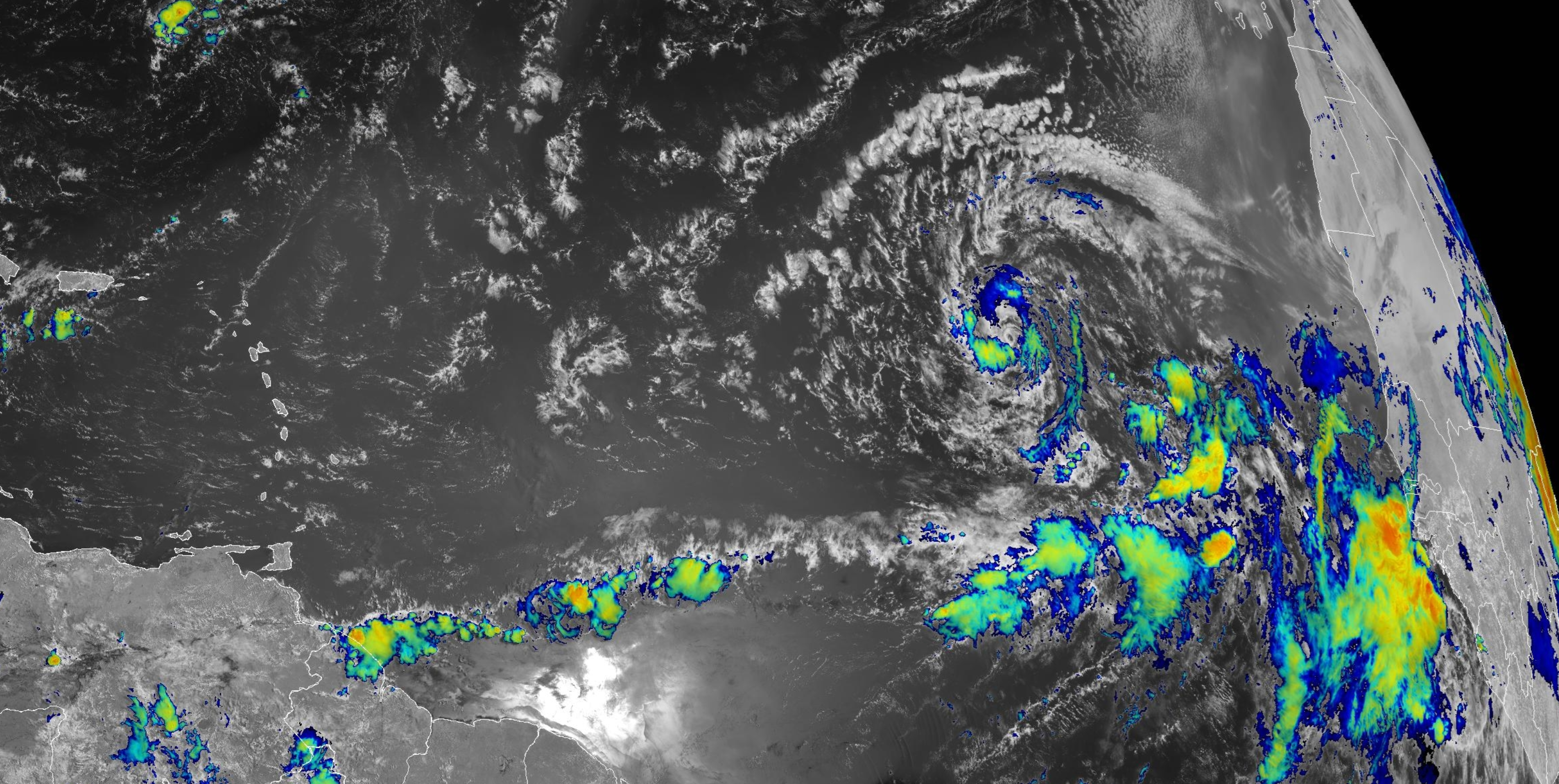
Eastern Atlantic & Tropical Africa | Satellite Image
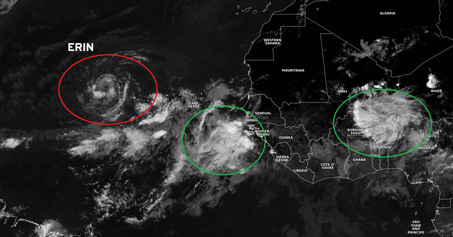
Another tropical wave emerged off the Africa coast earlier today but hasn’t maintained its convective vigor. Upstream — another wave moves out of Nigeria.
NASA GEOS-5 | 00z DUST Aerosol Optical Depth | 8-day Forecast
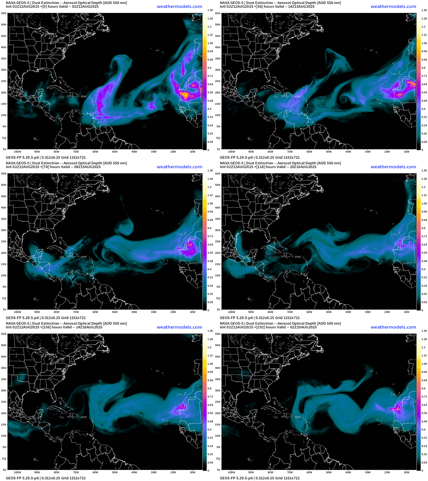
Plumes of Saharan dust coming off African continent to north of tropical wave and monsoon trough/ITCZ and any tropical waves must contend with this negative influence on its trek westward across the Atlantic MDR.
Atlantic Ocean Surface Temperatures (SST) + Anomaly (vs. last 20-years)
NOAA Tropical Surface Analysis | 06z
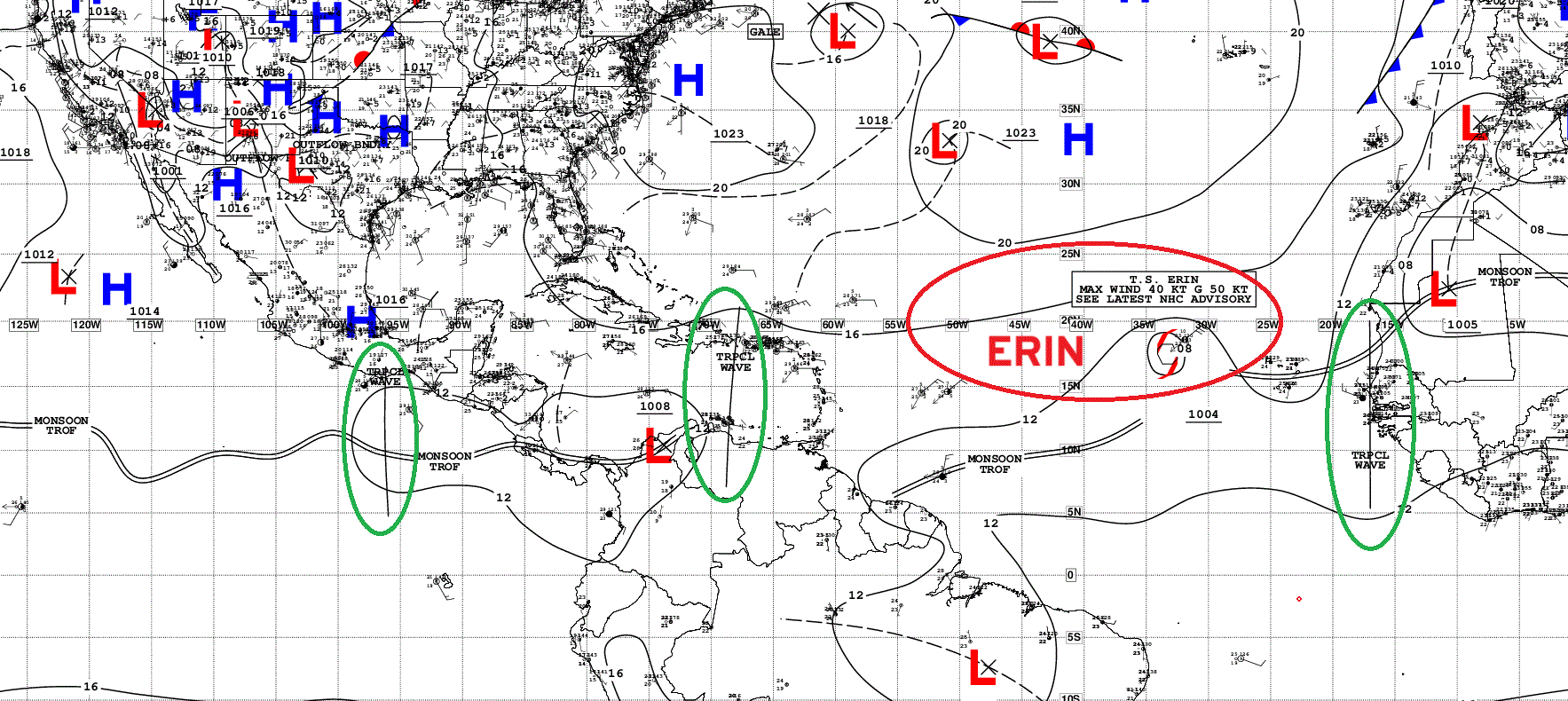
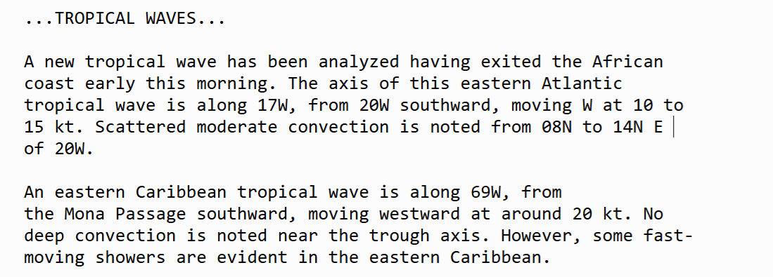
Atlantic Tropical Waves =1
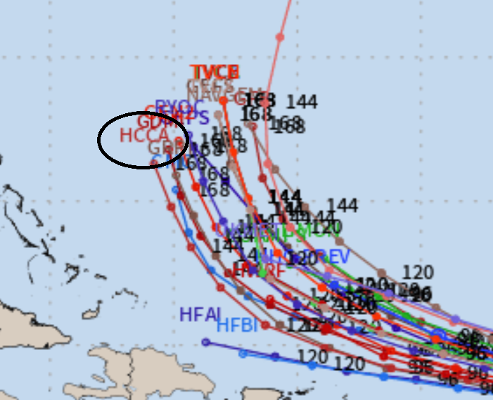
Tracks of Tropical Storm Erin (05L) | ATCF
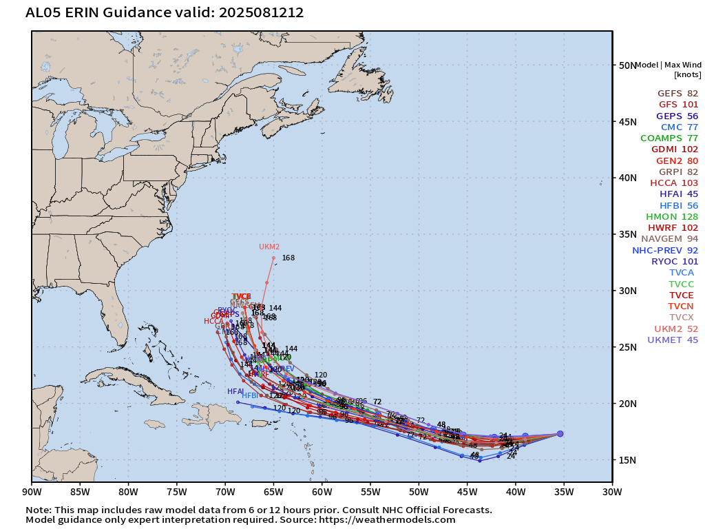
We watch the HCCA (Corrected Consensus) product from NHC — and it is on the WESTERN edge of the guidance envelope —> important for track changes at 12z.
EPS Ensembles (00z) Full Physics (3 ensembles = 6%) landfall impact
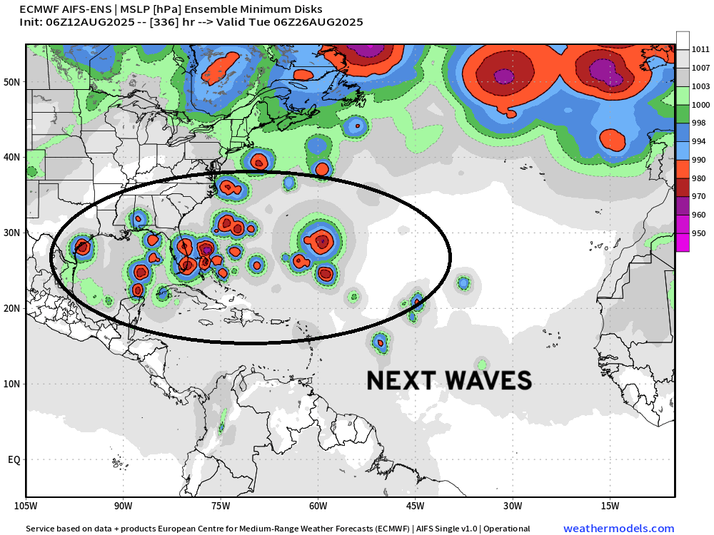
Looking into Day 14 —> Scattered development from following tropical waves.
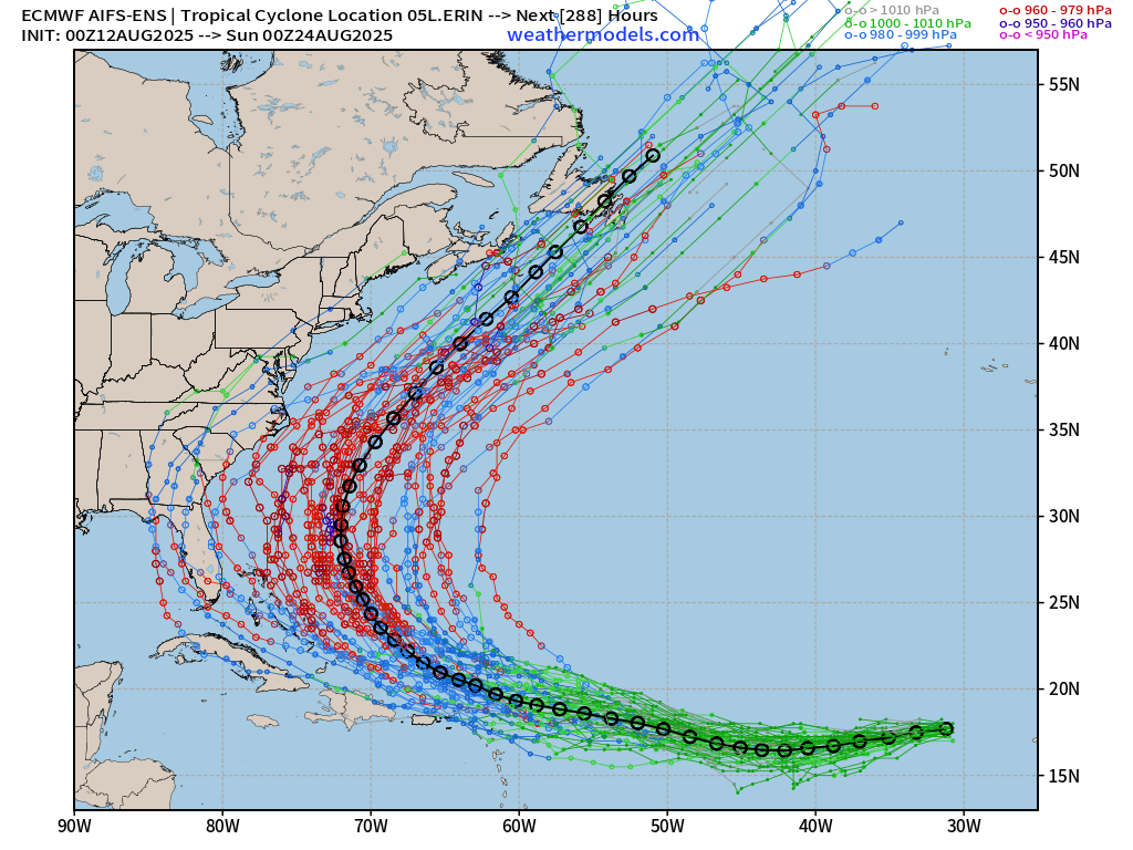
AIFS-ENS (06z) Machine Learning — a few more outlier landfalls ~10%
Following waves at Day 14 —> development
Previous 00z AIFS-ENS | Tropical Storm Erin (looks quite similar to 06z)
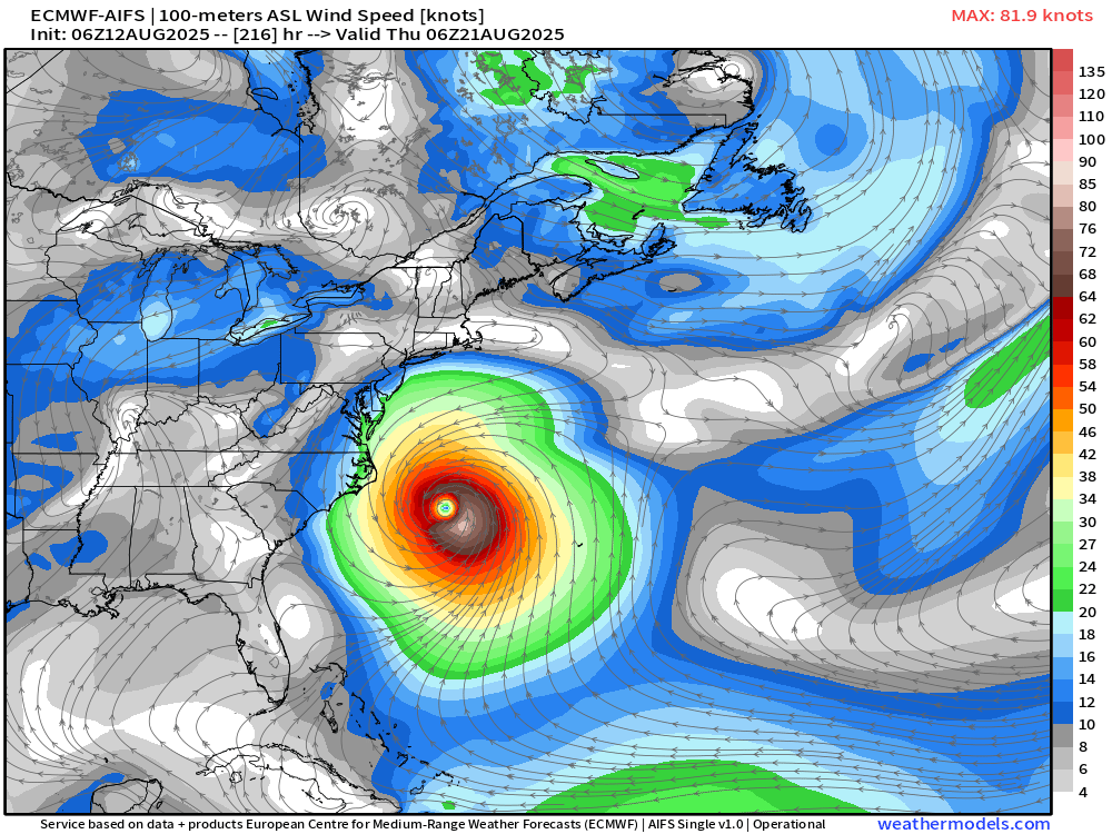
ECMWF AIFS-Single 06z Cycle —> Erin offshore at Day 9
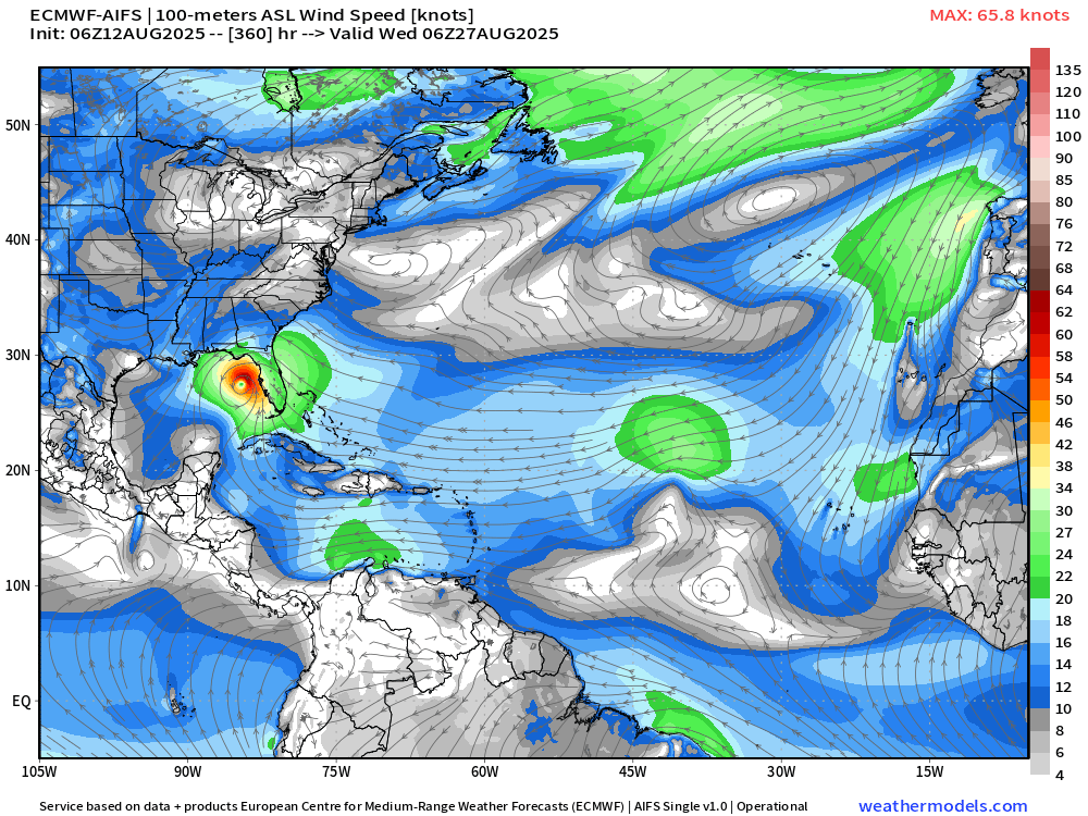
Gulf system at Day 15 —> just keeping an eye again for consistency (no action to take)
NOAA GFS 06z | Out to Sea —> Erin
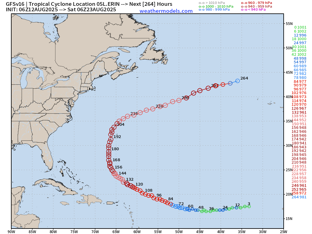
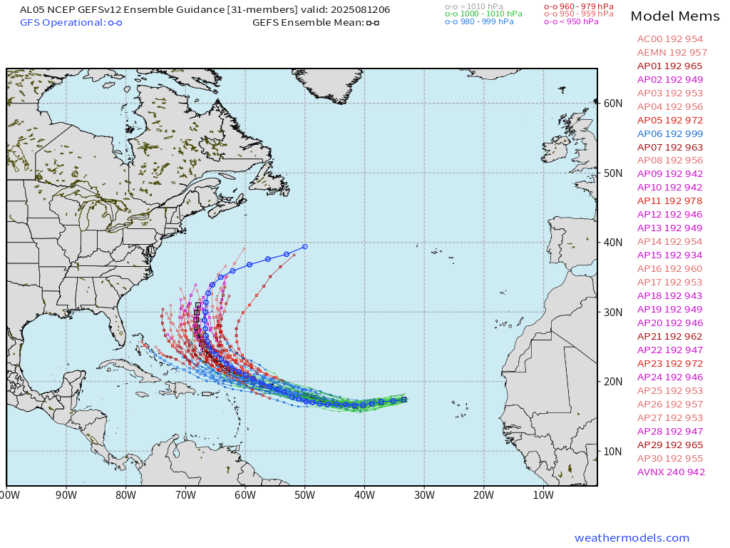
GEFS Ensembles 06z | All Tracks through Day 8 | Ensemble Mean is very close to GFS —> Out to Sea
Intensity of Erin from HAFS-A and HAFS-B —> Category 1 in the next 5-days — less vigorous intensification than previous forecasts
Eastern and Central Pacific Tropical Update
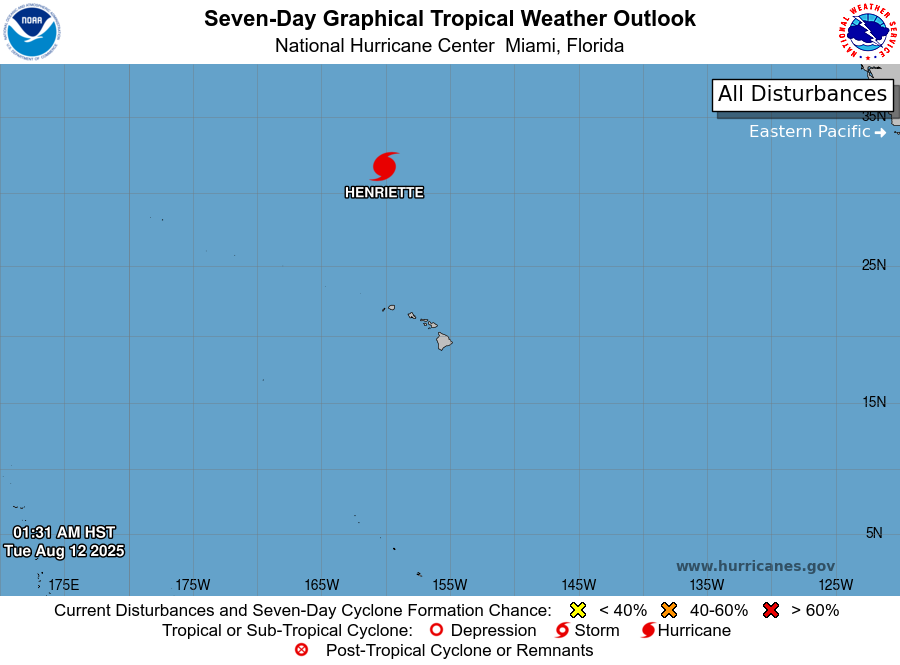
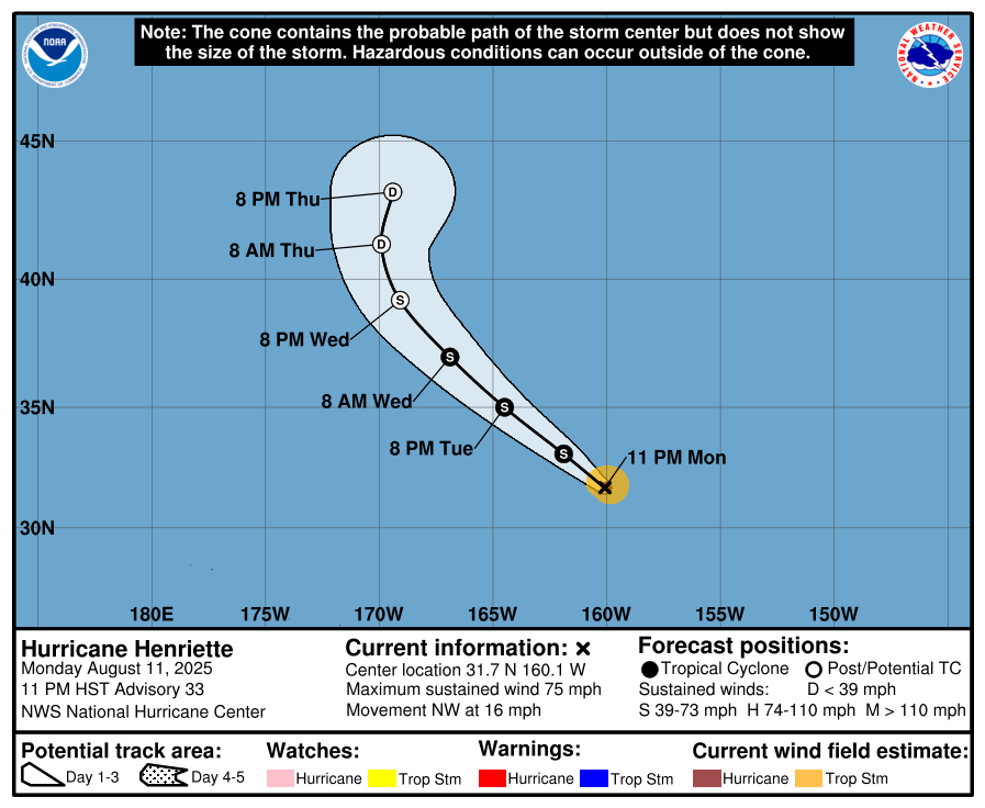
Henriette is still a tiny hurricane well north of Hawaii.
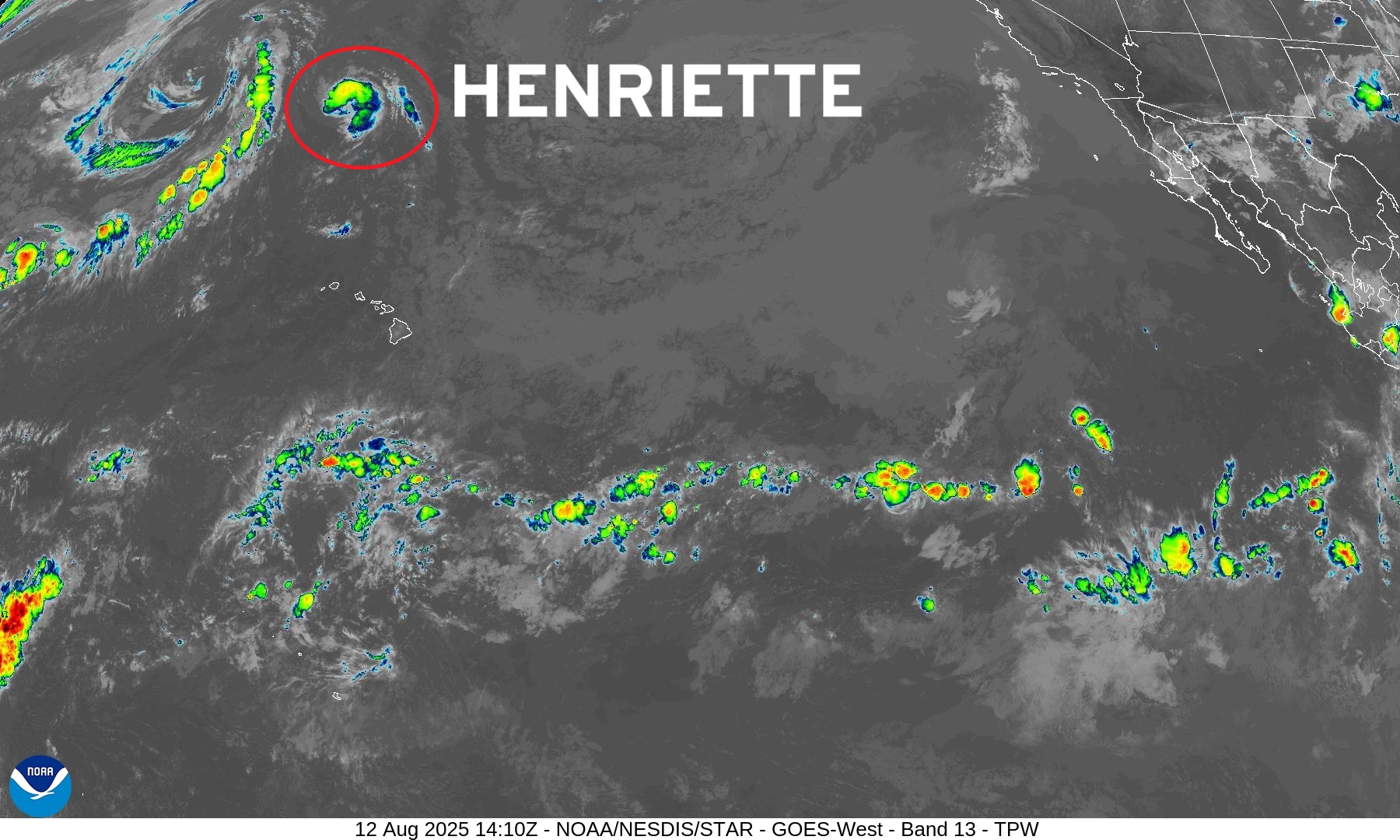
Rest of Eastern Pacific QUIET for the next 7-days
Western Pacific Typhoon Update
Typhoon Podul (16W) may become a major hurricane strength storm before landfall over southeast Taiwan in next 18-hours.
Ryan’s notes from August:
Heading into mid-August with a more active period in the Atlantic basin —> remember that we have many models updating every 6-12 hours, and many show catastrophic or historic solutions e.g. major hurricanes near land including the U.S.
HOWEVER, nothing is imminent or set in stone. We only use models to show the “plausible” scenarios of systems that could/may develop. We have 100s of solutions generated daily — 1000s per week. Digesting this information is the job of responsible meteorologists and media — to process the data, assess the risks, and add value.
The models cannot consistently and/or skillfully look over the predictability horizon e.g. 8-10 days especially with tropical cyclones. The convection / storm clusters are not resolved by the full physics weather models at their current resolution (9 km to 25 km). Also, the A.I. models do not provide that much of an additional skill gain for individual tropical cyclones that have not yet formed.
As we watch tropical waves come off Africa in the coming days, each/every has the potential to develop especially heading into August. However, when/where and what impacts are unknown.
Maps sourced from weathermodels.com designed and innovated by yours truly! Please subscribe there for real-time access to the newest maps, charts from all of the weather models including ECMWF.
- Milepost
- 700 · laid 2025-08-12T14:56:14.252000Z
- Source
- https://weather.substack.com/p/august-12-2025-tuesday-tropical-storm
- Digest
- f6aacf1d161904a98e3a4b5944c0f8cbc4263c998e32377e472c397c54b11d01
- Machine
- JSON