August 16, 2023 Hurricane Season
3 areas of interest in Atlantic & Hilary looms
August 2023 was the 10th-warmest August in the 132-year national record (1895–2026), at 74.4°F against a 1991–2020 normal of 73.1°F (+1.3°F).
August 2023 was the 43rd-wettest August in the 132-year national record (1895–2026), at 2.8in against a 1991–2020 normal of 2.7in (+0.1in).
NOAA/NCEI Climate at a Glance, contiguous United States. This is the observed record for the month, not a score of anything said in this piece — the forecast ledger begins 2026-08-17 and cannot reach earlier posts.
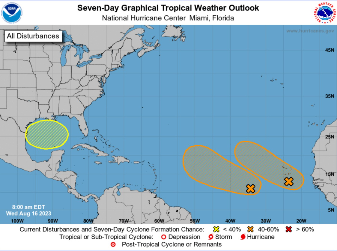
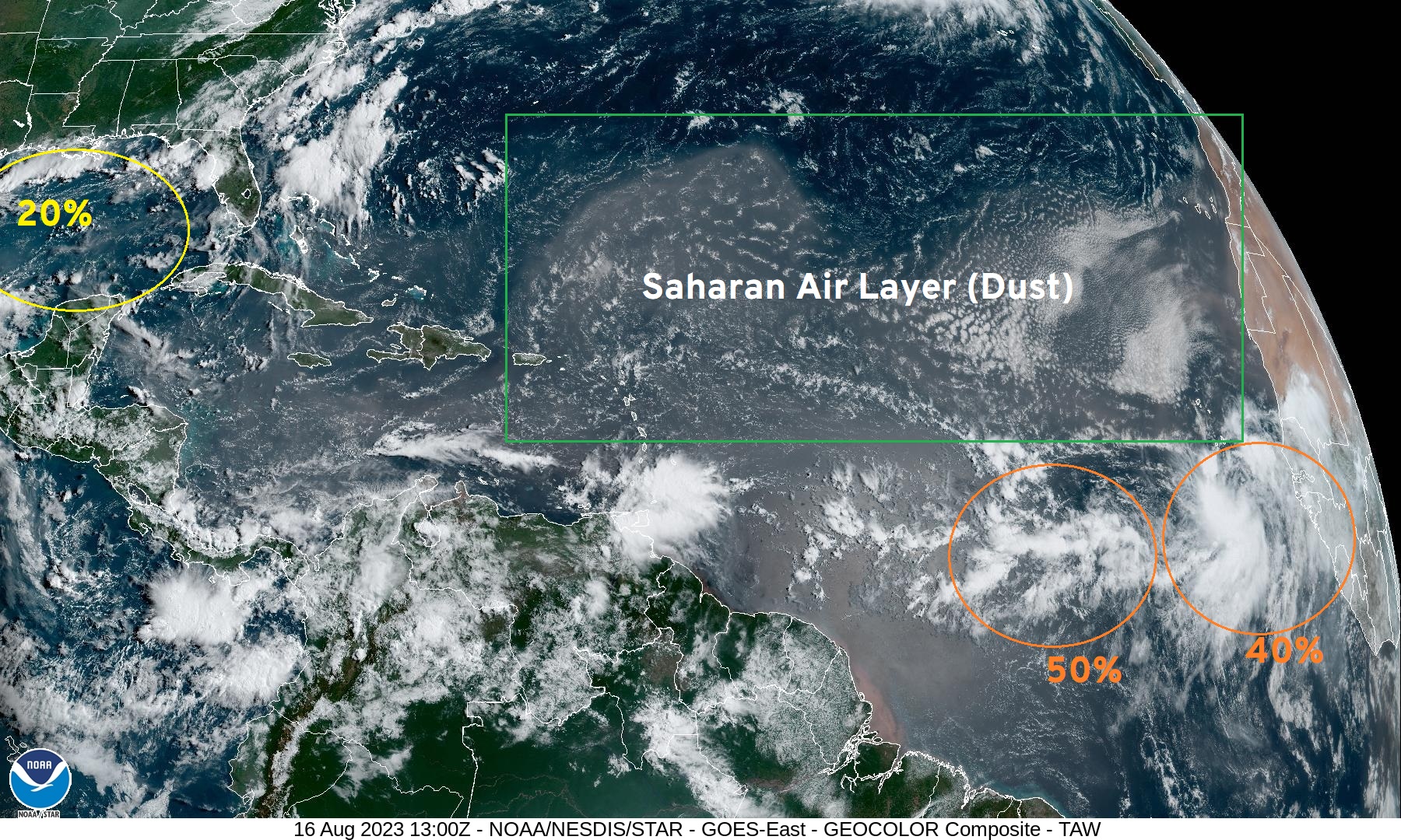
In the 7-day NHC tropical weather outlook, there are now 3 areas being watched for tropical cyclone development: Gulf of Mexico (20%) and two waves in the MDR (50% and 40%) as of Wednesday morning 8 AM. Unlikely to see these systems develop in the next 48 hours, but we only need convection to persist for 12-hours in order to create a center of circulation, especially over such warm ocean water. Dust remains an inhibiting factor over the central tropical Atlantic north of 20°N, and it is currently significant or thick. However, in the next several days, the Saharan Air Layer will diminish and may no longer be a major inhibitor for storm development heading into September.
Short term Atlantic Tropics
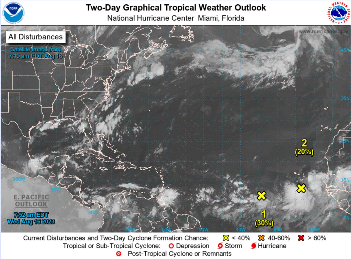
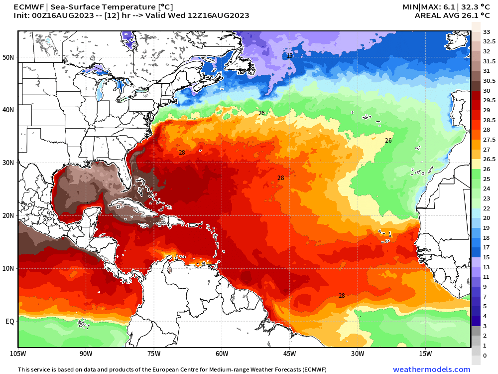
Two tropical waves (not yet invests) continue to slowly organize in the far Eastern Main Development Region (MDR) with 30% and 20% chance of formation in the next 48-hours. Note, the ocean waters are > 28°C and plenty warm for a hurricane. The general movement is WNW, so gaining latitude. Looking at GFS, the western wave — the 30% chance — seemed to have the best opportunity to intensify and track significantly westward toward the Eastern U.S. coastline in 10-12 days, but recurvature out to sea is climatologically favored.
Medium Range Atlantic Tropics
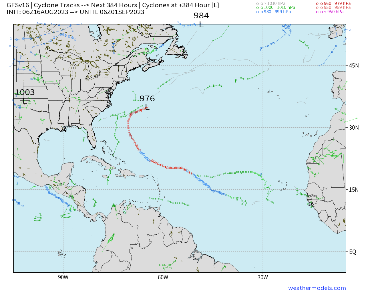
GFS 06z through 16-days cyclone tracks (weathermodels.com) has a long-lived Hurricane Emily (or Franklin) but limited development of the eastern-most wave, and nothing in the Gulf of Mexico. Active systems at Day 7 in the ECMWF ensembles include both tropical waves and a tropical storm in the Gulf of Mexico. Note, this is all 51-members, so some solutions have 0 or 3 named storms — so we use these track amalgamations for hints at development, and only track and intensity once a tropical cyclone is designated.
The tracks over the Caribbean are from the tropical wave currently at 30%. It dips WSW in the elongated monsoon trough and finds favorable environmental conditions in 4-5 days.
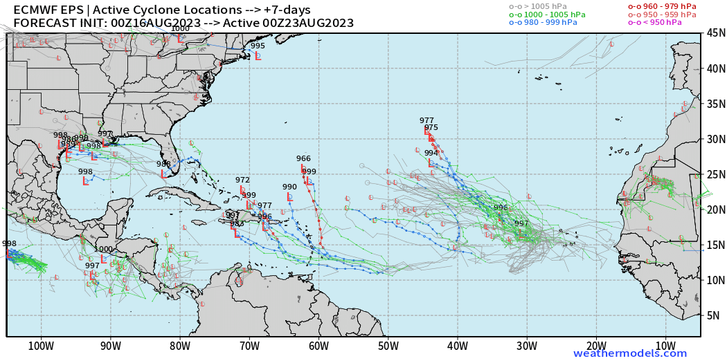
ECMWF EPS | +7 Days Ensemble tracks [weathermodels.com]
Looking ahead to 15-days, and the end of August, the ensemble tracks look ominous with hurricanes everywhere. However, we should not panic nor be inordinately concerned (yet) since the weather model run 51-times will generally produce at least 1 or 2 hurricanes in a 2-week period in the Atlantic during the most active parts of the season. Also, the vast majority of the hurricanes harmlessly recurve out to sea without land impacts. So, why bother showing this? There is a significant uptick in overall activity on the way.
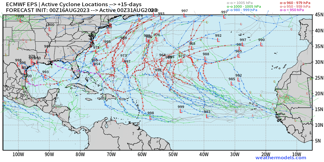
ECMWF EPS | +15 days Ensemble tracks [weathermodels.com]
Atlantic 2023 Year to Date | ACE: 17 (120% normal)
Unnamed Storm [January 2023]
Arlene 02L: 35 knots
Bret 03L: 60 knots
Cindy 04L: 50 knots
Don 05L: 65 knots
Emily
Franklin
Eastern Pacific Hurricane Season
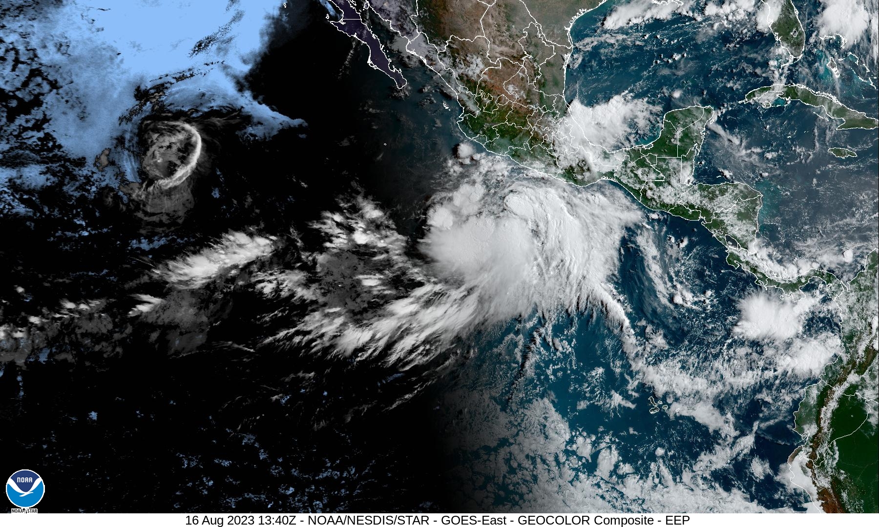
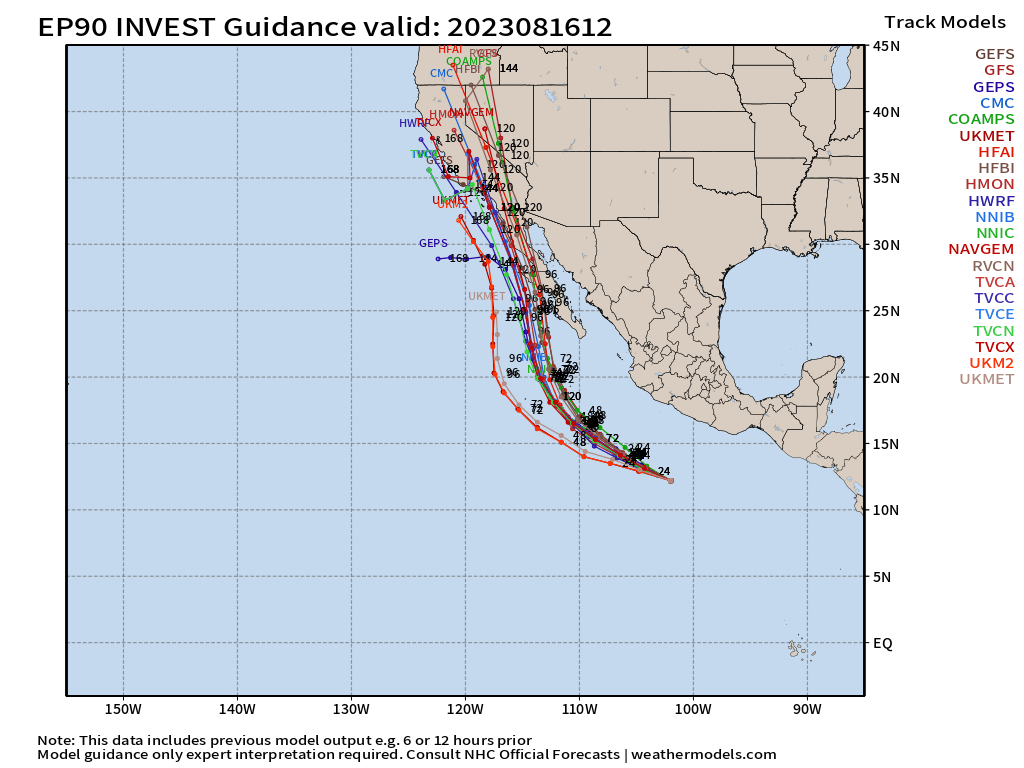
Invest 90E looks impressive on visible satellite imagery at 10 AM and is well positioned to rapidly intensify into powerful Hurricane Hilary. The tracks are into California, almost unanimously in about 5-days. Hilary will no longer be a hurricane, but it will be a formidable tropical system — perhaps still named — as it heads near or over the Baja California peninsula. The massive heat dome over the center of the U.S. will aid in ventilating Hilary and allow it to maintain convection longer than normal over colder water. This may be a serious issue for Southern California in terms of winds and flooding.
Eastern Pacific 2023 Year to Date
Adrian 01E: 90 knots
Beatriz 02E: 75 knots
Calvin 03E: 110 knots
Four 04E: 30 knots
Dora 05E: 125 knots
Eugene 06E: 60 knots
Fernanda 07E: 115 knots
Greg 08E: 45 knots
Hilary 09E: coming soon
ACE: 88 | 151% of normal (58)
Western Pacific Typhoon Season
Taking a break for the next week.
Western Pacific Typhoon 2023 Year to Date
Sanvu 01W: 30 knots
Mawar 02W: 160 knots
Guchol 03W: 90 knots
Talim 04W: 85 knots
Doksuri 05W: 130 knots
Khanun 06W: 120 knots
Lan 07W: 115 knots
ACE: 146 | 144% normal (101)
Thank you for subscribing! Your support pays for my servers and product development. Feel free to say hello and follow on Twitter (@RyanMaue)
- Milepost
- 69 · laid 2023-08-16T14:07:55.749000Z
- Source
- https://weather.substack.com/p/august-16-2023-hurricane-season
- Digest
- d36dac97bbe261158548cbe9fe19b8aac652d5687926e2d02a19b133aafd36b3
- Machine
- JSON