July 4, 2025 Hurricane Season Friday
Tropical Storm Chantal to form on Saturday and head into South Carolina
July 2025 was the 20th-warmest July in the 132-year national record (1895–2026), at 75.4°F against a 1991–2020 normal of 74.4°F (+1.0°F).
July 2025 was the 27th-wettest July in the 132-year national record (1895–2026), at 3.1in against a 1991–2020 normal of 2.9in (+0.2in).
NOAA/NCEI Climate at a Glance, contiguous United States. This is the observed record for the month, not a score of anything said in this piece — the forecast ledger begins 2026-08-17 and cannot reach earlier posts.

Happy Independence Day, America at 249
Friday’s Tropical Update
Atlantic Basin: Tropical Depression 03L likely to become “Chantal” but remain a minimal tropical storm prior to landfall early Sunday in South Carolina
Eastern Pacific Basin: Next system (90%) likely to form south of Mexico and would become Tropical Storm Gil (07E).
Western Pacific Basin: Tropical Storm Mun (04W) continues east of Japan over open ocean. Tropical Storm Danas (05W) will become a Typhoon and be squeezed west of Taiwan, then into China in a few days.
Current Satellite Imagery | United States
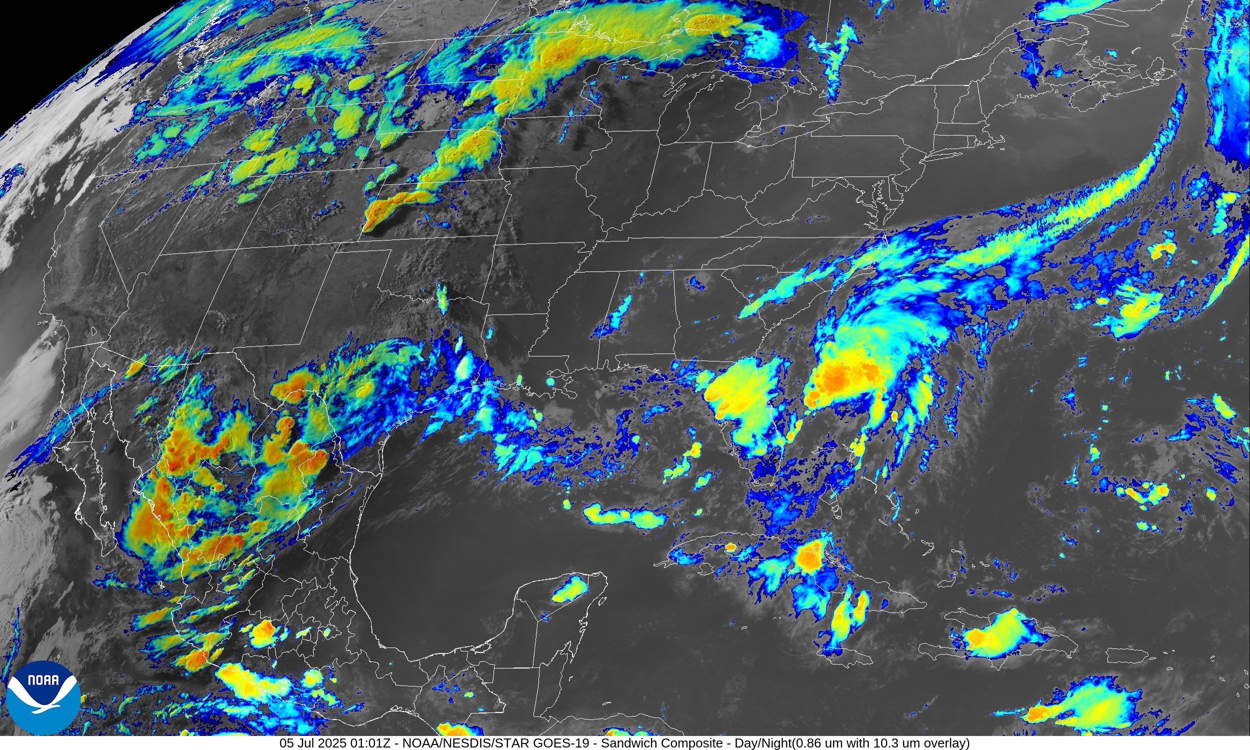
Monsoon moisture cleared out of AZ/NV/NM but terrible flooding associated with remnants of Tropical Storm Barry devastated the Hill Country of Texas with flash flooding.
Florida is on the left side of TD 03L with a trough to the north oddly enough keeping the rest of the Southeast dry. TD 03L looks less organized this evening after passing the eye test as a tropical storm earlier this afternoon.
New England and Mid-Atlantic are dry and clear.
Temperatures | 7:45 PM ET
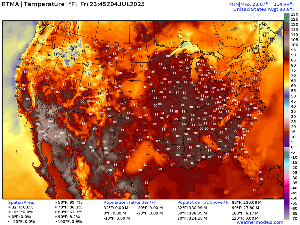
Not too bad across the Lower 48 this evening — 4th of July. Could be a LOT hotter, instead we are seeing a cool western U.S. outside of the deserts, and a rain / cloud covered Texas all day.
Temperature Anomaly | 7:45 PM ET
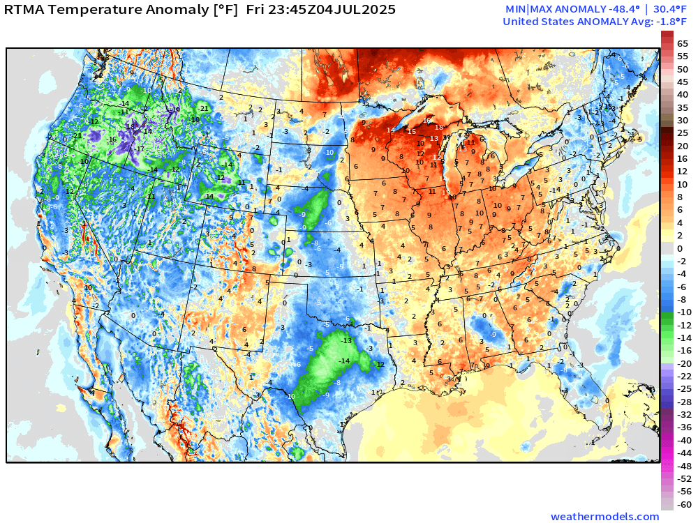
Overall, the Lower 48 is -1.8°F below average with the cool Western U.S. outweighing the warmth in the Great Lakes.
Lows for Saturday
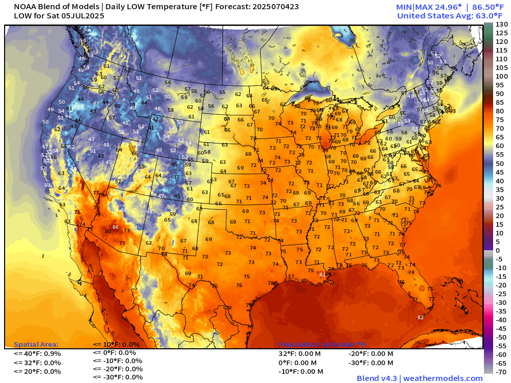
More mild in the 70s to start off Saturday east of the Rockies, except for the Northeast in the 50s and lower-60s.
Highs on Saturday and Sunday
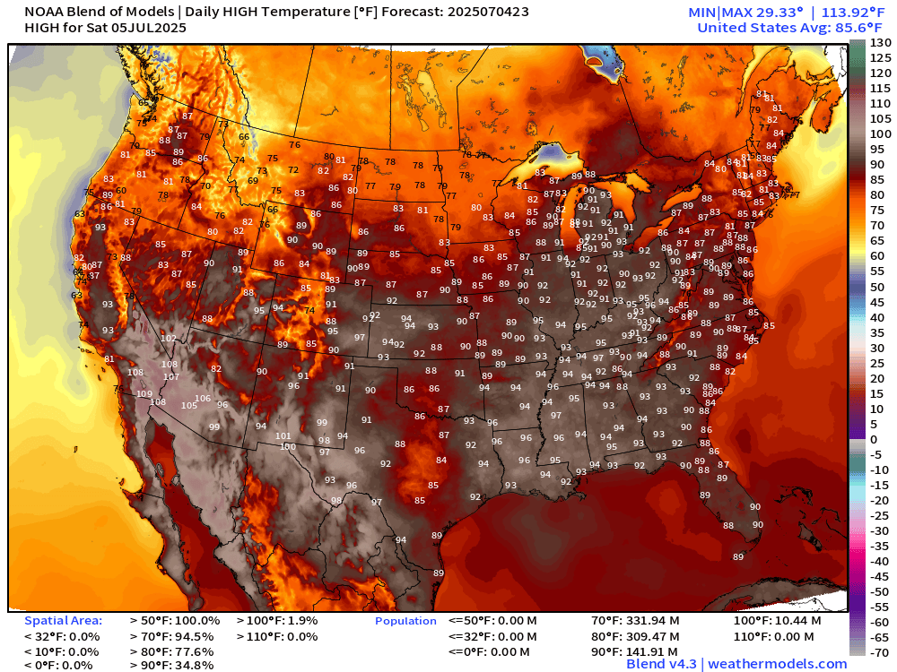
142 million at least 90°F with hot weather in Chicago, Detroit, and Cincy in the 90s. Mid-to-Upper 90s in the Deep South.
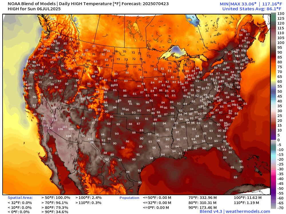
Hotter on Sunday by a fair margin as the West regains some 90s. Overall 174 million hit the 90°F mark with nationwide average high of 86.1°F.
Weather on Saturday
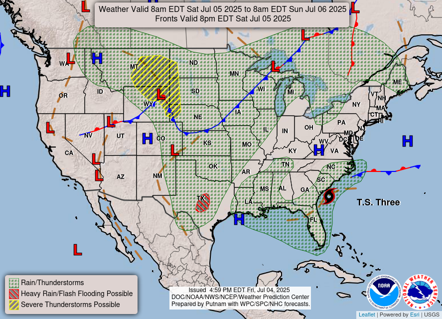
Widespread scattered showers and storms continue yet again along a front dipping through the Midwest and Plains. Tropical Storm Chantal will be nearing the South Carolina coast late Saturday.
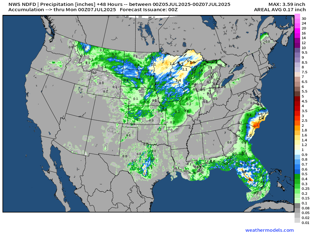
NWS Precipitation Next 48-hours
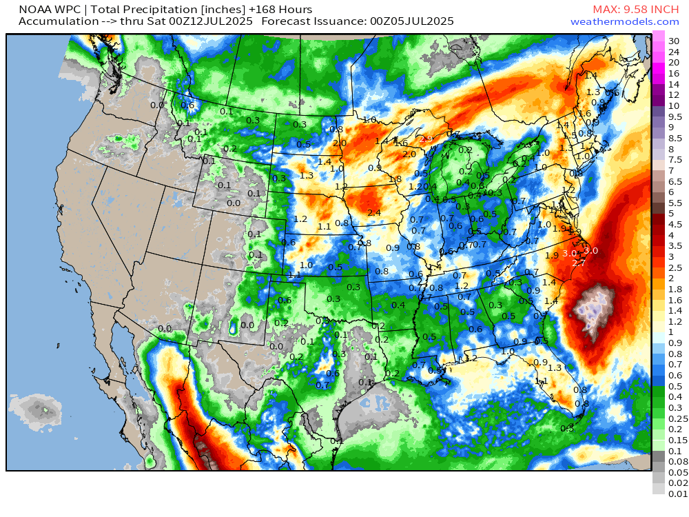
NWS WPC Precipitation Next 7-days
ECMWF 12Z | Integrated Vapor Transport | Next 8-days
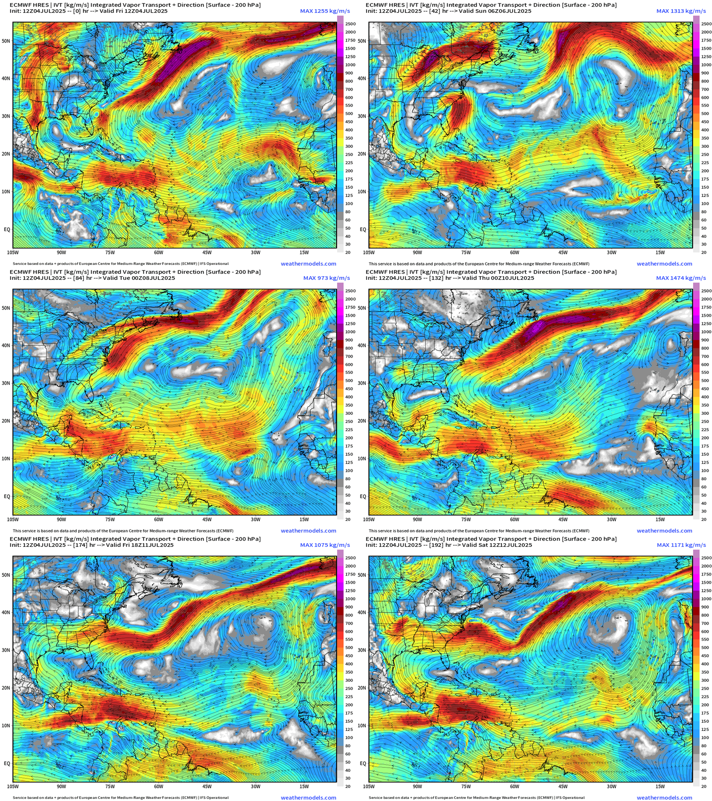
TS Chantal will merge with a passing trough/frontal boundary along the Northeast coast and then accelerate out in the Atlantic.
Tropical waves are obliterated as they head westward from Africa to the Lesser Antilles barely holding together any semblance of a circulation. Nothing else going in the Atlantic for 7-8 days (July 11).
Thank you to readers continuing into this Hurricane Season. My goal is to keep you informed about ongoing extreme weather events inside and outside of the tropics, but also a week (hopefully) heads up on what’s coming. I’ll be using a variety of weather modeling output, some of it may be unfamiliar, but it’s state-of-the-art and industry leading standard.
Atlantic Basin Outlook
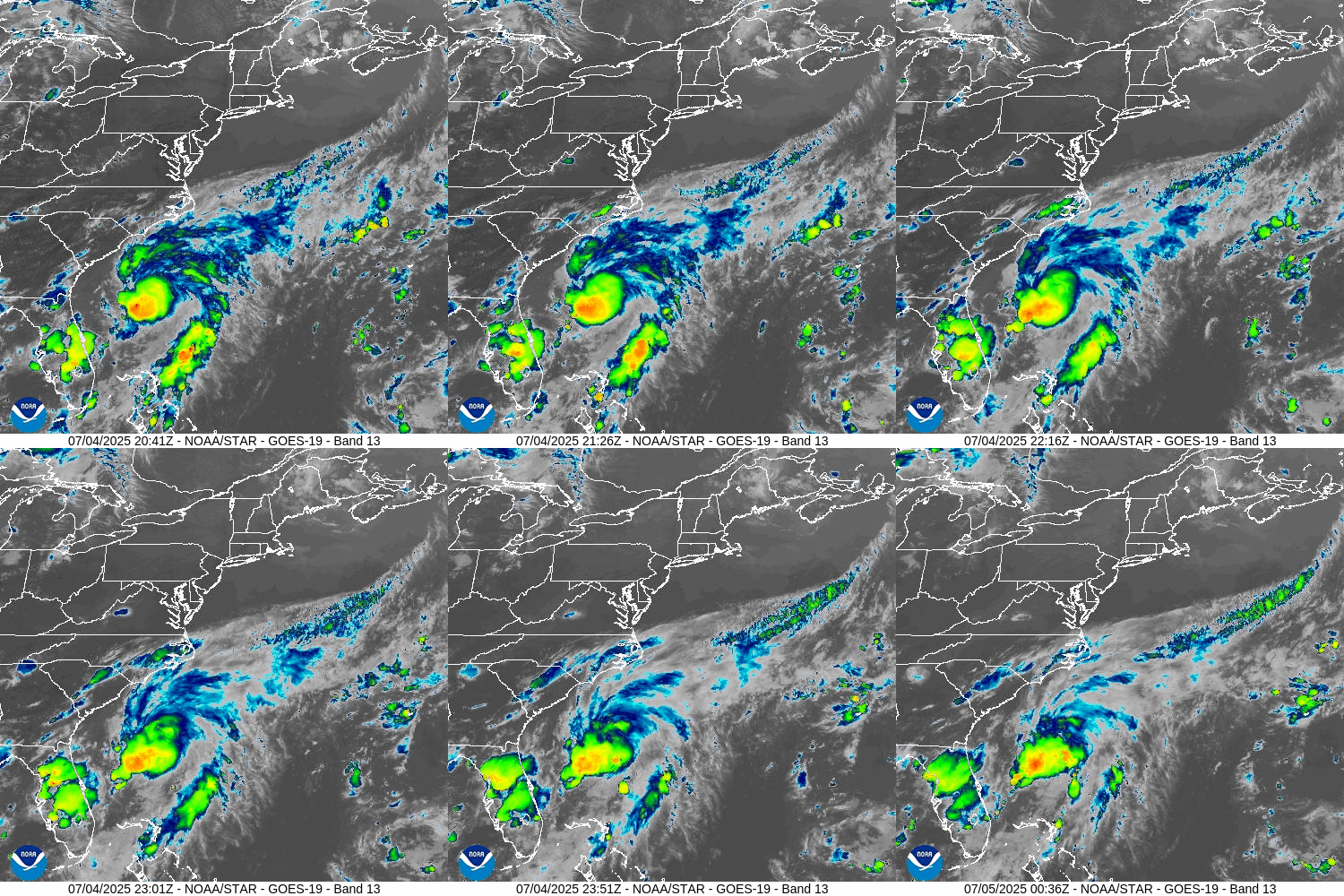
Tropical Depression 03L does have deep convection ENE of the center but wind shear from the SW is blowing/tipping over the system limiting the ability to align and intensify.
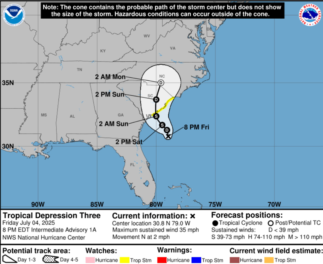
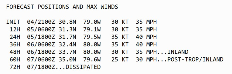
NHC Forecast | 35 knots at landfall = Minimal Tropical Storm
HAFS-A and B are more excited about the system — with pressure around 1000 mb and 850 mb winds at 60 knots suggesting more upward potential for “Chantal”
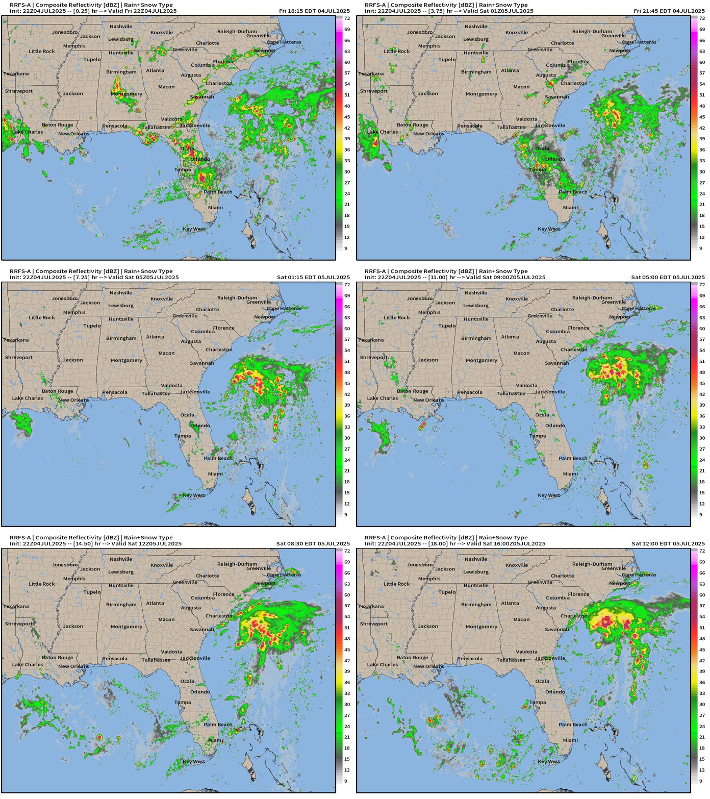
Loop from RRFS-A over next 18-hours does show more organization by Saturday morning.
NEW SUBSCRIBER OR ANNUAL UPGRADE | COUPON (through July 4th)
Eastern Atlantic Satellite Image
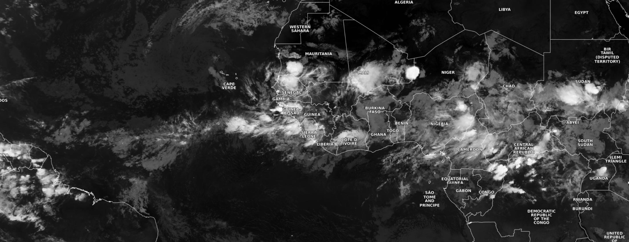
Major dust plume almost to the Lesser Antilles with another one — perhaps bigger — on its heels has wiped out convection from the Main Development Region (MDR).
NASA GEOS-5 | 00z DUST Aerosol Optical Depth (AOD) | 8-days Forecast
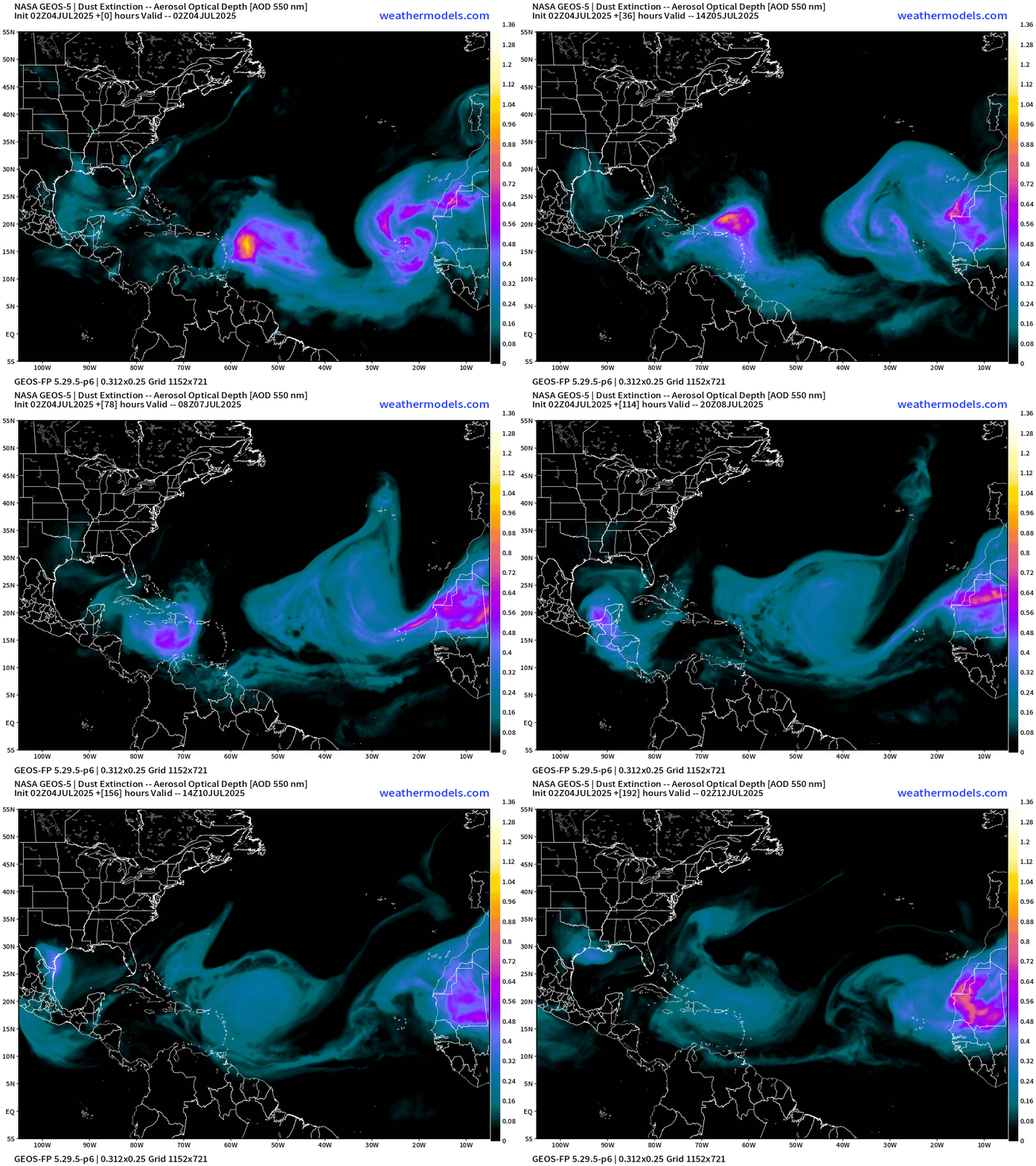
Very active and intense SAL + dust plumes from Africa over the next 8-days with no signs of stopping.
Major reason why the Atlantic MDR can’t get going with organized convection is perpetual plumes of dust from the Sahara. These air layers are warm and stable above the surface and inhibit convection. The plumes circulate clockwise (high pressure) with a major amount of dust heading into the Gulf over the next few days in 2 waves.
Atlantic Ocean Surface Temperatures (SST) | Anomaly
Very warm water for anything tropical to develop across the Gulf of Mexico eastward and across Florida to Bermuda. 28°C water expanding across the western Atlantic off the U.S. East Coast — but this likely a thin layer near the surface (of course) and could mix with much cooler air in the next 2-weeks as the weather pattern across the western Atlantic sees more rain and wind + waves,
Tropical Atlantic Satellite Imagery
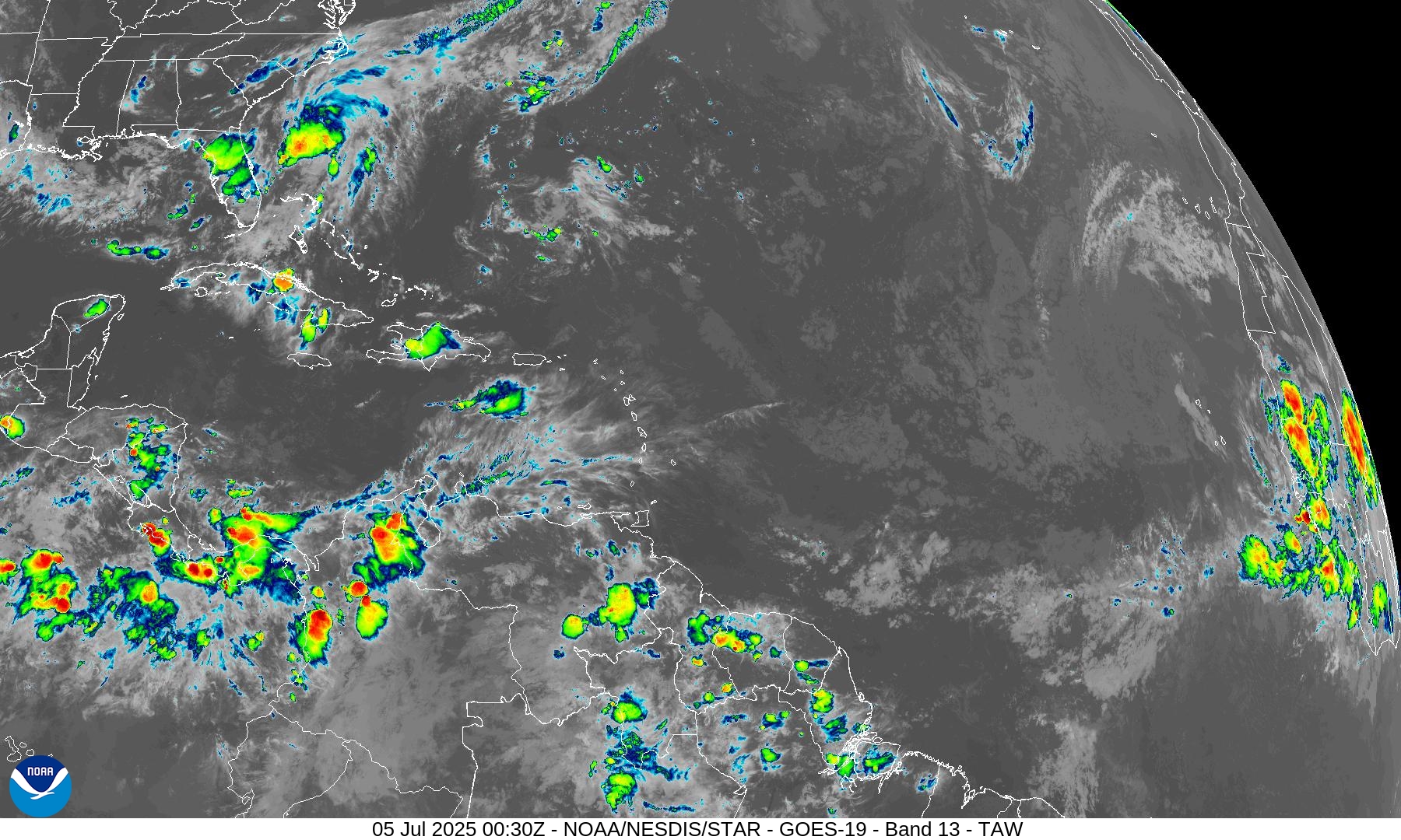
Tropics are almost devoid of convection — nothing in the MDR and the Caribbean and Gulf of America are mostly clear.
NOAA Tropical Surface Analysis | 18z
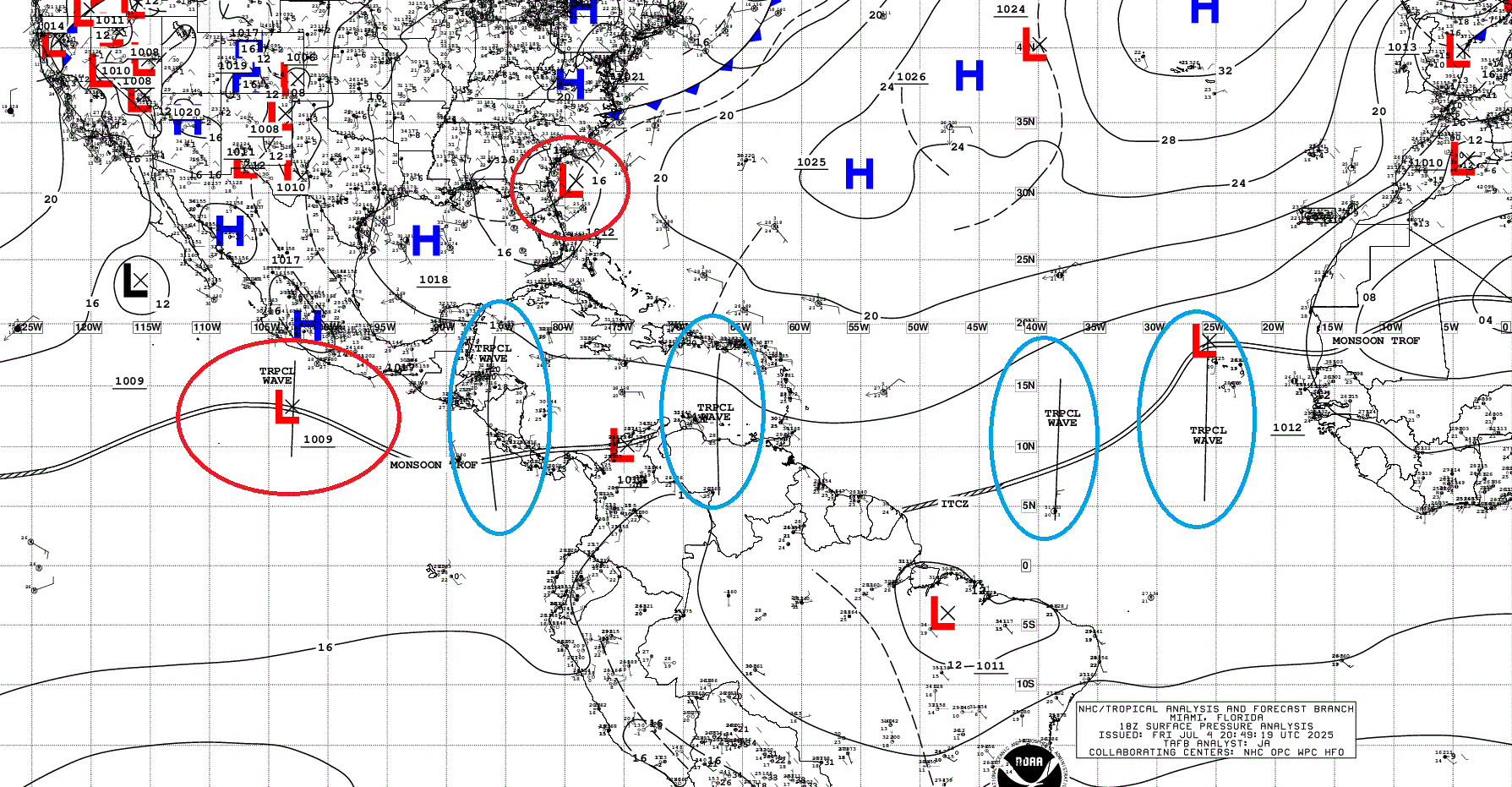
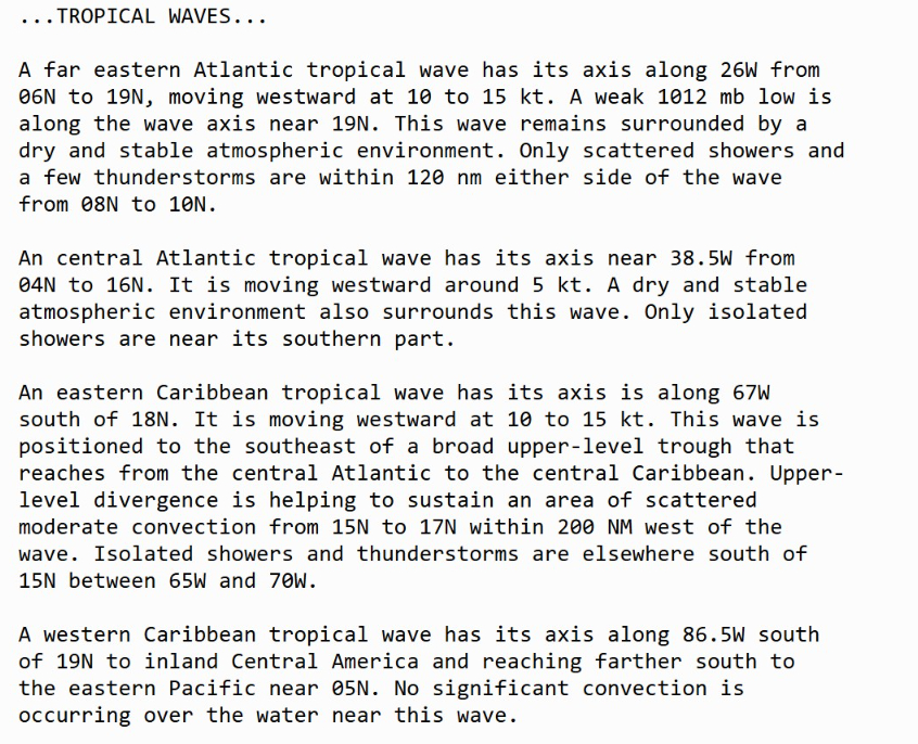
Atlantic Tropical Waves = 4 but no development expected from them (at least in the Atlantic).
HRRR Precipitable Water Next 48-hours
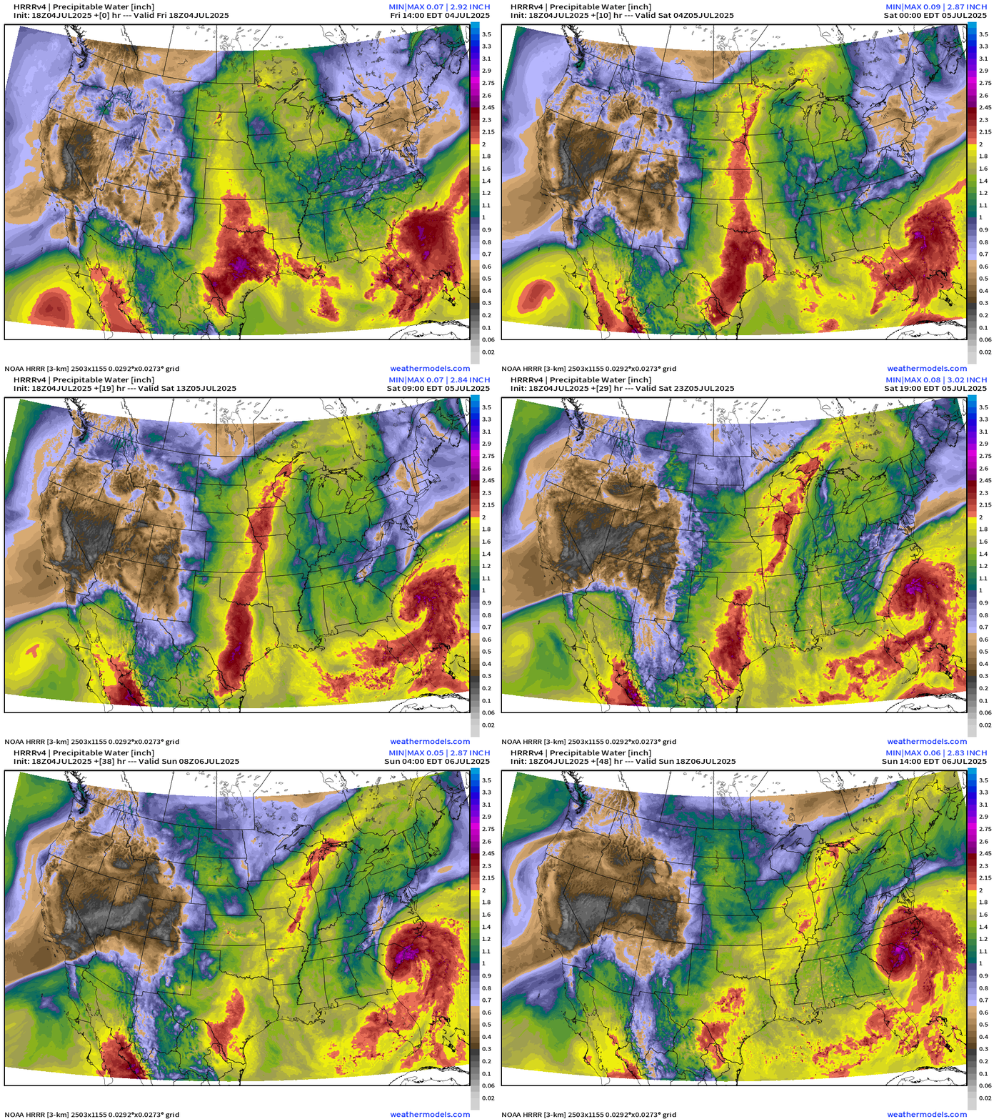
Chantal looks great on the HRRR prior to landfall — so I’d take the over on organization and intensity … maybe 55-knots. The warm Gulf Stream waters can do quick work on even a sheared system.
Atlantic Precipitable Water | Next 5 days
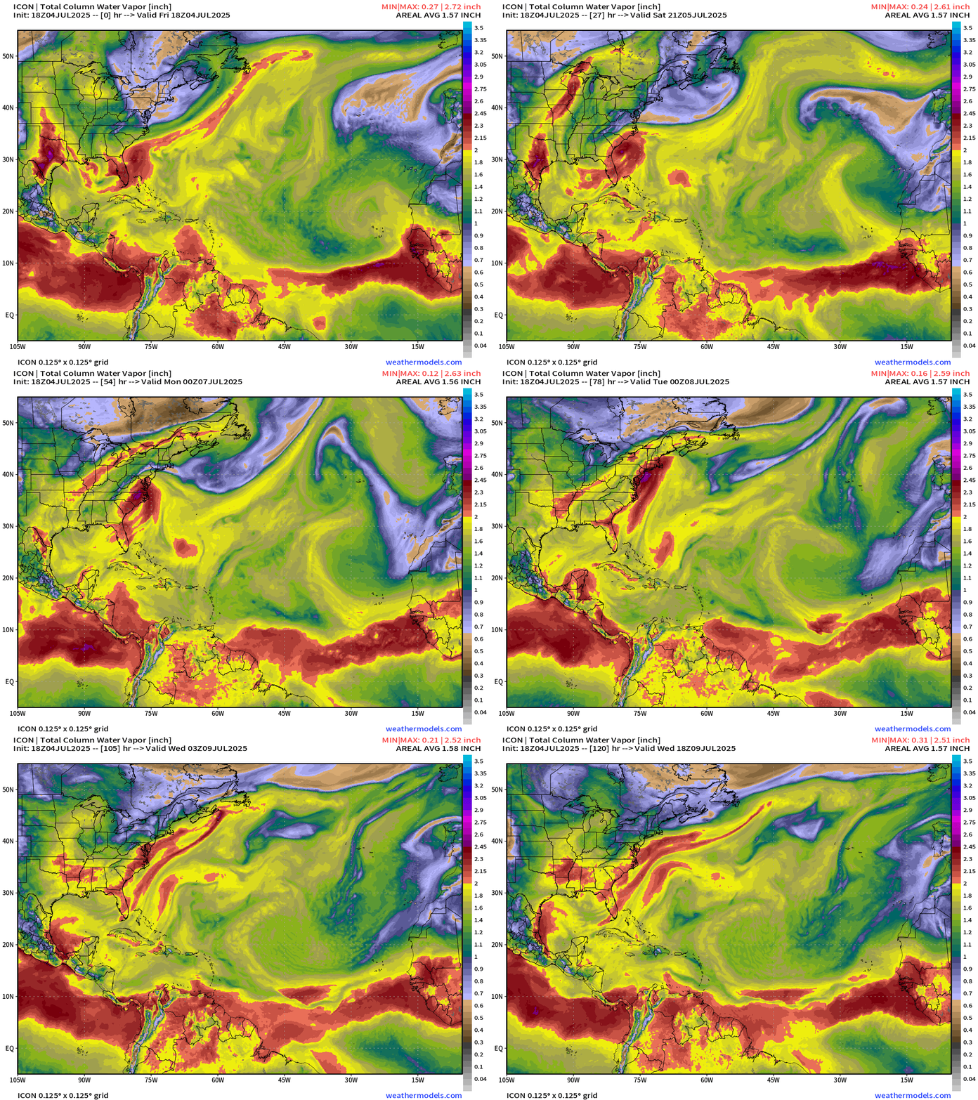
Nothing else besides TD 03L —> Chantal along the U.S. East Coast.
Medium range ensemble model outlook
These are 51-realizations of the same model with different initial conditions. Each ensemble gets equal ~2% weight in a mean calculation.
ECMWF Ensembles 12z | 15-Days | All storm Tracks
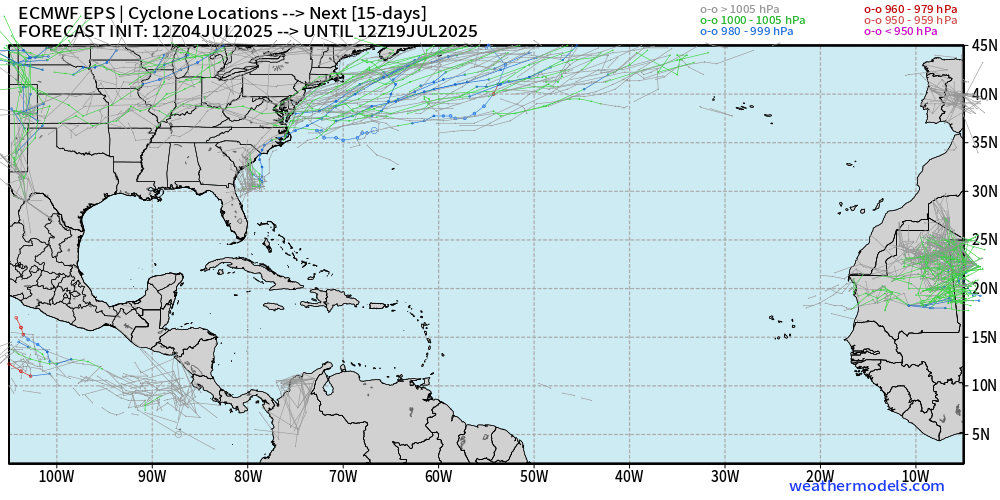
Comparison with AIFS-Ensemble 06z | 15-Days All Storm Tracks
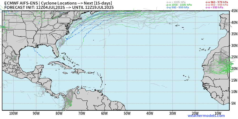
Aside from East Coast system … blank slate across the tropical Atlantic through July 19th.
Eastern Pacific Tropical Update
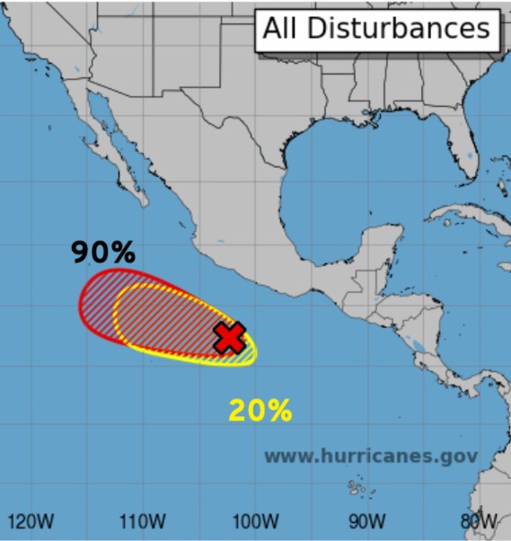
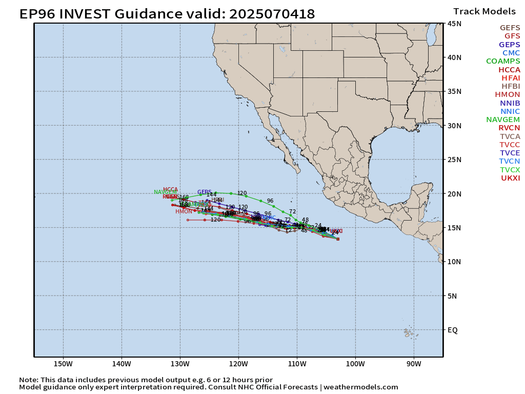
Gil (96E) — next up at 90% and then NHC is watching yet another system to develop in the wave train (20% 7-days)
Invest 96E will go westward once it starts cooking and could survive a little longer than Flossie, which was obliterated by cold water.
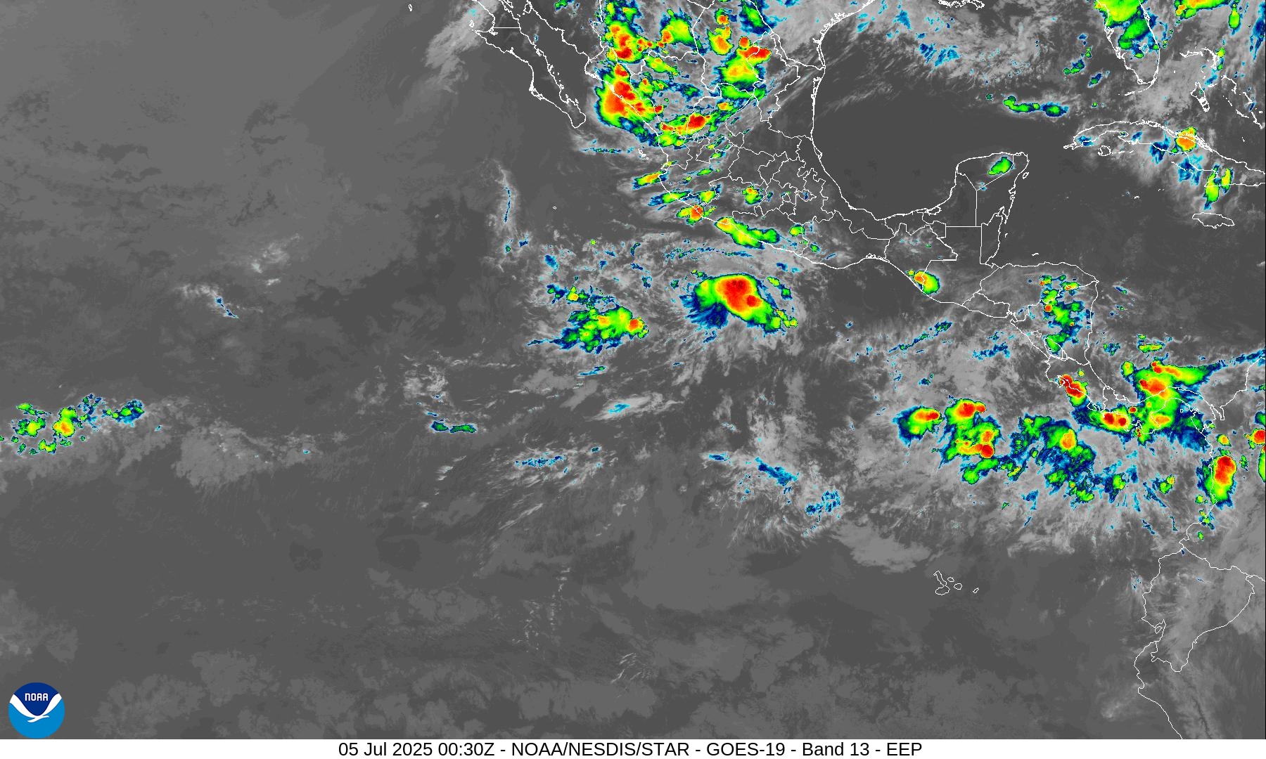
Can’t say the satellite presentation is too great this evening for Invest 96E.
Western Pacific Tropical Update
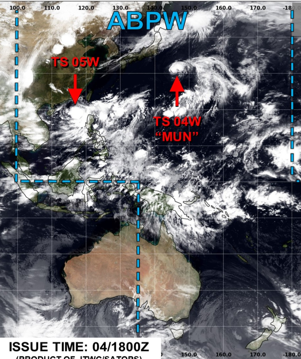
Tropical Storm Mun (04W) still forecast to become a minimal Typhoon well east of Japan.
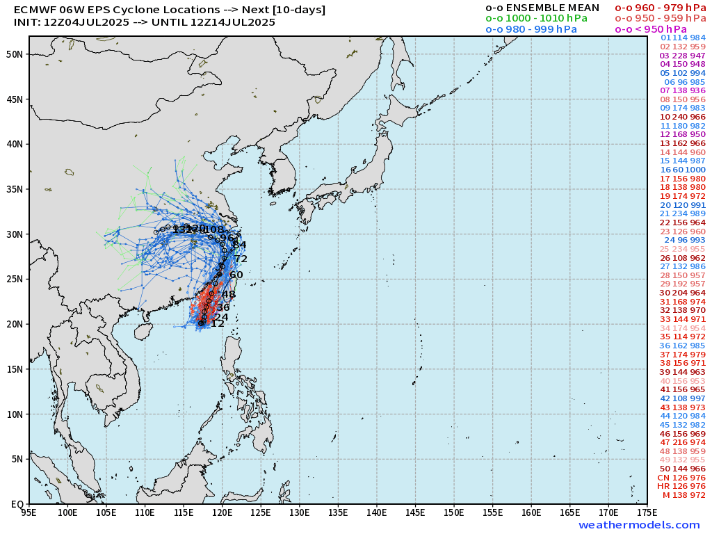
Tropical Storm Danas (05W) also will become a Typhoon and squeeze between China and Taiwan.
ECMWF EPS Ensemble Tracks
Some members are intense with pressure more typical with Major Typhoon suggesting potential for Rapid Intensification.
HWRF is also ambitious with Danas at least Category 2.
Precipitable Water Next 5-days
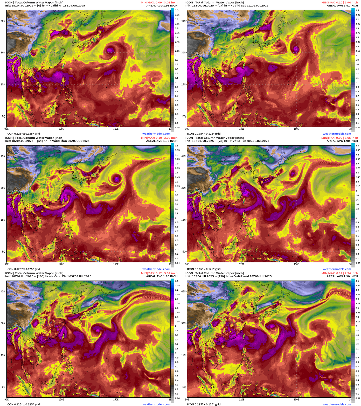
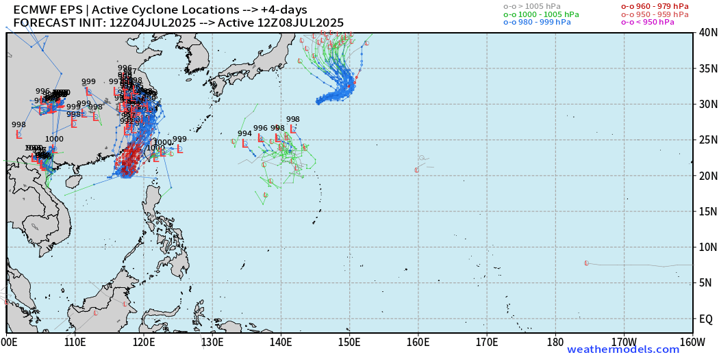
Perhaps another system comes out of the monsoon trough in addition to Mun and Danas, but lower chance in the EPS ensembles at 12z.
Day 4 Active Systems | ECMWF 12z Ensembles
Ryan’s Notes:
June 2025: We use the ECMWF for medium-range prediction because the GFS can’t be trusted due to false-alarm bias, and unrealistic intensification of tropical convection into spurious (ghost) storms. I don’t agree this is a good thing like CNN.
We can look at the GFS every day for weeks and see a modeled tropical storm or hurricane in the Caribbean or Gulf especially after Day 10. However, this is a known bias/false alarm problem with spurious convective — vorticity spin-ups due to the convective parameterization or estimation of vorticity generation due to intense diabatic heating. Perhaps it’s worthwhile to show what will not happen.
Maps sourced from weathermodels.com designed and innovated by yours truly! Please subscribe there for real-time access to the newest maps, charts from all of the weather models including ECMWF.
- Milepost
- 663 · laid 2025-07-05T01:36:02.052000Z
- Source
- https://weather.substack.com/p/july-4-2025-hurricane-season-friday
- Digest
- 25c7d0814eb2d7cb43e9eb2a455c4d5b0fd49fe1ae6c8d7072aa3acb87de1d5e
- Machine
- JSON