June 18, 2025 Hurricane Season Wednesday
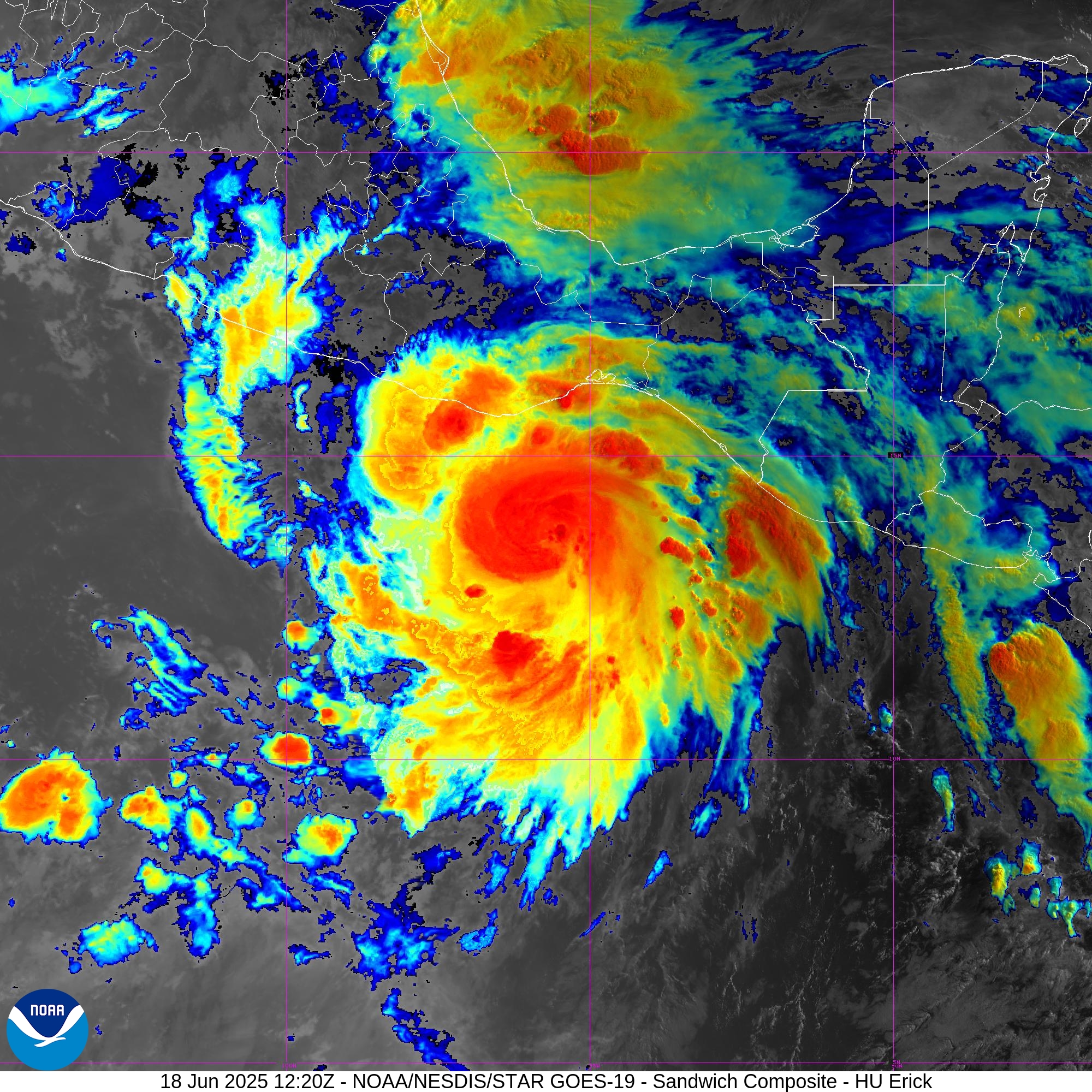
Hurricane Erick rapidly intensifying prior to landfall in 24-36 hours
June 2025 was the 7th-warmest June in the 132-year national record (1895–2026), at 71.2°F against a 1991–2020 normal of 69.5°F (+1.7°F).
June 2025 was the 26th-wettest June in the 132-year national record (1895–2026), at 3.3in against a 1991–2020 normal of 3.1in (+0.2in).
NOAA/NCEI Climate at a Glance, contiguous United States. This is the observed record for the month, not a score of anything said in this piece — the forecast ledger begins 2026-08-17 and cannot reach earlier posts.

Wednesday’s Tropical Update
Atlantic Basin: No areas being watched through the next 7-days (June 25) by NHC and the ECMWF ensembles are (mostly) blank for next 2-weeks — through the end of June without a named storm.
Eastern Pacific Basin: Hurricane Erick will continue strengthening today with landfall along the southern Mexico coast later on Thursday
Western Pacific Basin: No activity expected for the next 7-days.
Hurricane Erick upgraded this morning [75 mph]… waiting on the development of an eye. If the system can form and eyewall and rapidly warm/clear out the center, then it could reach into Category 3. Erick is small in size typical of near Mexico coast hurricanes forming out of the monsoon trough.
ECMWF 00Z | Integrated Vapor Transport | Next 8-days
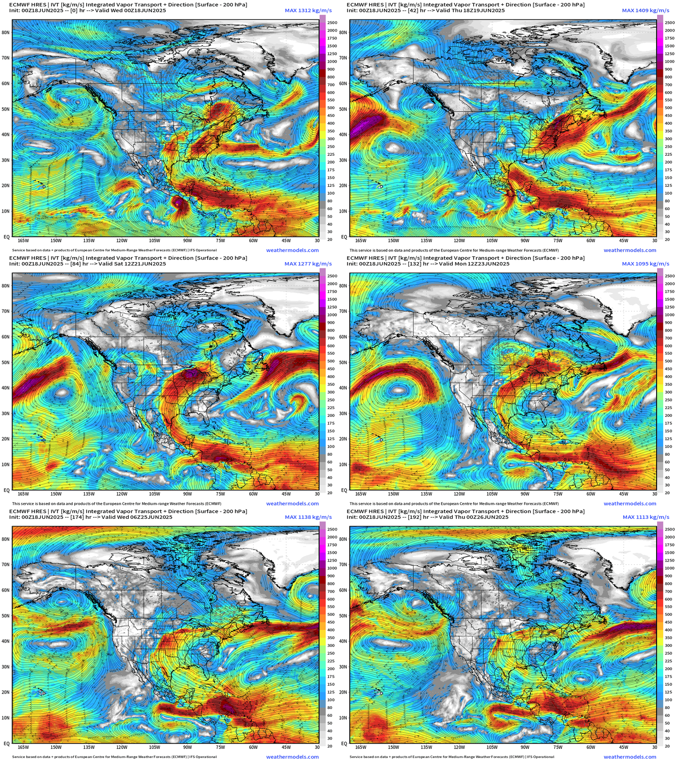
Large scale moisture transport …
Eastern Pacific: Hurricane Erick (05E) circulation dissipates over the mountains of southern Mexico but some moisture could be entrained/dragged northward into the main tropical plume all the way into Canada. A strong ridge is building over the Mid-Atlantic downstream of a trough digging into the western U.S. This trough provides a weakness for Erick to move poleward.
No tropical cyclone formation likely in the Atlantic basin in the next 7 days+
Tropical Atlantic | Precipitation and MSLP Next 10-days | ECMWF 00z
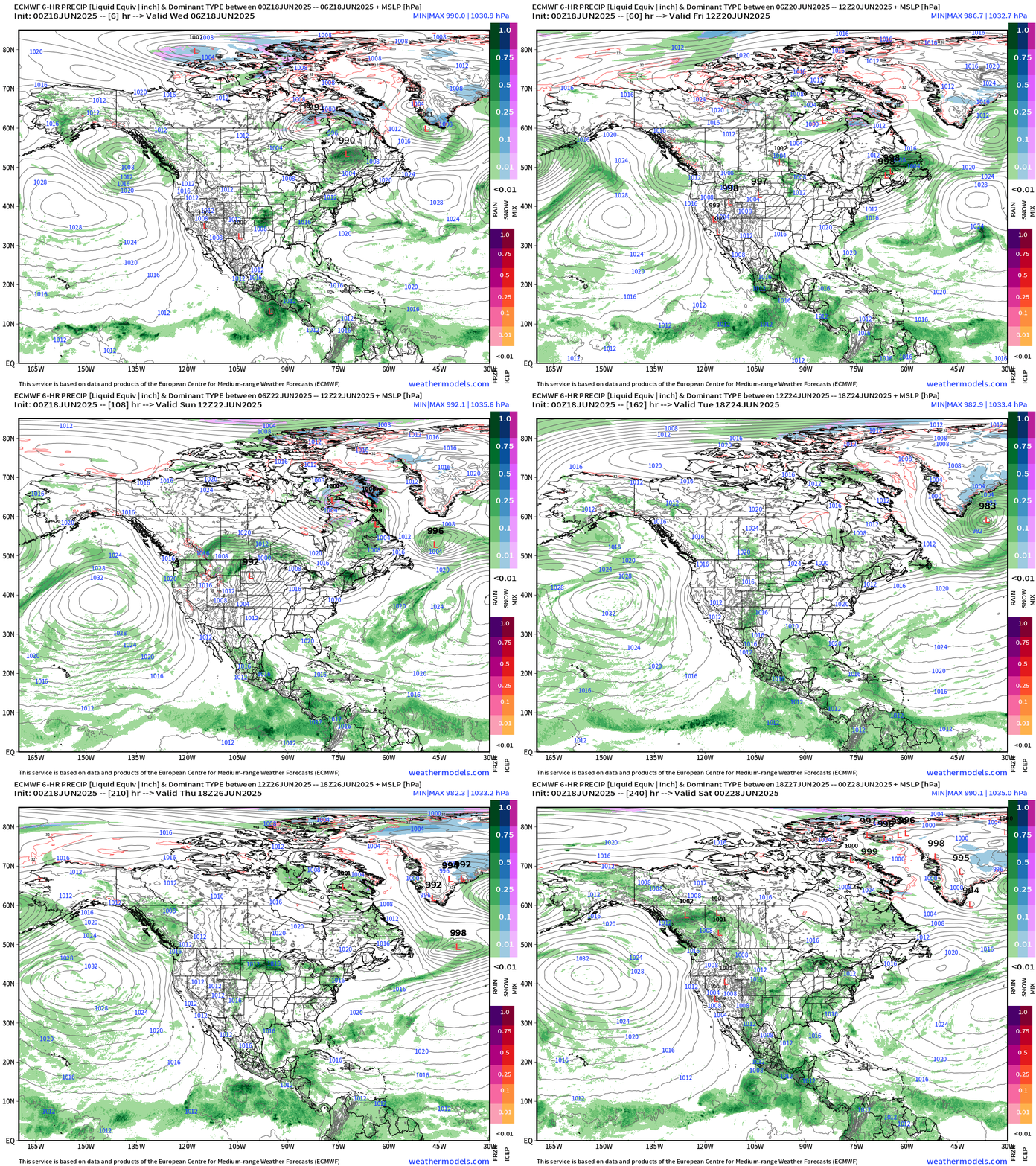
Scattered showers and storms across the ITCZ/monsoon trough from Hawaii to the Atlantic. Aside from Erick, not seeing immediate development of another system until maybe into Day 8-10 in the Eastern Pacific again south of Mexico.
Atlantic Basin Outlook
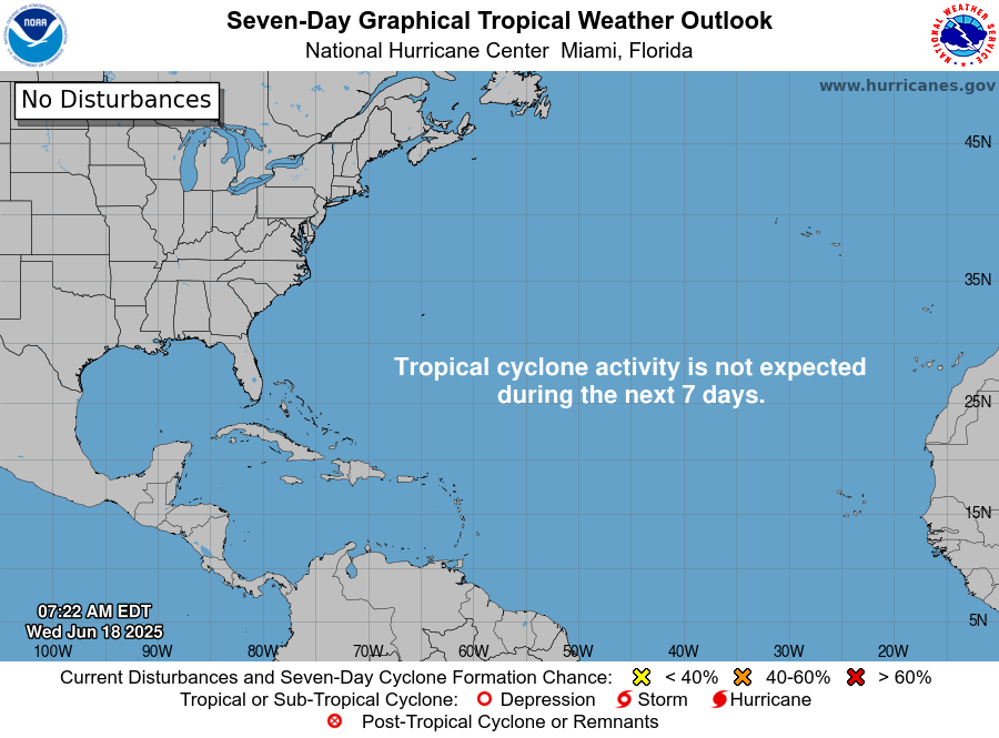
Ghost town for the next 7-days — likely pushing into the end of June without a named storm.
Eastern Atlantic Satellite Image
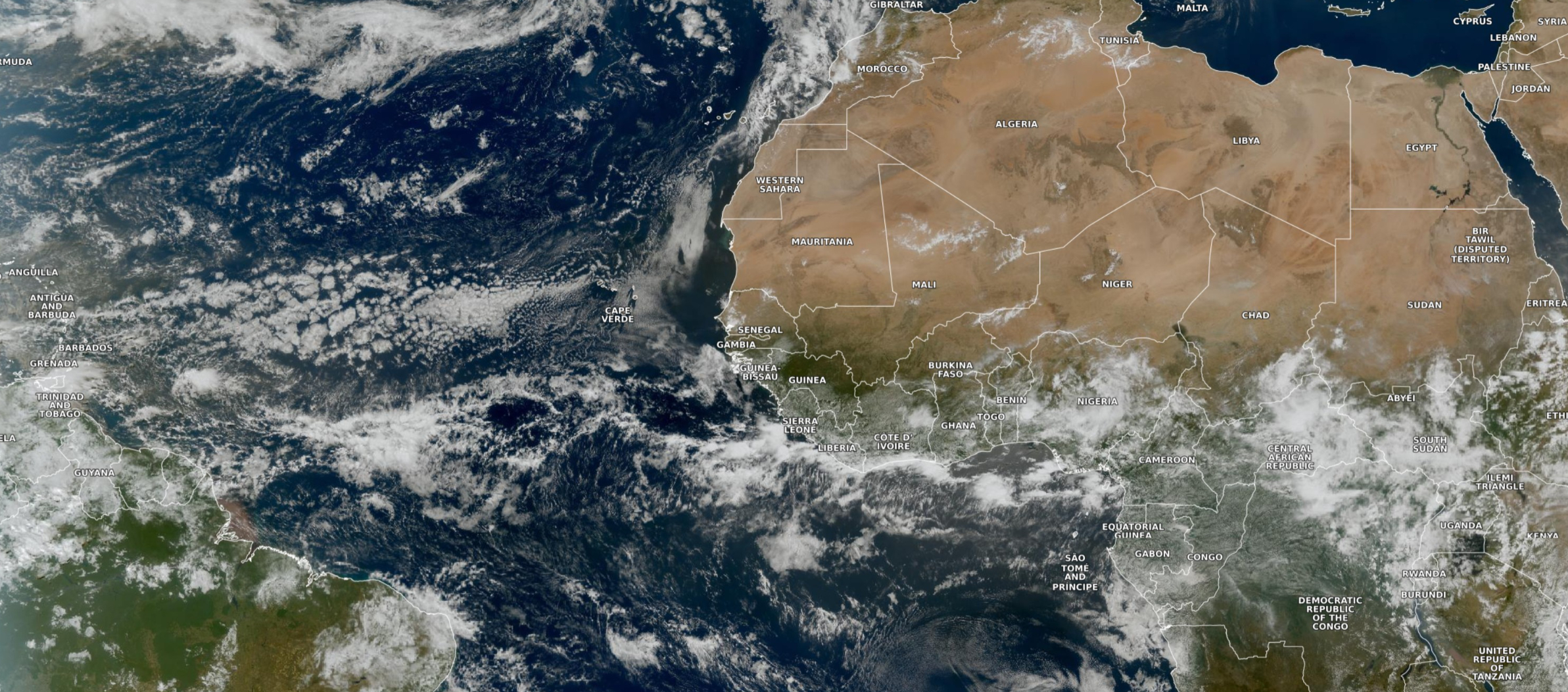
Just scattered showers in the tropical belt over the tropical Atlantic. Not seeing robust tropical wave development over Africa, just scattered convection.
ECMWF CAMS 00z DUST Aerosol Optical Depth (AOD) | 5-days Forecast
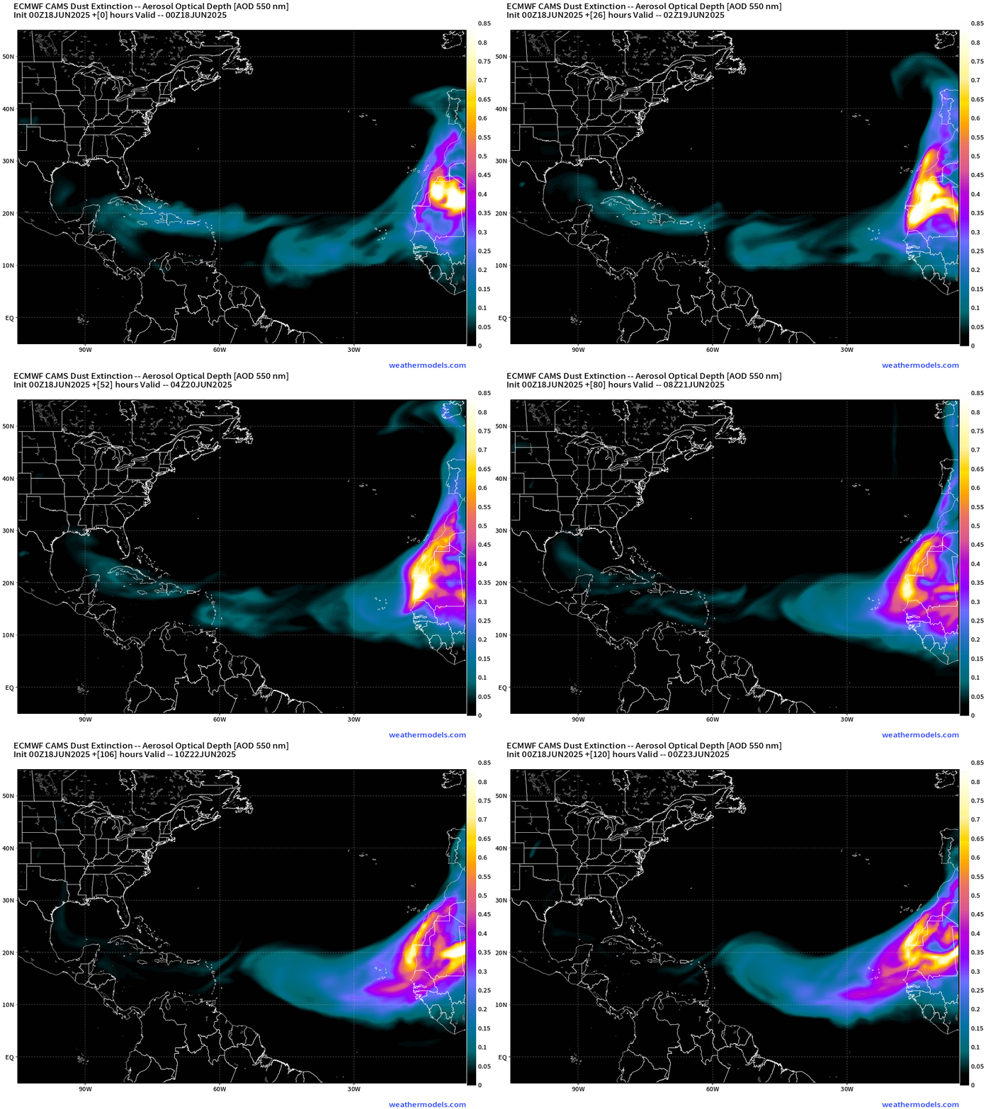
Still seeing a heavy dust plume coming off the African continent in 5-days.
Atlantic Ocean Surface Temperatures (SST) | Anomaly
The central Atlantic remains cooler than normal with the advancement of the 26°C isotherm to the east delayed. The overall “warm pool” of the Atlantic is less robust this mid-June compared to the two previous years.
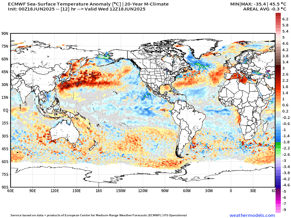
Note the development of a tropical Atlantic equatorial “Niña” with cool waters < 26°C similar to what you see near in the equatorial tropical Pacific.
Also, the continued passage of tropical storms along the coast of Mexico + persistent strong subtropical High Pressure off the U.S. West Coast = much cooler waters compared to normal east of Hawaii to Baja California.
Tropical Atlantic Satellite Imagery
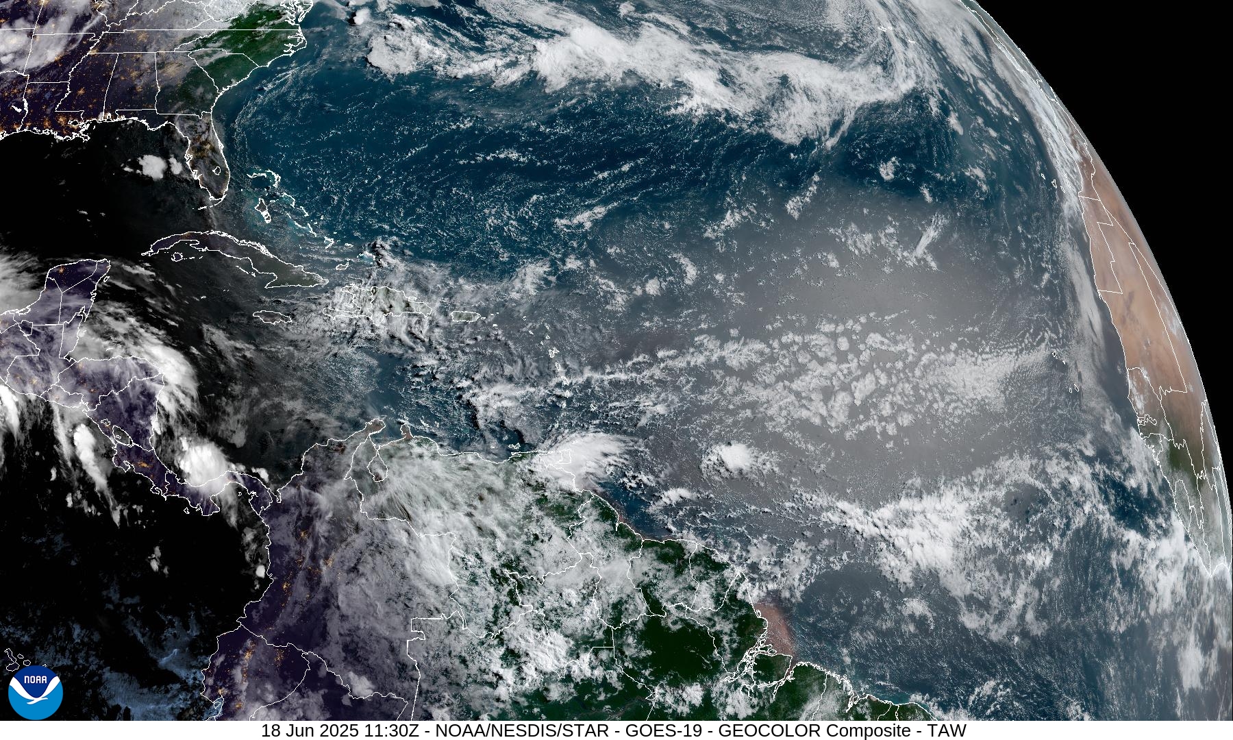
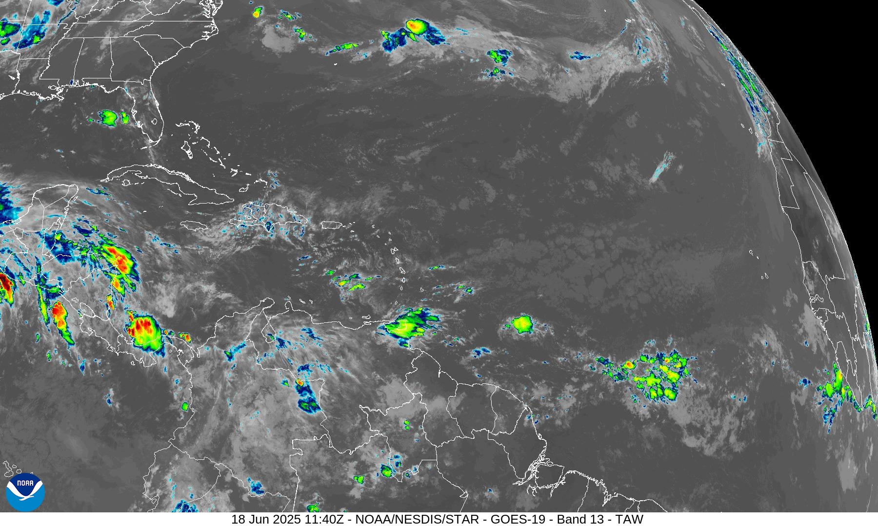
A few areas of convection associated with tropical waves, but nothing substantial. However, we can pick out the waves much easier today.
Tropical Surface Analysis | 06Z
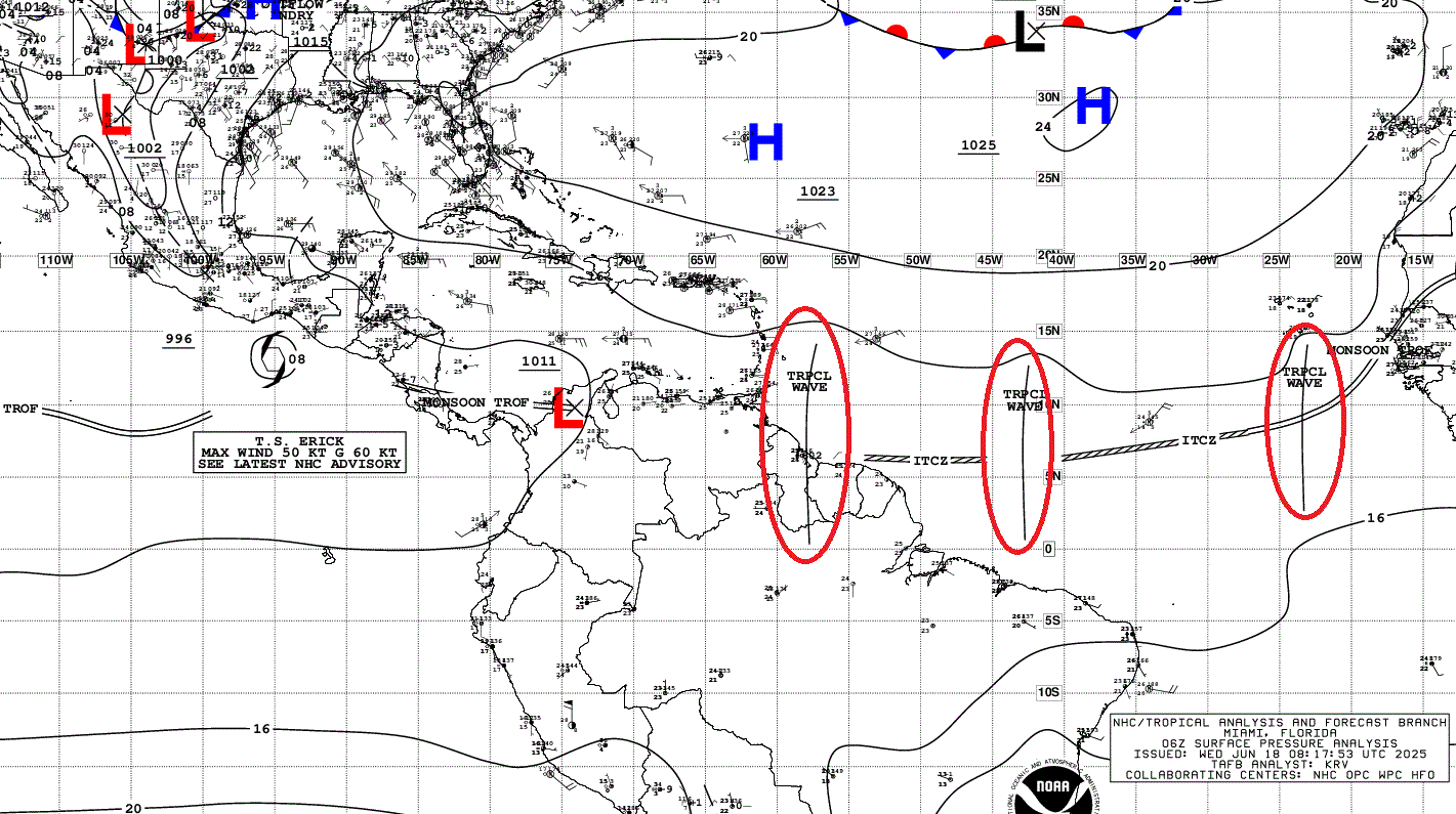
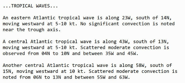
Atlantic Tropical Waves = 3 but no development expected [plausible or possible] in the Atlantic.
Thank you to readers continuing into this Hurricane Season. My goal is to keep you informed about ongoing extreme weather events inside and outside of the tropics, but also a week (hopefully) heads up on what’s coming. I’ll be using a variety of weather modeling output, some of it may be unfamiliar, but it’s state-of-the-art and industry leading standard.
Atlantic Precipitable Water | Next 5-days
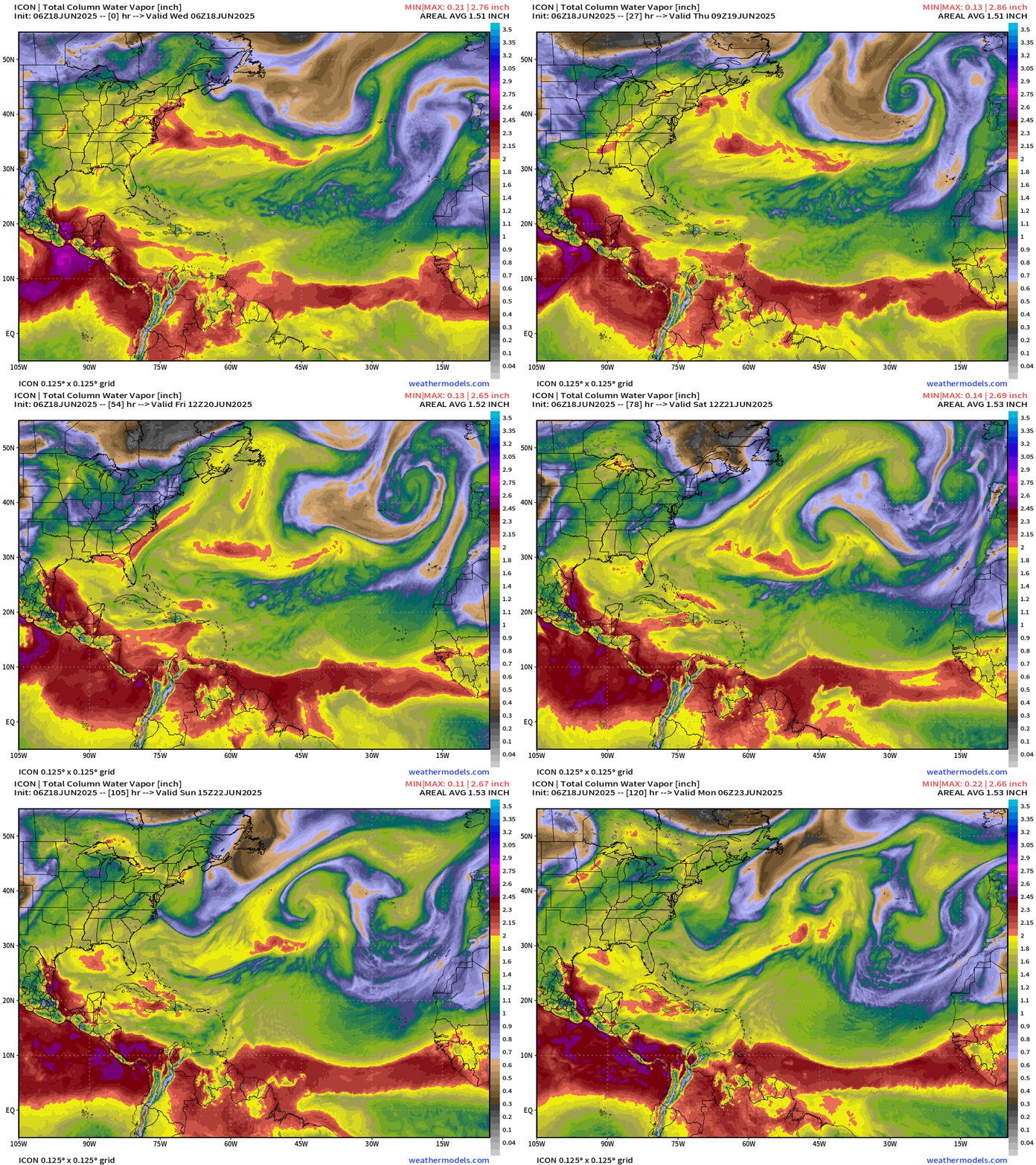
The ITCZ is again pushed south in 5-days in the Eastern Atlantic with next major surge of Saharan Air Layer dust.
850 mb Temperature during the next 5-days
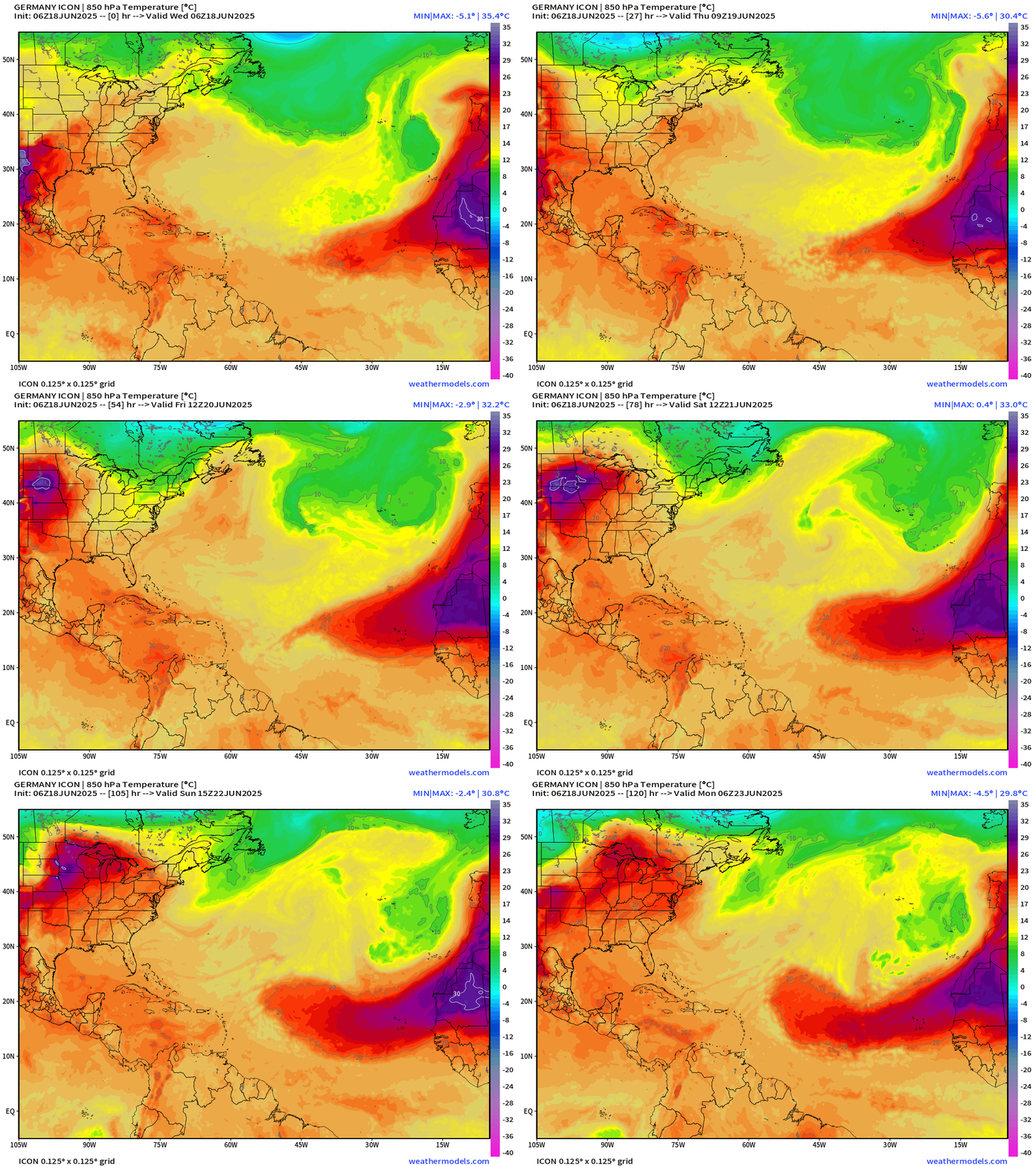
Warm air at 850 mb > 30°C exists over Senegal and Mauritania which extends into the central Atlantic with the 20°C isotherm pushing 2/3 of the way to the Lesser Antilles.
GFS Model Update | 06z Central America | Next 10-days
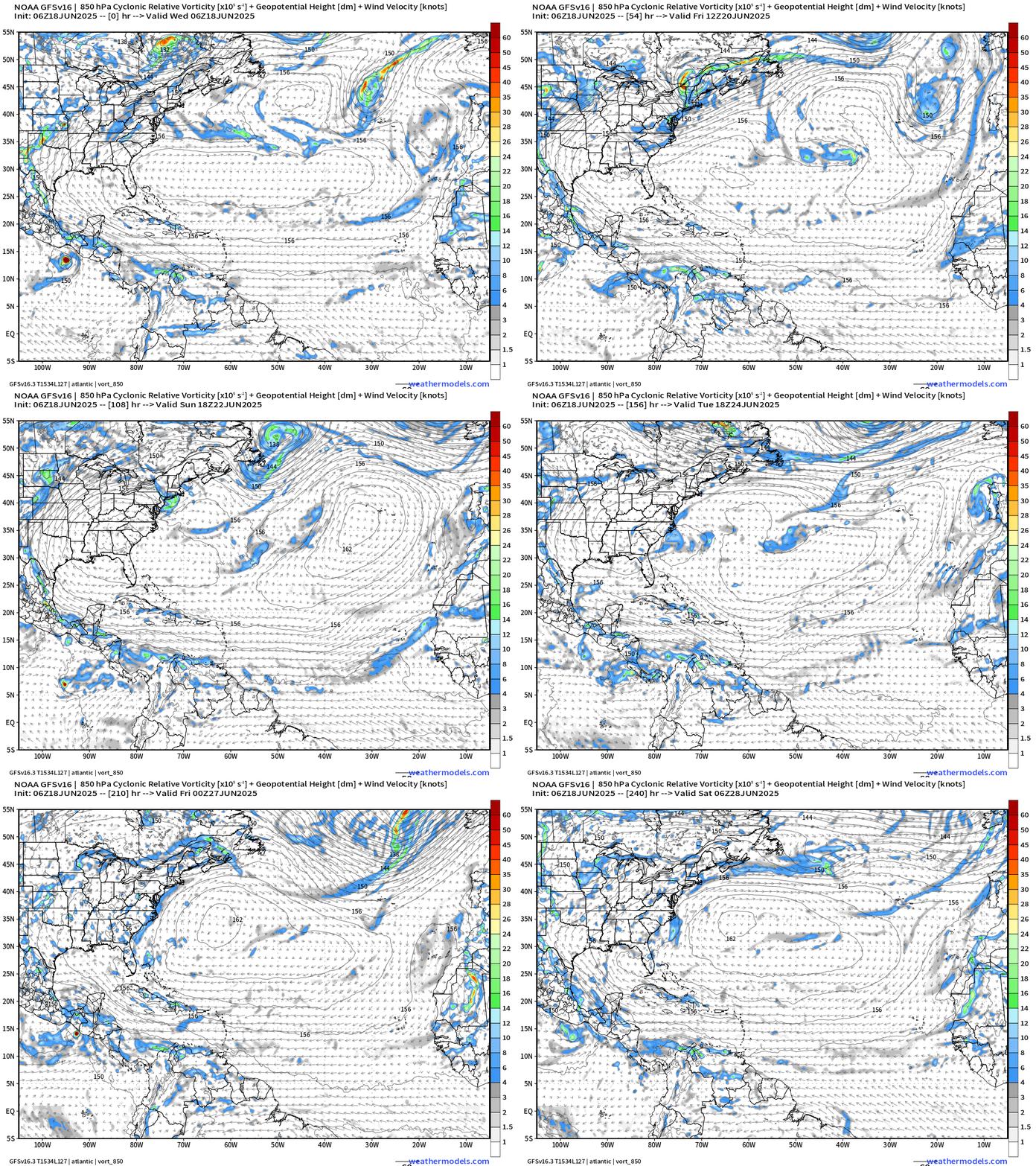
GFS spins up another tropical system in the Eastern Pacific towards Day 8-10.
Nothing else in the Atlantic to mention.
Medium range ensemble model outlook
These are 51-realizations of the same model with different initial conditions. Each ensemble gets equal ~2% weight in a mean calculation.
ECMWF Ensembles | 10-Days | All Storm Tracks
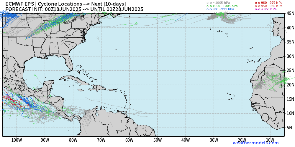
Entirely blank slate through June 27 except for one ensemble member (2%)
ECMWF Ensembles | 15-Days | Active Storm Tracks
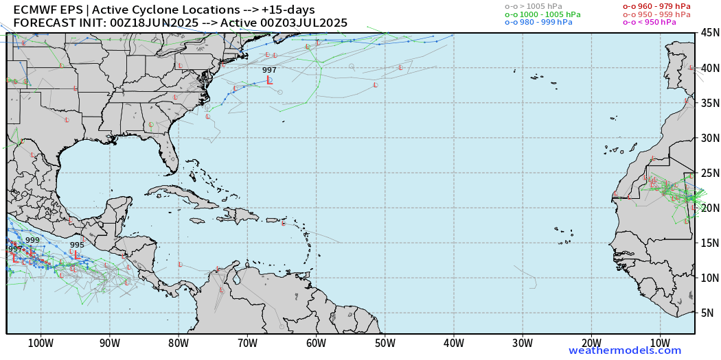
Nothing active in 15-days across the entire Atlantic basin = blank slate for July 2.
Eastern Pacific Tropical Update
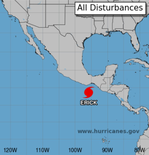
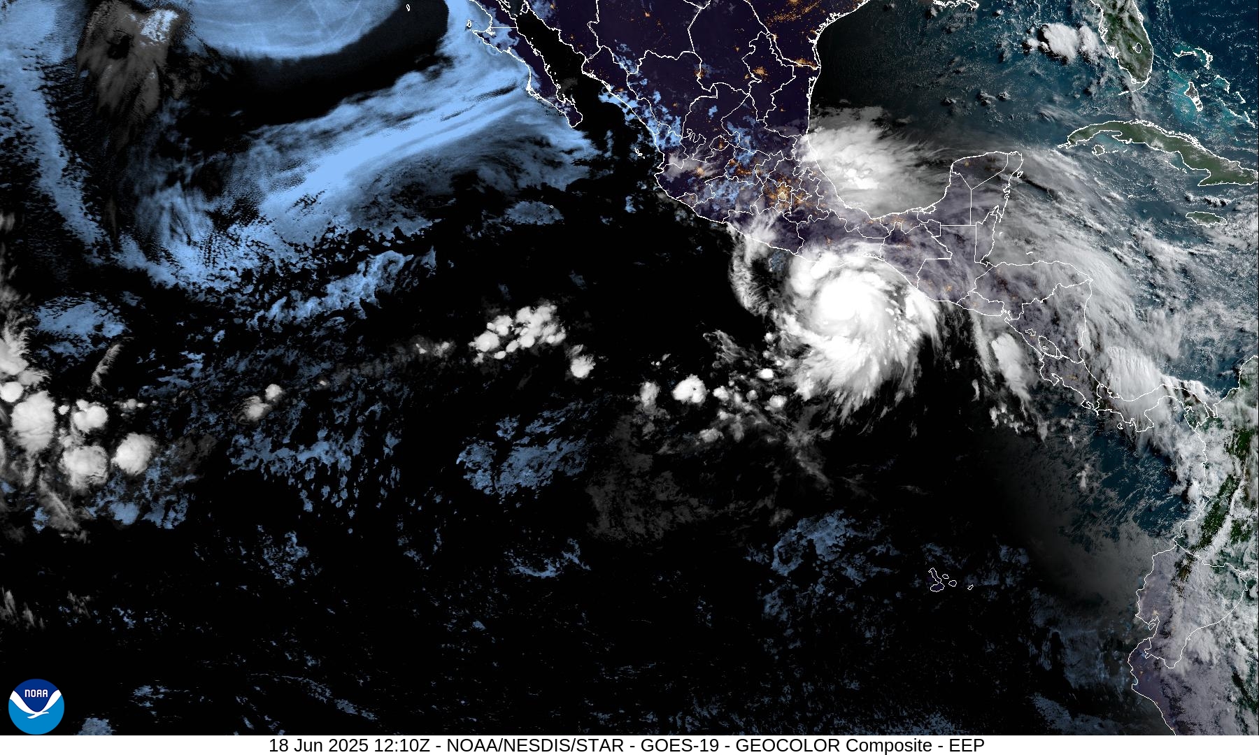
HURRICANE ERICK (05E)
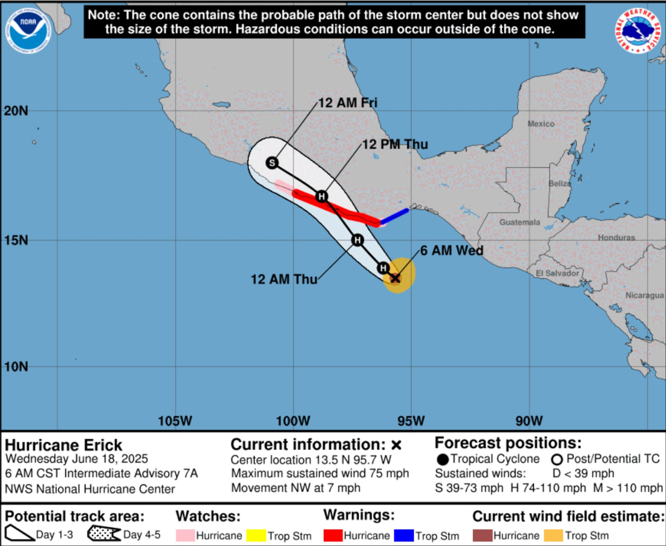
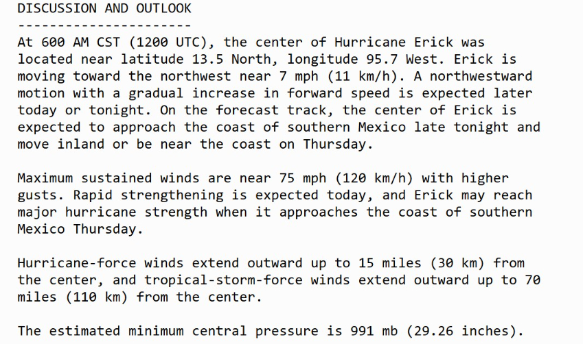
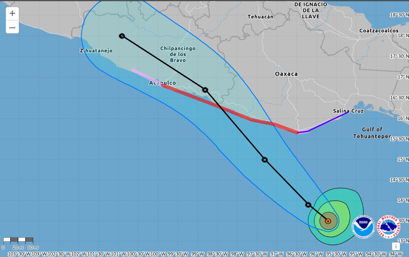
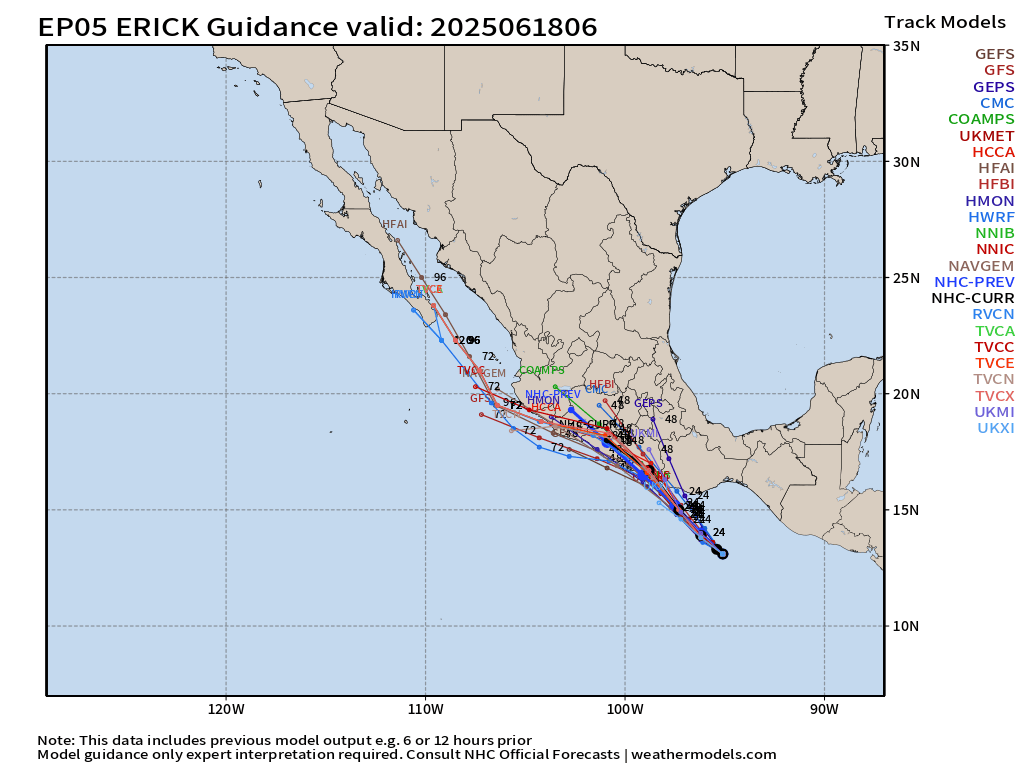
Erick likely to become a powerful Category 3 hurricane prior to landfall on Thursday.
HAFS-A and HAFS-B have central pressure at 970 mb to 972 mb suggesting a borderline Category 2/3 hurricane. The inner-structure of Erick is key to maximizing the intensity prior to landfall as a small, well-organized core with an emerging eyewall can drop pressure very fast. However, there is only 24-30 hours over warm water before disruption by the coastline begins to interrupt the intensification process.
ECMWF 00z Ensembles | Eastern Pacific
7-Days Active Storm Tracks
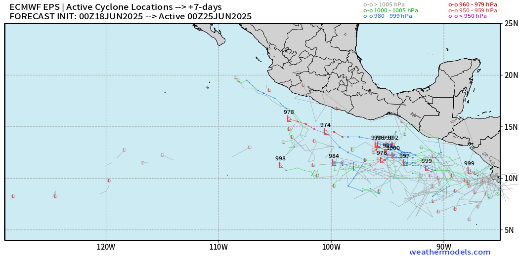
Seeing more members in 7-days with tropical storm / hurricane chances … might see NHC put up a 10% yellow hatching this evening.
12-Days Active Storm Tracks
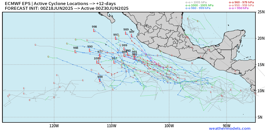
The next name is Flossie — and by the end of June, we should see it.
Western Pacific Tropical Update
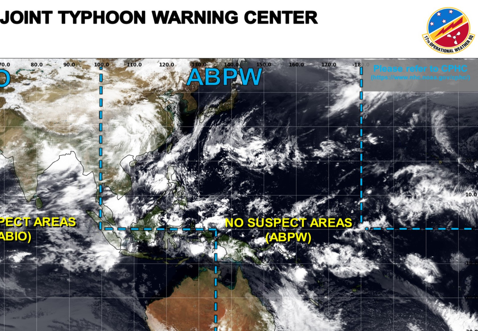
Day 7 Ensemble | Active Cyclone Tracks
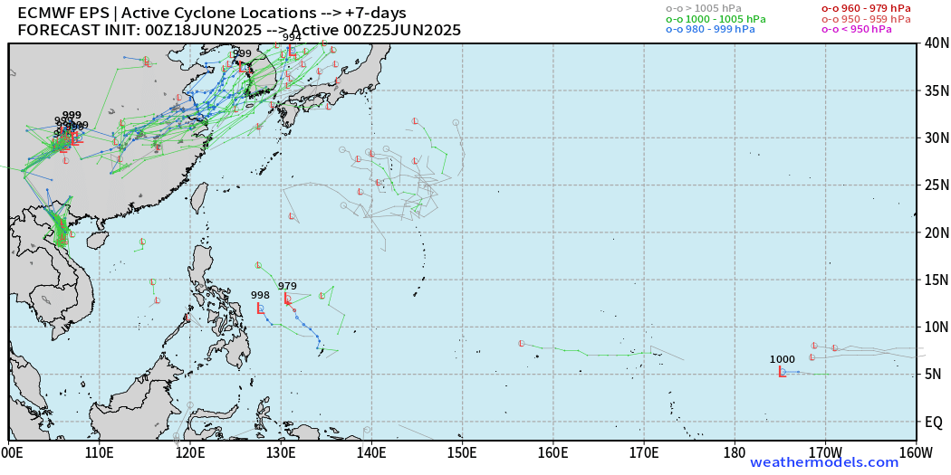
Signal for tropical storms or typhoons through 7-days is VERY LOW (< 5%)
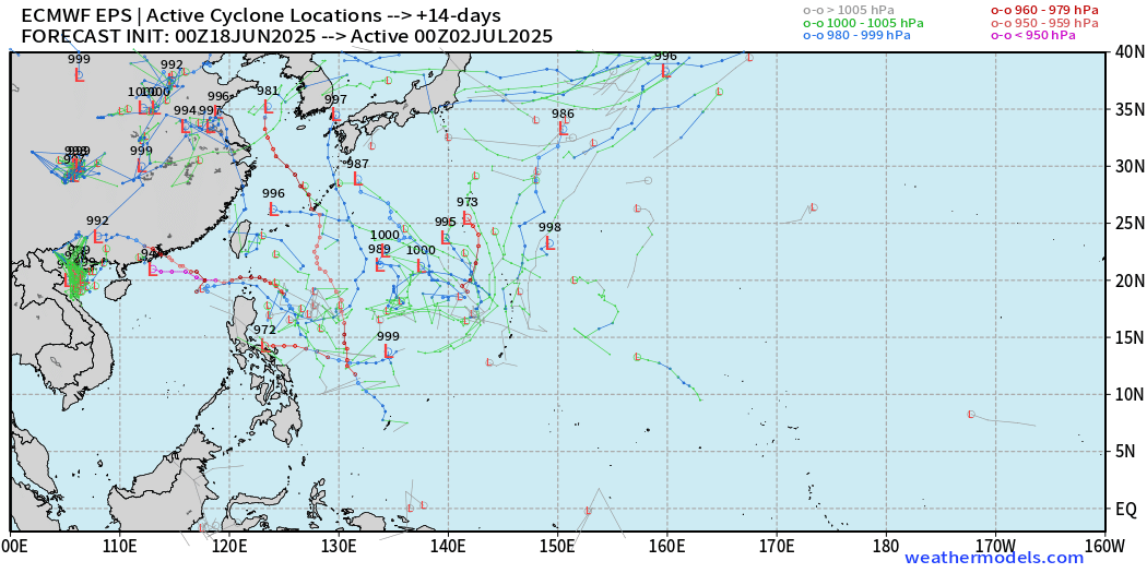
More random developments by Day 14 — so the Western Pacific CAN produce a typhoon if there is a trigger. However, the basin is largely dead.
Ryan’s Notes:
June 2025: We use the ECMWF for medium-range prediction because the GFS can’t be trusted due to false-alarm bias, and unrealistic intensification of tropical convection into spurious (ghost) storms. I don’t agree this is a good thing like CNN.
We can look at the GFS every day for weeks and see a modeled tropical storm or hurricane in the Caribbean or Gulf especially after Day 10. However, this is a known bias/false alarm problem with spurious convective — vorticity spin-ups due to the convective parameterization or estimation of vorticity generation due to intense diabatic heating. Perhaps it’s worthwhile to show what will not happen.
Maps sourced from weathermodels.com designed and innovated by yours truly! Please subscribe there for real-time access to the newest maps, charts from all of the weather models including ECMWF.
- Milepost
- 646 · laid 2025-06-18T12:53:32.667000Z
- Source
- https://weather.substack.com/p/june-18-2025-hurricane-season-wednesday
- Digest
- a12904fafa66b476b79faef428fb931be94710a420b5bca8d4f362d781229e07
- Machine
- JSON