June 15, 2025 Hurricane Season Sunday
Invest 94E likely to become Hurricane Erick in a few days south of Mexico
June 2025 was the 7th-warmest June in the 132-year national record (1895–2026), at 71.2°F against a 1991–2020 normal of 69.5°F (+1.7°F).
June 2025 was the 26th-wettest June in the 132-year national record (1895–2026), at 3.3in against a 1991–2020 normal of 3.1in (+0.2in).
NOAA/NCEI Climate at a Glance, contiguous United States. This is the observed record for the month, not a score of anything said in this piece — the forecast ledger begins 2026-08-17 and cannot reach earlier posts.

Sunday’s Tropical Update
Happy Father’s Day!
Atlantic Basin: No areas being watched through the next 7-days (June 22) by NHC and the ECMWF ensembles are blank for next 2-weeks. Only a tiny chance that post-Erick moisture can spin up in the far southern Gulf.
Eastern Pacific Basin: Tropical Storm Dalila (04E) is nearly gone, but Invest 94E behind it (60%) to become Erick, then the basin quiets into end of June.
Western Pacific Basin: No activity expected for the next 7-days.
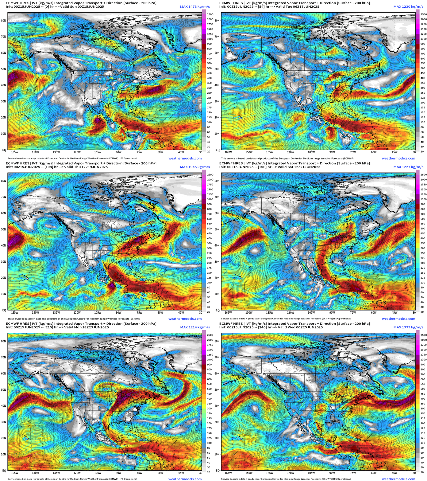
ECMWF 00Z | Integrated Vapor Transport | Next 10-days
Eastern Pacific:
Dalila is absorbed back into the ITCZ and trade winds without much enhancement of the Southwest U.S. monsoon.
Invest 94E (—> Erick) develops into a hurricane south of Mexico / Guatemala with the resulting moisture dragged across Texas into the Plains and a powerful midlatitude storm system over the Midwest and Great Lakes by next weekend.
No tropical cyclone formation likely in the Atlantic basin in the next 7-10 days+
Tropical Atlantic | Precipitation and MSLP Next 10-days | ECMWF 00z
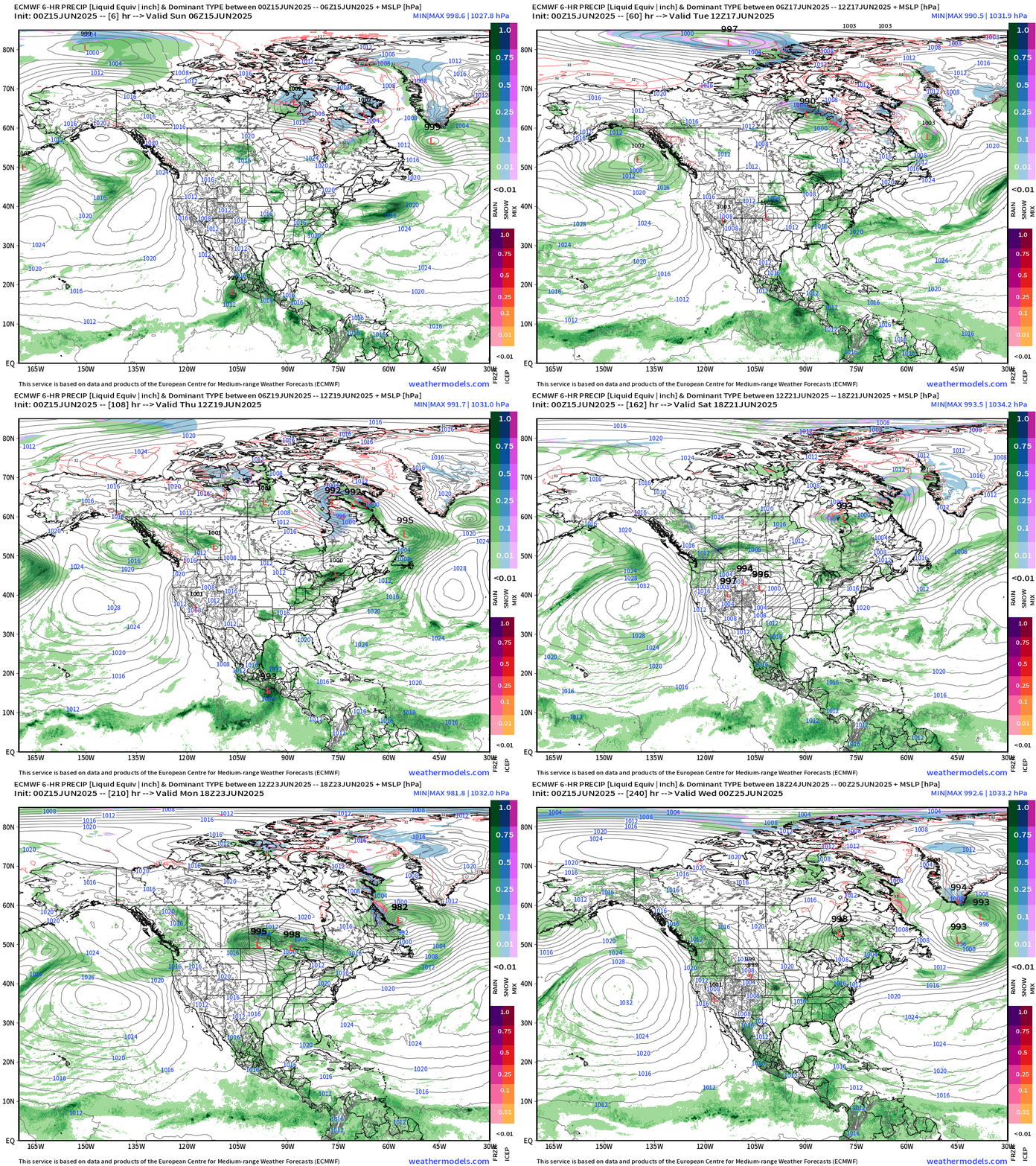
Strong High Pressure anchored over the Pacific at the surface assisting with offshore flow across the U.S. Southwest (very hot) with mid-level ridging dominating the Western U.S.
ECMWF AIFS 06z | Height Anomaly Next 10-days
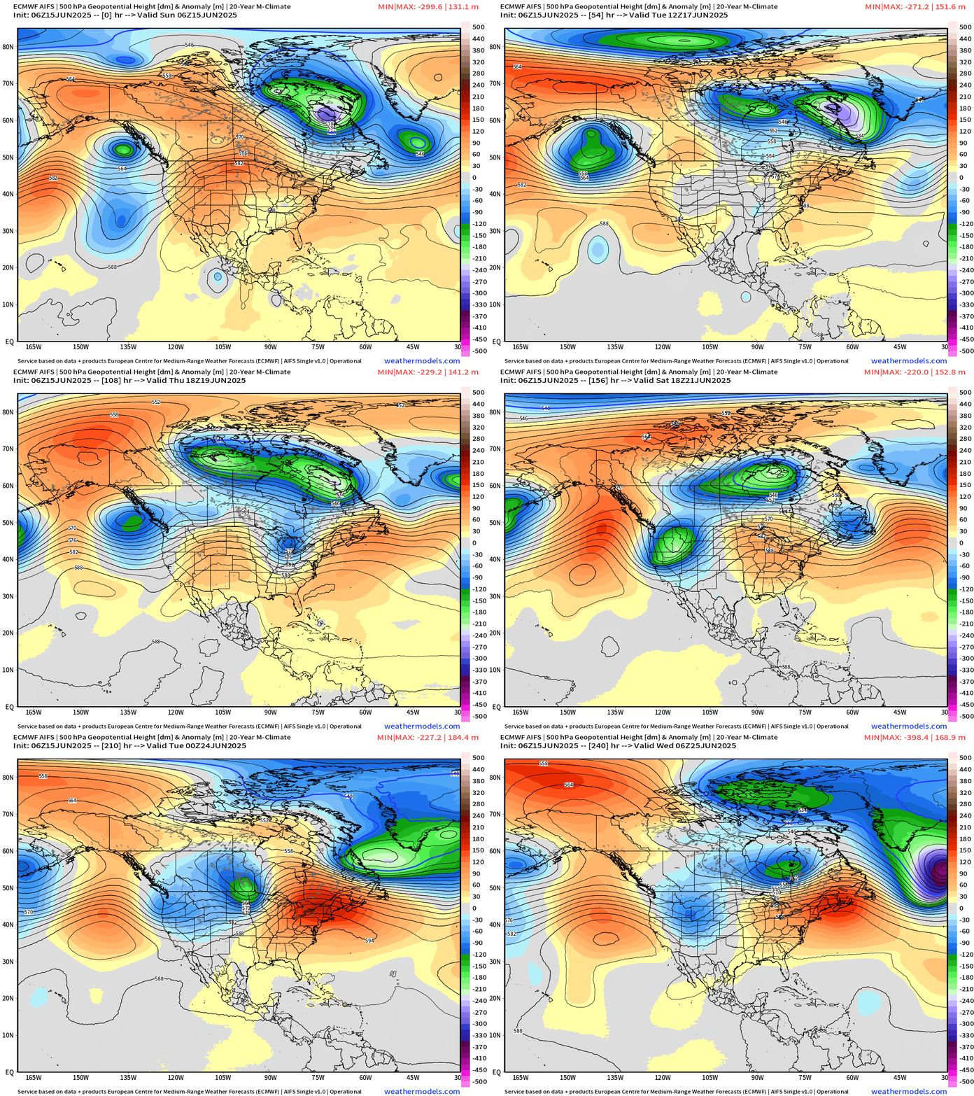
Ridge builds across the Northeast U.S. for much hotter weather into Days 7-10 with NYC pushing 100°F
Atlantic Basin Outlook
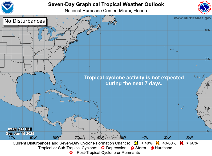
Nobody home for next 7-days.
Eastern Atlantic Satellite Image
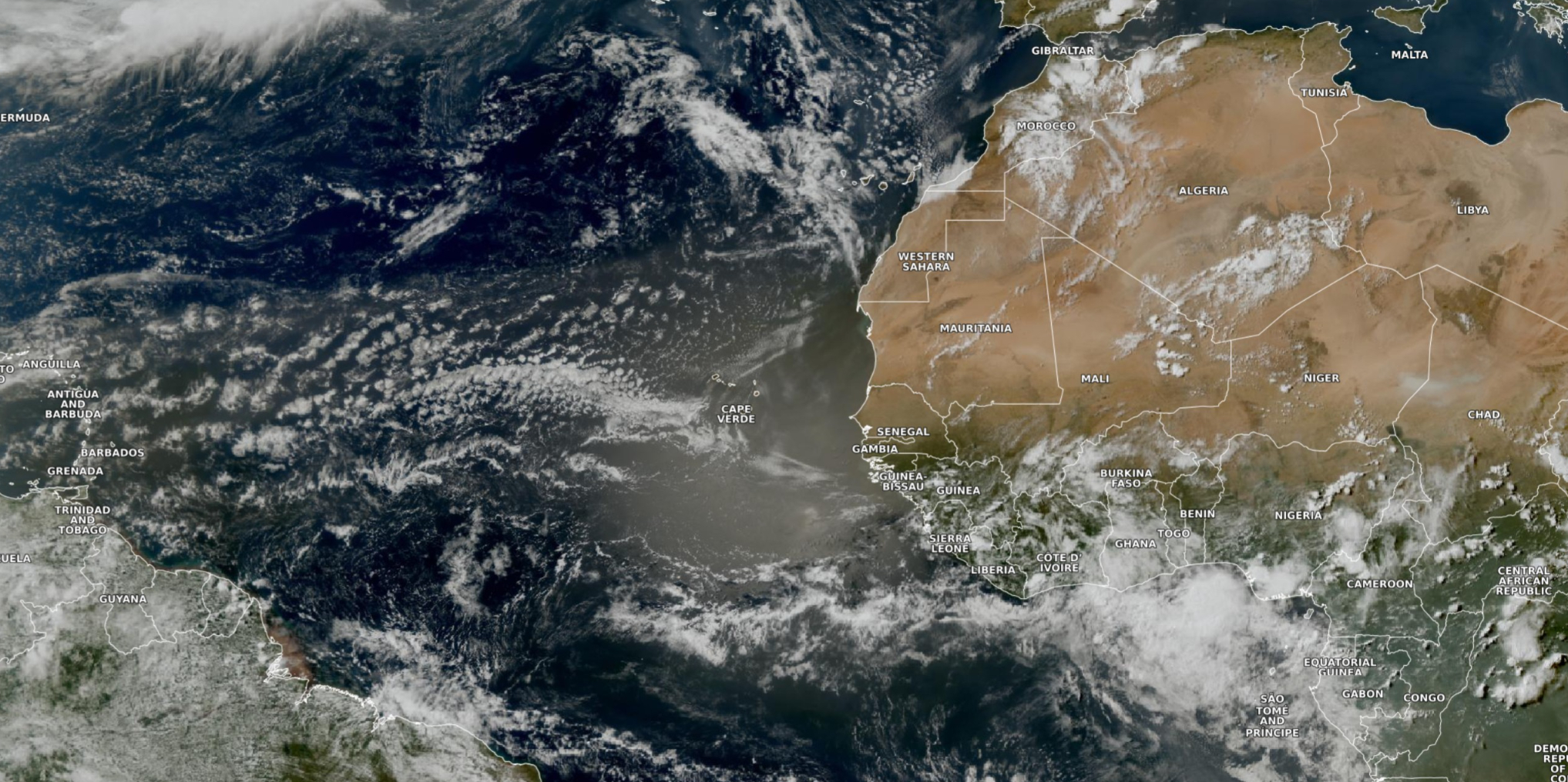
Dust layer from the Lesser Antilles to the Cape Verde Islands is noticed on visible satellite as a brown haze within shallow clouds w/o convection.
NASA 00z DUST Aerosol Optical Depth (AOD) | 8-days Forecast
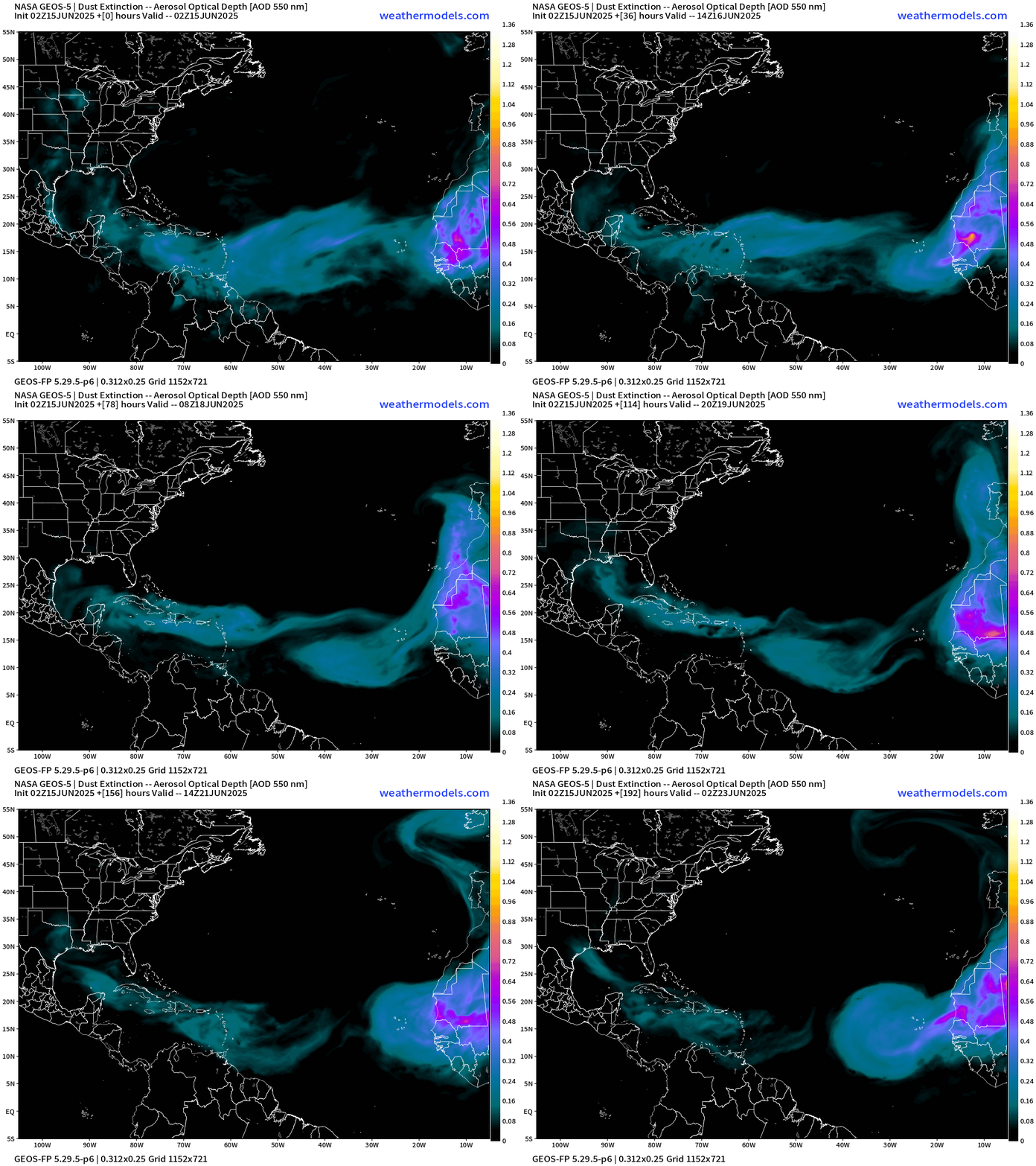
The dust isn’t as intense but does hold together across the entire Atlantic perhaps due to the brisk easterly trade winds.
Atlantic Ocean Surface Temperatures (SST) | Anomaly
This depiction uses ECMWF SSTs with a recent 20-year model hindcast climatology. The central Atlantic remains cooler than normal for June 15 with warmer than normal stretching from the Gulf of Mexico and across Bermuda.
However, actual SSTs are what matter and the 26°C and 28°C isotherms remain constrained to the MDR, Caribbean and Gulf. Mid-June is too early for tropical storm activity too far out in the Atlantic.
Note the development of a tropical Atlantic equatorial “Niña” with cool waters < 26°C similar to what you’d see near the Galapagos in the eastern tropical Pacific.
14-day Forecast of Ocean Temperatures at June 29th
Not seeing dramatic warming of the Atlantic aside from climatological into summer.
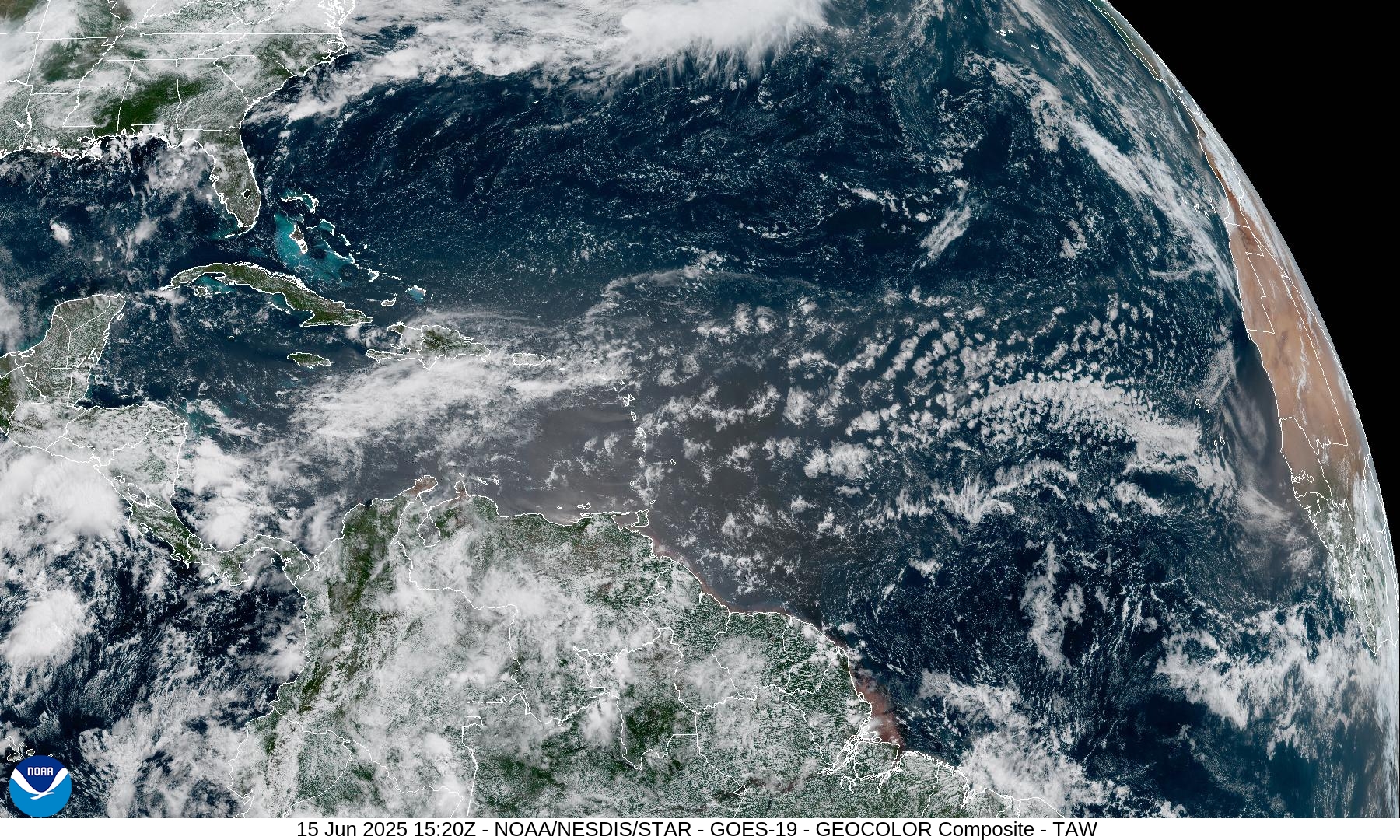
Tropical Atlantic Satellite Imagery
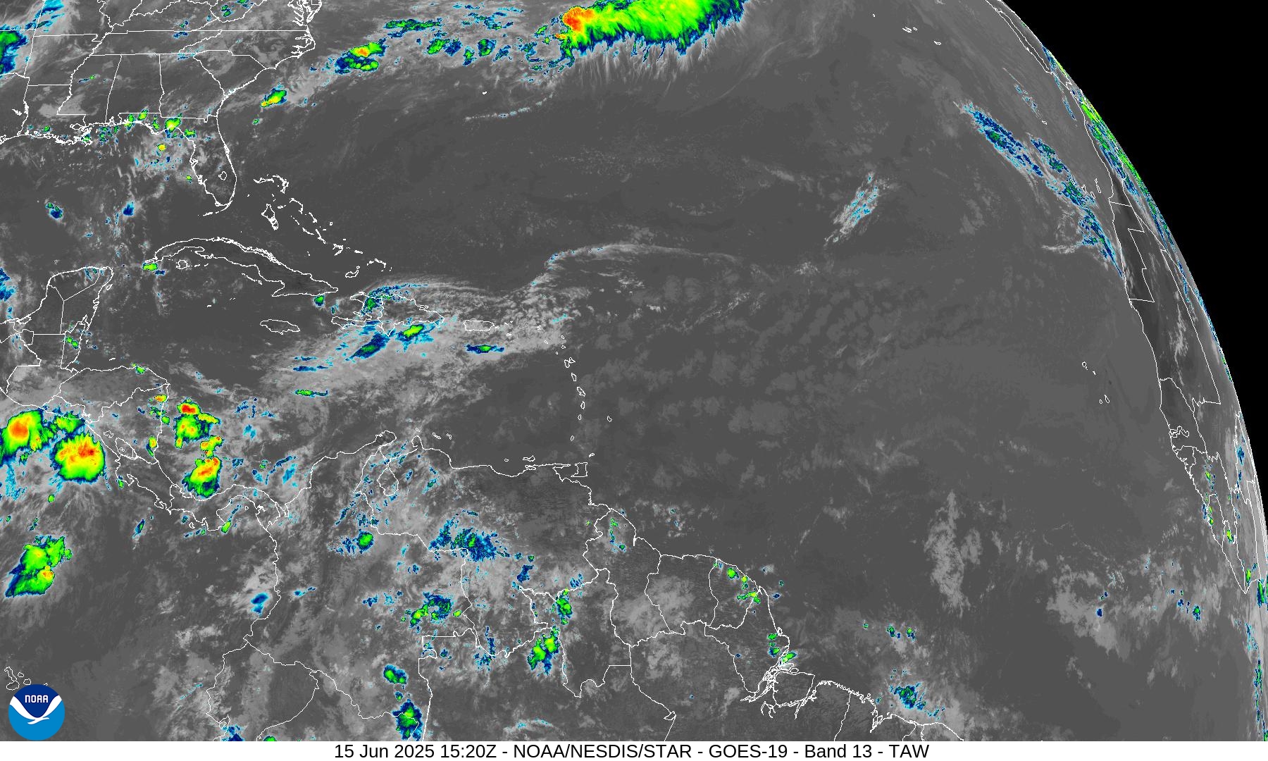
Difficult to even scare up a shower across the Tropical Atlantic. Just fair weather clouds in a dusty atmosphere from the Caribbean to the coast of Africa.
Tropical Surface Analysis | 06Z
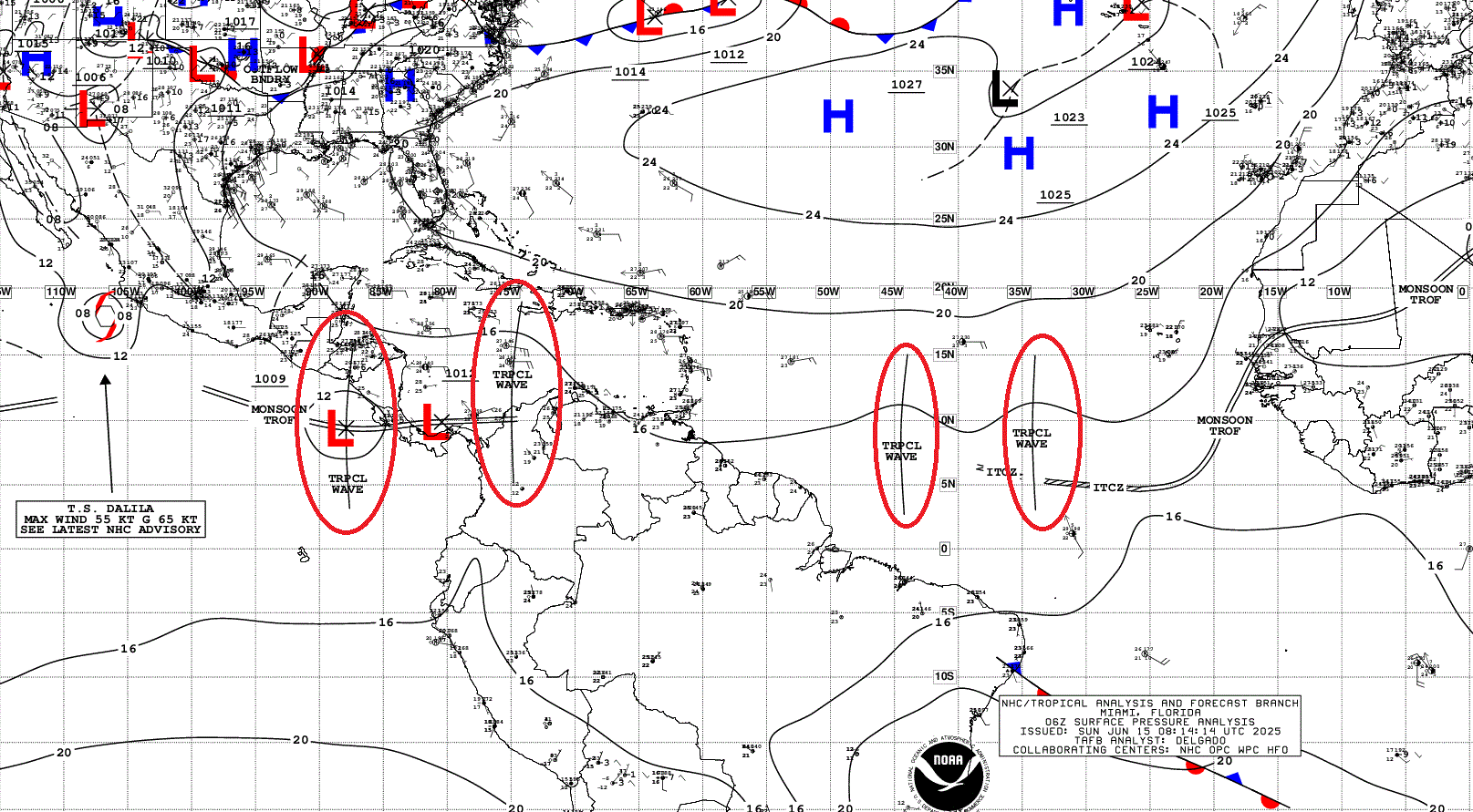
Atlantic Tropical Waves = 4 but no development expected [plausible or possible] at least in the Atlantic for 3 of them. However, Invest 94E is crossing Central America and has a 60% chance of development in the Eastern Pacific.
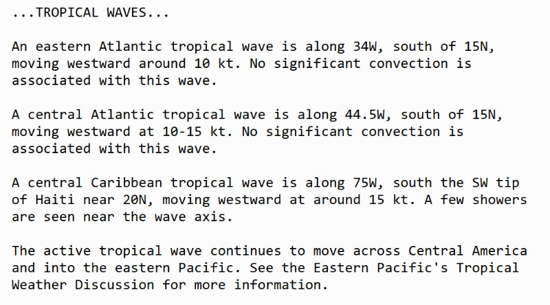
Thank you to readers continuing into this Hurricane Season. My goal is to keep you informed about ongoing extreme weather events inside and outside of the tropics, but also a week (hopefully) heads up on what’s coming. I’ll be using a variety of weather modeling output, some of it may be unfamiliar, but it’s state-of-the-art and industry leading standard.
Atlantic Precipitable Water | Next 5-days
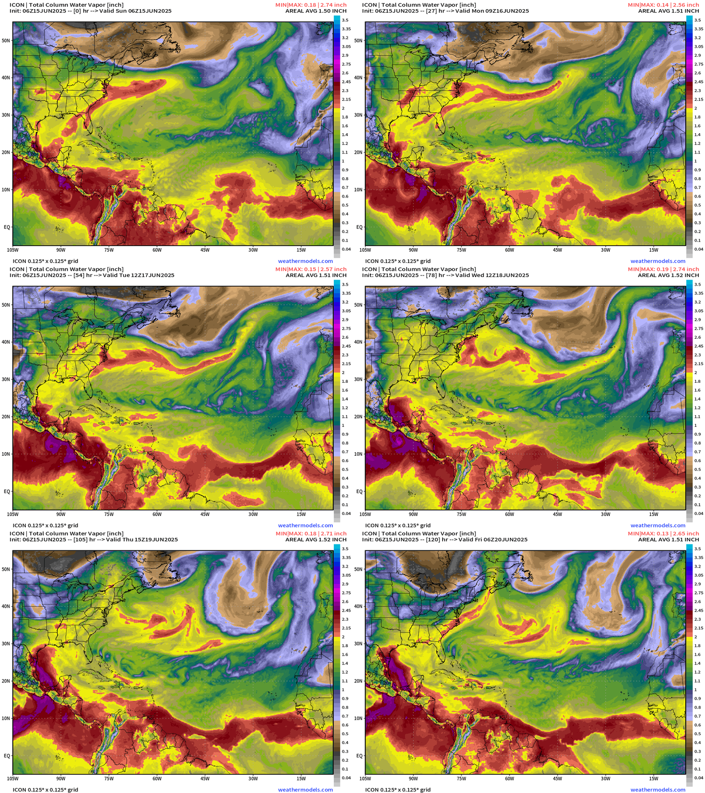
Dry air with embedded anticyclonic swirls cruising westward at 25°N within the large scale easterly flow. The ITCZ/Monsoon trough does have PWAT > 2” but waves are devoid of convection = too stable. The only show in town is over Central America and then into the Eastern Pacific off the far SE coast of southern Mexico and Guatemala with Invest 94E.
GFS Model Update | 06z Central American Gyre
Days 0 to 10 Relative Vorticity | See footnotes
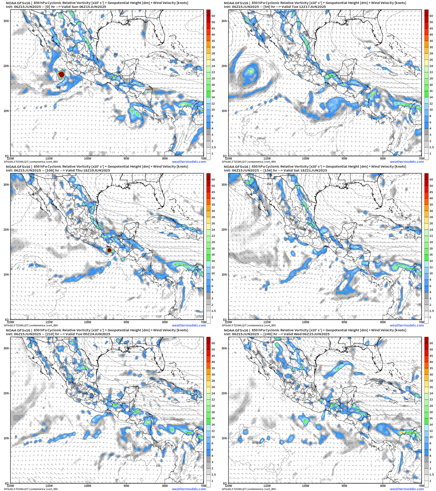
Dalila is gone and then we watch the potential rapid intensification of Invest 94E into Hurricane Erick before making landfall in Mexico by Friday.
Medium range ensemble model outlook
These are 51-realizations of the same model with different initial conditions. Each ensemble gets equal ~2% weight in a mean calculation.
ECMWF Ensembles | 10-Days | All Storm Tracks
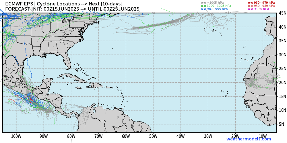
Blank slate except for tiny chance (< 5%) in western Gulf with cross-basin system or transfer of moisture/vorticity, but only 1 member out of 51 survives at named storm intensity.
ECMWF Ensembles | 15-Days | All Storm Tracks
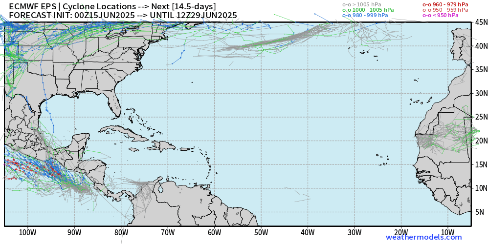
Nothing else to see in the next 2-weeks = June 29th — almost through June.
Eastern Pacific Tropical Update
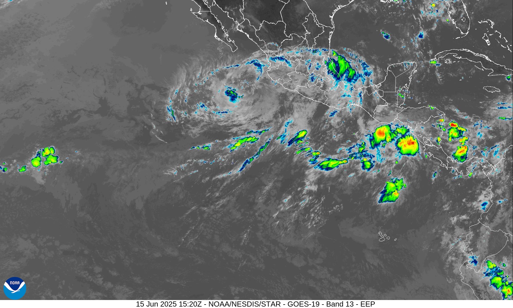
Convection with Tropical Storm Dalila is almost completely gone as it will be a remnant low by this afternoon.
Next area of disturbed weather is crossing Central America with active convection over the warm waters.
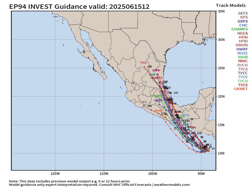
NHC at 60% chance for development of Invest 94E —> Erick
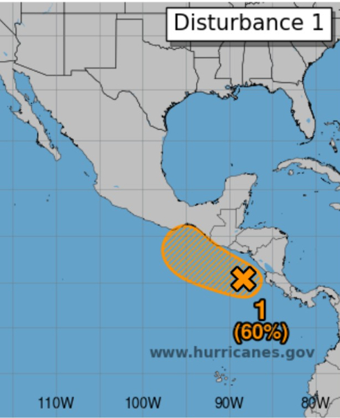
The ATCF Spaghetti tracks are tightly clustered on landfall in Mexico and perhaps still something to track after crossing into the edge of the Bay of Campeche by next weekend.
HAFS-A is bullish on a small but powerful Hurricane Erick in 4-days nearing the coast
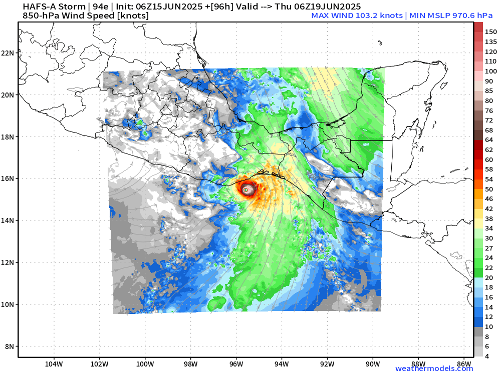
HWRF 06z is also on board with a tiny hurricane
Eastern Pacific SST
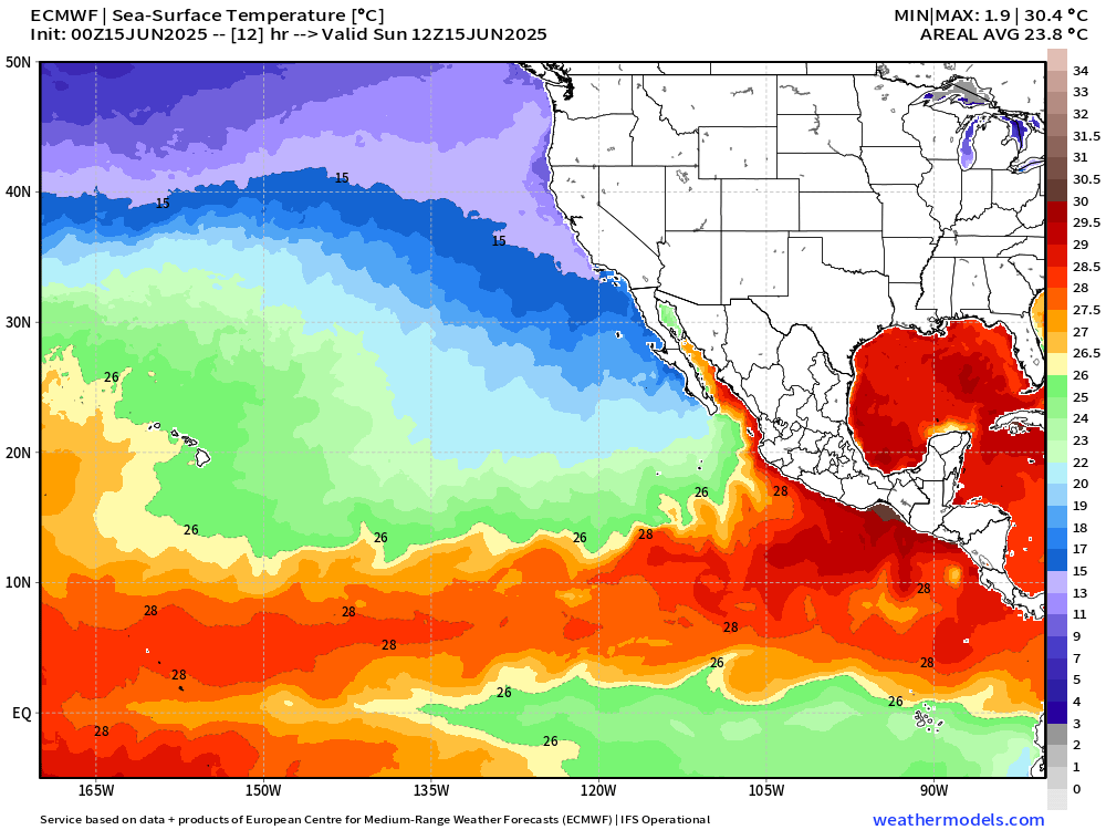
Waters along the coast of Mexico are warm but not exceptionally — in the 28°C range — where Invest 94E is tracking. The 26°C isotherm abruptly ends south of Baja California at 15°N. The EPAC will have 4 storms by next week total for a season, but the overall basin signal is screaming inactivity with the cooler waters.
ICON Precipitable Water Next 5-days
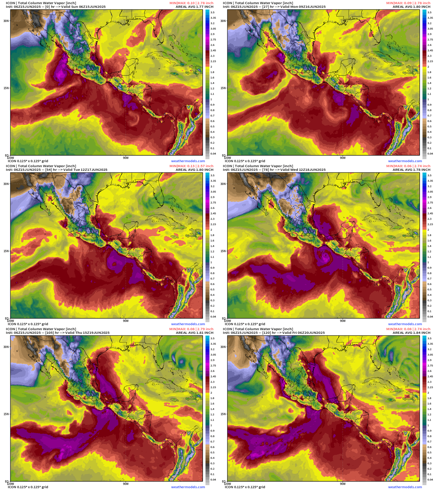
Regardless if Erick survives the transit through the Tehauntepec Gap into the southern Bay of Campeche, the deep layer moisture flow will take its remnants into Mexico and Texas by next weekend = more rain for the Lone Star State.
ECMWF 00z Ensembles | Eastern Pacific
3-Days Active Storm tracks
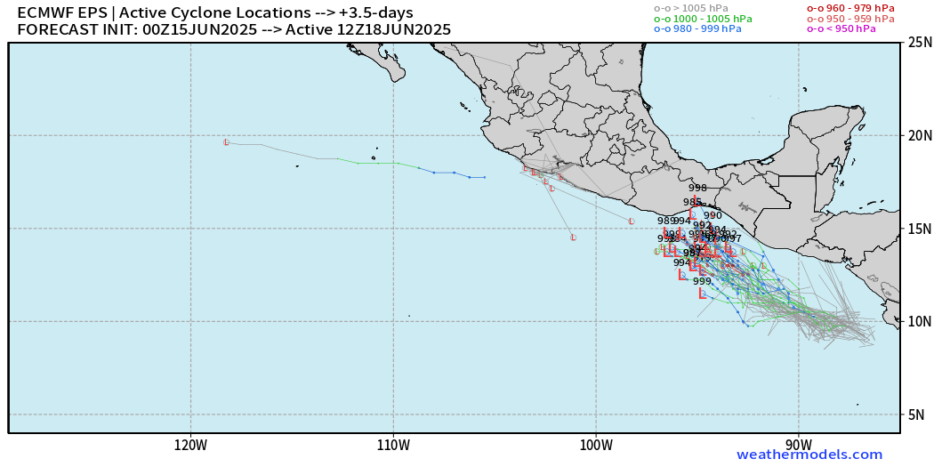
Ensembles are almost all on board with development of Erick … some are at hurricane intensity in 84-hours.
10-Days Active Storm Tracks
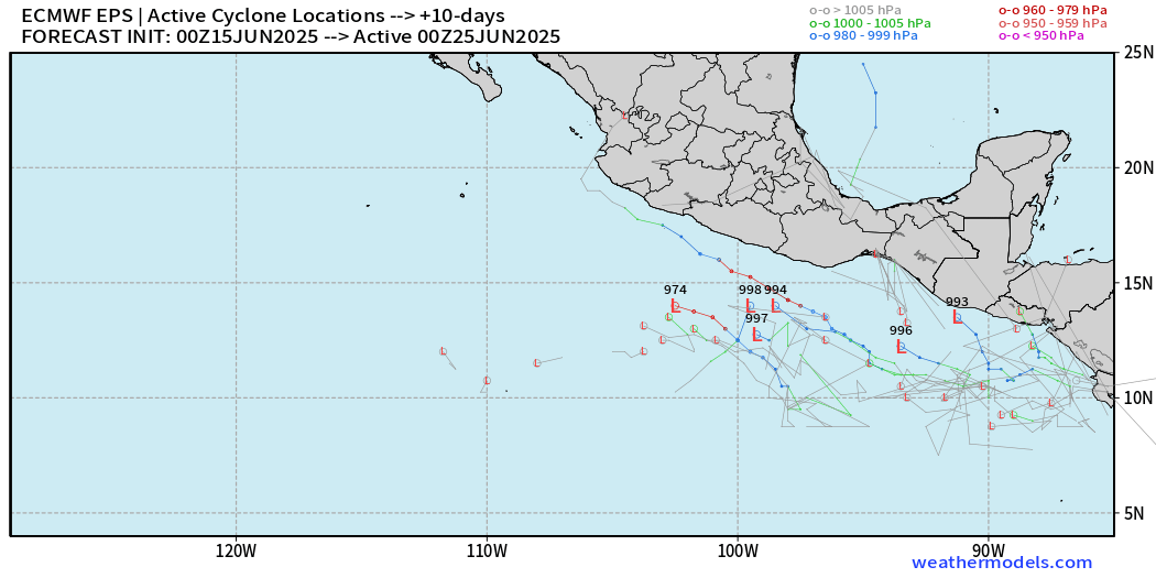
Then, by June 25th, the EPAC is quiet with number of active ensemble tracks < 20% = lower chance of another system.
Western Pacific Tropical Update
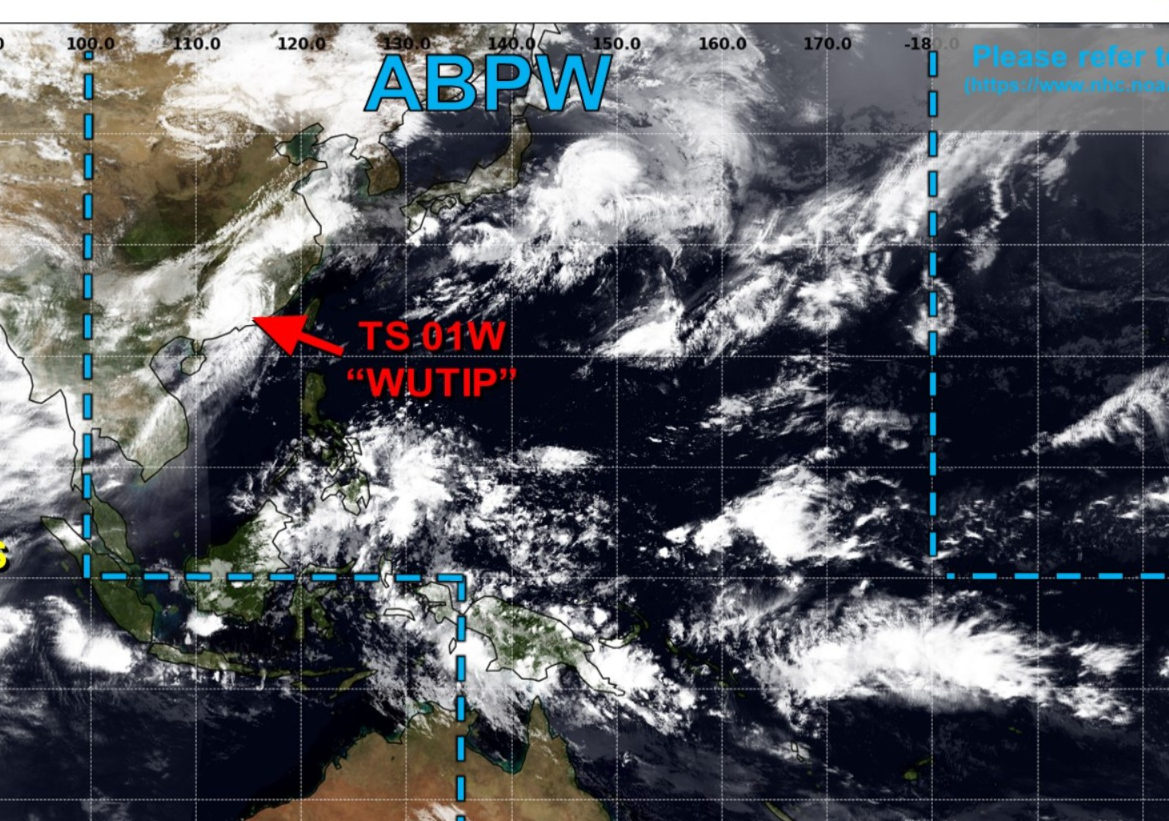
Final warning on Tropical Storm Wutip (01W) was issued … and no other areas are being watched.
Day 7 Ensemble | Active Cyclone Tracks
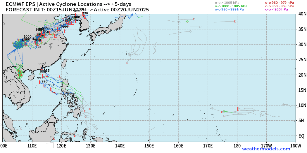
Signal for tropical storms or typhoons after Wutip through 7-days is LOW (10%) for something in the South China Sea.
Day 10 Ensemble | Active Cyclone Tracks
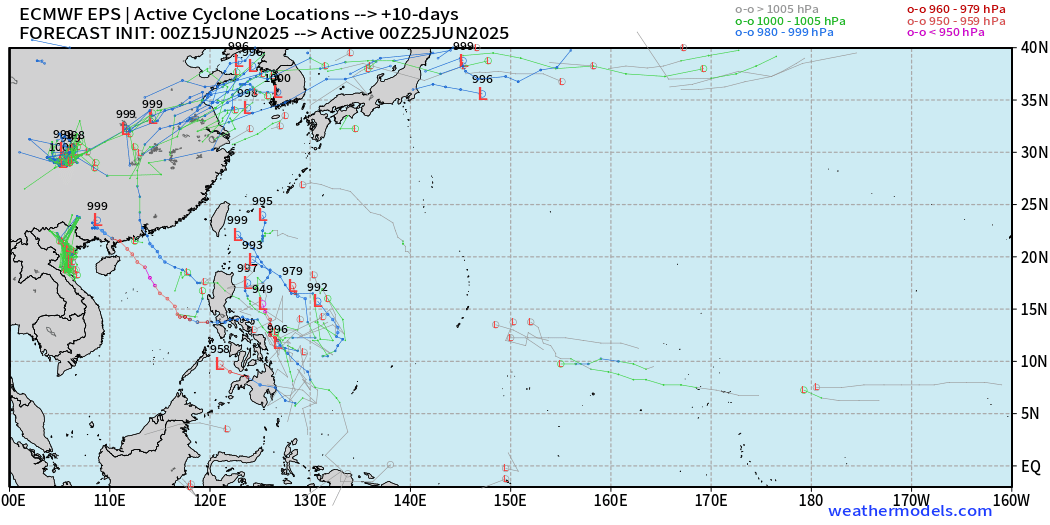
Slightly more activity by Day 10, but still LOW chance of development.
Ryan’s Notes:
June 2025: We use the ECMWF for medium-range prediction because the GFS can’t be trusted due to false-alarm bias, and unrealistic intensification of tropical convection into spurious (ghost) storms. I don’t agree this is a good thing like CNN.
We can look at the GFS every day for weeks and see a modeled tropical storm or hurricane in the Caribbean or Gulf especially after Day 10. However, this is a known bias/false alarm problem with spurious convective — vorticity spin-ups due to the convective parameterization or estimation of vorticity generation due to intense diabatic heating. Perhaps it’s worthwhile to show what will not happen.
Maps sourced from weathermodels.com designed and innovated by yours truly! Please subscribe there for real-time access to the newest maps, charts from all of the weather models including ECMWF.
- Milepost
- 642 · laid 2025-06-15T16:15:26.321000Z
- Source
- https://weather.substack.com/p/june-15-2025-hurricane-season-sunday
- Digest
- 7196d9344f2f6c7b155b64e2c6017290cdcafd8973f3160fab2c99debaa11aea
- Machine
- JSON