June 9, 2025 Monday Evening Edition
More rain into weekend across Eastern U.S. with unsettled pattern
June 2025 was the 7th-warmest June in the 132-year national record (1895–2026), at 71.2°F against a 1991–2020 normal of 69.5°F (+1.7°F).
June 2025 was the 26th-wettest June in the 132-year national record (1895–2026), at 3.3in against a 1991–2020 normal of 3.1in (+0.2in).
NOAA/NCEI Climate at a Glance, contiguous United States. This is the observed record for the month, not a score of anything said in this piece — the forecast ledger begins 2026-08-17 and cannot reach earlier posts.

Monday Evening Weather Headlines
Hurricane Barbara upgraded but won’t last very long as it reaches much cooler water, dry air, and wind shear. Tropical Storm Cosme to the WSW is in better shape and should become a Hurricane as well, minimal, Category 1, before decaying.
We’re stuck in an unsettled and wet pattern for the foreseeable future across the Plains and Eastern U.S. into mid-June.
Eastern Pacific Hurricane Basin
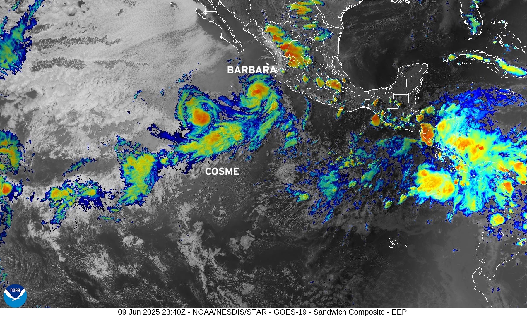
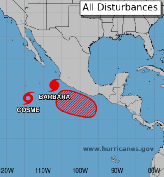
Another area of disturbed weather will likely form into a tropical depression by this weekend and become the 4th named storm of the EPAC season. The Atlantic has been quiet — and should remain so for the next 10-14 days.
Precipitable Water Next 5-days
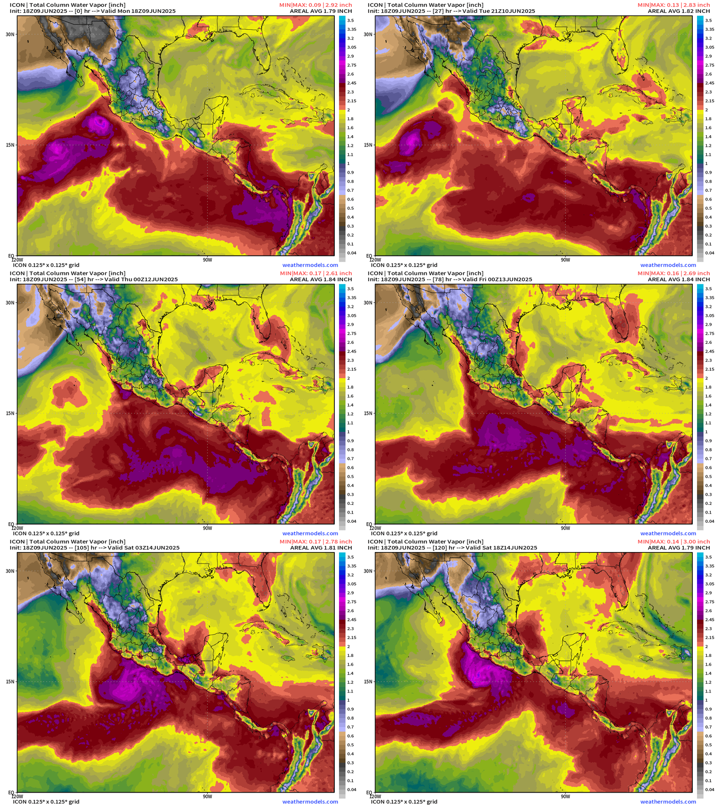
The next system is Dalila and I’d expect it to fare better than Barbara and Cosme with a higher intensity ceiling over the warm waters south of Mexico.
Atlantic Basin | 15-days Ensemble Tracks
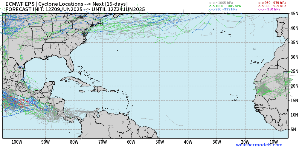
12z updated ECMWF EPS ensembles are blank for the Atlantic basin through June 24.
NHC doesn’t expect any tropical cyclone activity through 7-days …
Monday Evening Weather
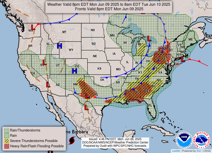
A frontal boundary is draped from west Texas into the Southeast and through western NY and PA with rain and storms continuing this evening.
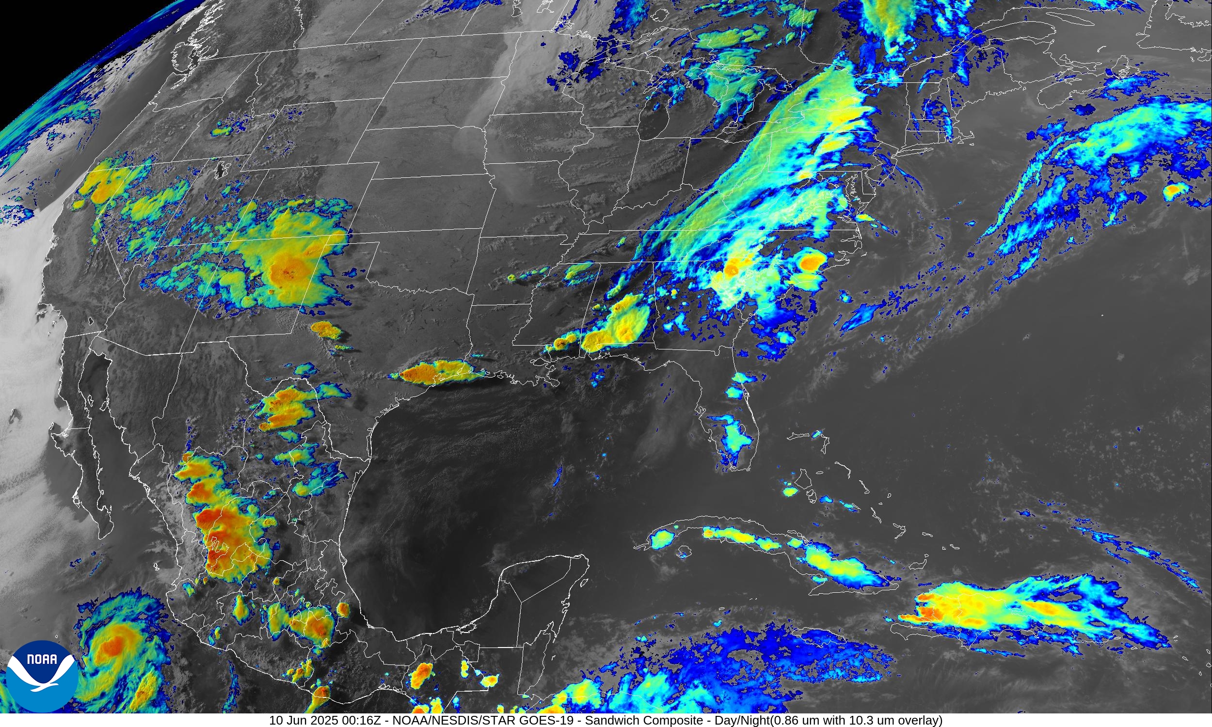
Current Satellite Imagery
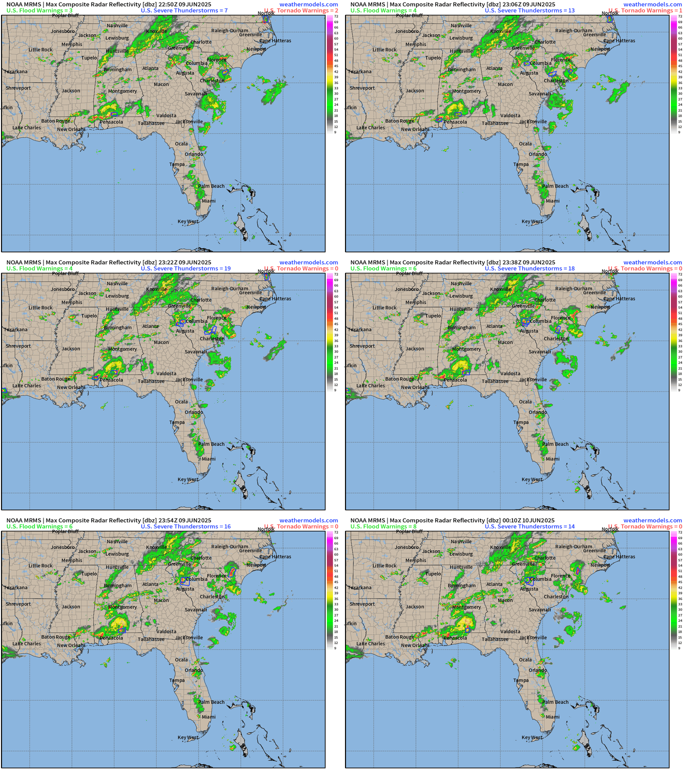
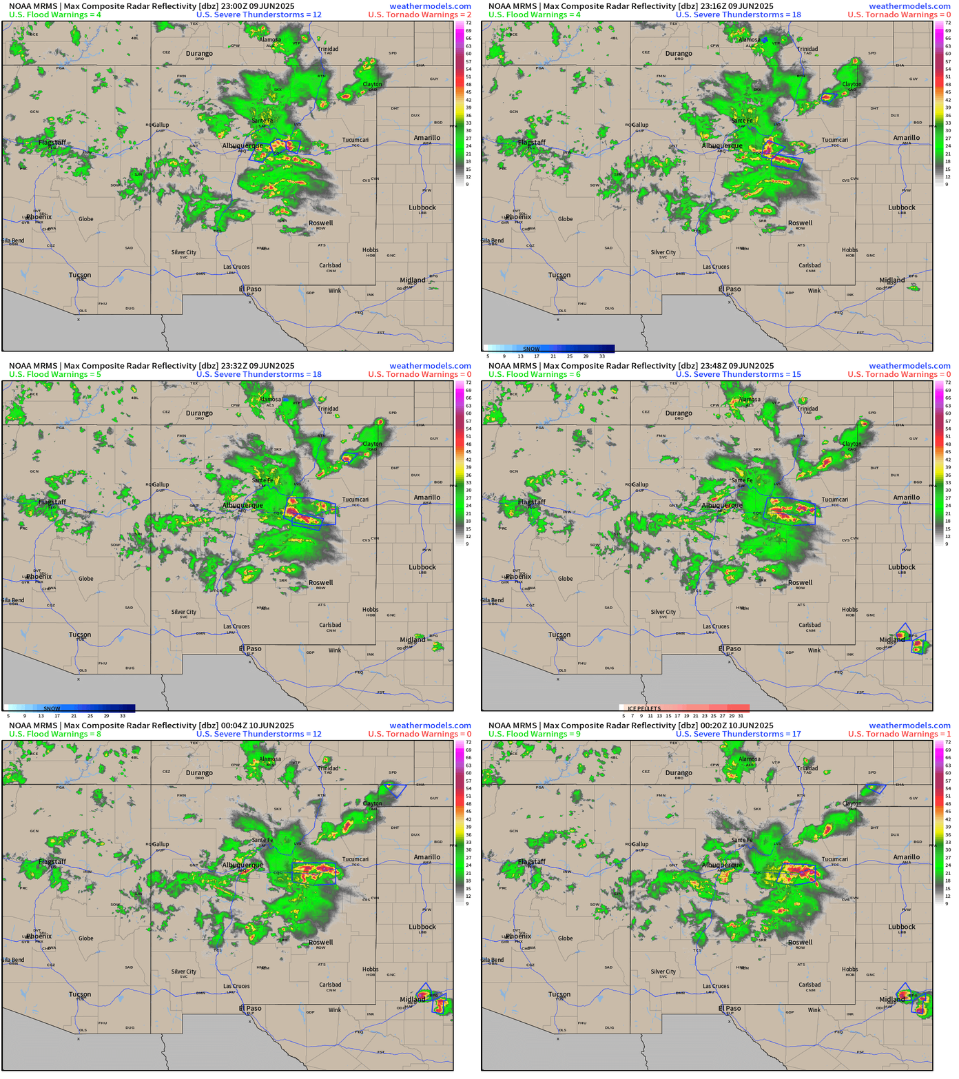
Radar Loops: 8:10 PM ET
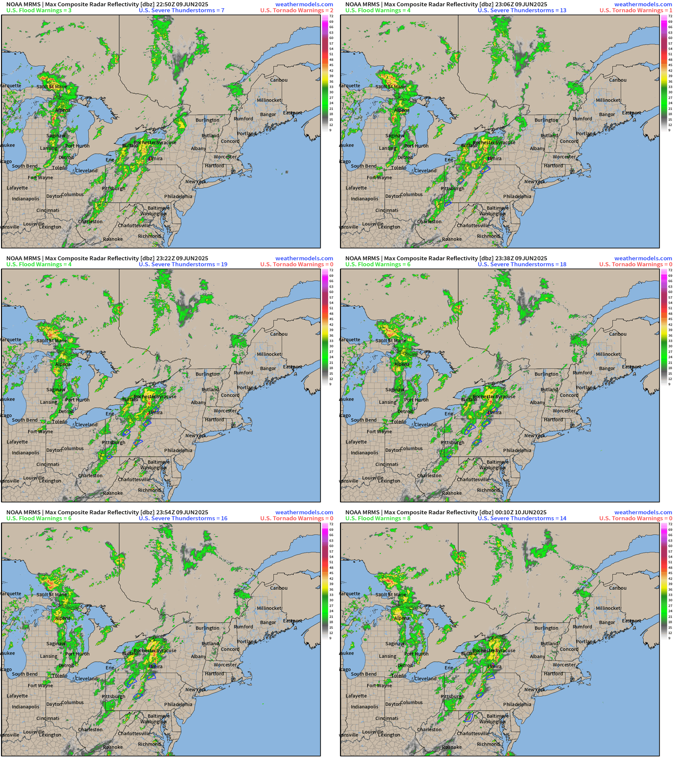
Some scattered storms with heavy rain — may be briefly severe with gusty winds. However, these should die down into the later evening leaving rain as the primary threat.
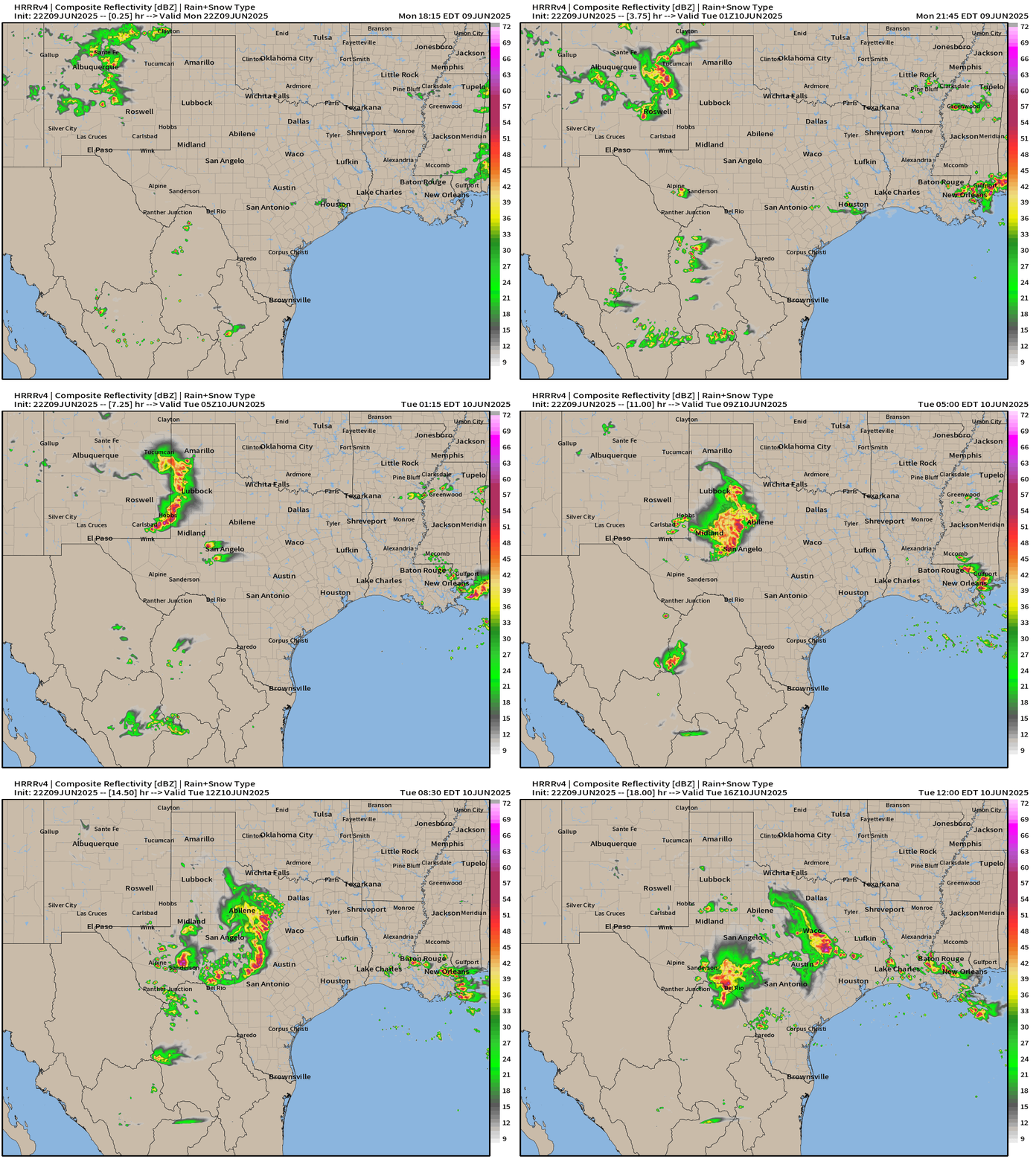
Simulated Radar | HRRR 22z | Next 18-Hours
A storm complex will coalesce out of New Mexico and dip ESE into central Texas sweeping through Austin by early morning.
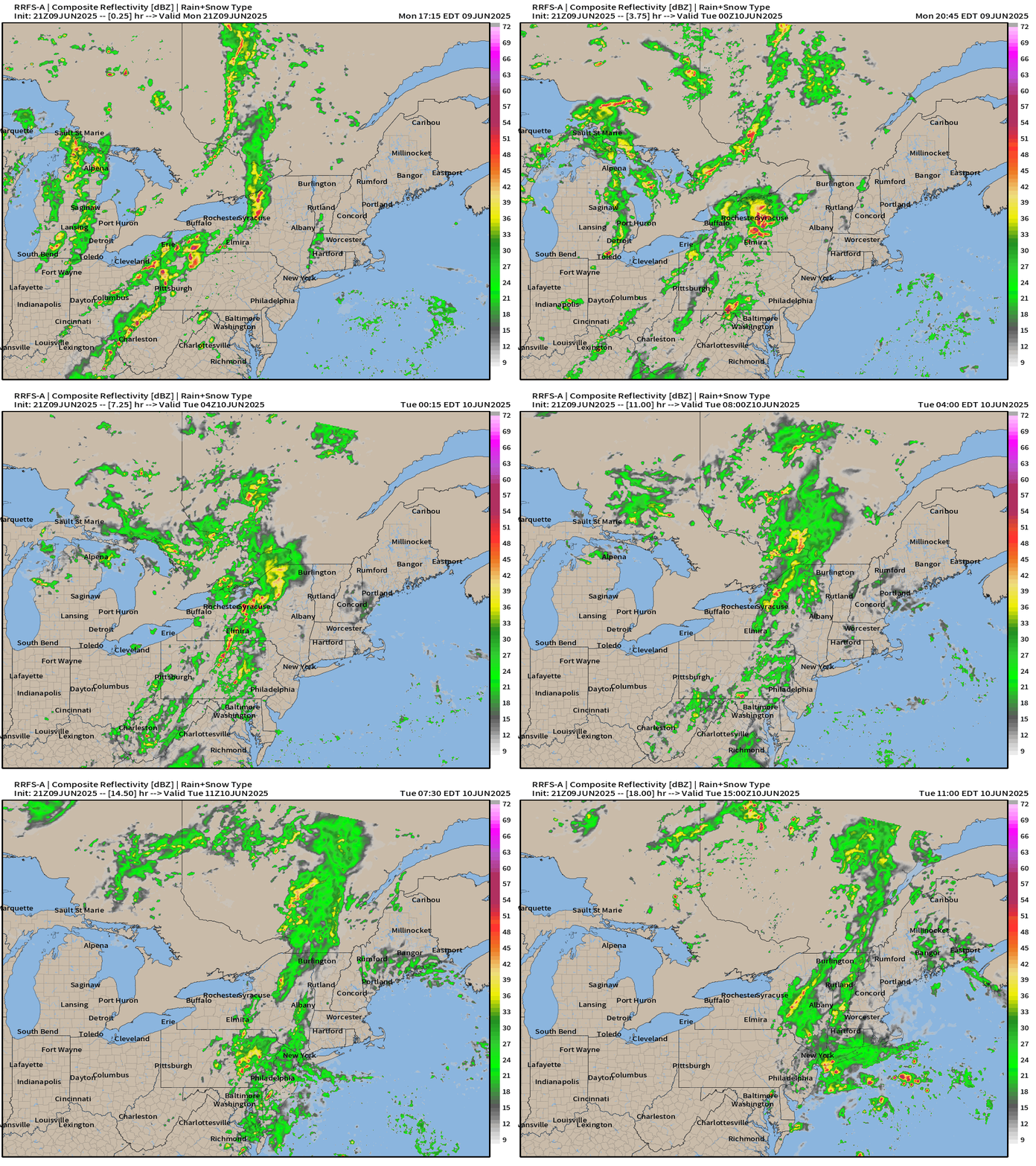
Rain across the Northeast will continue through the morning.
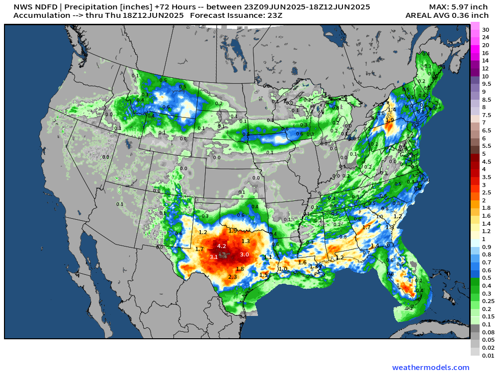
NWS Precipitation next 72-Hours
Weather on Tuesday | Fronts at 8 PM
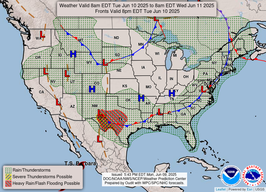
Heaviest rain in west Texas through the morning … and then along the frontal boundary stalled out across the southern U.S.
Temperature Analysis | 8:30 PM ET
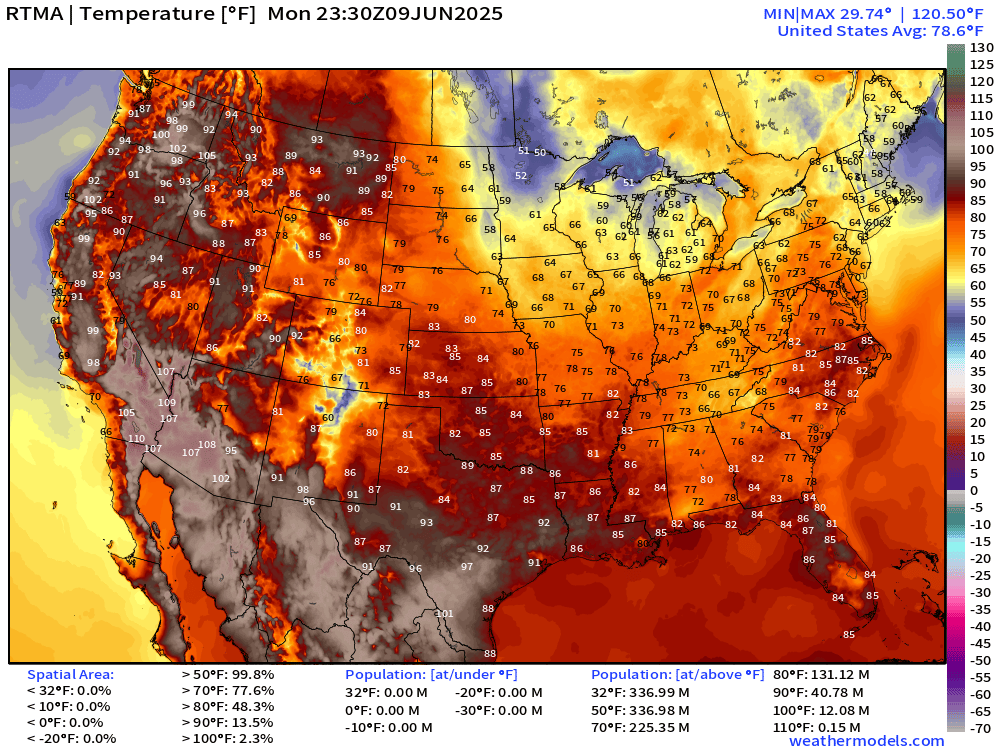
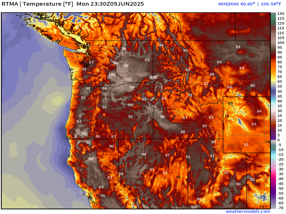
HOT across southeast Washington > 100°F.
109°F so far high in Phoenix.
Temperature Anomaly | 8:30 PM ET
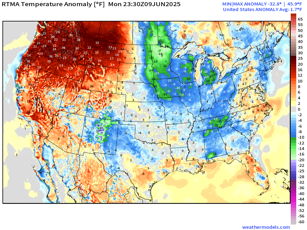
Overall the Lower 48 is 1.7°F above normal [1991-2020] with considerable heat across the Pacific Northwest > 20°F above normal.
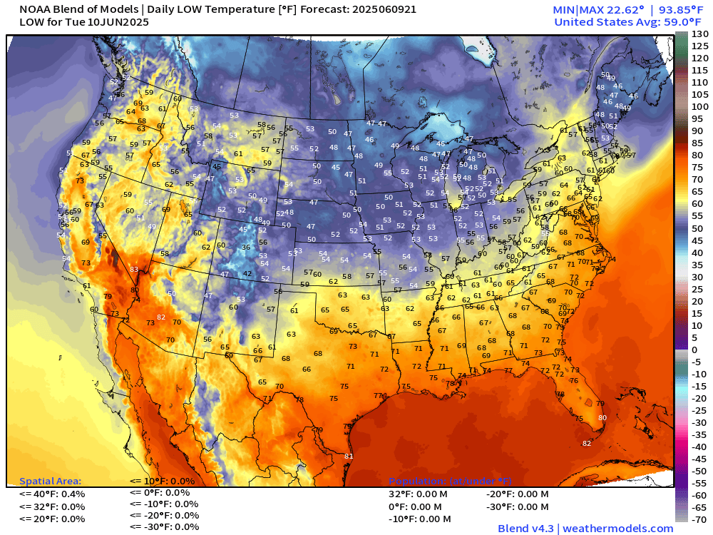
Tuesday Morning Lows
Tuesday High Temperatures
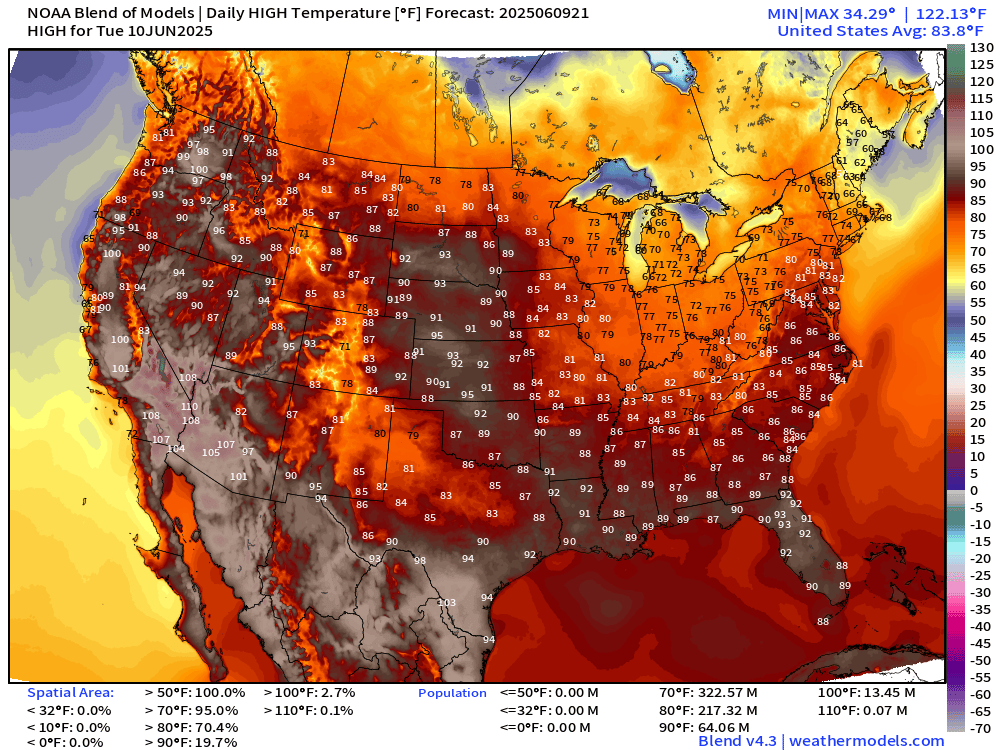
83.8°F is the Lower 48 average high temperature with 217 million at least 80°F, and 64 million above 90°F.
Wednesday High Temperatures
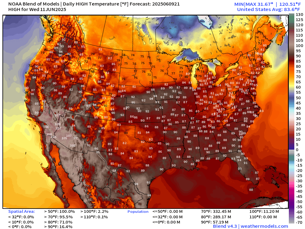
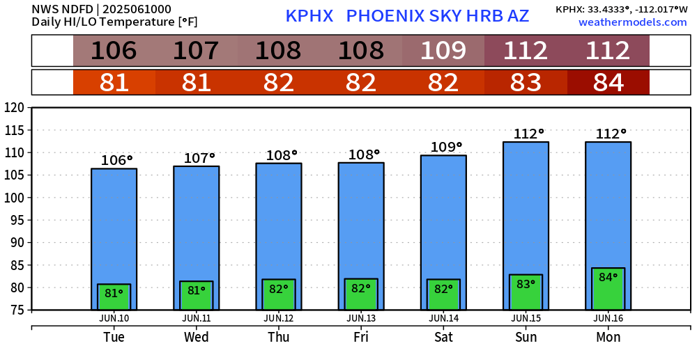
Extreme heat across the Southwest intensifies with Phoenix to 112°F by Sunday.
NWS WPC Precipitation | Next 7-days
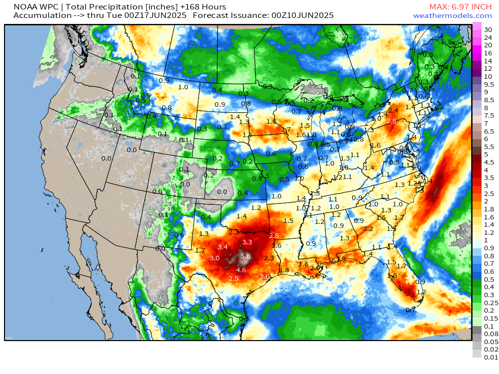
Wet pattern continues … large area of 1” or more across the Eastern U.S.
Highest totals in Texas, 3 to 5” or more around Austin/San Antonio.
Precipitation and MSLP Next 8-Days | ECMWF 12z
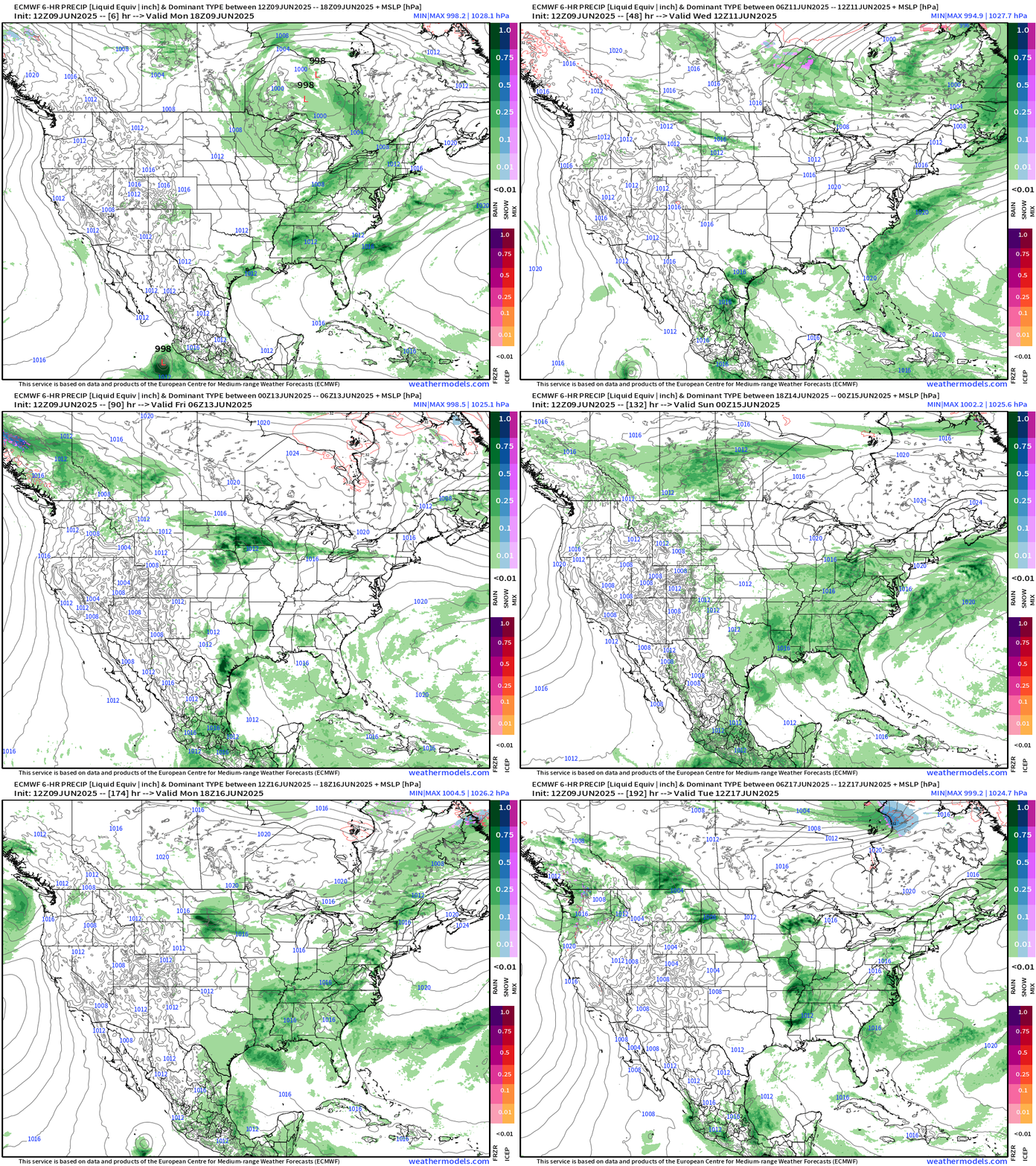
Moisture continues to flow out of the Gulf of Mexico — beaten back by Canadian troughs — then surge northward again on a 3-5 day repeat cycle.
ICON Model 5-day Precipitable Water
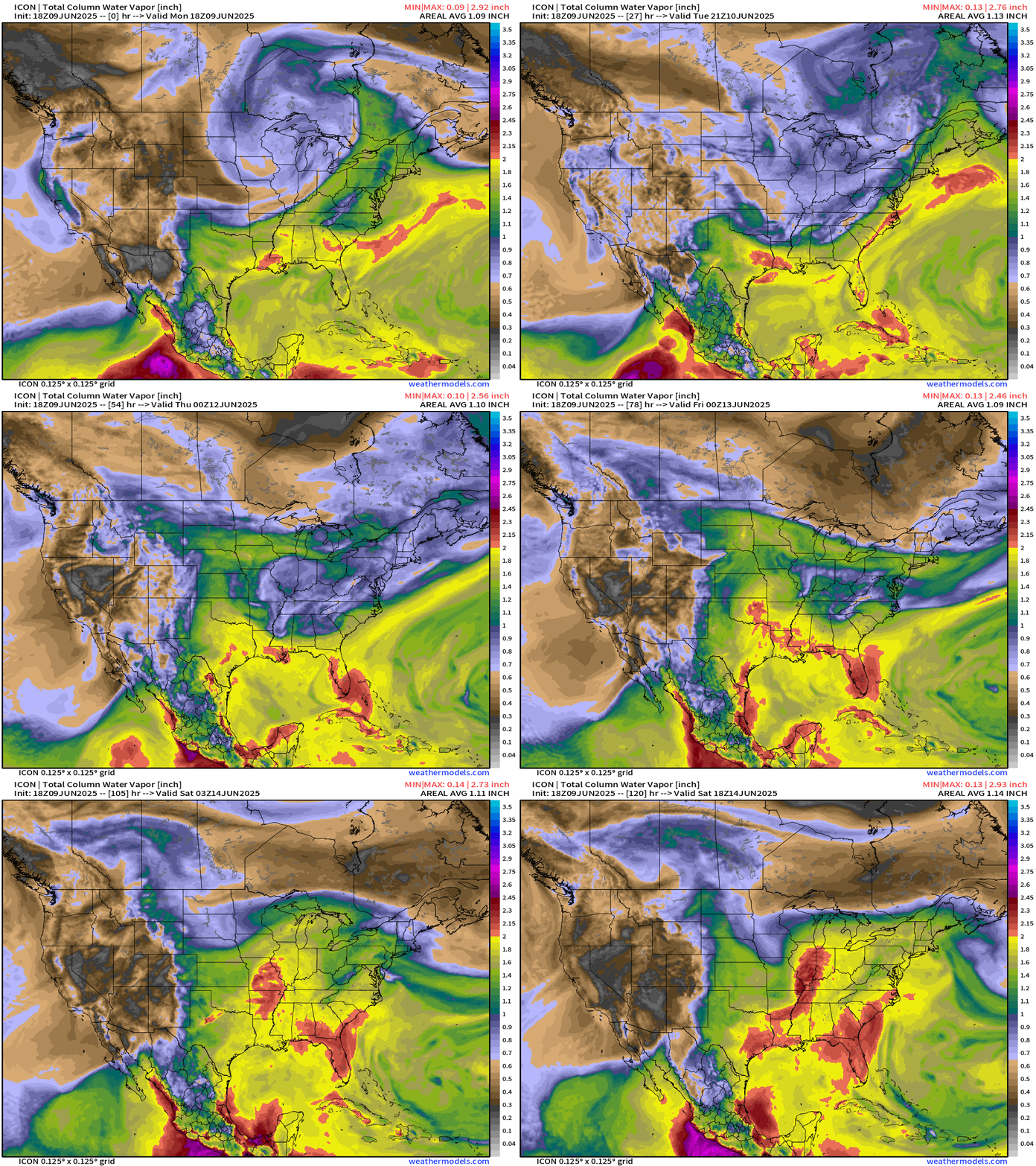
2” PWAT into the Midwest by this weekend = potential for heavy rain.
Upper Level Weather Pattern | Height Anomaly next 10-days
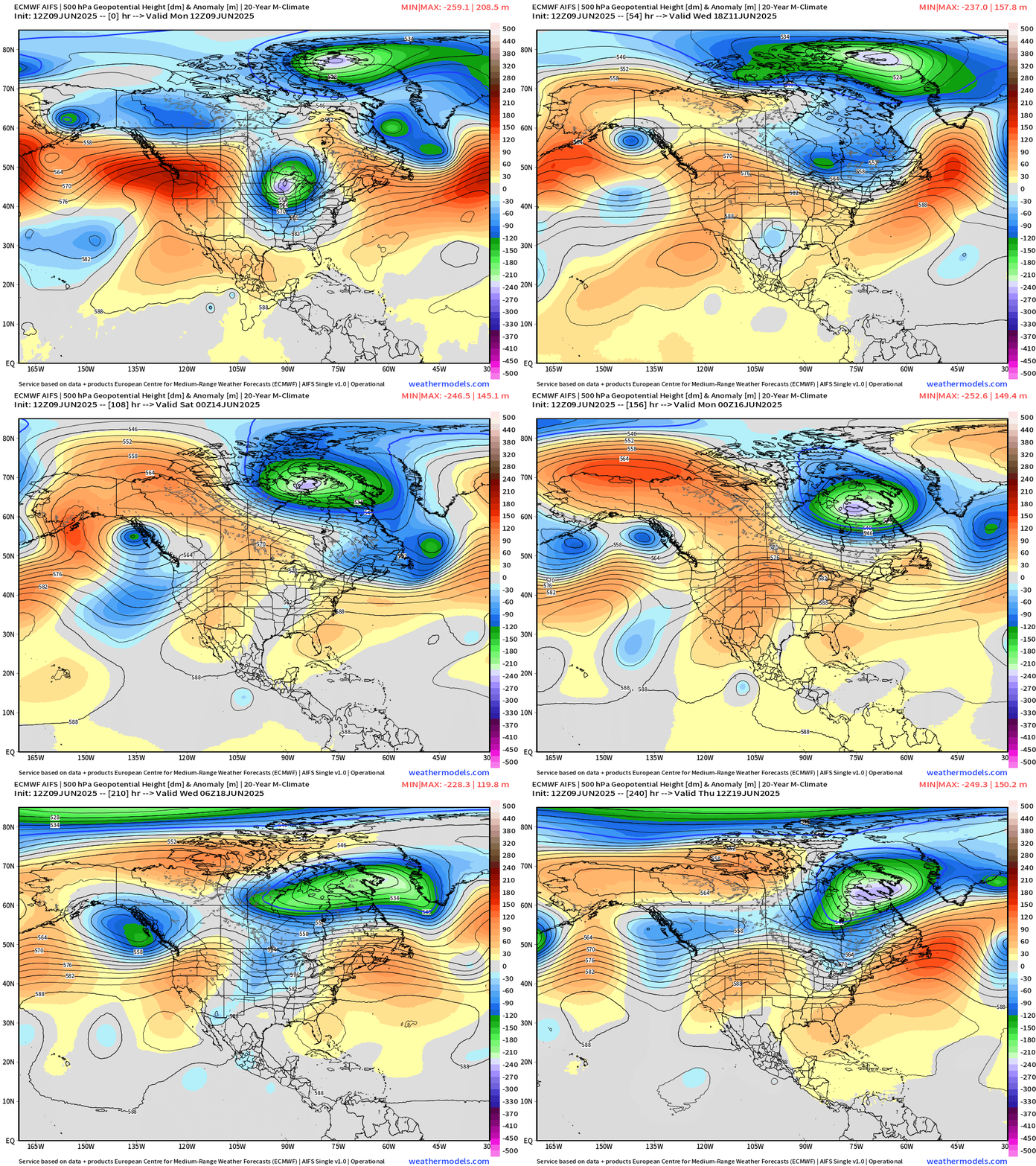
Not seeing a large heat dome across the Lower 48 — except for maybe the U.S. Southwest. However, troughs in Canada easily beat back any high pressure cells + moisture from the south = unsettled conditions for the next 7-10 days+
ECMWF EPS 12z | 5-Day Chunks Temperature Anomaly
Days 1-5: June 9 - June 13
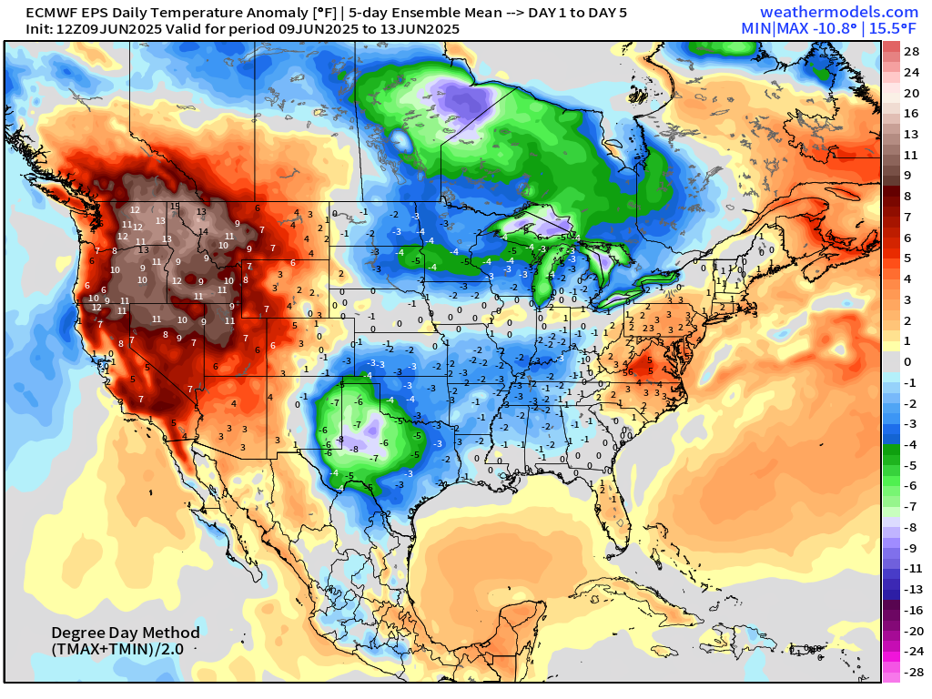
Heat across Pacific Northwest.
Days 6-10: June 14 - June 18
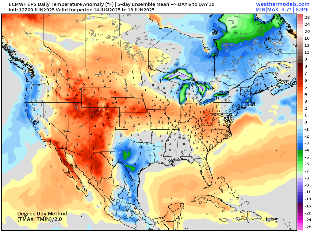
Days 11-15: June 19 - June 23
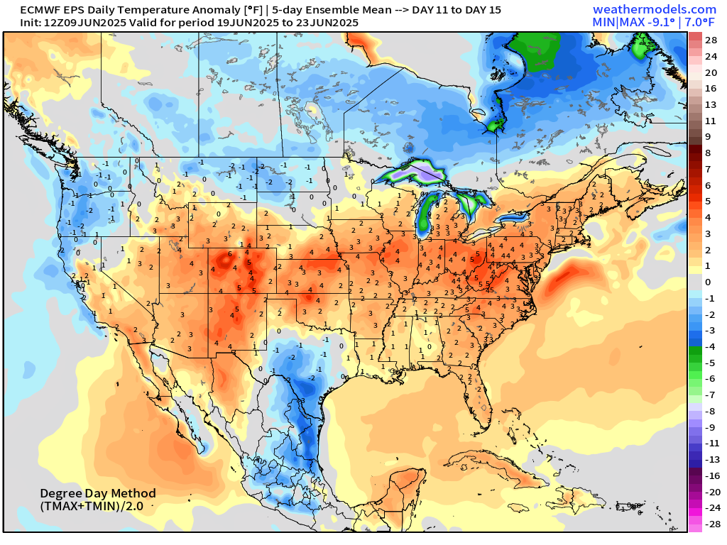
Maps sourced from weathermodels.com designed and innovated by yours truly! Please subscribe there for real-time access to the newest maps, charts from all of the weather models including ECMWF.
- Milepost
- 635 · laid 2025-06-10T00:34:58.234000Z
- Source
- https://weather.substack.com/p/june-9-2025-monday-evening-edition
- Digest
- ea807aa5150174d89c016669c53ced26b2a301adc3823fafb1e6e7a7bb41166b
- Machine
- JSON