June 8, 2025 Tropical Update Sunday
Tropical Storm Barbara forecast to become a hurricane
June 2025 was the 7th-warmest June in the 132-year national record (1895–2026), at 71.2°F against a 1991–2020 normal of 69.5°F (+1.7°F).
June 2025 was the 26th-wettest June in the 132-year national record (1895–2026), at 3.3in against a 1991–2020 normal of 3.1in (+0.2in).
NOAA/NCEI Climate at a Glance, contiguous United States. This is the observed record for the month, not a score of anything said in this piece — the forecast ledger begins 2026-08-17 and cannot reach earlier posts.

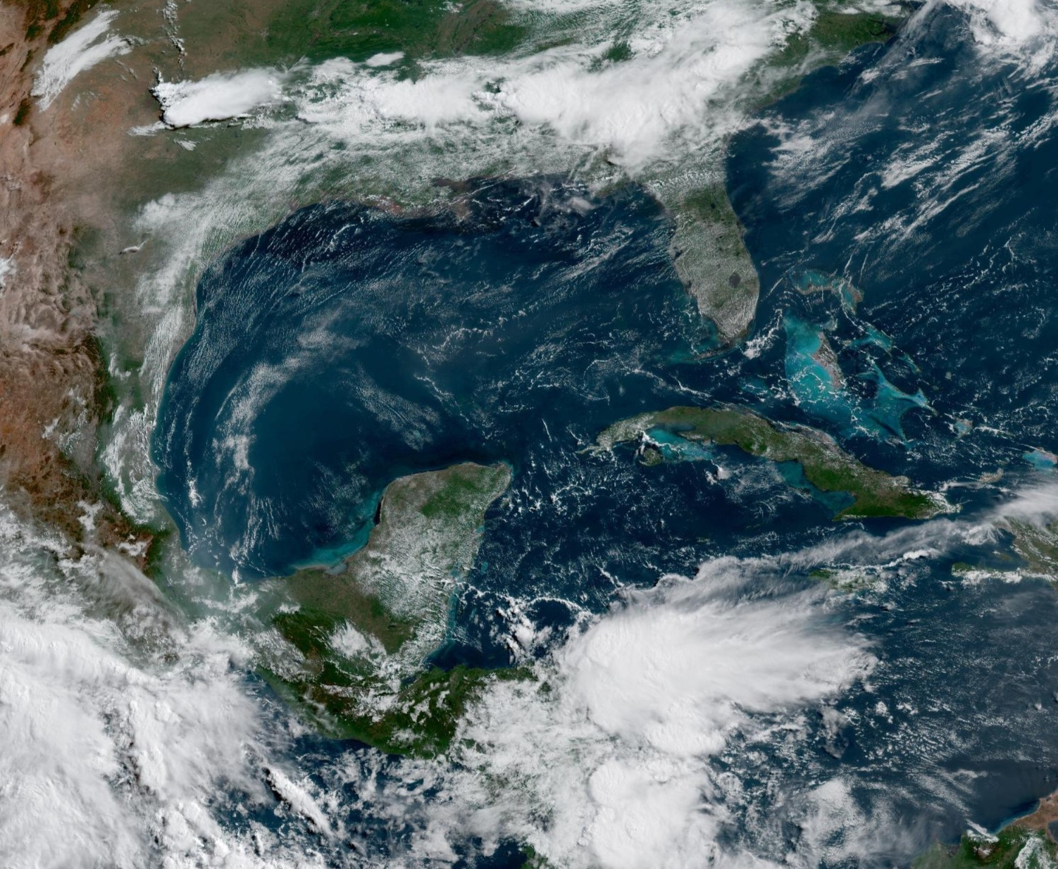
Sunday’s Tropical Weather Headlines
Atlantic tropical update: No areas being watched through the next 7-days (June 15) by NHC and the ECMWF ensembles are blank for 10-days (June 18).
Eastern Pacific tropical update: Tropical Storm Barbara (02E) forecast to become a Category 1 hurricane. Invest 91E to the SW may interact down the road. (Now Tropical Depression 03E)
Thank you to readers continuing into this Hurricane Season. My goal is to keep you informed about ongoing extreme weather events inside and outside of the tropics, but also a week (hopefully) heads up on what’s coming. I’ll be using a variety of weather modeling output, some of it may be unfamiliar, but it’s state-of-the-art and industry leading standard.
ECMWF 00Z | Integrated Vapor Transport | Next 10-days
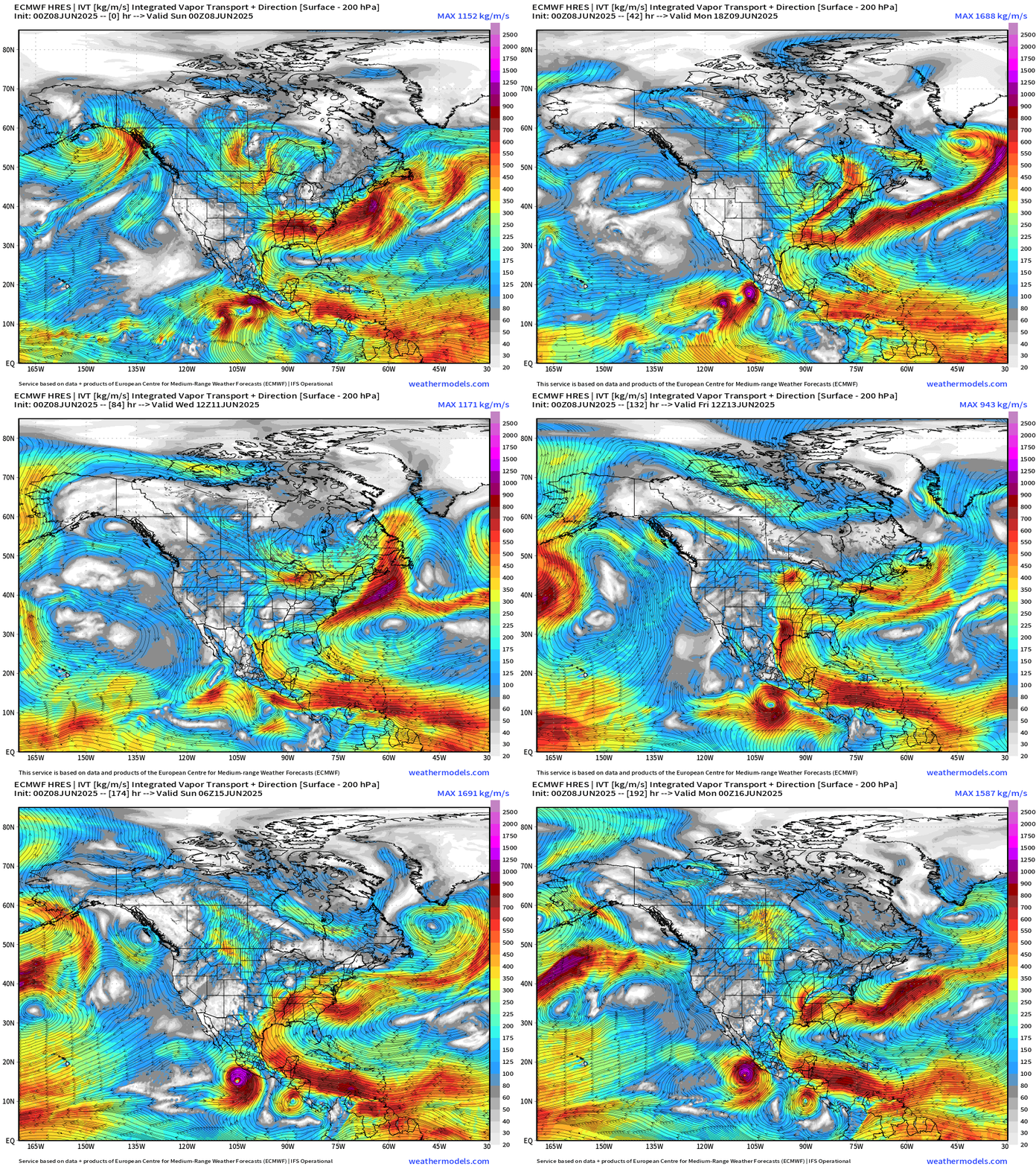
Eastern Pacific: Barbara (02E) and Invest 91E very close together off the southern coast of Mexico. The former may become a hurricane briefly before reaching cooler waters. After these two, another named storm is likely in 5-days or so.
Gulf and Caribbean are under influence of strong subtropical high keeping moisture flowing out of the deep tropics with trades or easterlies. This is keeping the eastern U.S. wet and unsettled as Canadian troughs continue to dip into the Midwest and Northeast.
No tropical cyclone formation likely in the Atlantic basin in the next 10-days+
Precipitable Water Next 5-days | Atlantic Basin
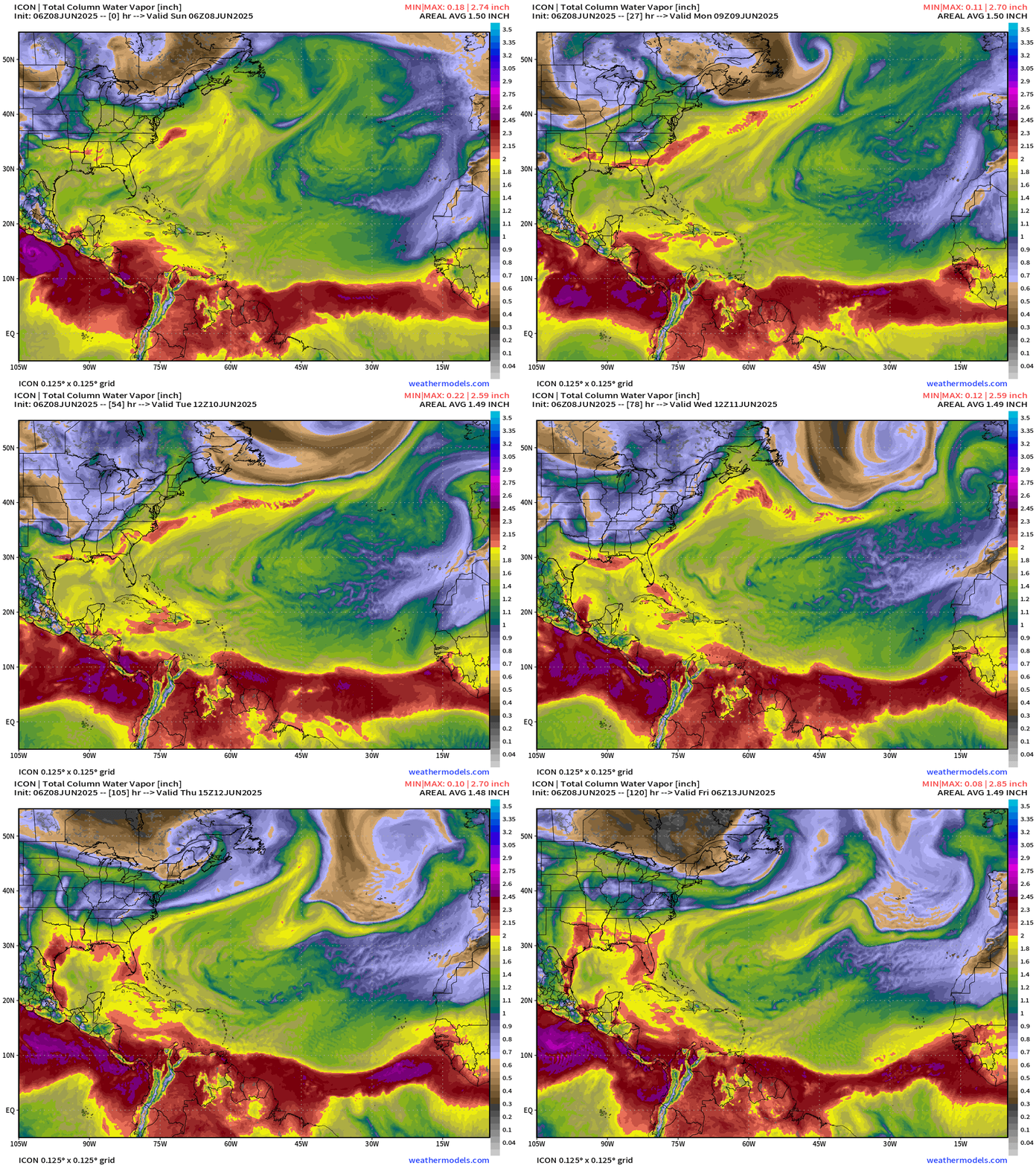
We need > 2” PWAT to fire up a tropical storm or a hurricane.
PWAT remains under 2” in the Gulf and Caribbean w/o a trigger for tropical cyclone development. The ITCZ/monsoon trough is flat with a sharp gradient south of the Saharan Air Layers.
Tropical Atlantic | Precipitation and MSLP Next 10-days
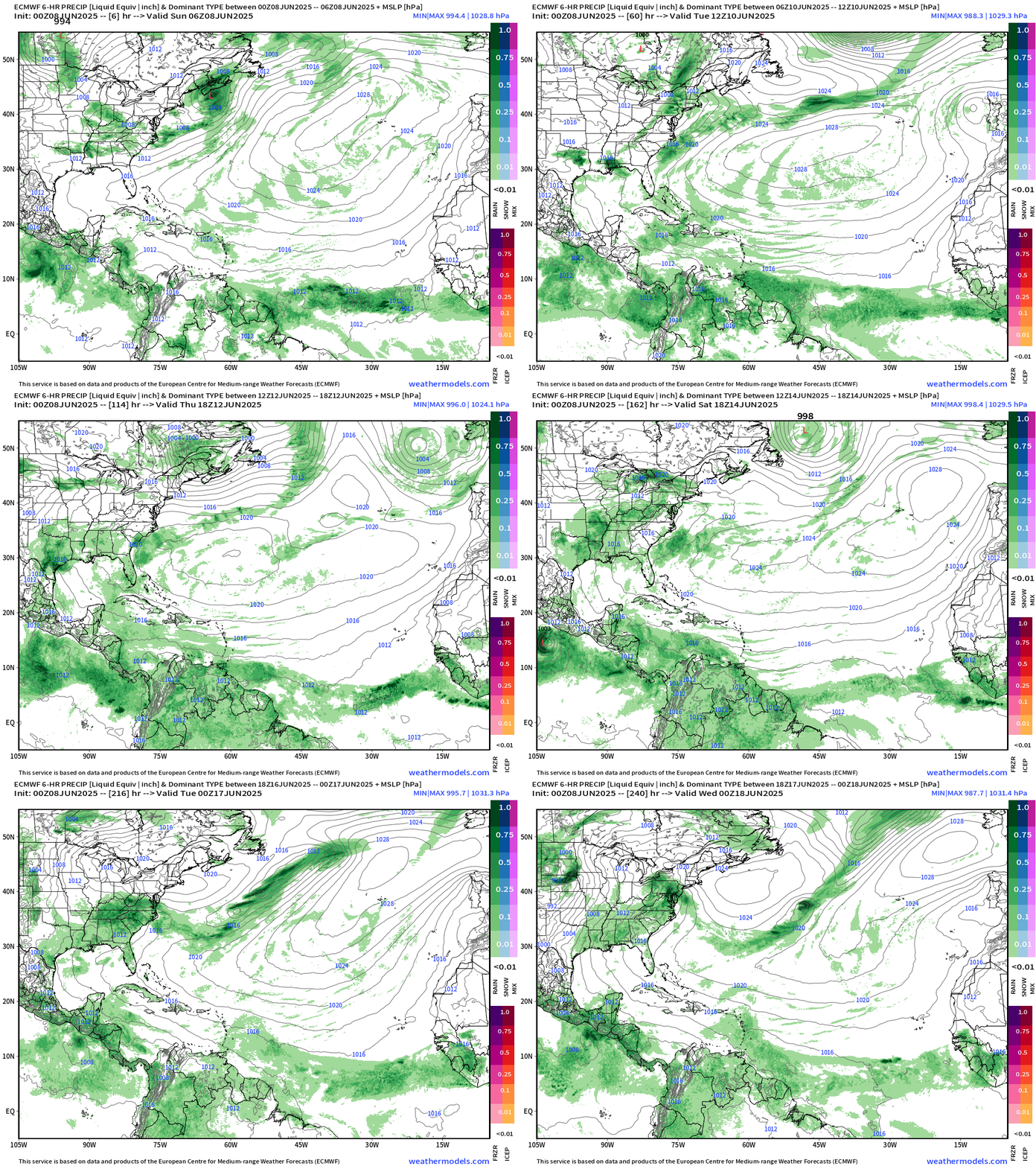
Same story as yesterday typical for early June — Strong 1028-1030 mb High Pressure across the Atlantic basin at 35°N (Azores High) eventually breaks down because of cold fronts / Canadian troughs. Until then, the strong Azores high will shove the ITCZ in the Atlantic slightly south of climatological position.
Atlantic Basin
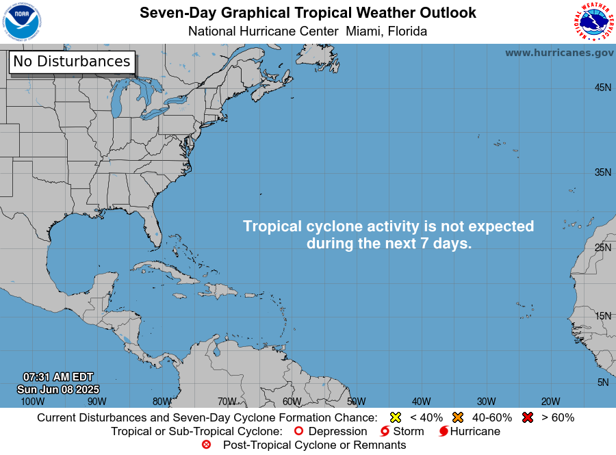
Nobody home for next week — good news.
Eastern Atlantic Satellite Image
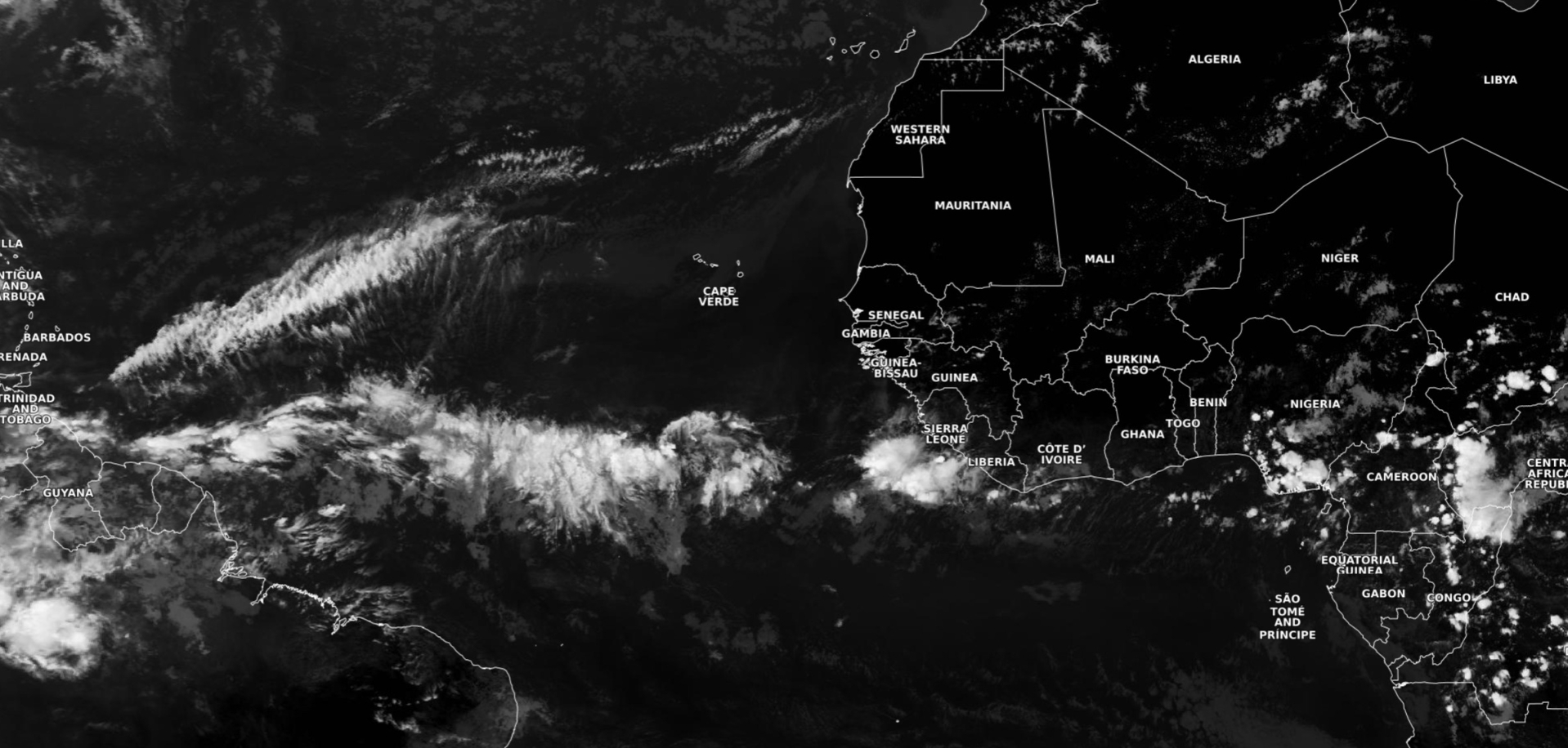
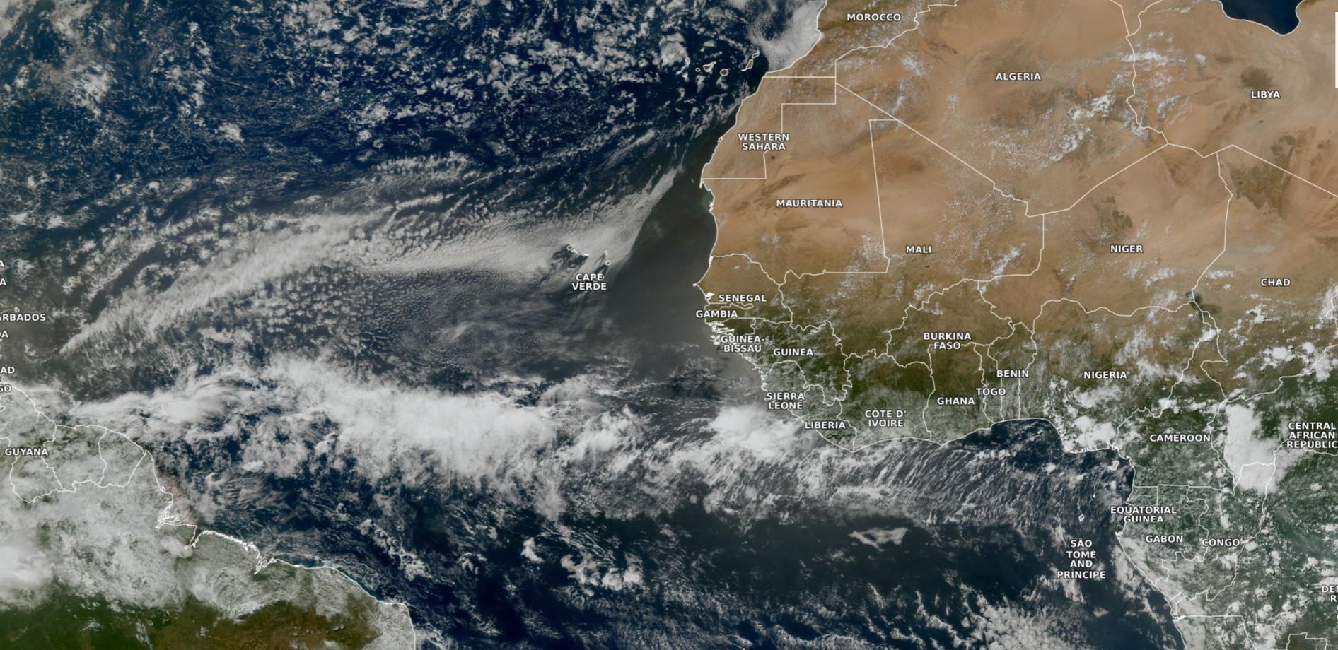
Dust layer in between two bands of clouds. The northern side is shallow stratocumulus over cooler waters while the ITCZ/monsoon trough has some convection. Tropical waves over Africa are quite close to the Equator.
NASA-GEOS-5 00z DUST Aerosol Optical Depth (AOD) | 8-days Forecast
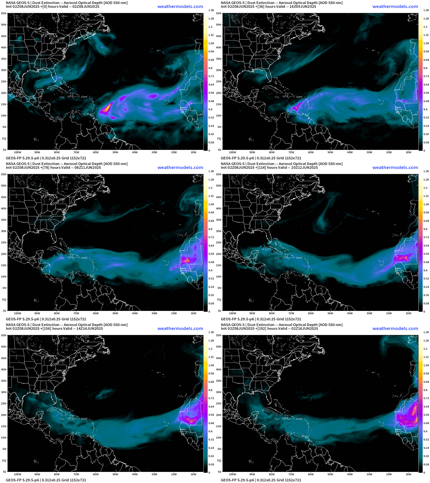
Dust now approaching the Lesser Antilles but will disperse into the Caribbean and Gulf.
Atlantic Ocean Surface Temperatures (SST) | Anomaly
This depiction uses ECMWF SSTs with a recent 20-year model hindcast climatology.
Comparison Tropical Cyclone Heat Potential 2024 and 2025
Left (2024) and Right (2025) — considerable heat potential difference as of June 6th compared to last year especially outside of the Caribbean.
Tropical Atlantic Satellite Imagery
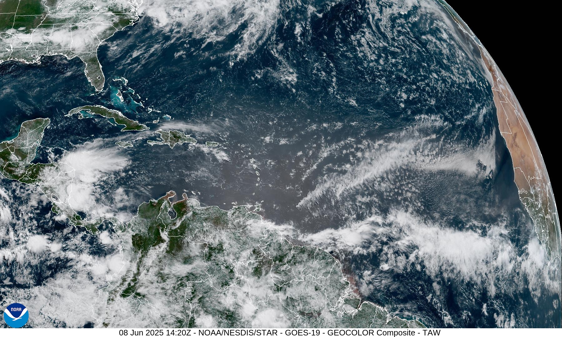
Only point of discussion is Saharan dust — lack of convection is noticeable as a result from Africa to the Caribbean.
Tropical Surface Analysis | 06Z
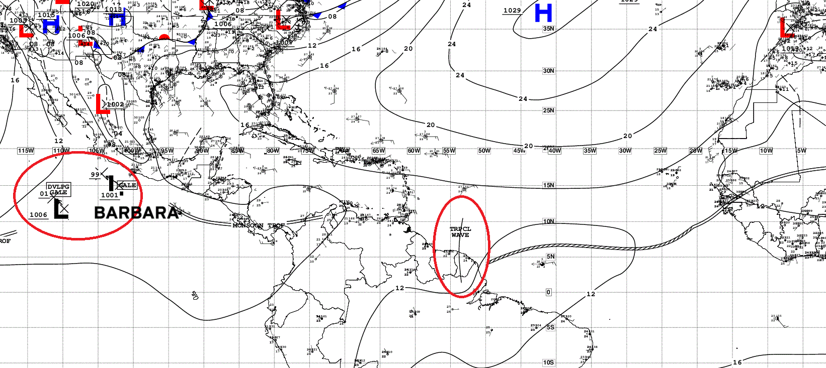
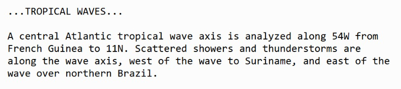
Atlantic Tropical Waves = 1 but no development expected [plausible or possible] over Suriname / Brazil.
GFS Model Update
Days 0 to 10 Relative Vorticity
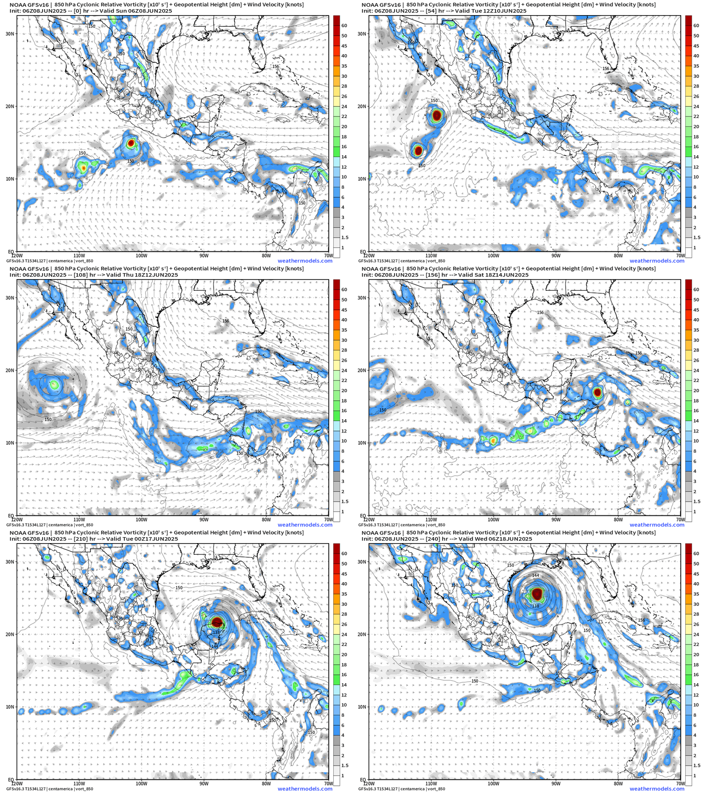
We can look at the GFS every day for weeks and see a modeled tropical storm or hurricane in the Caribbean or Gulf especially after Day 10. However, this is a known bias/false alarm problem with spurious convective — vorticity spin-ups due to the convective parameterization or estimation of vorticity generation due to intense diabatic heating. Perhaps it’s worthwhile to show what will not happen.
And, yet again a major hurricane develops out of the Caribbean gyre across the Yucatan into the Gulf of Mexico by Tuesday, June 17 +9 days. The vorticity originates from the Eastern Pacific and southern Caribbean.
However, this is still highly unlikely w/o ensemble support from the more trusted model — ECMWF EPS.
The binary interaction between Invest 91E and Barbara looks quite interesting.
Medium range ensemble model outlook
These are 51-realizations of the same model with different initial conditions. Each ensemble gets equal ~2% weight in a mean calculation.
ECMWF Ensembles | 10-Days | All Storm Tracks
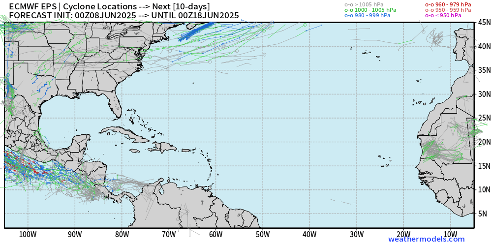
Blank slate through June 17.
Eastern Pacific Tropical Update
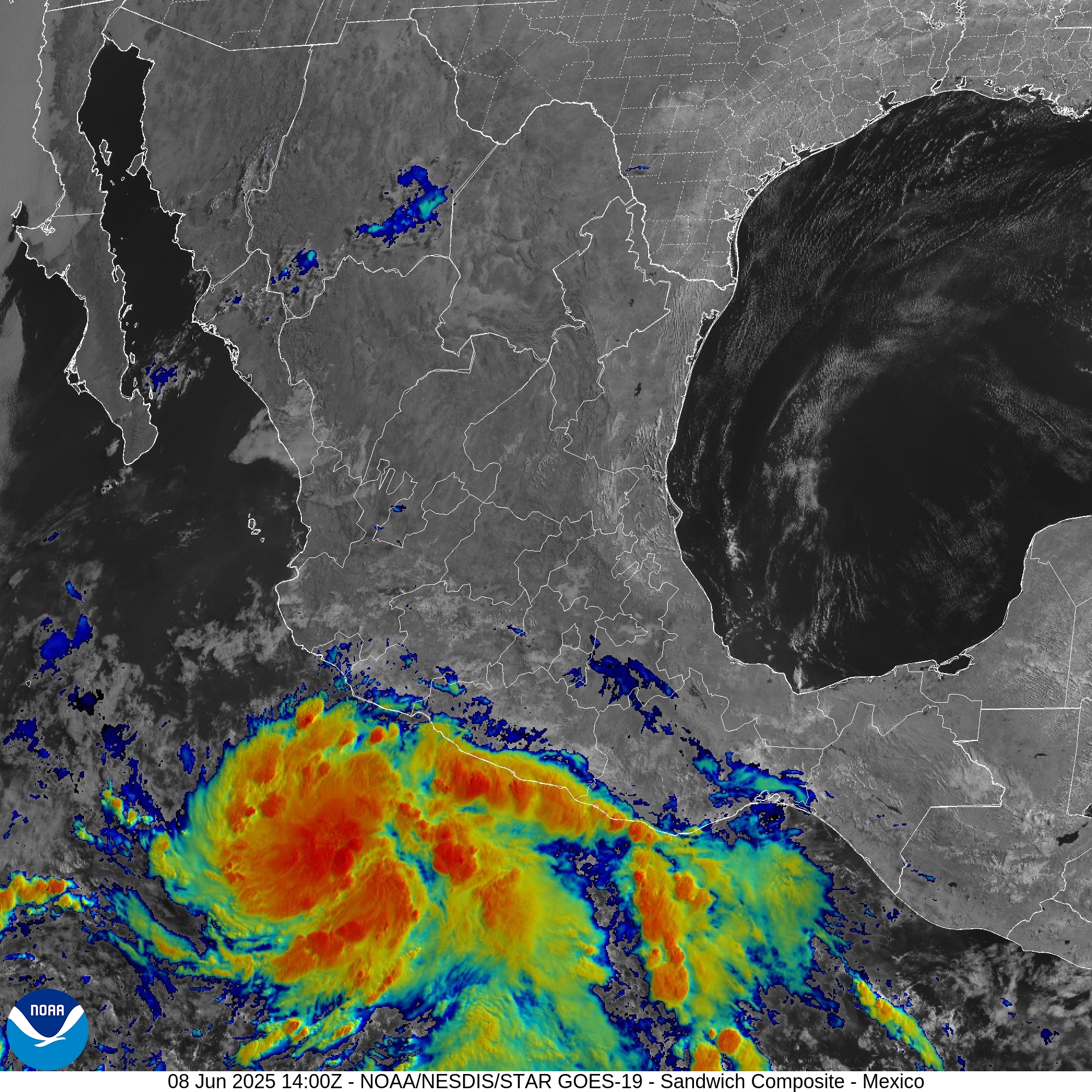
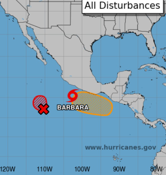
Barbara is underway (02E) and Cosme is highly likely to form later today or tomorrow. Then, another area to be watched in 4-5 days along the southern coast of Mexico.
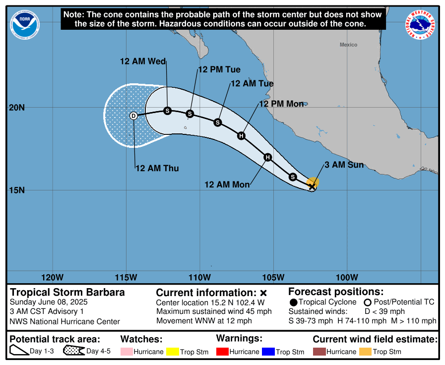
Barbara expected to become a minimal hurricane later this evening.
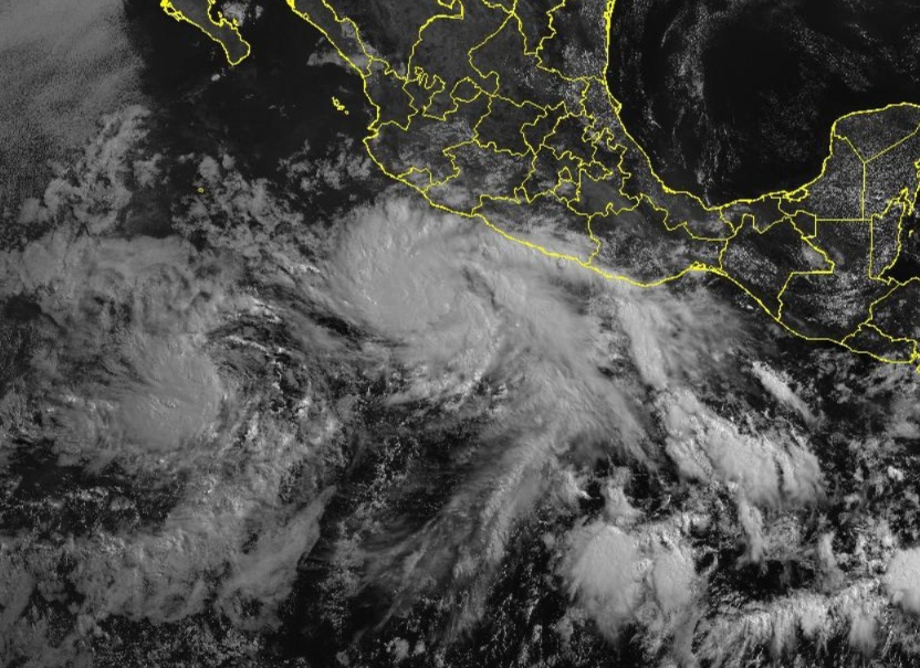
ECMWF 00z Ensembles | Eastern Pacific
30-Hours active storm tracks
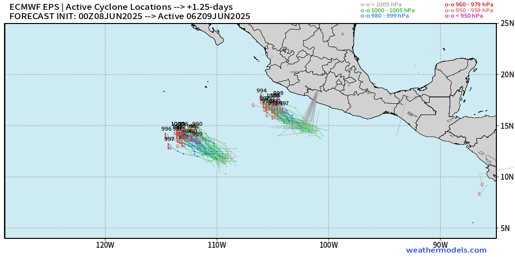
Barbara (right) and Invest 91E (Cosme to the left)
7-Days Active Storm tracks
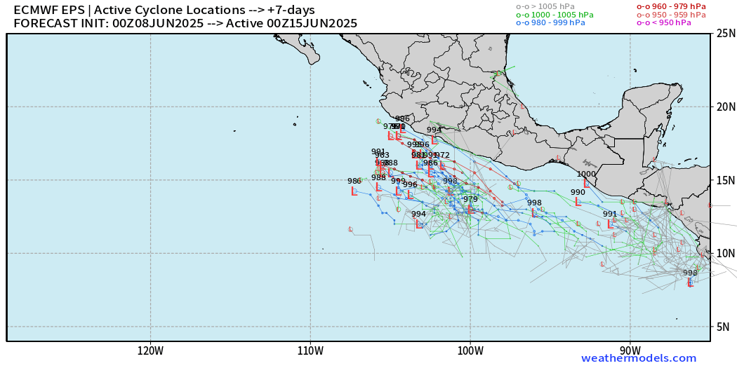
Another storm by next weekend possible.
Western Pacific Tropical Update
JTWC watching Invest 92W over the Philippines but Low Chance of development in the next 24-hours
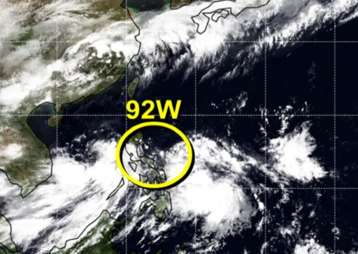
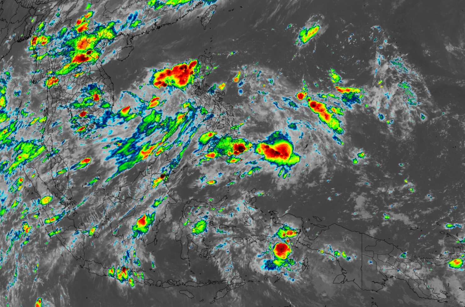
Disorganized convection in the monsoon trough across the South China Sea and Philippines.
Integrated Vapor Transport Next 5-days
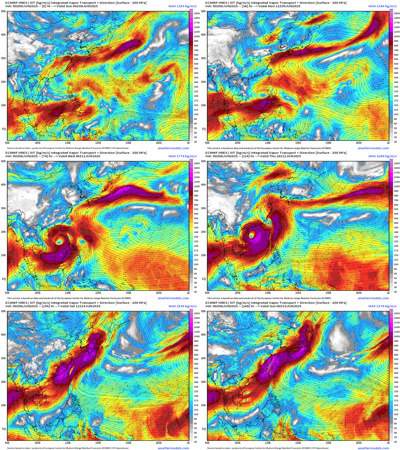
A large circulation consolidates somewhat into a low pressure center or oblong gyre with a lot of moisture into southern China.
Day 5 Active Cyclone Tracks
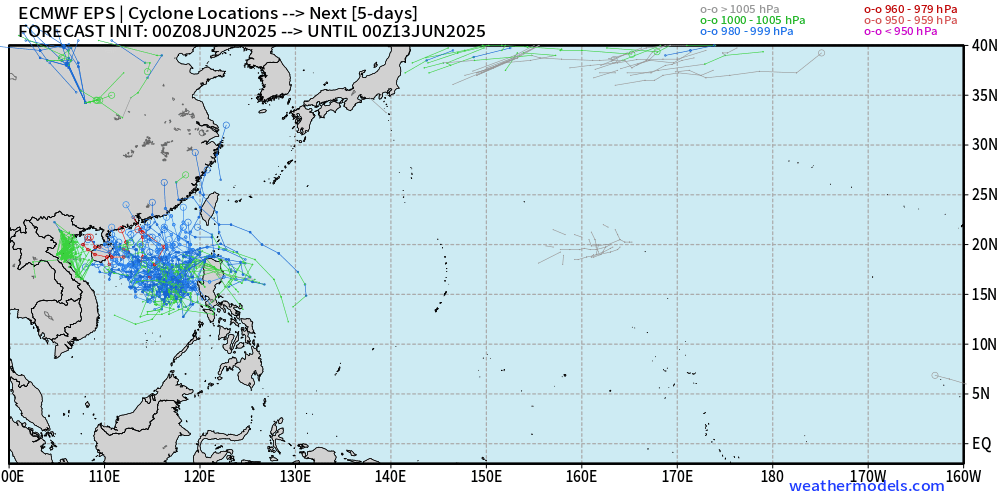
The ensembles are all in the 980-990 mb pressure category = minimal typhoon if it can consolidate further.
Day 15 All Tracks
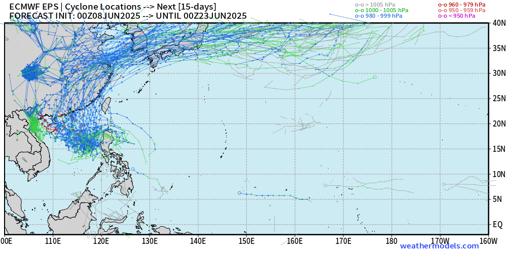
Amazingly, nothing else in the Western Pacific aside from the current Invest 92W.
SST and Anomaly
Water temperatures are cooler than normal west of the Philippines due to the continued mixing from the elongated monsoon circulation. The 26°C isotherm is well south of Japan.
Ryan’s Notes:
June 2025: We use the ECMWF for medium-range prediction because the GFS can’t be trusted due to false-alarm bias, and unrealistic intensification of tropical convection into spurious (ghost) storms. I don’t agree this is a good thing like CNN.
Maps sourced from weathermodels.com designed and innovated by yours truly! Please subscribe there for real-time access to the newest maps, charts from all of the weather models including ECMWF.
- Milepost
- 633 · laid 2025-06-08T15:10:22.823000Z
- Source
- https://weather.substack.com/p/june-8-2025-tropical-update-sunday
- Digest
- edcc3e5474183895c4a1c9dfb78256196d18aa5af1c1f08bdc3ba22af8a5646e
- Machine
- JSON