June 1, 2025 Sunday Evening Edition
Meteorological Summer Begins
June 2025 was the 7th-warmest June in the 132-year national record (1895–2026), at 71.2°F against a 1991–2020 normal of 69.5°F (+1.7°F).
June 2025 was the 26th-wettest June in the 132-year national record (1895–2026), at 3.3in against a 1991–2020 normal of 3.1in (+0.2in).
NOAA/NCEI Climate at a Glance, contiguous United States. This is the observed record for the month, not a score of anything said in this piece — the forecast ledger begins 2026-08-17 and cannot reach earlier posts.

Sunday Evening Weather Headlines
Tropical Update issued earlier this morning for June 1st, the first official day of Atlantic Hurricane Season. No development expected in the next 10-days in the Atlantic. Coin flip chance of seeing Barbara by next weekend off the southern coast of Mexico.
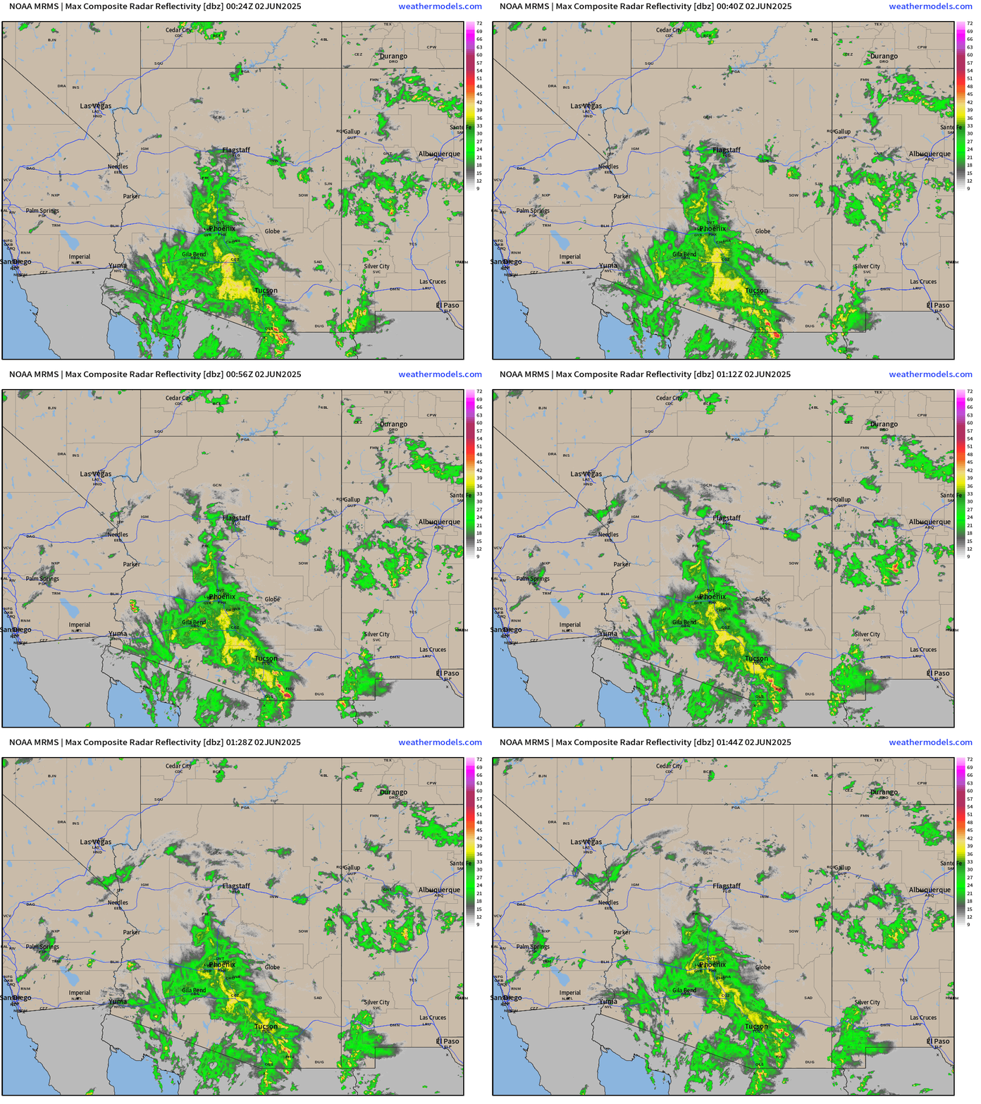
Remnants of Tropical Storm Alvin dumping moderate rainfall on Phoenix this evening, rare for June 1st, but very welcome.
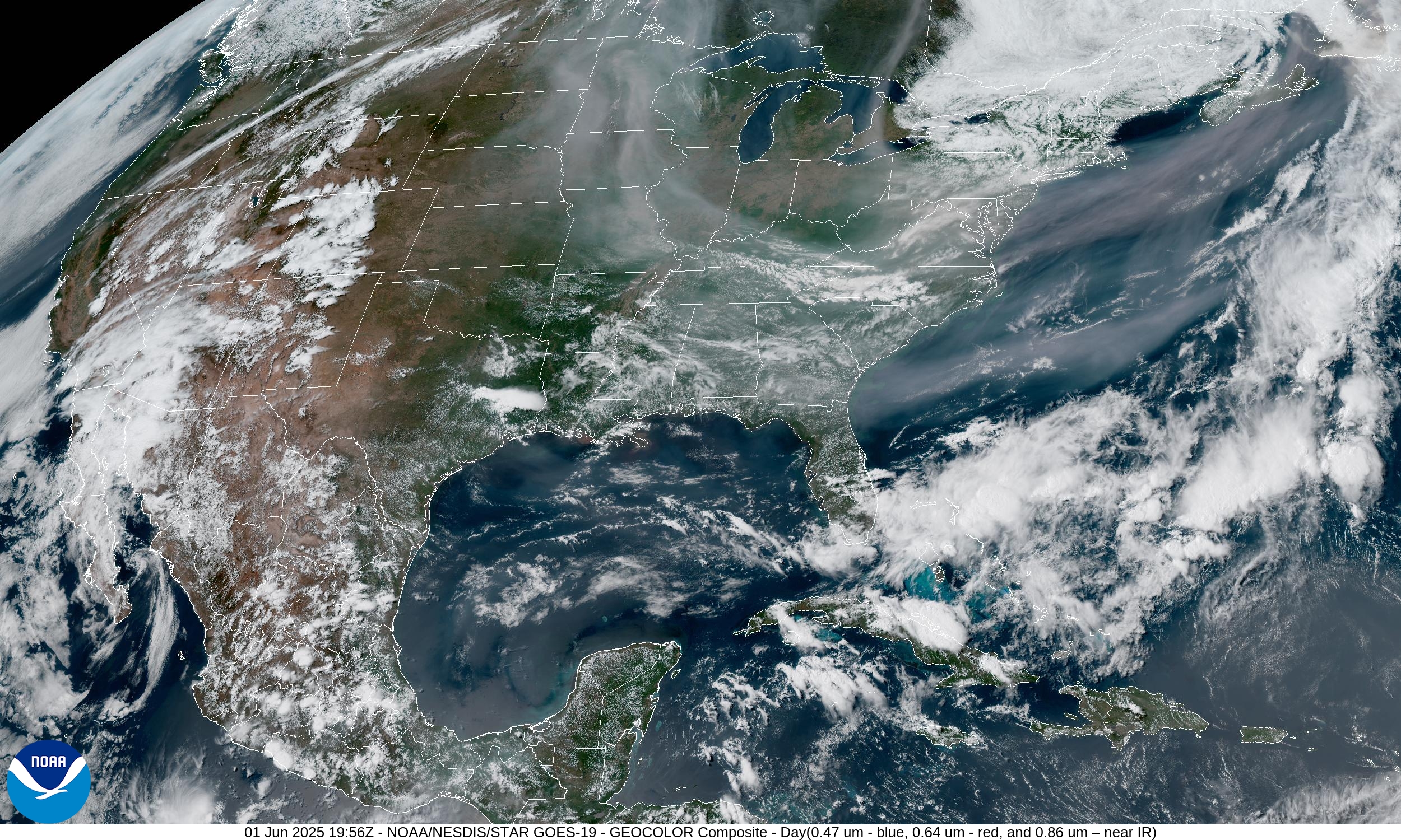
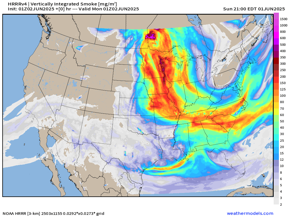
Thick Canadian wildfire smoke will continue to sag well southward evening to the Gulf coast until winds can flip southerly and push the plumes back across the border
Satellite earlier today shows the thick smoke out of the Midwest down the Mississippi River into north Florida. Bleh!
HRRR model has an active smoke concentration w/ongoing fires even outside of the model domain boundaries.
Skies across the Southeast did clear up later in the evening with more blue as the smoke dissipated slightly with the humidity from actual clouds.
Sunday Evening Weather
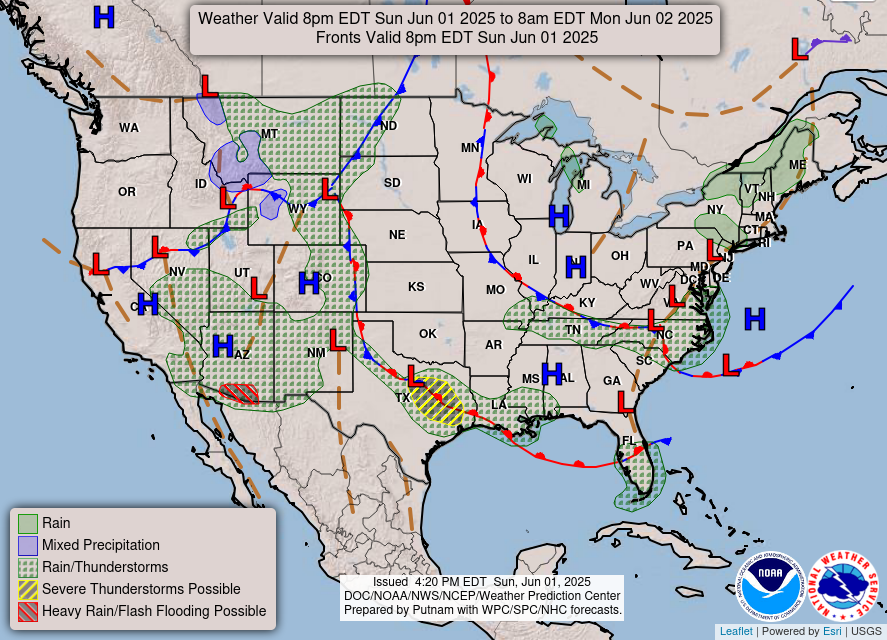
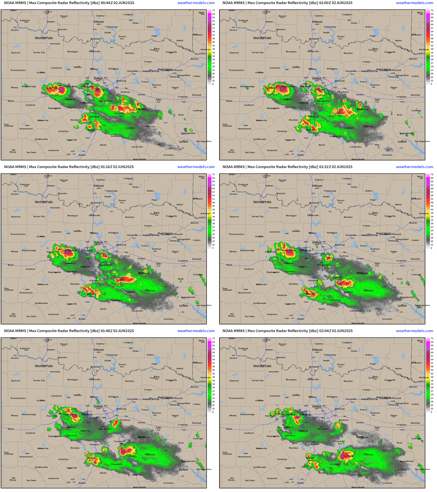
Neat to see the “heavy rain” across southern Arizona. Thunderstorms were also heading into Dallas / Fort Worth this evening, but have now mostly fizzled.
Current Satellite Imagery
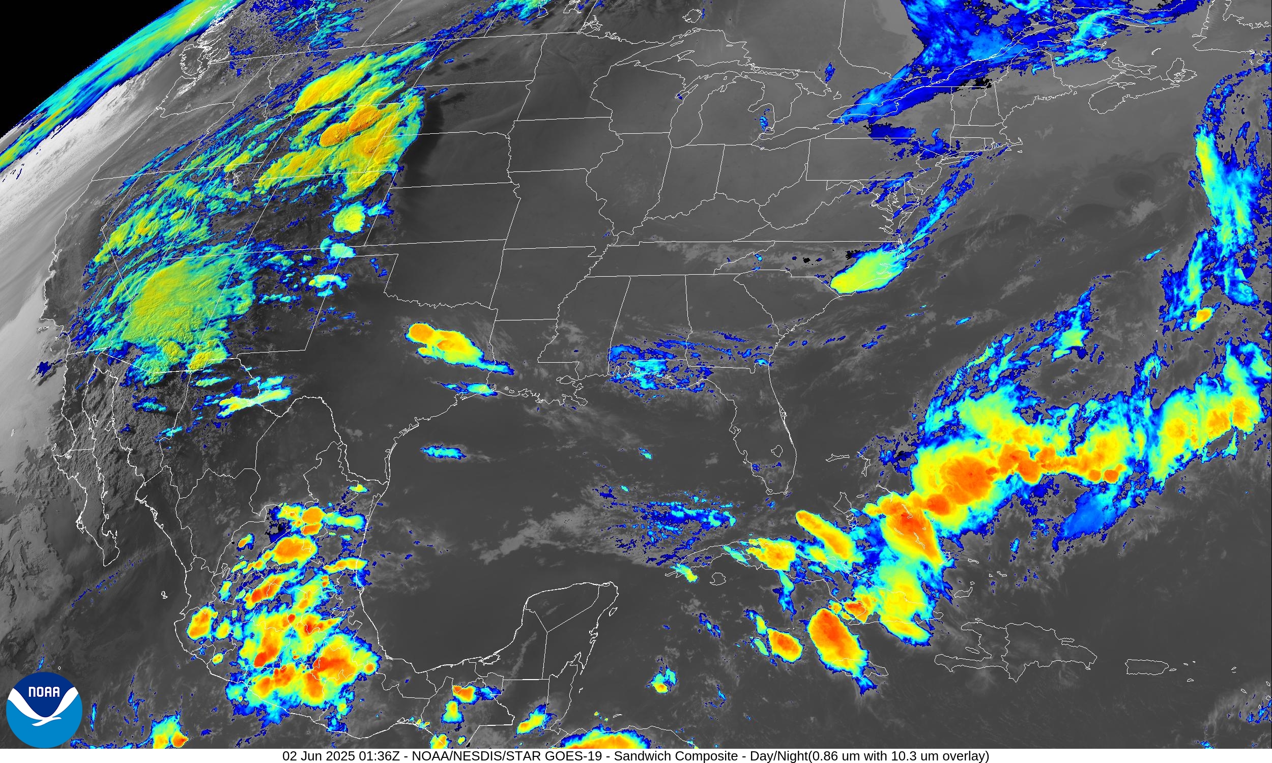
High pressure + smoke in charge of the Plains, Midwest, Great Lakes, and Southeast — finally drying out after 2 weeks of rain. The cold front attached to a Nor’easter cleared south Florida.
Convection and storms/showers with Alvin moving into the Arizona and maybe into Vegas.
Radar Loops: 9:45 PM ET
Arizona
North Texas
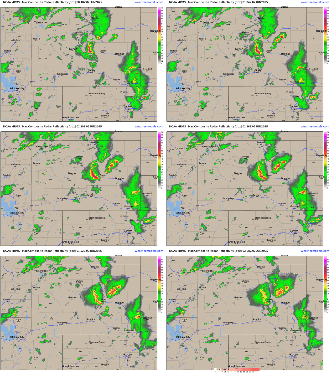
Wyoming
Simulated Radar | HRRR 00z | Next 48-Hours
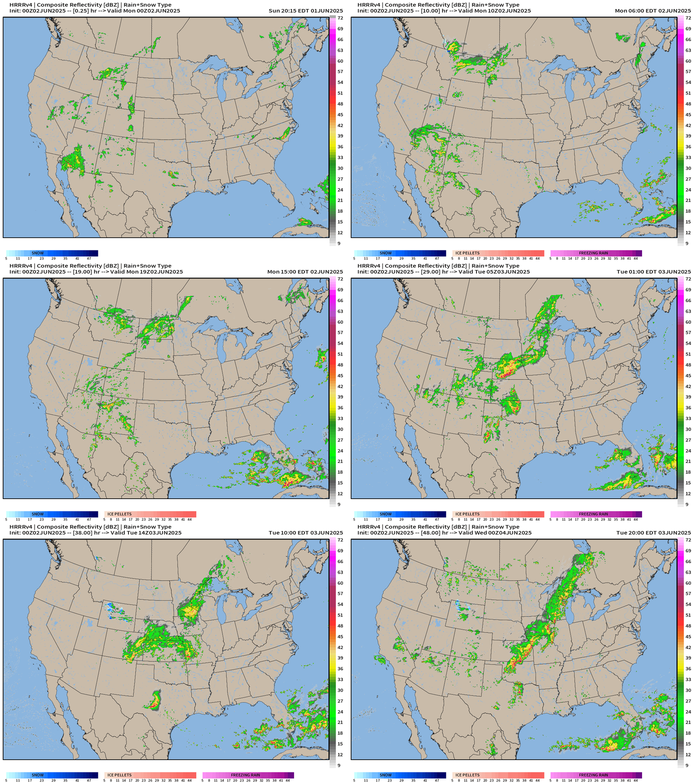
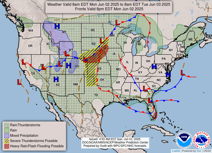
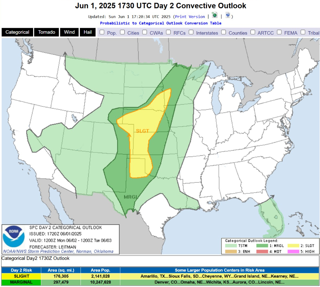
Monday: chance of severe storms firing with the daytime heating across the Plains and then moving east into Iowa and the Midwest along a N-S oriented frontal boundary. Only a SLIGHT risk of severe weather.
Florida all of a sudden is the focus of heavy rain.
NWS Precipitation next 72-Hours
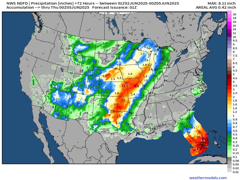
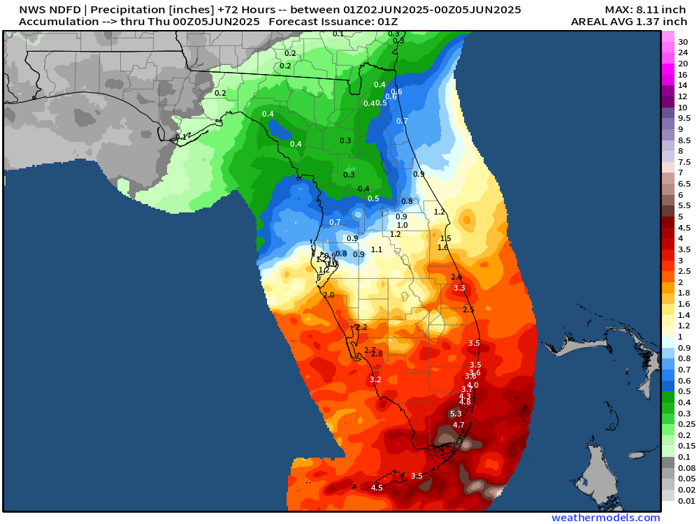
1-2” of rain along Ohio River including Cincy into Washington D.C. and up into New England.
High Temperatures Next 8-Days Mon June 2 - Tues June 10
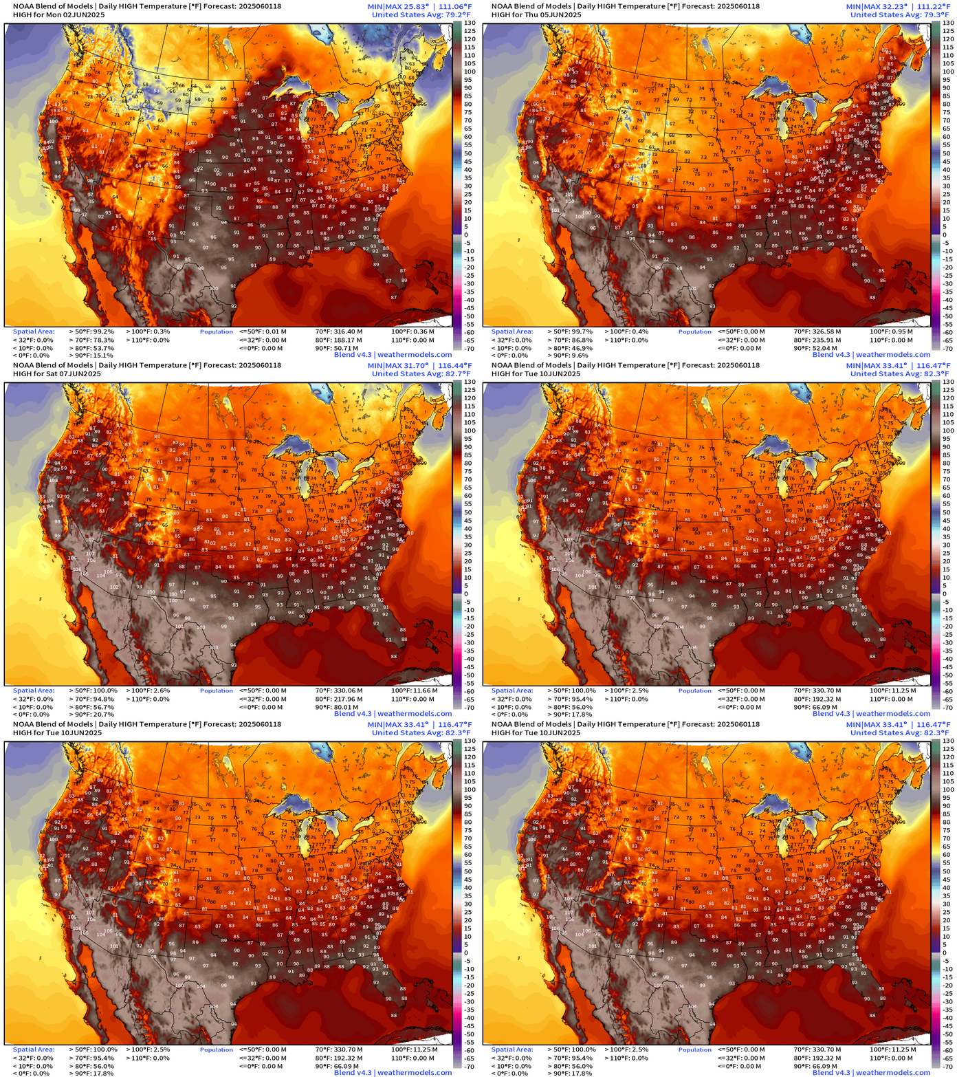
The Canadian cold fronts are winning the battle against any heat domes or high pressure ridges across much of the Lower 48 — keeping the extreme heat bottled up in the Southwest, California, Texas, and along the Gulf Coast. Otherwise, comfortable 70s and 80s for vast majority of real estate and population.
Weather on Monday | Fronts at 8 PM
Temperature Analysis | 9:30 PM ET
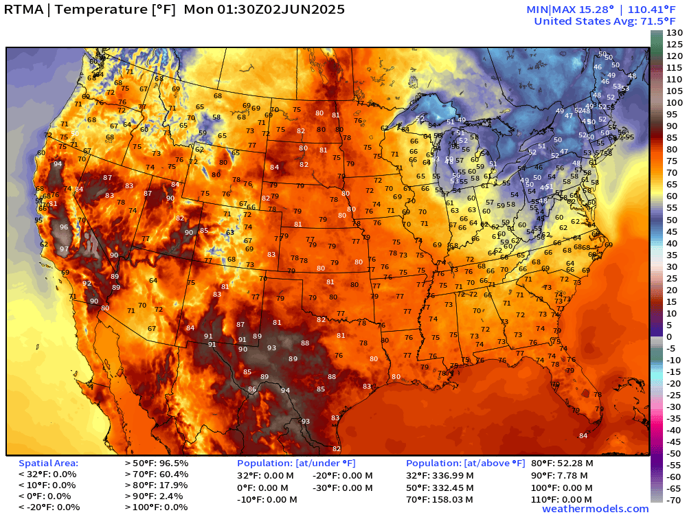
Only in the 40s and 50s across the Northeast this evening.
Temperature Anomaly | 9:30 PM ET
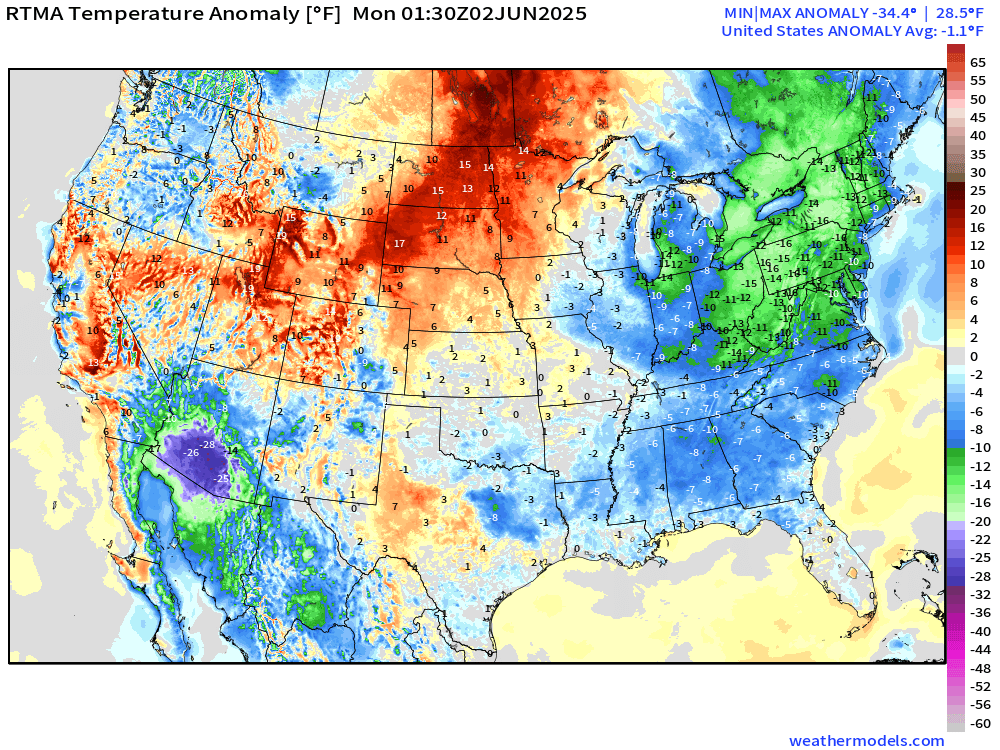
Overall the Lower 48 is -1.1°F below normal [1991-2020] clouds and rain keeps temperatures down across Arizona (almost 30°F below normal). Large area of green (-10°F to -15°F) below normal across Ohio River Valley into New England.
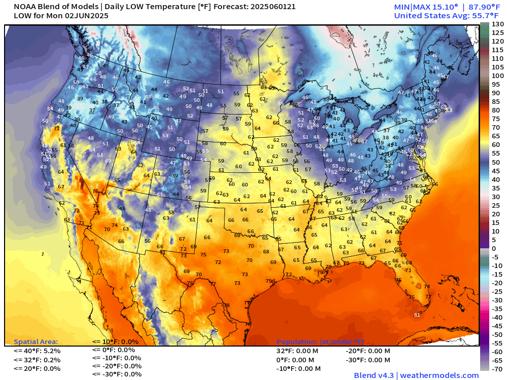
Monday Morning Lows
Monday High Temperatures
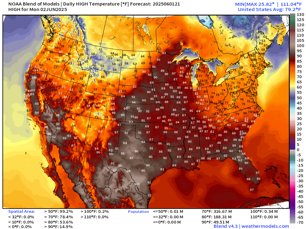
79.2°F is the Lower 48 average high temperature with 188 million at least 80°F, and 49.5 million above 90°F.
Tuesday High Temperatures
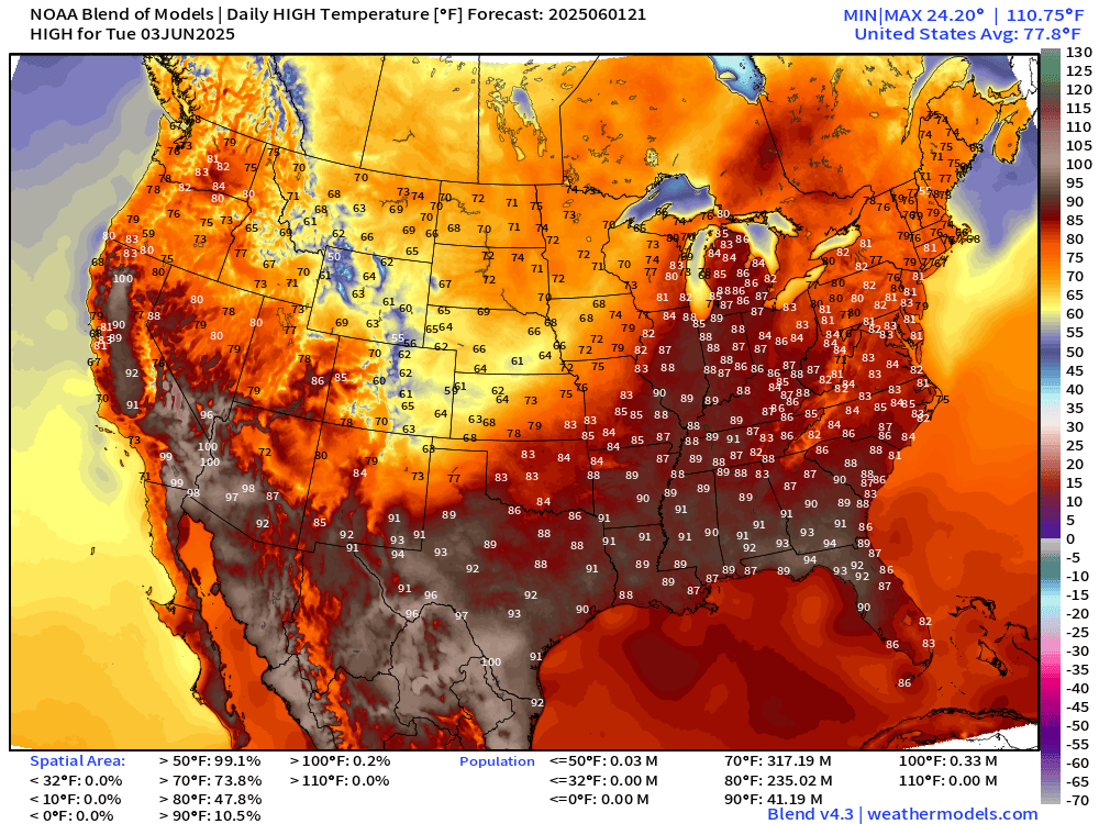
Yet another cold front through the central Plains and Midwest pushing 60s and 70s for high temperatures in Denver and Kansas. Amazing for early June.
NWS WPC Precipitation | Next 7-days
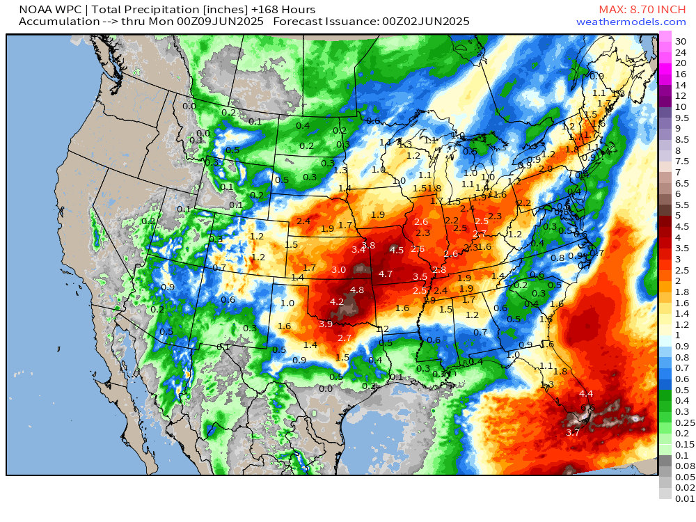
Huge rainfall yet again for TX/OK/KS/Missouri including St. Louis, OKC.
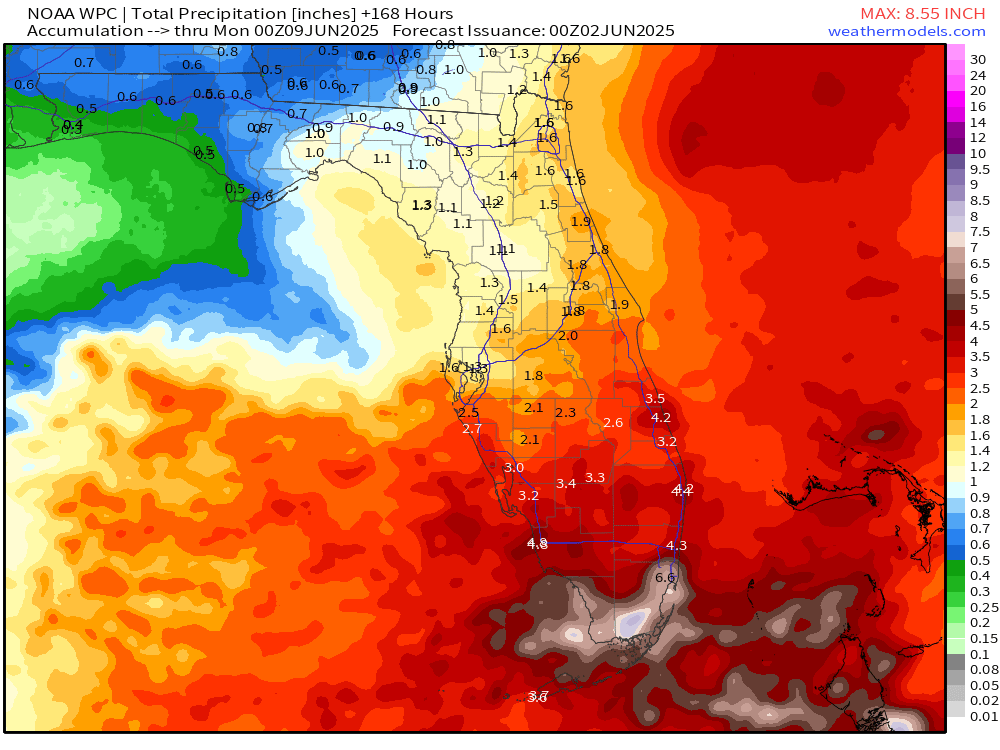
But check out Florida … could see 6-8” in south Florida including Miami. Very welcome news.
Precipitation and MSLP Next 6-Days | ECMWF 18z
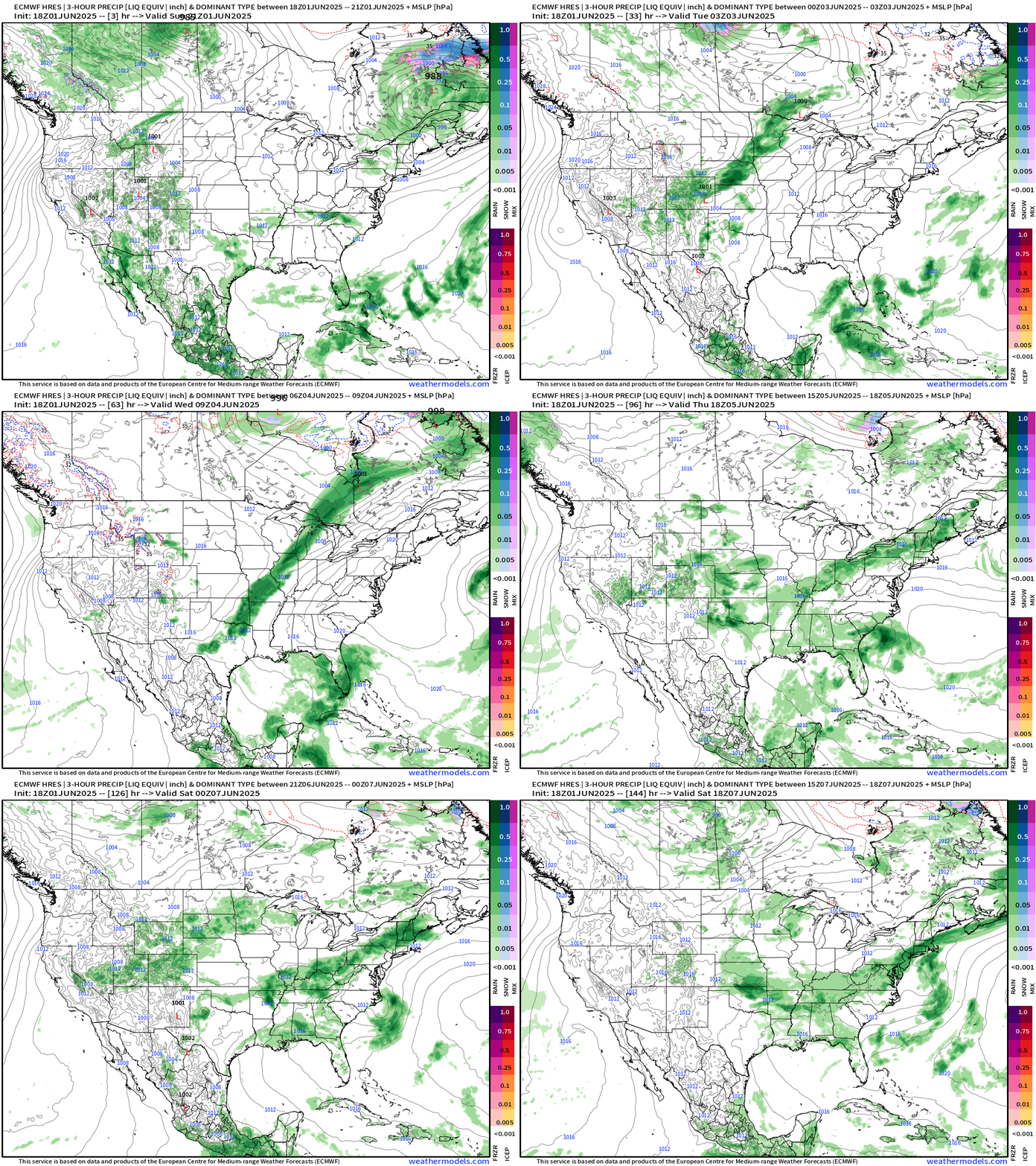
Interesting tropical moisture flow from the east across Florida … with a tiny area of low pressure trapped along the SE coast — could spin up into a weak tropical depression, but most likely will stay attached to stalled frontal boundary.
We really don’t need another week of stalled frontal boundaries — but that’s apparently what we’re going to get to deliver the boatloads of rain.
ICON Model 5-day Precipitable Water
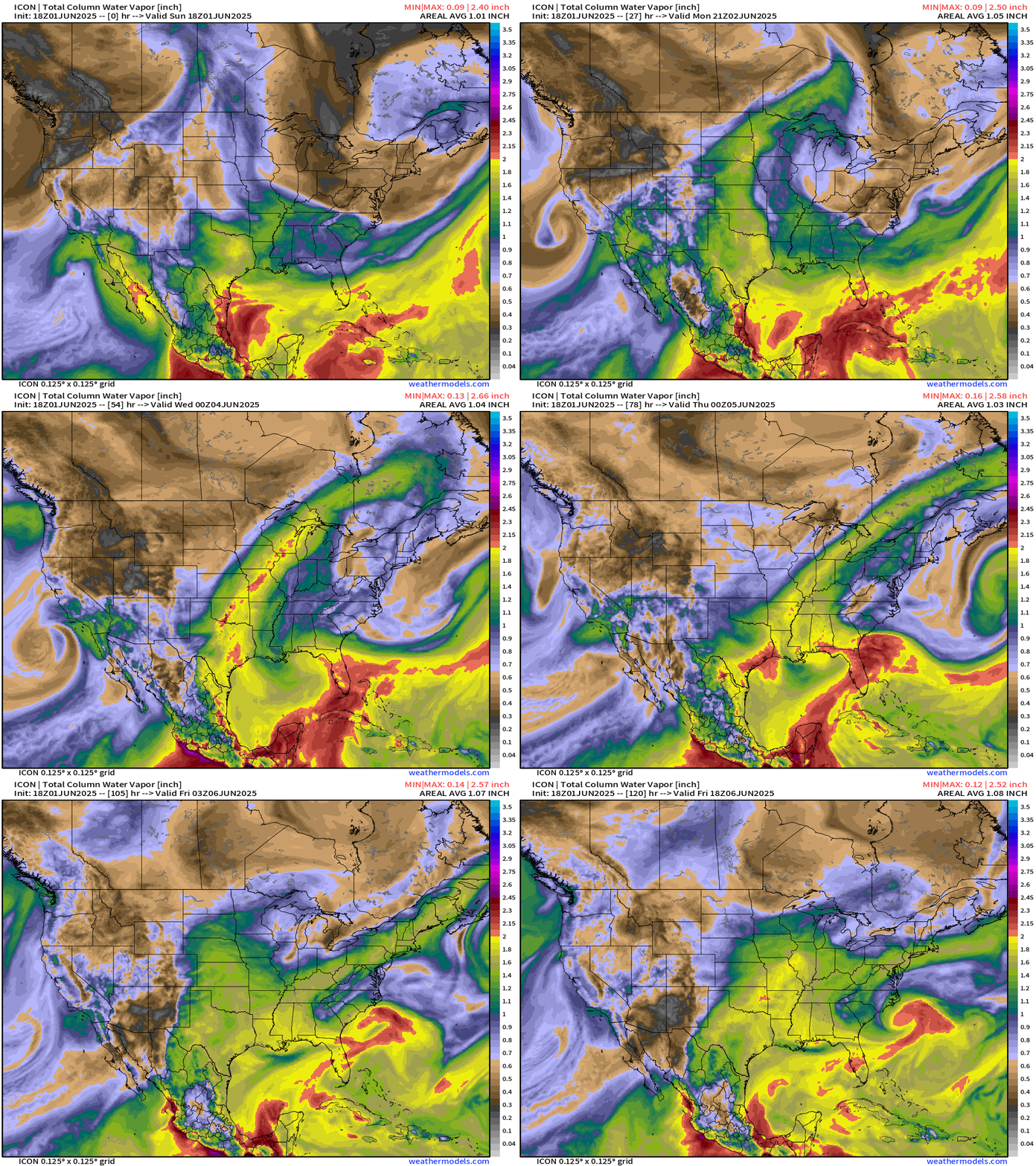
My favorite parameter!
ICON also has the little spinner off the Southeast coast … we’ll see if this is a surprise close-in development of a tropical depression.
Upper-level low spins down the California coast helping to send moisture into the U.S. Southwest.
Return flow of moisture from the Gulf from the south will increase humidity, increase shower and storm coverage, and hopefully keep the Canadian smoke at bay this week.
Upper Level Weather Pattern | Height Anomaly next 10-days
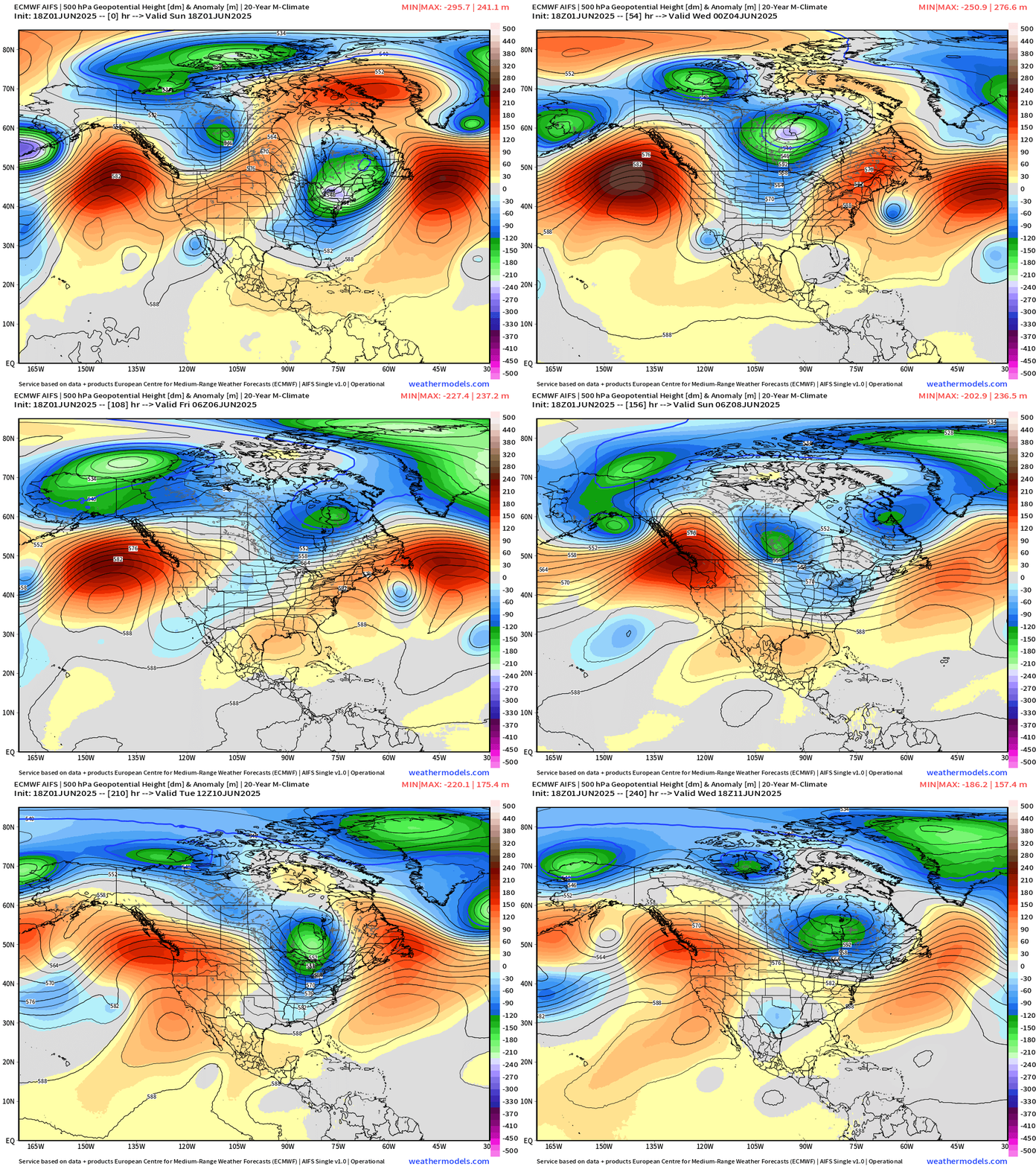
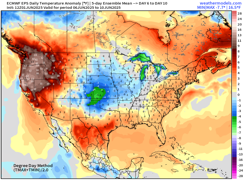
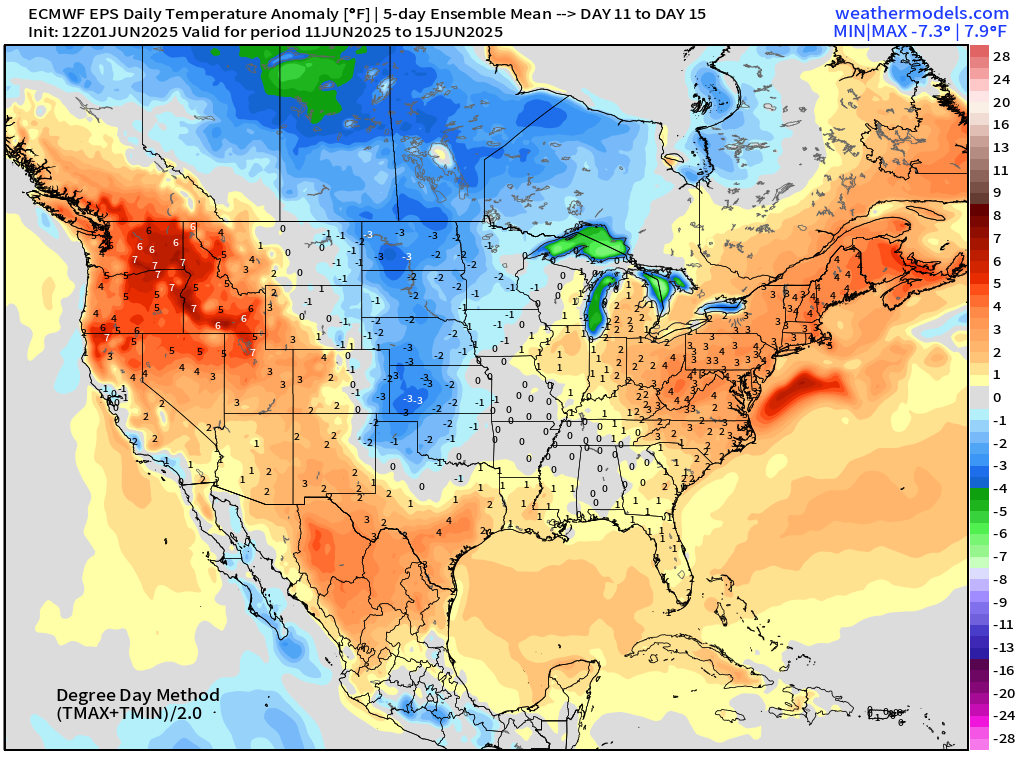
Strong ridging returns to the Gulf Coast and then retrogrades to the Southwest = cranking up temperatures into the 90s and 100s.
However, yet another sequence of Canadian troughs will smash cold fronts — and probably more smoke — into the Lower 48 including the Midwest and Great Lakes.
Enjoy the warmth tomorrow and Tuesday before temperatures cool down again.
ECMWF EPS 12z | 5-Day Chunks Temperature Anomaly
Days 1-5: June 1 - June 5
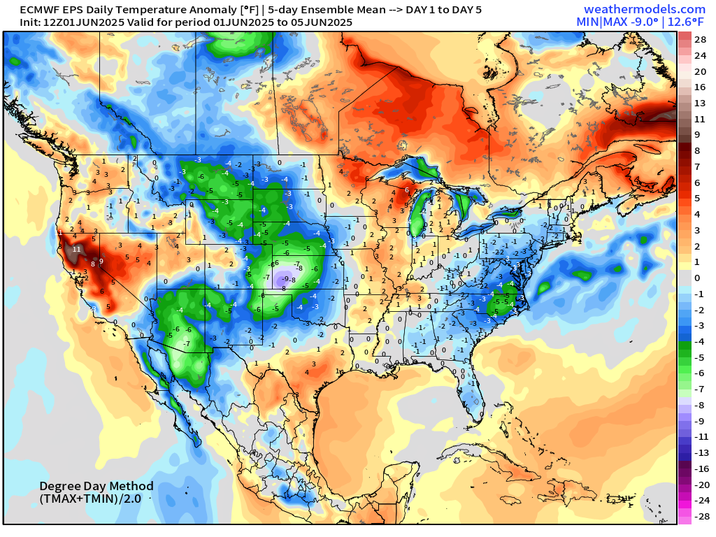
Days 6-10: June 6 - June 10
Days 11-15: June 11 - June 15
Maps sourced from weathermodels.com designed and innovated by yours truly! Please subscribe there for real-time access to the newest maps, charts from all of the weather models including ECMWF.
- Milepost
- 625 · laid 2025-06-02T02:27:58.179000Z
- Source
- https://weather.substack.com/p/june-1-2025-sunday-evening-edition
- Digest
- 0e6ab193564fab3cd46ca5befae031987c9c393be4831542ebe9cfef1c9deb5a
- Machine
- JSON