May 27, 2025 Tuesday Tropical Update
Tropical Storm Alvin likely to form in Eastern Pacific
May 2025 was the 27th-warmest May in the 132-year national record (1895–2026), at 61.7°F against a 1991–2020 normal of 61.0°F (+0.7°F).
May 2025 was the 12th-wettest May in the 132-year national record (1895–2026), at 3.7in against a 1991–2020 normal of 3.1in (+0.6in).
NOAA/NCEI Climate at a Glance, contiguous United States. This is the observed record for the month, not a score of anything said in this piece — the forecast ledger begins 2026-08-17 and cannot reach earlier posts.

Tuesday’s Tropical Weather Headlines
Atlantic tropical update: not expecting any development through at least 7-days, but chance for something in the Caribbean or Gulf of Mexico after Day 10 as the Atlantic hurricane season gets underway in June. No chances of a “pre-season” system.
A Caribbean / Central American gyre circulation in early June is conducive to spinning up tropical storms in the Eastern Pacific & Caribbean/Gulf.
Eastern Pacific tropical update: Global models agreement — Eastern Pacific to see first storm [Alvin] before in the next 48-72 hours. NHC is up to 90% chance in 48-Hours in the Outlook. Alvin should become a Hurricane over 30°C SST.
Integrated Vapor Transport | Next 10-days
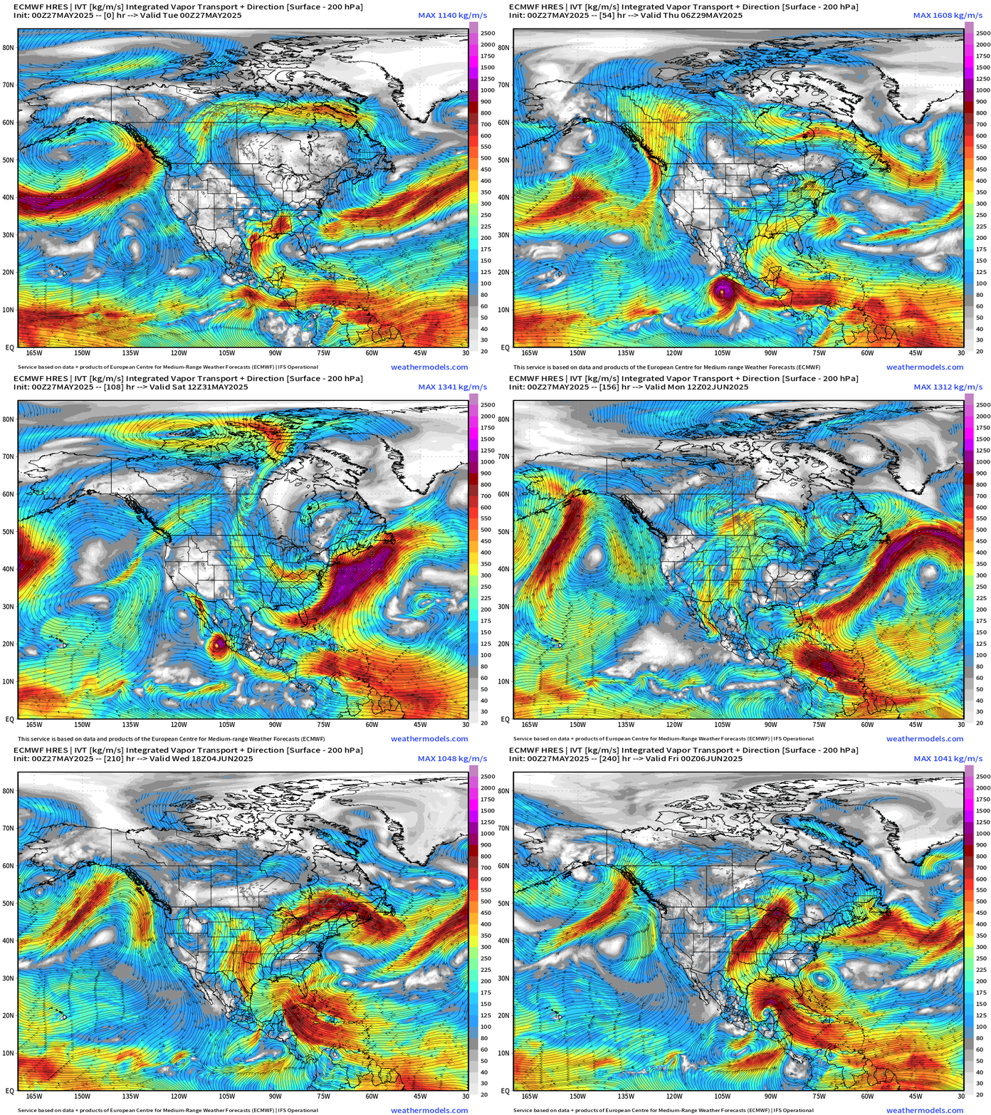
A surge of moisture from the Lesser Antilles into the Caribbean reaches the Gulf of Mexico by Day 10. This pattern is conducive for tropical storm development into the second week of June.
Alvin parallels the coast of Mexico and decays prior to making landfall, most likely. The moisture is pulled into the U.S. Southwest to enhance rainfall chances over Southern California and Arizona, including Phoenix into early next week.
Atlantic Basin
Eastern Atlantic Satellite Image
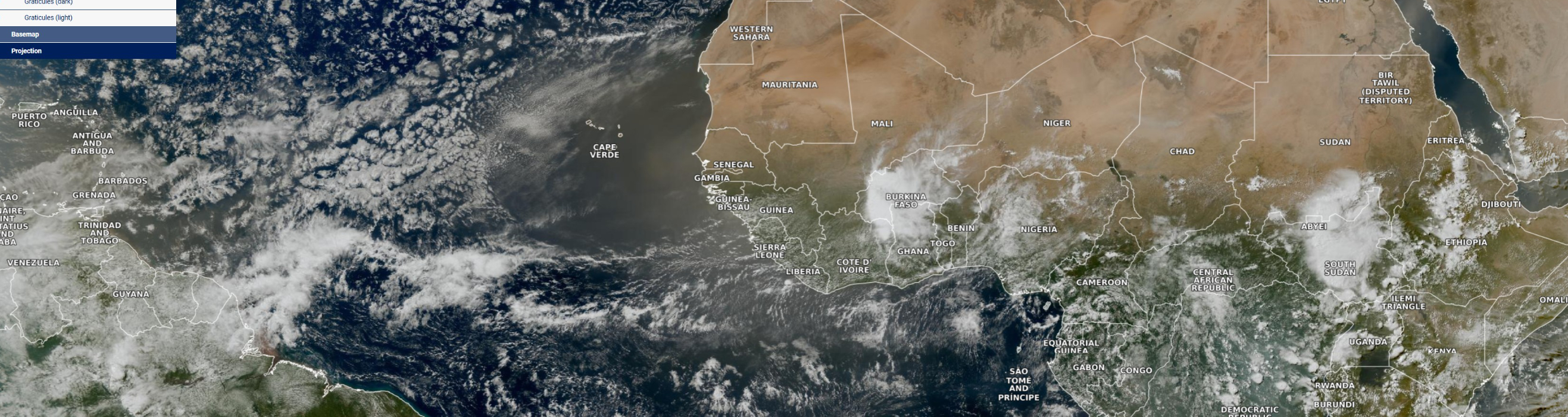
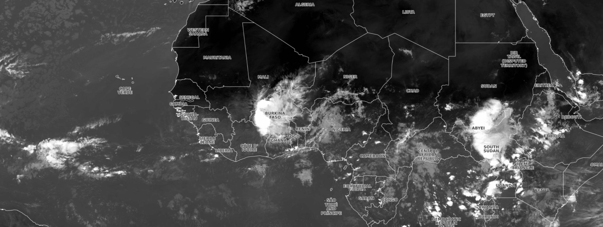
Large cloud-free dust haze has moved further in the Eastern Atlantic with a strong Saharan Air Layer (SAL). Tropical waves over Burkina Faso and Sudan are vigorous, and several days from emerging over the Atlantic. The Easterly Wave season is underway but we don’t expect development in the Main Development Region (MDR) of the tropical Atlantic until July.
NASA GEOS-5 Dust | 7-days Forecast
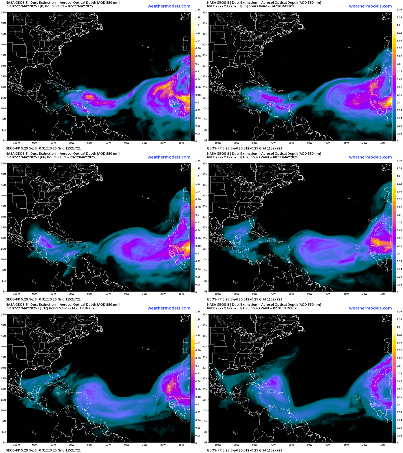
SAL into Lesser Antilles will make the Gulf in 3-4 days. Then, the next major plume will be right on its heels. The dust inhibits solar radiation from reaching the ocean surface — net cooling!
Atlantic Ocean Surface Temperatures (SST) and Anomaly
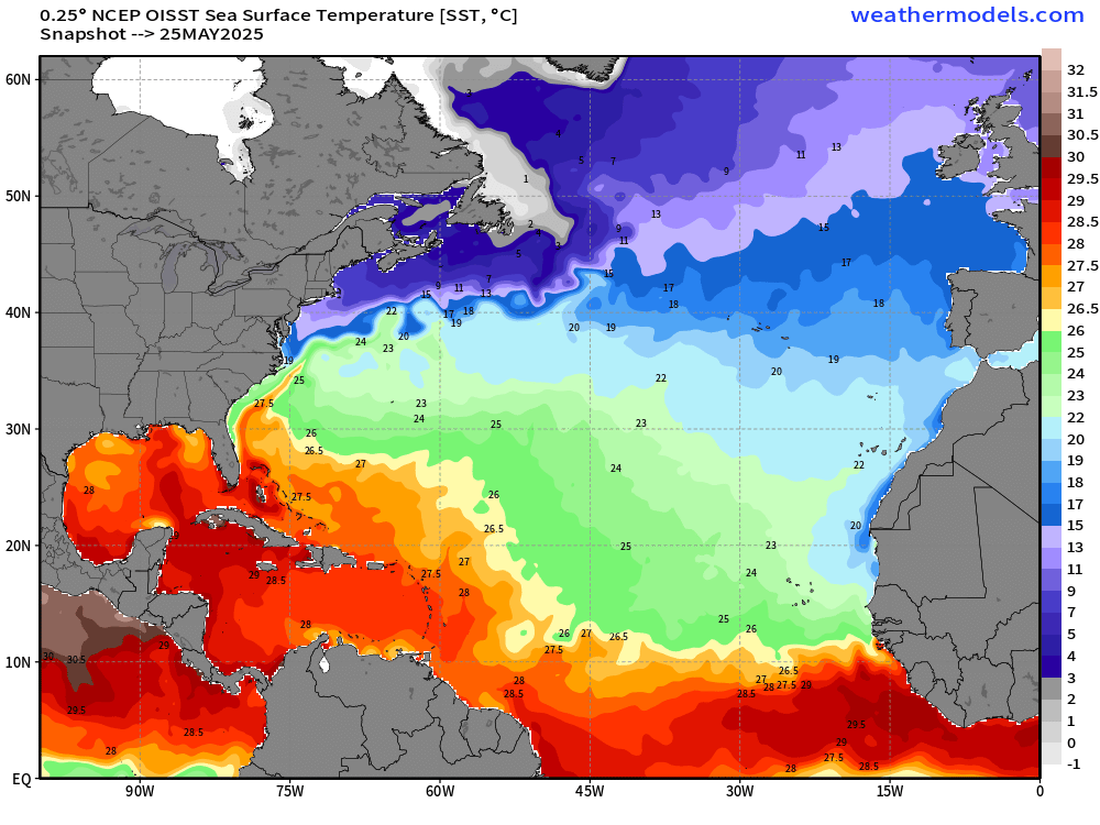
Actual sea-surface temperatures < 26°C won’t support tropical storm genesis through normal convective pathways shutting off the MDR for a while. The Gulf and Caribbean are open for business with 28°C surface water available.
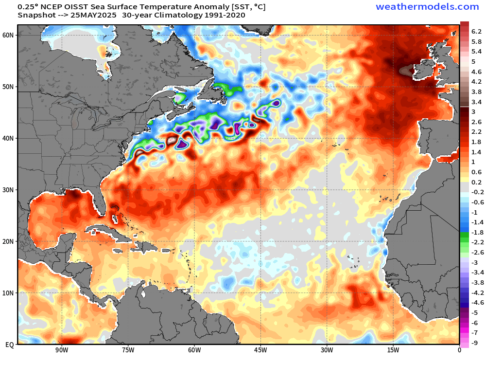
Anomaly (compared to 1991-2020) is 1-2°C above normal across the Gulf and into the Southwest Atlantic off the coast of Florida to Bermuda. However, even if it’s warmer than normal, the actual T is still < 26°C.
Important: actual Sea-Surface Temperatures (SST) help form and intensify tropical storms and hurricanes NOT the anomaly. We need sustained 26°C SST for typical tropical pathway storm development. You can see the green (under 26°C) extends still to 10°N latitude = too chilly for typical MDR development, but that will warm over the next 2-weeks to be viable.
The Caribbean is already (always) warm enough for a major hurricane (28°C). The Gulf is still chilly across the northern half of the basin.
Tropical Atlantic Satellite Imagery
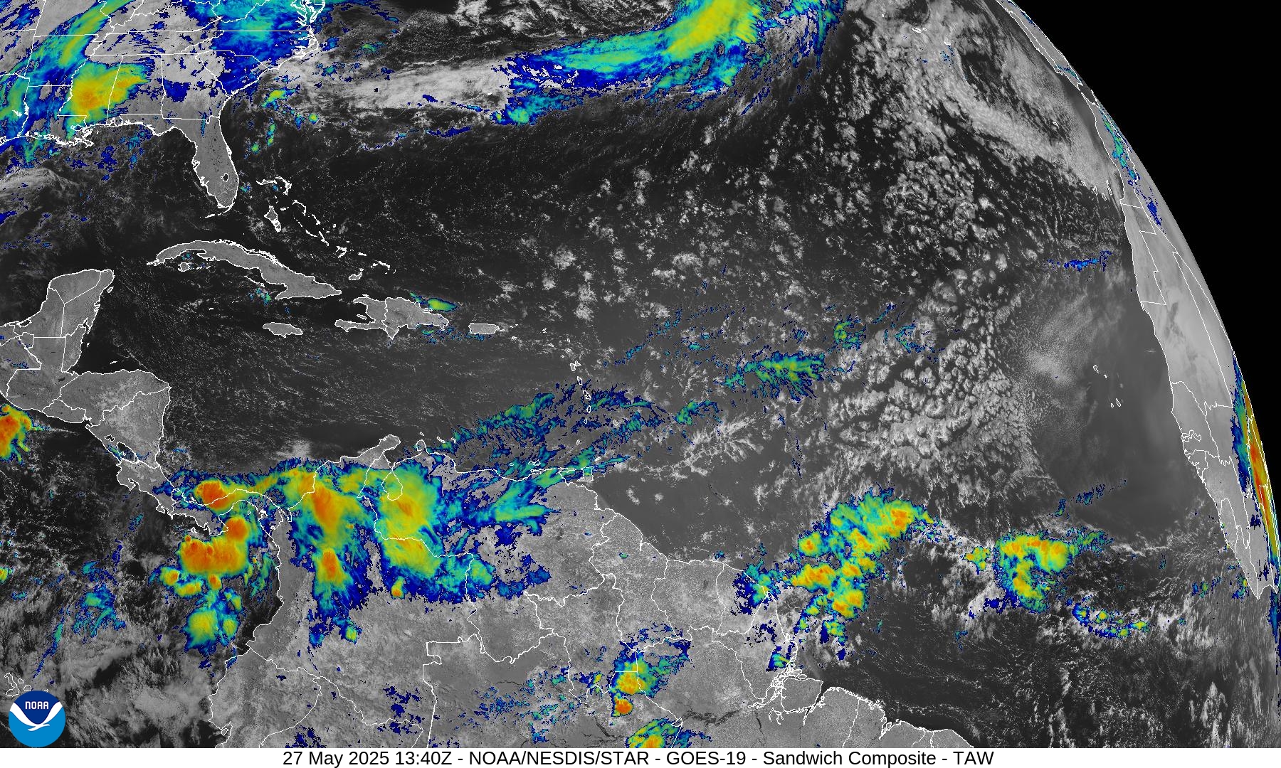
Two tropical waves — one heading through Venezuela = moderate convection, and another approaching the NE coast of South America with some convection.
Tropical Surface Analysis 06Z
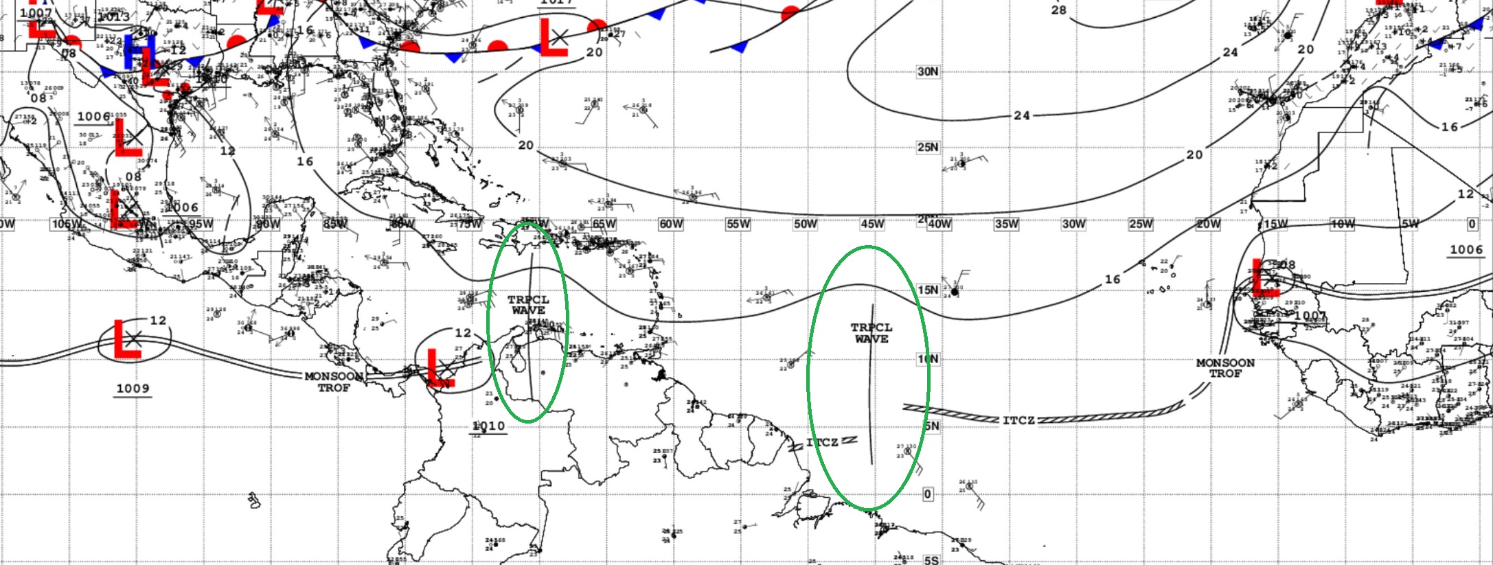
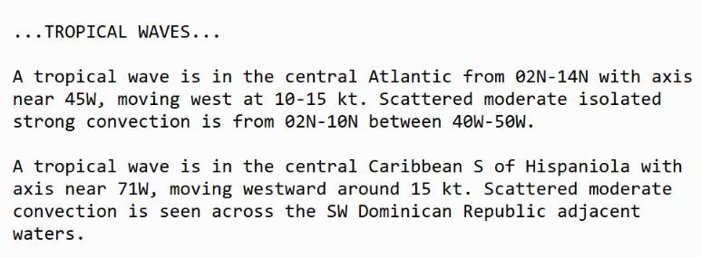
Tropical Waves = 2 but no development in the Atlantic
However, no tropical development expected. But these systems can provide the seedlings for Eastern Pacific hurricanes in 10-14 days from their emergence off African coast.
Long range model outlook
ECMWF 00z | Day 10
Both ECMWF and GFS show a disturbance in the Caribbean or over Yucatan into the Gulf of Mexico by Day 8-10 suggestive of decent chance of a tropical storm. There is some ensemble support. Still quite a ways out over the skillful forecast horizon.
GFS 00z | Day 10
ECMWF Ensembles | 10-Days Active Tropical Storm Tracks
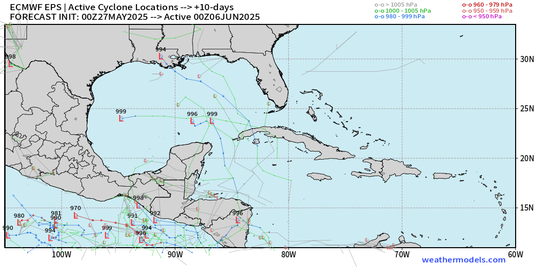
Day 13
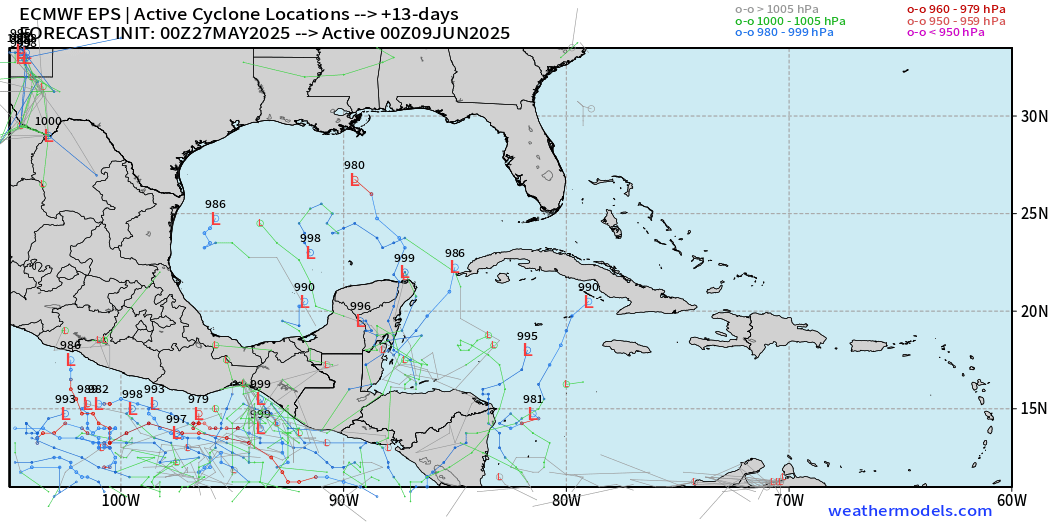
Day 15
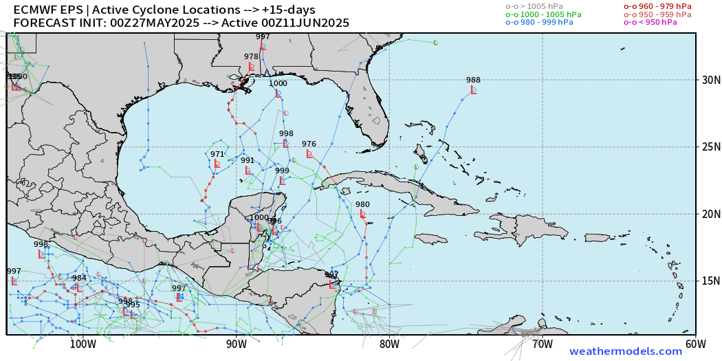
There are 10/51 (20%) or so that show a strong tropical storm or hurricane in the next 15-days into mid-June. Worth watching!
Eastern Pacific Tropical Update
Invest 90E designated by NHC with 90% chance of tropical storm development in the next 48-hours.
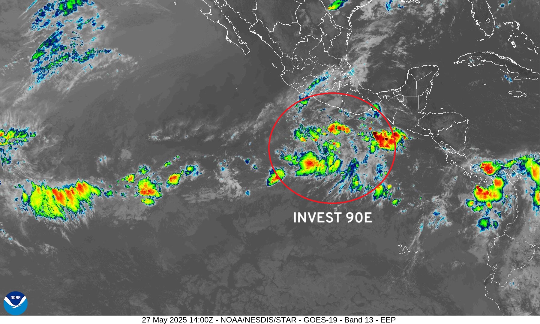
Upper-level wind shear is not ideal with a cut-off low dipping off Southern California to help steer Invest 90E (Alvin) quickly to the north and then northeast over colder water into Mexico.
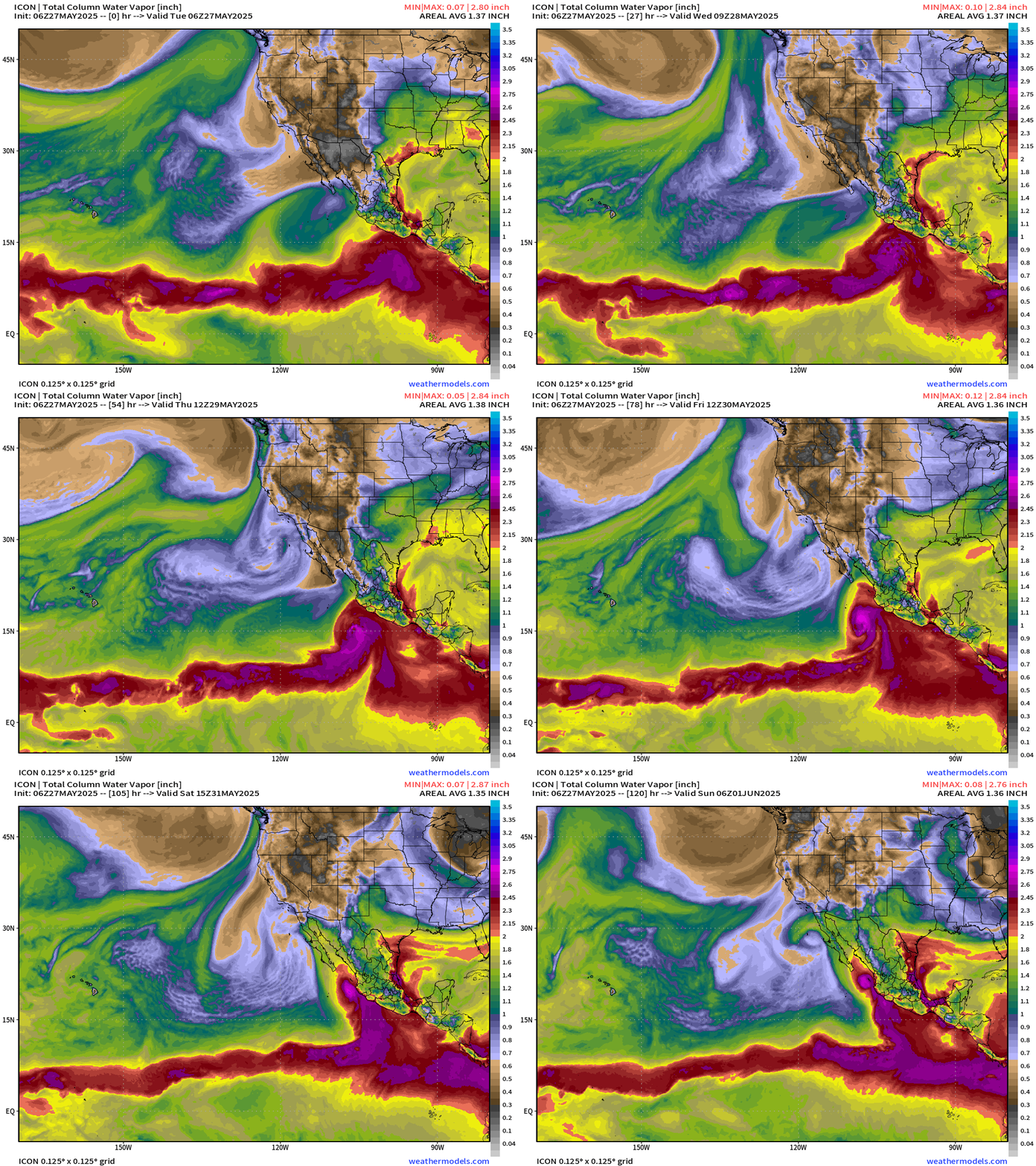
Precipitable Water Animation | ICON 06z
My favorite weather parameter shows Alvin over the next 5-days near the coast of Mexico.
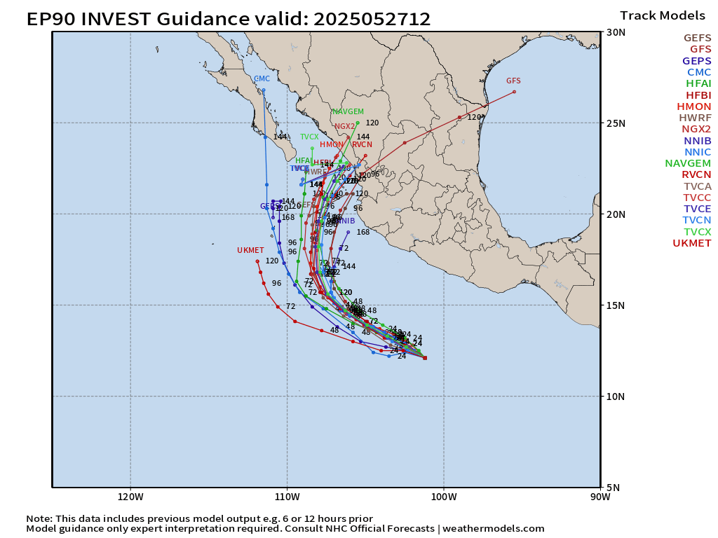
Model Spaghetti Tracks
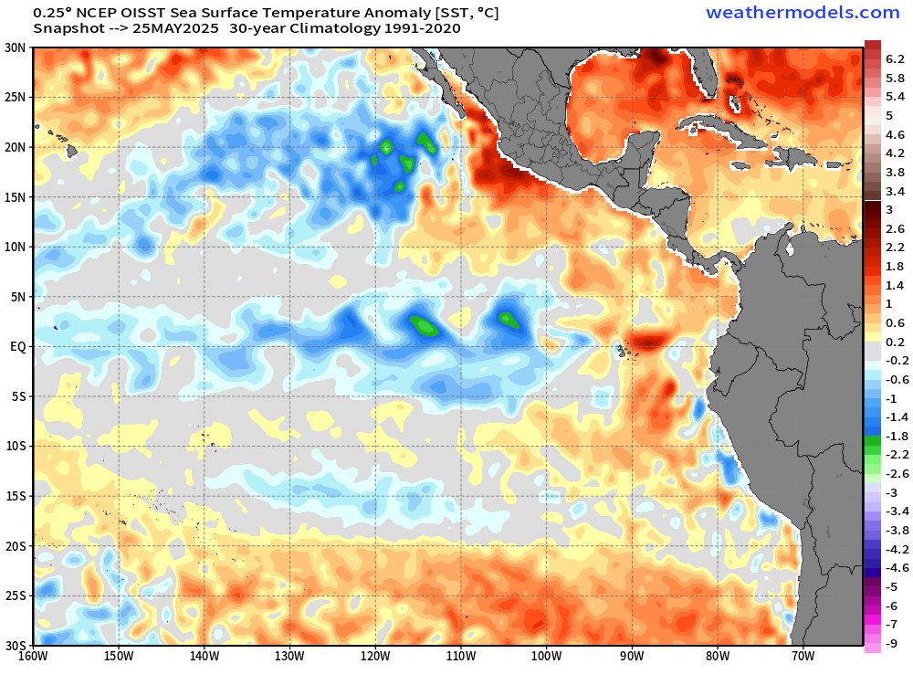
SSTs very warm in Eastern Pacific near coast of Mexico > 30°C
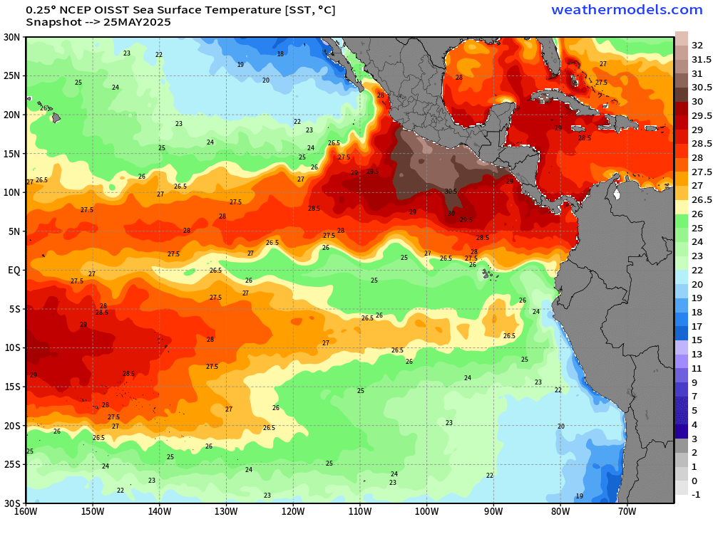
Note the cooler equatorial waters under 26°C = green and below normal.
HWRF Mesoscale Model
Intensity of Alvin?
HWRF is near major hurricane pressure and winds.
HAFS (A and B) are weaker, but still Category 1 hurricane. Makes more sense with upper-level conditions.
ECMWF 00z Ensembles | Eastern Pacific
Day 3.5
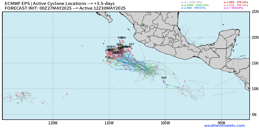
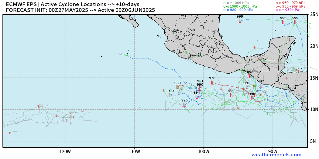
Day 10 — additional development possible on the heels of Alvin in line with climatology of the Eastern Pacific. June is a rather busy month out there!
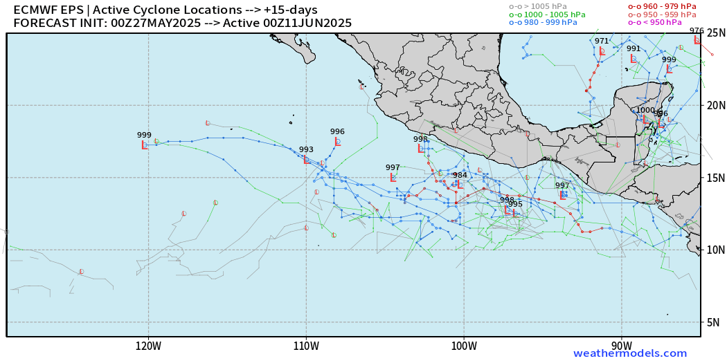
Day 15
Maps sourced from weathermodels.com designed and innovated by yours truly! Please subscribe there for real-time access to the newest maps, charts from all of the weather models including ECMWF.
- Milepost
- 617 · laid 2025-05-27T14:38:44.353000Z
- Source
- https://weather.substack.com/p/may-27-2025-tuesday-tropical-update
- Digest
- a314973dd5fc3d051ebcf8a463a8606fb83b1b6696e11ab40b32ca4fef1157b4
- Machine
- JSON