May 23, 2025 Friday Weather Update
Memorial Day Weekend looks wet and cool
May 2025 was the 27th-warmest May in the 132-year national record (1895–2026), at 61.7°F against a 1991–2020 normal of 61.0°F (+0.7°F).
May 2025 was the 12th-wettest May in the 132-year national record (1895–2026), at 3.7in against a 1991–2020 normal of 3.1in (+0.6in).
NOAA/NCEI Climate at a Glance, contiguous United States. This is the observed record for the month, not a score of anything said in this piece — the forecast ledger begins 2026-08-17 and cannot reach earlier posts.

Friday’s Headlines:
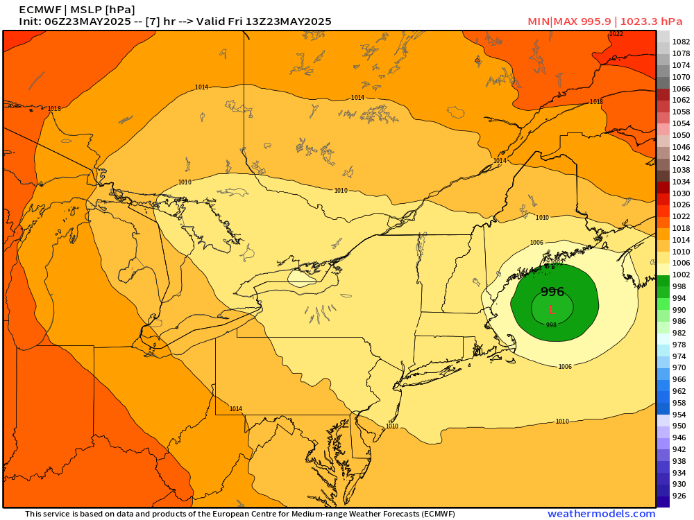
Nor’easter still spinning off New England coast at 996 mb
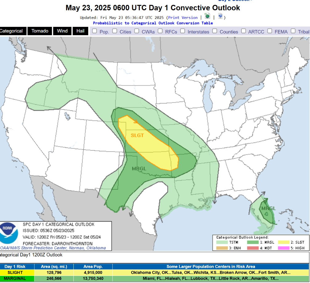
Only a slight chance of severe weather in the central Plains centered on Kansas
Atlantic tropical update: not expecting any development through at least 10 days into early June. Not seeing a “pre-season” tropical storm.
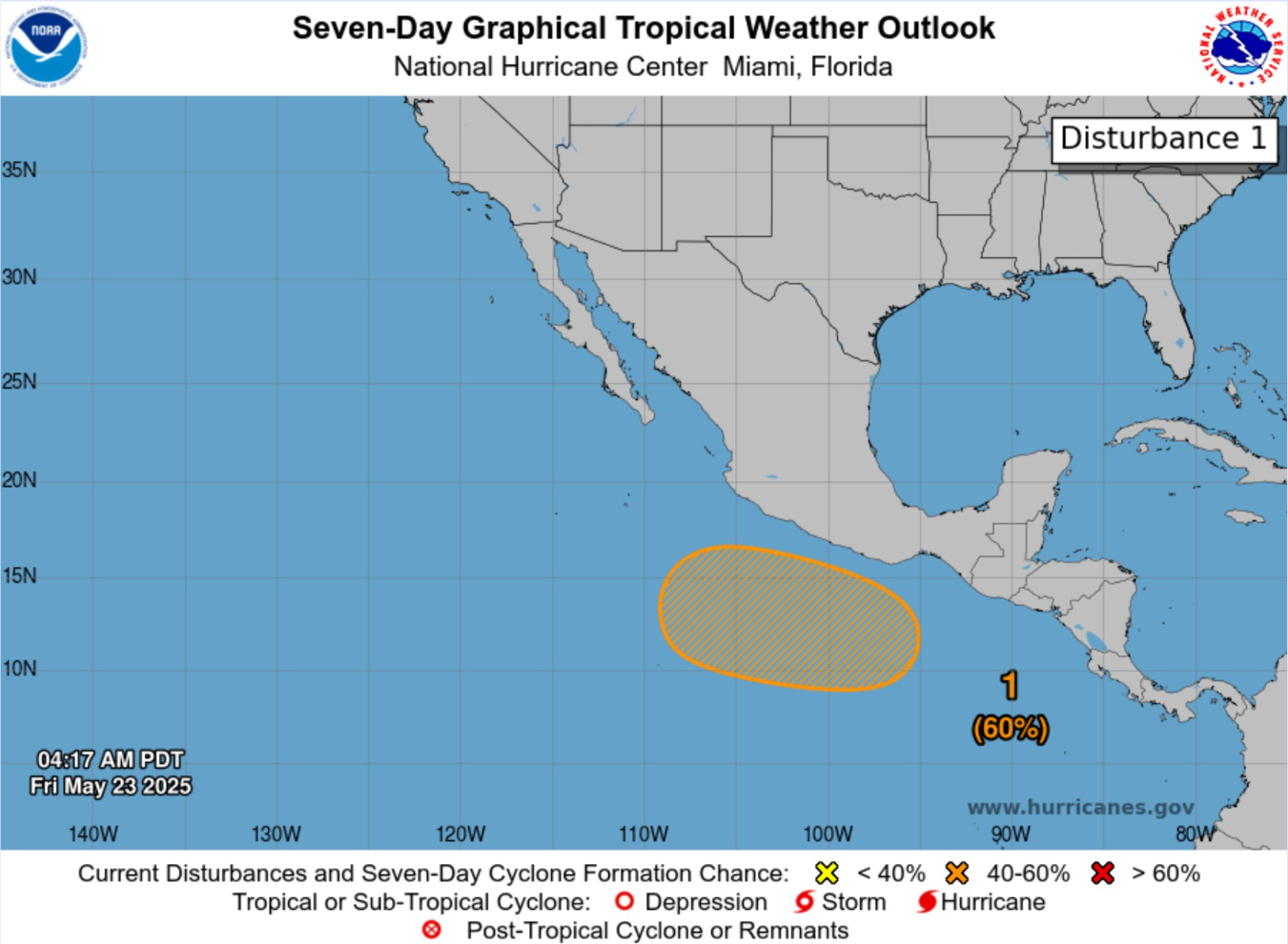
Global models agreement — Eastern Pacific to see first storm [Alvin] before end of the month. NHC is up to 60% chance in 7-days in the Outlook.
Cooler/well below normal temperatures from Midwest, Great Lakes, and Northeast keep a lid on any heat wave discussion until probably June
Separate post coming on NOAA Hurricane Outlook | Seasonal Forecast
Today’s Weather | Friday
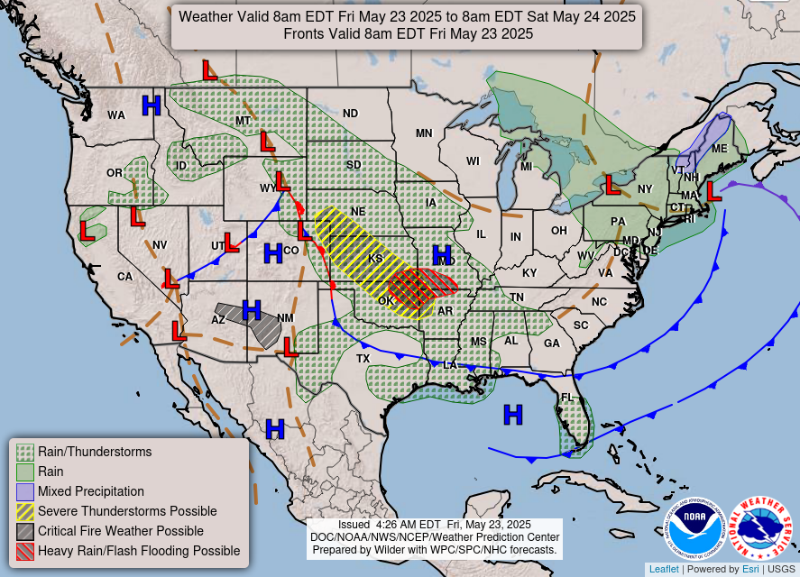
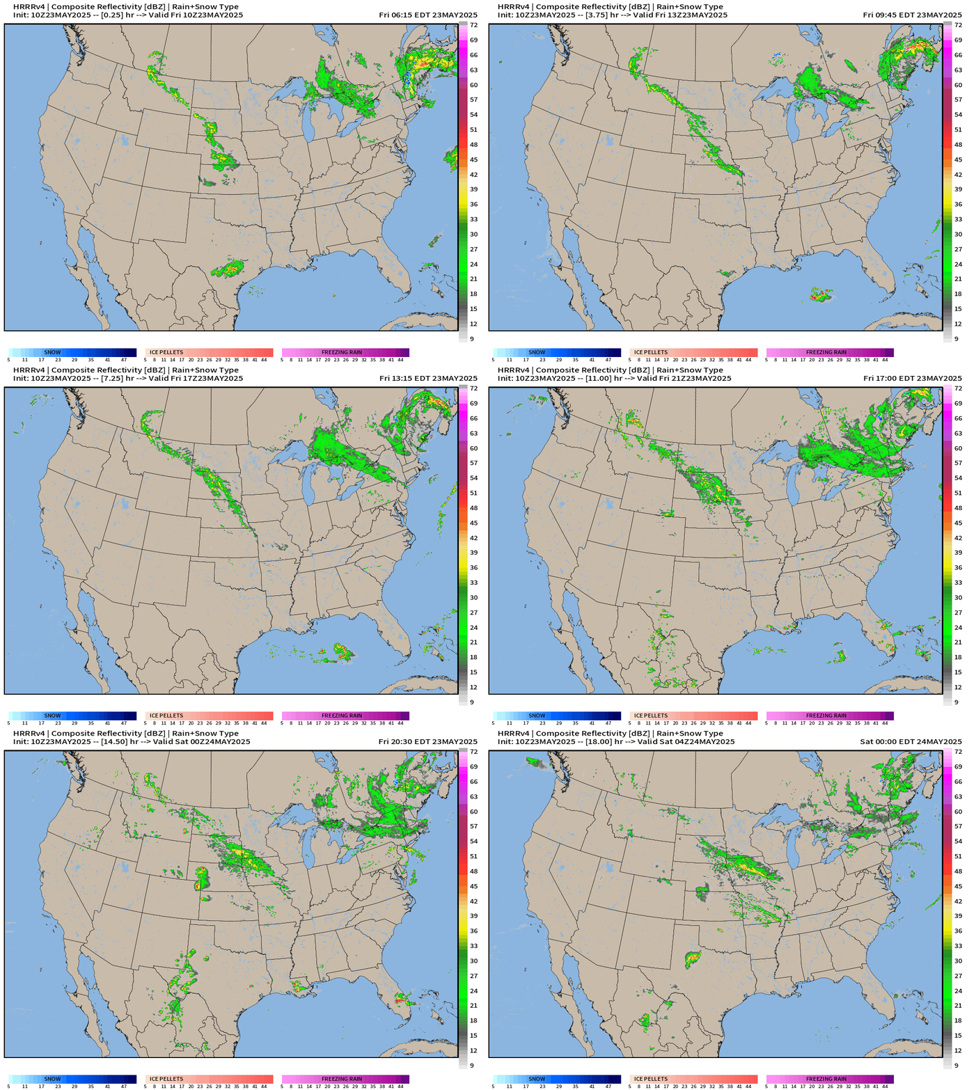
Heaviest rain and thunderstorms in the central Plains today as moisture flow returns from the Gulf. Cold fronts attached to the Nor’easter keeping the Southeast and Mid-Atlantic dry with cooler than normal temperatures.
Slight chance of severe weather mainly gusty winds and hail.
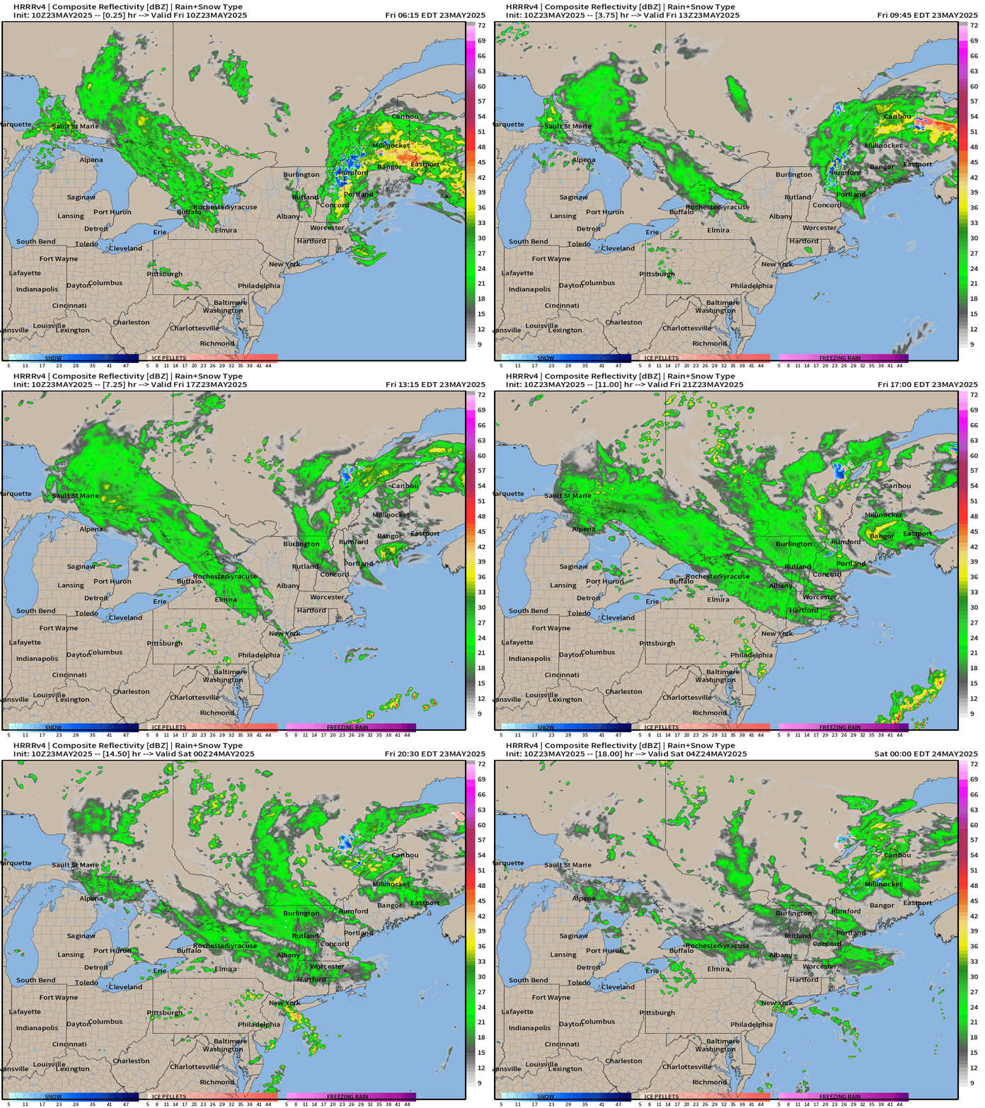
Unusual Nor’easter off the Maine Coast | 996 mb
This system is quite intense for late-May in the 990s with a lifecycle similar to a blizzard in January without the cold Arctic air to generate heavy snow.
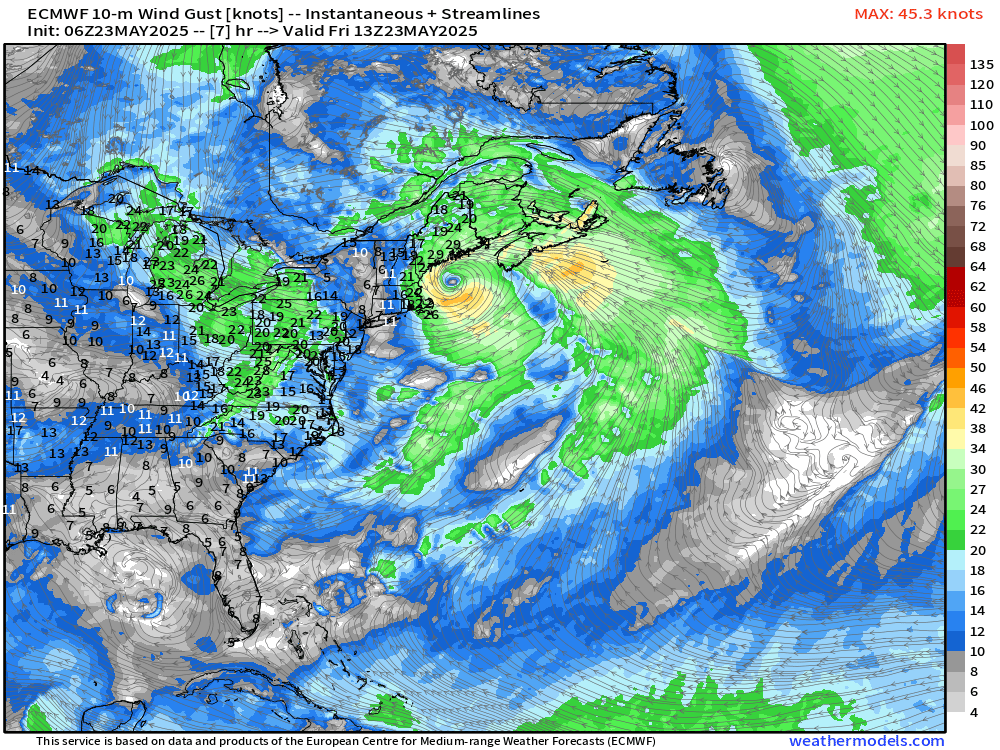
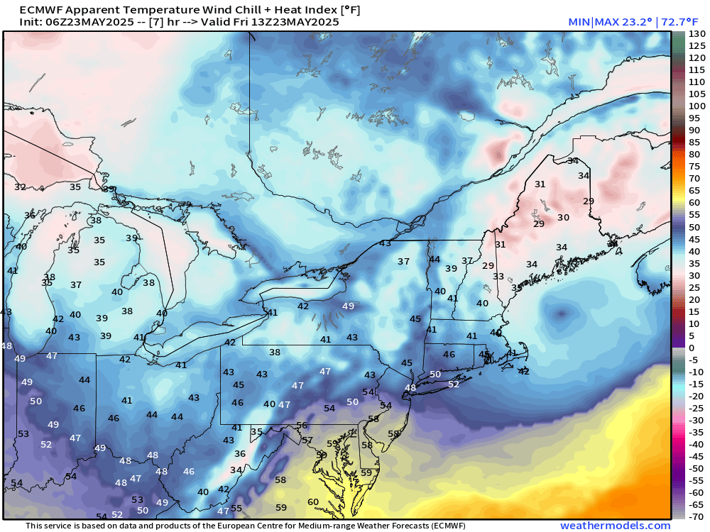
Winds are gusty today especially around Boston earlier over 40 mph with rain and mist. The strongest winds are just around the low pressure center, which has occluded. The circulation across the Northeast and Great Lakes is impressive with strong northerly component winds bringing cool, dry Canadian air well southward.
Wind chills this morning were in the 20s and 30s across Michigan and Maine!
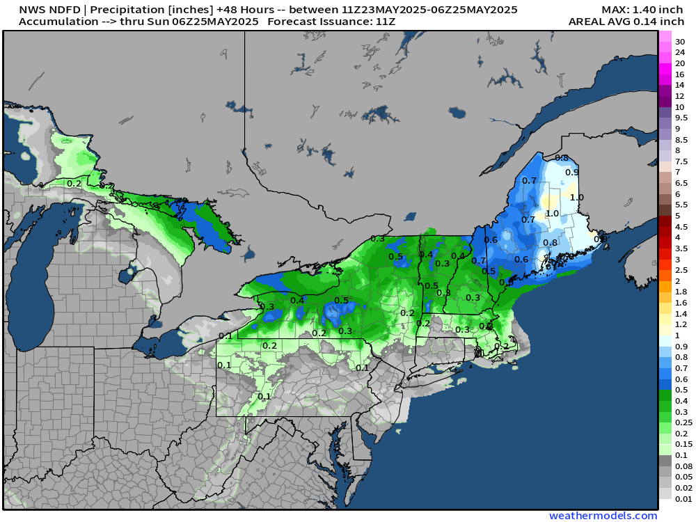
Still upwards of an inch of rain possible in Maine, today.
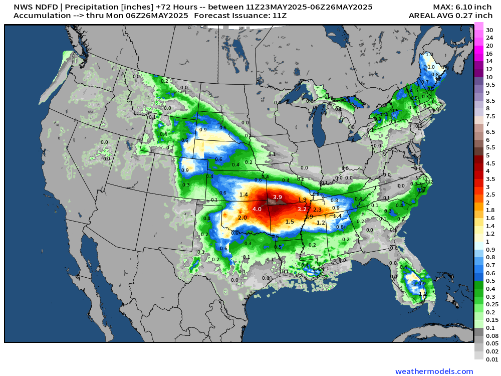
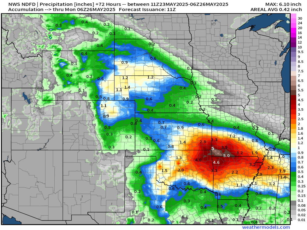
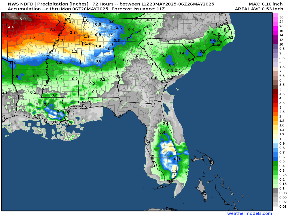
NWS Precipitation next 72-Hours
The heavy rain is back across central Plains from OKC/Tulsa to Little Rock and Memphis. NWS has a few counties up to 6” in SW Missouri and a larger area of 3”-4” surrounding.
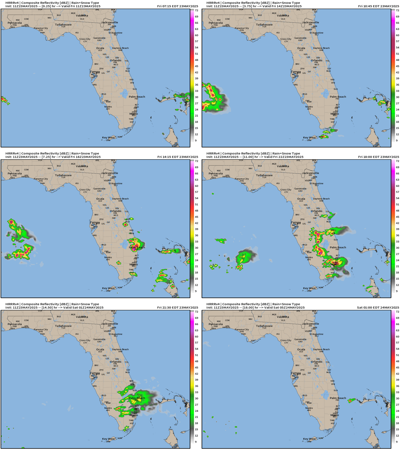
Some chance of rain in Florida as a weak frontal boundary helps provide some lift and instability. They will take whatever is offered!
HRRR Simulated Radar Next 18-hours through Saturday 12 AM ET
Florida zoom — sea breeze thunderstorms
TROPICS
Eastern Atlantic Satellite Image
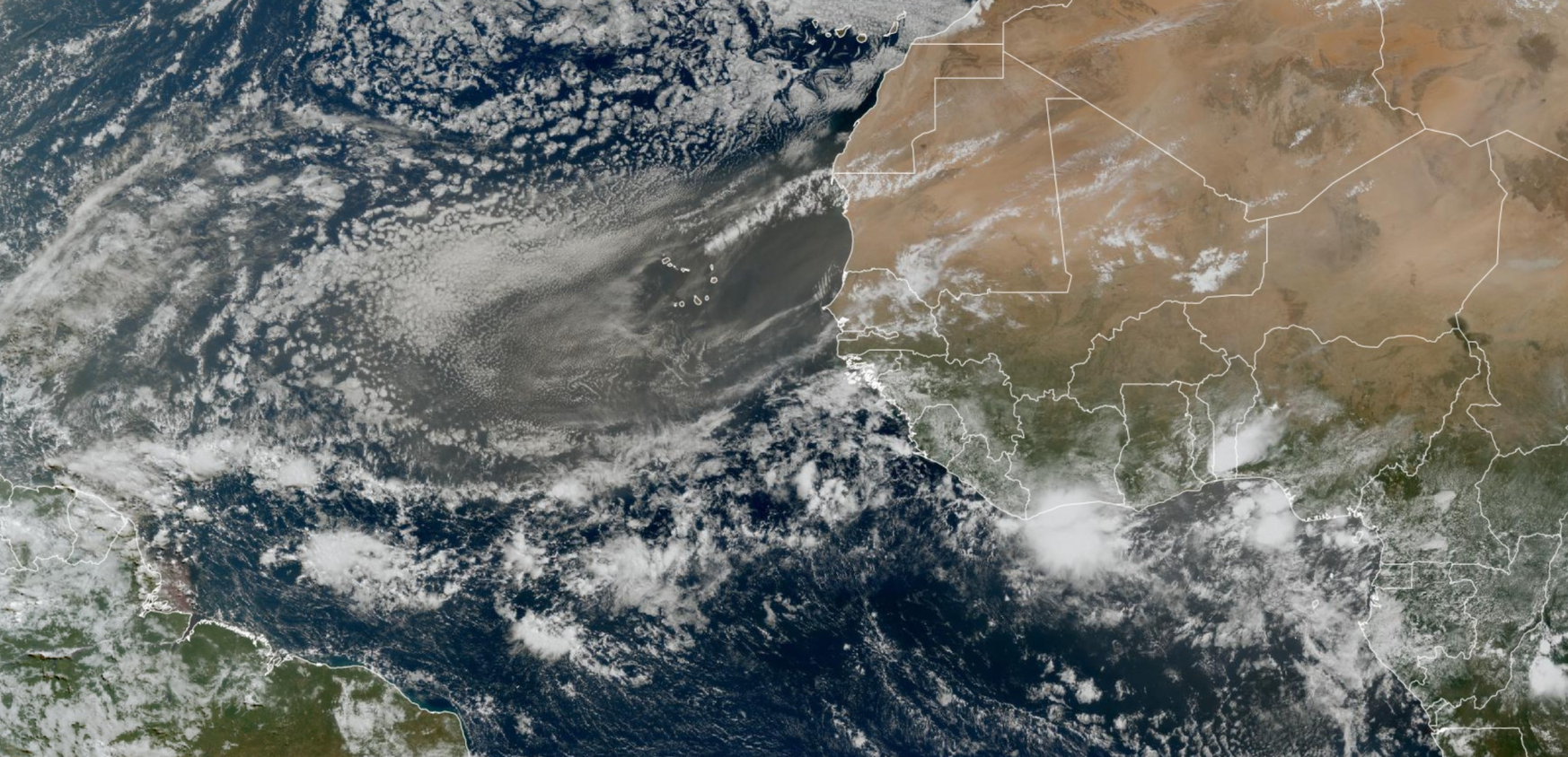
Very heavy dust coming off the African continent will travel westward into the Caribbean after 6-7 days.
NASA GEOS-5 Dust | 7-days Forecast
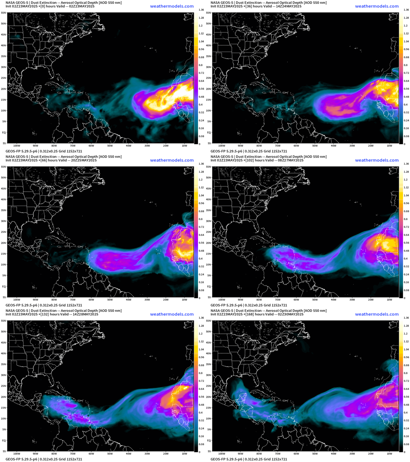
Saharan Air Layer and Dust looks to make the Gulf of Mexico by late next week with continued bursts coming off Africa.
Atlantic Ocean Surface Temperatures (SST)
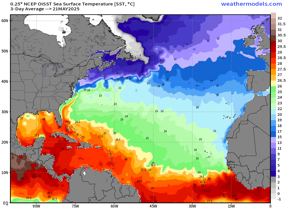
Gulf of Mexico now much warmer with 28°C reaching the coast around Pensacola connected to loop current eddy.
Important: actual Sea-Surface Temperatures (SST) help form and intensify tropical storms and hurricanes NOT the anomaly. We need sustained 26°C SST for typical tropical pathway storm development. You can see the green (under 26°C) extends still to 10°N latitude = too chilly for typical MDR development, but that will warm over the next 2-weeks to be viable.
The Caribbean is already (always) warm enough for a major hurricane (28°C). The Gulf is still chilly across the northern half of the basin.
Tropical Atlantic Satellite Imagery
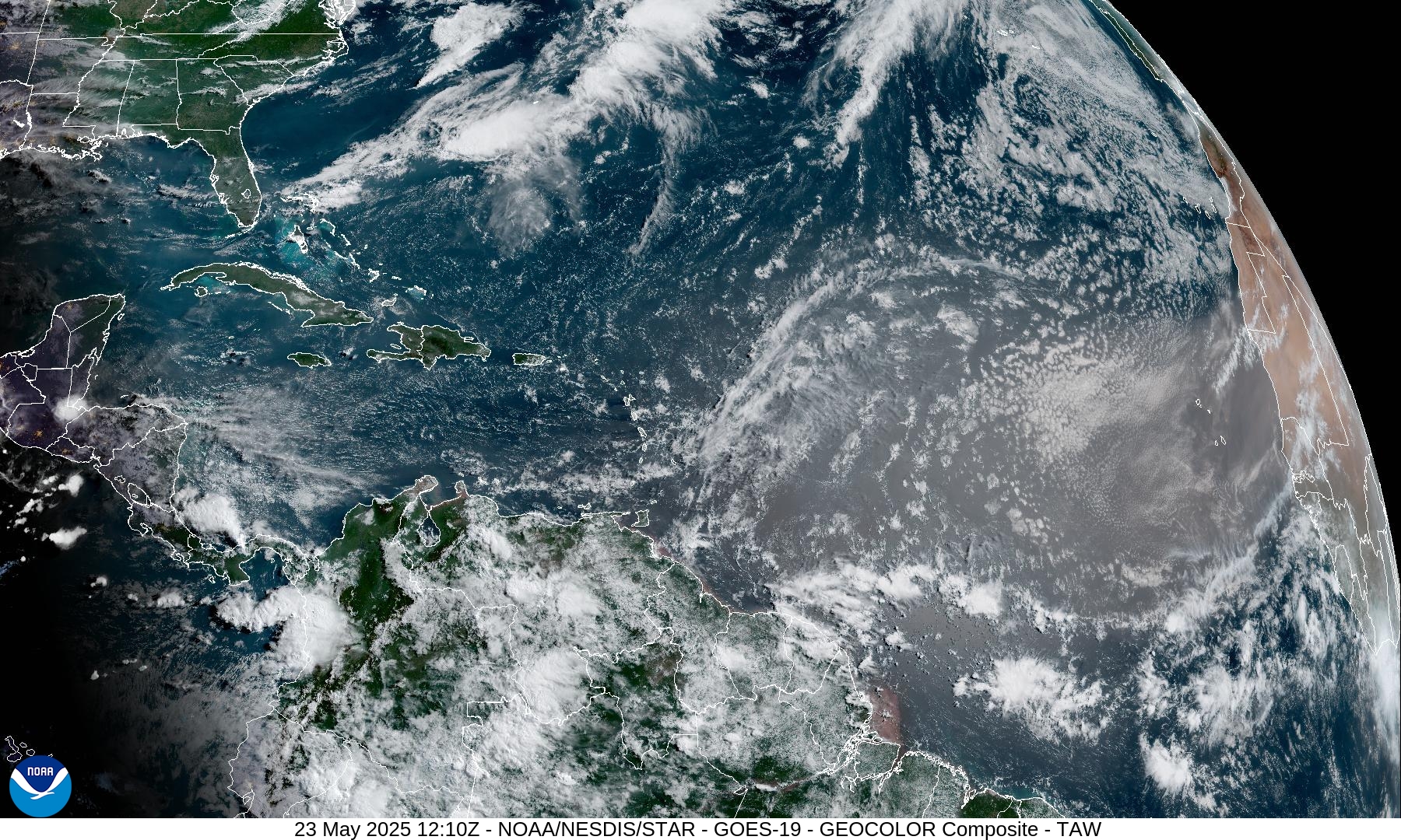
New Tropical Wave emerges off Africa
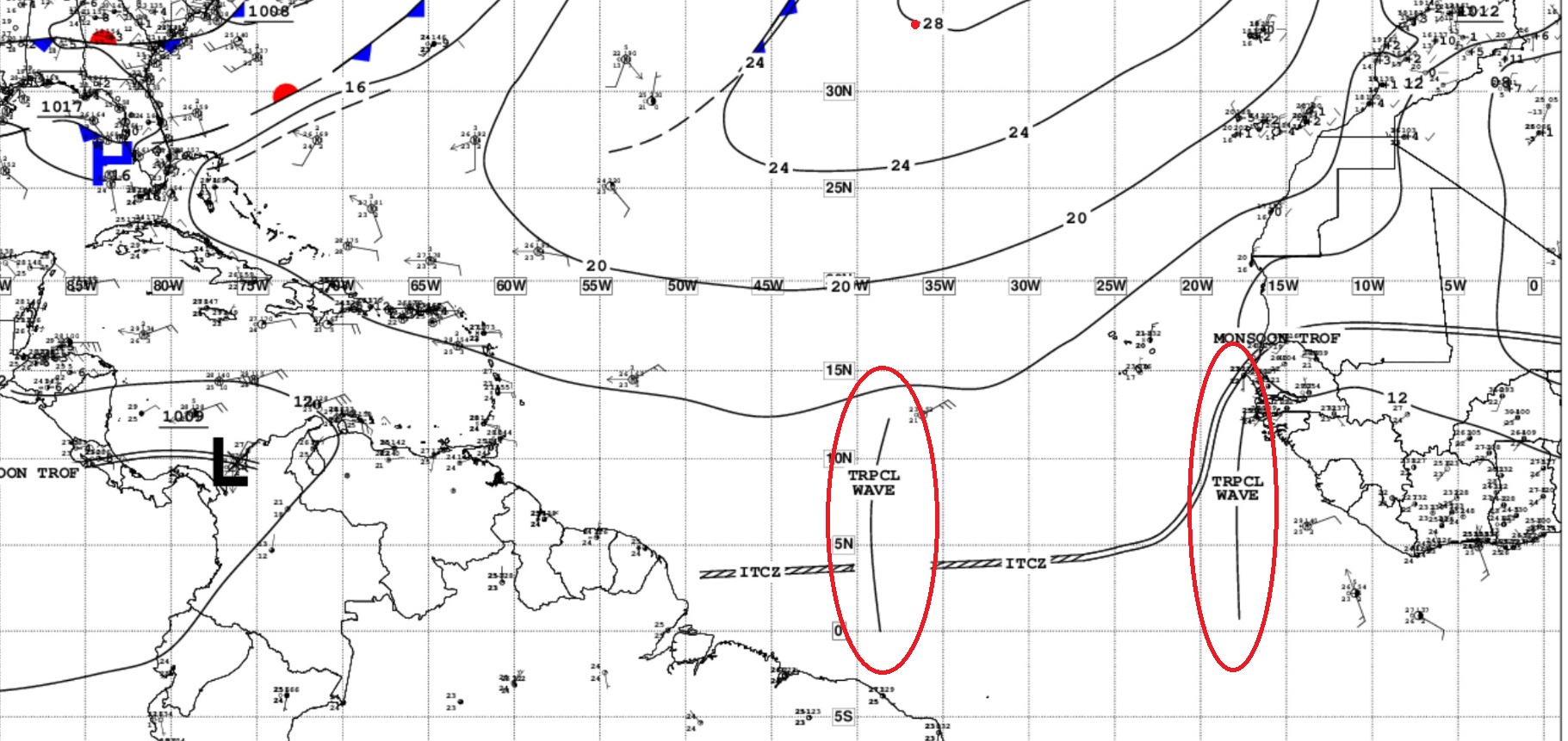
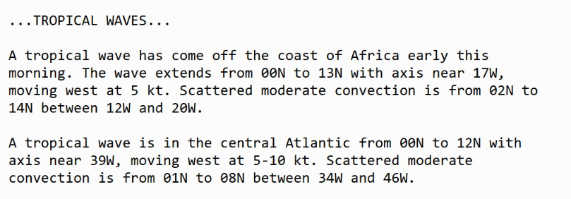
However, even with the cooler ocean temperatures to deep tropical latitude in the MDR, 2 tropical waves continue westward.
However, no tropical development expected. But these systems can provide the seedlings for Eastern Pacific hurricanes in 10-14 days.
ECMWF Ensembles | 10-Days Tropical Storm Tracks = 0
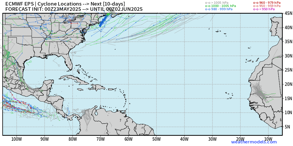
Atlantic is expected to remain dead quiet for the next 10-days through June 1st.
Eastern Pacific Tropical Update
IR satellite imagery shows some convective bursts but the area being watched by NHC with model support has not really formed yet.
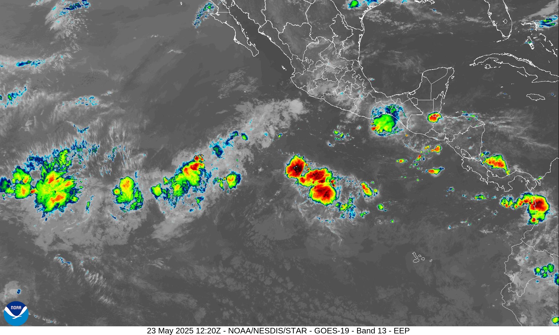
NHC up to 60% chance for storm development in the Eastern Pacific next 7-days
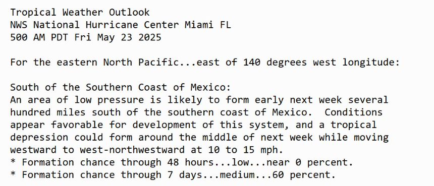
ECMWF 00z Ensembles | Eastern Pacific
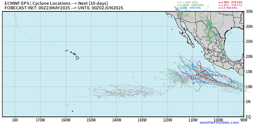
High chance of Alvin developing in the next 7-days according to ensembles — however, uncertainty about track or intensity.
Germany ICON (DWD) Precipitable Water next 7.5 Days
My favorite parameter showing Hurricane Alvin
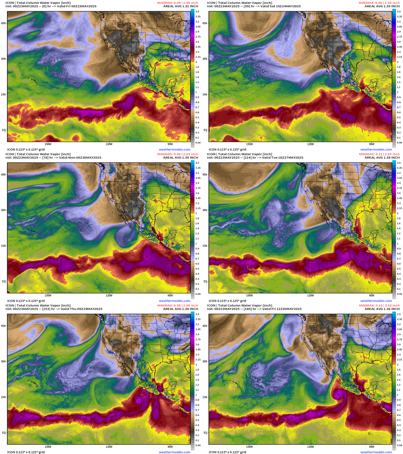
ECMWF and GFS comparison at Day 8+
At this juncture, I’d have to bet on Alvin forming by middle of next week and becoming a hurricane over the very warm water [30°C] of the Eastern Pacific just south of Mexico.
Satellite Imagery This Morning Across Lower 48
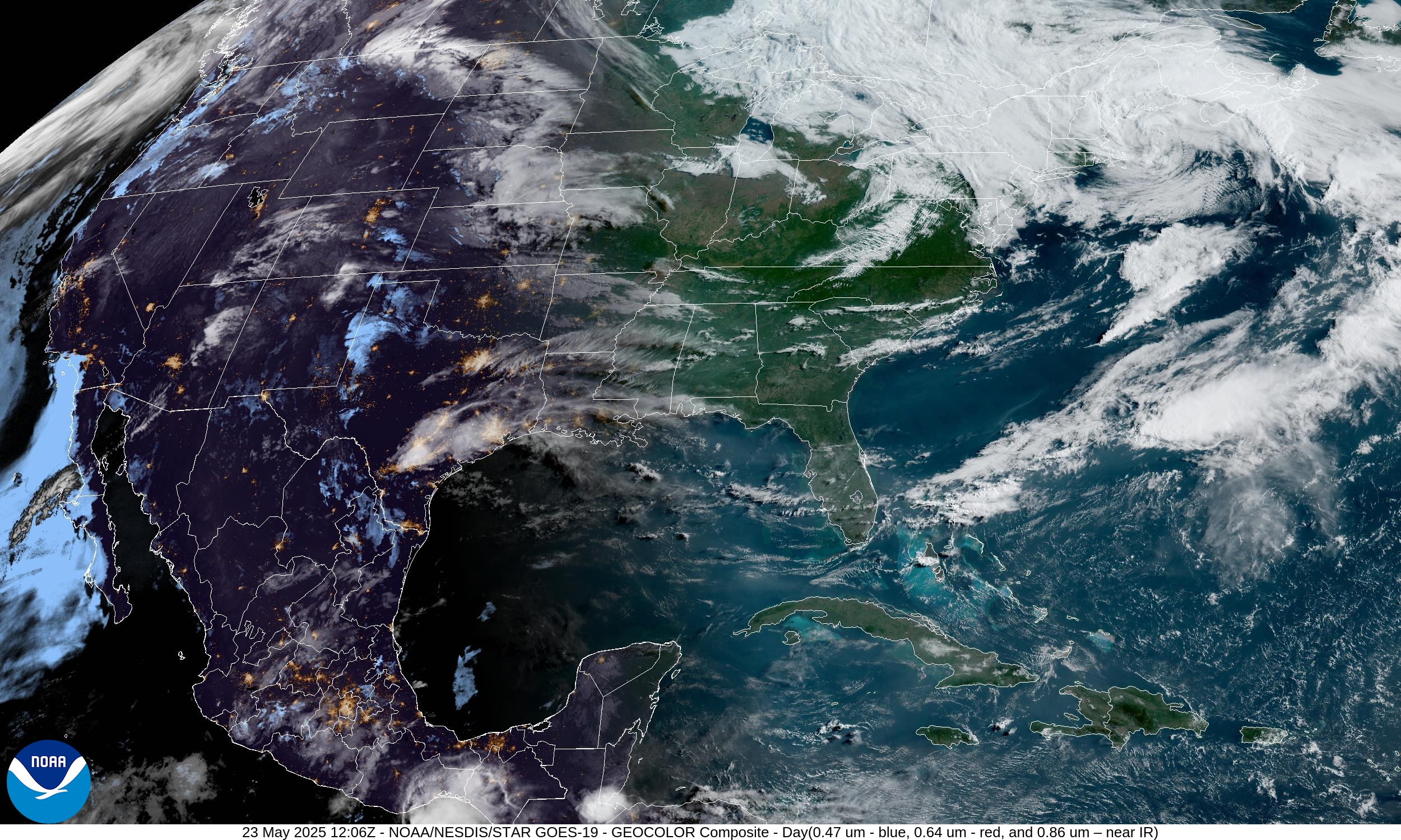
Impressive Nor’easter off Maine with compact swirl of clouds. A cloud decks extends back into Michigan.
High Temperatures Today | Friday May 22, 2025
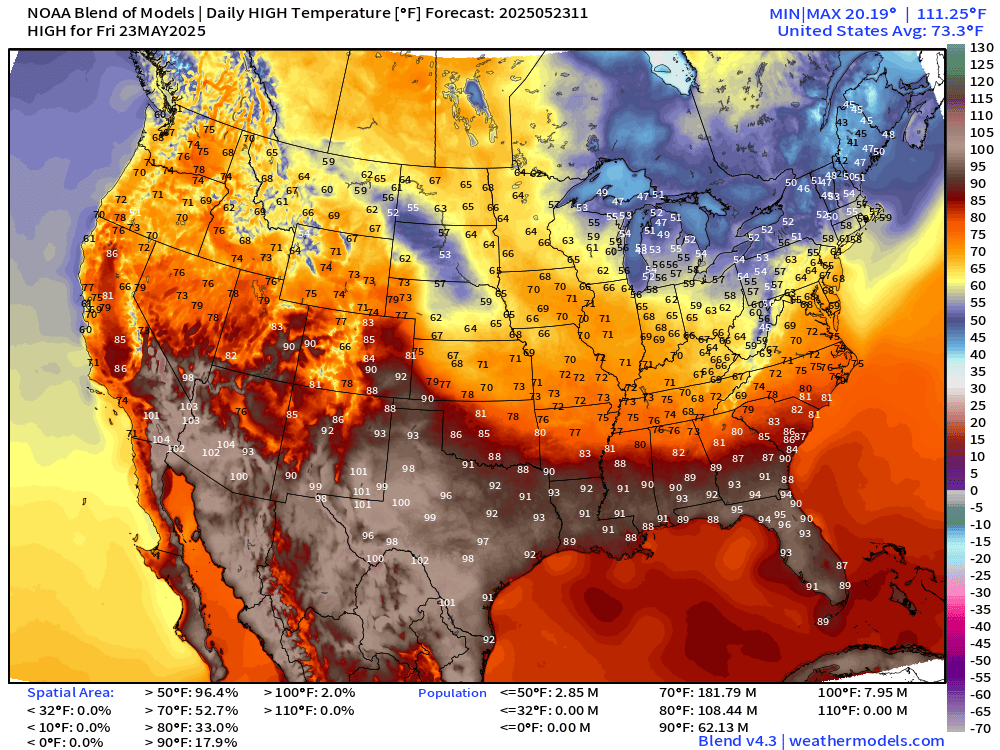
73.3°F is the Lower 48 average high temperature with 108 million at least 80°F, and 62 million above 90°F. 40s and 50s in Michigan over to New England with clouds and rain.
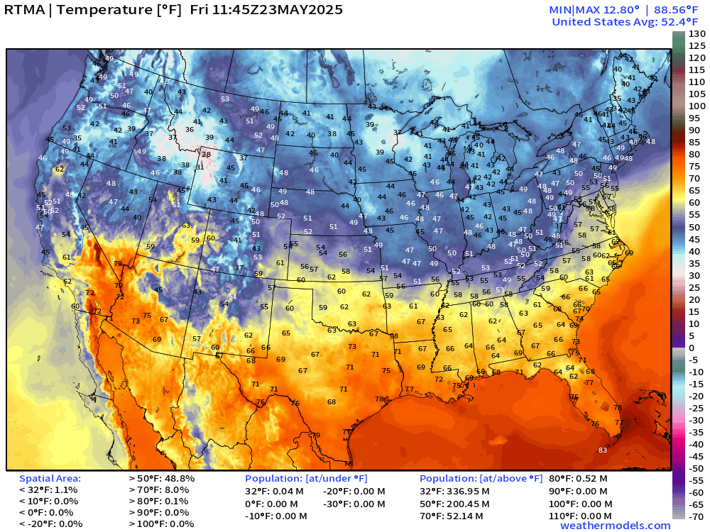
Temperature Analysis | 7:45 AM ET
Temperature Anomaly | 7:45 AM ET
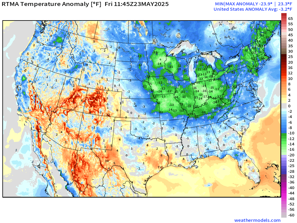
Overall the Lower 48 is -3.2°F below normal [1991-2020]
Saturday Morning Lows
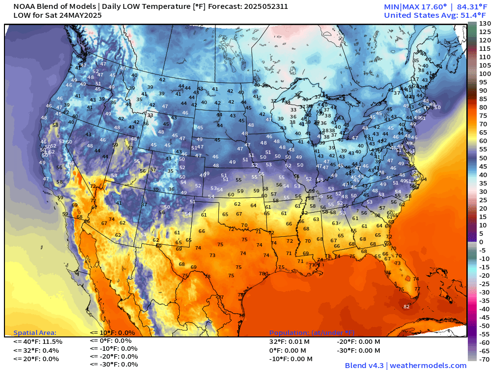
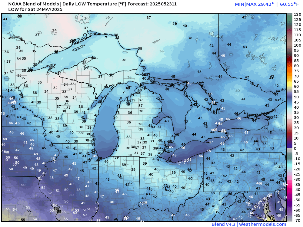
Chilly in the 30s from Minnesota into Michigan … some areas frosty or near freeze!
Saturday High Temperatures
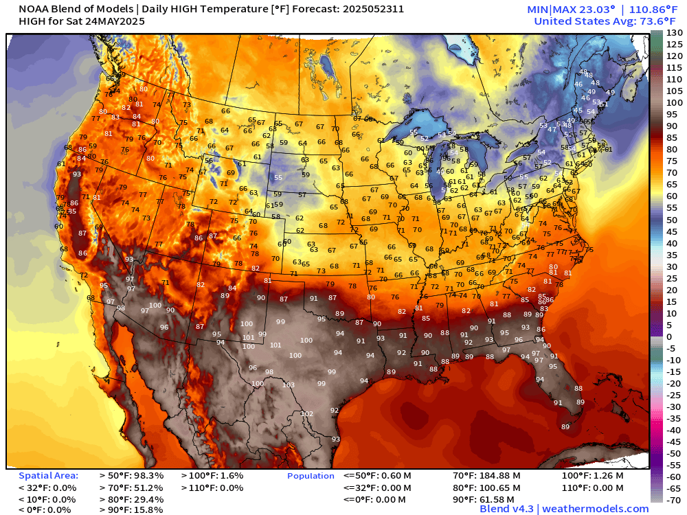
90s and 100s across Texas widespread — and mid-90s in Florida with 97°F in Tallahassee
Sunday High Temperatures
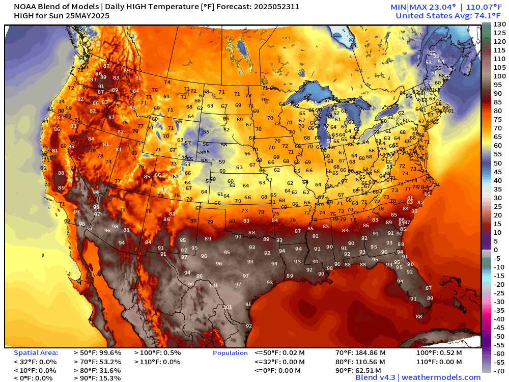
Comfortable temperatures continue in the 60s and 70s across the northern 2/3 of the Lower 48. Hottest temperatures in Texas, Florida and South Georgia well into the 90s.
Warming trend into Memorial Day!
Memorial Day | Monday High Temperatures
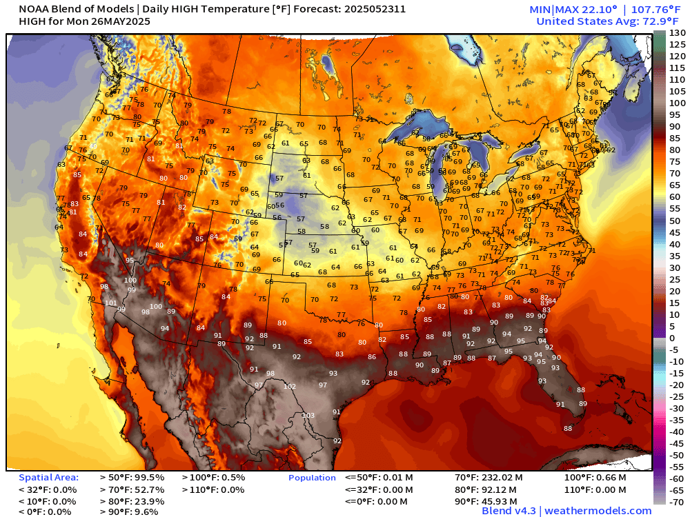
72.9°F is the Lower 48 Average High Temperature for the beginning of summer tourist season with 60s and 70s quite popular.
Precipitation Chance on Monday during the Day
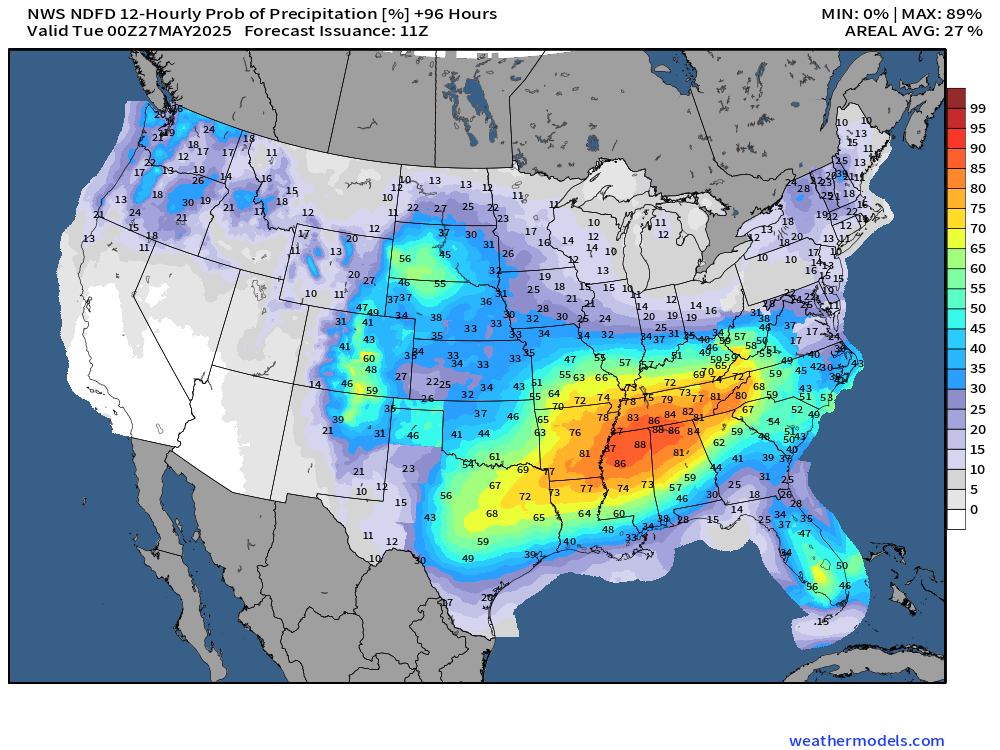
Memorial Day rain chances are high from Dallas to Birmingham, Nashville, and up to 60% in Atlanta.
NWS WPC Precipitation | Next 7-days
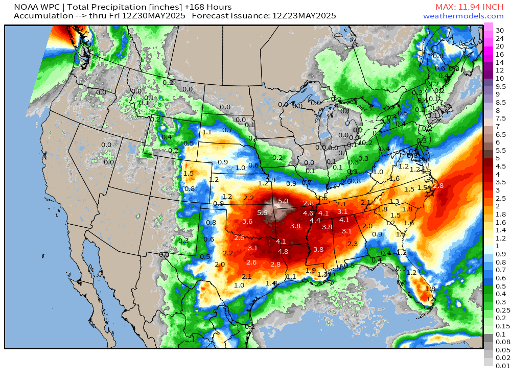
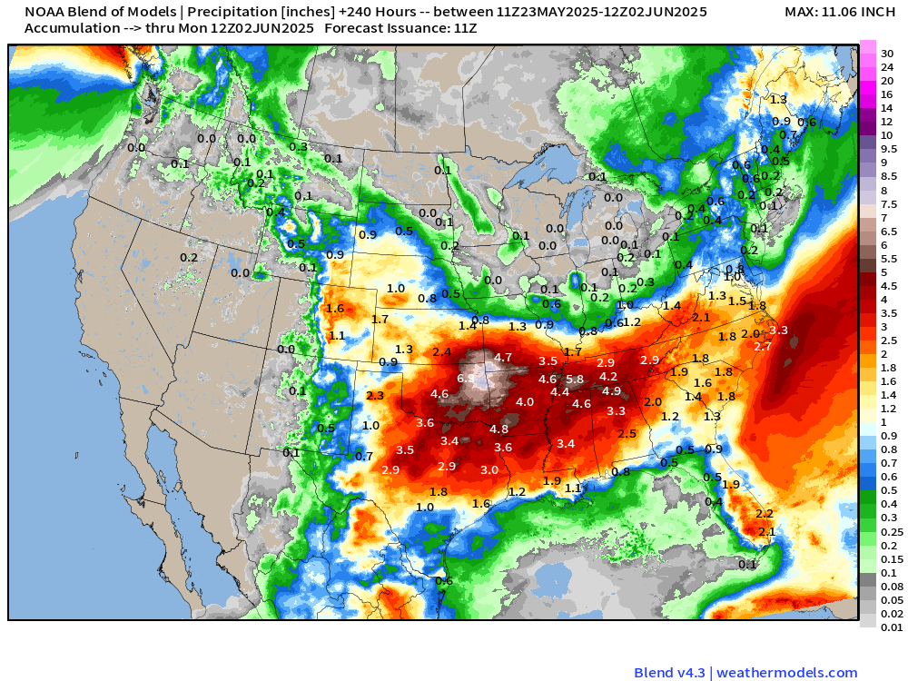
Yet again major rainfall totals for the next week centered on NW Arkansas but 3-4” extending from Little Rock to Nashville for 7-days.
Precipitation and MSLP Next 6-Days | ECMWF 06z
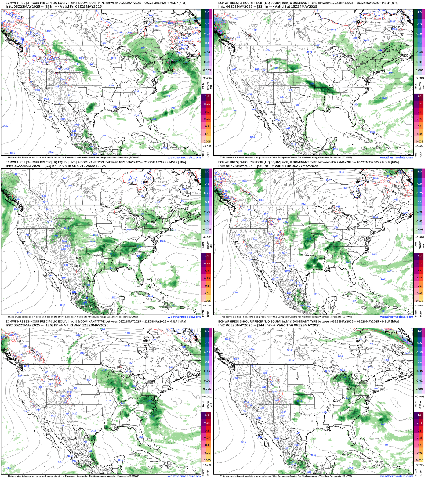
Saturday-Sunday: heavy rain centered on Kansas City, OKC, and Little Rock
Memorial Day: widespread showers and storms across the Plains, Texas, into the Tennessee River Valley and Southeast.
NOAA Blend of Models Precipitation Next 10-days
Upper Level Weather Pattern | Height Anomaly next 10-days
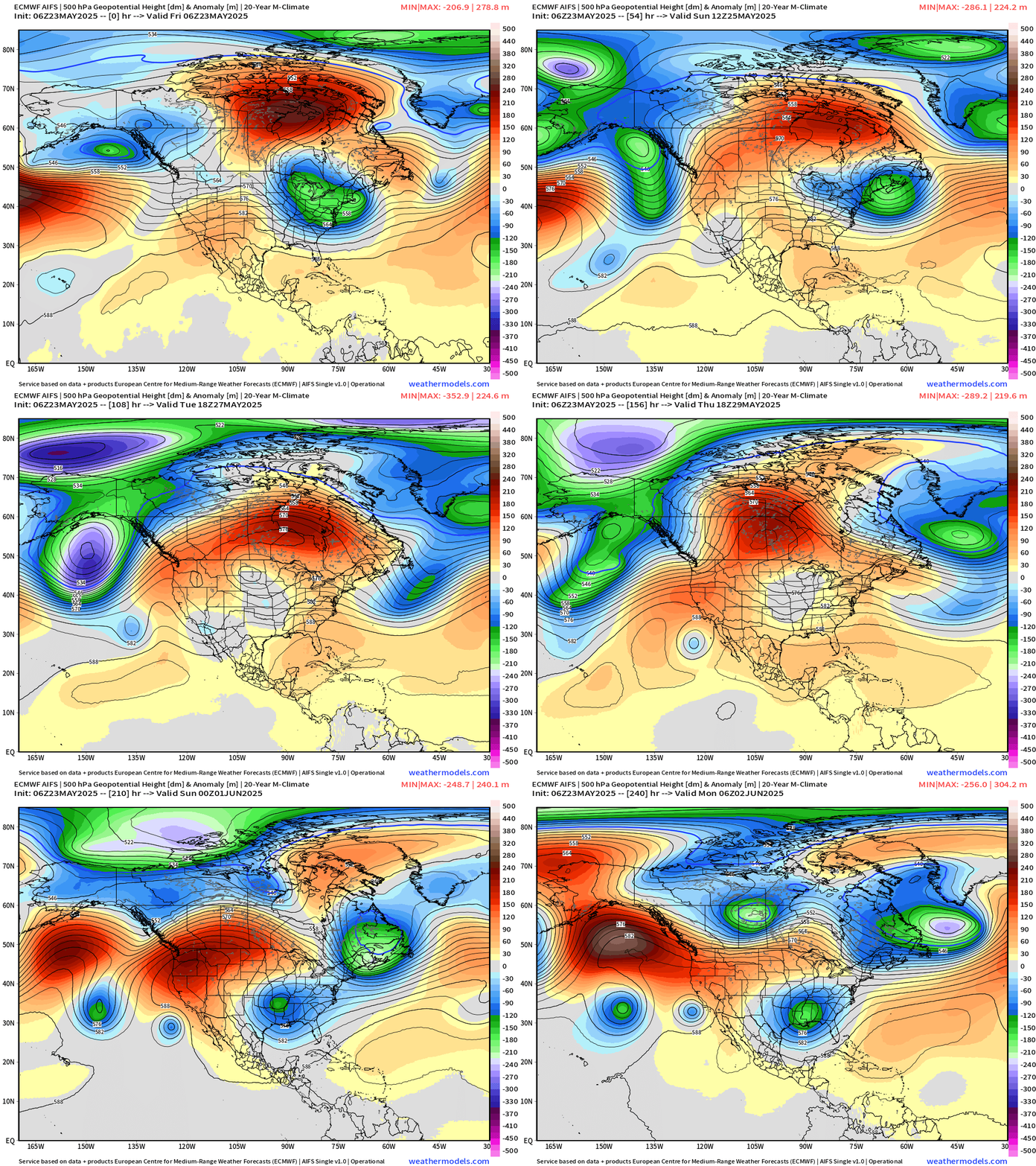
Sustained ridging develops across Canada and is reinforced by Western U.S. warmth at Days 7-10. The ridge over Canada acts like a block and troughs are able to dip southward and affect Great Lakes and Northeast with cool shots.
ECMWF EPS 00z | 5-Day Chunks Temperature Anomaly
Days 1-5: May 23 - May 27
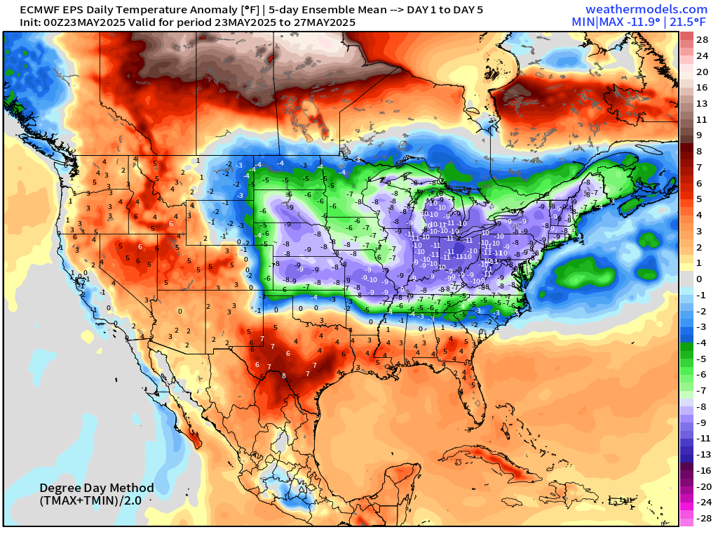
5-day anomaly of 10°F below normal centered on Detroit with cooler than 9°F below normal from South Dakota into New England.
Days 6-10: May 28 - June 1
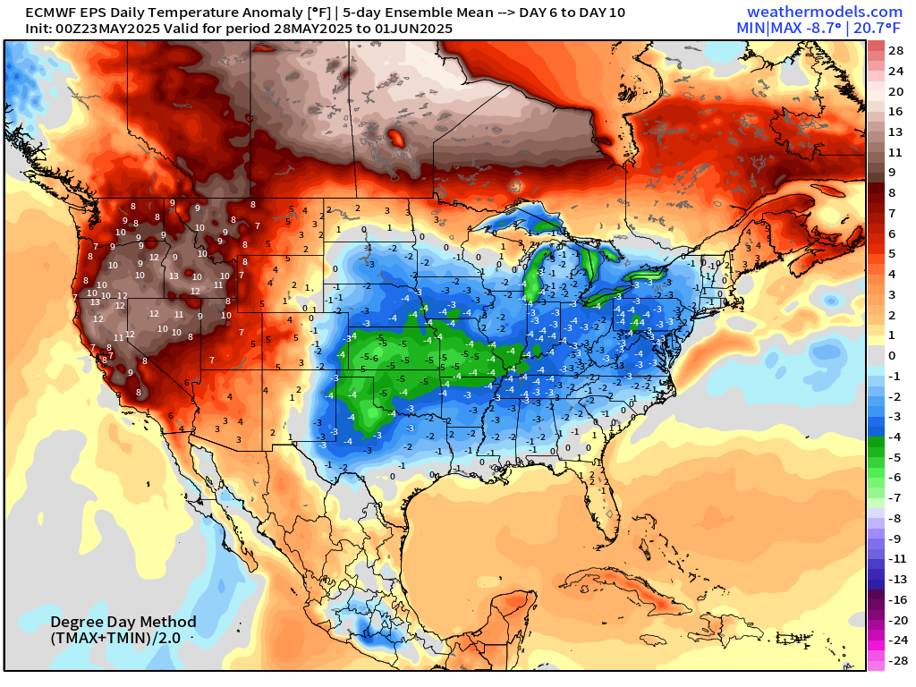
Significant warmth across the Western U.S. and into Canada, but cooler in the Plains and eastern U.S. exempting Florida.
Days 11-15: June 2 - June 6
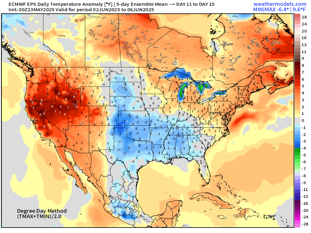
June starts off with the Ensemble Mean with cool (relative to normal) across Texas into the Southeast. That is not a heat wave signal.
Maps sourced from weathermodels.com designed and innovated by yours truly! Please subscribe there for real-time access to the newest maps, charts from all of the weather models including ECMWF.
- Milepost
- 614 · laid 2025-05-23T13:05:11.097000Z
- Source
- https://weather.substack.com/p/may-23-2025-friday-weather-update
- Digest
- 6af804f481f67babdbd729d0ff7a766525a8de6fcea99dac6f55b2d2fac1b8b4
- Machine
- JSON