May 4, 2025 Sunday Weather Update
Boatloads of rainfall across southern U.S. next week
May 2025 was the 27th-warmest May in the 132-year national record (1895–2026), at 61.7°F against a 1991–2020 normal of 61.0°F (+0.7°F).
May 2025 was the 12th-wettest May in the 132-year national record (1895–2026), at 3.7in against a 1991–2020 normal of 3.1in (+0.6in).
NOAA/NCEI Climate at a Glance, contiguous United States. This is the observed record for the month, not a score of anything said in this piece — the forecast ledger begins 2026-08-17 and cannot reach earlier posts.
Quick late Sunday update while watching the NBA games …
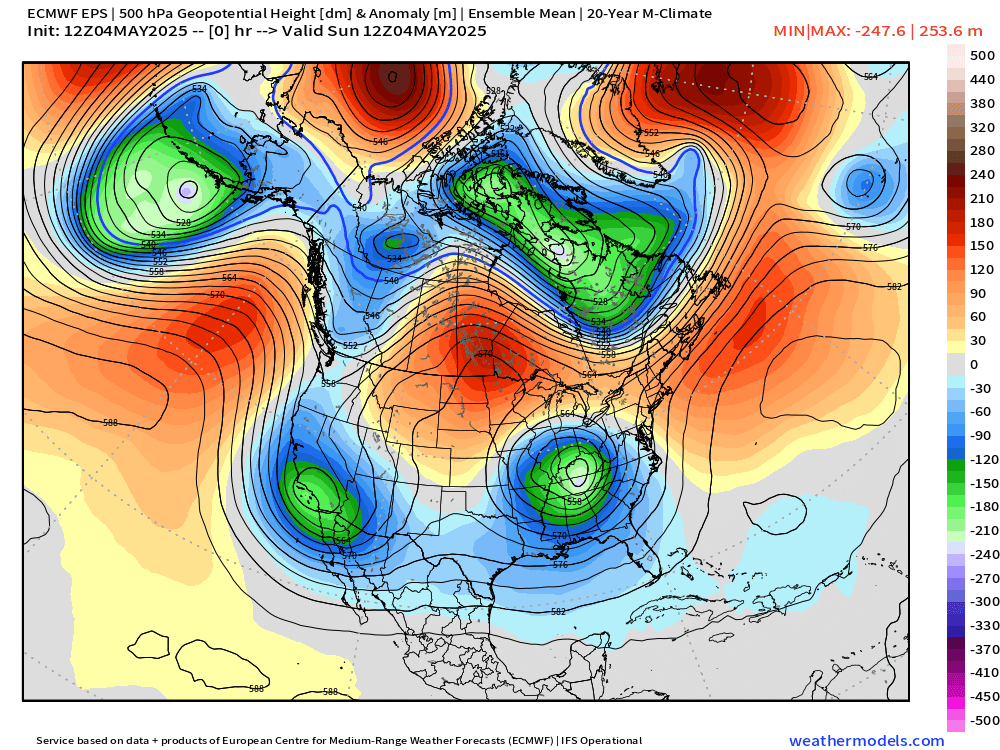
The great May 2025 Omega Block is underway with unusual weather in quite a few locations. The Southwest U.S. is cool and rainy as well as Indiana and the Ohio River Valley. Ridging in North Dakota and Canada lead to 80s for high temperatures.
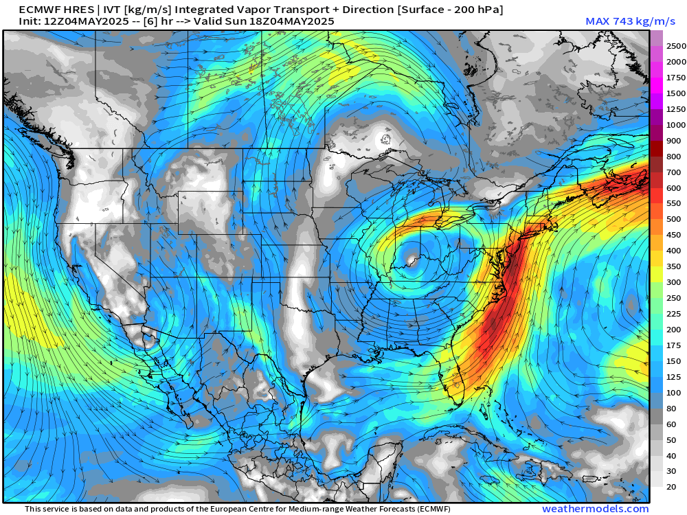
A mini-atmospheric river on the Atlantic side of the Indiana cut-off is bringing plenty of moisture and heavy rain into the Mid-Atlantic and Northeast.
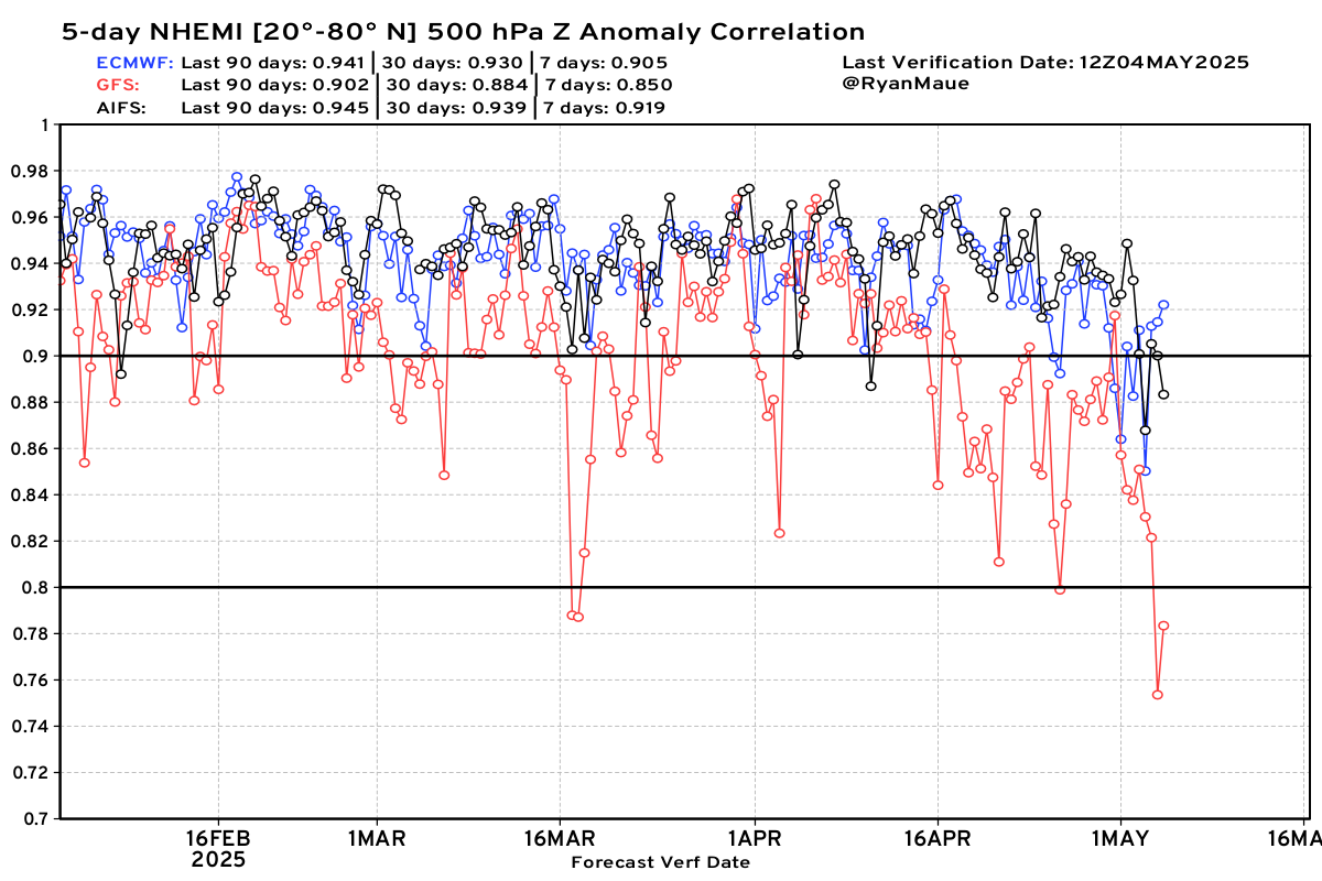
Sadly, NOAA GFS model skill has gone into the ditch. This chart compares 5-day NHEMI height forecasts for ECMWF, AIFS, and GFS (red line).
Drop-outs or “poor skill” periods are NOT what we’re looking for going into the Hurricane Season. Thankfully, we can use the A.I. models as well as ECMWF’s ensemble system.
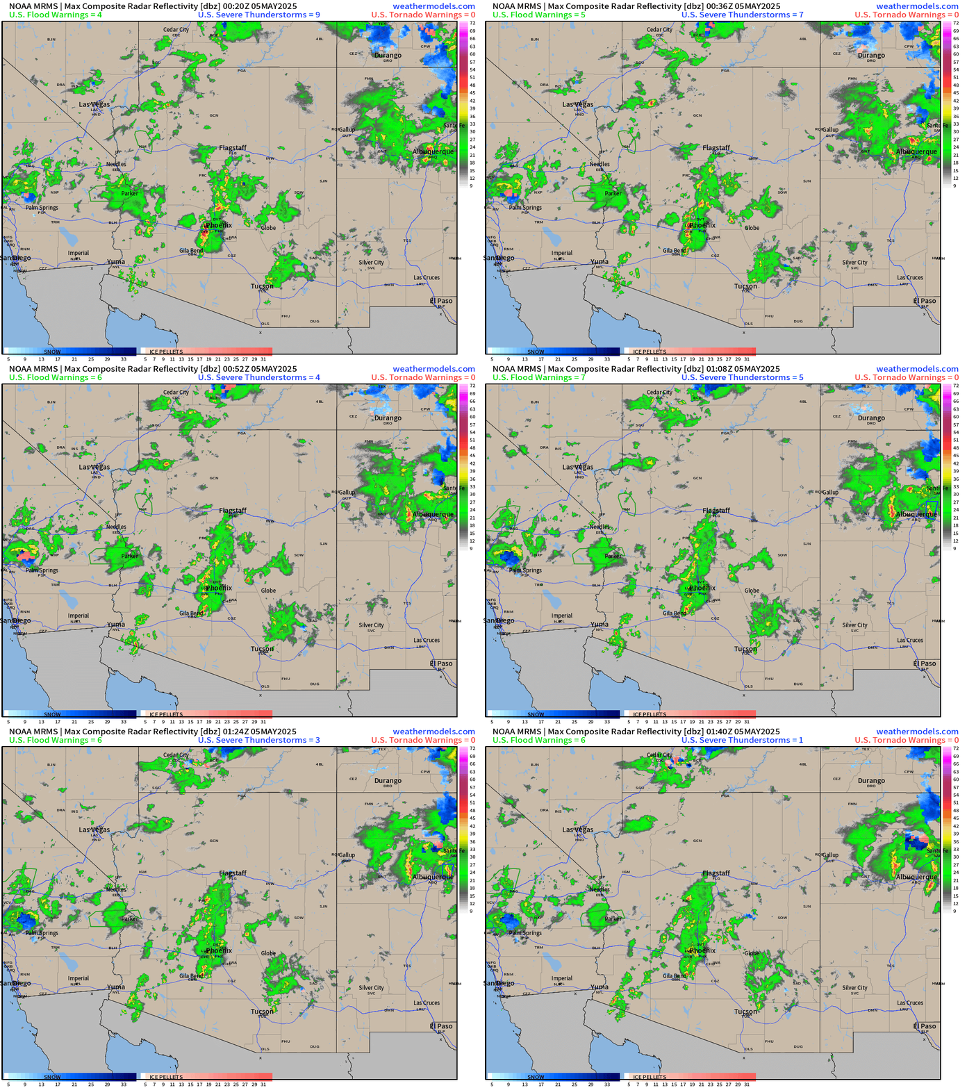
Radar Simulation next 18-hours through Monday afternoon 1 PM ET
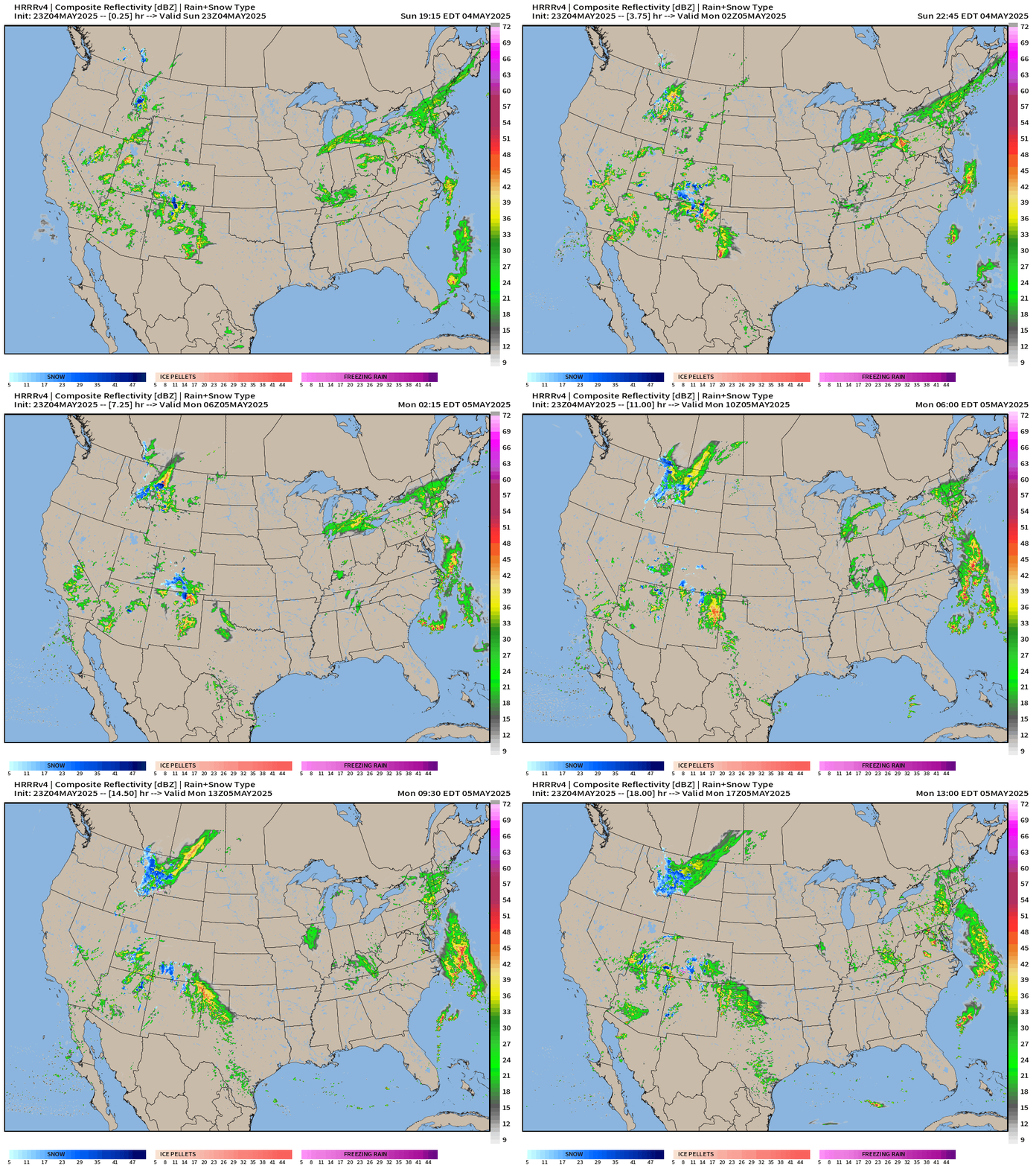
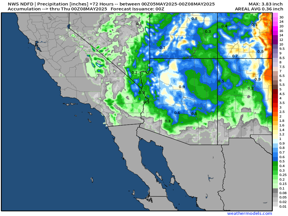
Unusual to see this spinning storm over the U.S. southwest and all of the rainfall including Las Vegas, Phoenix, and storms in New Mexico — outside of monsoon season.
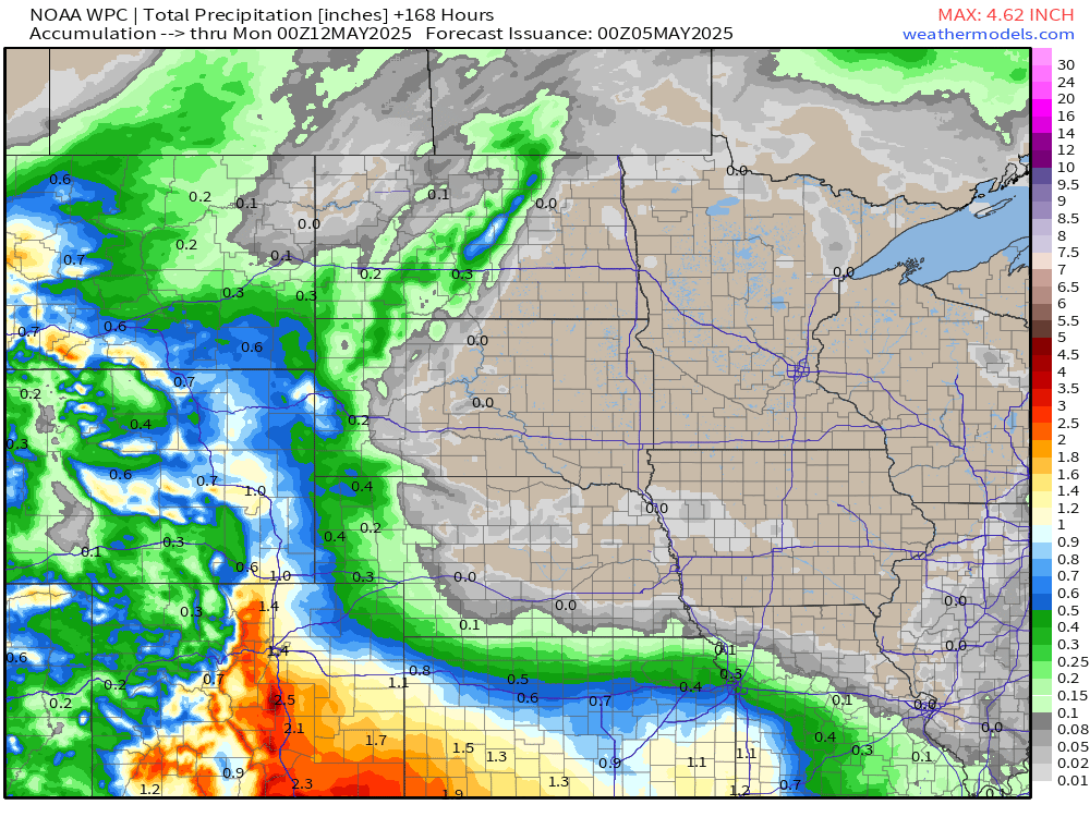
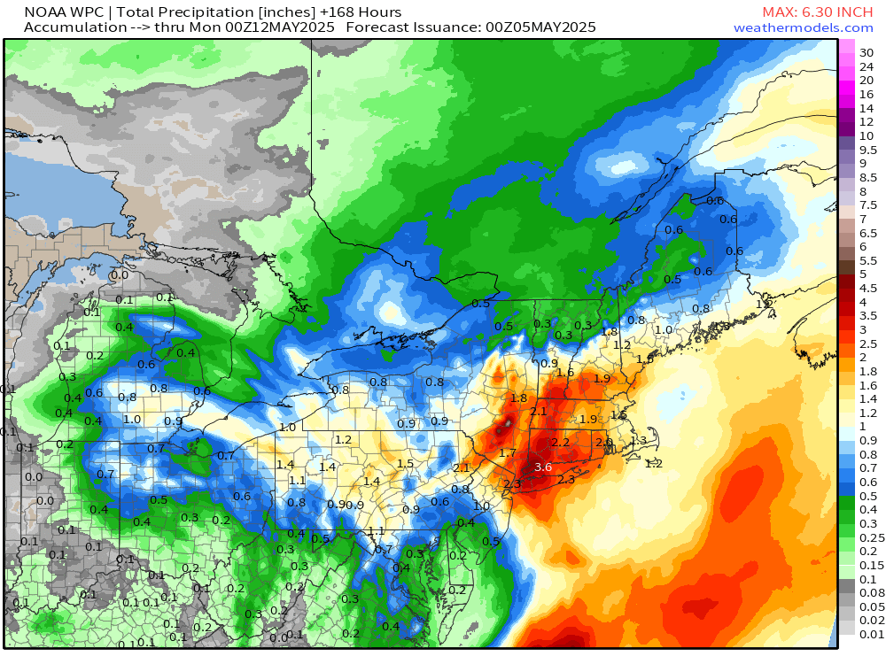
NWS WPC Precipitation | Next 7-days
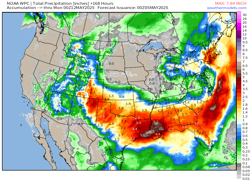
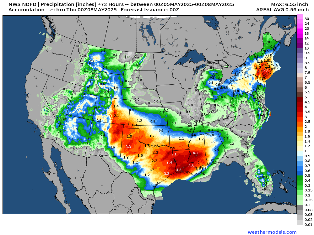
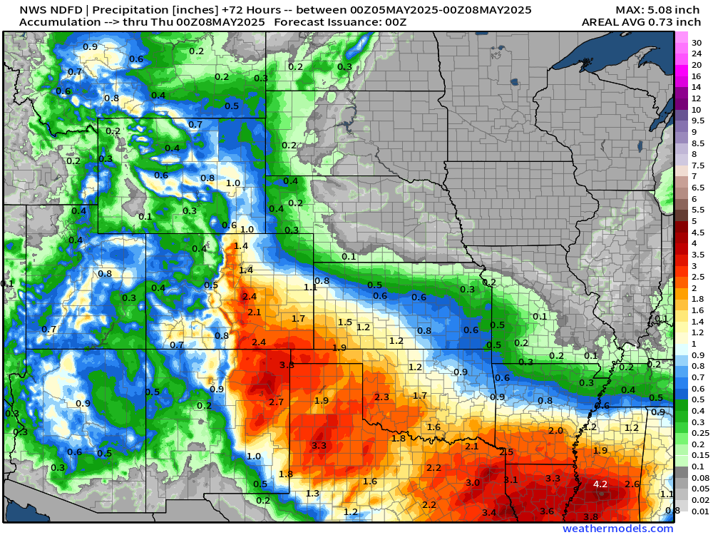
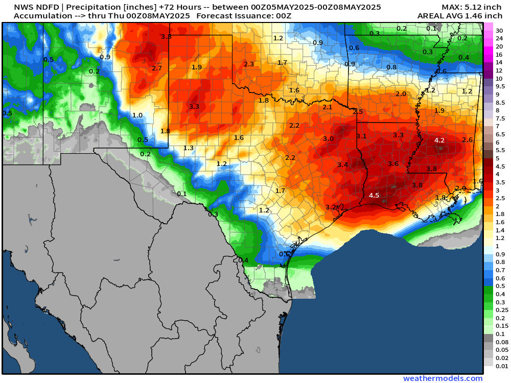
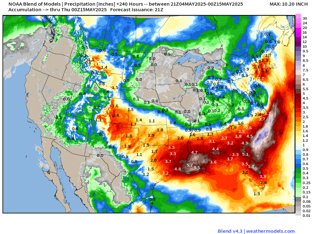
Big story this coming week is the enormous rainfall totals from Texas along the Gulf Coast into the Southeast.
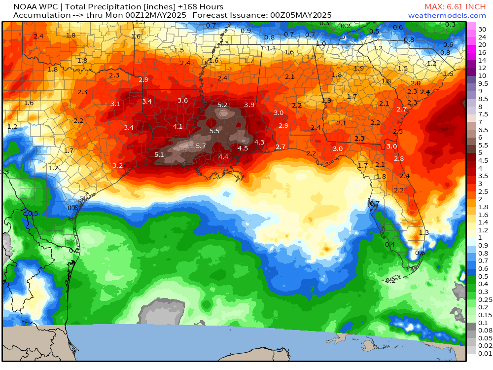
Zero rainfall across the Midwest!
Up to 4” around NYC and 1-2” in New England, mainly in the next 48-hours.
Sunday Evening Weather
Mixed precipitation tonight across the mountains in the Great Basin and Four Corners. A chilly rain in the Ohio River Valley continues!
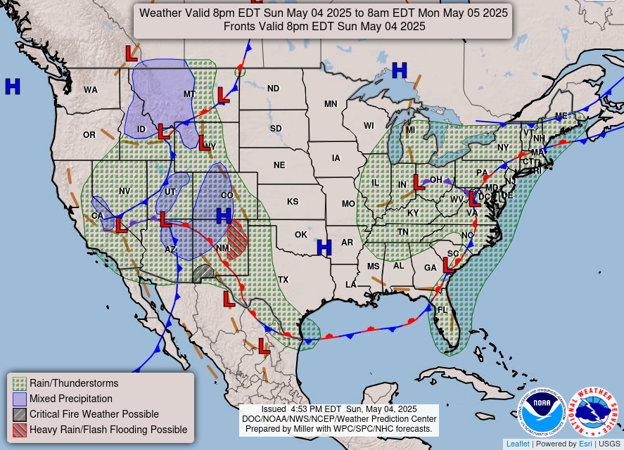
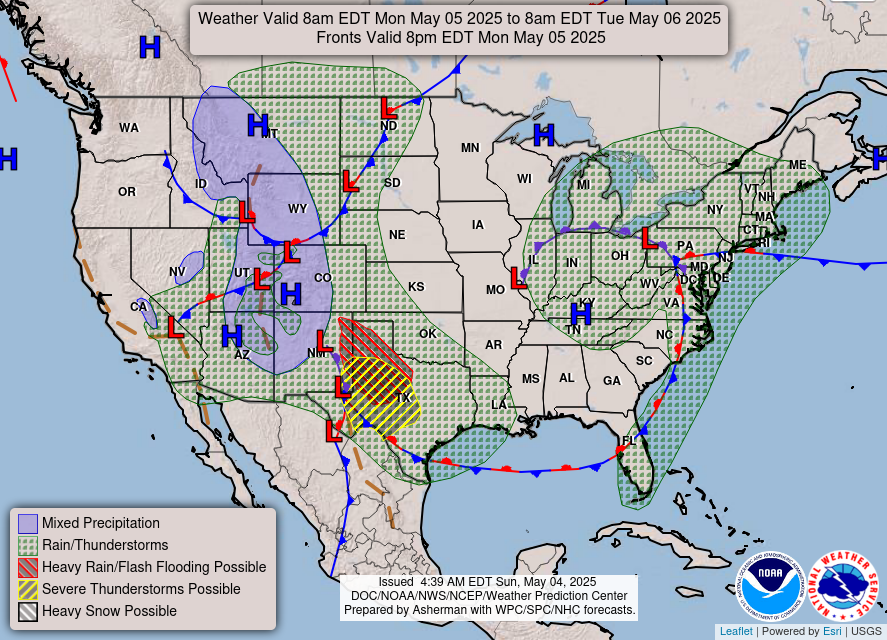
Frontal Boundaries this Evening 8 PM and Weather on Monday
Similar weather for Monday with little movement of the Omega Block.
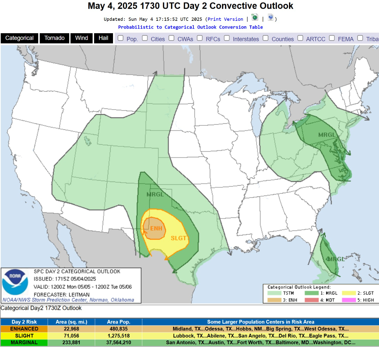
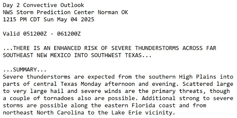
But, add in some severe storm potential for west Texas!
Massive hail and strong winds, maybe a tornado in ENHANCED risk counties of Texas.
Temperature Analysis | 8:45 PM ET
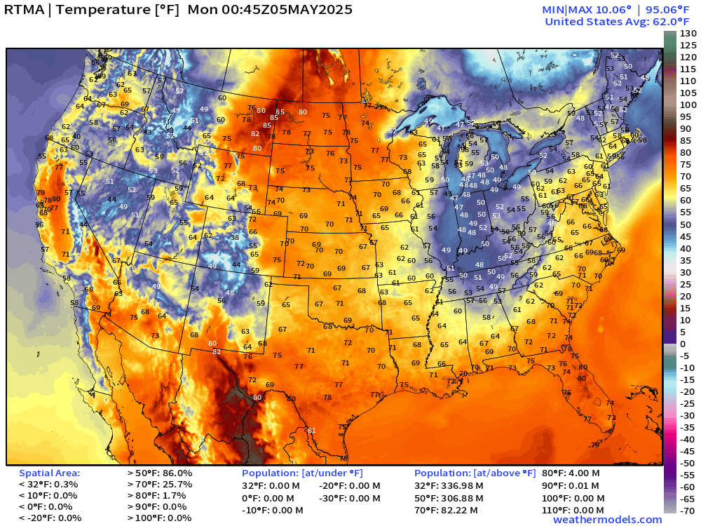
80s in North Dakota with 40s in Indiana … chilly air descending behind the trough into the Southeast.
Temperature Anomaly | 8:45 PM ET
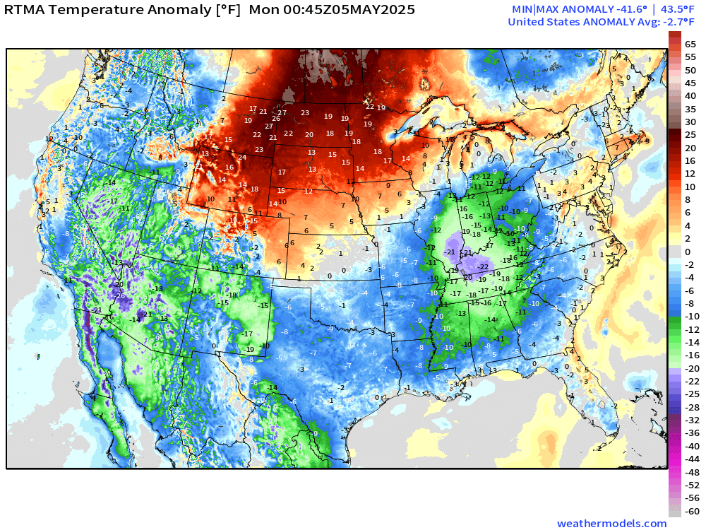
Overall the Lower 48 is -2.7°F below normal
Satellite Imagery this Morning
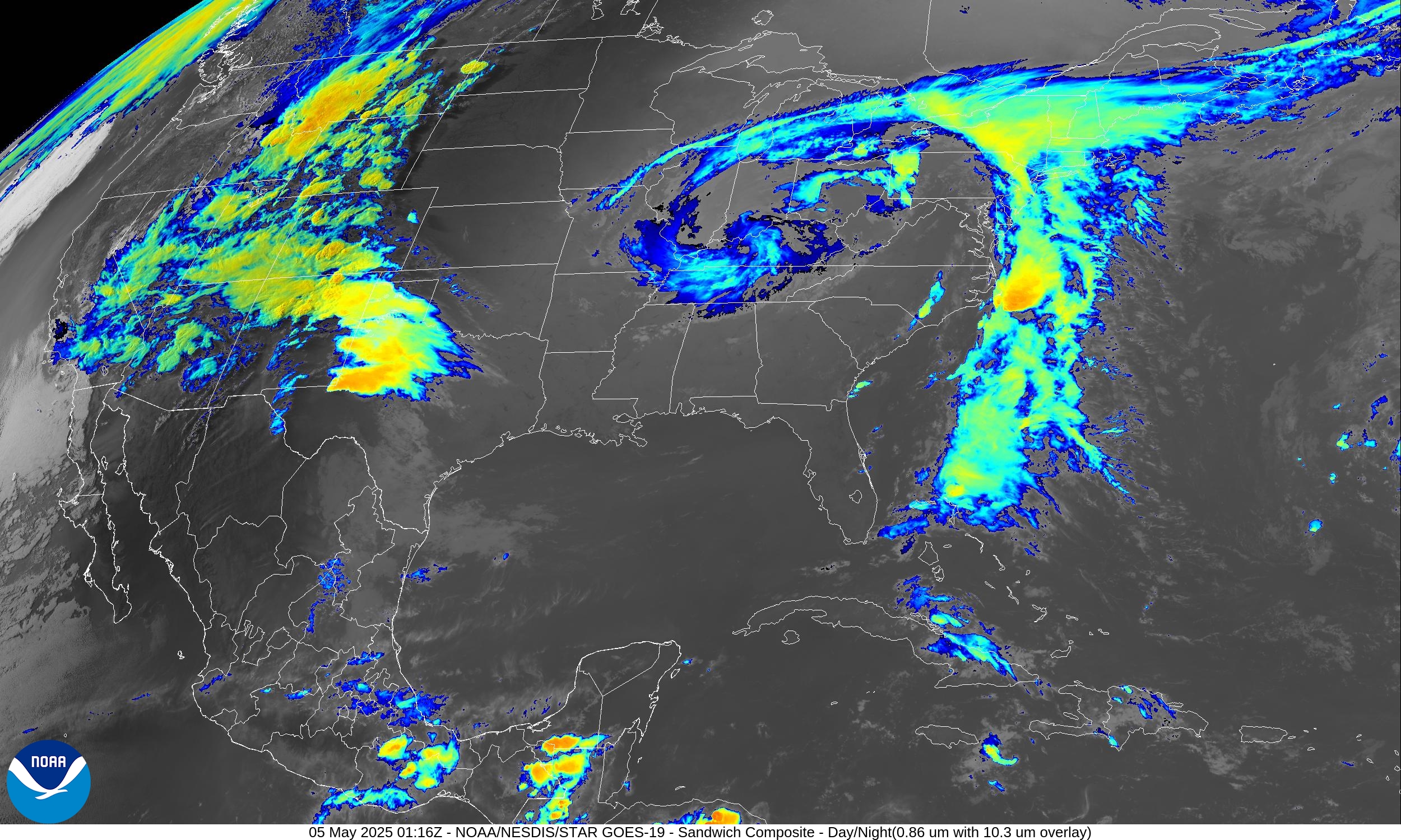
Cool satellite image showing the two cut-off troughs … and the convection leading to hail in severe warned storms.
Opportunity to show the Arizona radar map
Phoenix Sky Harbor has dodged the rain so far … but storms to the west will moisten the metro.
All new paid subscribers can use this coupon link to receive 20% off the Newsletter and receive all daily updates heading into hurricane season.
Low Temperatures on Monday
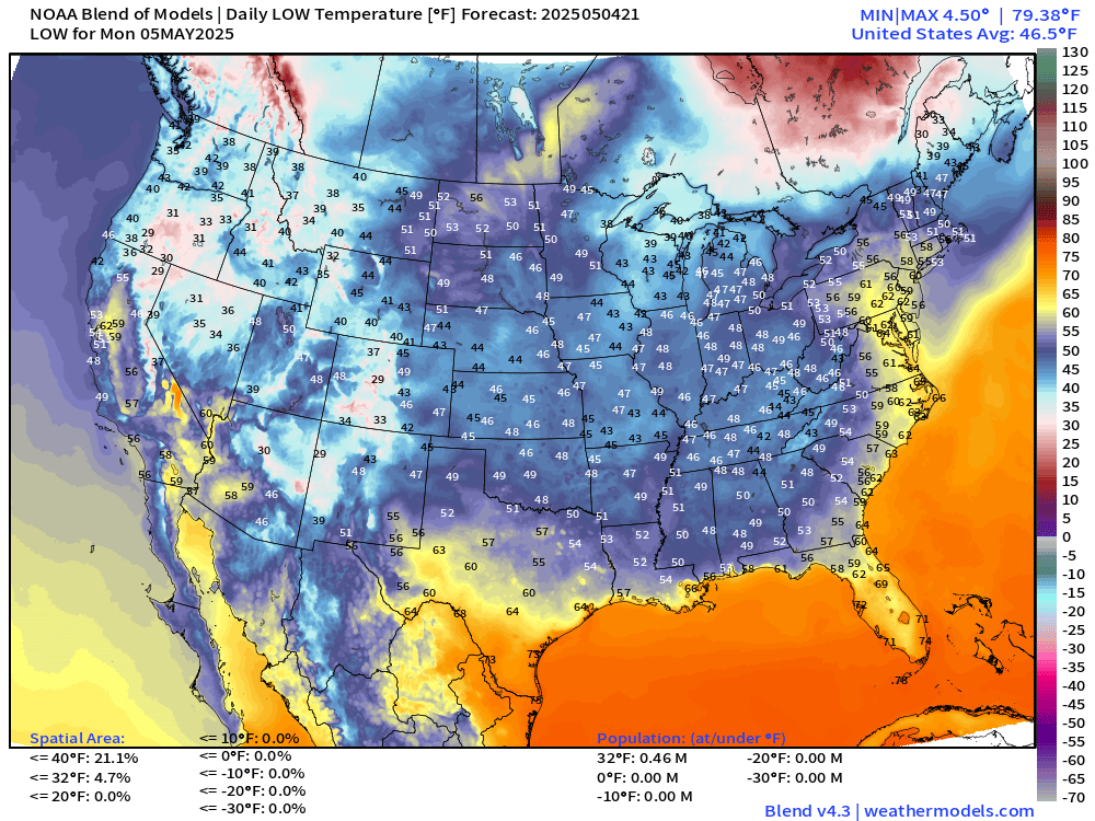
40s quite popular from the Plains to the Southeast!
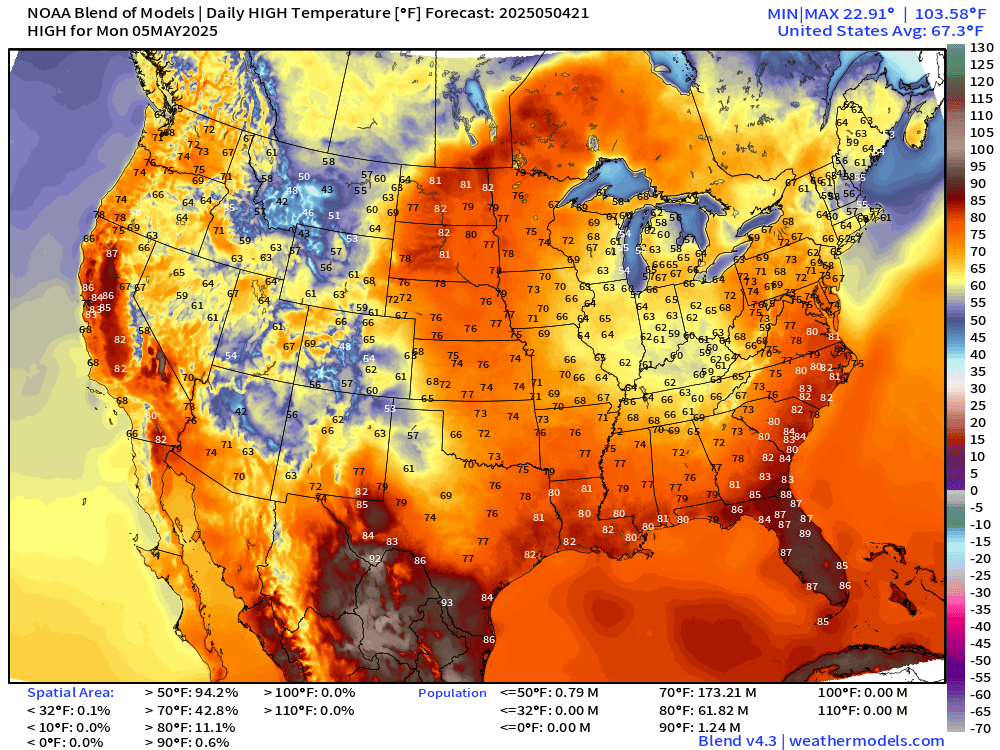
High Temperatures on Monday
High Temperatures Next 9-Days
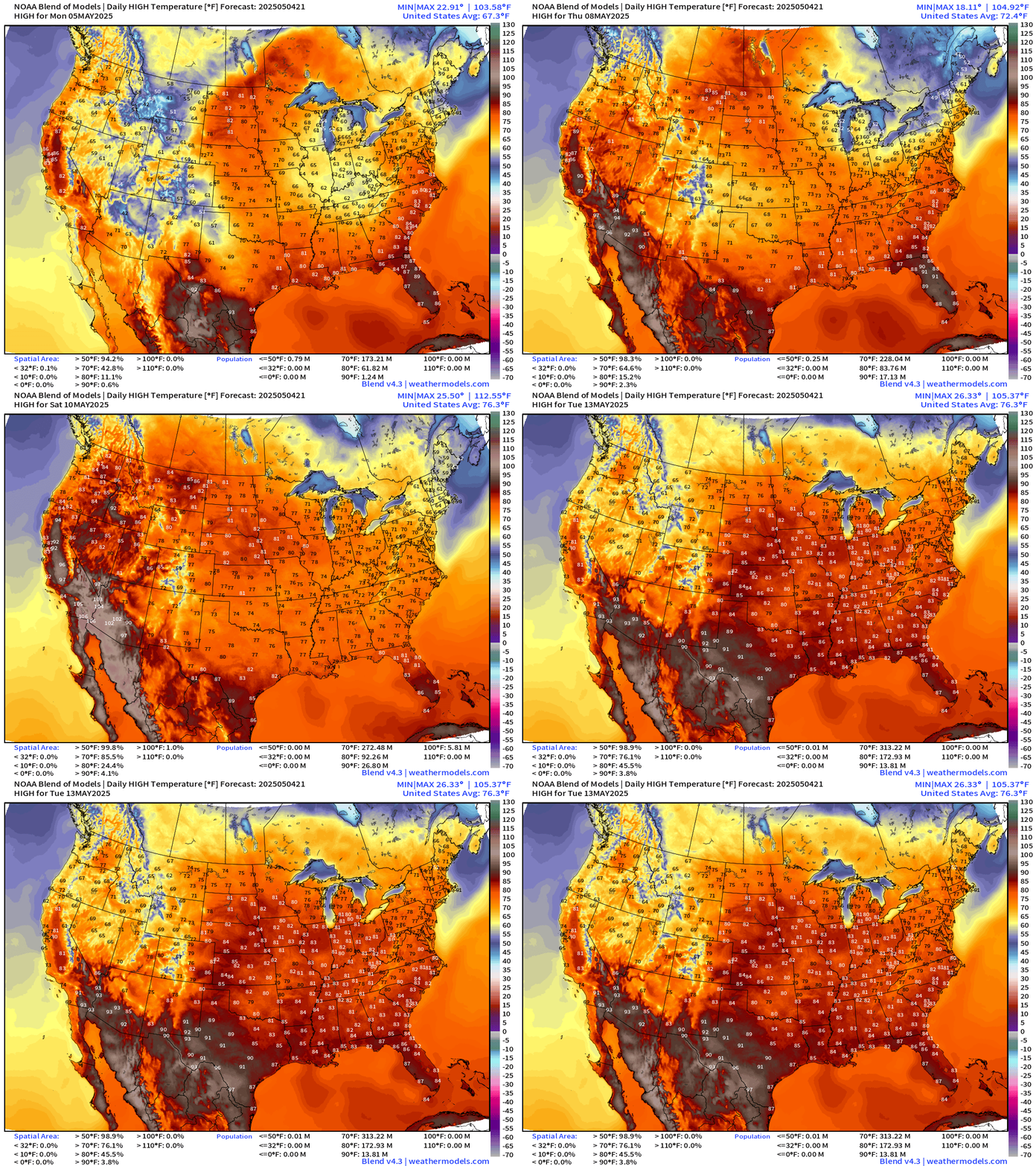
Slow warming day after day but only “heat” in the Southwest where it’s quite typical. However, before we get to the 100s in Phoenix again, we’ll see clouds and rain with highs in the 70s — maybe only the 60s in Vegas on Monday.
Then, by next weekend, coast to coast 70s and lower 80s as the Lower 48 warms into mid-May.
Precipitation and MSLP Next 6-Days | ECMWF 18z
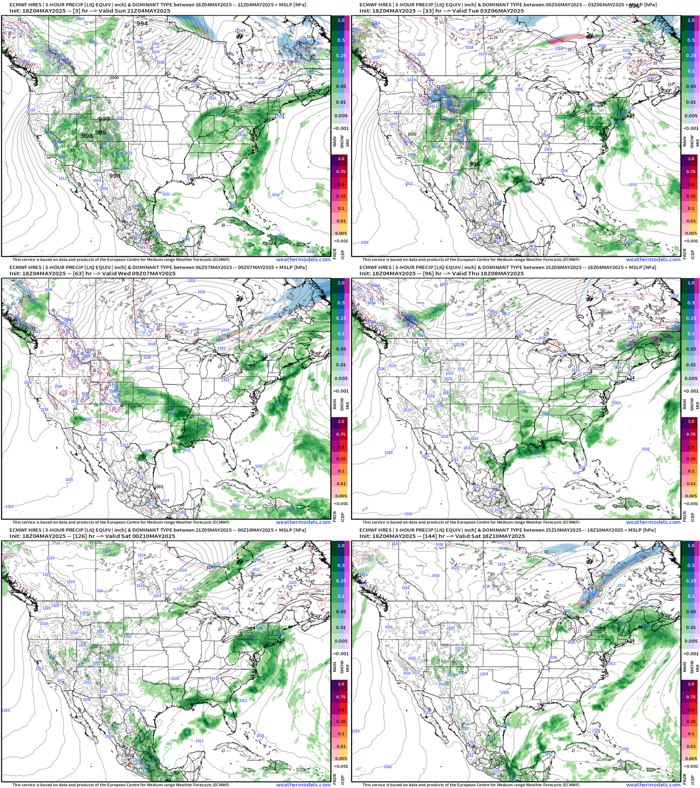
An omega block is typically very dry for the hump portion but the curly cut-off lows are slow moving, rain producers where an ocean can be tapped for moisture. That’s the case for the mid-Atlantic and Northeast with a river of moisture off the Atlantic inland adding up to 2-3” of total rain in just the next 3-days.
NWS Rainfall Next 72-Hours
NOAA Blend of Models Precipitation Next 10-days
Upper Level Weather Pattern | Height Anomaly next 10-days
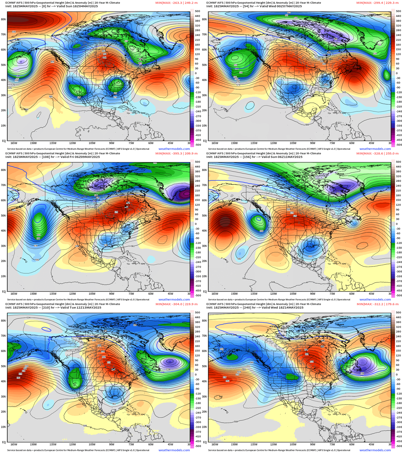
It’s becoming difficult to ditch these upper-level troughs spinning out of Canada and the North Pacific. Unless you’re lucky and underneath the ridge part of the block, it’s gloomy and wet. AIFS forms another Omega block!
ECMWF EPS 12z | Weekly Temperature Anomaly
Week 1: May 4 - 10
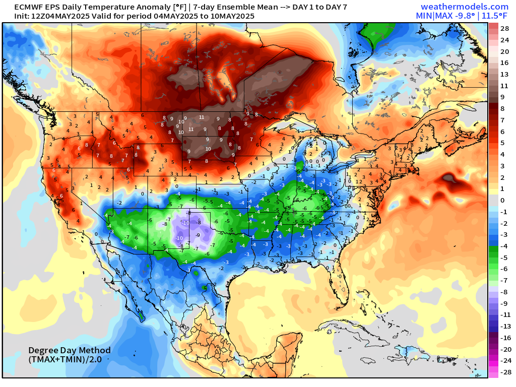
Significant negative temperature anomaly (-8°F) centered on North Texas extending to the Great Lakes.
Week 2: May 11 - 17
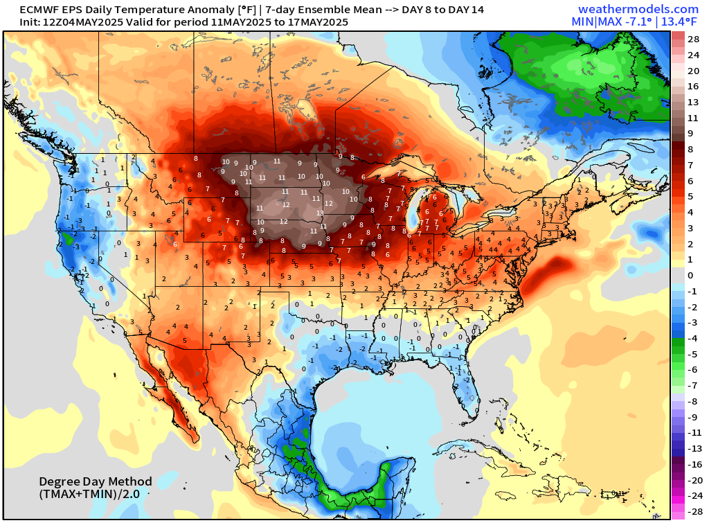
Still below normal (slightly) across the Gulf Coast. Much warmer than normal across the Dakotas and northern Plains.
Maps sourced from weathermodels.com designed and innovated by yours truly! Please subscribe there for real-time access to the newest maps, charts from all of the weather models including ECMWF.
- Milepost
- 596 · laid 2025-05-05T01:51:06.430000Z
- Source
- https://weather.substack.com/p/may-4-2025-sunday-weather-update
- Digest
- c5320a2a779960ed9ccf75046ad34569cdd90a8f5cd723ab44eff15a5658113c
- Machine
- JSON