May 3, 2025 Saturday Weather Update
Omega block to bring wacky early May weather pattern
May 2025 was the 27th-warmest May in the 132-year national record (1895–2026), at 61.7°F against a 1991–2020 normal of 61.0°F (+0.7°F).
May 2025 was the 12th-wettest May in the 132-year national record (1895–2026), at 3.7in against a 1991–2020 normal of 3.1in (+0.6in).
NOAA/NCEI Climate at a Glance, contiguous United States. This is the observed record for the month, not a score of anything said in this piece — the forecast ledger begins 2026-08-17 and cannot reach earlier posts.
Kentucky Derby this evening around 7 PM in Louisville will be soggy after 1-inch of rain falls today with temperatures in the lower-60s. We’ll see how the descendants of Secretariat operate on a muddy track. Favorite is “Journalism” at 3-1, but Grok suggests Coal Battle (30-1) for value as an underdog pick for place or show.
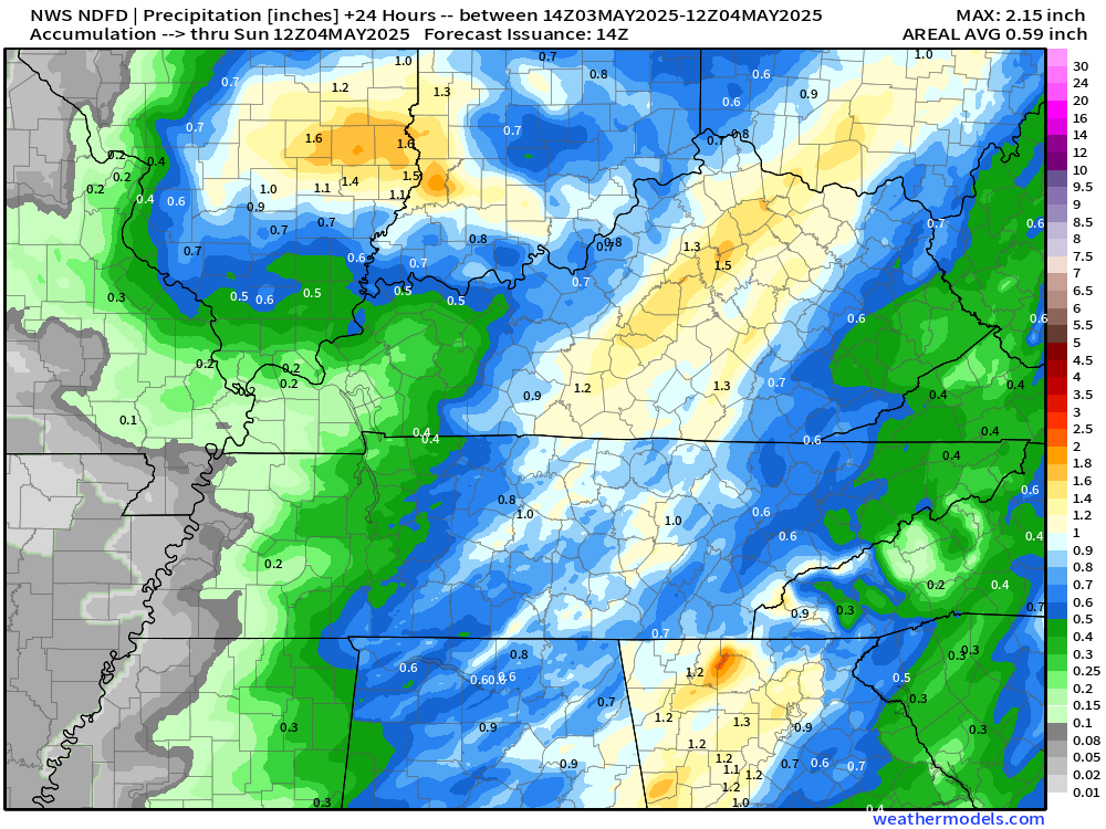
NWS Rainfall Today > 1” up to 2” in Illinois and Kentucky, North Georgia
Radar through 11:30 AM ET
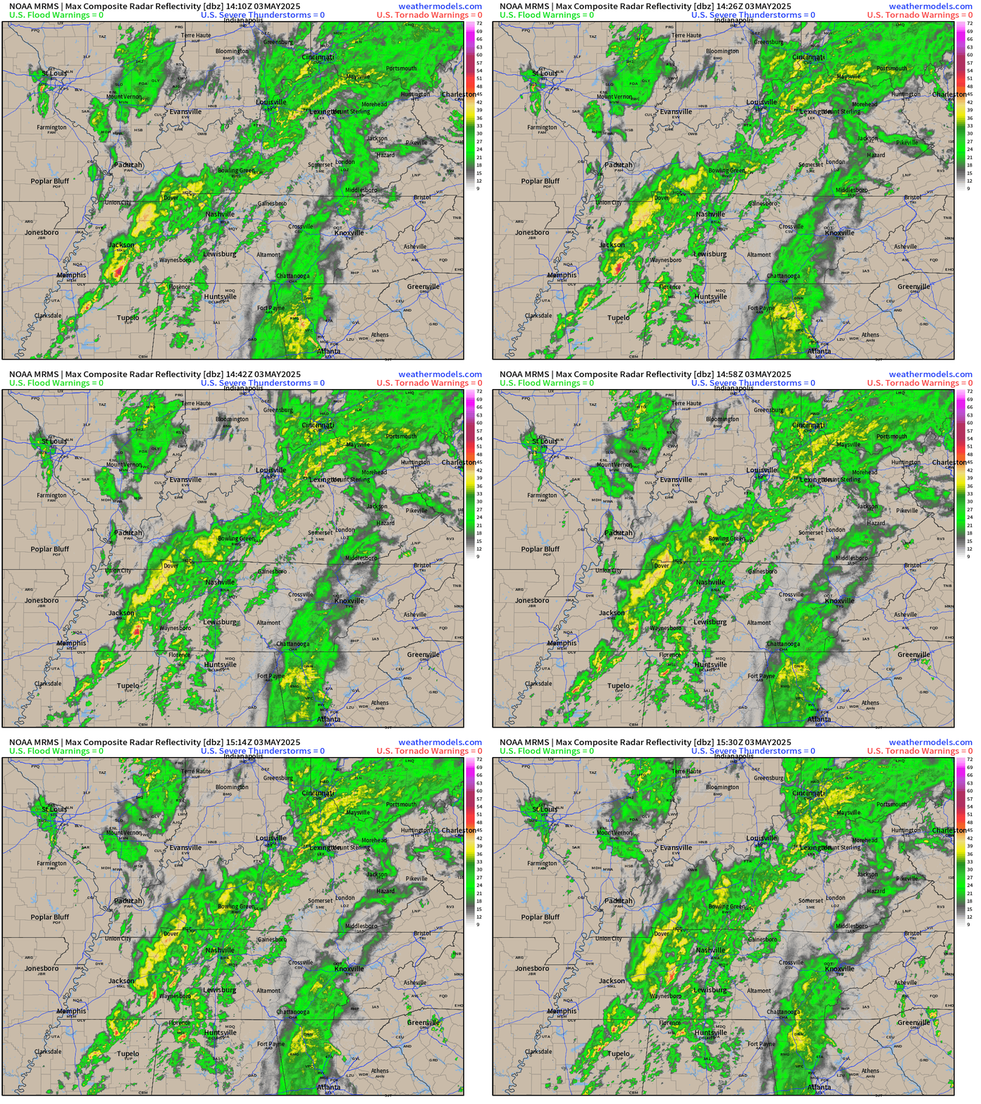
A wave of rainfall in western TN will make it to Louisville in the early afternoon and be a steady drenching. At the tail end of this frontal boundary associated with the cut-off low development, gloomy cool conditions through Georgia into North Florida.
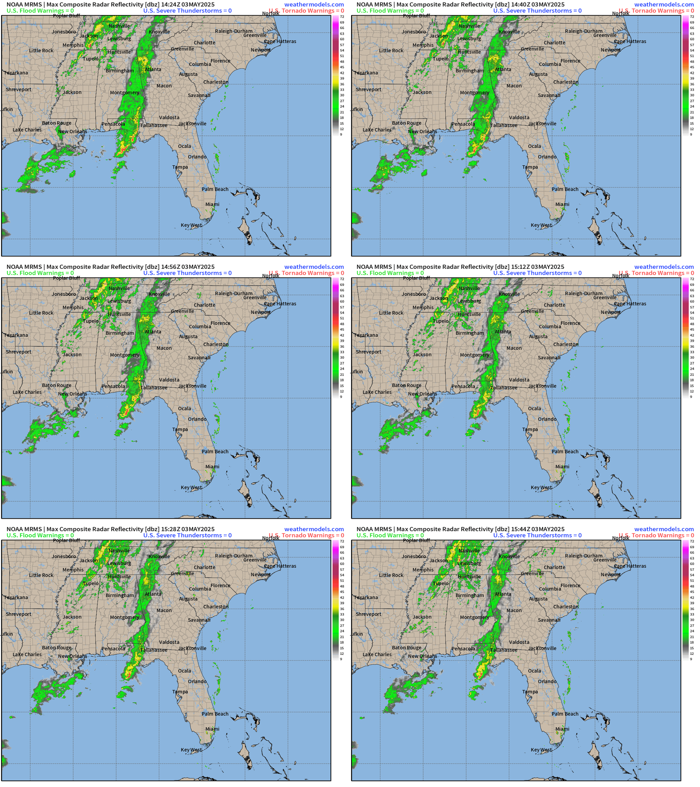
Today’s Weather
HRRR next 18-hours through 3 AM ET on Sunday
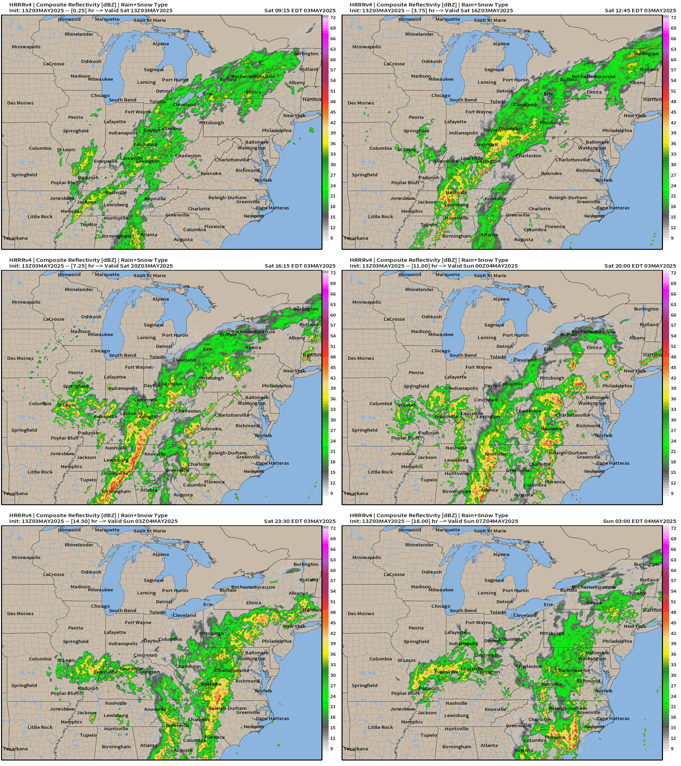
A mid-level and surface circulation will spin over southern Illinois into Kentucky this afternoon with a band of heavy showers and storms developing on the southern pinwheel periphery. Some of these could become briefly severe with small hail.
Frontal Boundaries this Evening 8 PM and Weather on Saturday
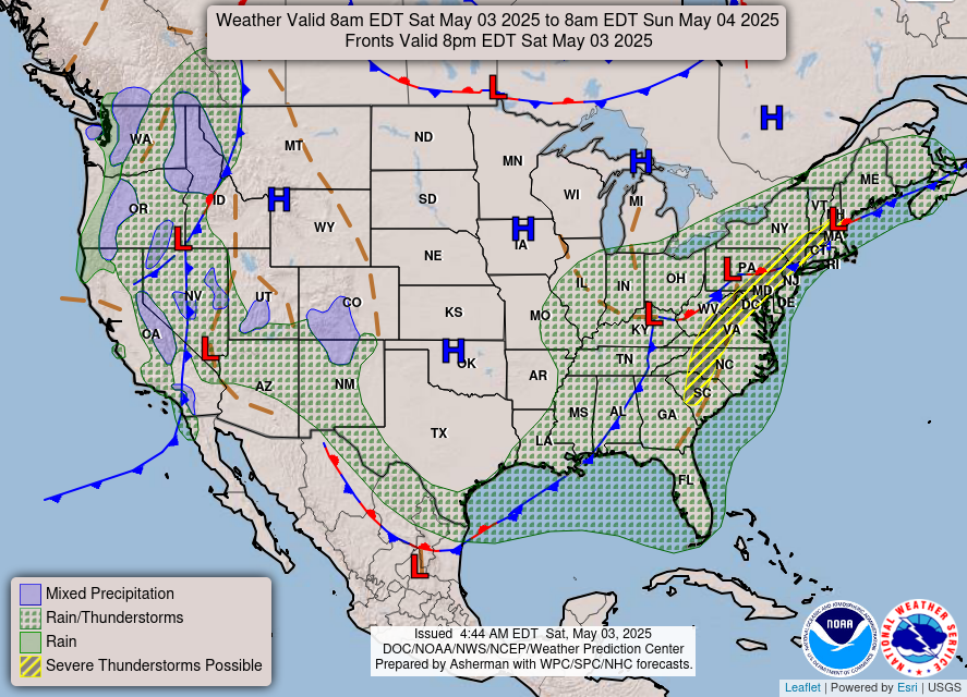
The risk for severe thunderstorms is Slight according to SPC. The rain and clouds will keep temperature down in the Southeast but we’re already pushing into the 80s from D.C to Boston this morning!
Temperature Analysis | 11:15 AM ET
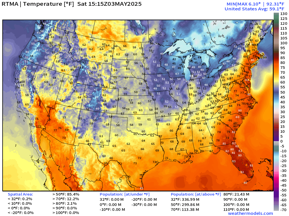
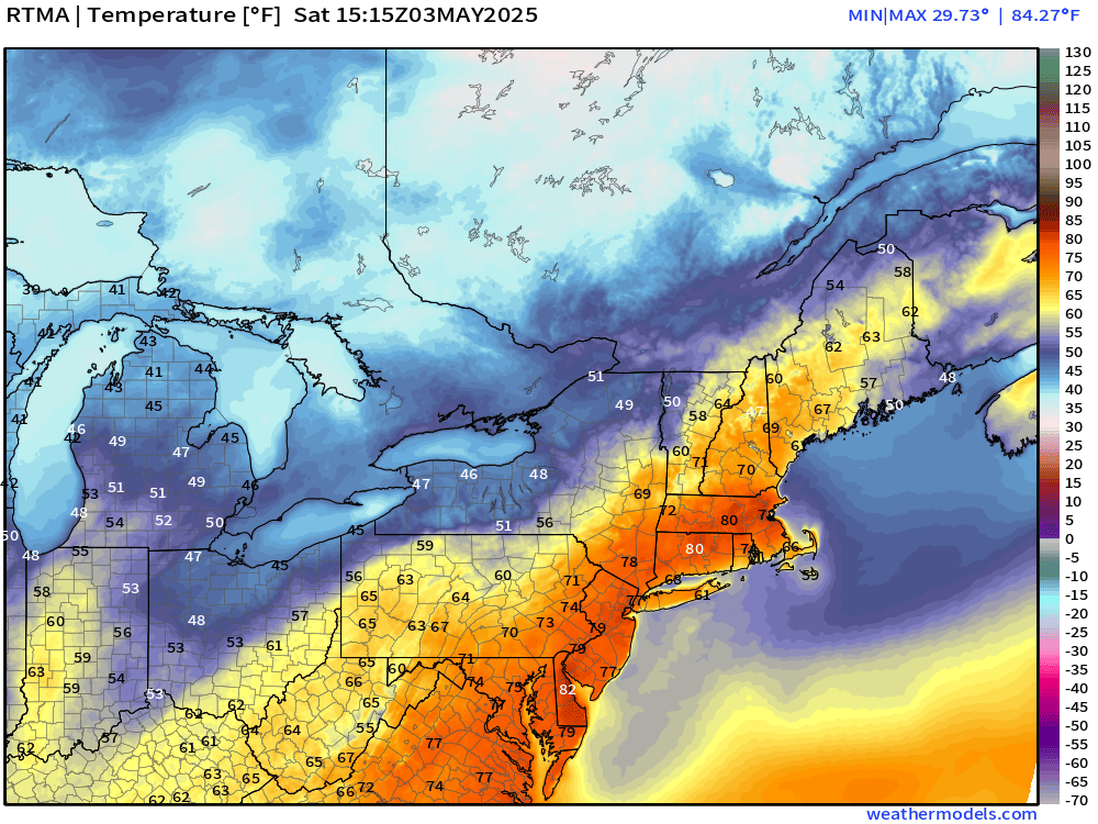
Check out the 70s and 80s from D.C. to NYC and Boston. Must feel wonderful especially on a weekend day!
Temperature Anomaly | 11:15 AM ET
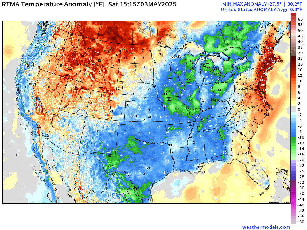
Overall the Lower 48 is -0.9°F below normal
Today’s High Temperatures | Saturday
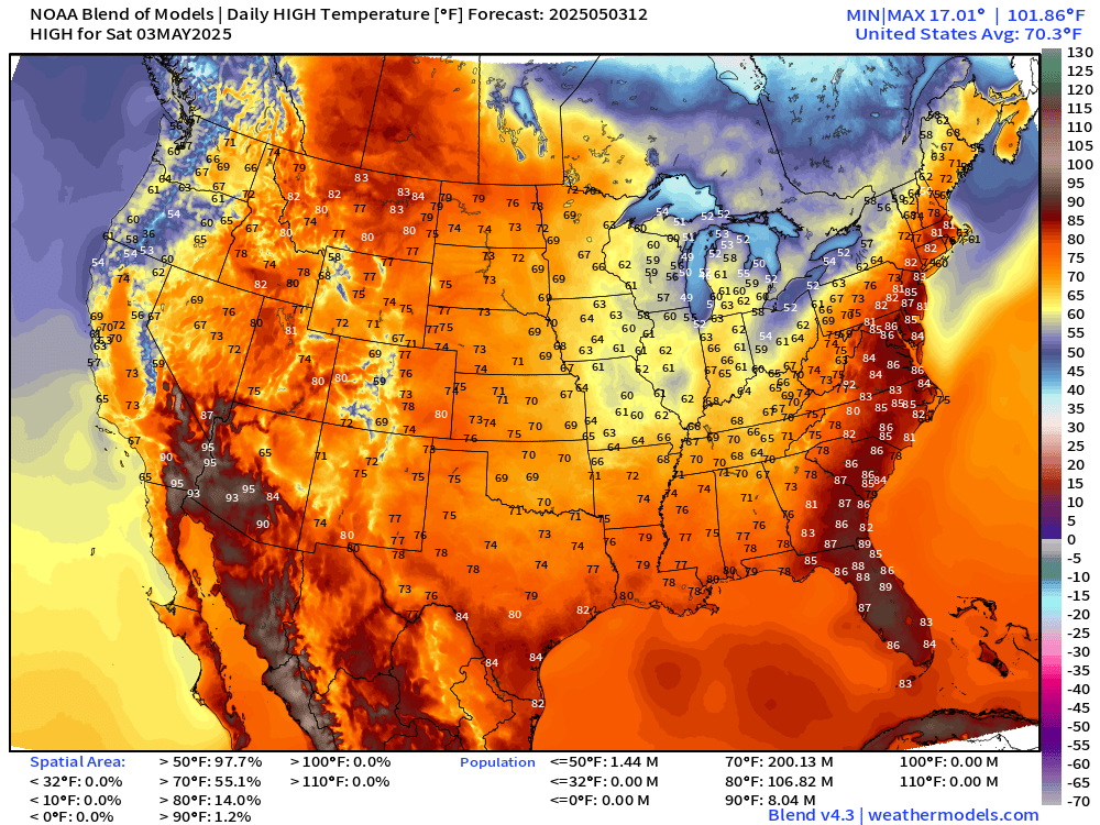
Well into the 80s in Montana and the Canadian Prairies. Also in the mid-80s along I-95 from Florida to Boston, MA. Comfortable 60s and 70s elsewhere including Dallas, St. Louis and Nashville. Where the clouds have vacated, 60s and 70s with brilliant May sunshine!
Satellite Imagery this Morning
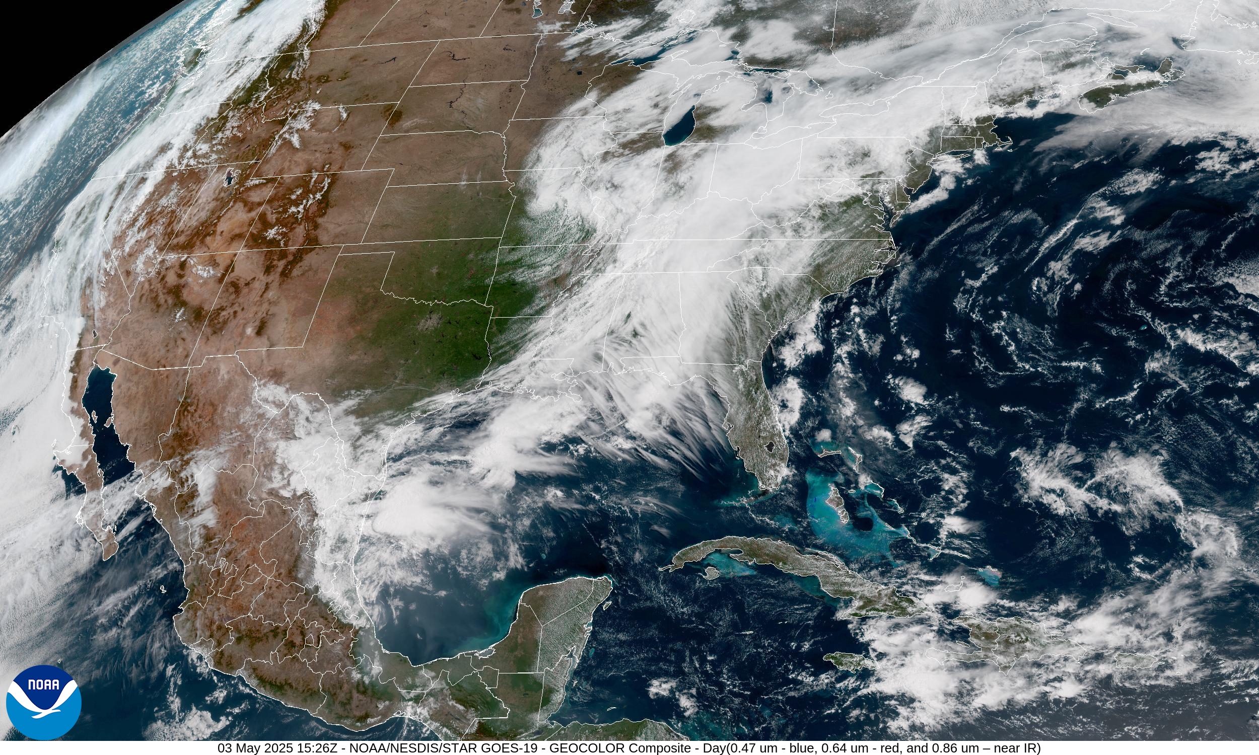
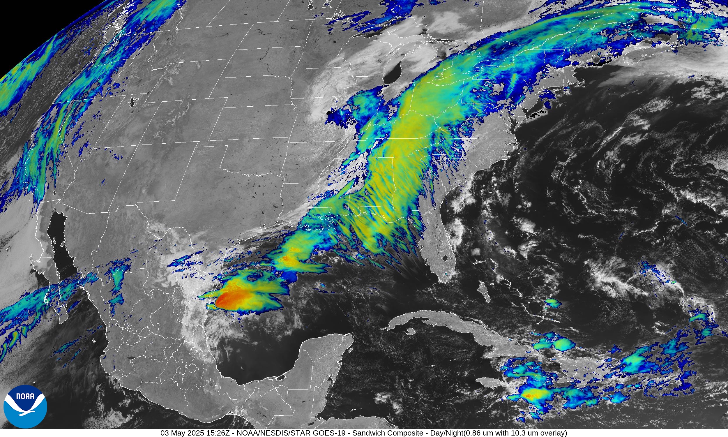
The entire Plains have cleared out beneath high pressure and ridging of the Omega Block. A lot of upper-level divergence in the Southeast is showing up with wispy clouds at upper-levels streaking across Florida panicking the geoengineering crowd.
The Rockies are clear as well. All of that sunshine and dry air will help growers prepare for planting!
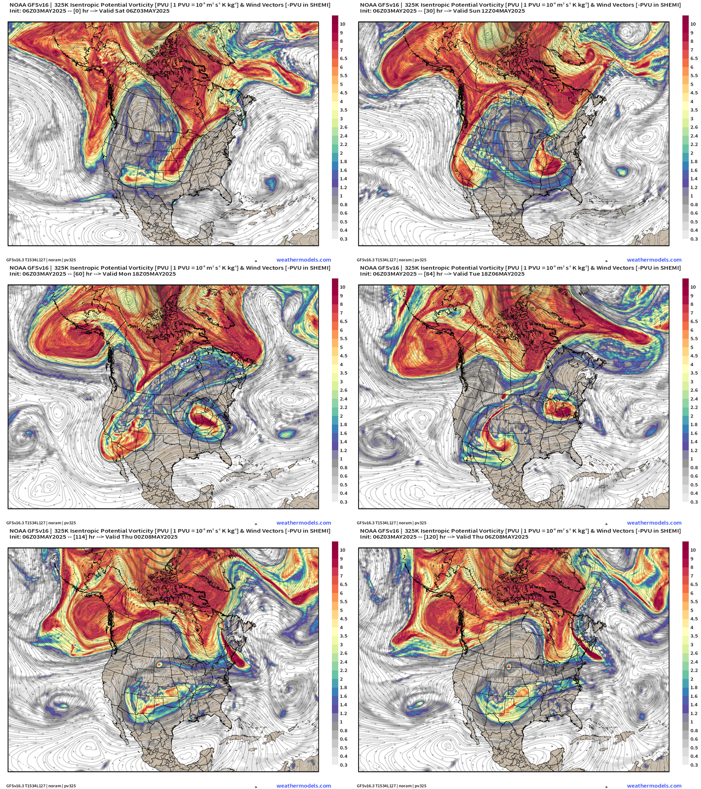
Ridge over 2 Cut-off Trough — Omega Blocking Pattern
This animation with Potential Vorticity on the 325K Isentropic level shows well the upper-level wave breaking from the main upper-level circulation into 2 cut-off lows that spin independently for a few days. GFS model depiction probably has higher error that normal but we can use this for the summary over the next few days.
Often with the breakdown of one cut-off low with an omega block another one takes its place but moves a 1/4 wavelength upstream (Rossby wave breaking dynamics).
Simulated Water Vapor Satellite next 6-days
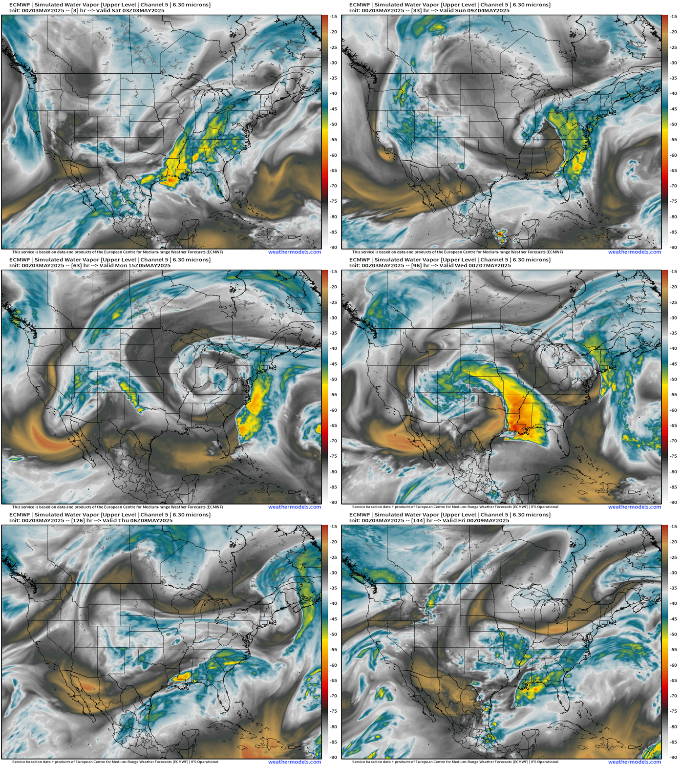
Very dry air out of Canada will be advected well south into the Gulf coast around the cut-off low over the Ohio River Valley.
Once the Southwest U.S. cut-off ejects eastward, a huge convective event (Sever weather looks likely across Texas late Monday into Tuesday. This will be a tornado + large hail threat.
All new paid subscribers can use this coupon link to receive 20% off the Newsletter and receive all daily updates heading into hurricane season.
Low Temperatures on Sunday
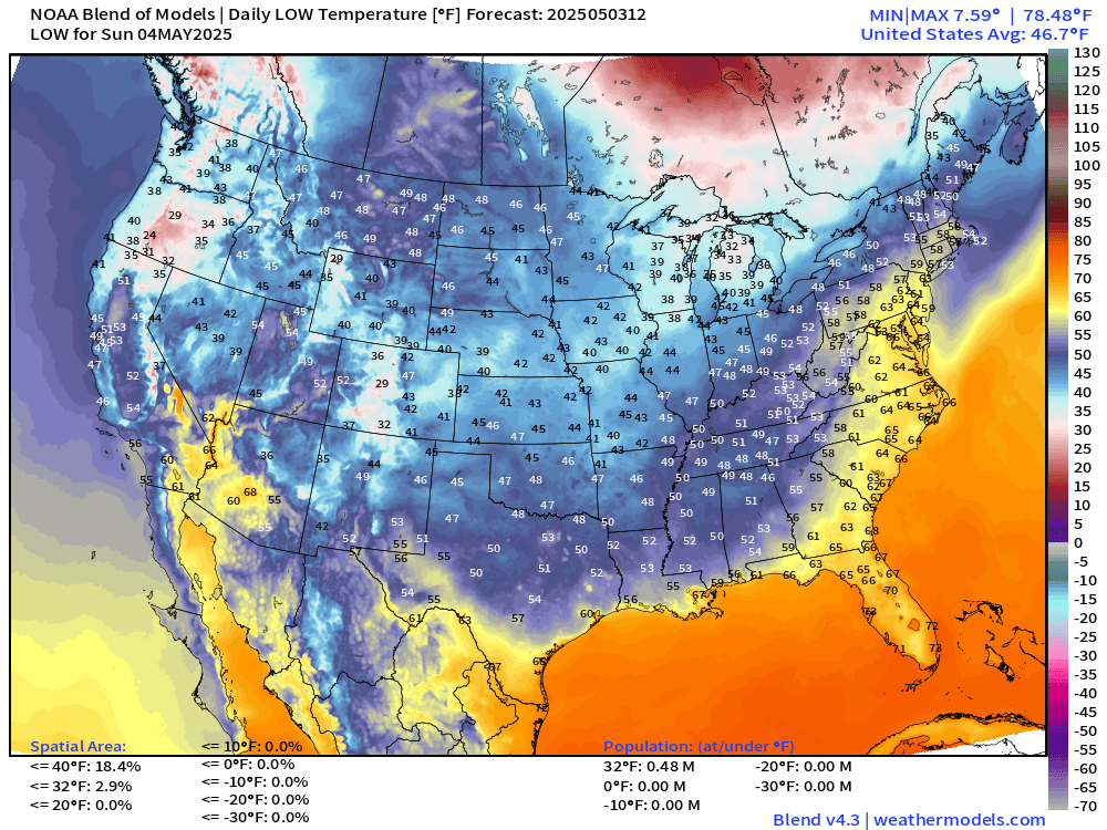
Still a handful of folks in northern Michigan and Oregon below freezing … about 1/2 million.
High Temperatures on Sunday
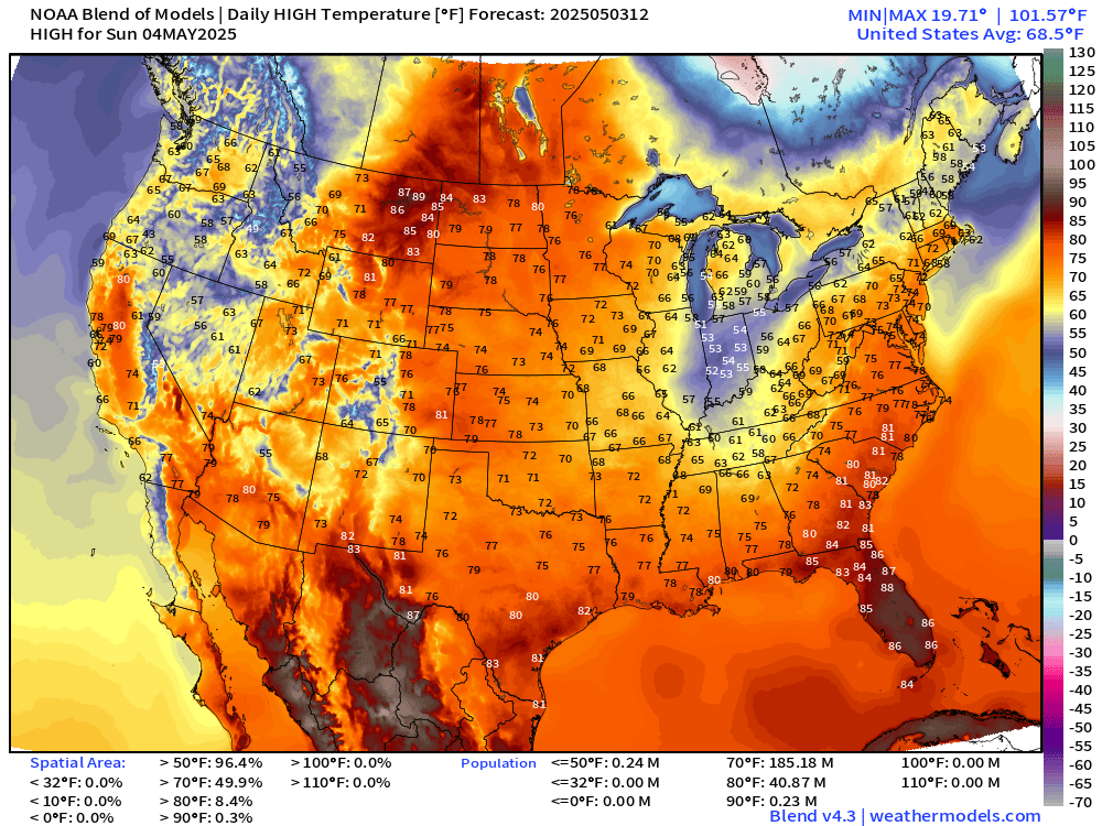
Clouds and gloom will keep temperatures down in the 50s across Indiana. Sunshine and cool air elsewhere with 60s and 70s dominating the Lower 48 from the West Coast to New England. Astounding cool/comfortable pattern for early May with only 41 million at 80°F+.
High Temperatures Next 9-Days
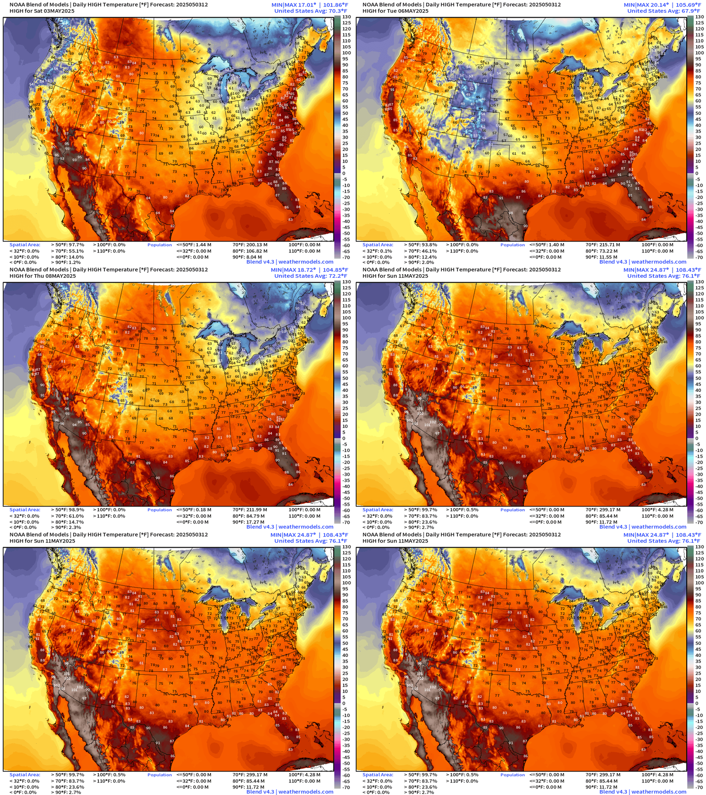
Slow warming day after day but only “heat” in the Southwest where it’s quite typical. However, before we get to the 100s in Phoenix again, we’ll see clouds and rain with highs in the 70s — maybe only the 60s in Vegas on Monday.
Then, by next weekend, coast to coast 70s and lower 80s.
Precipitation and MSLP Next 6-Days | ECMWF 06z
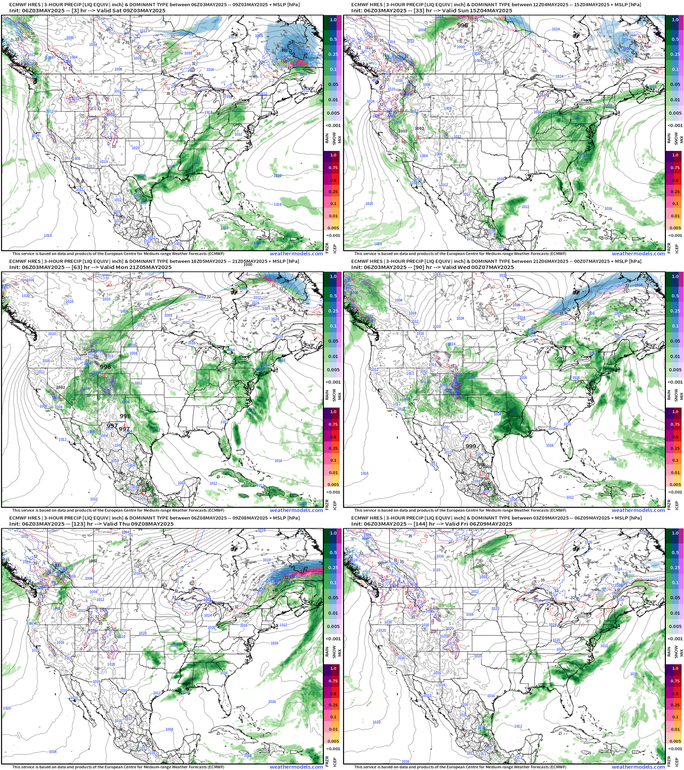
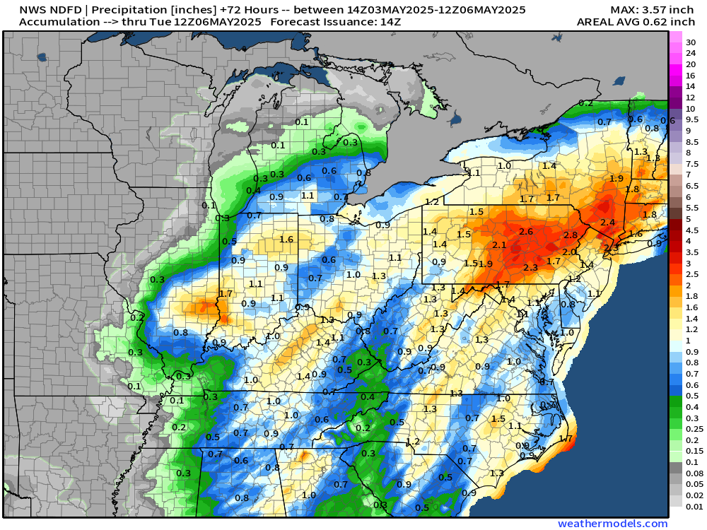
An omega block or other ridging pattern is typically very dry for the hump portion but the curly cut-off lows are slow moving, rain producers where an ocean can be tapped for moisture. That’s the case for the mid-Atlantic and Northeast with a river of moisture off the Atlantic inland adding up to 2-3” of total rain in just the next 3-days.
NWS Rainfall Next 72-Hours
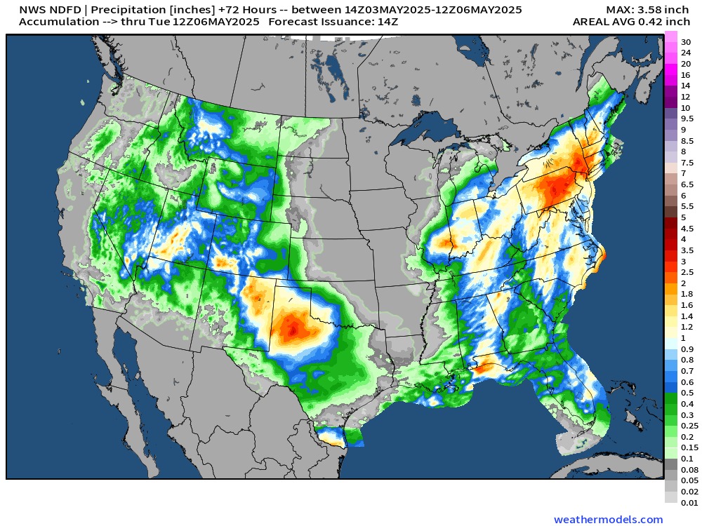
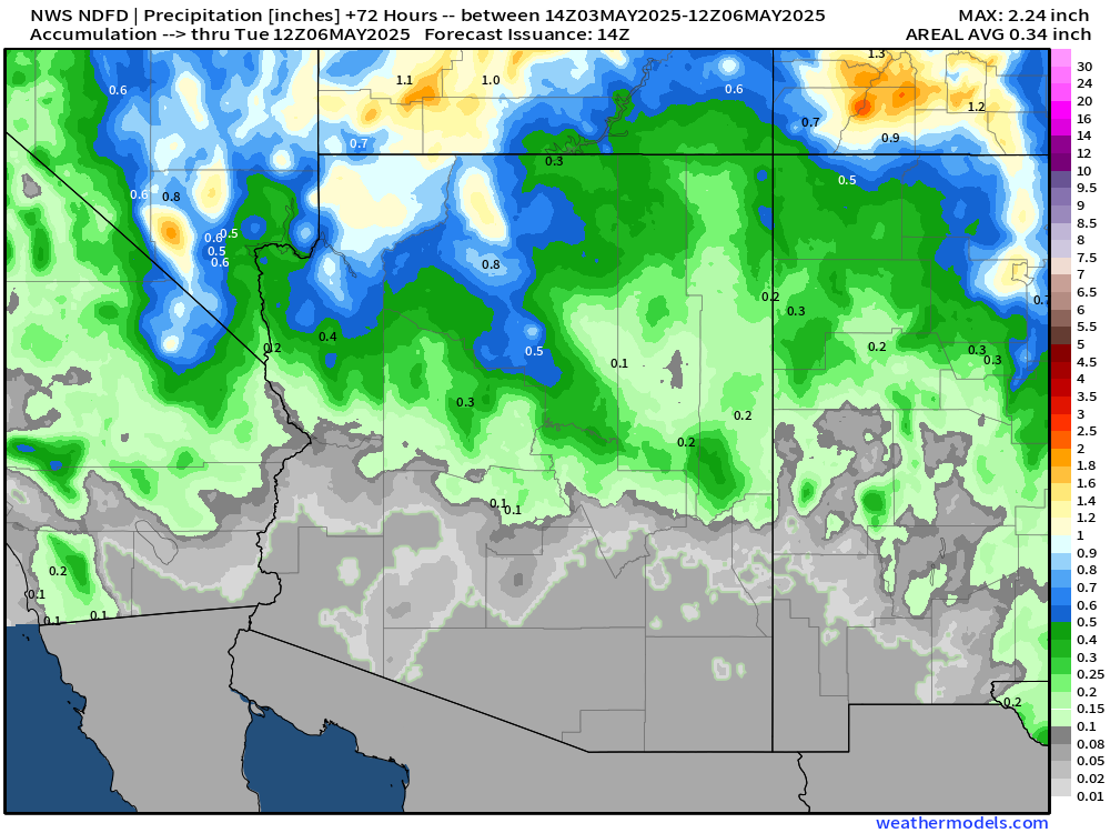
Even Las Vegas with half-inch of rain and a tenth of an inch in Phoenix.
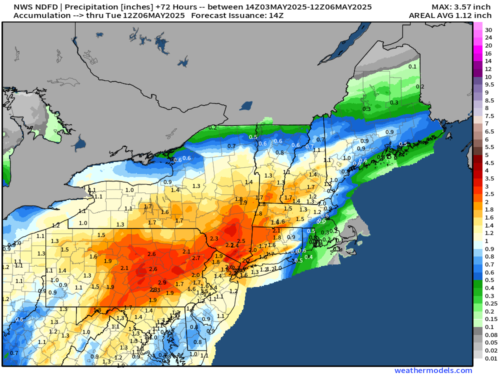
NWS has around 2” in NYC and more in central Pennsylvania.
Quite a large area with more than 1-inch of rain in early May for your grass and garden.
NWS WPC Precipitation | Next 7-days
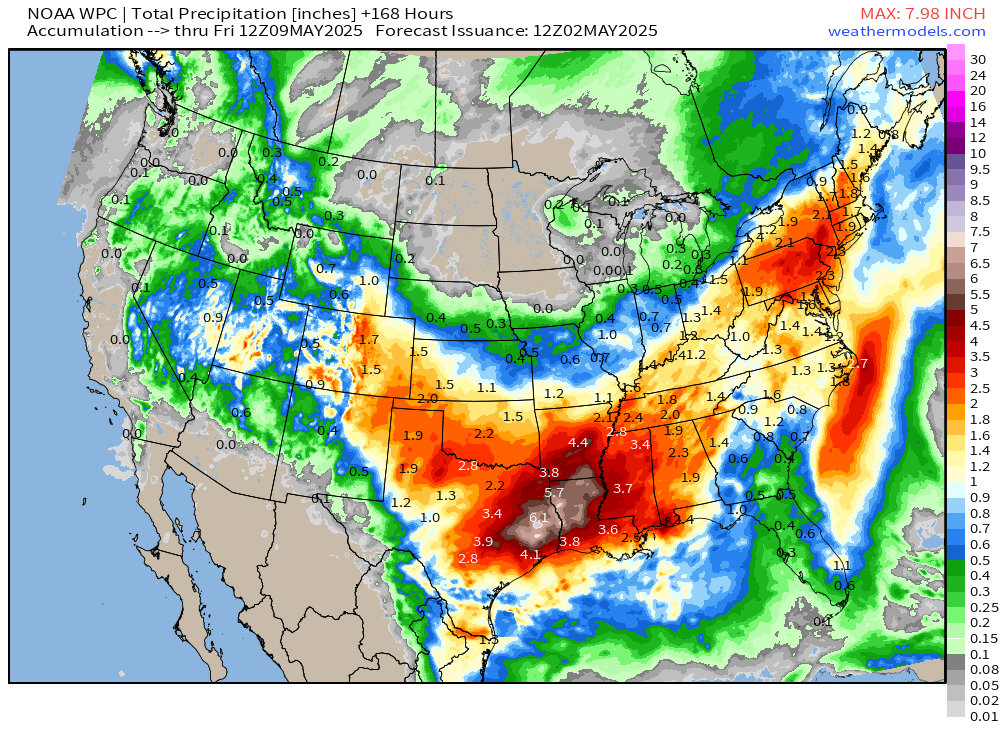
Eastern Texas and Louisiana will be inundated later next week with boatloads of rain over 6-inches.
NOAA Blend of Models Precipitation Next 10-days
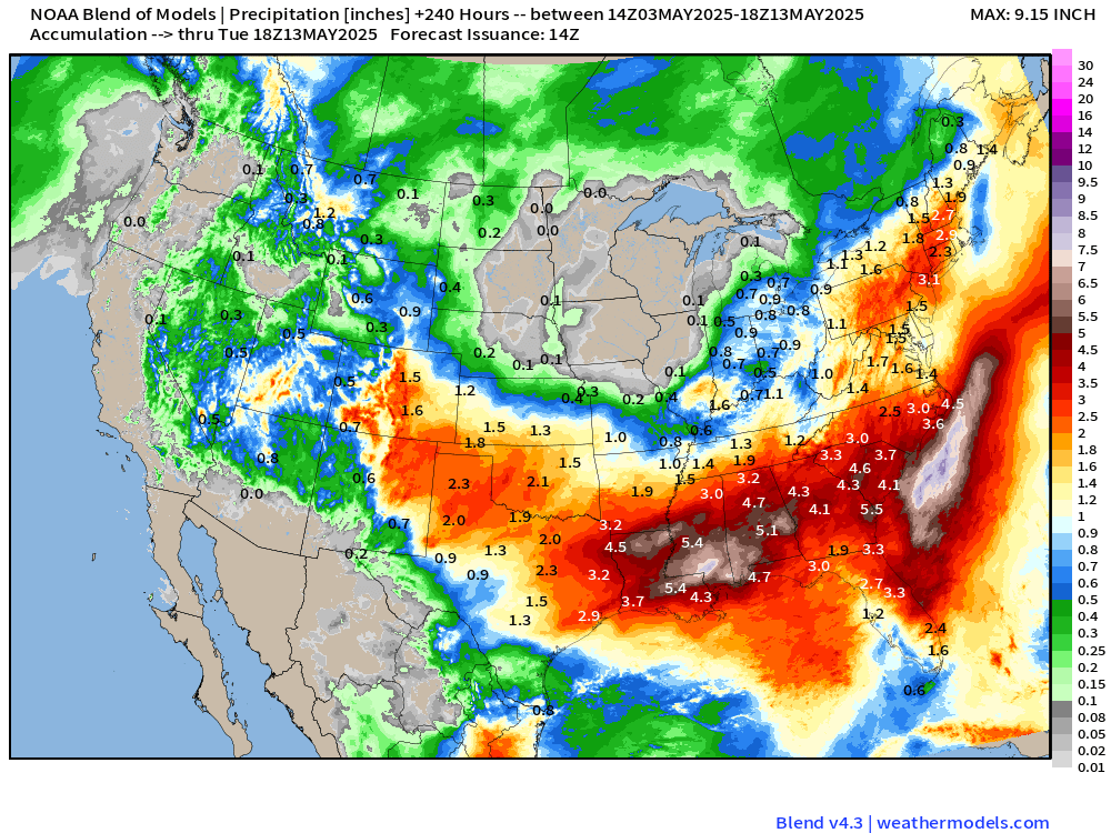
Then that rainfall moves east into the end of the 7-10 period … 4”+ across a wide spread from Texas to South Carolina. Good news is Florida sees some, too!
Upper Level Weather Pattern | Height Anomaly next 10-days
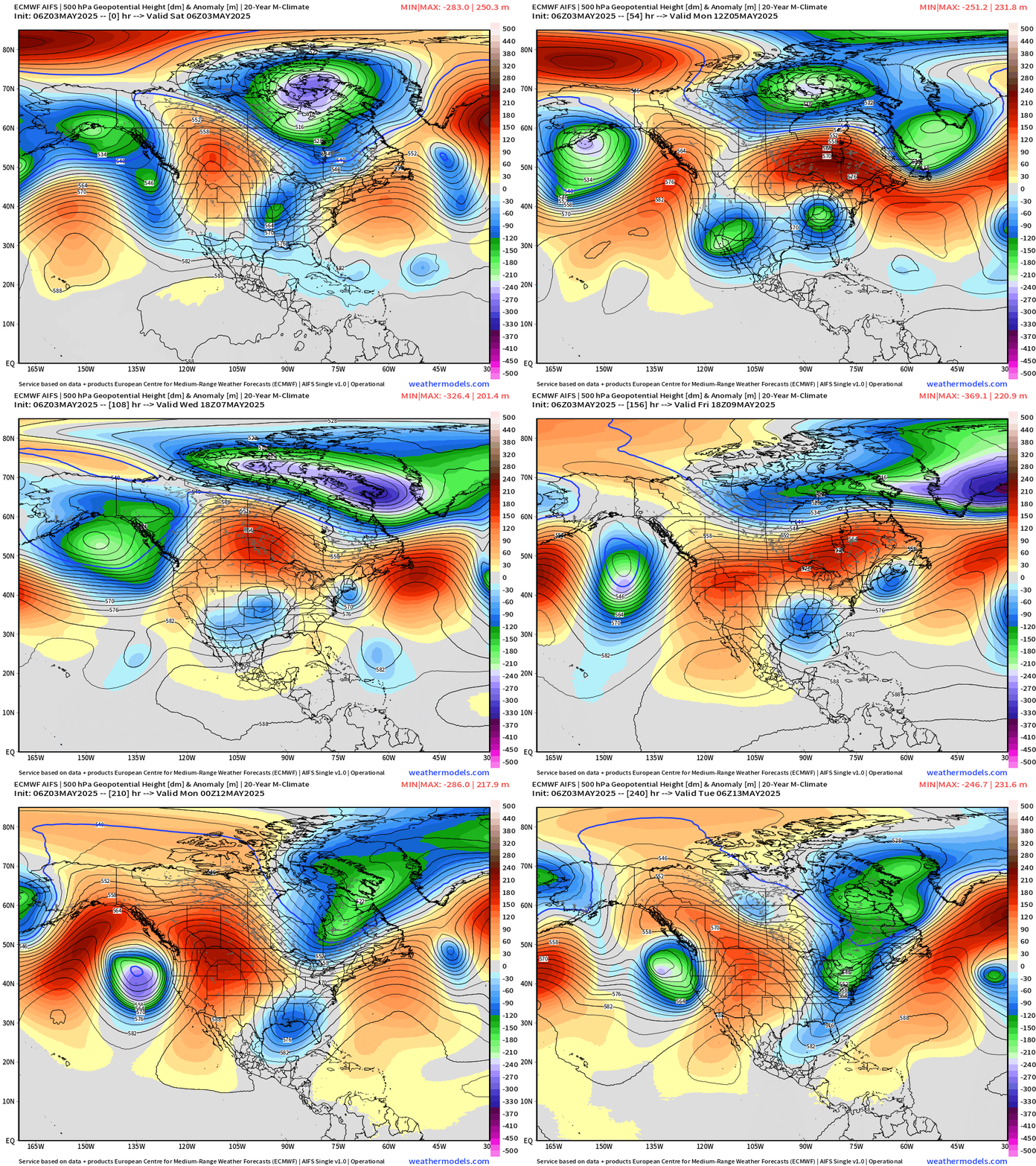
It’s becoming difficult to ditch these upper-level troughs spinning out of Canada and the North Pacific. Unless you’re lucky and underneath the ridge part of the block, it’s gloomy and wet.
ECMWF EPS 00z | Weekly Temperature Anomaly
Week 1: May 2 - 8
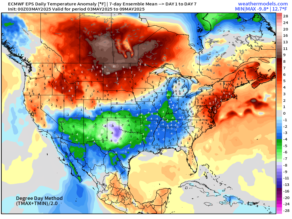
Significant negative temperature anomaly (-8°F) centered on North Texas extending to the Great Lakes.
Week 2: May 9 - 15
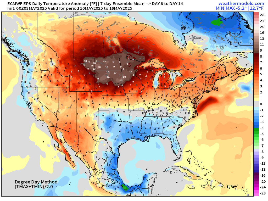
Still below normal (slightly) across the Gulf Coast. Much warmer than normal across the Dakotas.
Maps sourced from weathermodels.com designed and innovated by yours truly! Please subscribe there for real-time access to the newest maps, charts from all of the weather models including ECMWF.
- Milepost
- 595 · laid 2025-05-03T16:16:26.683000Z
- Source
- https://weather.substack.com/p/may-3-2025-saturday-weather-update
- Digest
- 12372a35d0a68ac677a01e73b2c490c2190cbdee8e1d40d56a1198a18499d280
- Machine
- JSON