April 29, 2025 Tuesday Weather Update
Heavy rain again for Oklahoma
April 2025 was the 16th-warmest April in the 132-year national record (1895–2026), at 53.6°F against a 1991–2020 normal of 51.8°F (+1.7°F).
April 2025 was the 31st-wettest April in the 132-year national record (1895–2026), at 2.9in against a 1991–2020 normal of 2.7in (+0.2in).
NOAA/NCEI Climate at a Glance, contiguous United States. This is the observed record for the month, not a score of anything said in this piece — the forecast ledger begins 2026-08-17 and cannot reach earlier posts.
Unlocked / Free Post —> please share [and like] to expand the reach of this Newsletter (Dr. Ryan Maue | Weather Trader)
Plus, a coupon for all new sign-ups.
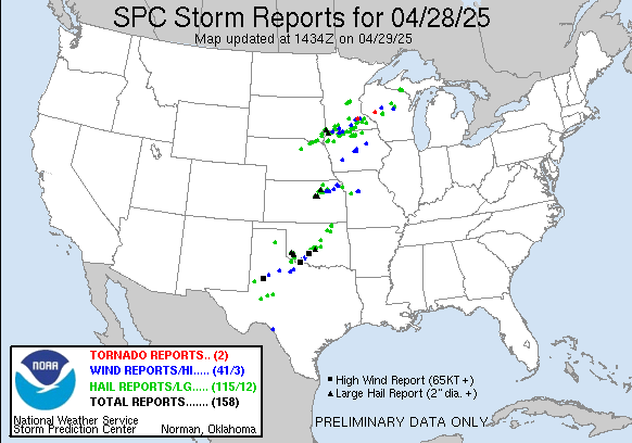
Yesterday’s conditional severe weather outbreak underperformed, and that’s great news for folks in Minnesota and Wisconsin. Only 2 tornado reports out of the “Moderate Risk” issued by SPC. Mesoscale models did show intense supercells but they were sparse and not well organized for a long-duration.
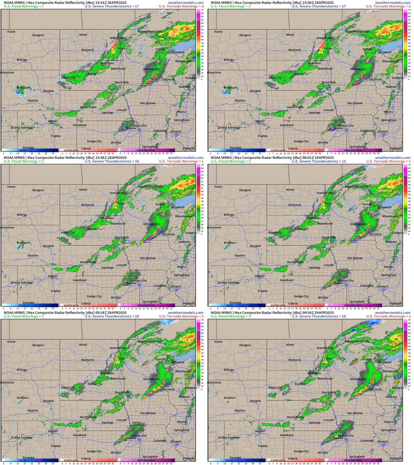
The observed radar from 8:30 PM ET did show a squall line south of Minneapolis trailing back into Nebraska. Many hail and wind reports were along that boundary.
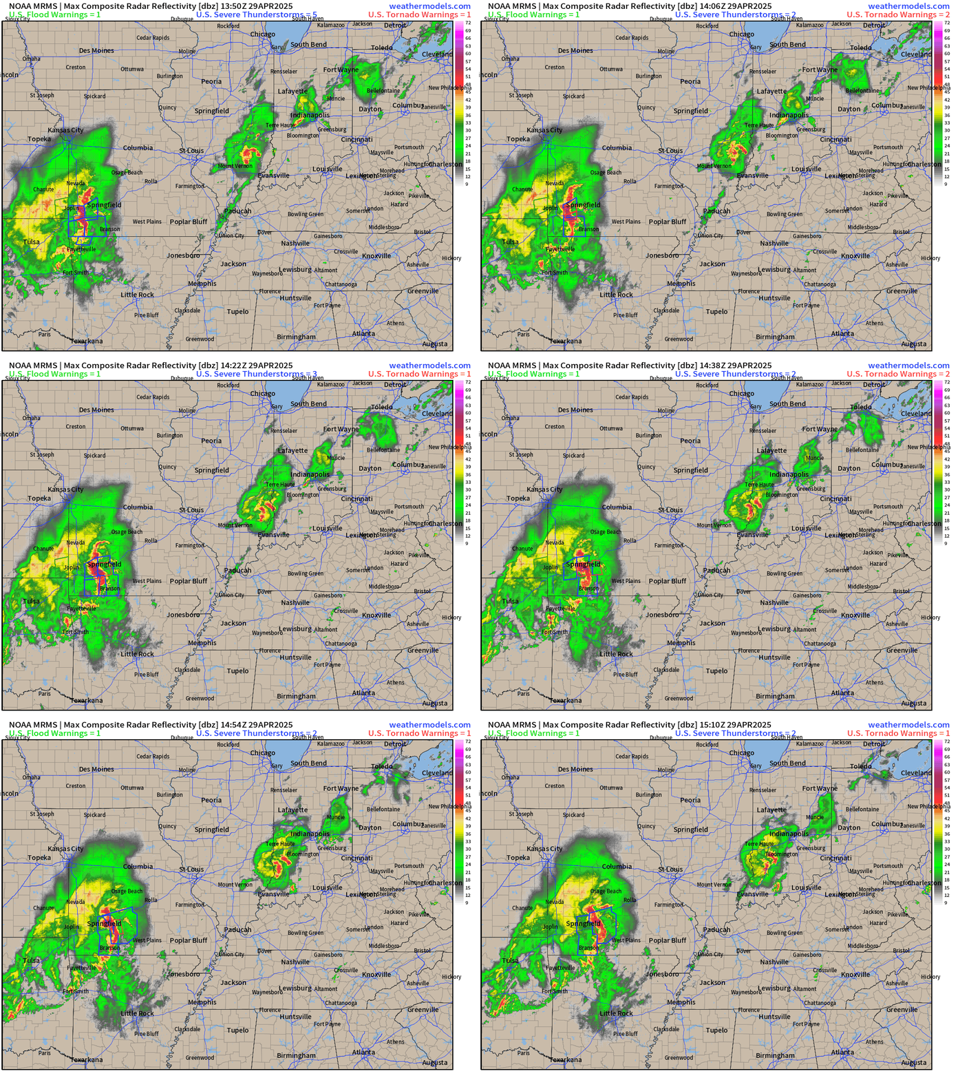
Today’s Radar: 11:10 AM ET
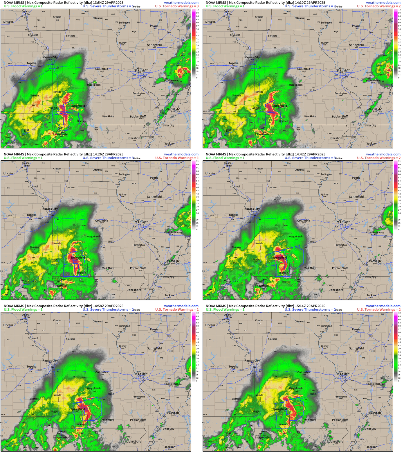
This morning, quite a heavy duty convective complex is rolling through Missouri including Springfield with damaging winds, and earlier tornado warnings. Another small cluster of beneficial rain is in southern Indiana just south of Indianapolis.
The squall line has a characteristic bow shape with some overall rotation typical of Plains MCS type systems.
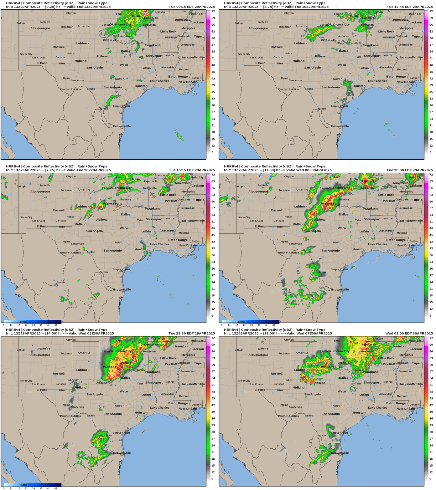
HRRR next 18-hours through 3 AM ET on Wednesday
During the afternoon, more storms blow up in Texas and move NE into Oklahoma along the frontal boundary. Heavy rain and some isolated damaging winds or tornadoes could happen. The Red River Valley again will be the focus of very heavy rainfall.
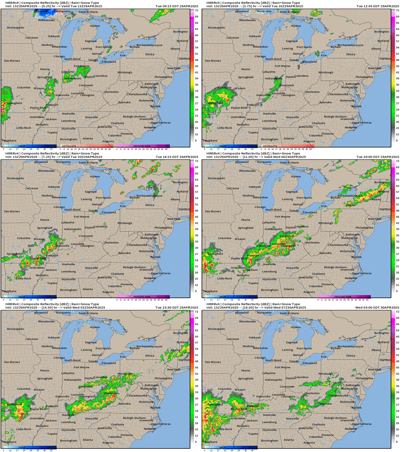
Storms develop in Southern Illinois and move along the Ohio River Valley into the mountains where they fizzle overnight.
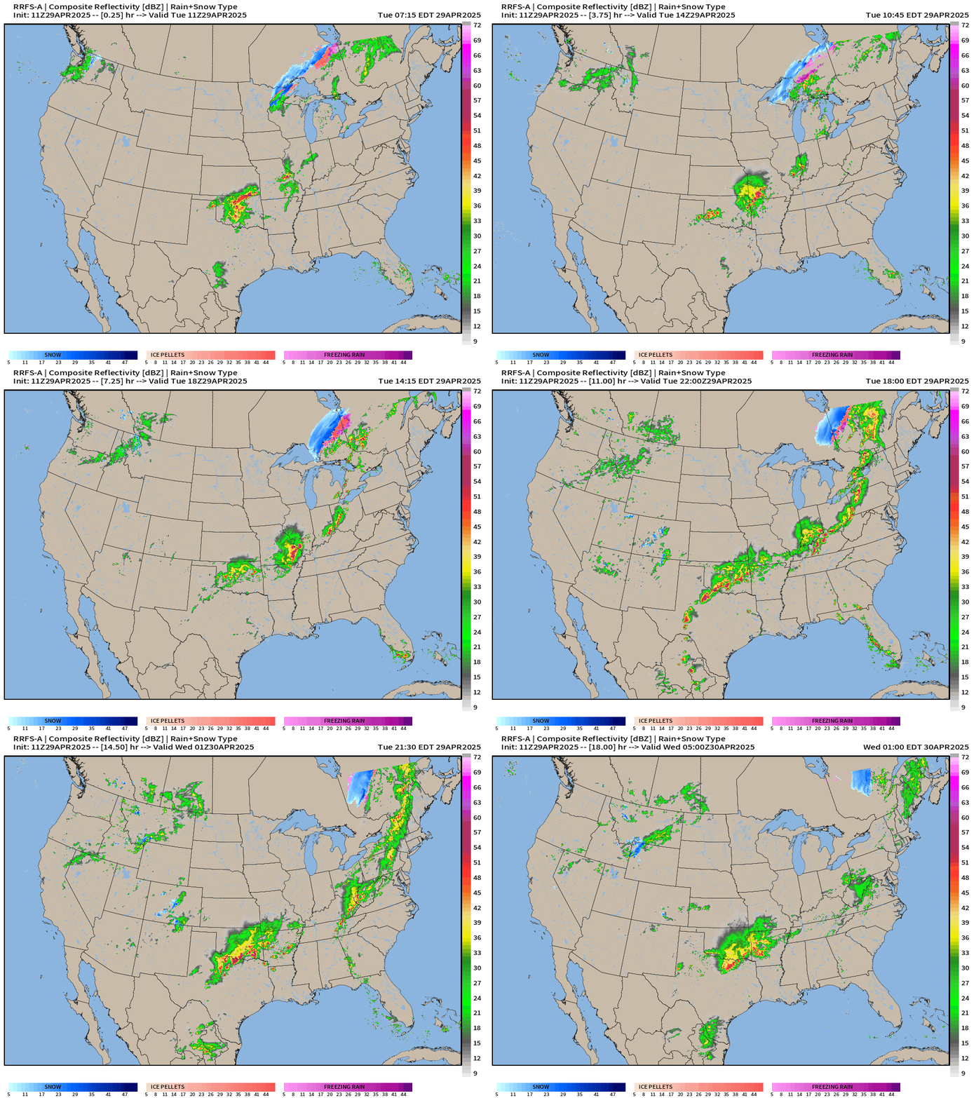
RRFS-A Radar Simulation next 18-hours through Wednesday 1 AM ET
Larger view from the experimental RRFS-A shows the multiple clusters or corridors of storms in the warm sector ahead of the frontal boundary. Snowfall in the UP of Michigan may intensify heading ENE through Canada for the last day of April.
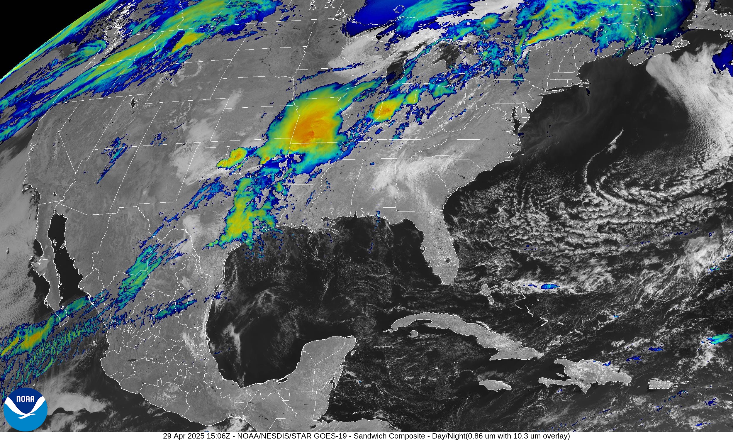
Current Satellite Imagery
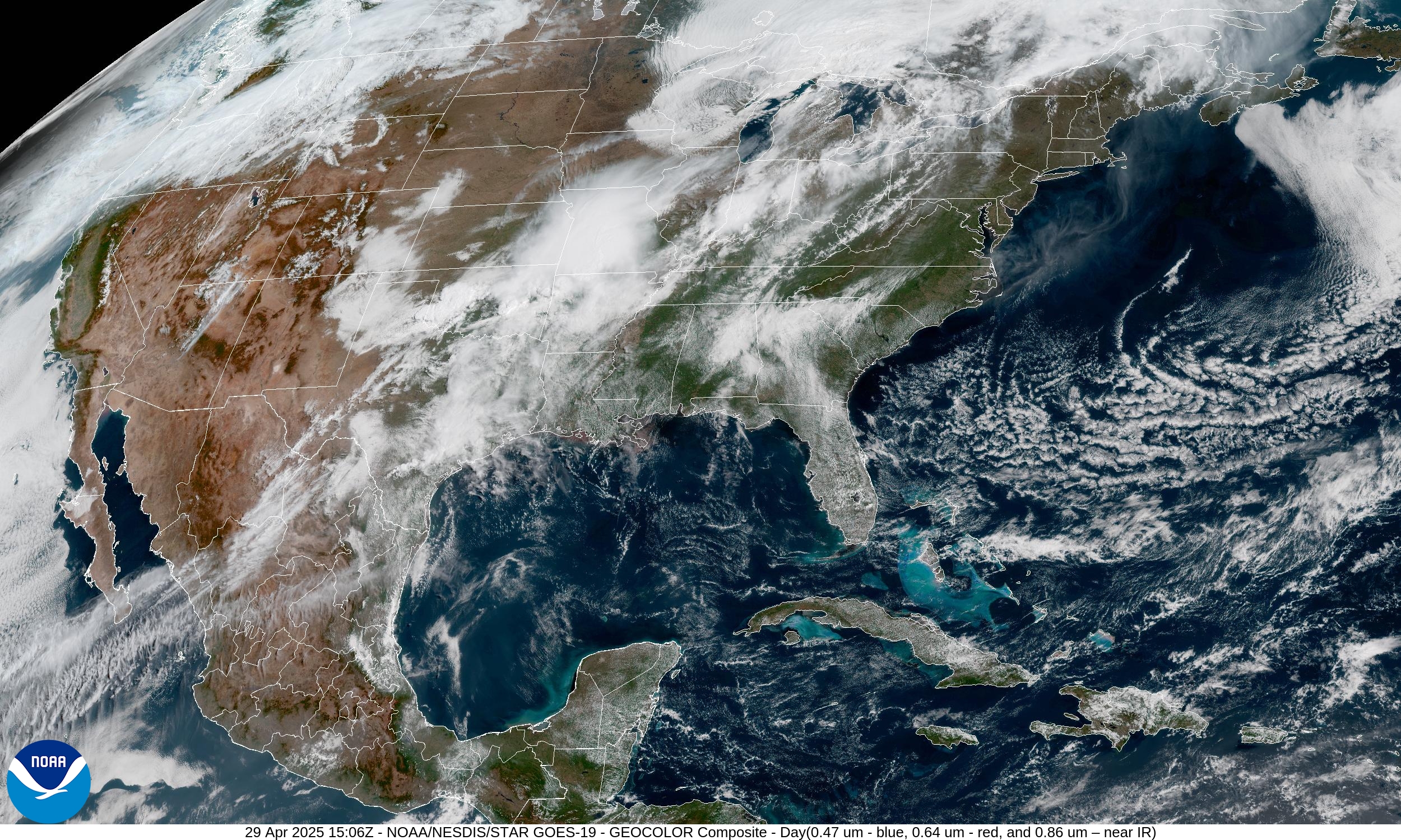
Low clouds will break up across the Southeast with the strong late-April sunshine. The main areas of convection shown earlier on radar show up well in the “Sandwich” IR+VIS combination.
Weather Summary Tuesday
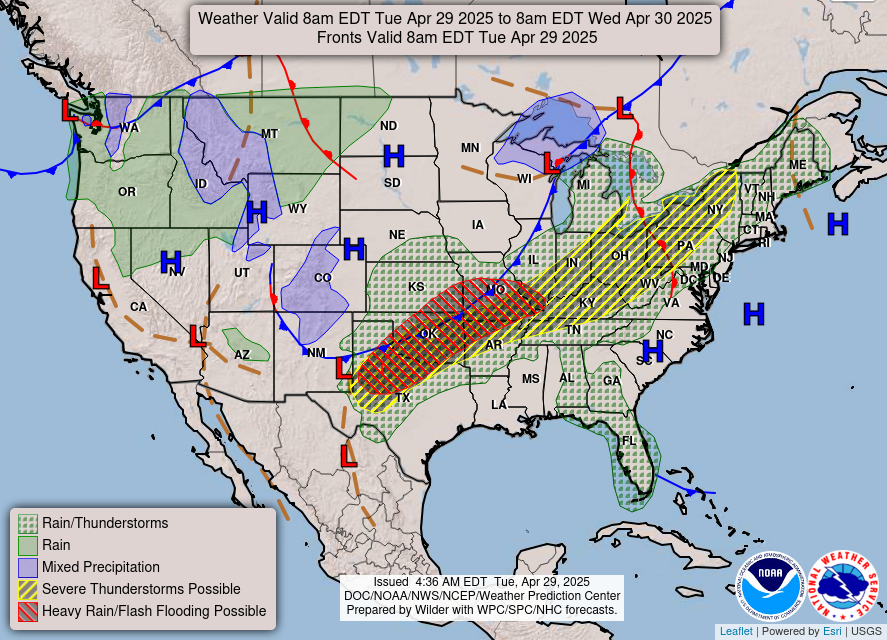
Heavy rain in the red hatching on the map overlays north Texas, Oklahoma, and Missouri = broken record as this weather pattern repeats.
All new paid subscribers can use this coupon link to receive 20% off the Newsletter and receive all daily updates heading into hurricane season. All current paid subscribers are locked in to original $5/month rate as friends of Ryan.
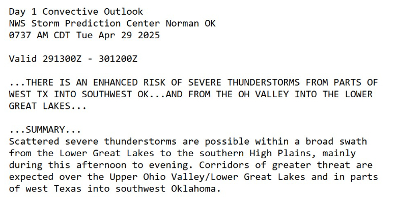
Enhanced Risk of Severe Storms
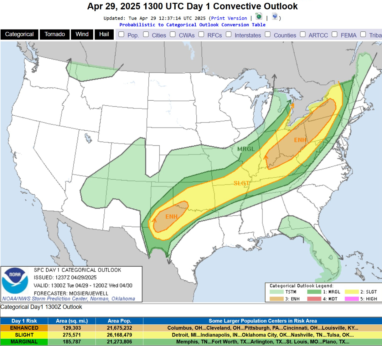
Almost 22 million population in the Enhanced corridors with damaging winds and hail the main threat. I doubt there’ll be many tornadoes especially if yesterday was a bust.
Temperature Analysis | 10:45AM ET
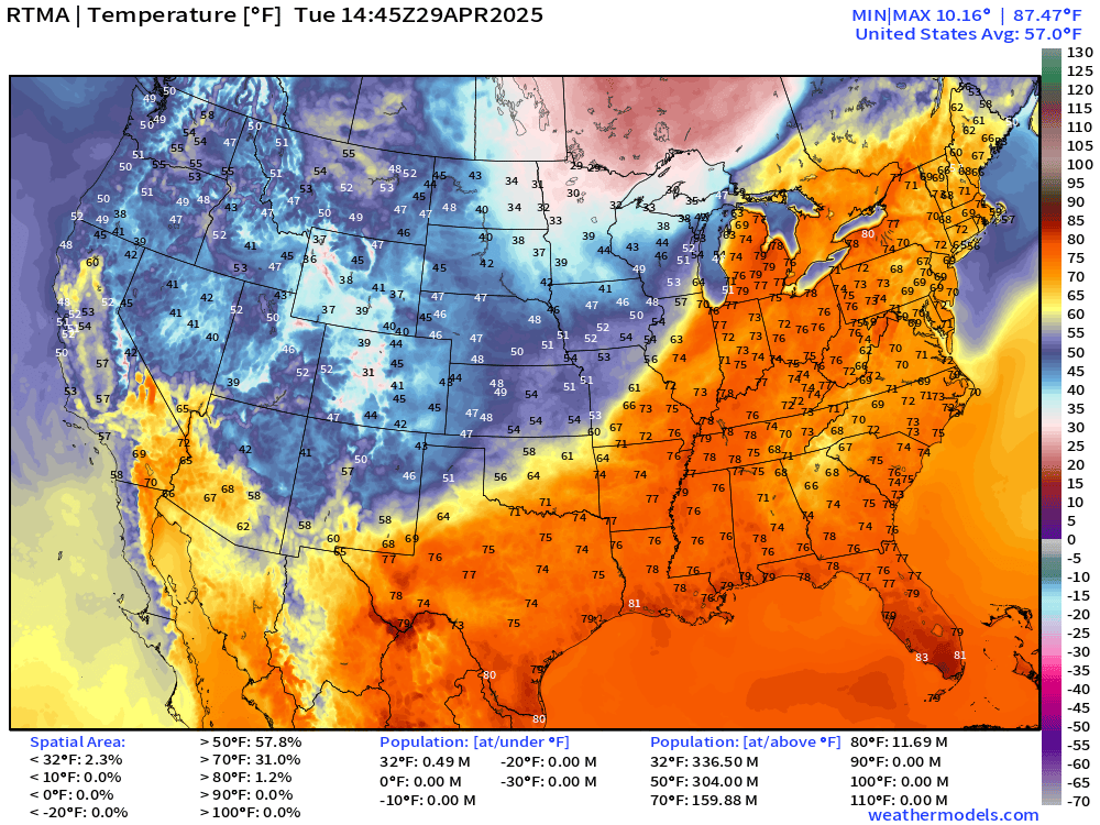
Nice warm sector in the 70s and near 80°F in the Great Lakes. However, COLD behind the frontal boundary and on the backside of the low pressure system. Temperatures only in the 20s in northern Minnesota!
Temperature Anomaly | 10:45AM ET
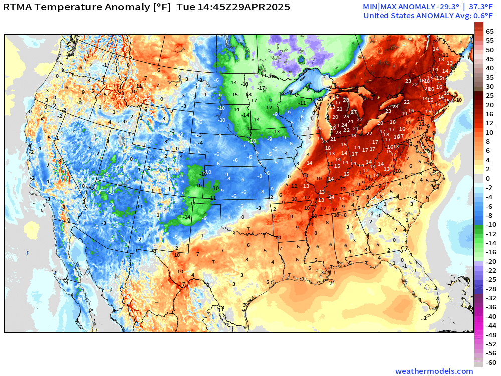
Overall the Lower 48 is 0.6°F above normal with the warm sector barely outweighing the colder, Canadian air plunging into the Midwest.
High Temperatures on Tuesday
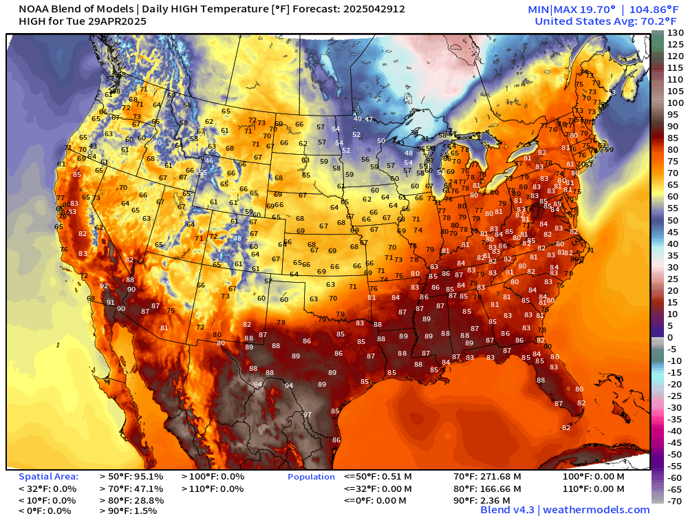
Toasty today in the Great Lakes and Northeast in the 70s and 80s including NYC and Washington D.C. The Southwest warms up a little bit but still very few 90s. The nationwide average high temperature is 70.2°F
Low Temperatures on Wednesday
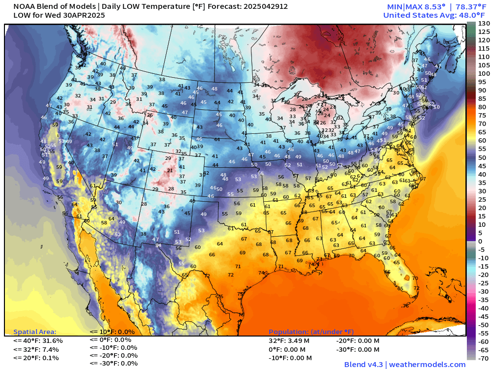
Still a hard freeze in Michigan to end April.
High Temperatures on Wednesday
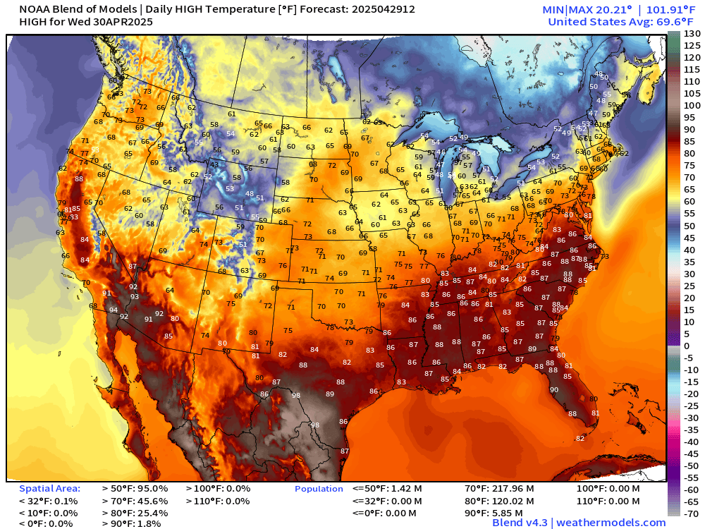
120 million at/above 80°F but certainly could be a lot more almost into early May.
High Temperatures Next 9-Days
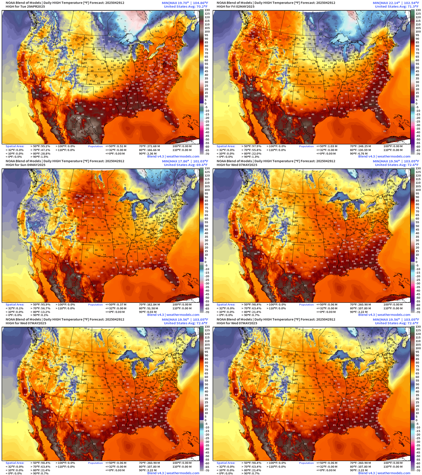
Warming trend to 70s and 80s across the northern tier heading into next week. This is seasonable and mild — not by any means hot. I don’t see heat and humidity outside of 80s for much of the country for the next 8-10 days. Amazing.
Precipitation and MSLP Next 6-Days | ECMWF 06z
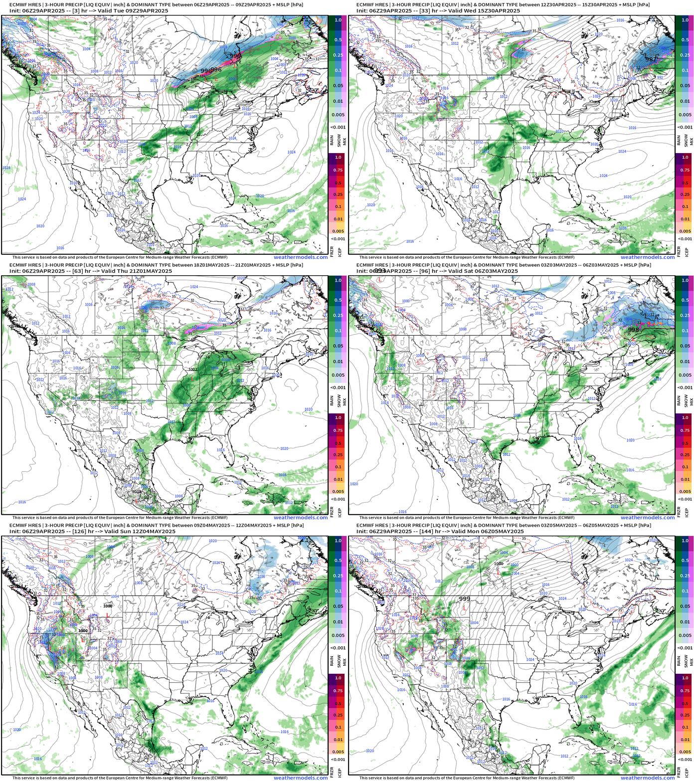
After today’s storm system races into Canada, another takes shape along the tail end of the frontal boundary for the weekend. Then, by Sunday into Monday, sprawling high pressure clears out almost the entire country!
NWS Rainfall Next 72-Hours
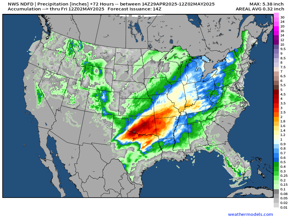
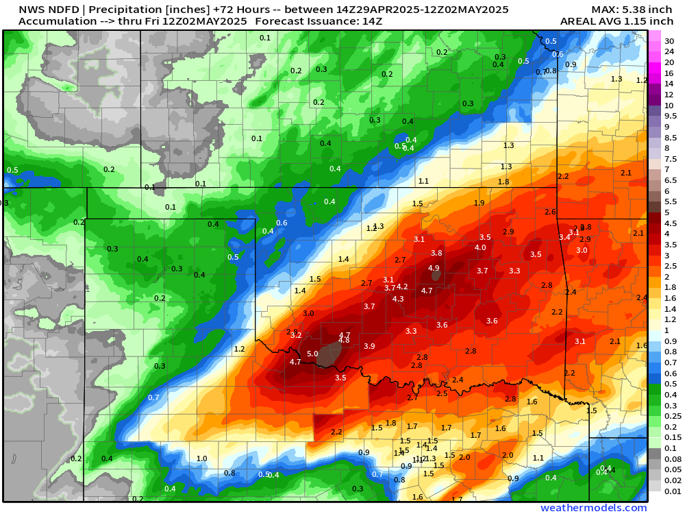
NWS has > 5” in SW Oklahoma.
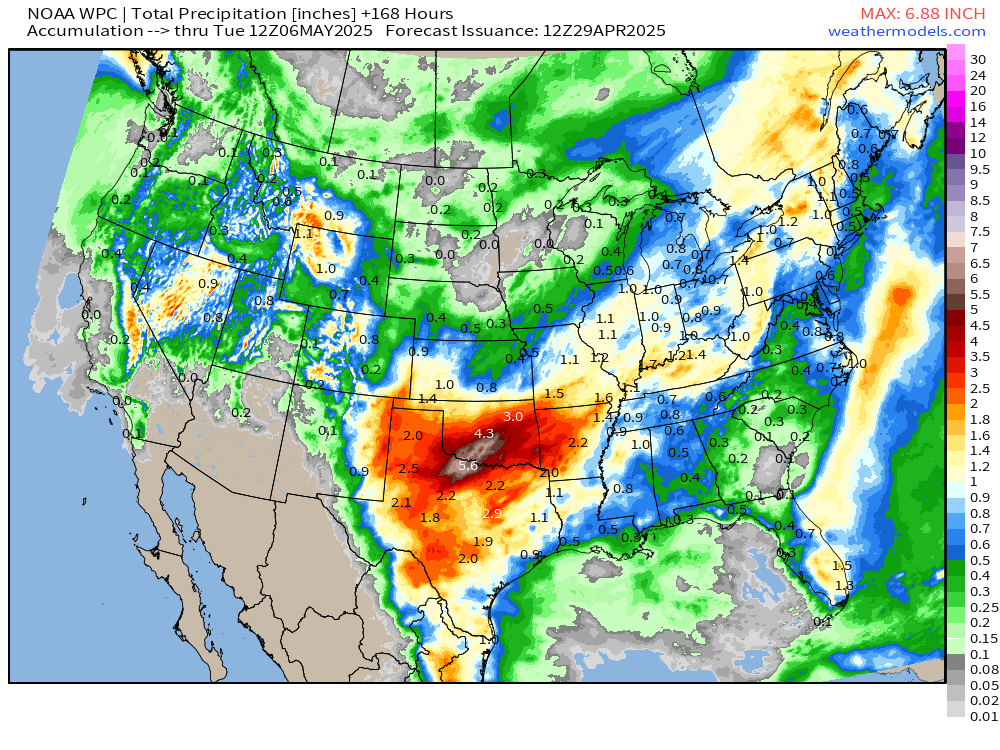
NWS WPC Precipitation | Next 7-days
NOAA Blend of Models Precipitation Next 10-days
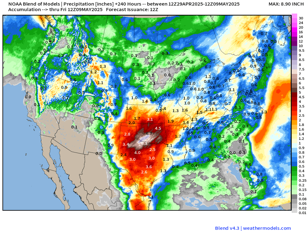
The pattern continues to favor additional rain in north Texas, Oklahoma, and the central Plains over 10-days. Could see totals in excess of 8-10-inches when all said and done.
ECMWF Integrated Vapor Transport next 10-days
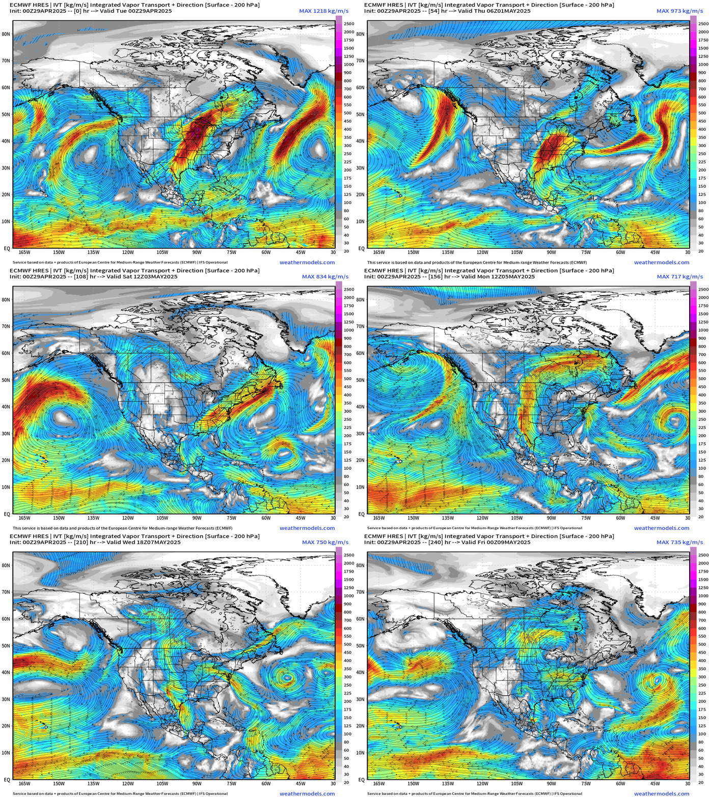
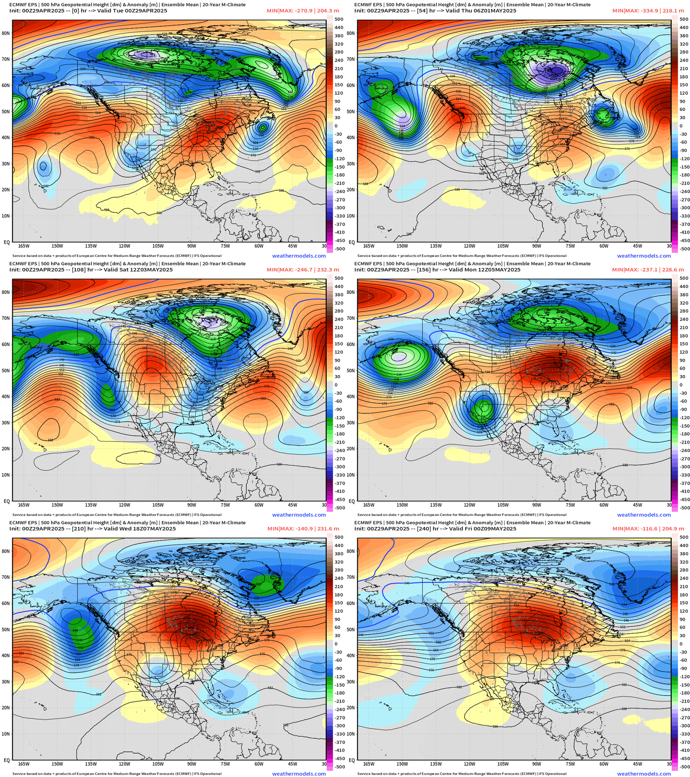
The overall pattern blocks and slows down by May 6th or so with a ridge over trough grinding the gears of the upper-level jet to a halt. This limits moisture input to the Plains and instead allows high pressure and clear conditions — but not hot — to dominate the Lower 48 by the second week of May. Exceptionally dry period ahead that would allow for planting after the block finally solidifes.
We can see the dry areas outside of the Plains moisture plume in the Week 2 precipitation anomaly (%)
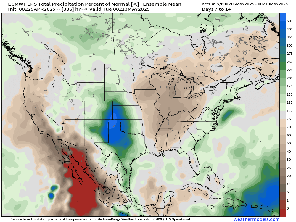
In the coming days, that whole area will be brown for below normal precipitation!
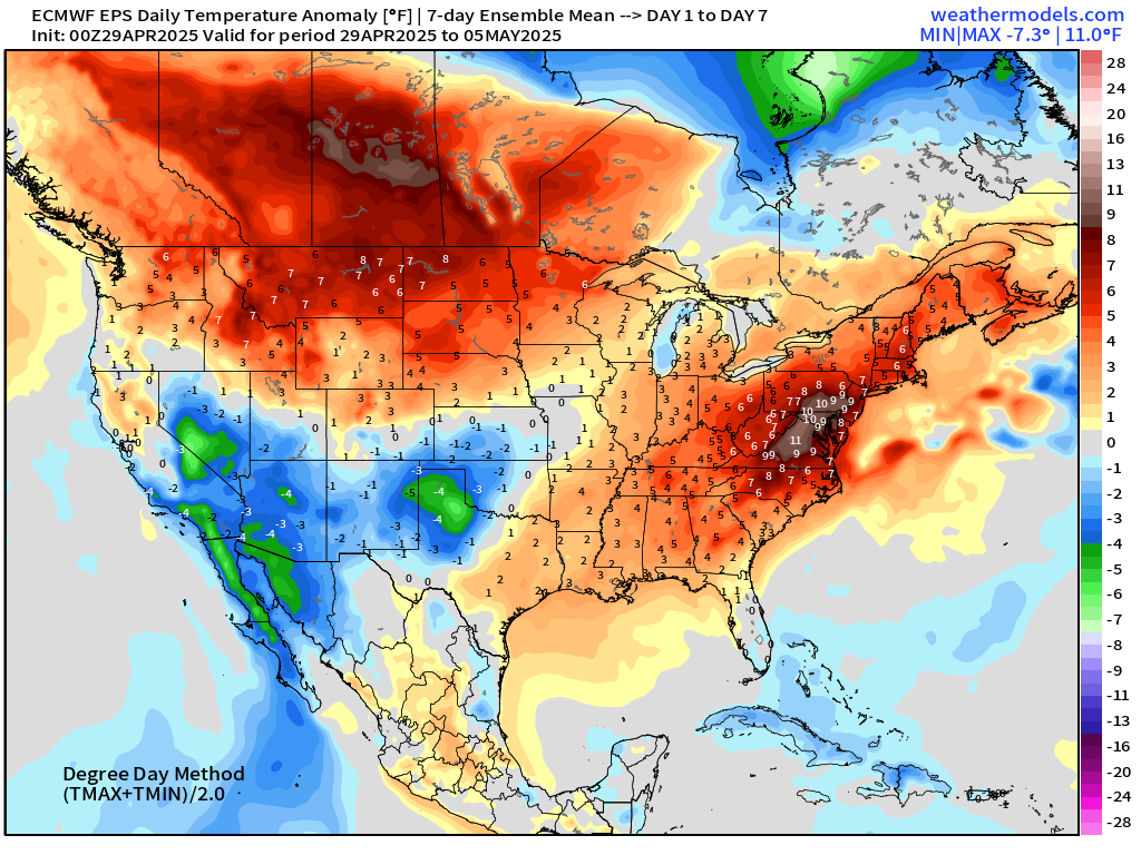
ECMWF EPS 00z | Weekly Temperature Anomaly
Week 1: April 29 - May 5
Week 2: May 6 - May 12
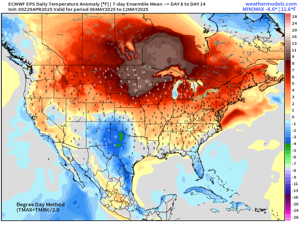
10°F above normal centered over North Dakota through the first week of May with the blocking ridge.
Who writes and researchers this Newsletter? Dr. Ryan N. Maue [X https://x.com/ryanmaue] with 20-years experience of daily weather model production and analysis. You may have seen my weather maps! I live in Atlanta but was born and raised in Northern Michigan. I know snow, and southern heat and humidity.
Maps sourced from weathermodels.com designed and innovated by yours truly! Please subscribe there for real-time access to the newest maps, charts from all of the weather models including ECMWF.
- Milepost
- 591 · laid 2025-04-29T16:02:40.259000Z
- Source
- https://weather.substack.com/p/april-29-2025-tuesday-weather-update
- Digest
- a1d55babdafa09ffa51c47c53e6733b9f9a421eaa7dd437ff6c17d7b2a378d23
- Machine
- JSON