April 16, 2025 Wednesday Weather Update
Sunday storm system in Plains
April 2025 was the 16th-warmest April in the 132-year national record (1895–2026), at 53.6°F against a 1991–2020 normal of 51.8°F (+1.7°F).
April 2025 was the 31st-wettest April in the 132-year national record (1895–2026), at 2.9in against a 1991–2020 normal of 2.7in (+0.2in).
NOAA/NCEI Climate at a Glance, contiguous United States. This is the observed record for the month, not a score of anything said in this piece — the forecast ledger begins 2026-08-17 and cannot reach earlier posts.

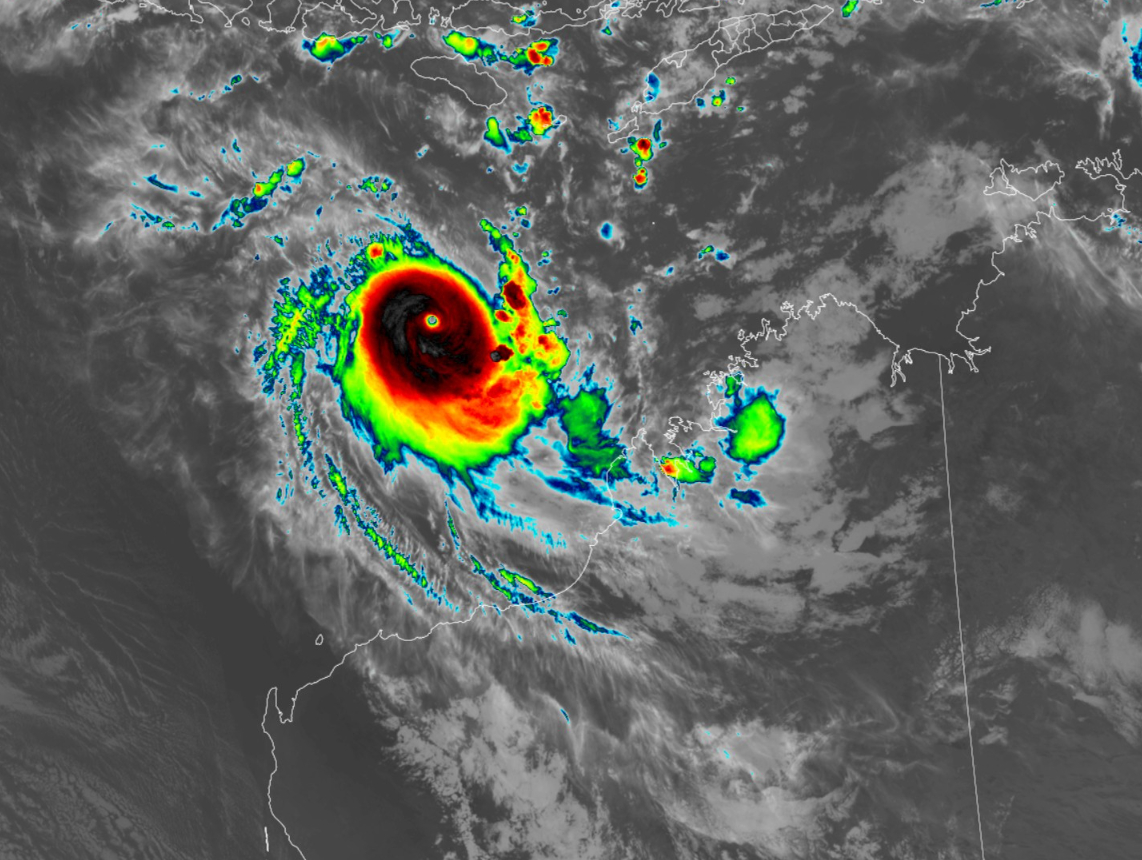
A Category 5 tropical cyclone (hurricane) off the NW coast of Australia has rapidly intensified over very warm ocean water. TC Errol (29S) has been meandering for several days but finally got its act together.
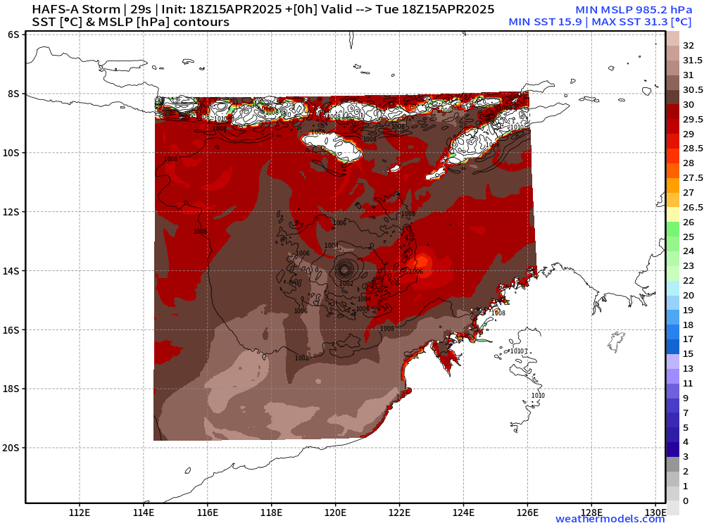
HAFS mesoscale model shows SSTs 30°C and higher around 14°S latitude in the Southern Hemisphere tropics in the eastern Indian Ocean. That’s more than enough for the most intense tropical cyclones.
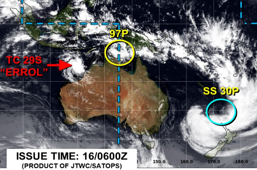
The “hurricane season” in the Southern Hemisphere around Australia is winding down. April is the last busy month even though some storms can survive into May. 30P was another storm that has now transitioned to lash New Zealand as a post-tropical / subtropical cyclone.
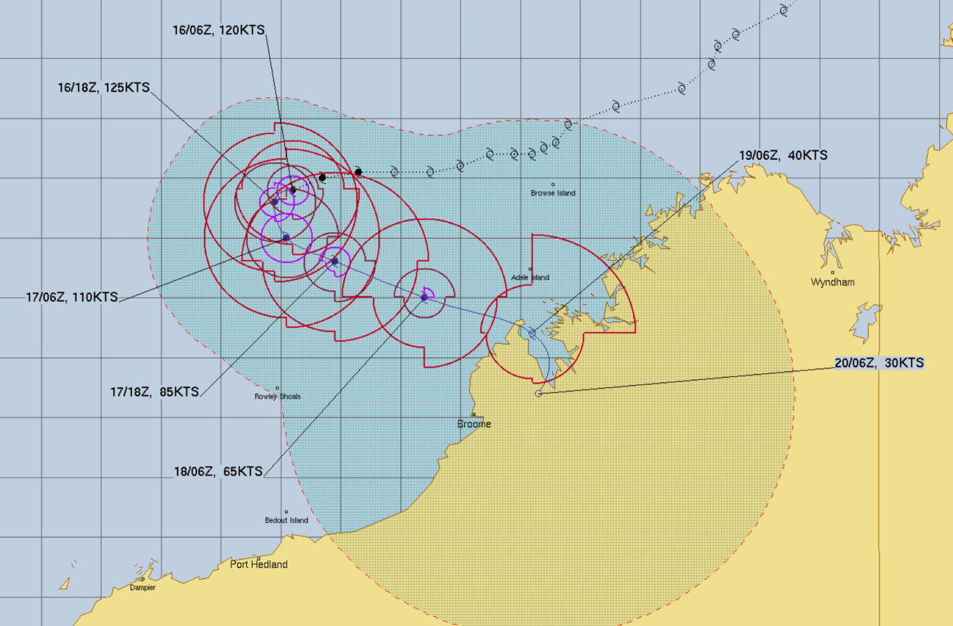
Errol (29S) will turn back to the coast but weaken prior to landfall probably below Category 1 status. The result will be rainfall for the arid coastal zone w/little population impact.
Current Satellite Imagery
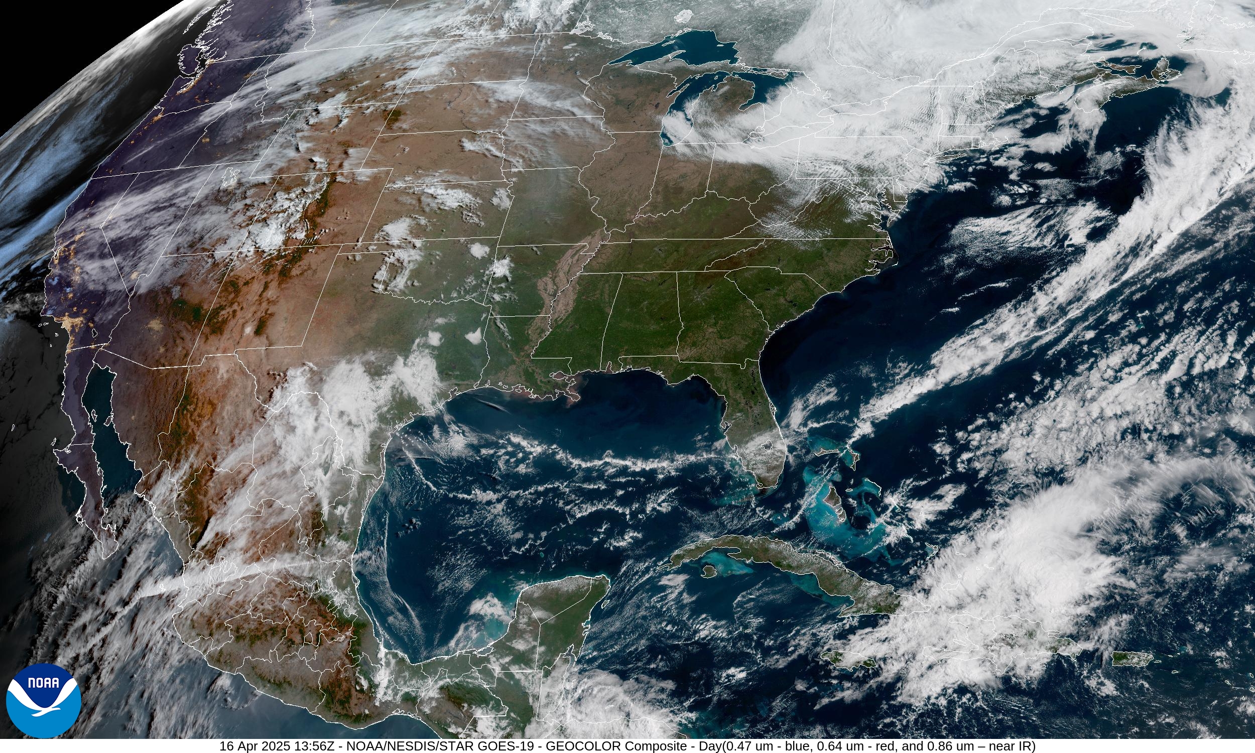
Still dealing with clouds and come leftover snow showers across New England. A cool front has made its way through the Gulf and into South Florida but not expected more than some clouds. Crystal clear over the vast majority of the Lower 48 with the dry air mass in control.
HRRR Radar 48-Hour Forecast through Friday morning 8 Am
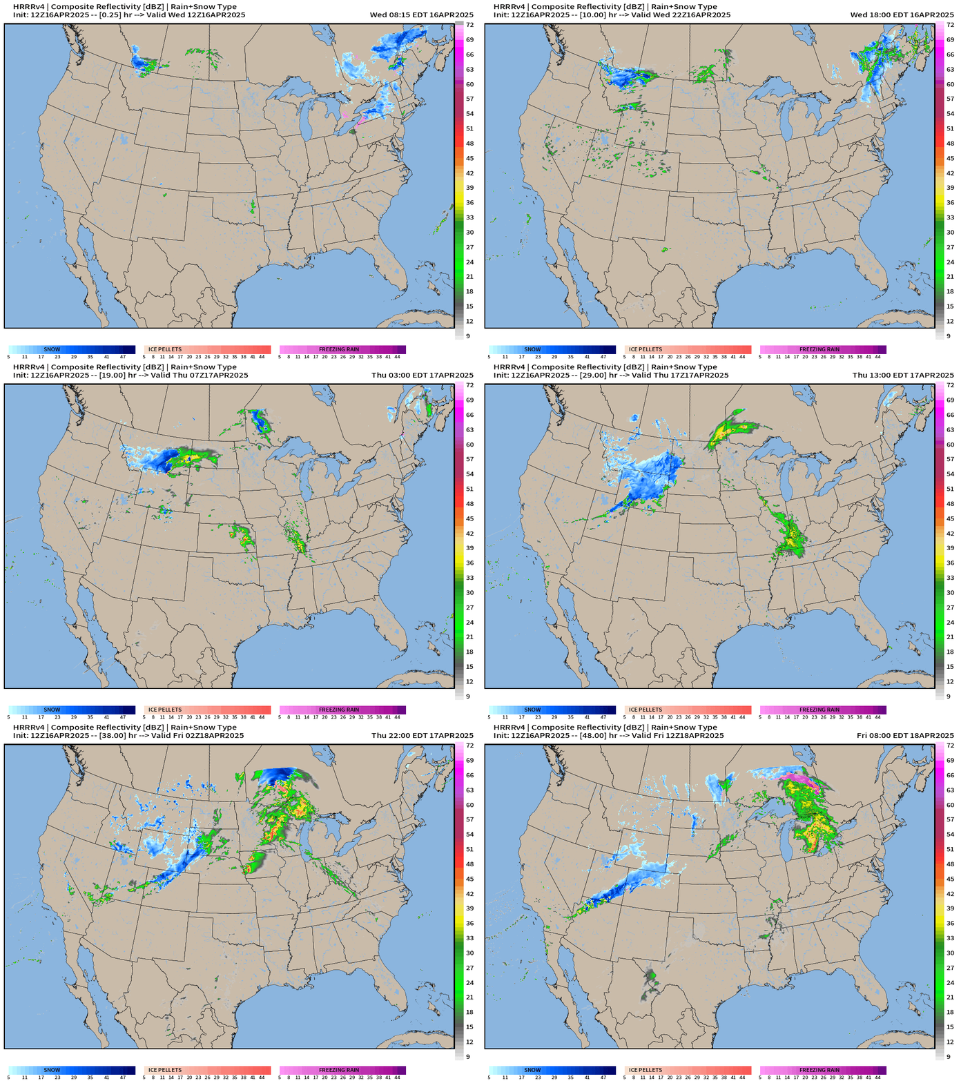
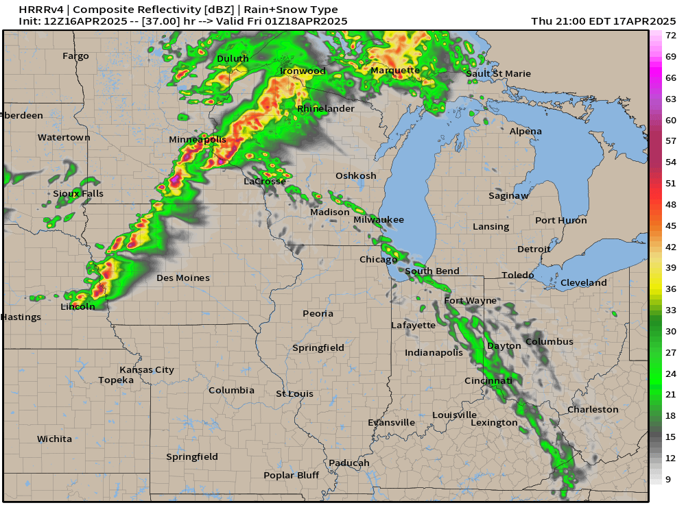
The next storm system tracking out of Montana/Wyoming into the Plains and then Midwest into Friday will have a brief threat of severe thunderstorms later on Thursday.
Thursday 9 PM ET
Highs Today | Wednesday
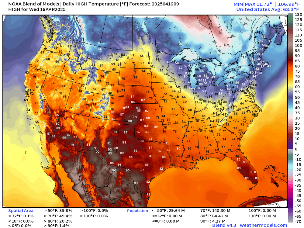
Comfortable 70°s from North Dakota to North Florida. 50s in Michigan is progress with warmer temperatures on the way for Friday ahead of the storm system.
High Temperatures Next 9-days
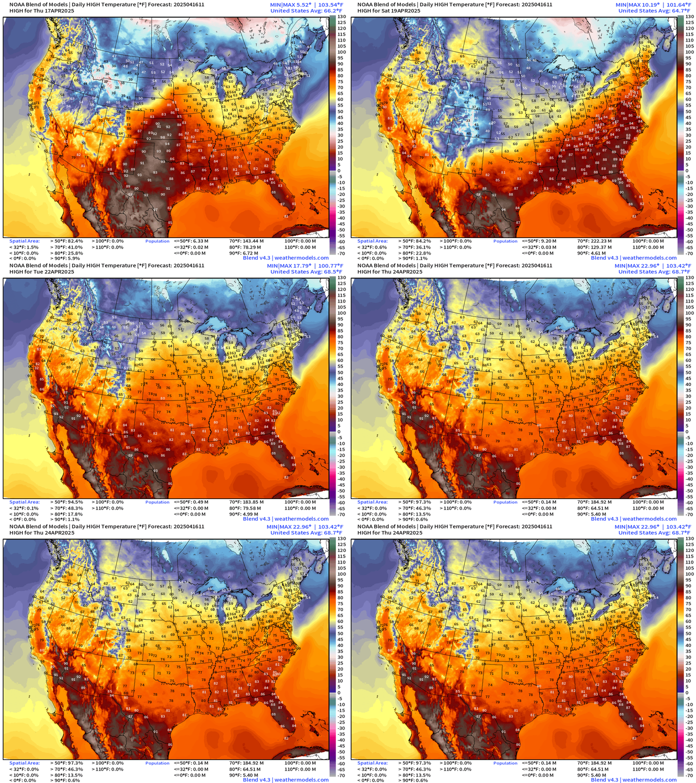
Heading into late April, seasonable temperatures with frontal boundaries and storm systems keeping the roller coaster on the tracks — up and down.
Coupon offer new and current subscribers through April 16: 20% off annual (upgrade) = $40/year. I’m increasing the price [$5 —> $8] for new subs on May 1st so lock in. Your continued support has allowed me with the help of Claude and Grok to develop new products. I am appreciative of all subscribers over the past year+ who have read the past almost 600 posts!
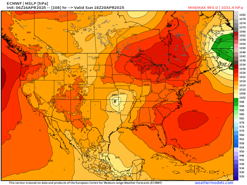
Easter Sunday Storm System in the Plains
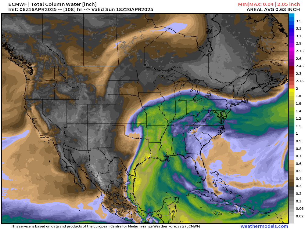
ECMWF 06Z has 1001 mb low centered near Tulsa, Oklahoma Sunday afternoon at 2 PM with a sharp dry line and plenty of moisture ahead of it to the north up to a warm front extending from Kansas to Michigan.
The low tracks into Iowa maintaining a compact structure into Monday.
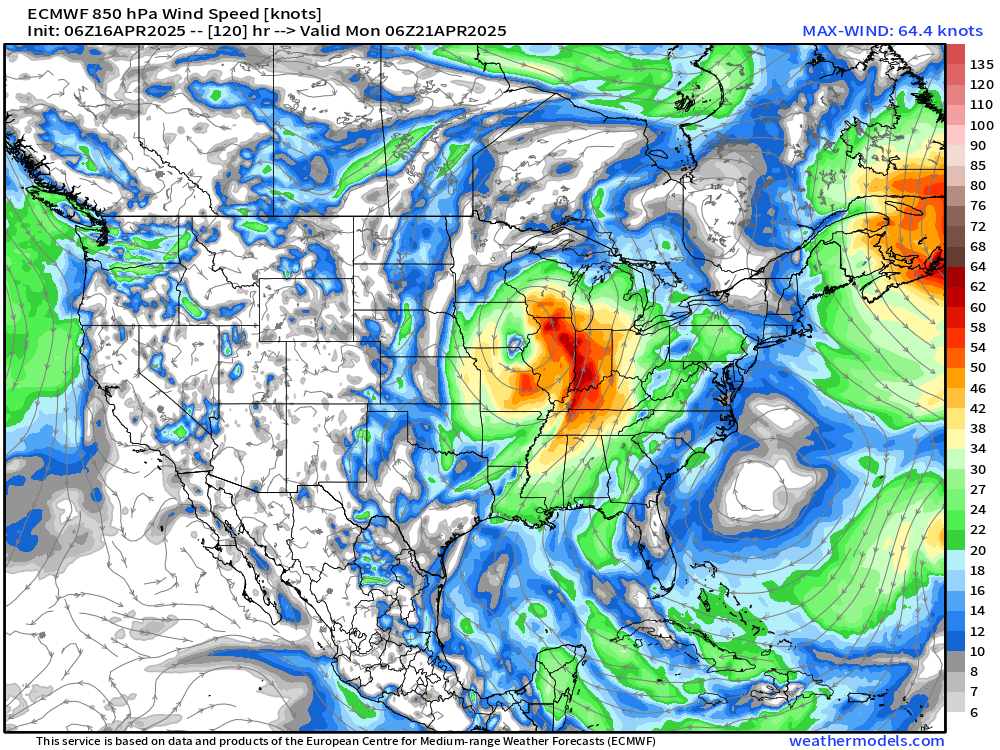
This has the potential for severe weather with the dynamics looking impressive. However, the system is embedded within a cooler environment than might be expected for an April 20th system.
Otherwise, travel looks good for this weekend for Easter.
Weather on Wednesday

The dry cold front has moved through Florida. Scattered snow showers still going in the northern Rockies.
Precipitation and MSLP Next 6-Days | ECMWF 06z
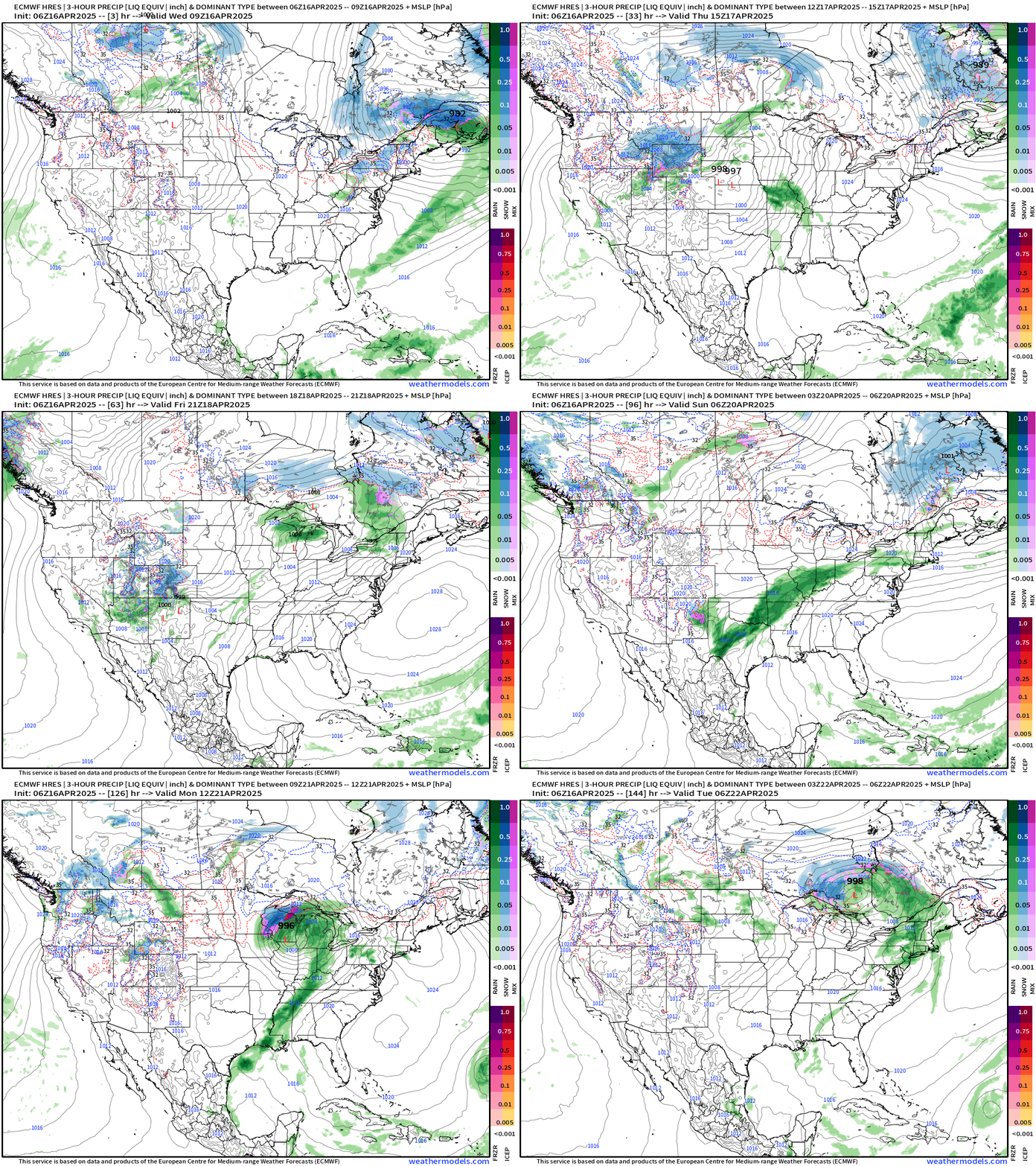
Finally ditching the storm system across New England early on Thursday.
Easter Sunday storm system lifecycle is very spring-like with a compact low-pressure center and frontal boundaries = all modes of severe weather possible Sunday-Monday from the Plains to the Great Lakes.
Weather on Thursday
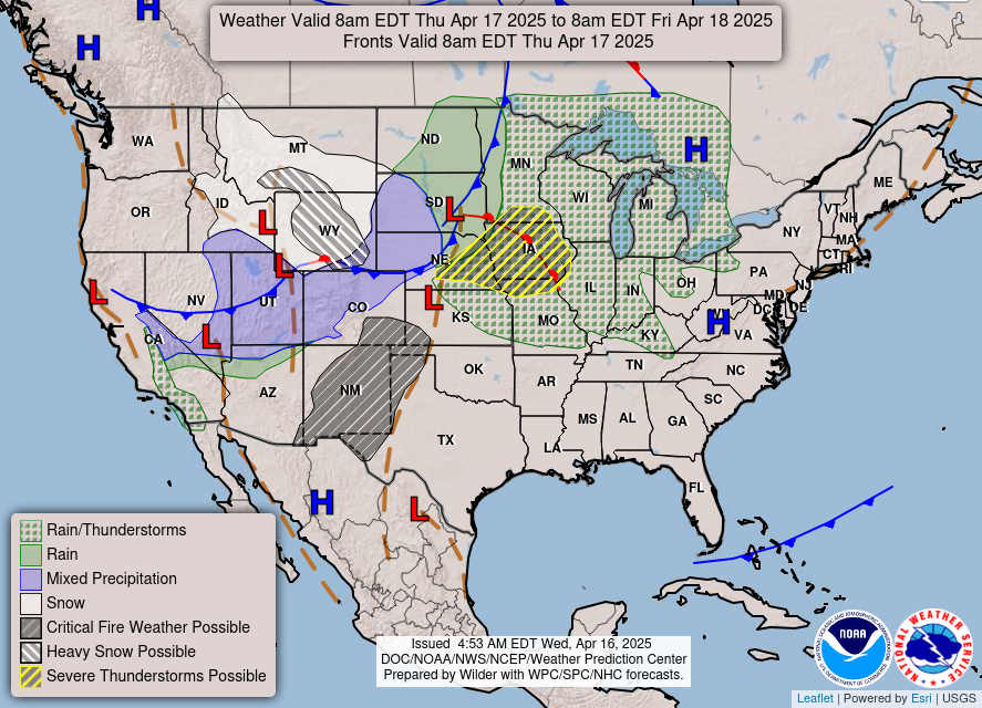
Weak storm system with snowfall in Montana and Wyoming in the cold air behind the low pressure center in South Dakota. In the warm sector, Slight Risk of severe storms along the stubby warm front.
Integrated Vapor Transport | Next 10-days
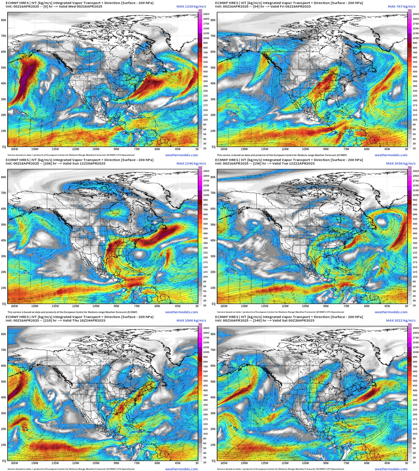
Subtropical ridging off the Southeast coast is typically necessary for the moist flow out of the Gulf of Mexico into Texas and the Plains. Into next week, we see the transition to a much wetter and storm pattern across the central and eastern U.S. and this shows up well in the forecast rainfall amounts mainly in week 2:
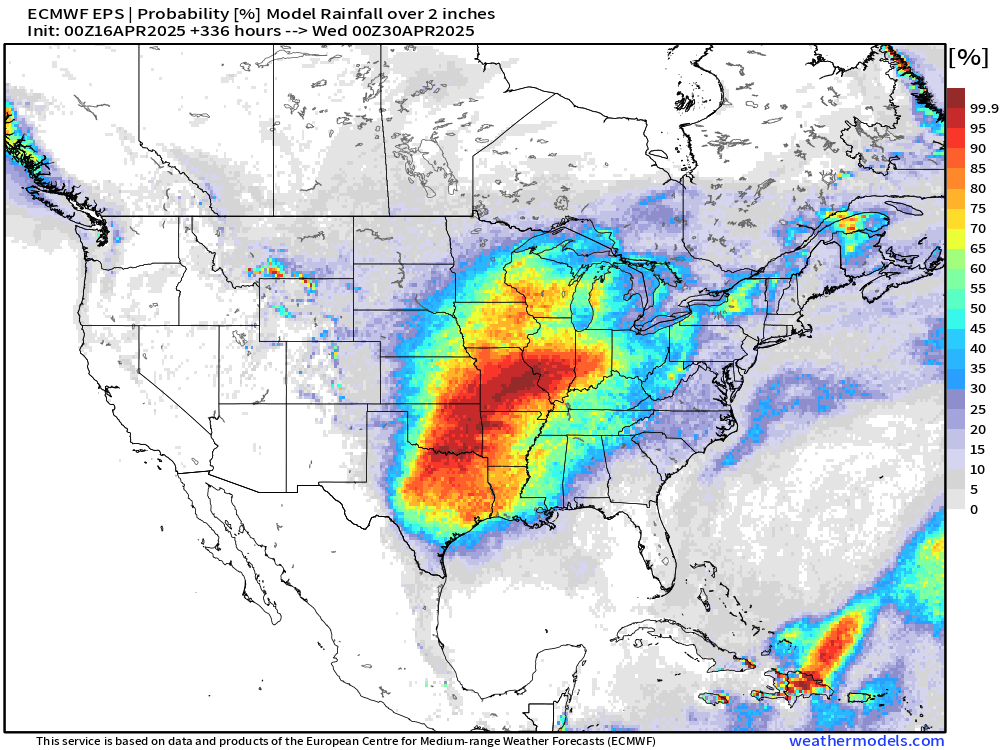
Rainfall | Ensemble Median Next 14-days
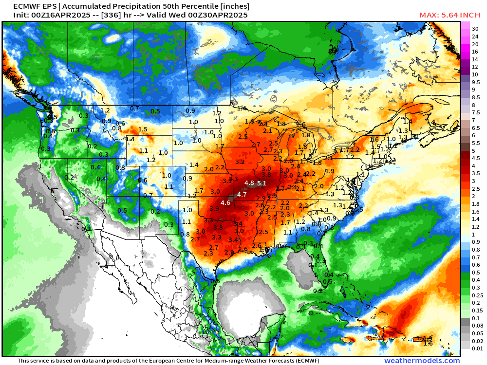
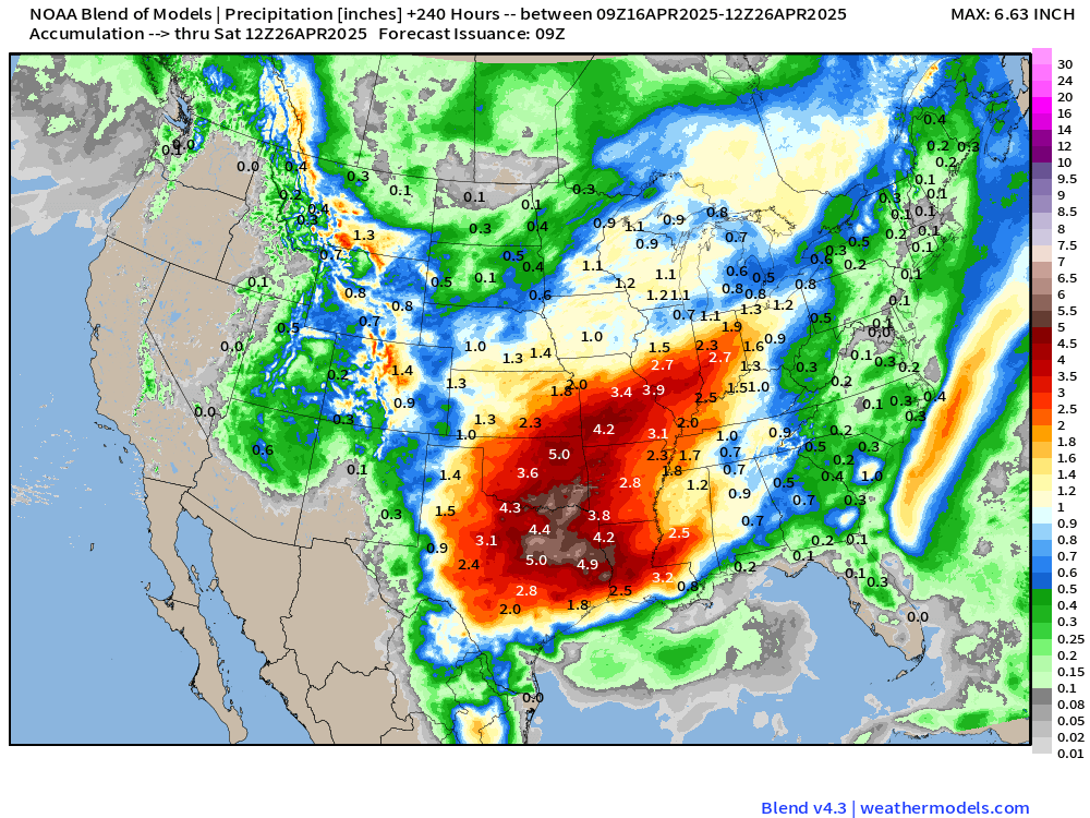
Now up to a 5-inch+ maximum from OKC to St. Louis.
And probability of 2-inches or more is nearly 100% from Dallas to St. Louis. Bountiful rains are quite welcome!
Temperature Analysis | 9:45 AM ET
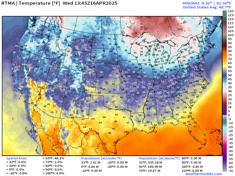
Average Lower 48 temperature at 48.7°F
Temperature Anomaly | 9:45 AM ET
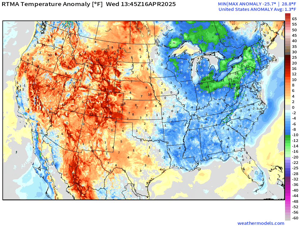
Overall the Lower 48 is 1.3°F above normal but chilly in the Great Lakes.
Low Temperatures on Thursday
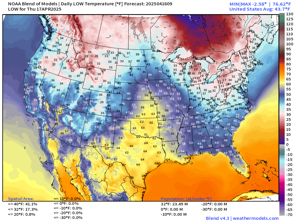
Still below freezing — as expected across the Great Lakes into the Mid-Atlantic and Northeast.
High Temperatures on Thursday
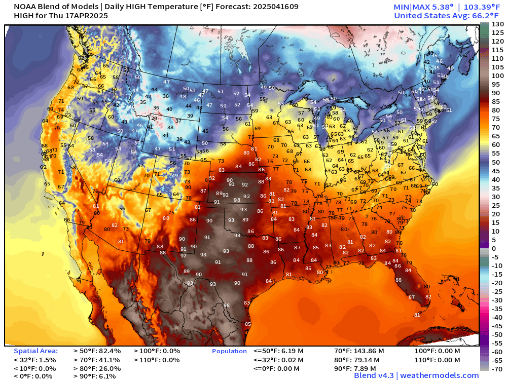
90s into Kansas. 144 million at/above 70°F
NWS Rainfall and Snowfall Next 72-Hours
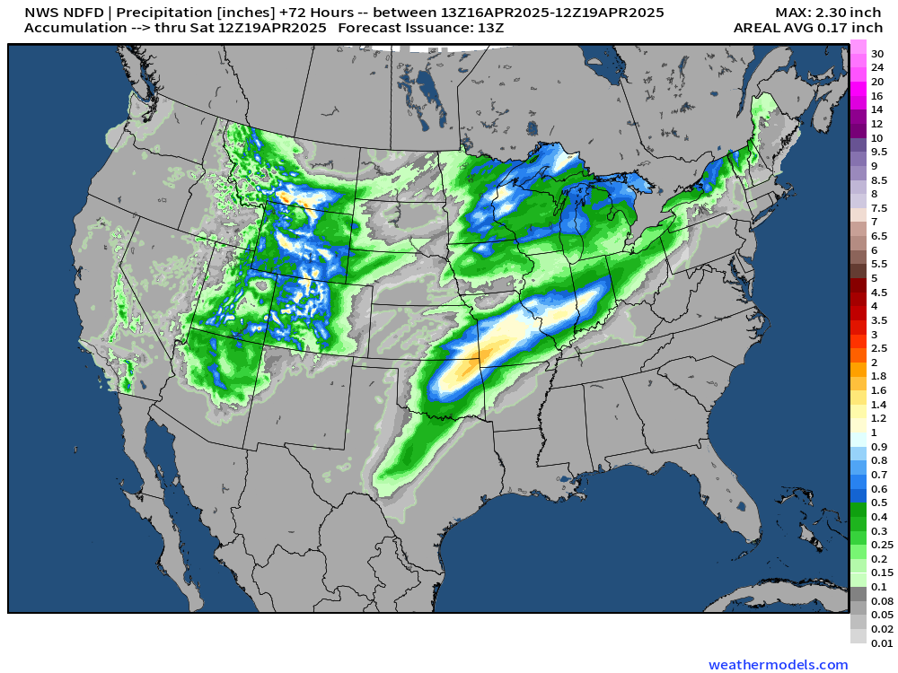
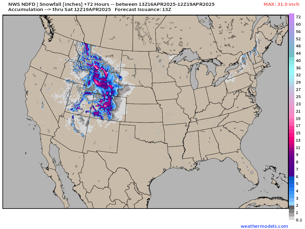
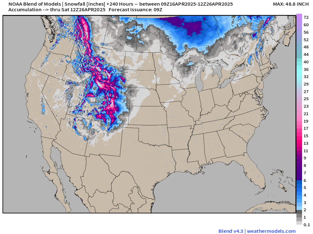
Rocky Mountain heavy snowfall continues!
NWS WPC Precipitation | Next 7-days
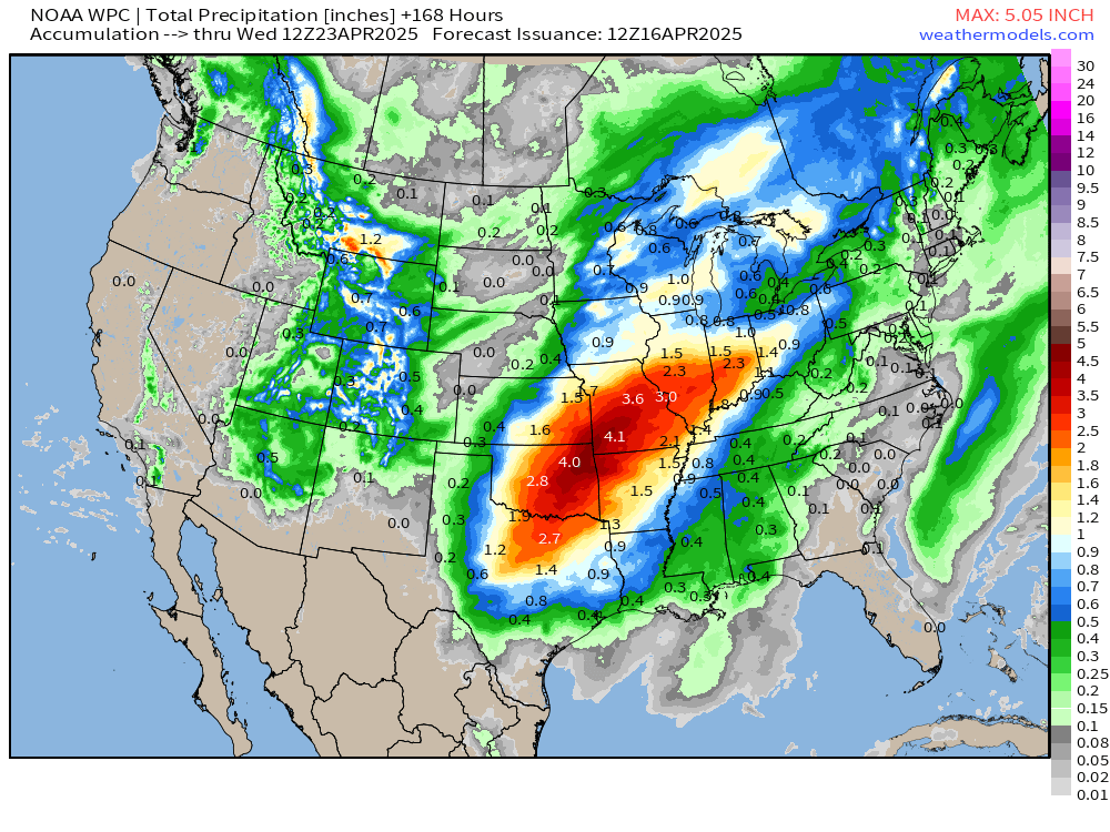
7-day WPC forecast blend shows a 5” maximum on the map
Blend of Models | 10 Days Precipitation and Snowfall
ECMWF 06Z AIFS | Upper-Level Pattern for North America next 10-days
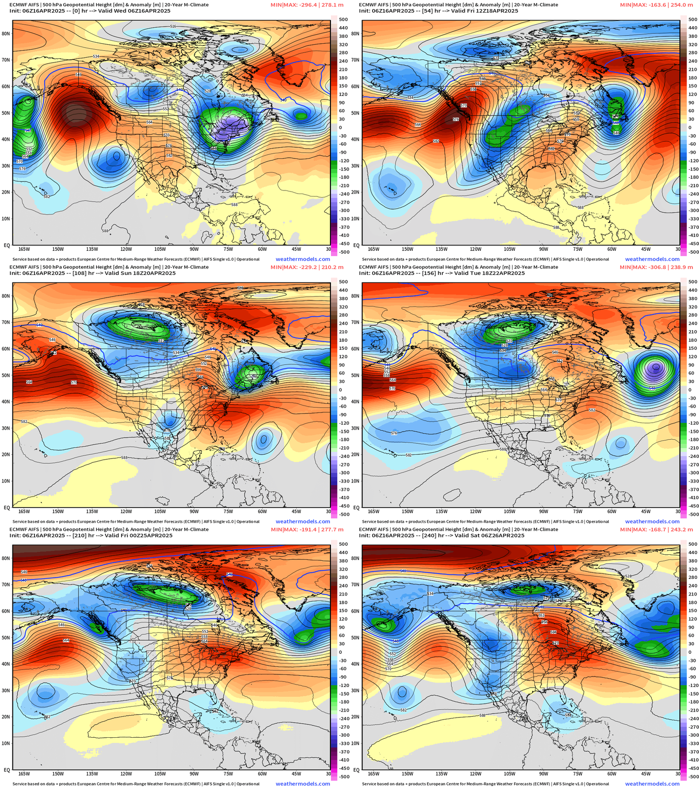
Nice ridging for the Eastern U.S. heading into next week = warm up!
Snowfall Next 14-Days | Ensemble Median
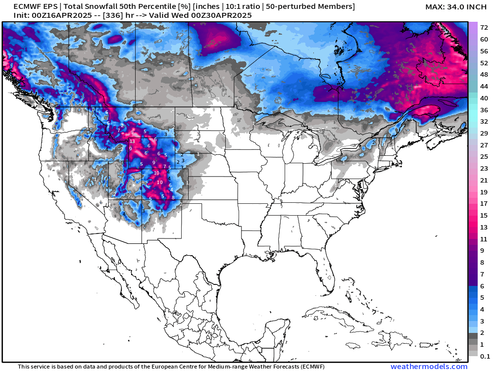
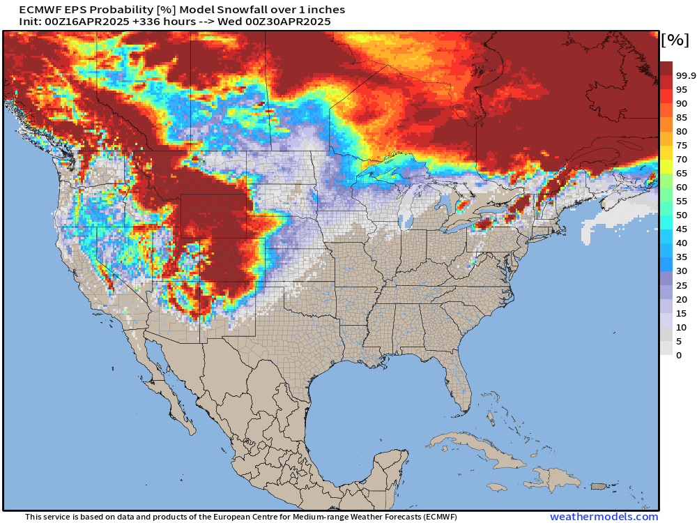
Might be done with the snowfall in Michigan and most of New England after today’s storm system exits.
Chance of 1-inch of Snowfall next 2-weeks
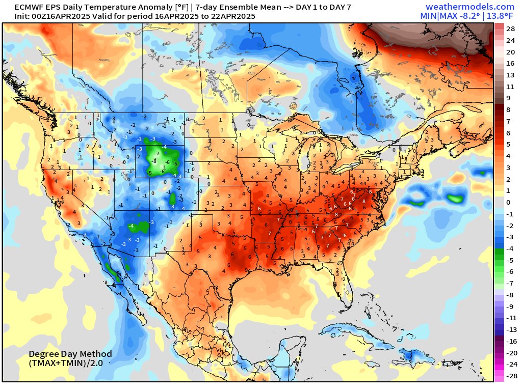
ECMWF EPS 00z | Weekly Temperature Anomaly
Week 1: April 16 - 22
Week 2: April 23 - 29
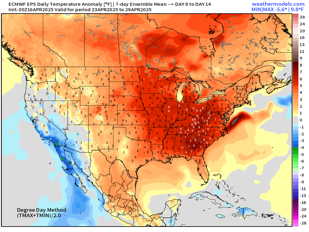
Put the 2-weeks together and we’re +7°F above normal across the Southeast into the Ohio River Valley. Not a heat wave, but pleasantly warm to balance out the recent cooler Canadian air masses.
Who writes and researchers this Newsletter? Dr. Ryan N. Maue [X https://x.com/ryanmaue] with 20-years experience of daily weather model production and analysis. You may have seen my weather maps! I live in Atlanta but was born and raised in Northern Michigan. I know snow, and southern heat and humidity.
Maps sourced from weathermodels.com designed and innovated by yours truly! Please subscribe there for real-time access to the newest maps, charts from all of the weather models including ECMWF.
- Milepost
- 577 · laid 2025-04-16T14:26:05.817000Z
- Source
- https://weather.substack.com/p/april-16-2025-wednesday-weather-update
- Digest
- 3995710fed533b19d97d69082b2d143e05b102f9354718aa48d085852eee3b1f
- Machine
- JSON