February 23, 2025 Sunday Weather
Much warmer week will feel more like Spring
February 2025 was the 56th-warmest February in the 132-year national record (1895–2026), at 34.7°F against a 1991–2020 normal of 35.6°F (-0.9°F).
February 2025 was the 56th-wettest February in the 132-year national record (1895–2026), at 2.2in against a 1991–2020 normal of 2.1in (+0.0in).
NOAA/NCEI Climate at a Glance, contiguous United States. This is the observed record for the month, not a score of anything said in this piece — the forecast ledger begins 2026-08-17 and cannot reach earlier posts.

Good Afternoon!
Hopefully everyone is enjoying a rather quiet Sunday weather day. After the past few weeks, we are certainly deserving of a break. With only 5-days left of February, we’ll be turning the calender into Meteorological Spring [MAM] starting March 1st.
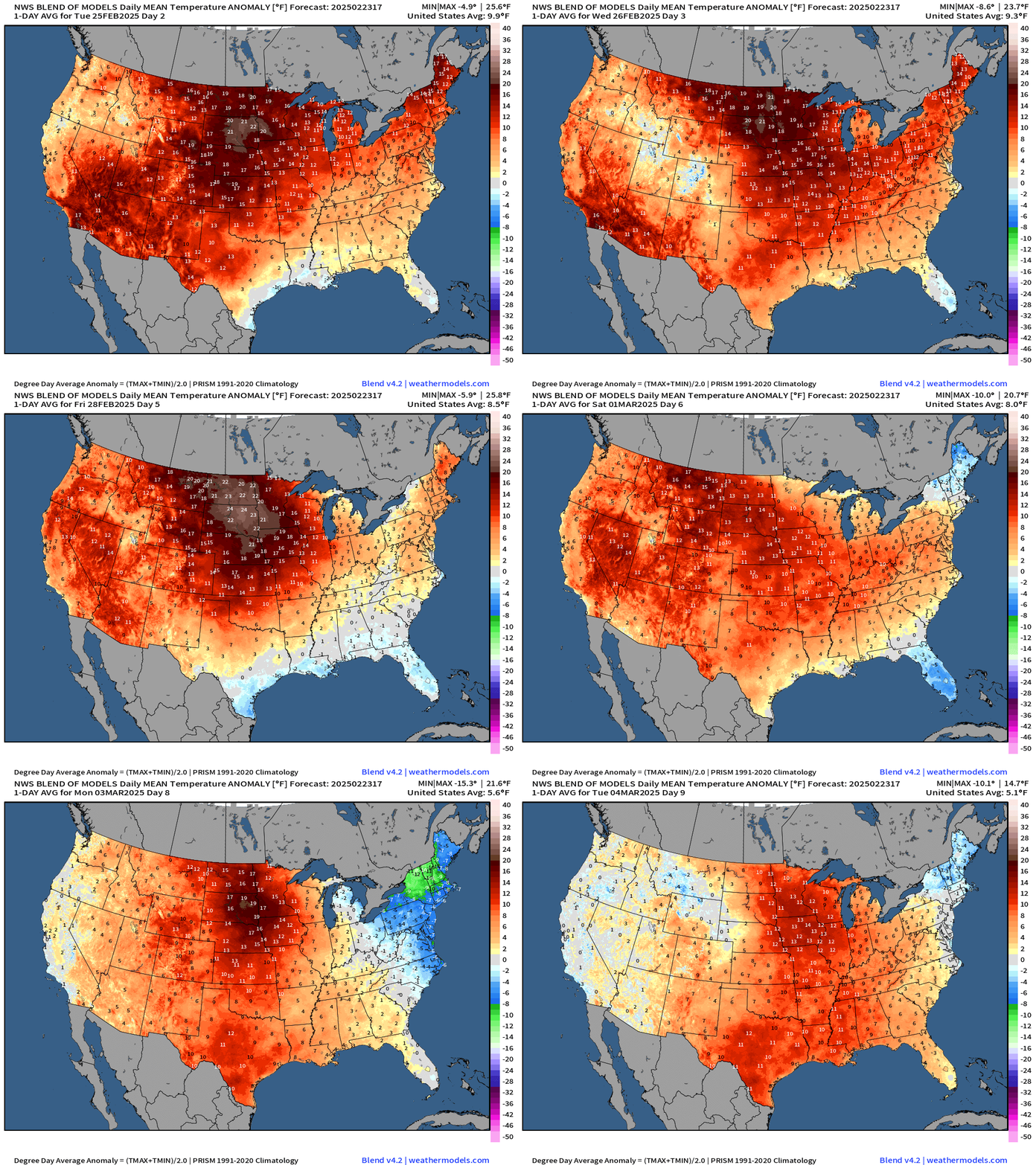
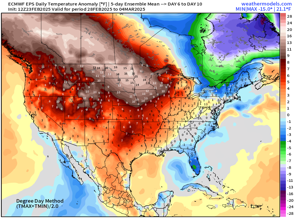
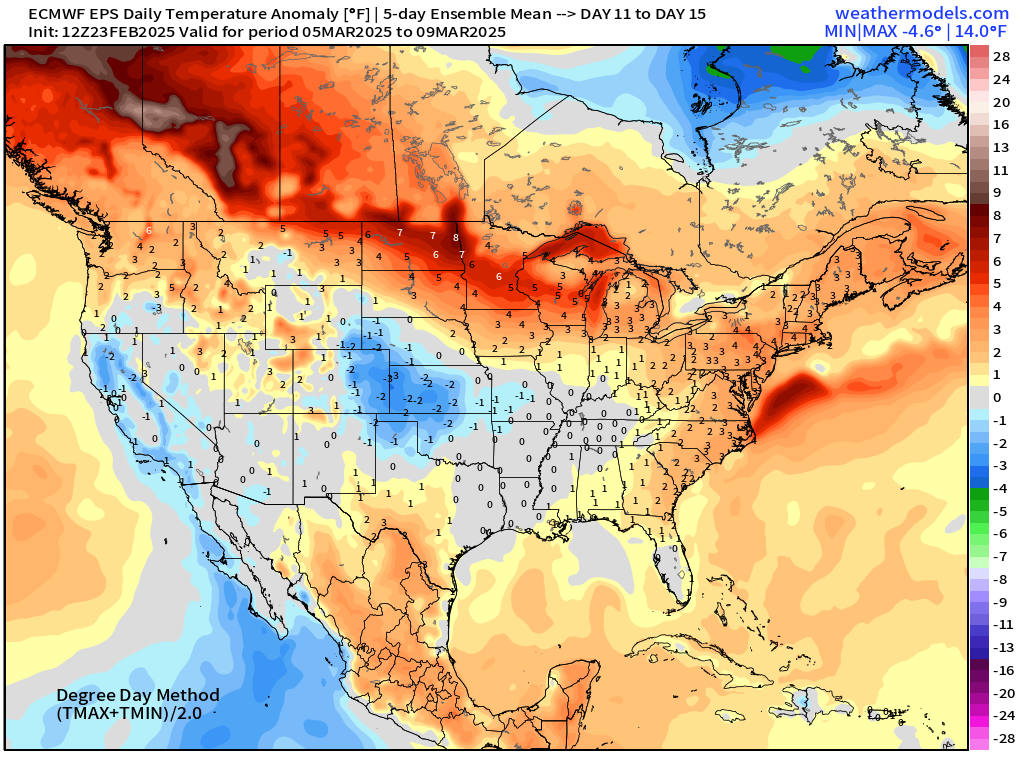
Let’s start with the Blend of Models temperature anomaly for the next 9-days until March 4. I see a LOT of red with only a few exceptions with cold fronts affecting the Great Lakes and Northeast later in the week and next weekend.
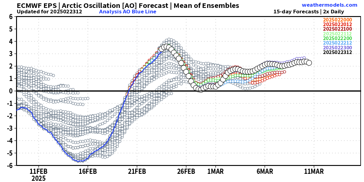
The upper-level weather pattern recently transitioned from strongly negative to positive Arctic oscillation (AO) — and will remain generally positive into early March, meaning a lot of synoptic disturbances progressing through the Lower 48 = busy weather pattern.
But the coldest Canadian Arctic air will not spill out totally like last week, instead providing small doses and brief cold shots focused on the Great Lakes and Northeast. Also, as the hemisphere warms into Spring, the cold air pool will erode slowly but surely.
ECMWF EPS 15-day Ensemble Mean Temperature Anomaly
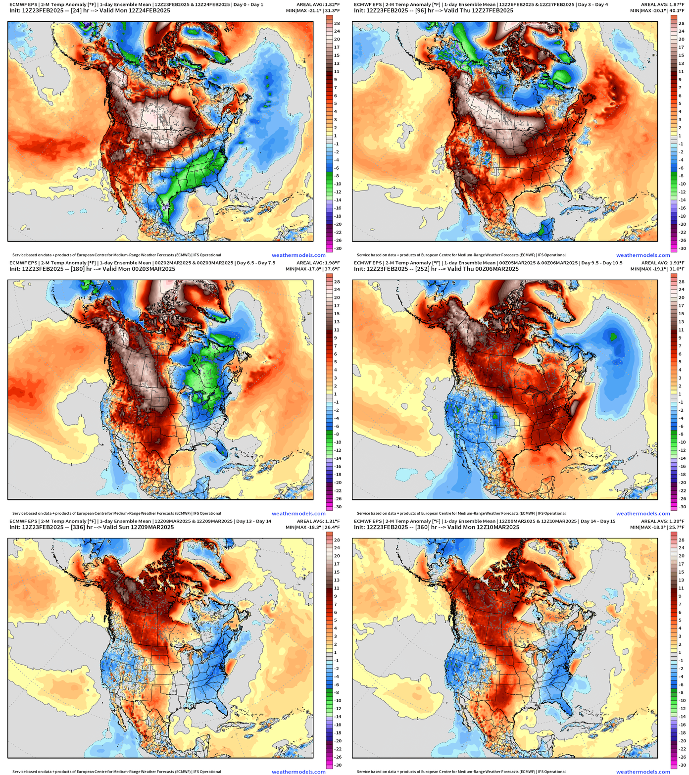
Amazing to see +30°F to 40°F above normal anomaly where just a week ago it was the opposite due to warm Pacific origin air with the atmospheric river systems and storm track affecting the Northwest. The favored location for cold pool formation shifts from Western Canada to Quebec as the tropospheric polar vortex is instead anchored over Hudson Bay.
All week = warmth across the Lower 48
Next weekend: eastern trough with a brief cold shot
Into Days 8-9 (March 3-4) we see some leakage of that cold air in Quebec into the Northeast. More winter cold.
Short-term weather … HRRR Next 18-Hours Radar and Snowfall
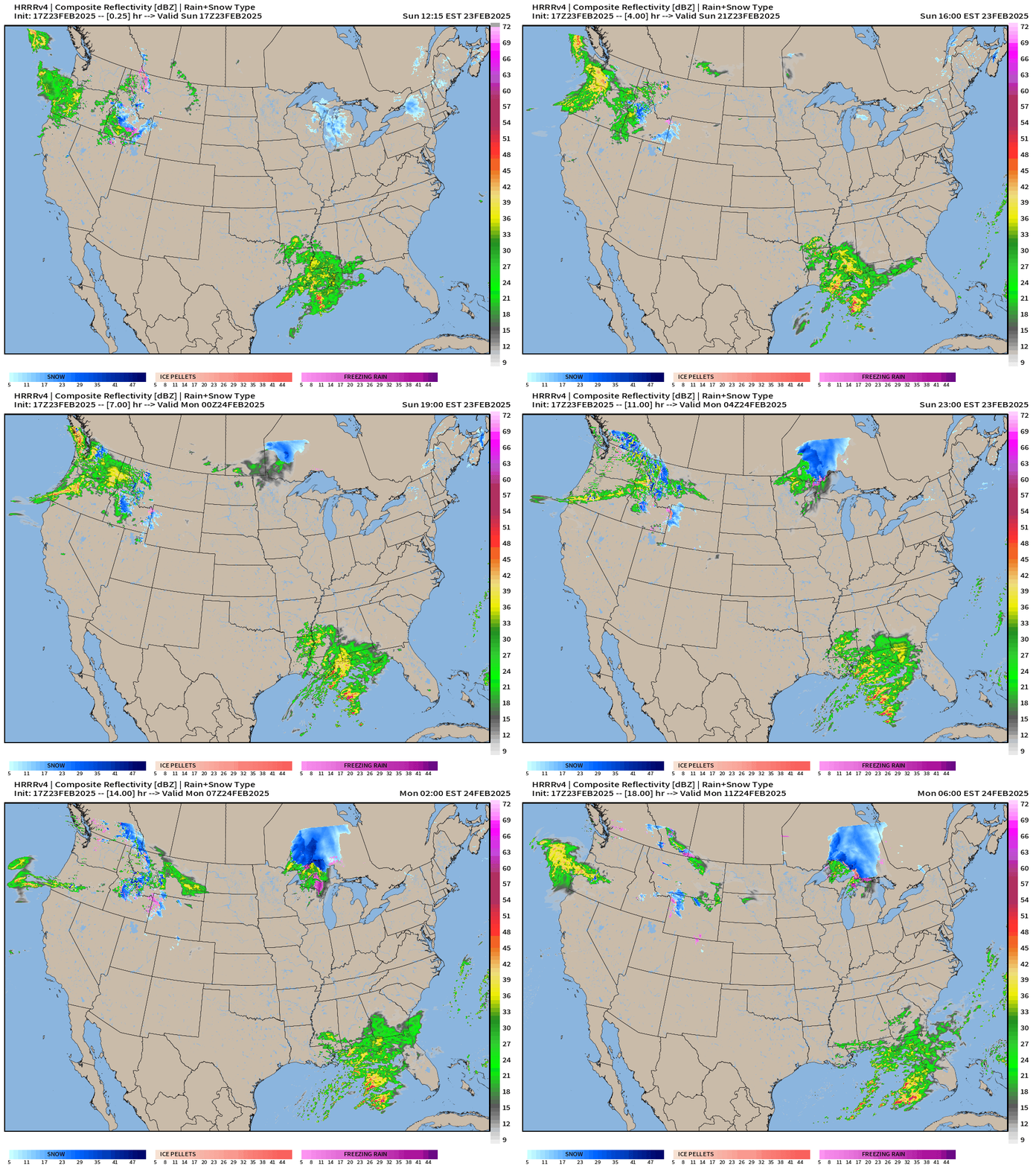
A few weather systems are providing rain and snow, but nothing too impactful.
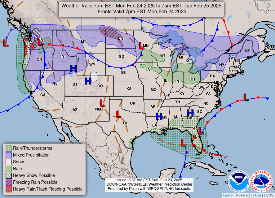
Fronts at 7 PM Sunday
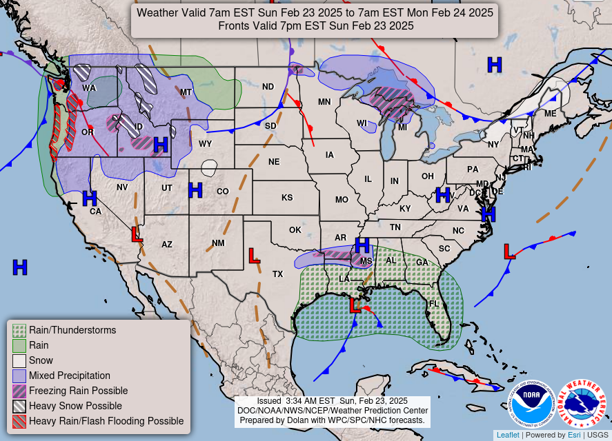
Fronts Monday Evening
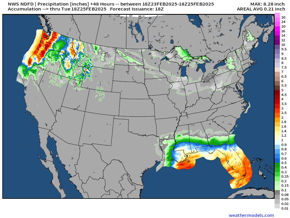
Florida will get plenty of rainfall over the next 48 hours. The atmospheric river contineus bombarding the Pacific Northwest.
Total Precipitation Next 48-hours from NWS
Total Snowfall Next 48-hours from NWS

Mountain snowfall out west. Only light accumulations with the weak storm system across the Great Lakes and perhaps Maine.
Temperature Analysis 1:00 PM EST
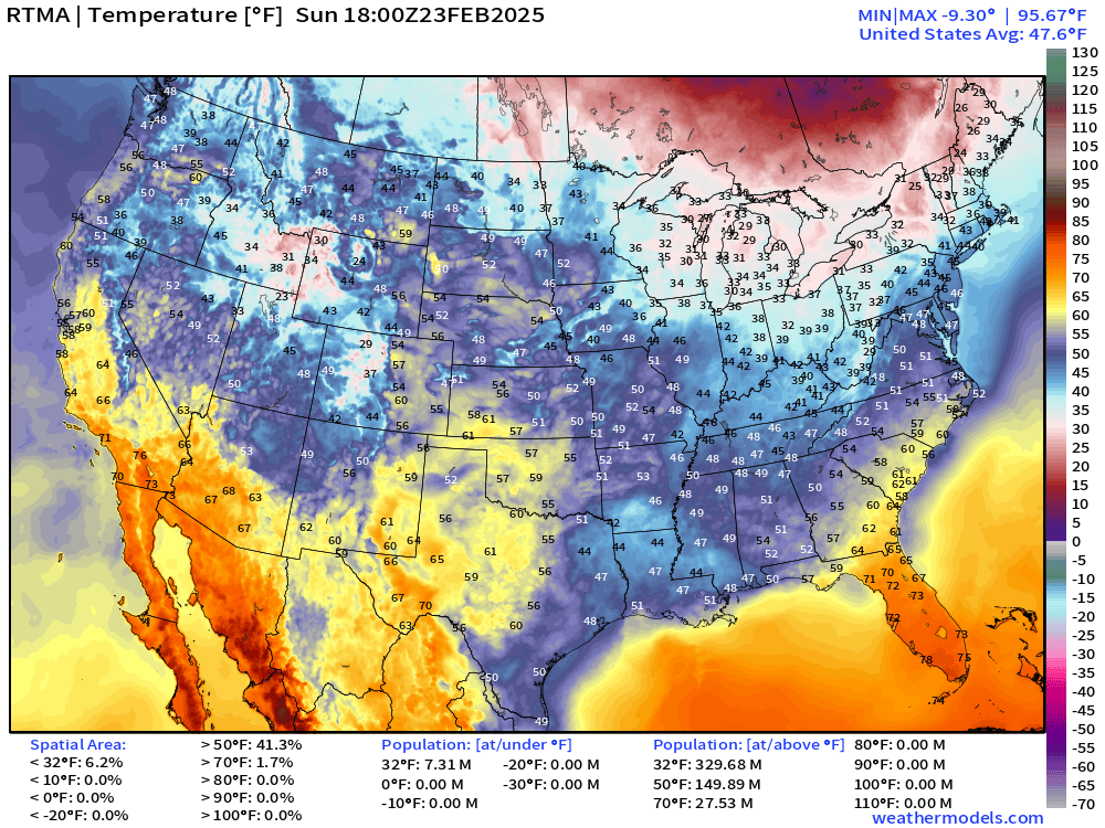
Everyone is almost thawing out … 7 million left over. 27 Million at/above 70°F
Temperature Anomaly 1:00 PM ET
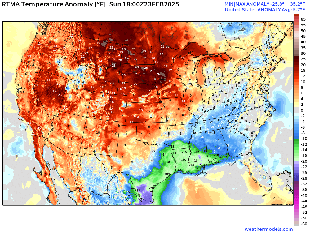
Lower 48 Temperature anomaly = +5.7°F above normal. The cold pool is left over in South Texas into New Orleands.
High Temperatures on Sunday
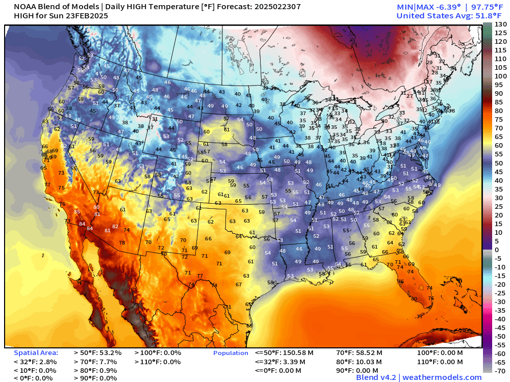
Much better to see 60s into the Plains
Low Temperatures on Monday
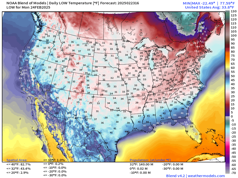
Average Lower 48 low temperature is above freezing at 33.8°F — much warmer compared to last week when the Lower 48 Low was 13°F.
High Temperatures on Monday
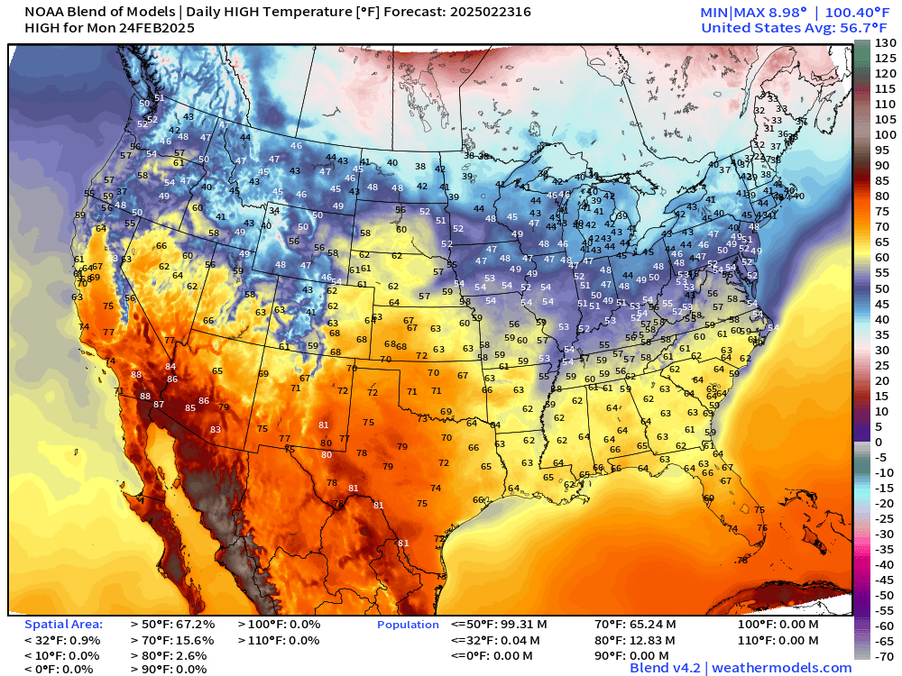
56.7°F average Lower 48 High Temperature! Only 40,000 population below freezing probably in farth northern Maine.
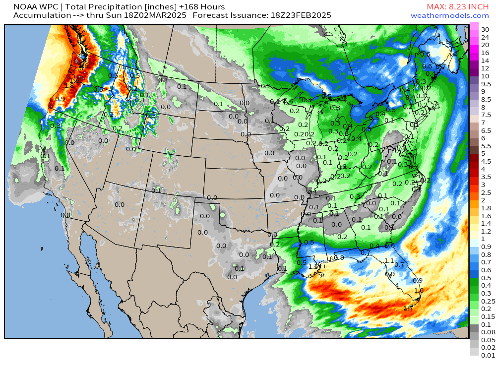
NWS WPC Precipitation | Next 7-days
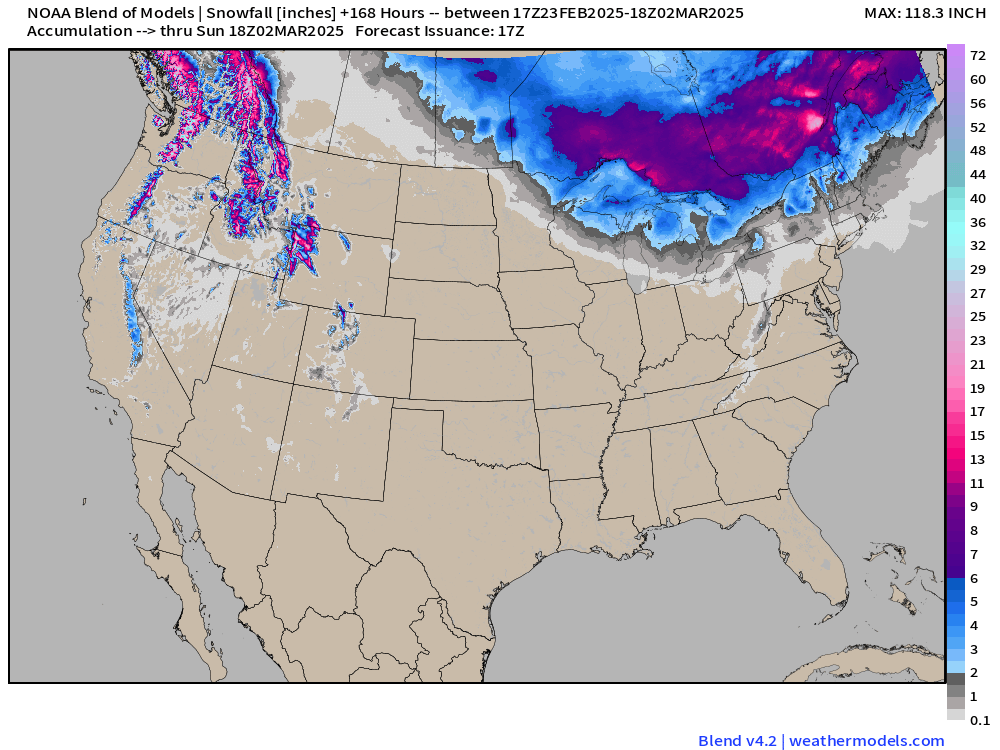
Blend of Models Snowfall | Next 7-days
Polar Vortex Watch
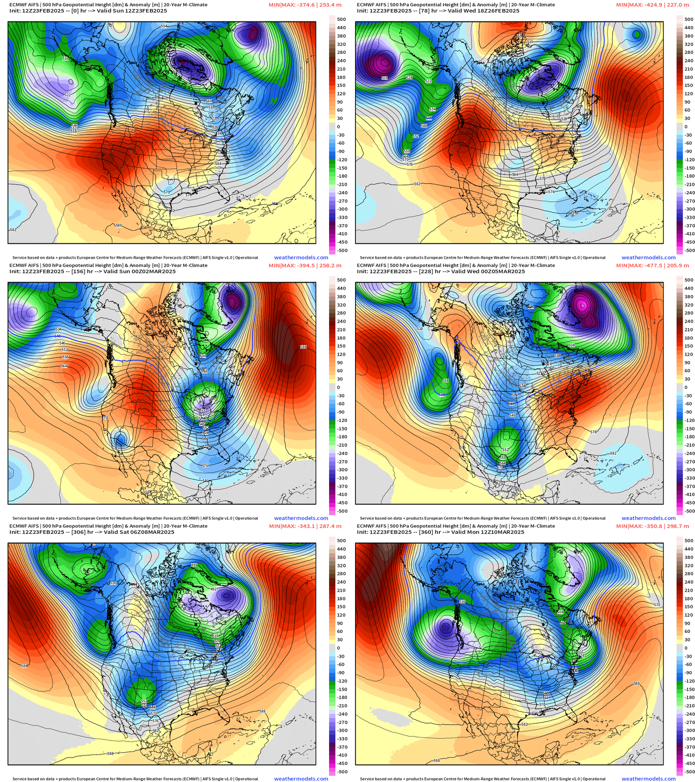
ECMWF AIFS over the next 15-days shows the progression of many mobile troughs originating from the North Pacific and meandering through the Lower 48, sometimes cutting-off with stronger ridging in between.
Still a LOT of troughing / lower heights in the Middle Latitudes and then increasing into Week 2 in Canada. That’s not a "blow torch” pattern at all, but seasonable and perhaps a little cooler than normal into early March.
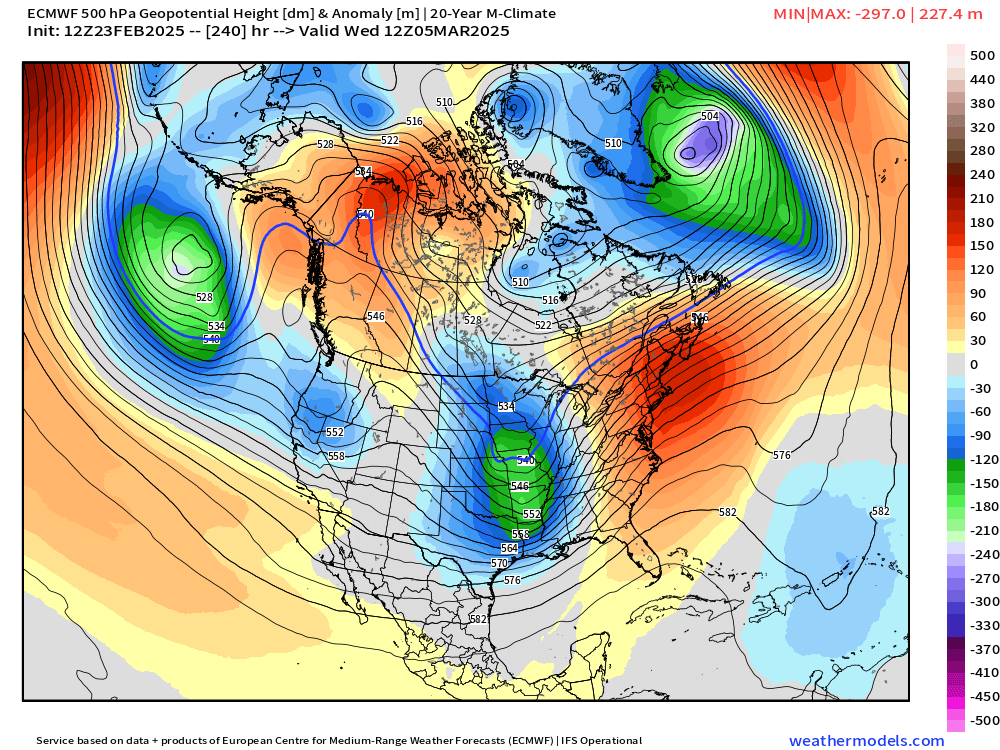
Height Anomaly at Day 5
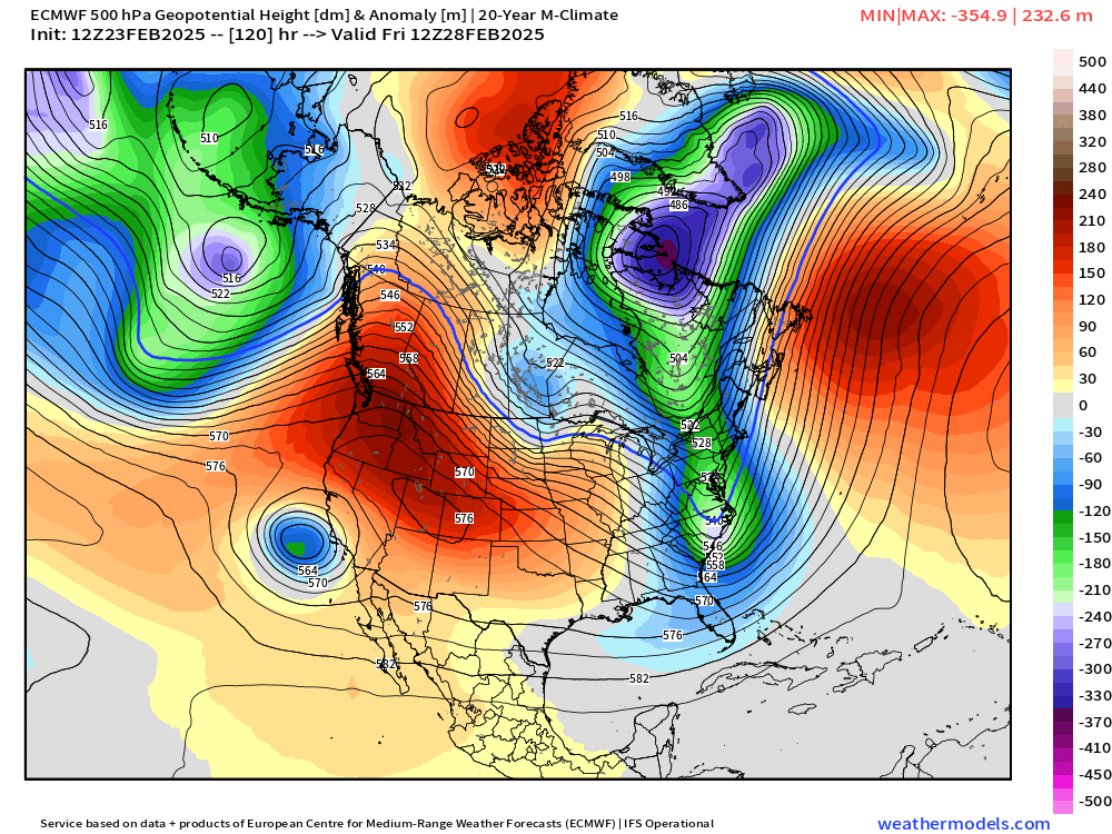
Ridge out west vs. trough across Eastern U.S. connecting to the main tropospheric Polar Vortex anchored over northern Quebec.
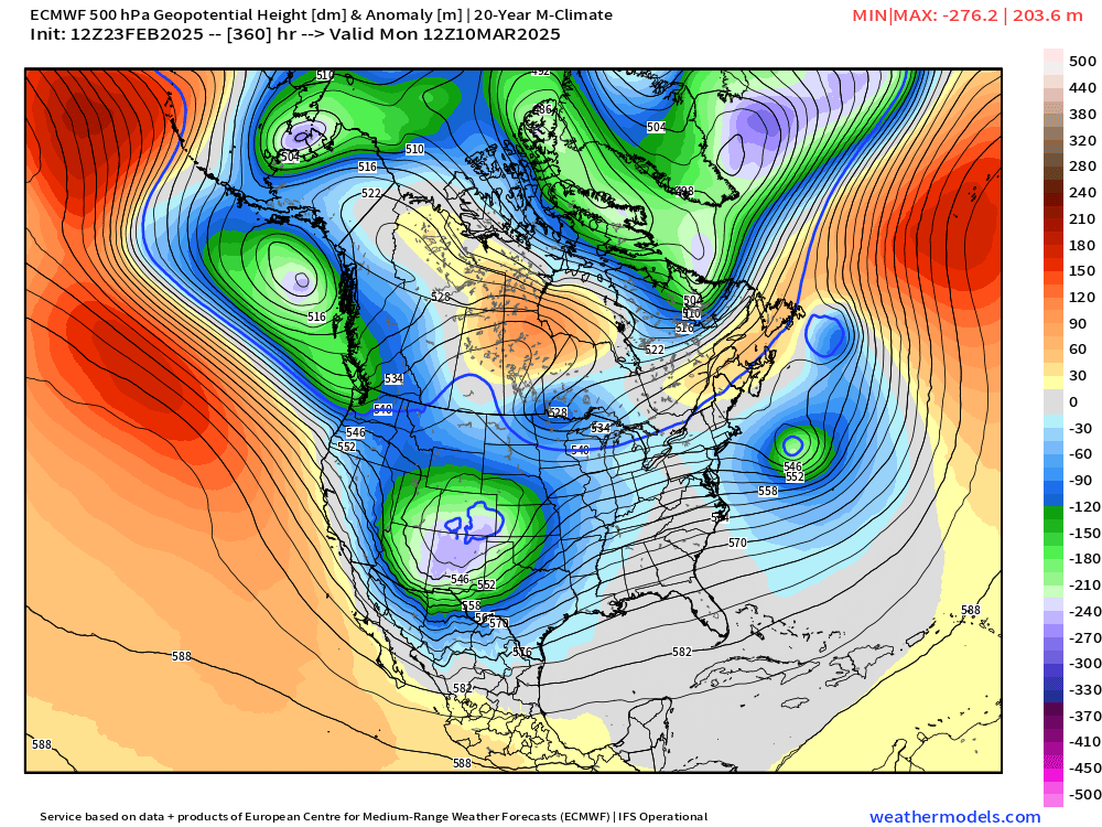
Heigh Anomaly Day 10
Mobile Trough in central U.S. with a parade underway of more systems.
Day 15 Height Anomaly
GFS Dynamic Tropopause
Snaphots of the GFS upper-level tropopause potential temperatures [Days 4, 7, 12]: the intense white fuzzball finally moves into Arctic out of Canada and weakens south of Greenland.
By Day 12, we see an expansion of the purple Polar air mass but a slight weakening in the overall temperature. That’s expected heading into March as the hemisphere slowly warms!
ECMWF 12z Precipitation Type | Next 10-days
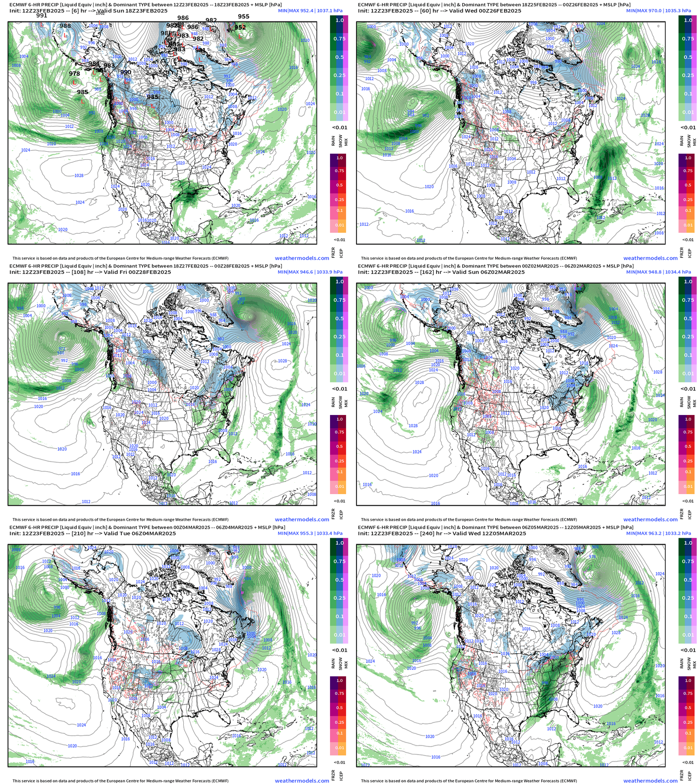
Best chances of snowfall will be with Canadian Clipper systems as the main storm track is well to the north. A storm off the East Coast is well off shore this coming week. We can’t discount a major low intenifying off the Northeast Coast with perfect phasing with the jet stream, but the odds are low.
GFS Snowfall Last 3-cycles | Out to 16-days
ECMWF Snowfall Last 2-cycles | Out to 15-days
Even will the warming trend, the GFS and ECMWF models through 2-weeks still show a LOT of snowfall on the maps in the northern 1/3 of the Lower 48 including the Great Lakes and New England.
This is exceptional into the first 10-days of March. So, I assume after a few days of quiet and enjoyable weather this week, we’ll be back to worrying about a winter storm.
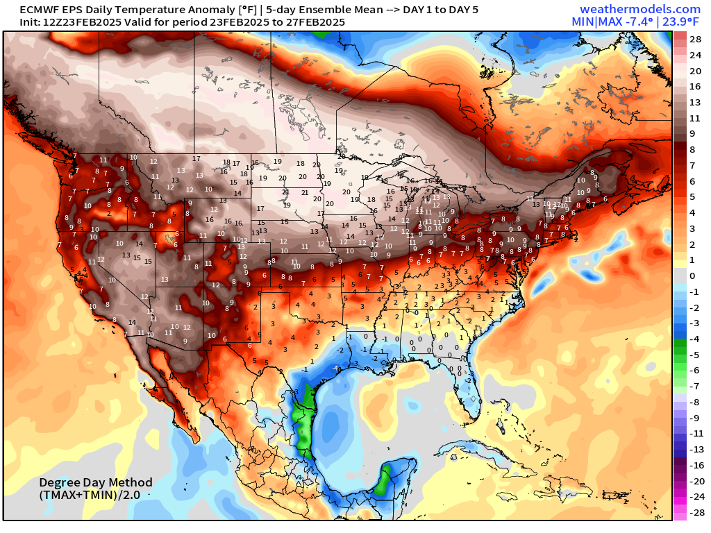
ECMWF EPS 12z | 5-Day Chunk Temperature Anomaly
Days 1-5: February 23 - February 27
Days 6-10: February 28 - March 4
Days 11-15: March 5 - March 9
Who writes and researchers this Newsletter? Dr. Ryan N. Maue [X https://x.com/ryanmaue] with 20-years experience of daily weather model production and analysis. You may have seen my weather maps! I live in Atlanta but was born and raised in Northern Michigan. I know snow, and southern heat and humidity.
Maps sourced from weathermodels.com designed and innovated by yours truly! Please subscribe there for real-time access to the newest maps, charts from all of the weather models including ECMWF.
- Milepost
- 530 · laid 2025-02-23T19:19:23.949000Z
- Source
- https://weather.substack.com/p/february-23-2025-sunday-weather
- Digest
- f4b8e0835d1ab9def0bdb6ab7f03535abae64c41fbe973c6370f40ba34c43e45
- Machine
- JSON