August 2023 North Atlantic Hurricane Season
El Niño and warm Atlantic ocean waters fight it out
August 2023 was the 10th-warmest August in the 132-year national record (1895–2026), at 74.4°F against a 1991–2020 normal of 73.1°F (+1.3°F).
August 2023 was the 43rd-wettest August in the 132-year national record (1895–2026), at 2.8in against a 1991–2020 normal of 2.7in (+0.1in).
NOAA/NCEI Climate at a Glance, contiguous United States. This is the observed record for the month, not a score of anything said in this piece — the forecast ledger begins 2026-08-17 and cannot reach earlier posts.
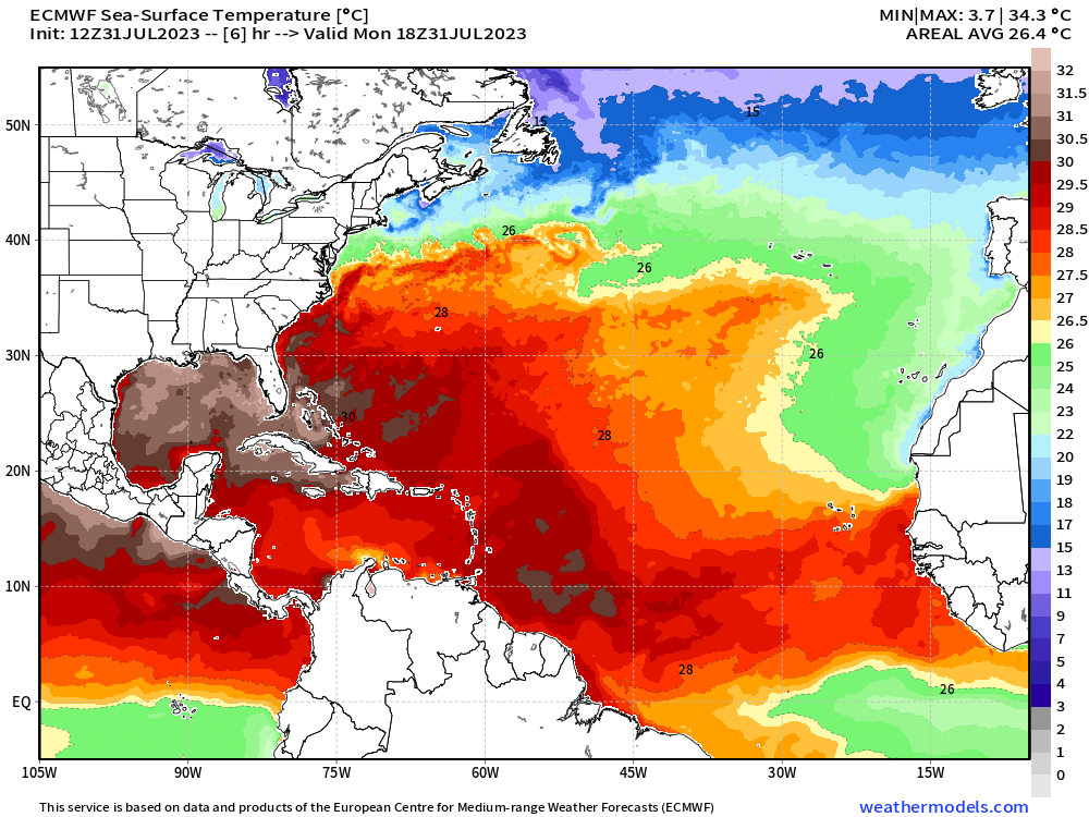
Sea surface temperatures are very warm heading into August.
Actual ocean surface temperatures [SST] on July 31, 2023 from the ECMWF HRES weather forecasting model shows very warm waters well in excess of 28°C over a large area of the Tropical Atlantic. There is nothing ocean-wise that would prevent the development of a major hurricane.
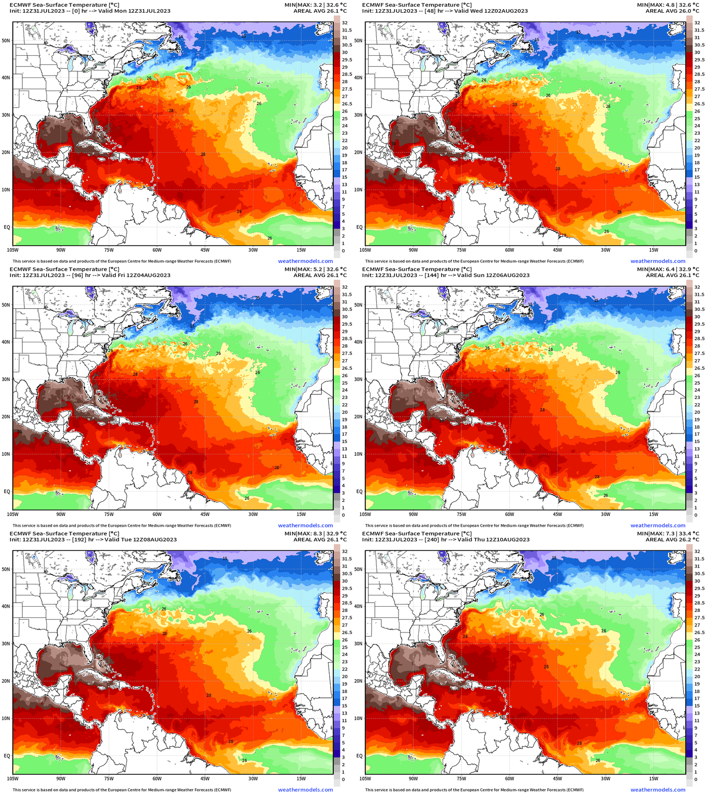
A fantastic feature of ECMWF HRES is the coupled-ocean which is also forecasted throughout the 10-day period. There is some warming but it is not really enough to change the colors of the map since they are in 0.5°C increments. If you look at 6-hourly or hourly SST data from an ocean model, then you would see that there is diurnal or daily variability in SST in some places on the order of 2-3°C with coolest readings in early morning.
Unnamed Storm
Arlene 02L: 35 knots
Bret 03L: 60 knots
Cindy 04L: 50 knots
Don 05L: 65 knots
Right now, the only show in town is Invest 96L and NHC knocked down the development chances from 70% to now 50% as it tracks northward in the central tropical Atlantic. The overall environment is hostile with wind shear from a variety of upper-level disturbances randomly spinning nearby in the the Atlantic.
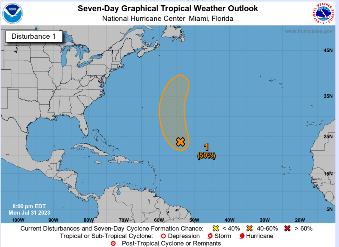
Invest 96L. Next name is Emily.
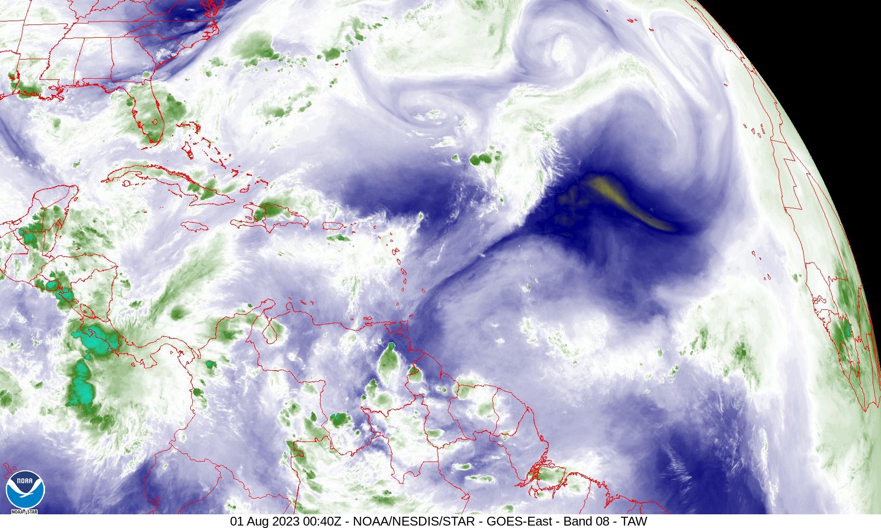
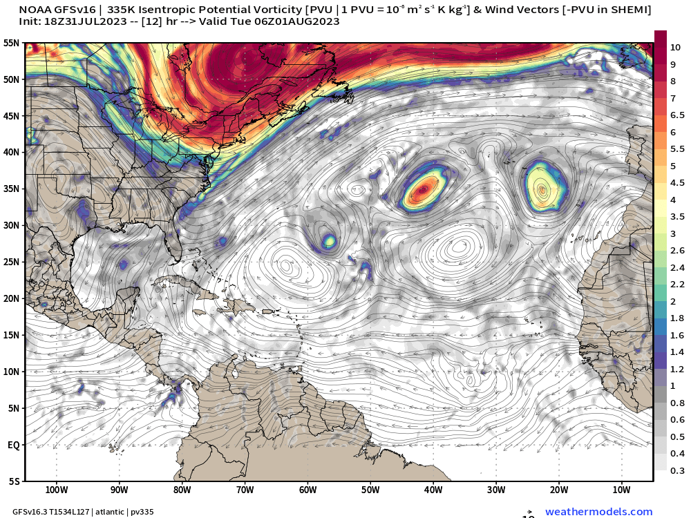
Let’s look at the 335K isentropic PV to see the upper-level disturbances to the east of 96L. There is a brief window of opportunity for development until the midlatitude trough over the Northeast picks up 96L and whisks it along to U.K. and Europe. To see the upper-level features, the water vapor satellite imagery is best. Such complicated configurations of upper-level troughs is expected in subtropical latitudes especially in an El Nino summer.
Long range: Next 2-weeks
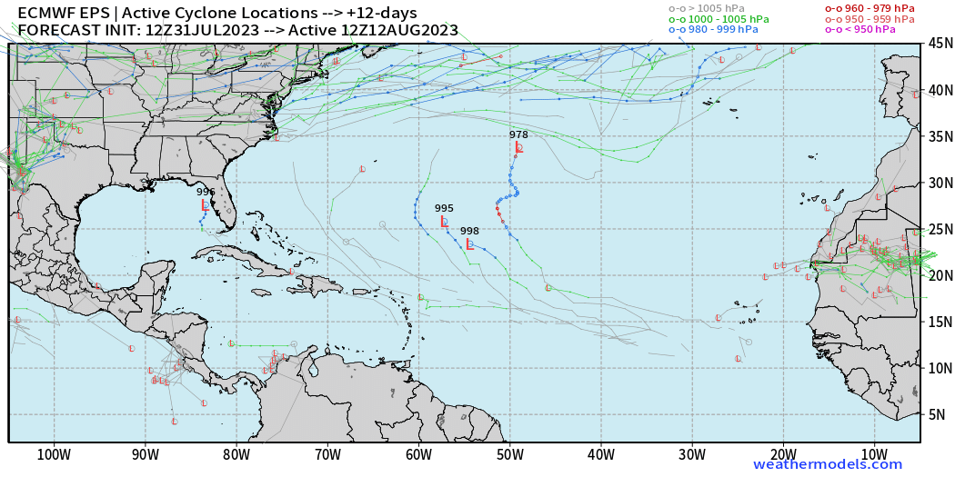
The ECMWF ensembles are showing only minimal tropical wave development in 12-14 day range suggesting the first half of August will be quiet across the North Atlantic. We watch everyday for new forecast guidance, so that may change.
Eastern Pacific Hurricane Season
A hurricane is developing off the coast of Mexico but will move due west picking up the name Dora (05E) likely on Tuesday, which will put the storm in the August column.
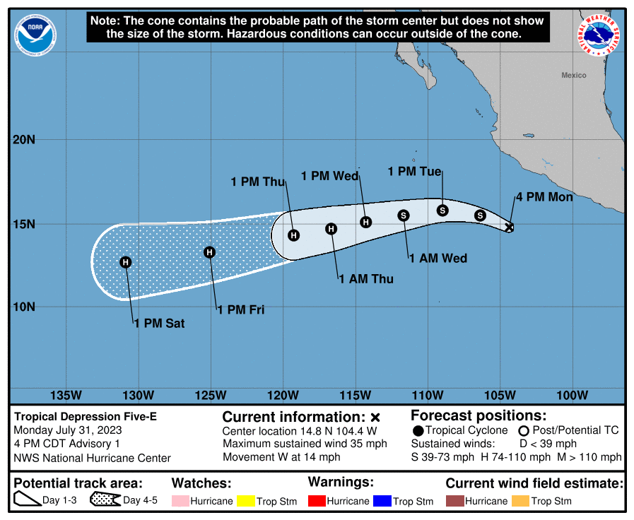
NOAA has launched their new hurricane modeling system called the Hurricane Analysis and Forecast System (HAFS) to eventually replace HMON and HWRF. There are two configurations of HAFS — A and B. Both forecast models project major hurricane status with Dora in the next 72-84 hours. The intensification is very bullish, but I do not have much of a handle on the model yet. The HWRF and its rapid intensification skill is a known known.
Adrian 01E: 90 knots
Beatriz 02E: 75 knots
Calvin 03E: 110 knots
Four 04E: 30 knots
Dora 05E: Forecast 90-knots
Western Pacific Typhoon Season
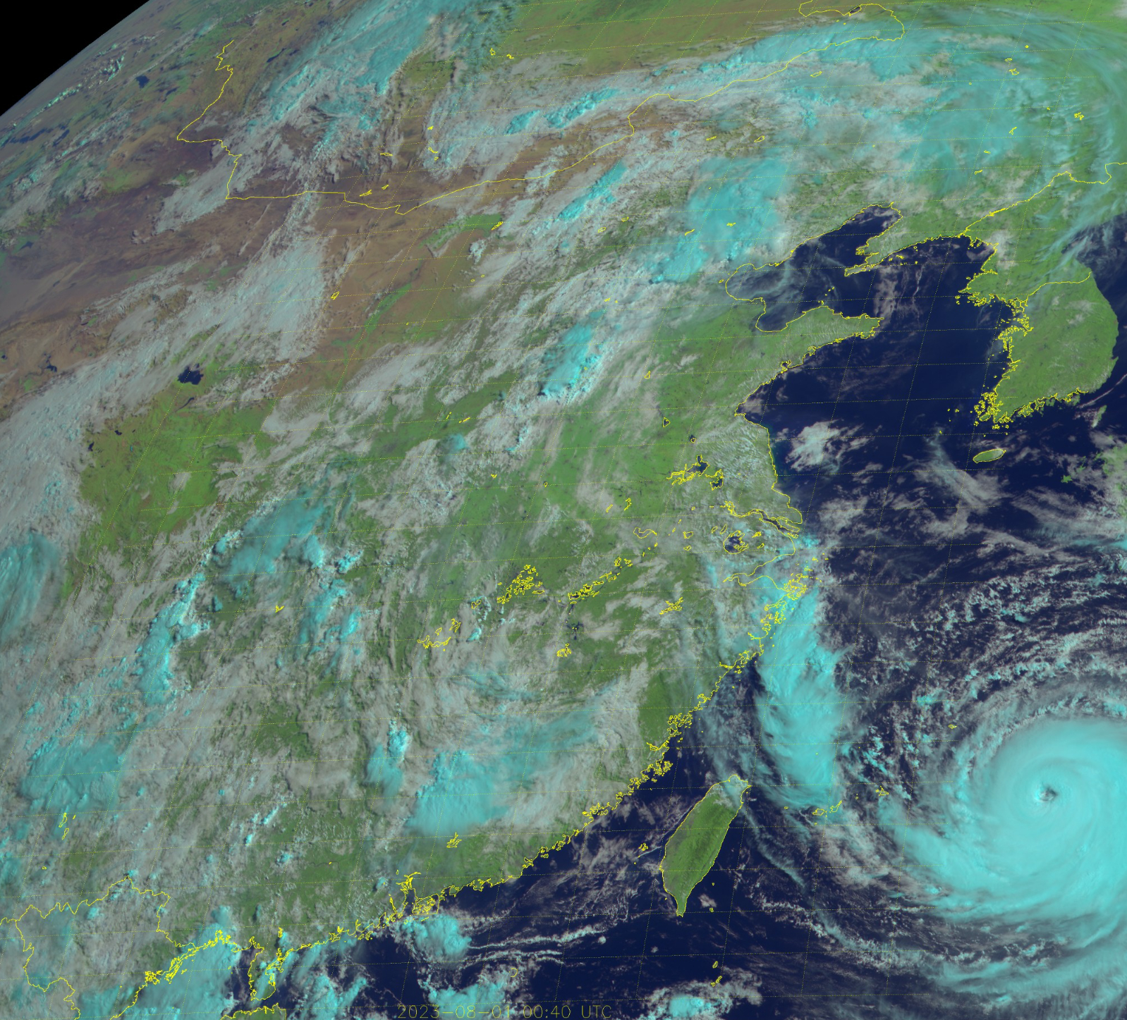
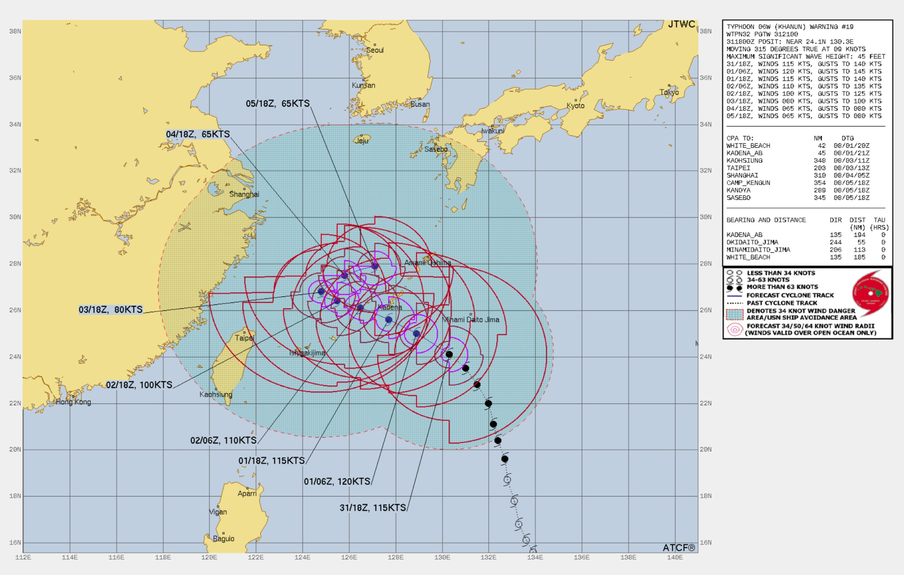
Typhoon Khanun [06W] 115-knots | Category 4 with a well-developed eye early Tuesday morning from visible imagery. However, Khanun is expected to blow a tire and come to a halt in the next few days before doubling back to the ENE. This particular track would be deleterious for the Typhoon with entrainment of dry air from the continent as well as cooler upwelled water. Forecasts a few days ago suggested a threat to China, but that has changed.
Sanvu 01W: 30 knots
Mawar 02W: 160 knots
Guchol 03W: 90 knots
Talim 04W: 85 knots
Doksuri 05W: 130 knots
Khanun 06W: 115 knots + (ongoing)
- Milepost
- 52 · laid 2023-08-01T01:36:20.795000Z
- Source
- https://weather.substack.com/p/august-2023-north-atlantic-hurricane
- Digest
- cdf61271a5d7fe130de62d29c3369b34bdc1ff59717b09904d3707aa2005bda6
- Machine
- JSON