Grace poised to intensify into powerful hurricane
Henri safely off East Coast near Bermuda
August 2021 was the 18th-warmest August in the 132-year national record (1895–2026), at 73.9°F against a 1991–2020 normal of 73.1°F (+0.9°F).
August 2021 was the 12th-wettest August in the 132-year national record (1895–2026), at 3.1in against a 1991–2020 normal of 2.7in (+0.5in).
NOAA/NCEI Climate at a Glance, contiguous United States. This is the observed record for the month, not a score of anything said in this piece — the forecast ledger begins 2026-08-17 and cannot reach earlier posts.
During the next 3-5 days, we will have two hurricanes in the Atlantic that have the potential to reach major or Category 3 strength. Hurricane Grace is a major threat to populated land first over the Yucatan and then westward into the Gulf of Mexico and Tampico, Mexico.

Over the next 36-hours, Grace will be intensifying over some of the deepest and warmest ocean heat content water on Earth in the northwestern Caribbean. Many historical Category 5’s passed through here including Gilbert (1988) and Wilma (2005).

The Tropical Cyclone Heat Potential (TCHP) is a fantastic visualization of ocean heat content integrated from the surface to the 26°C isotherm. Grace will be traveling over water at the top of the color scale. Rapid intensification probably will not occur, then it will not be because of thermodynamics or ocean fuel, but dry air and disorganized nature of Grace — large circulation with a history of land interaction.

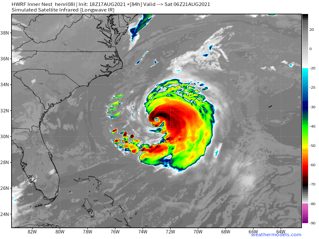
HWRF 18z prior to landfall in Yucatan has Grace as a hurricane but unlikely a well developed eye or inner-core. But, in 3-days, that would be a higher likelihood in the Gulf of Mexico.

Henri may become a major hurricane

This weekend Hurricane Henri will be a massive storm off the East Coast. Warm ocean temperatures, low wind shear, and upper-level divergence may allow Henri to reach Category 4 prior to crossing 35°N latitude. While no threat to land as a tropical system, the post-tropical stage may impact far eastern Canada.
Next 2-weeks August 17-31, 2021
Grace and Henri will continue for the next 5-7 days.
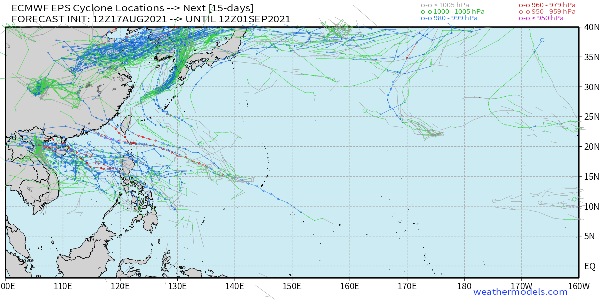
The ECMWF EPS storm tracks (15-days) from the recent 12z forecast does show some recurving hurricanes spawned from African easterly waves but no signal of westward advancement suggesting a weakness in the Bermuda high — due to Henri.

15-day ECMWF EPS 12z (August 17, 2021) from WeatherModels.com
The Western Pacific east of the Philippines to the Dateline is a ghost town. No Super Typhoons over the very warm water. Very quiet. Not unexpected because of La Nina.

- Milepost
- 49 · laid 2021-08-18T03:42:11.309000Z
- Source
- https://weather.substack.com/p/grace-poised-to-intensify-into-powerful
- Digest
- 84ff1e7ba9fcd11eaca82cda713e200374e3ff8dd3617f75afdd08e01730e4c3
- Machine
- JSON