December 25, 2024 Wednesday Winter Weather
Will Nor'easter next week have enough cold air?
December 2024 was the 4th-warmest December in the 131-year national record (1895–2025), at 38.1°F against a 1991–2020 normal of 34.3°F (+3.8°F).
December 2024 was the 64th-driest December in the 131-year national record (1895–2025), at 2.4in against a 1991–2020 normal of 2.5in (-0.1in).
NOAA/NCEI Climate at a Glance, contiguous United States. This is the observed record for the month, not a score of anything said in this piece — the forecast ledger begins 2026-08-17 and cannot reach earlier posts.

Today’s weather was mostly quiet except for the Pacific Northwest. A warmer and wetter pattern takes over for the next 4-5 days before a subtle pattern shift allows colder Canadian continental air to flood into the Eastern U.S.
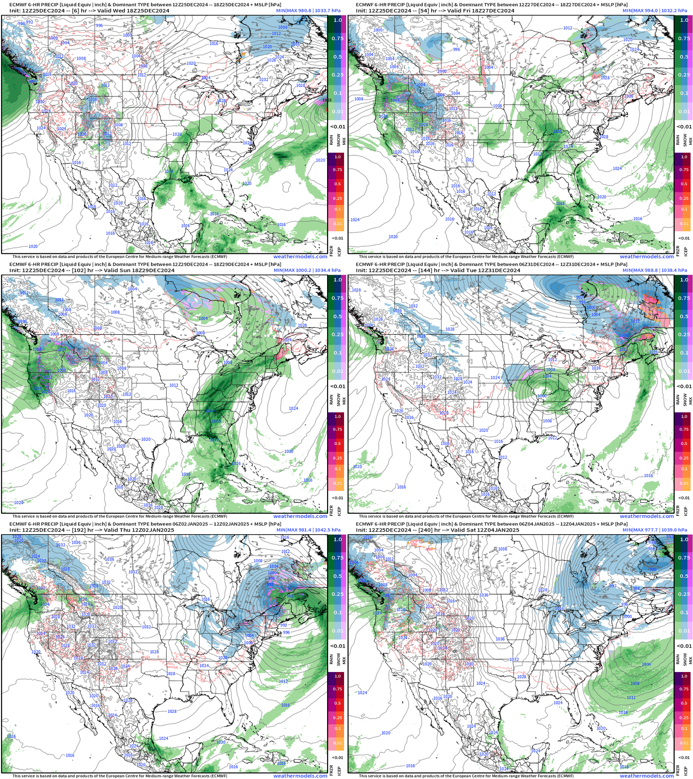
By next Wednesday, a potential Nor’easter could develop but looks like mostly rain with temperatures too warm for significant snow. However, the low tracks into Canada and stalls out — its circulation allows NW winds to drag Arctic air all the way into the Southeast by the following weekend. This is a Day 7-10 time period event, so way down the road.
In the meantime, we’ll deal with a lot of rain across the Mississippi River Valley, and several atmospheric rivers bombarding the West Coast — from Central California coast northward into OR/WA.
ECMWF 12z precipitation type and MSLP next 10-days
Severe Weather and Heavy Rain on Thursday
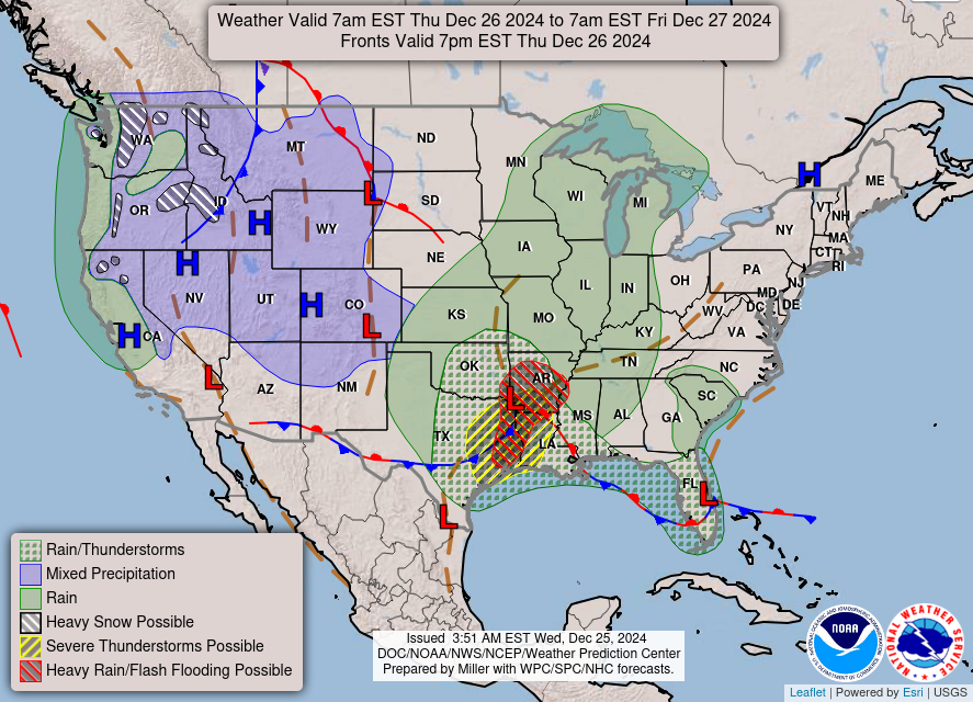
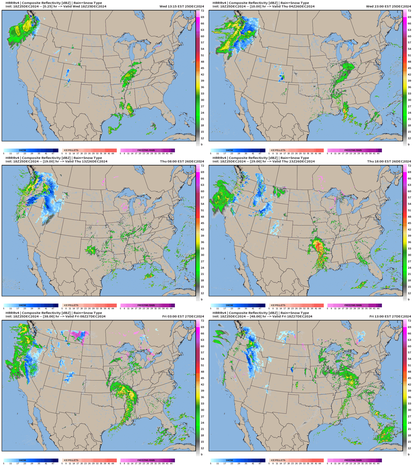
Gulf of Mexico moisture will surge north into Arkansas with a developing storm system leading to heavy rain and potential for some severe thunderstorms in TX/LA/AR.
HRRR simulated radar | Next 48-hours through Friday afternoon
NWS | Total Precipitation Next 48-hours
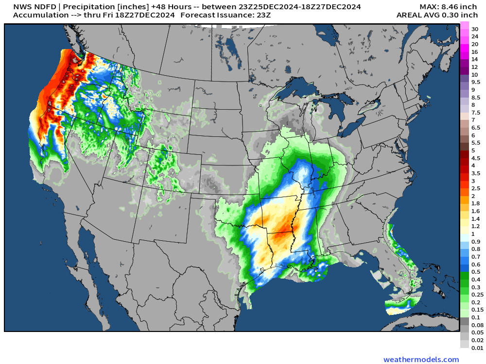
Large area of 1-2” centered upon Louisiana and Arkansas. A lot more — 6-8” along the CA/OR/WA coastline.
NWS | Total Snowfall Next 48-hours
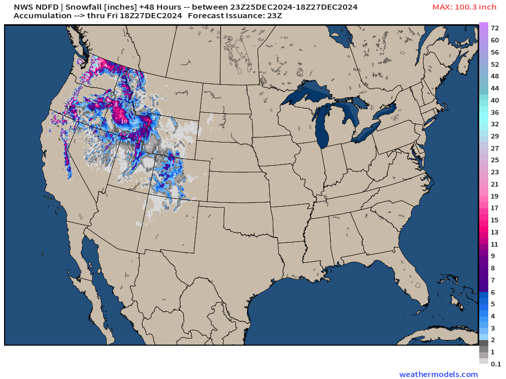
Nice to see the Pacific moisture going to good use for snowfall across the Western U.S. in the Rockies even with much above normal temperatures.
Nor’easter that goes to waste?
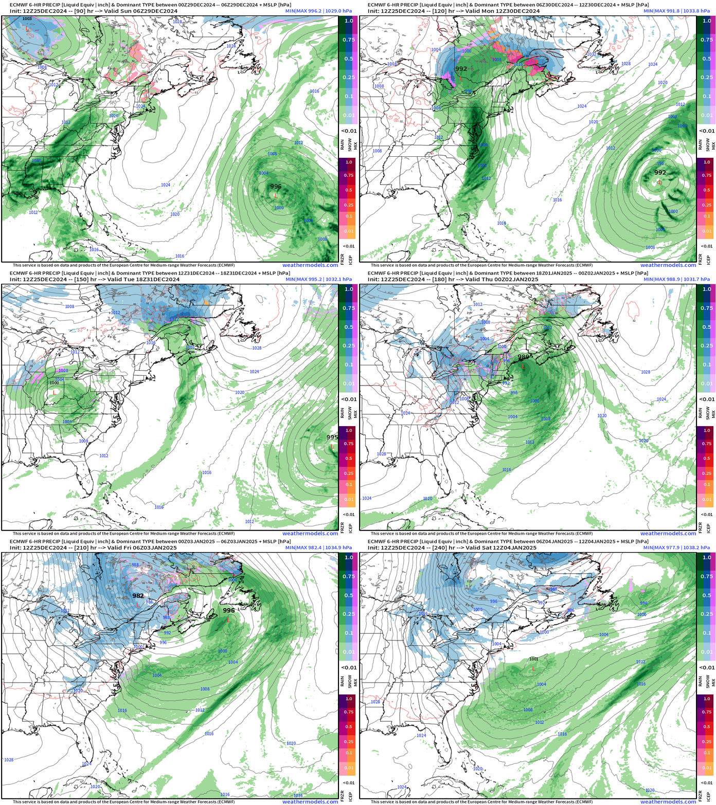
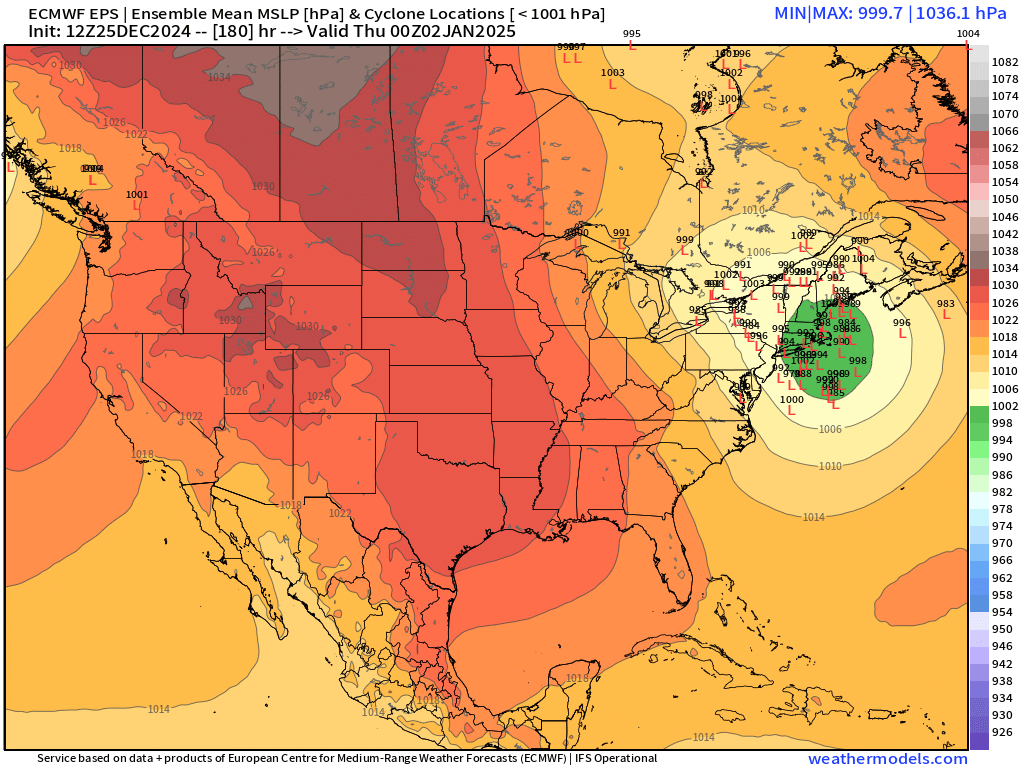
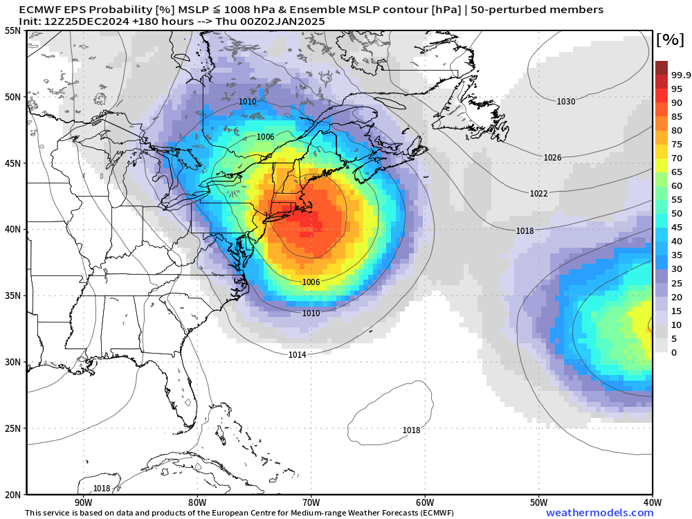
The HRES shows the storm system developing off New England but in a ‘too warm’ air mass for a blizzard. The ensembles show a low pressure collection late Wednesday suggesting high confidence in storm development — regardless of the snowfall. Colder air behind the storm will allow for Lake Effect snowfall, of course.
Atmospheric Rivers | Next 10-days
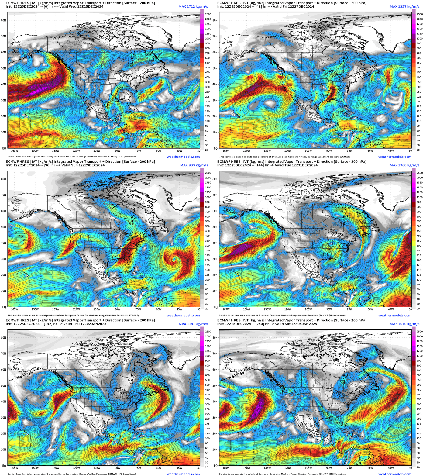
4 more atmospheric rivers for the U.S. West Coast.
But, also note significant moisture plumes off the U.S. East Coast with developing storm systems. No shortage of moisture, but certainly not enough cold air.
January 2025 begins with Eastern U.S. Troughing
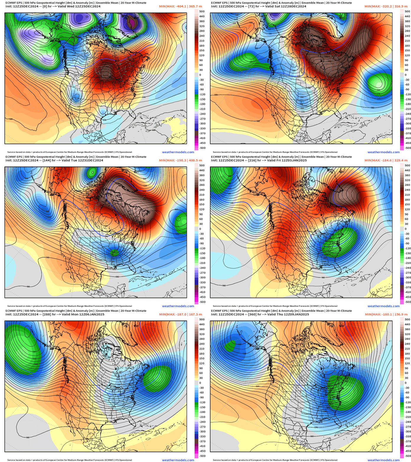
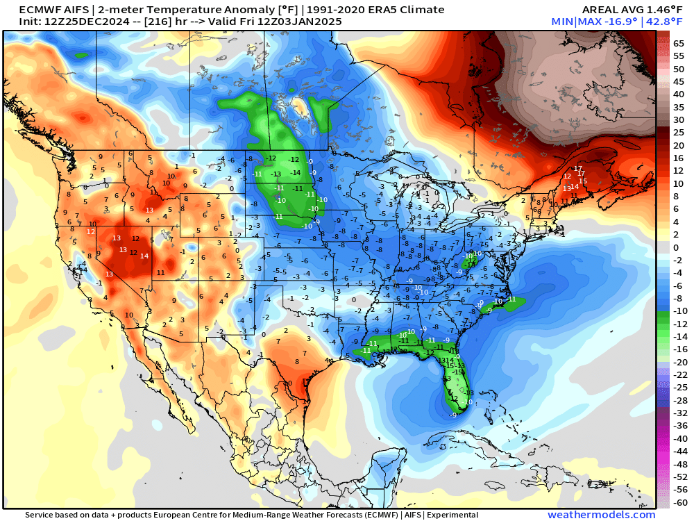
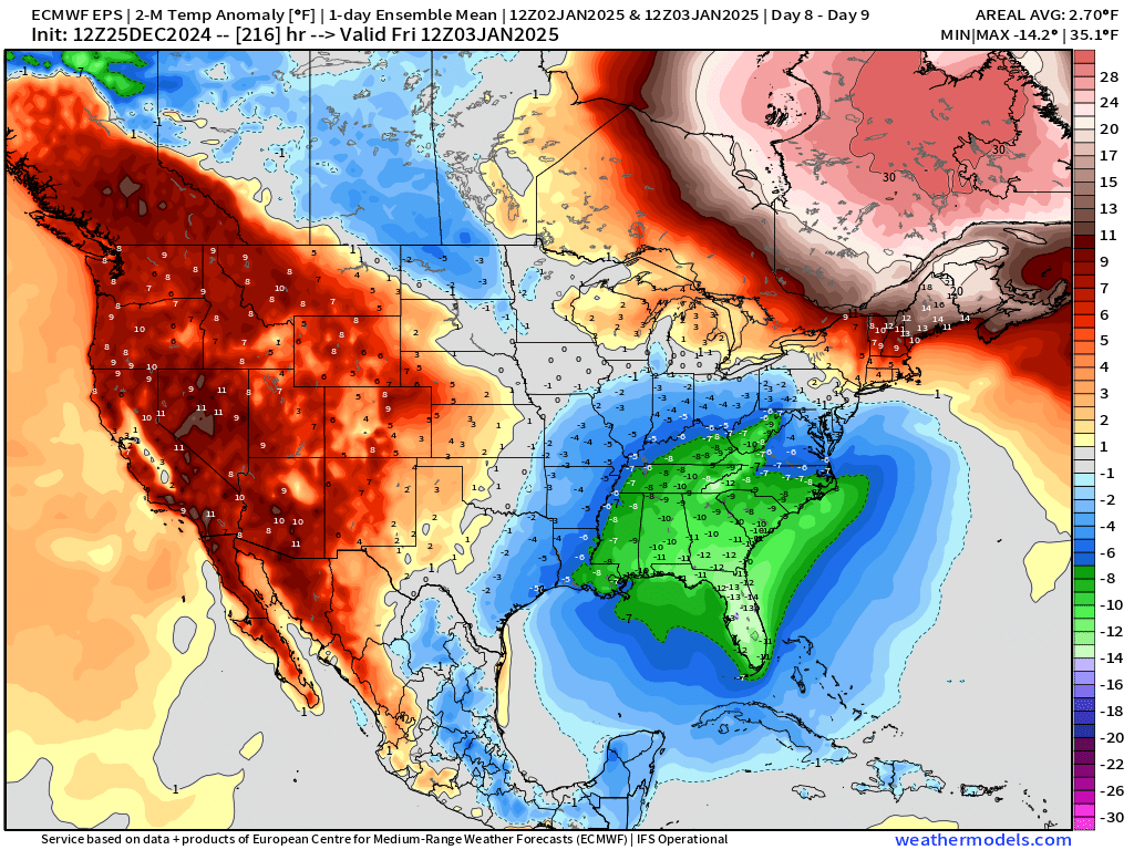
I don’t think anyone who wants winter weather can complain about the pattern shift through the first week of January 2025 with troughs digging into the Eastern U.S. and persisting. However, compared to “normal” the coldest air might be in the Southeast e.g. January 3 (my birthday)
ECMWF AIFS
ECMWF EPS Ensemble Mean
Thursday Morning Temperatures
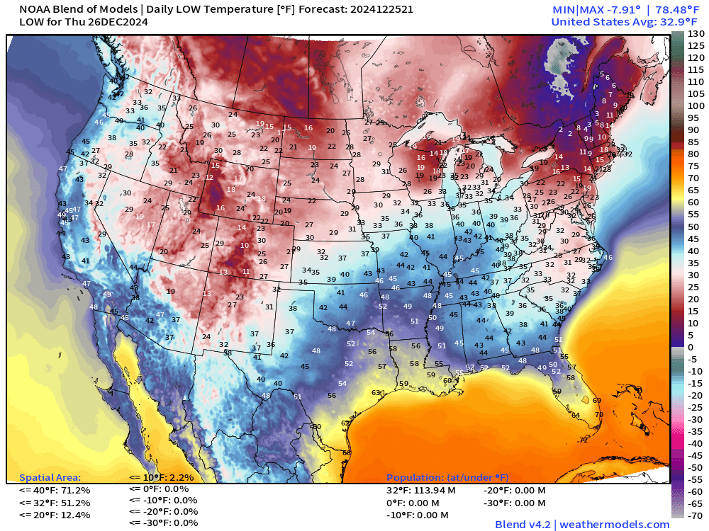
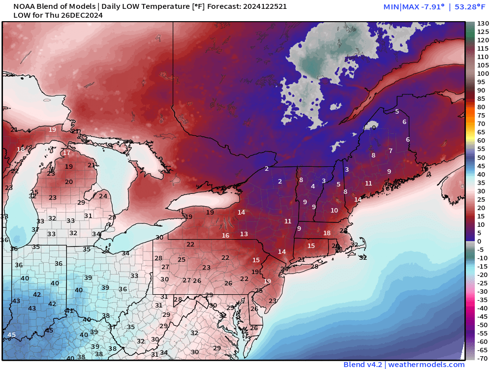
114 million at/below freezing … with coldest temperatures still in New England.
Thursday High Temperatures
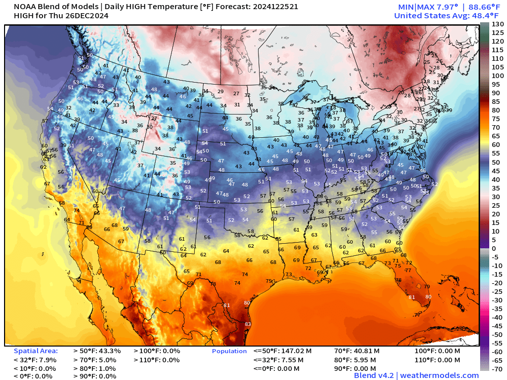
50s creeping into Indianapolis and Columbus, Ohio. 60s into Nashville. However, easterly winds with the Appalachian wedge will keep Atlanta and the Carolinas cooler than otherwise in the low-50s.
6:15 PM ET Temperatures across the Lower 48
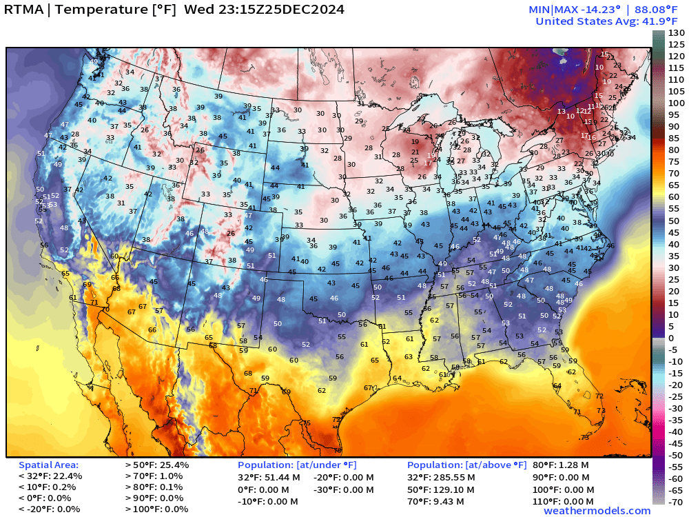
Temperature Anomaly | 6:15 PM ET
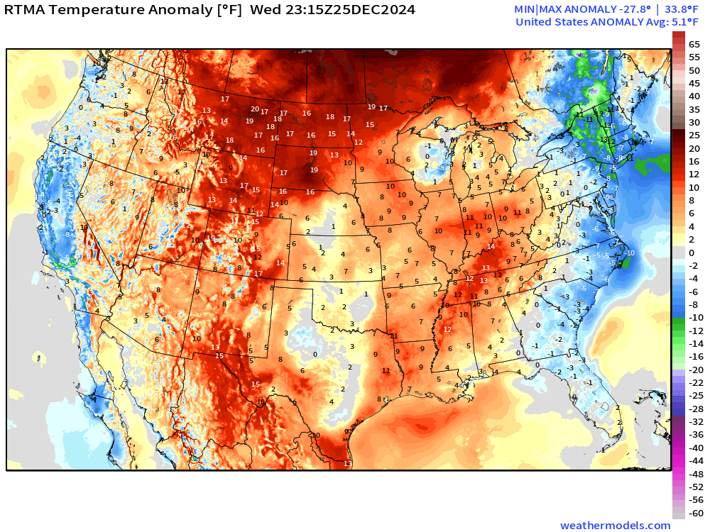
Overall the Lower 48 is 5.1°F (above normal).
Total Precipitation next 7-Days | NOAA WPC
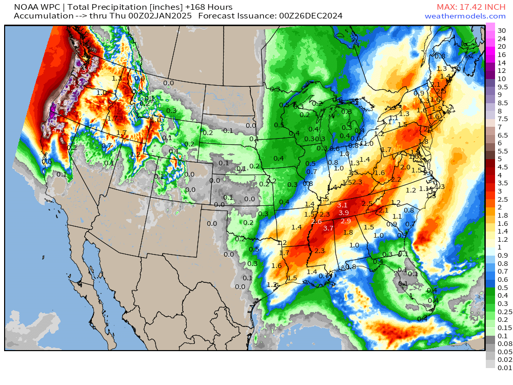
Very wet pattern for Eastern U.S. for late December. Boatloads for Pacific Northwest.
7-day Ensemble Median Snowfall
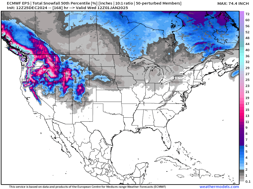
Plenty of mountain snow … and almost nothing east of the Rockies.
15-Days Ensemble Median Snowfall
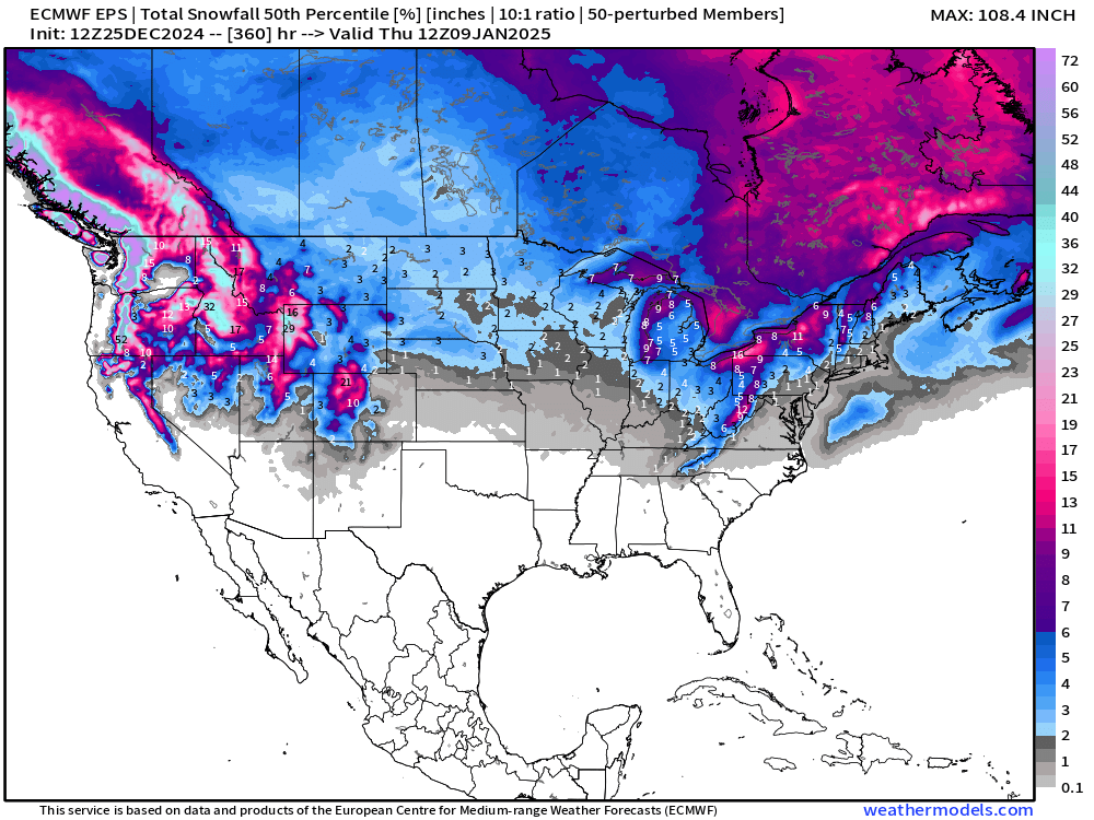
We need to look past the next 7 days for winter weather to return across the eastern 2/3 of the Lower 48. The median of the ensemble won’t show extreme events e.g. if less than 50% chance of snowfall of any accumulation on this map.
So, we look at the probabilities out of the 50-ensembles (2% for each)
Probability of 1” or 3”+ Snowfall Next 15-days
Starting to see 10-20% chances of at least 1-inch of snow creeping into Atlanta and the Carolinas.
Zooming out to the entire Lower 48 for 1-inch
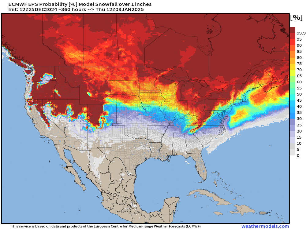
But for powerful winter storms e.g. blizzards, we need to look at higher snowfall totals.
Probability of 6” or more
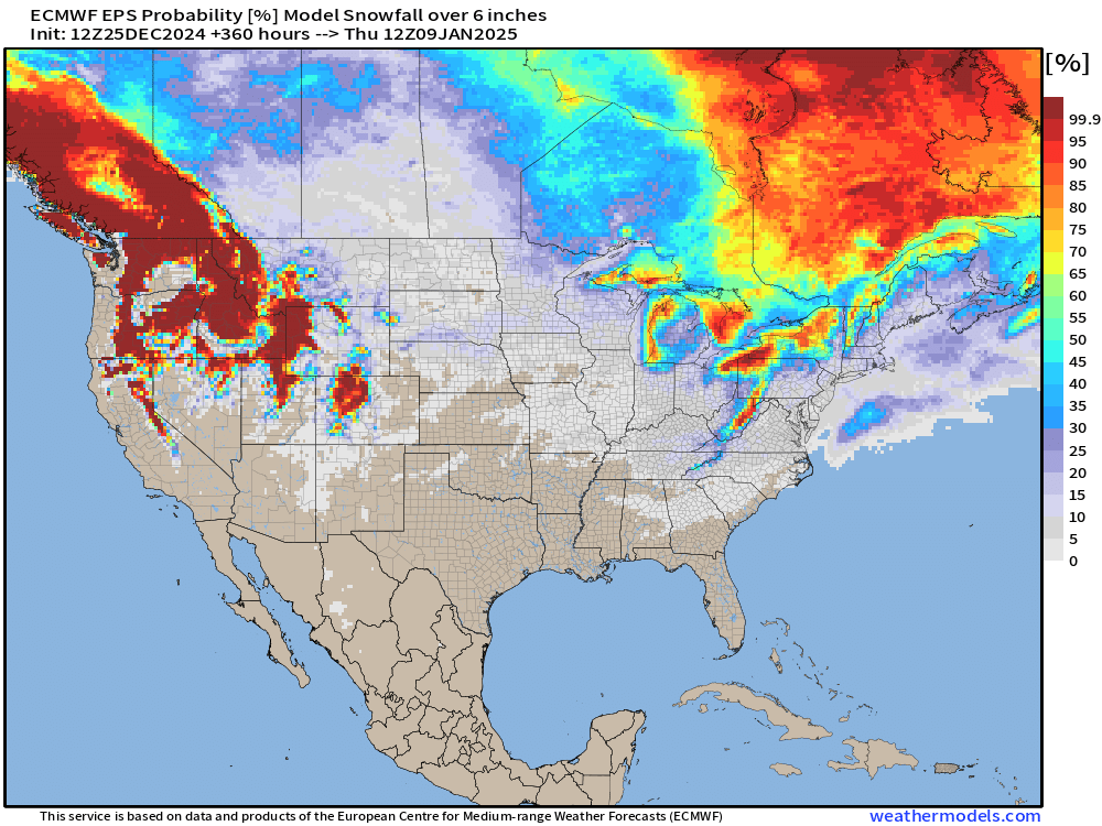
Not surprising to see the lack of a coherent signal for winter storms / Nor’easters when the first 7-10 days are blank. In other words, too soon to say much about storm tracks in the long range aside from noticing the upper-level pattern (c.f. 500 mb ensemble height anomaly) looks favorable for lows to develop off the East Coast.
ECMWF EPS 12z | 5-Day Chunk Temperature Anomaly
Days 1-5: December 25 - December 29
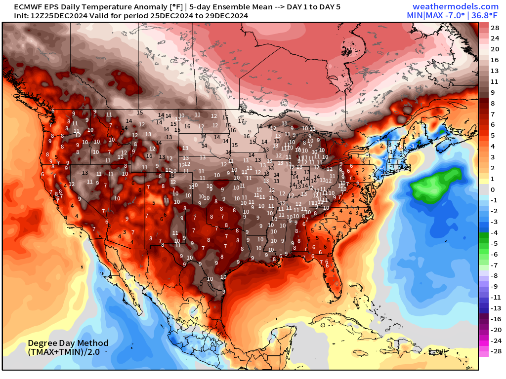
Days 6-10: December 30 - January 3
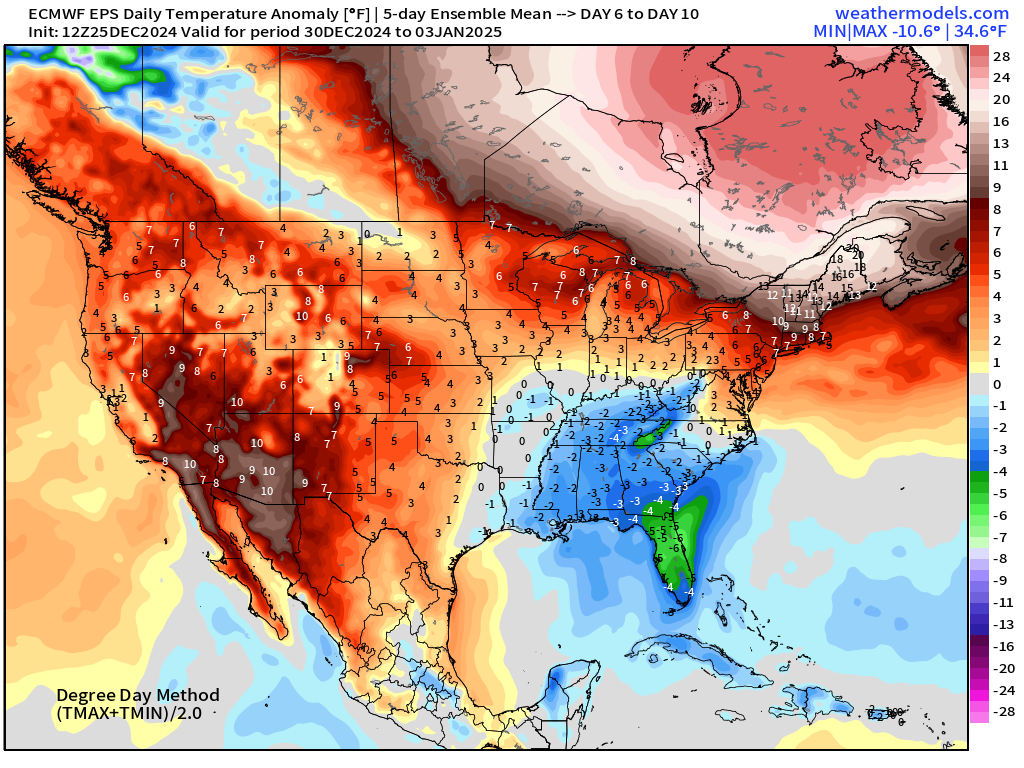
Days 11-15: January 4 - January 8
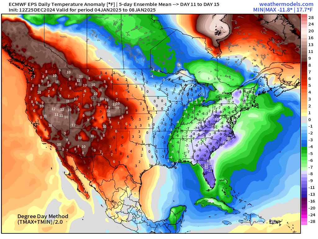
Significant cold anomaly across Eastern U.S. with [relative] warmth out west.
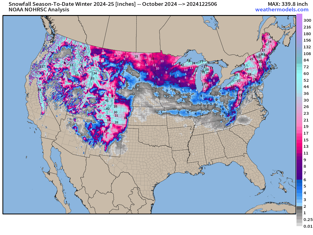
Snowfall Analysis | Season to Date October 1, 2024 — today
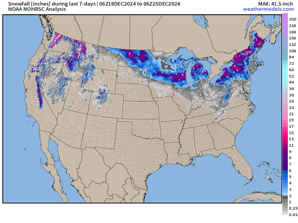
Snowfall Last 7-Days
Maps sourced from weathermodels.com designed and innovated by yours truly! Please subscribe there for real-time access to the newest maps, charts from all of the weather models including ECMWF.
- Milepost
- 471 · laid 2024-12-26T00:10:45.365000Z
- Source
- https://weather.substack.com/p/december-25-2024-wednesday-winter
- Digest
- 8740b0fc47045f6903df2b665a801b07156639a78b409777260491b753d24a65
- Machine
- JSON