December 19, 2024 Thursday Winter Weather
Alberta Clipper dropping snowfall across Great Lakes with much colder air behind front
December 2024 was the 4th-warmest December in the 131-year national record (1895–2025), at 38.1°F against a 1991–2020 normal of 34.3°F (+3.8°F).
December 2024 was the 64th-driest December in the 131-year national record (1895–2025), at 2.4in against a 1991–2020 normal of 2.5in (-0.1in).
NOAA/NCEI Climate at a Glance, contiguous United States. This is the observed record for the month, not a score of anything said in this piece — the forecast ledger begins 2026-08-17 and cannot reach earlier posts.

Alberta Clipper with colder Canadian Air behind front
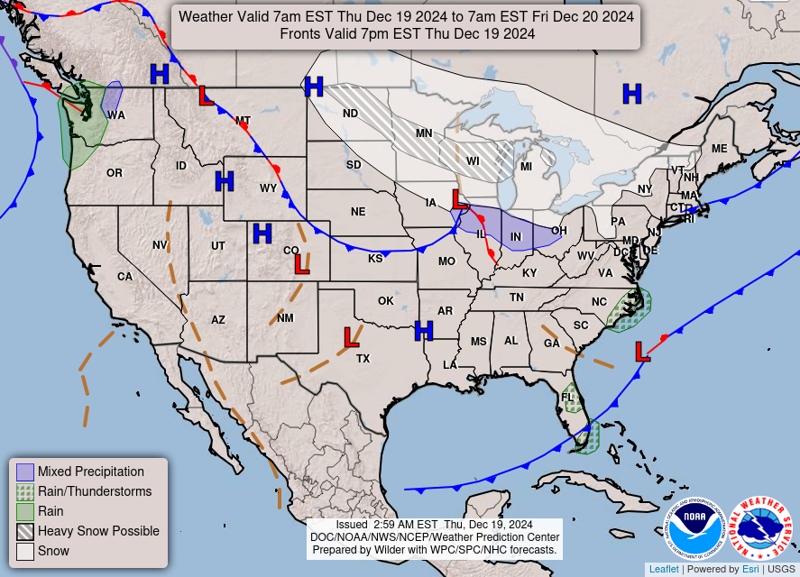
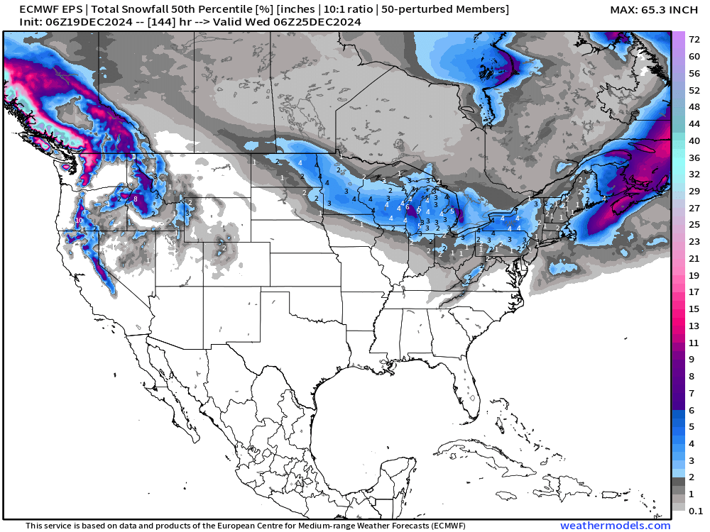
Even though the Clipper system has a high central pressure of 1012 mb, it is embedded within anomalously high background pressure. The significant thermal gradient drives gusty winds to blow around the snowfall — large area of 6-inches plus across the Great Lakes. The system’s snowfall may not melt until warmer temperatures on Christmas Eve, but then there’s another chance of snow in time for Santa Claus.
By Friday afternoon, the Clipper System loses its identity and is a mess of scattered snow showers in the colder air, and showers ahead of the front.
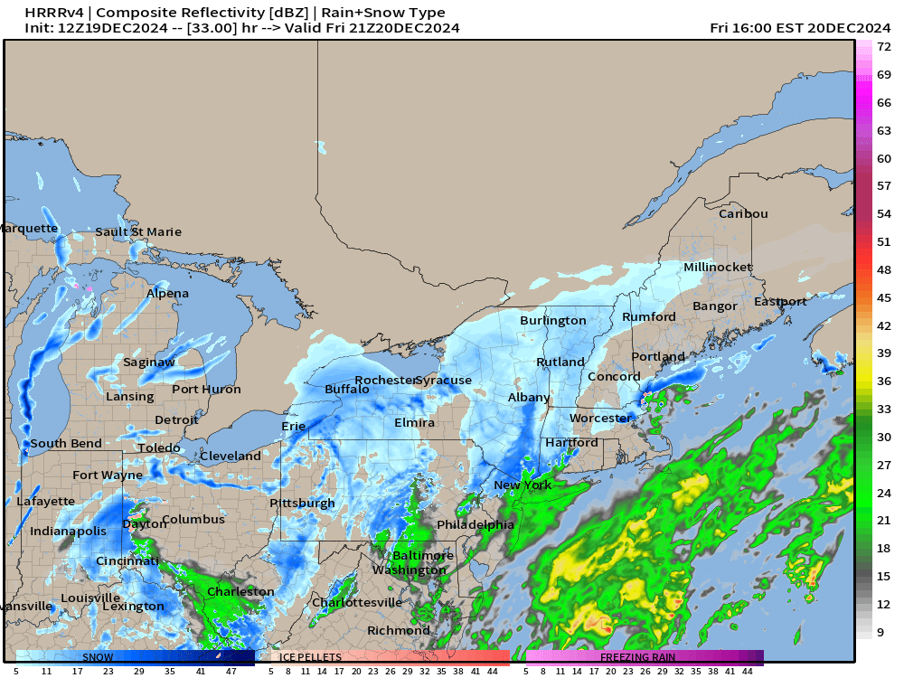
Once offshore, a new storm center develops and heads into Canada.
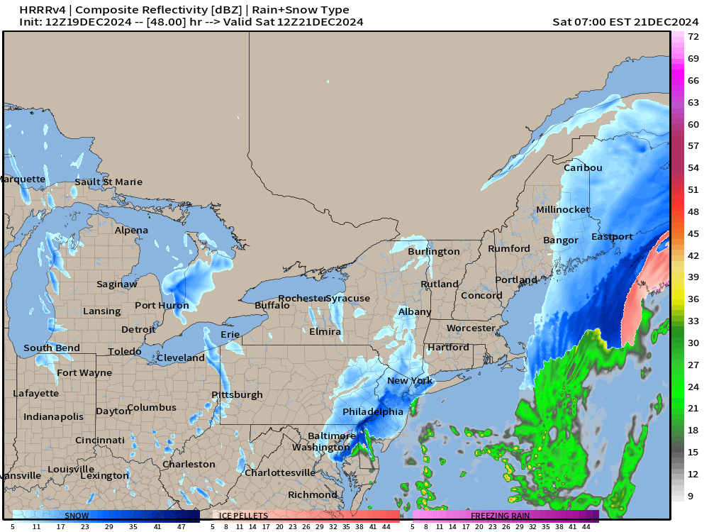
However, there is a small area of snowfall possible early Saturday morning from Philadelphia to New York City with minor accumulations (1” of less).
Simulated Radar Next 18-hours
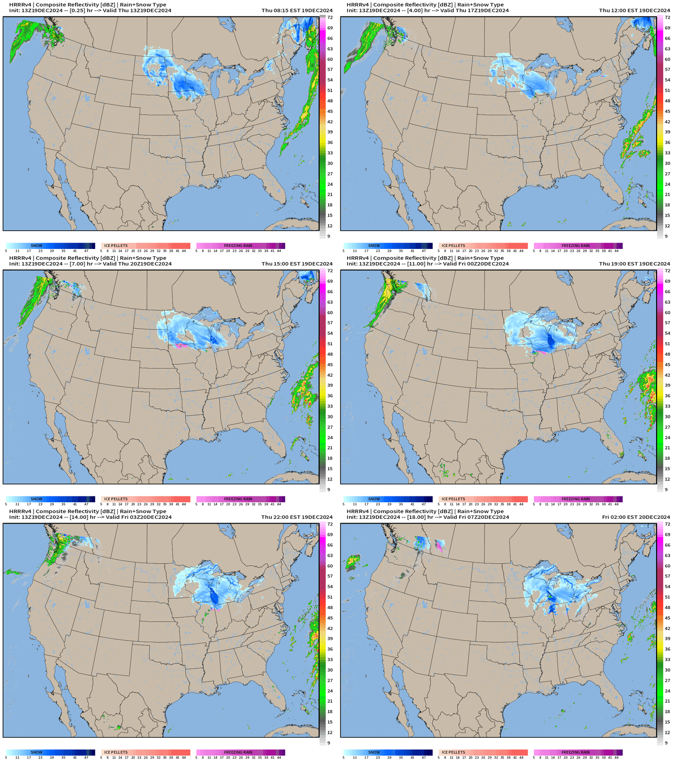
Some Lake Effect snowfall enhancement is possible heading into early Friday.
HRRR snowfall next 48-hours
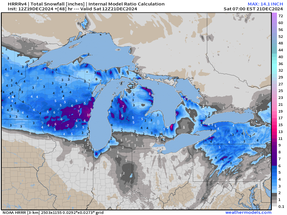
Model (HRRR) snowfall is up to 10-inches along the Wisconsin Lake Michigan shoreline north of Milwaukee.
NWS Snowfall Forecasts Next 48-Hours
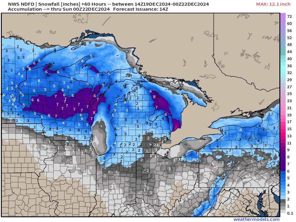
The NWS map is similar to the model output.
North Pacific Jet still screaming and Zonal
Keep looking into the longer range for a change in the North Pacific jet stream intensity, zonal character, and northward displacement. AIFS and HRES from ECMWF 00z are different over the eastern Pacific, but that’s expected with 15-day forecasts that are more about pattern recognition and trends rather than pinpoint details. The resulting warmth shunted into North America comes with a sequence of atmospheric rivers aimed at Northern California to Oregon and Washington + Western Canada.
Next 15-days Precipitation Anomaly [inches]
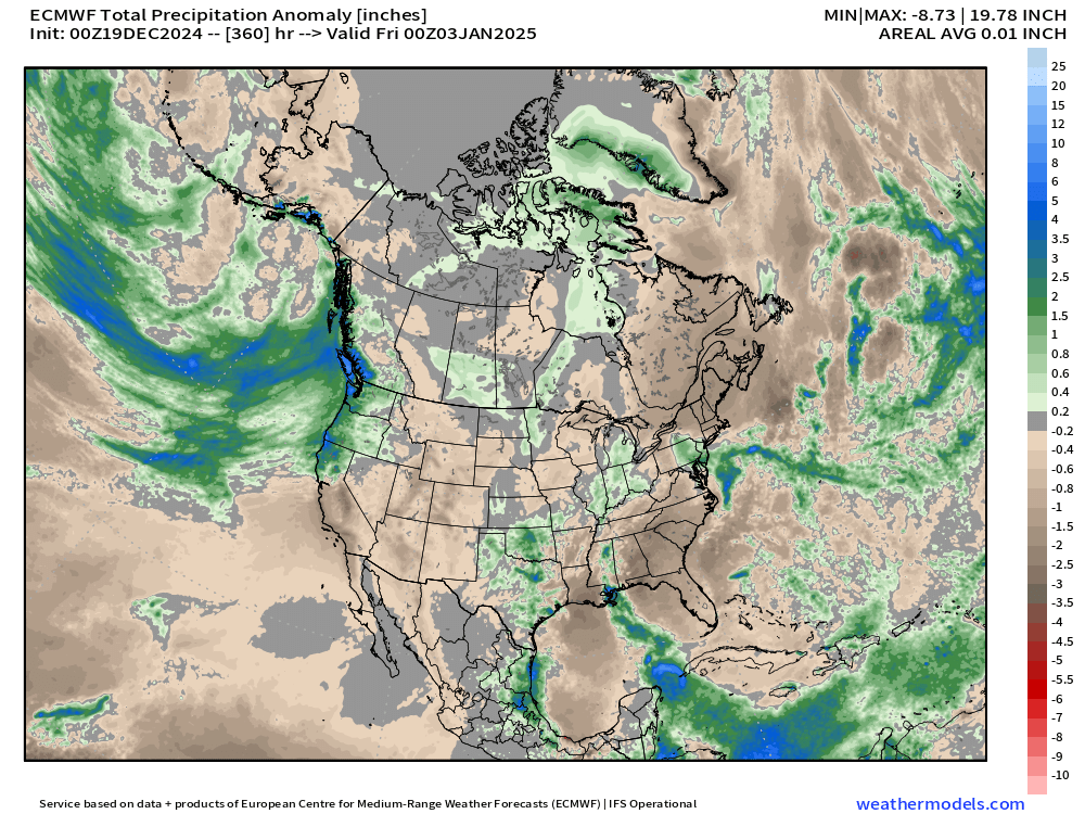
This map is precipitation including melted snow/ice into just one QPF (quantitative precipitation forecast) value deviation from climatology [inches] … not %. There is general dryness across the Great Basin across the Western U.S. and in the Southeast U.S. and Northeast U.S. The atmospheric rivers show up well in the Northeast Pacific.
Day 10 Temperature Anomaly
Whether your are looking at the ECMWF suite of guidance or NOAA (GFS and GEFS) there is unanimous warmth centered upon Hudson Bay and much above normal temperatures in the Lower 48. This is Day 10 —> evening of Saturday December 28.
Day 10 Height Anomaly (500 hPa) | Upper Level Pattern
There are some cracks in the armor to the western U.S. ridging/blocking with the GFS/GEFS guidance at Day 10. The ECMWF guidance has a weak shortwave / cut-off trough instead.
So, there may be some hints/signals in the Day 10 range for a pattern change/shift that could materialize into the New Year.
9:45 AM ET Temperatures across the Lower 48
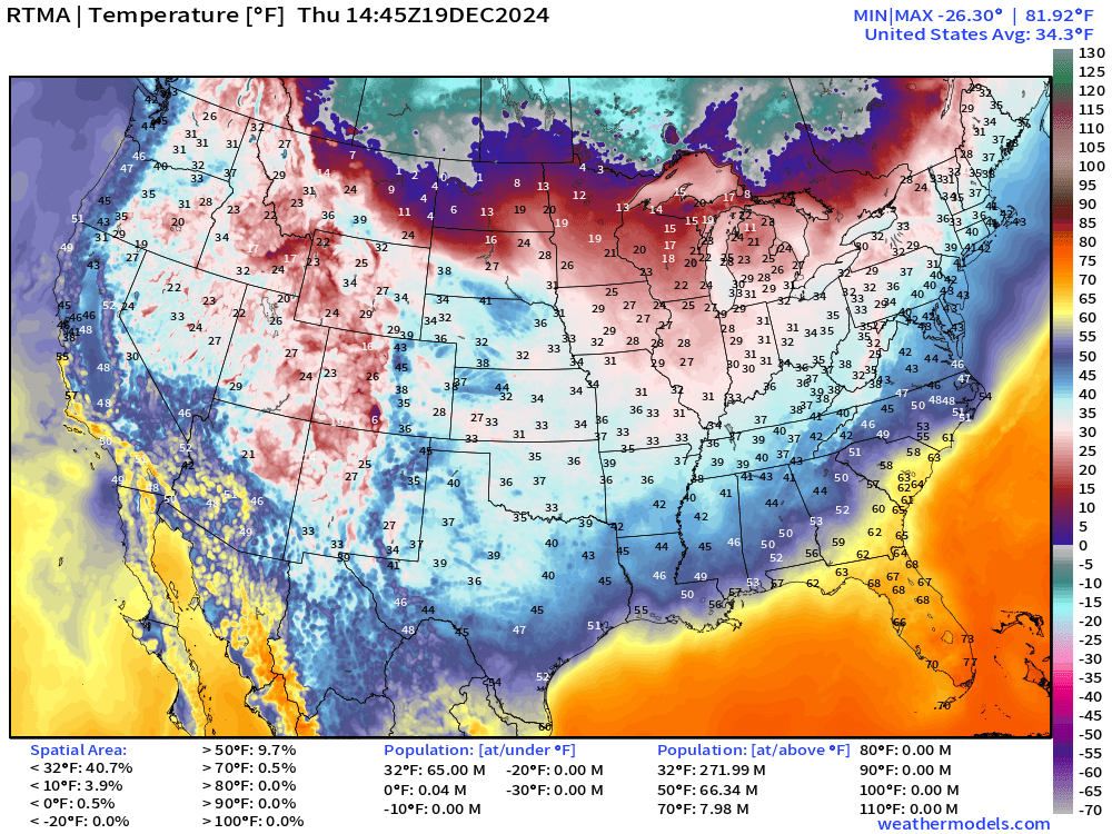
Colder air filtering into the Midwest and Great Lakes behind the frontal boundary with the Clipper system. 65 million population at/below freezing.
Temperature Anomaly | 9:45 PM ET
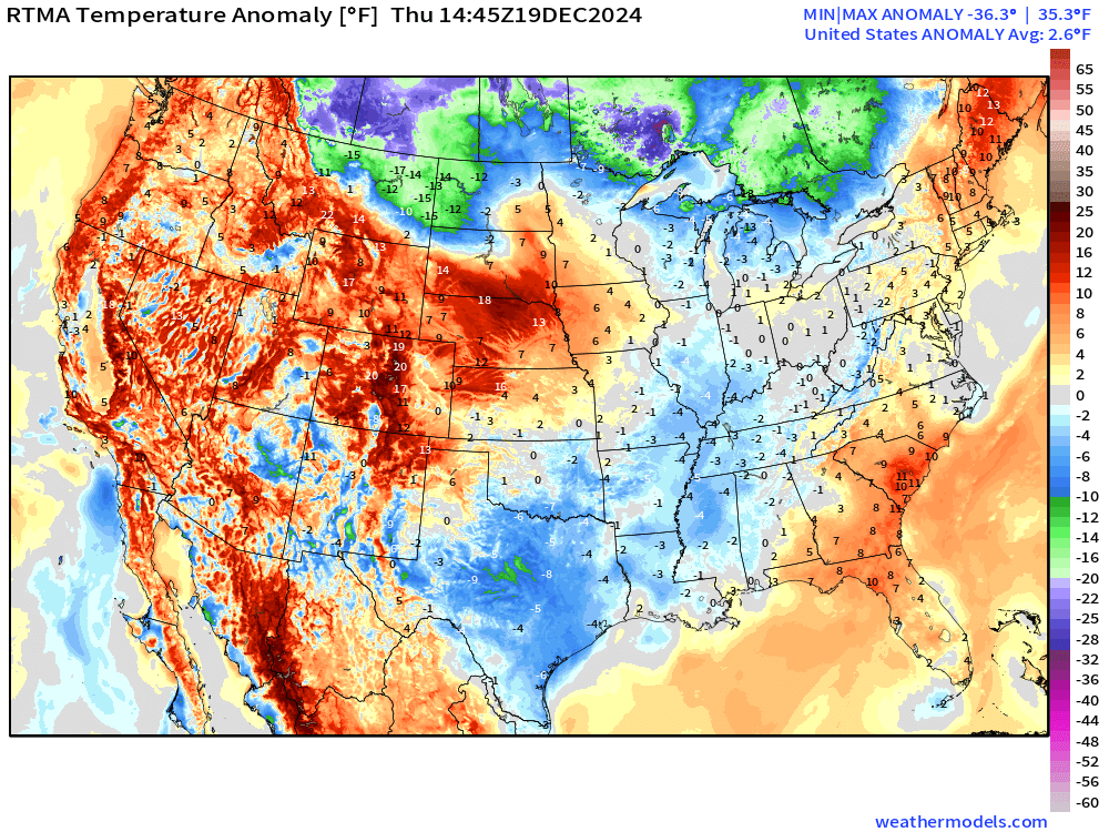
Overall the Lower 48 is 2.6°F (above normal) with coldest air just now breaking across the Canadian border into Montana, North Dakota, and UP of Michigan.
Next 9 Days Daily Temperature Anomaly
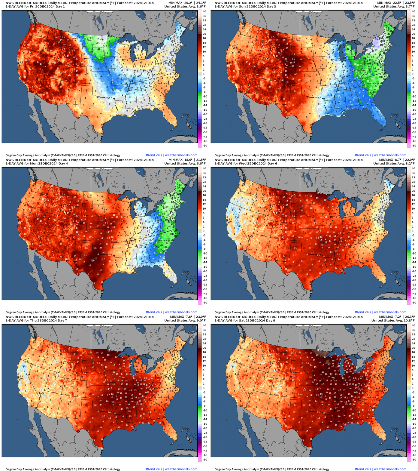
By Christmas Day, the colder / below normal air mass is pushed off the East Coast.
Then, red —> dark red with nearly 20°F above average temperatures for the center of the Lower 48.
High Temperatures on Thursday
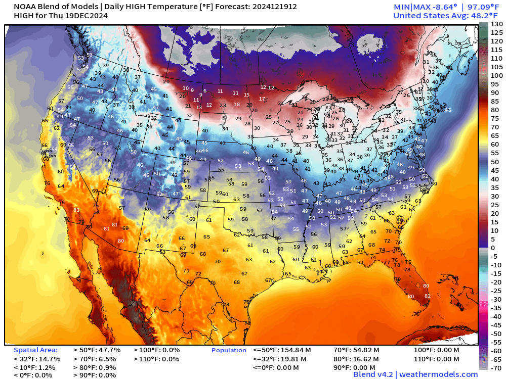
Sub-freezing high temperatures for about 15% of the Lower 48 real-estate in the Midwest and Great Lakes.
Low Temperatures on Friday
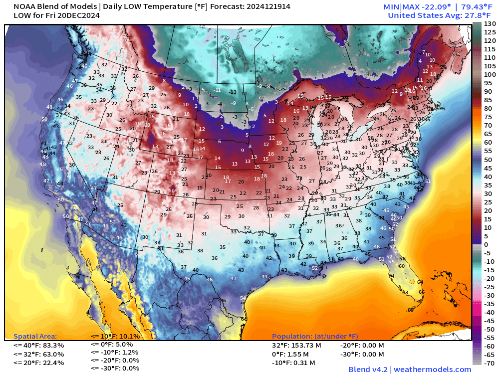
Sub-zero temperatures finally plunging into the Dakotas and Minnesota. 20s dip into Oklahoma and Arkansas —> and heading east for the weekend.
High Temperatures on Friday
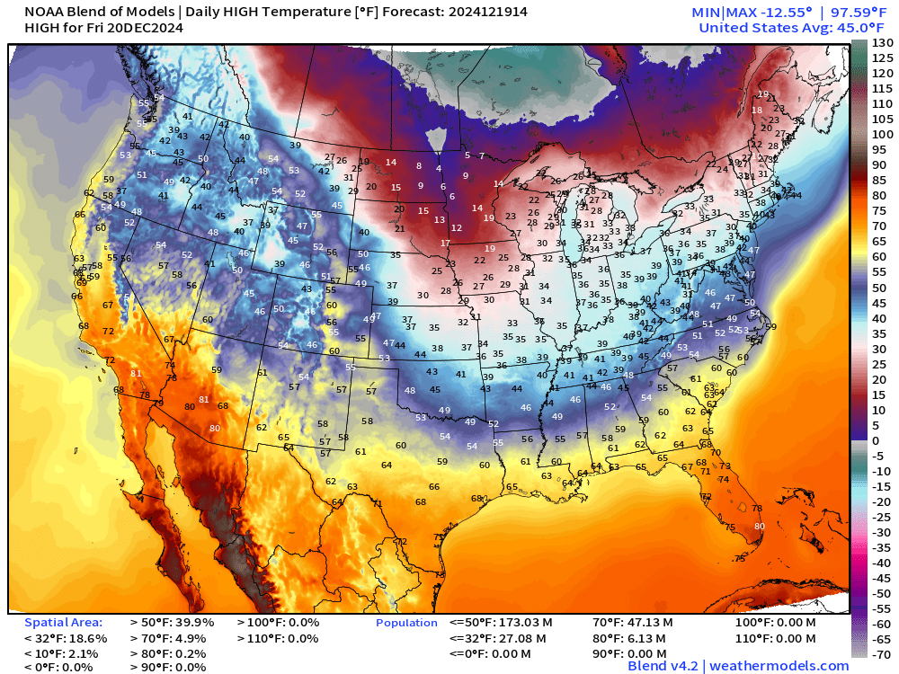
30s for Highs into St. Louis. Still above freezing by a bit in Chicago and Detroit to help mitigate the snowfall cleanup, and melt the roadways for weekend Christmas travel.
Christmas Morning
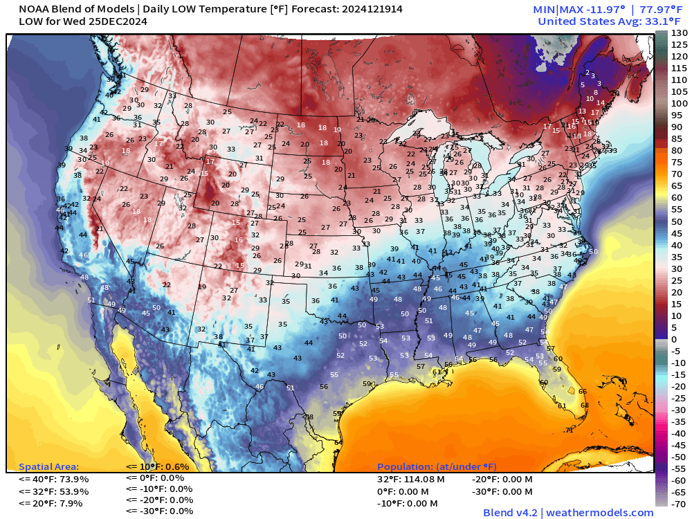
Seasonable chill with more than half of the Lower 48 at least colder than freezing. New England will be the coldest in the teens.
Christmas High Temperatures
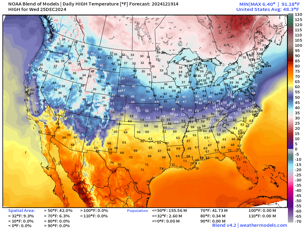
Comfortable mid-30s in the Great Lakes to 40s and 50s into the Ohio River Valley, and then 60s in the Southeast with 70s in Texas and Florida. The temperature gradient is quite zonal.
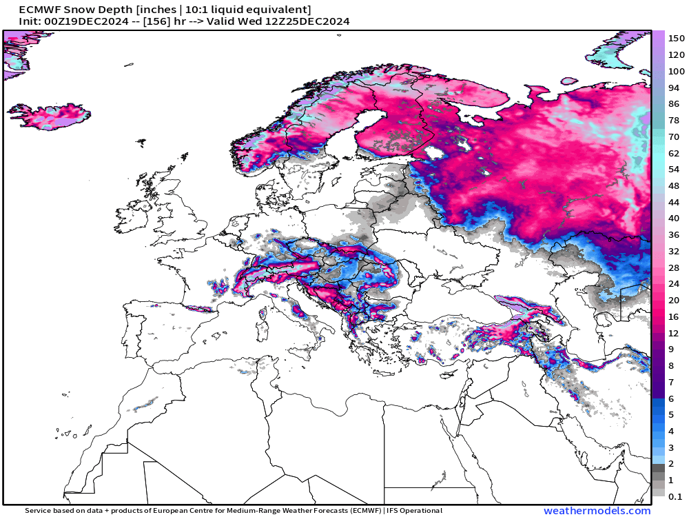
Snow Depth —> White Christmas?
Model snow depth is a bit difficult, but there’s a decent chance of snow cover for many states … and maybe somewhat in the Northeast? Hmmm …
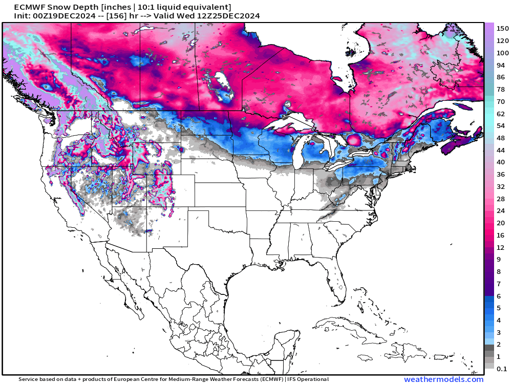
Europe does not often see White Christmas aside from the mountains (Alps) and Scandanavia … Western Russia will be mostly snow covered.
Total Precipitation next 7-Days | NOAA WPC
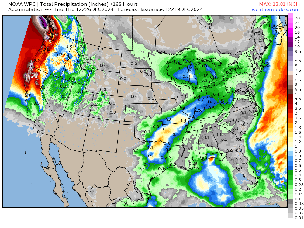
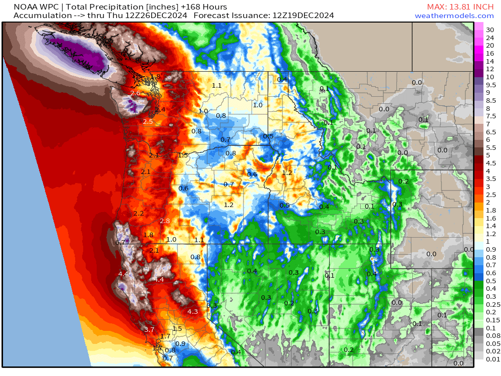
Precipitation totals will add up across the West Coast from multiple atmospheric rivers
ECMWF MSLP and Precipitation Type 06z | Next 6-days
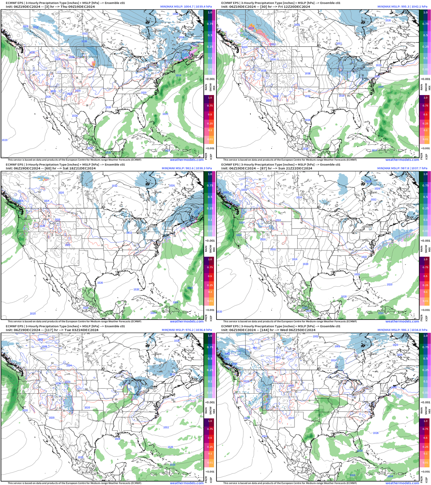
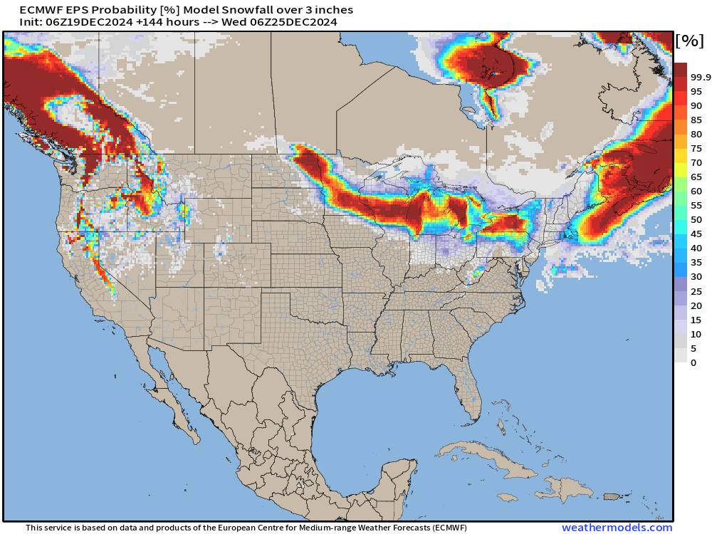
This 6-day forecast gets through Christmas Eve — and there is a weak short-wave or Clipper System with chance of snow heading into Wednesday. This could provide light snowfall over a large area that provides a White Christmas!
6-day Ensemble Median Snowfall
Probability of 3”+ Snowfall Next 6-days
Next 15-days
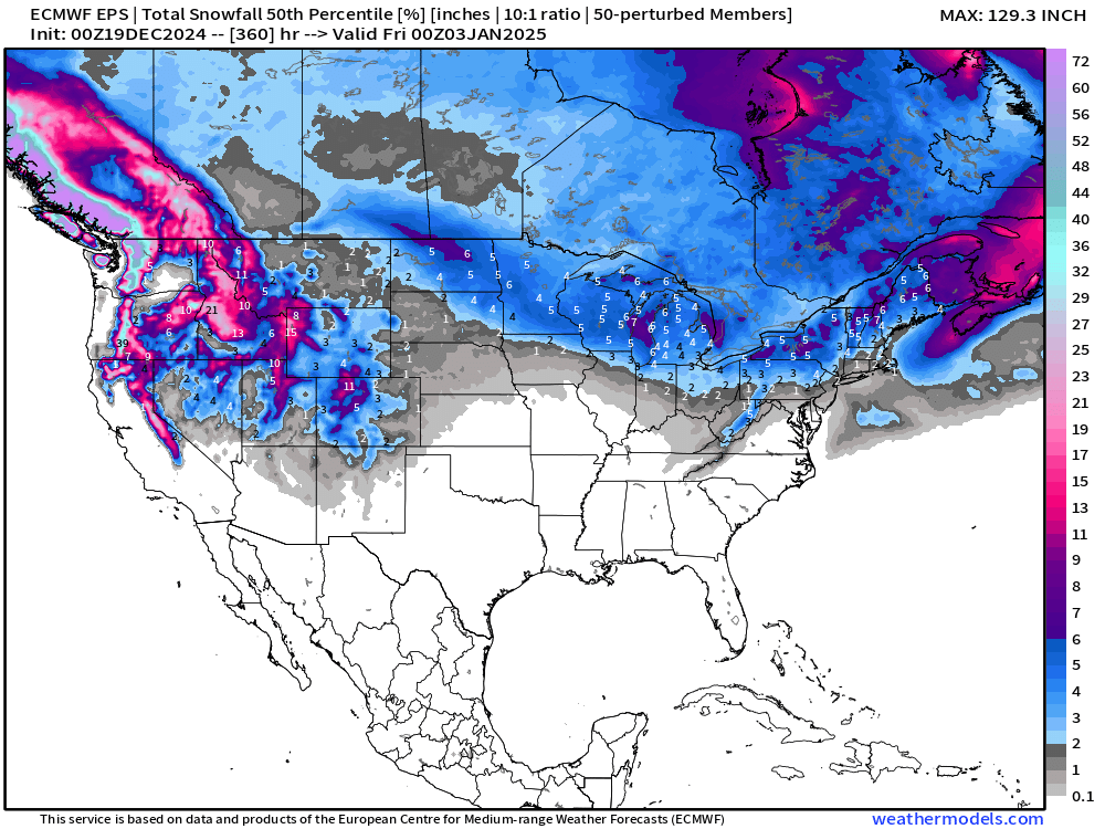
Still no weak (or strong) signal for a strong winter storm across the Eastern U.S. into January 2025.
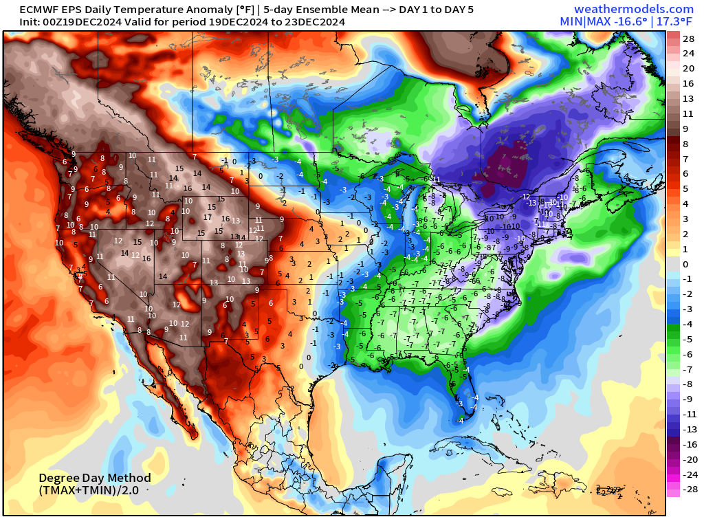
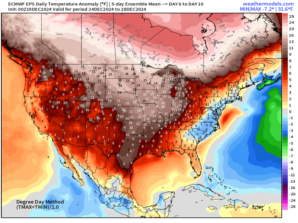
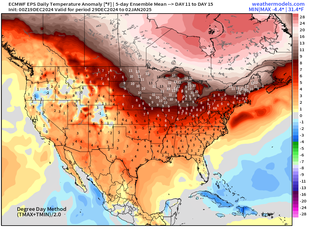
ECMWF EPS 00z | 5-Day Chunk Temperature Anomaly
Days 1-5: December 19 - December 23
Days 6-10: December 24 - December 28
Days 11-15: December 29 - January 2
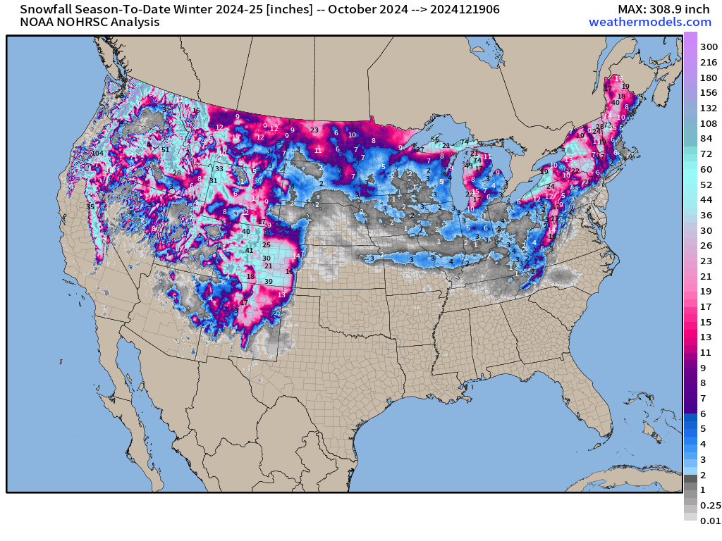
Snowfall Analysis Season to Date | October 1, 2024 — today.
Maps sourced from weathermodels.com designed and innovated by yours truly! Please subscribe there for real-time access to the newest maps, charts from all of the weather models including ECMWF.
- Milepost
- 464 · laid 2024-12-19T16:03:32.939000Z
- Source
- https://weather.substack.com/p/december-19-2024-thursday-winter
- Digest
- 01e61a544beb28eaba233387850f685612f4514b734e5c659048ab20fa16981e
- Machine
- JSON