December 9, 2024 Monday Weather Update
Short Arctic blast follows a Clipper system into end of week
December 2024 was the 4th-warmest December in the 131-year national record (1895–2025), at 38.1°F against a 1991–2020 normal of 34.3°F (+3.8°F).
December 2024 was the 64th-driest December in the 131-year national record (1895–2025), at 2.4in against a 1991–2020 normal of 2.5in (-0.1in).
NOAA/NCEI Climate at a Glance, contiguous United States. This is the observed record for the month, not a score of anything said in this piece — the forecast ledger begins 2026-08-17 and cannot reach earlier posts.

Monday Headlines
A Clipper system is moving through the Great Lakes with a cold front separating colder Canadian air from moist, warm air from the Gulf of Mexico.
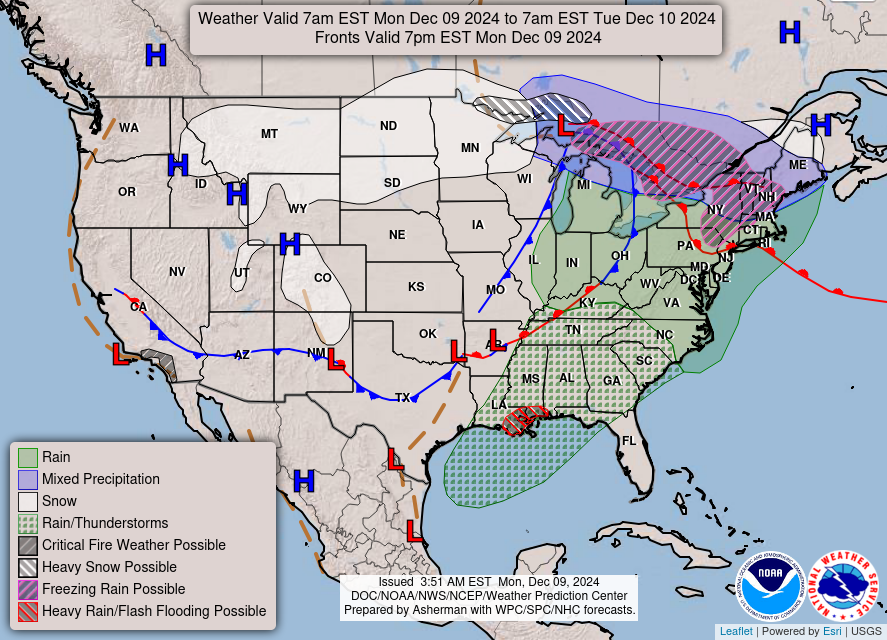
Some system snow is likely from the Clipper but not very much … a few inches across New England according to HRRR.
We need to wait for the main-event Canadian “polar vortex” trough to arrive and finally blast the coldest air into the Midwest and Great Lakes into Thursday. Until then, a rich moisture feed ahead of the cold front remains across the Eastern U.S. in the “warm sector” meaning considerable rain — not snow. Over the next 48-hours into Wednesday morning, the Arctic front does make it through Texas and approaches the Southeast.
11:15 AM ET Temperatures across the Lower 48
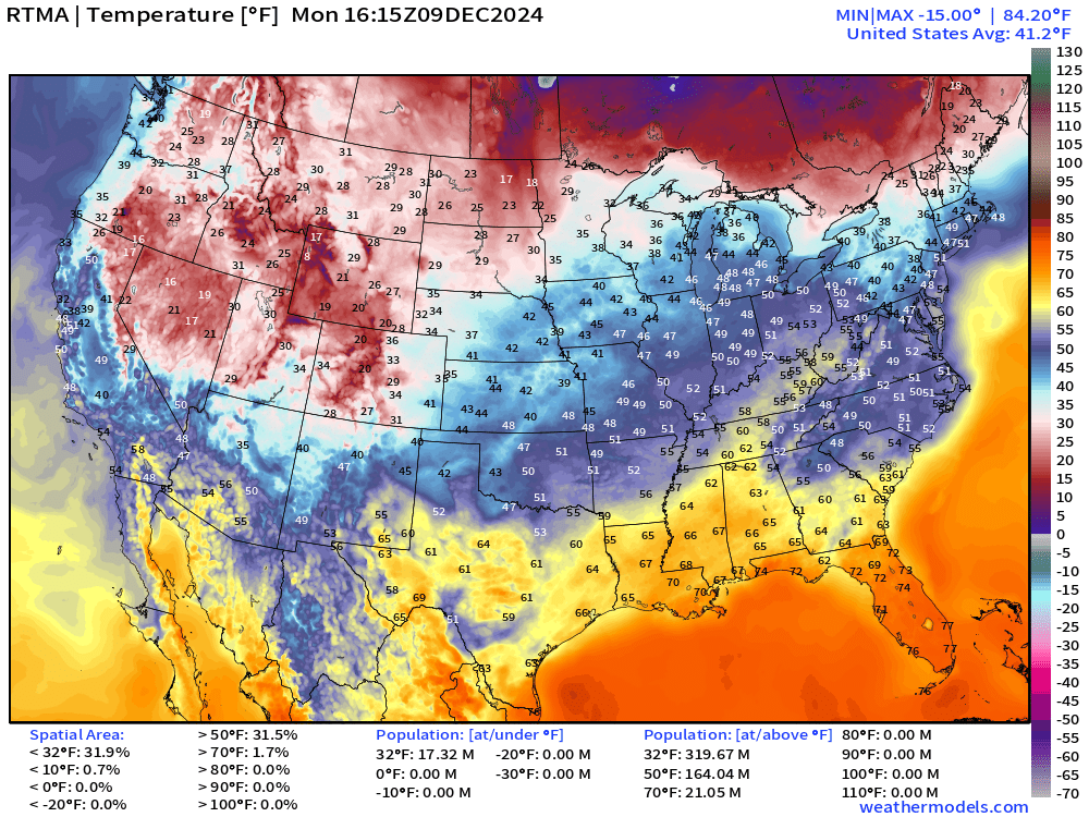
Mild across the eastern U.S. with 40s into Michigan and New England. 60s into the Ohio Valley.
Temperature Anomaly | 11:15 AM ET
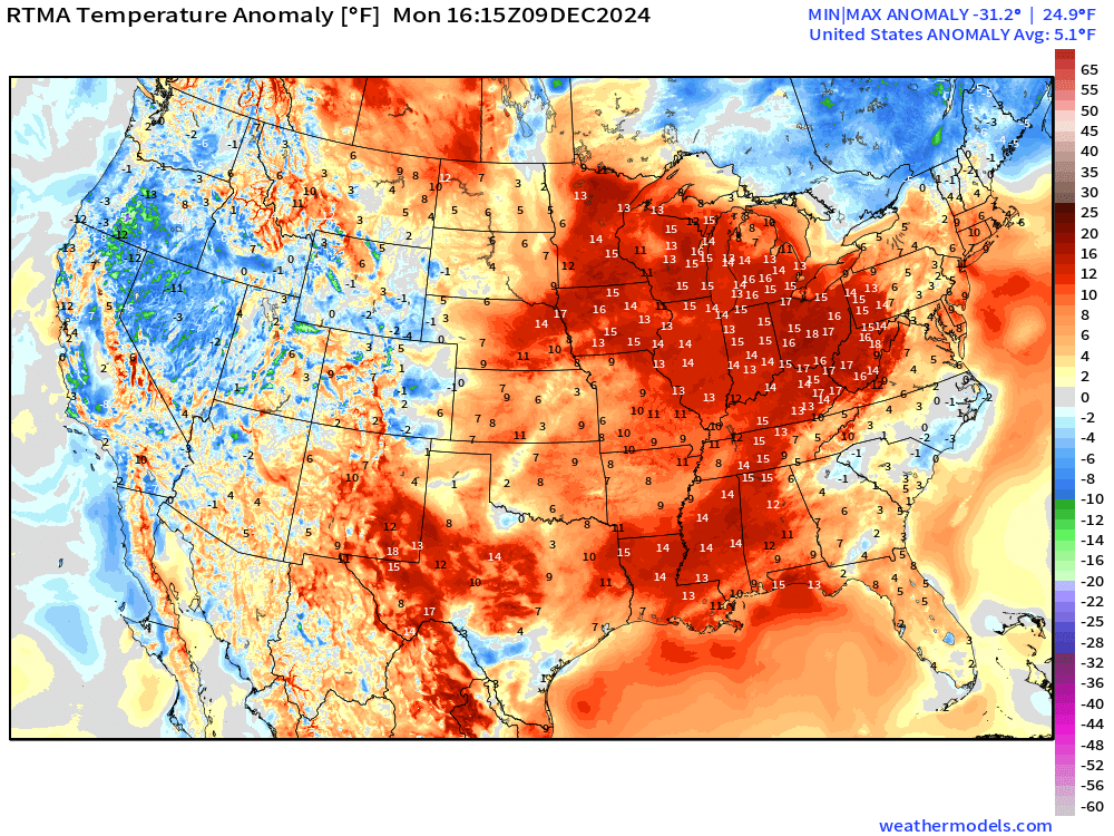
Overall the Lower 48 is +5.1°F (above normal) with 15°F positive anomalies in dark red over considerable real-estate.
Weather on Monday
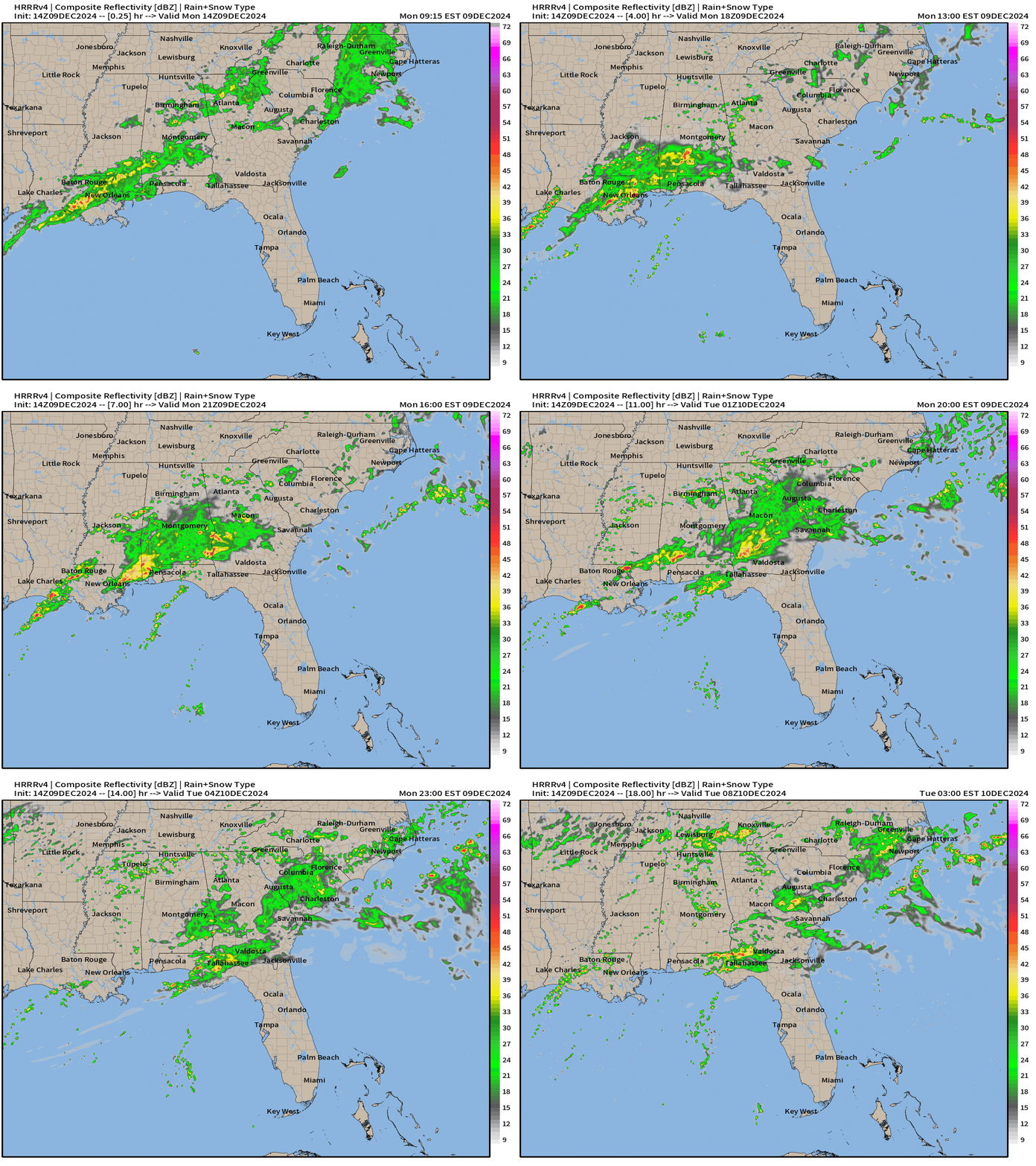
Scattered rain showers all day across the Southeast.
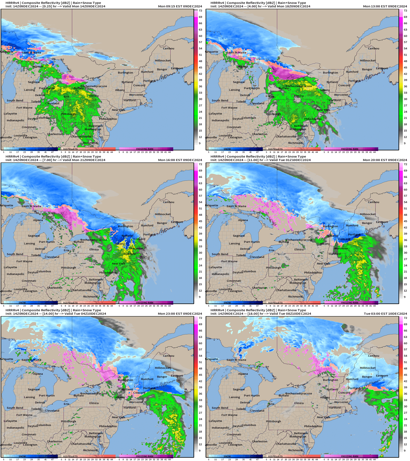
Quick burst of winter weather with the warm front moving through the Northeast.
10-Day Upper Level Pattern | ECMWF 06z AIFS
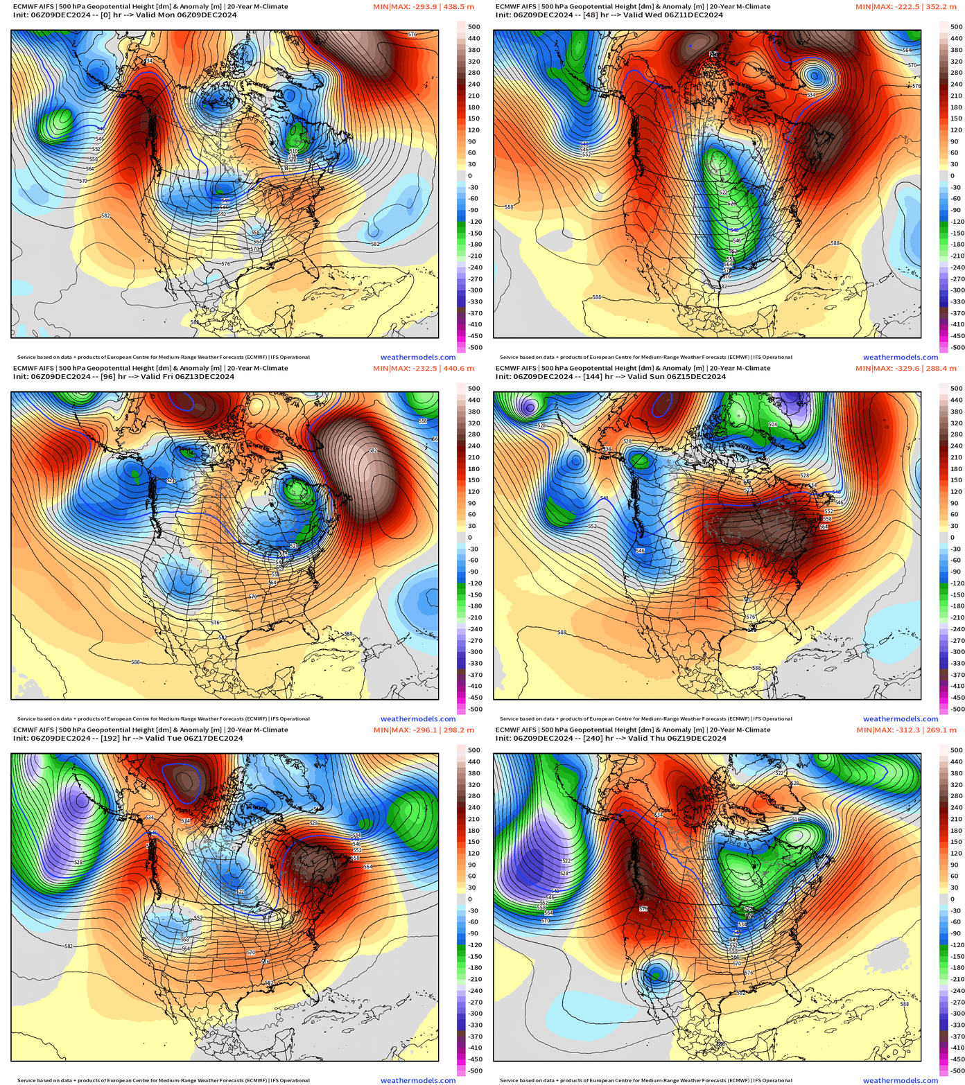
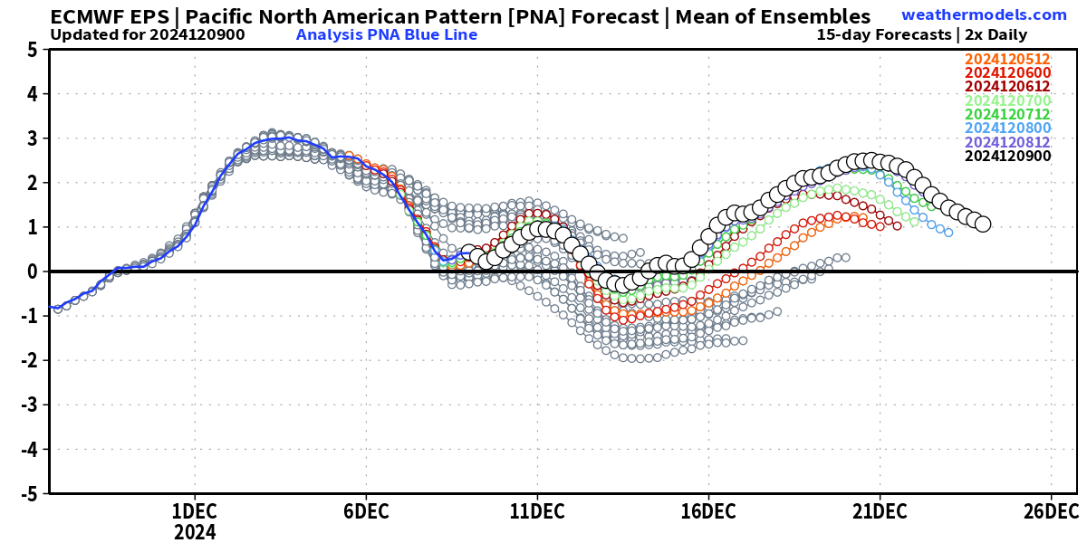
Upper-level pattern remains progressive with mobile troughs and ridges every 1-2 days. The lack of blocking is noticeable. However, AIFS shows sustained ridging across Western North America consistent with a positive PNA pattern. EPS PNA trend shows consistent trend toward more positive.
The anchor of the polar vortex over the Hudson Bay region cannot penetrate far south into Week 2, but with the intensity of the upcoming mid-week Arctic blast significantly underestimated, I wouldn’t be surprised if the Midwest, Great Lakes, and Northeast remain under risk for colder air.
Trough and Arctic Air Intrusion
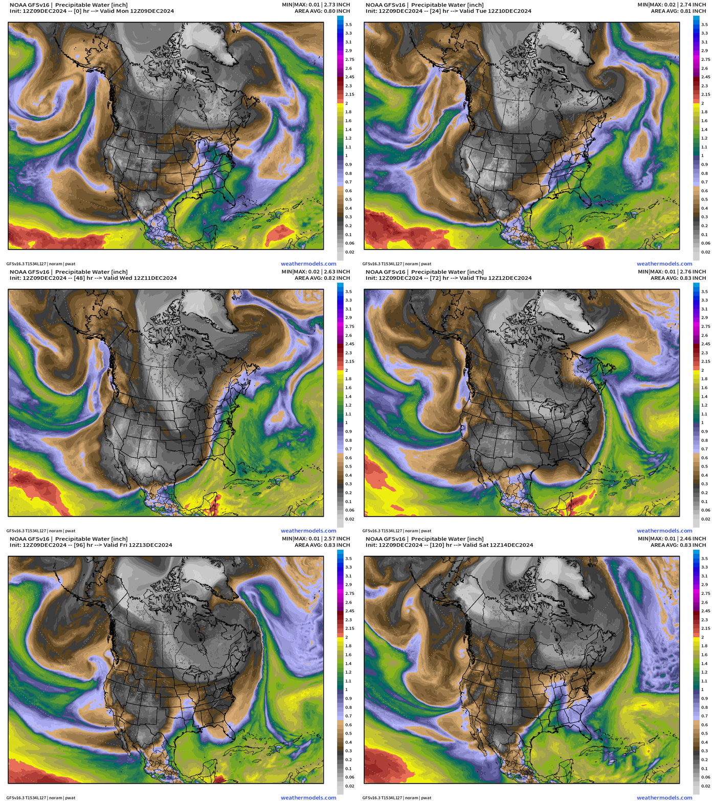
Precipitable water for the next 5-days nicely shows the Arctic front moving through the entire eastern U.S. and the reinforcing shot of very cold air on Thursday. However, this is very short-lived as return flow out of the south immediately arrives for the weekend.
Gap Flow from Trough
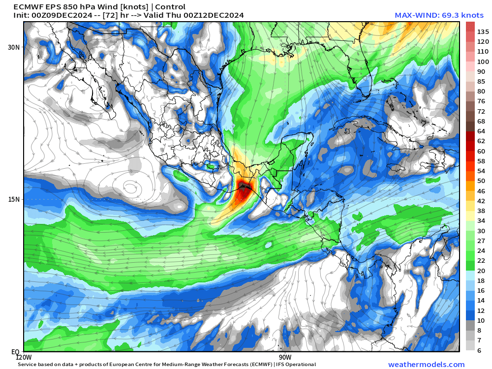
High pressure behind the Arctic front fills into the Gulf of Mexico — yielding a strong Gap Flow event from the Gulf into the Eastern Pacific. Hurricane force winds are possible/likely on Wednesday.
Maps Showing Trough + Quebec Strong Cyclone + Moisture Feed: Wednesday and Thursday
970 mb Low pressure has a strong circulation coincident with the Arctic trough + moisture laden front or "atmospheric river” streaming up the East Coast
Next 6-days Precipitation Type | ECMWF 06z
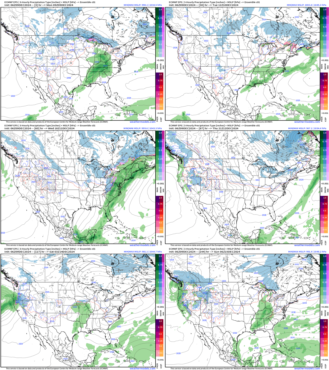
Moisture returns to the Western U.S. this weekend. A weak area of low pressure heads into the Great Lakes on Saturday.
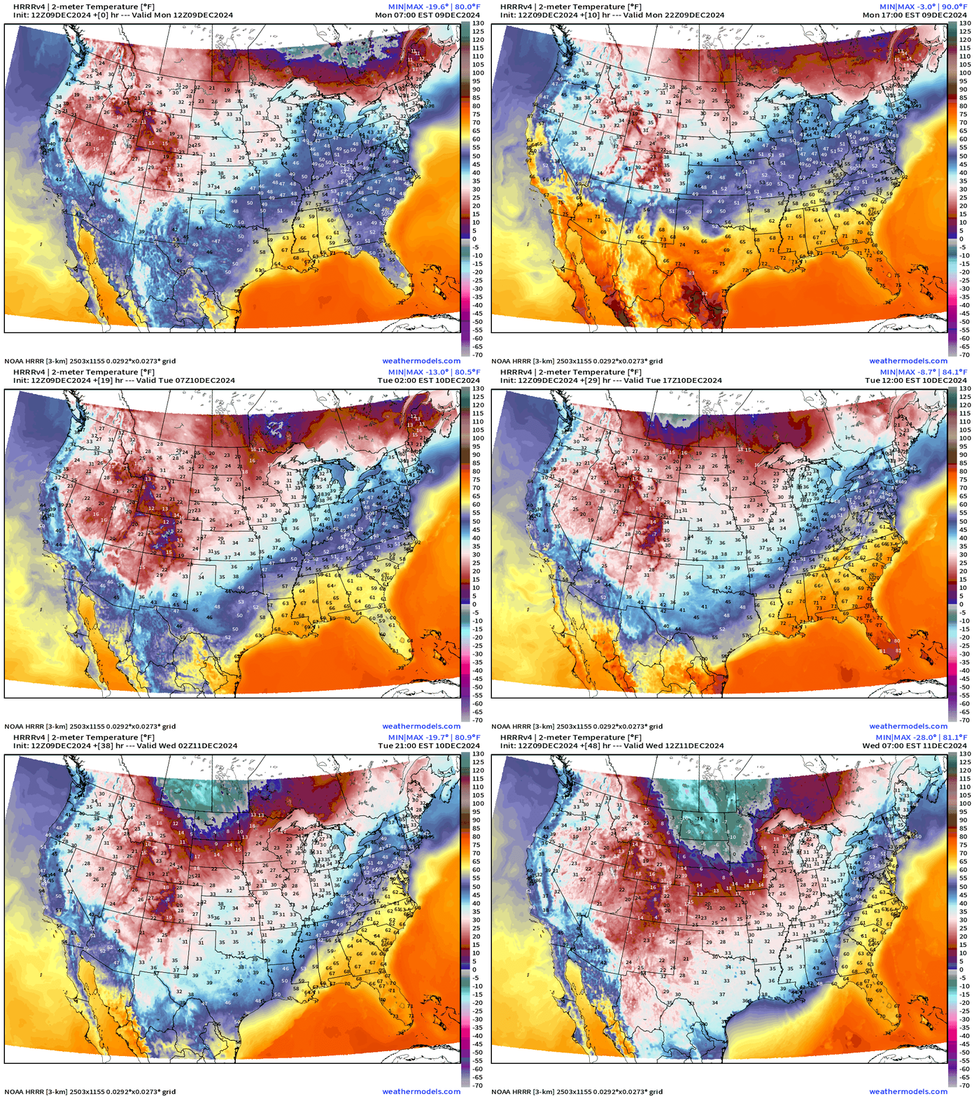
High Temperatures on Monday
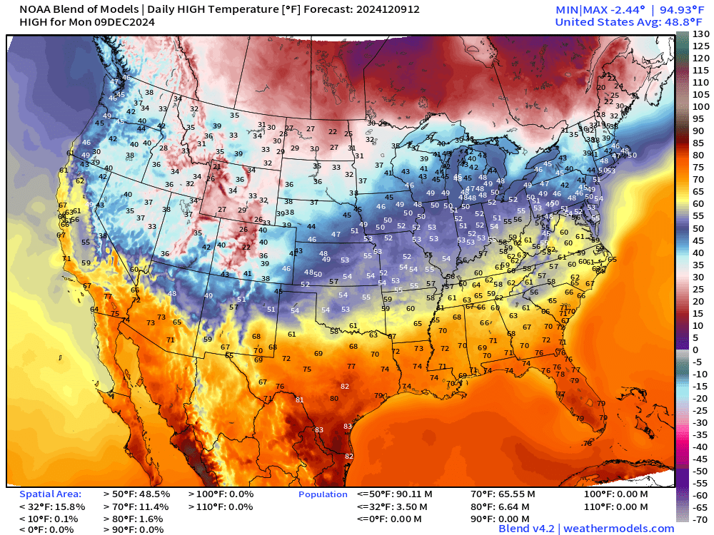
Much above normal temperatures with 80s in Texas and Florida.
Low Temperatures on Tuesday
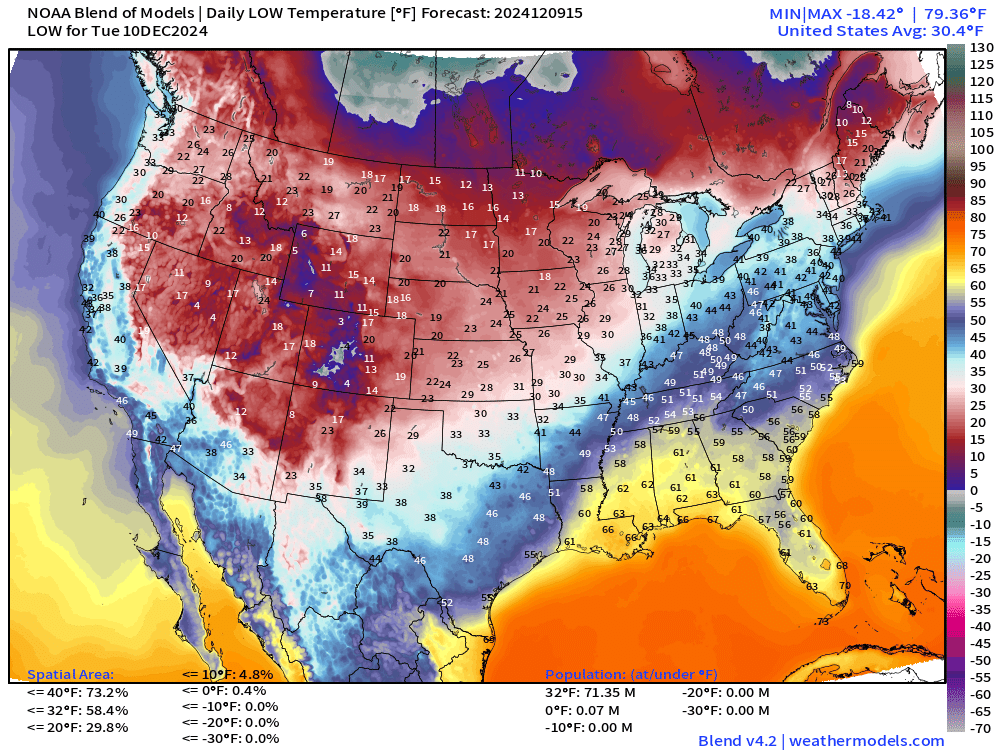
Coldest air remain west of the Mississippi with mild 60s across the Southeast.
High Temperatures on Tuesday
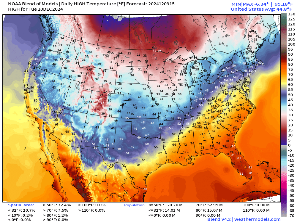
Another very warm day across the Southeast with 60s into the Mid-Atlantic and 50s in NYC.
Low Temperatures Wednesday - Friday
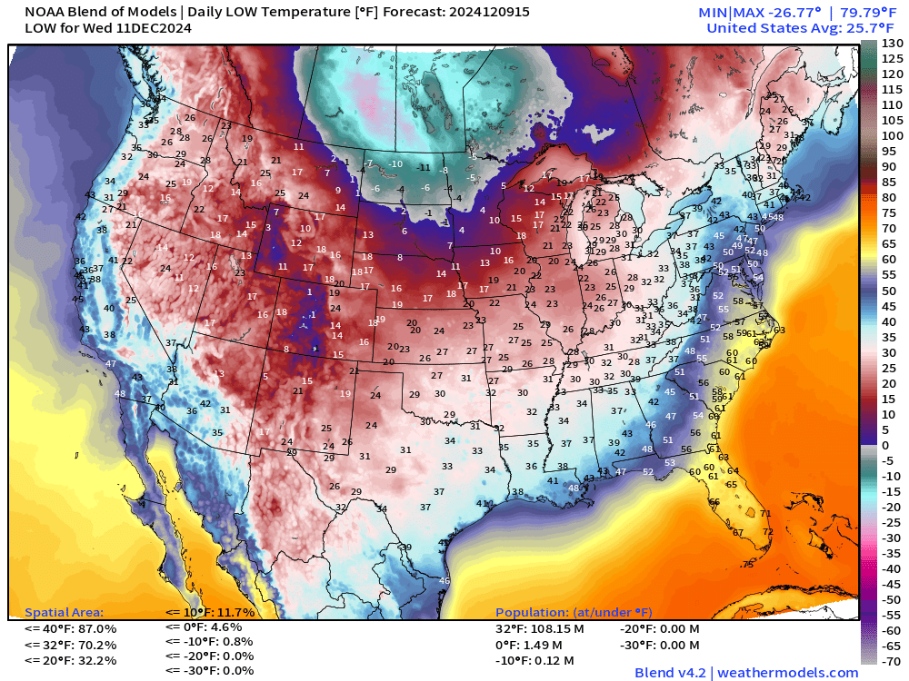
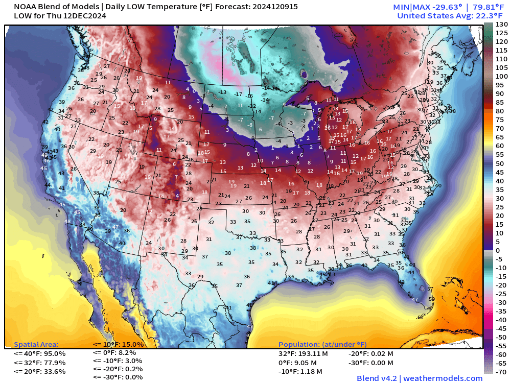
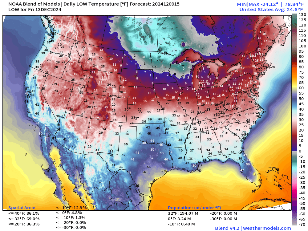
The Arctic blast is coldest from Minneapolis to Chicago into the Northeast by Friday before relief for the weekend.
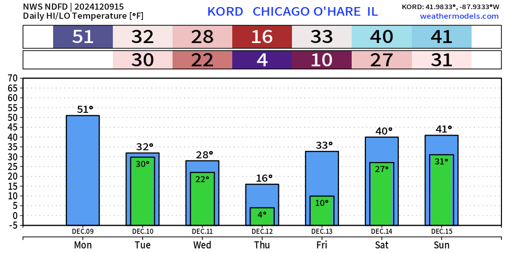
Chicago down to 4°F
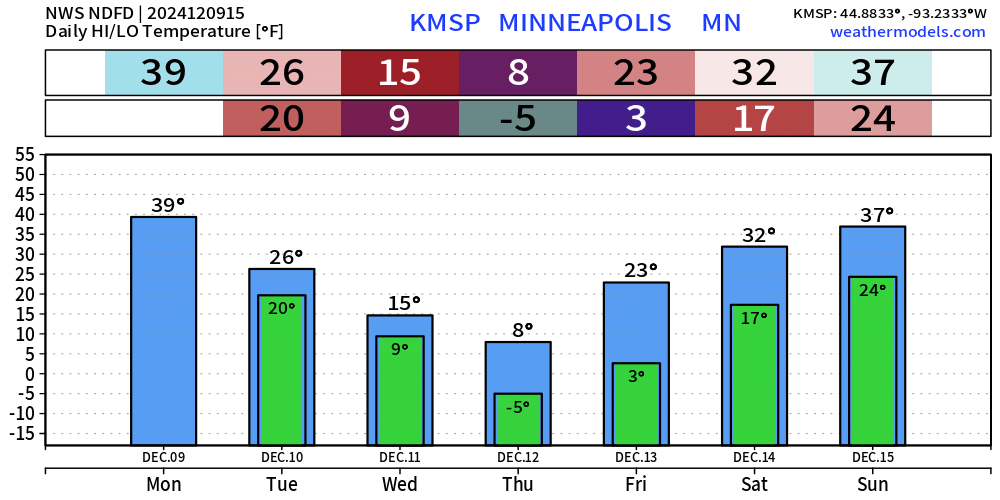
Minneapolis down to -5°F
Snowfall Forecasts
15-day Ensemble Median Snowfall
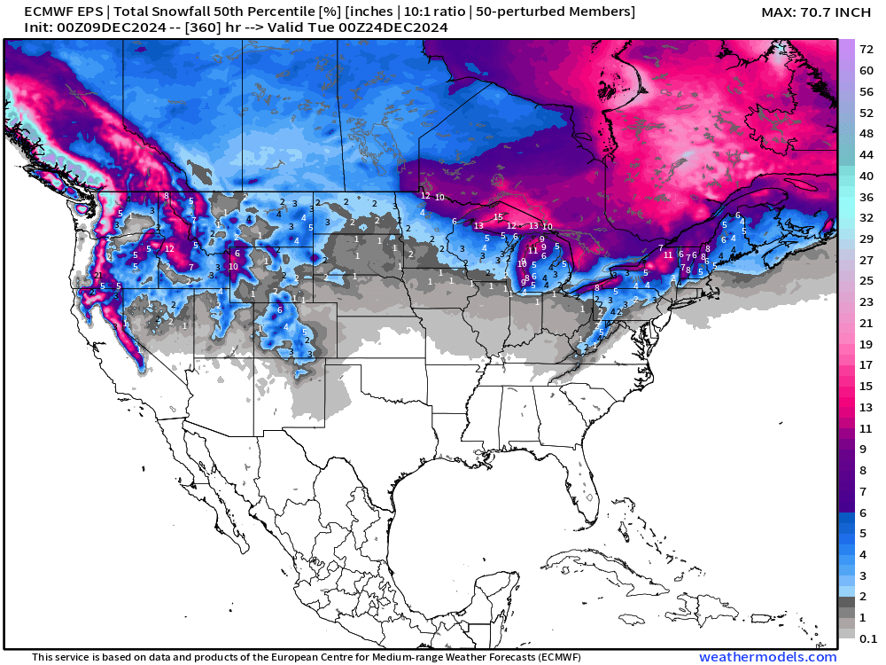
Good to see the Western U.S. with snowfall again — after a long dry spell.
Probability of 6”+ Snowfall Next 15-days
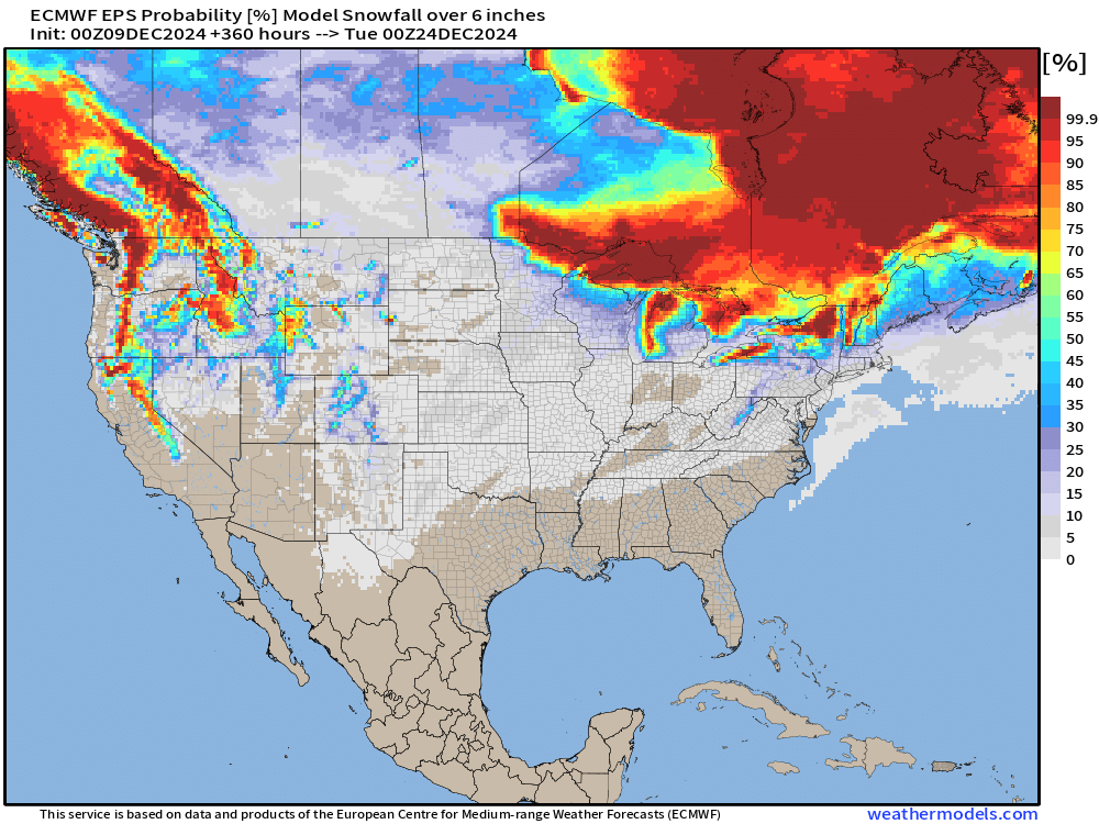
Very low chance of significant snowfall with a storm across the Lower 48 into Christmas Eve … outside of Lake Effect.
15-Days ECMWF HRES Snowfall
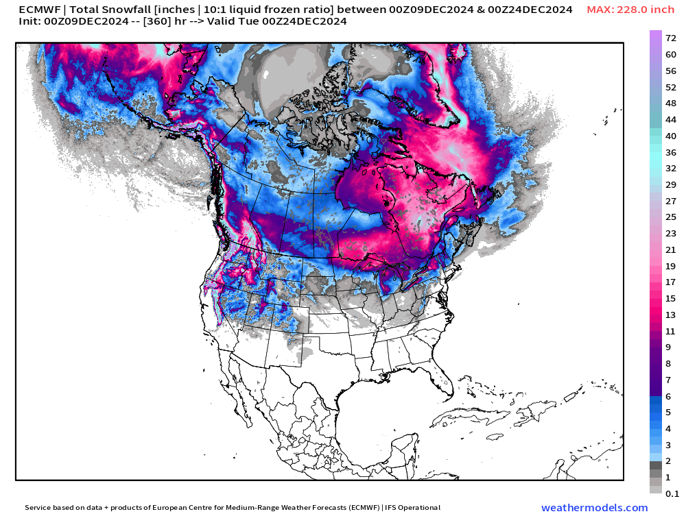
Plenty of snowfall in Canada!
Cool Maps
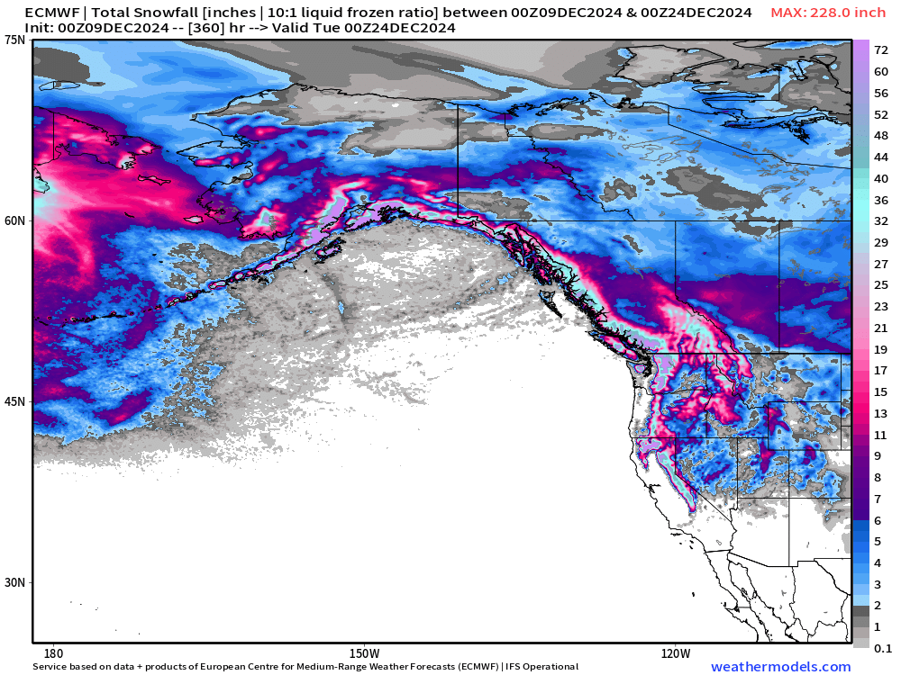
Quick Look at the Northwest Pacific and ocean-effect snowfall from cold Siberian air on the back side of storm systems parading through the Pacific jet stream.
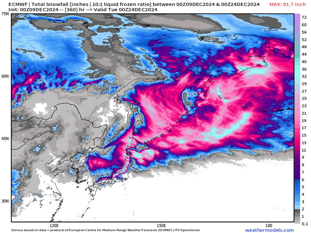
And, comparison with Northeast Pacific — ocean temperatures are quite warm, and not enough cold air can extend much passed the Int’l Dateline to blanket ships with snowfall. Instead the moisture is lifted over coastal mountains and dumped as snow on land.
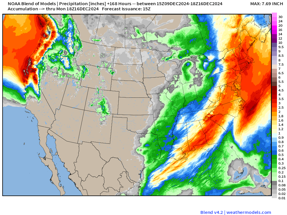
Total Precipitation next 7-Days | NOAA WPC and Blend of Models
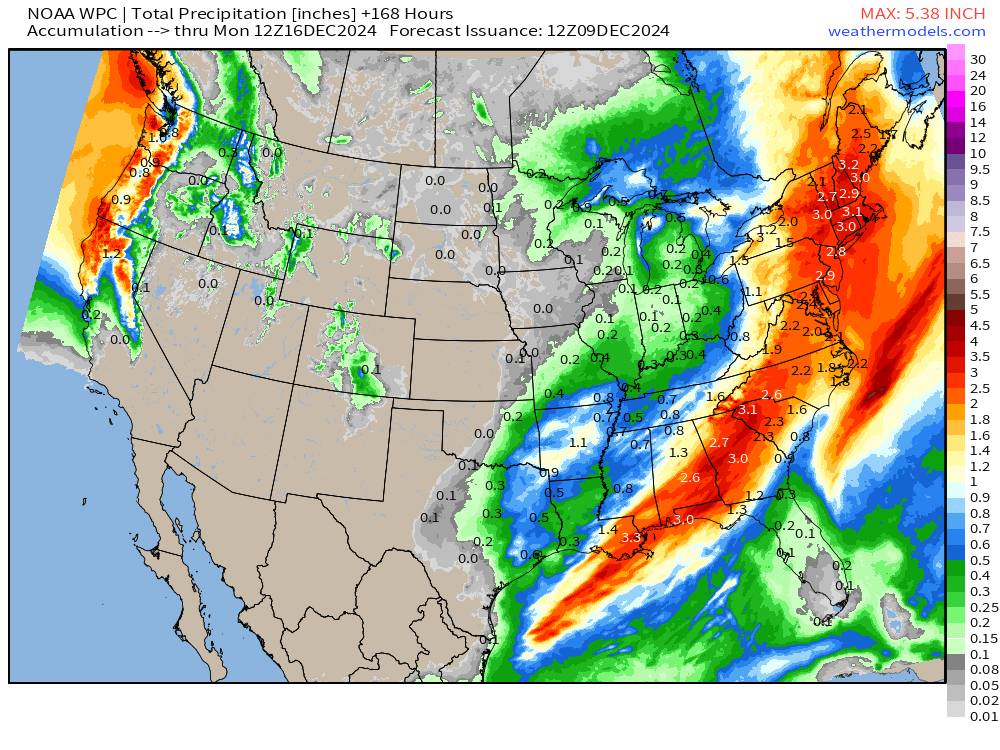
Another comparison between WPC and National Blend of Models … next 7-days precipitation (includes rain and snow)
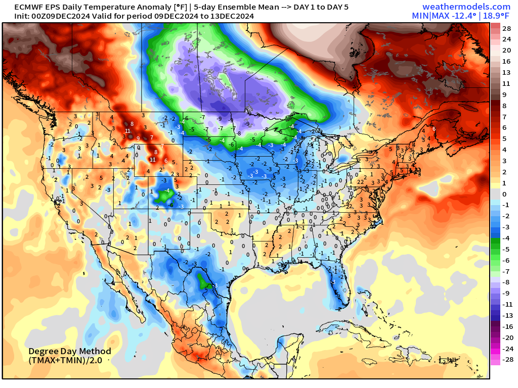
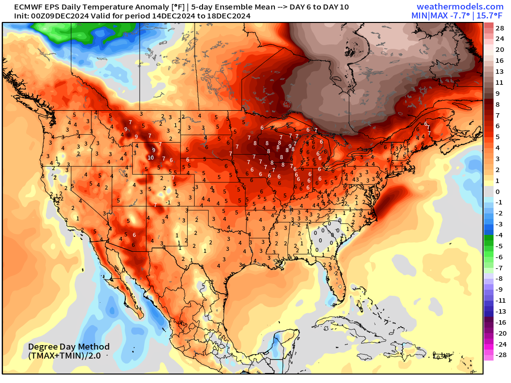
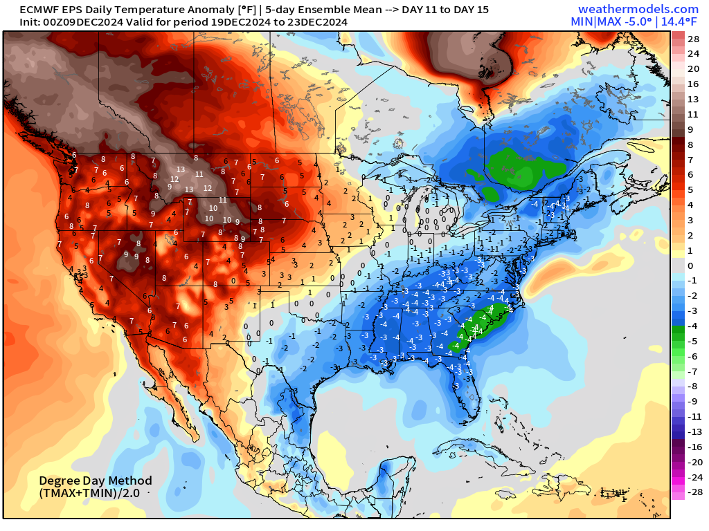
EPS 00z | 5-Day Chunk Temperature Anomaly
Days 1-5: December 9 - December 13
Days 6-10: December 14 - December 18
Days 11-15: December 19 - December 23
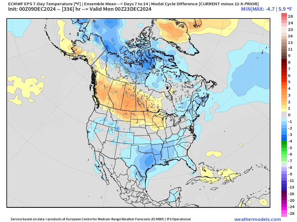
Week 2 (7-day) Model Cycle Change | EPS 00z minus yesterday EPS 12z
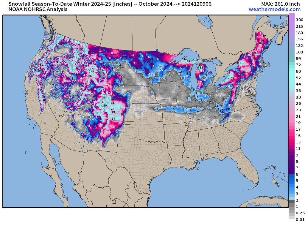
Snowfall Analysis | October 1, 2024 — today
Maps sourced from weathermodels.com designed and innovated by yours truly! I actually create all of my content from scratch.
- Milepost
- 454 · laid 2024-12-09T17:09:44.801000Z
- Source
- https://weather.substack.com/p/december-9-2024-monday-weather-update
- Digest
- 175ea50d35ebbb607580b308136ff0029b44d22808c11e3fb75d2e0bbddaca16
- Machine
- JSON