December 2, 2024 Monday Weather Update
One more Arctic blast before relief arrives for Eastern U.S. by Sunday
December 2024 was the 4th-warmest December in the 131-year national record (1895–2025), at 38.1°F against a 1991–2020 normal of 34.3°F (+3.8°F).
December 2024 was the 64th-driest December in the 131-year national record (1895–2025), at 2.4in against a 1991–2020 normal of 2.5in (-0.1in).
NOAA/NCEI Climate at a Glance, contiguous United States. This is the observed record for the month, not a score of anything said in this piece — the forecast ledger begins 2026-08-17 and cannot reach earlier posts.

Monday Headlines
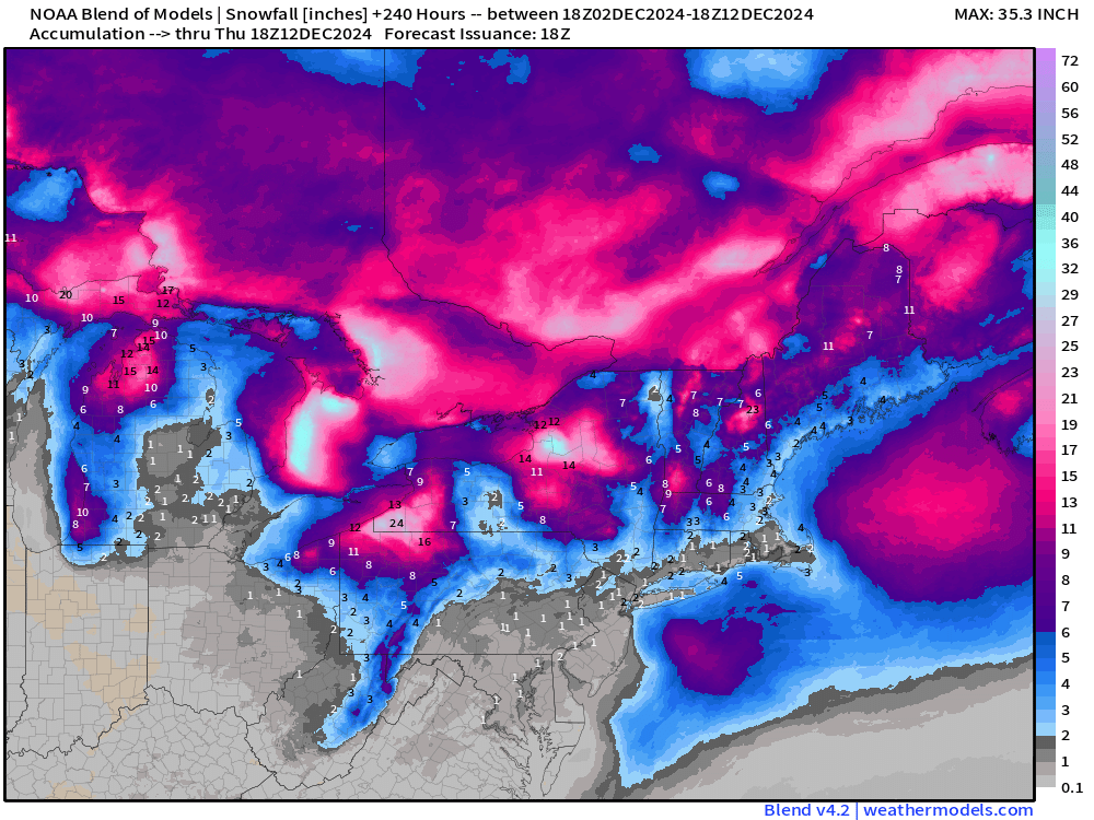
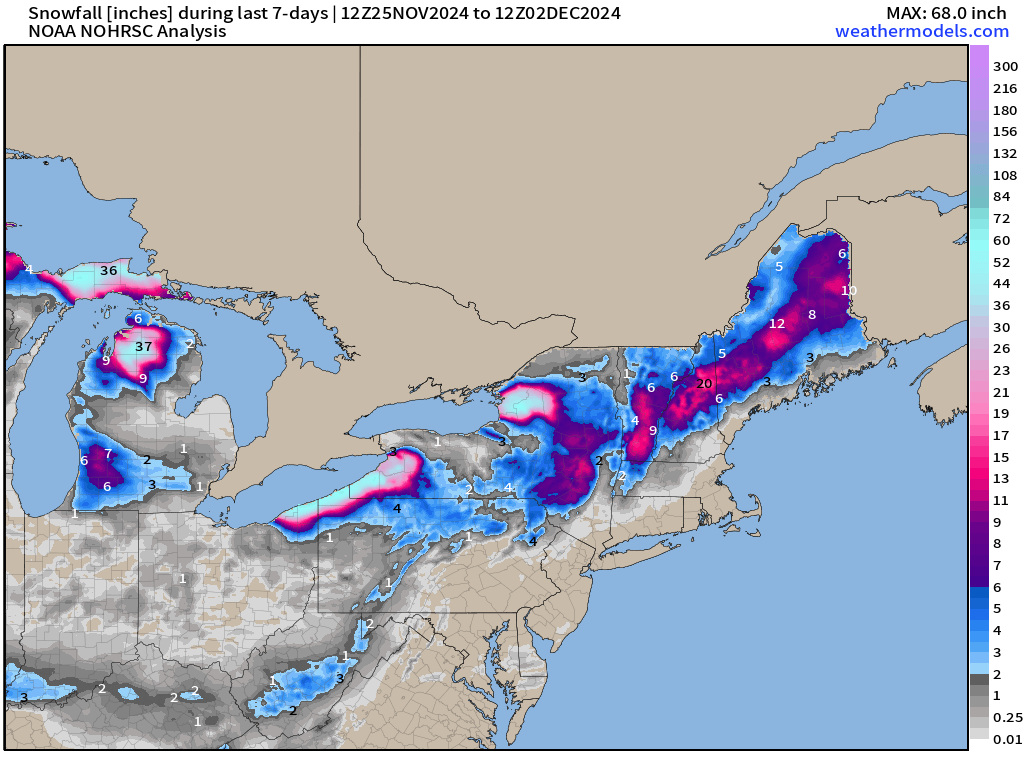
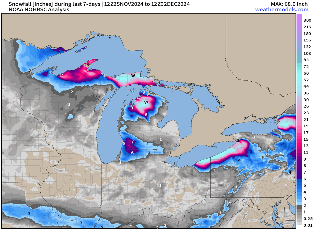
Cold air behind an Arctic front continues fueling the Great Lakes Effect snow machine with SW Michigan seeing 8-12” or more making US-31 travel difficult.
Another shot of cold air arrives out of Canada for the rest of the week east of the Rockies. A powerful storm system tracks through New England and nearly bombs out in Canada helping with the counter-clockwise cold air advection out of Ontario into the Great Lakes.
Break in Arctic air will come by this weekend courtesy of the Pacific Ocean.
I have an op-ed (essay) in the New York Times online Sunday [6 AM] with thoughts about U.S. weather forecasting in a second Trump administration.

I’ll write more about some of the background in this article [Gift Link to read] later this week. So far the feedback has been overwhelmingly positive, and that certainly makes me optimistic that NOAA and the U.S. numerical weather prediction enterprise will see necessary investments (not cuts) by Congress in 2025. Thank you to Weather Trader’s loyal subscribers for the support over the past 18-months. We made the NY Times!
Satellite | 3:30 PM ET
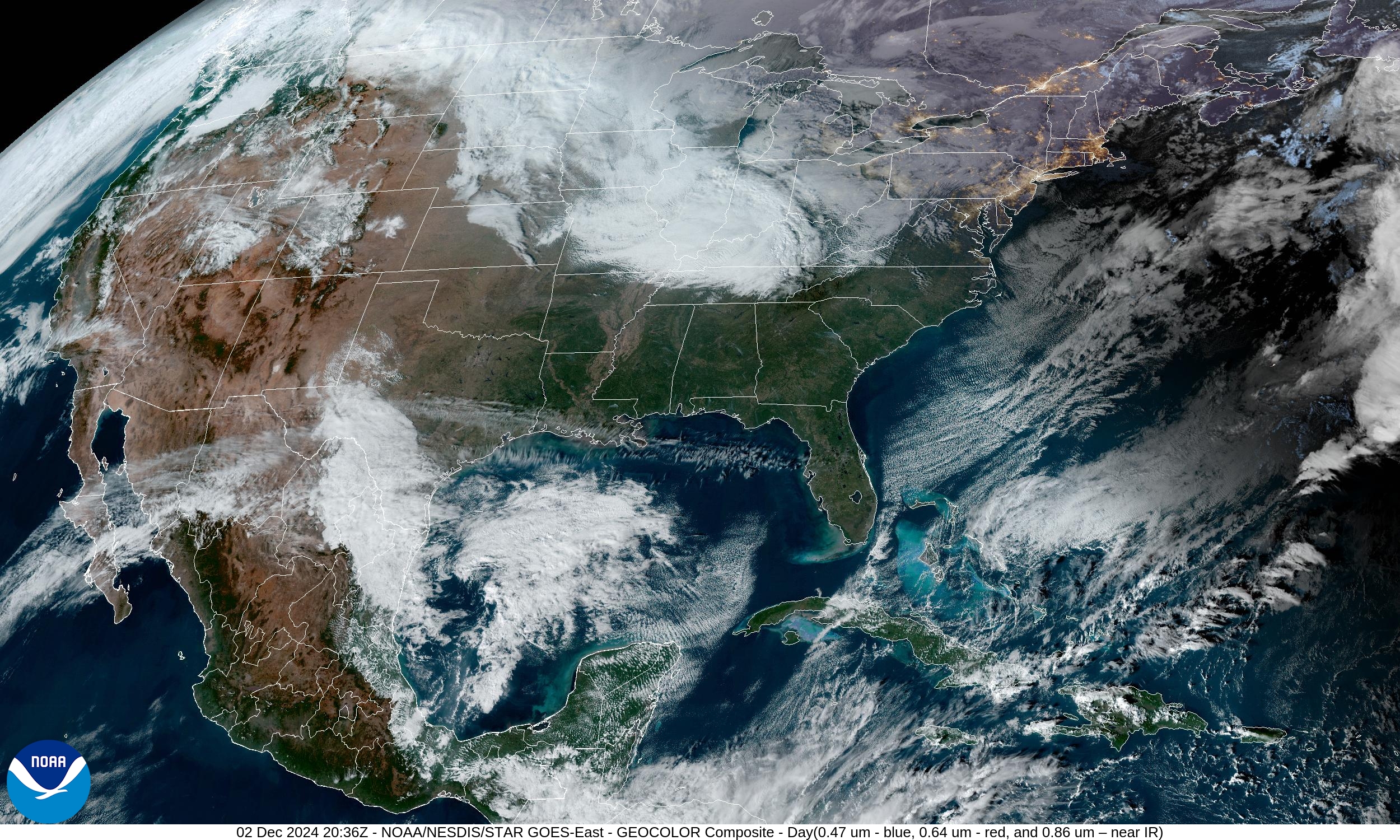
Clear skies in the Arctic air in the Southeast including all of Florida where temperatures are still rather chilly this afternoon. This is seasonable for early December, and no records will be set.
Lake Effect snow showers continue especially in Michigan.
3:15 PM ET Temperatures across the Lower 48
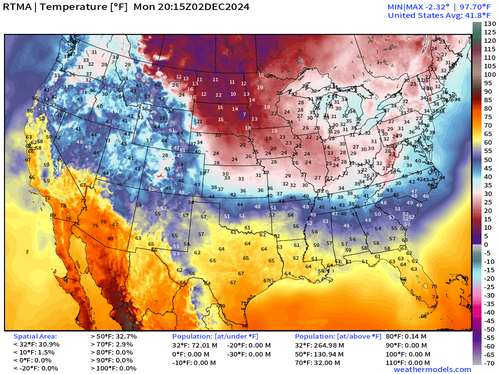
72-million still below freezing in the mid-afternoon. 32 million at/above 70°F.
Temperature Anomaly | 3:15 PM ET
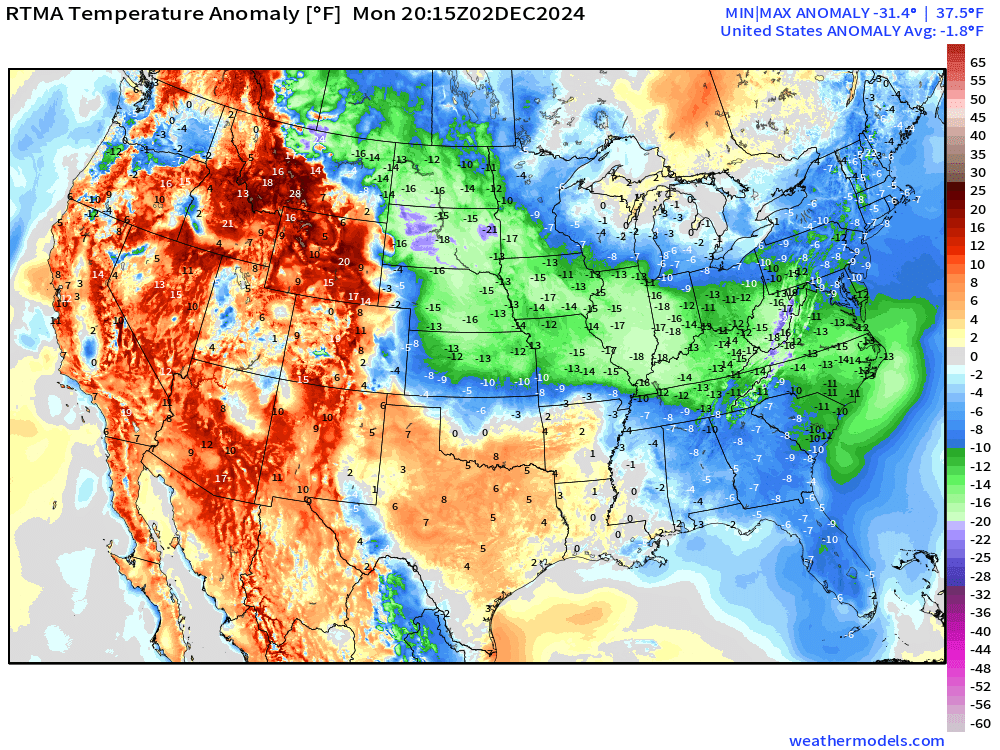
Overall the Lower 48 is -1.8°F (below normal)
Lake Effect Snow Machine | Next 48-hours | HRRR
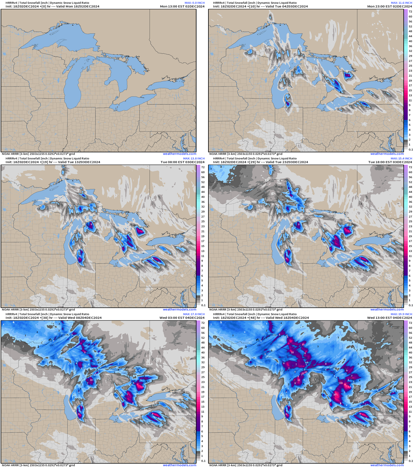
Moisture from the Northwest with a clipper type system adds significantly to the Lake Effect snowfall into Wednesday.
Upper-Level Pattern | ECMWF 12z | Next 15-days
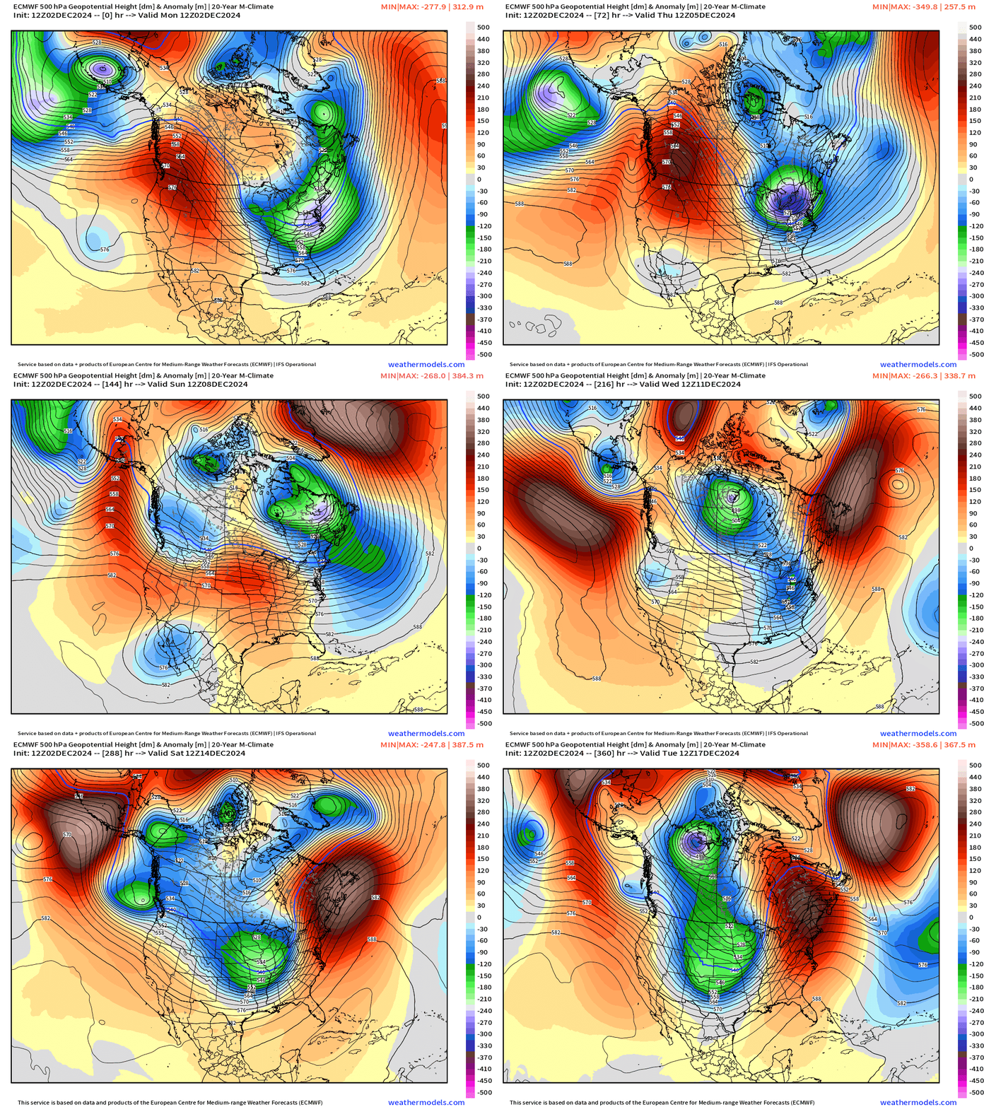
The Lower 48 is only being brushed and sideswiped by some intense Canadian Arctic polar vortex anomalies. The troughs are quite mobile with the upper-level pattern highly amplified into mid-December.
However, by the middle of the month, potential for a major Arctic blast.
Next 7-days Precipitation Type | ECMWF 12z
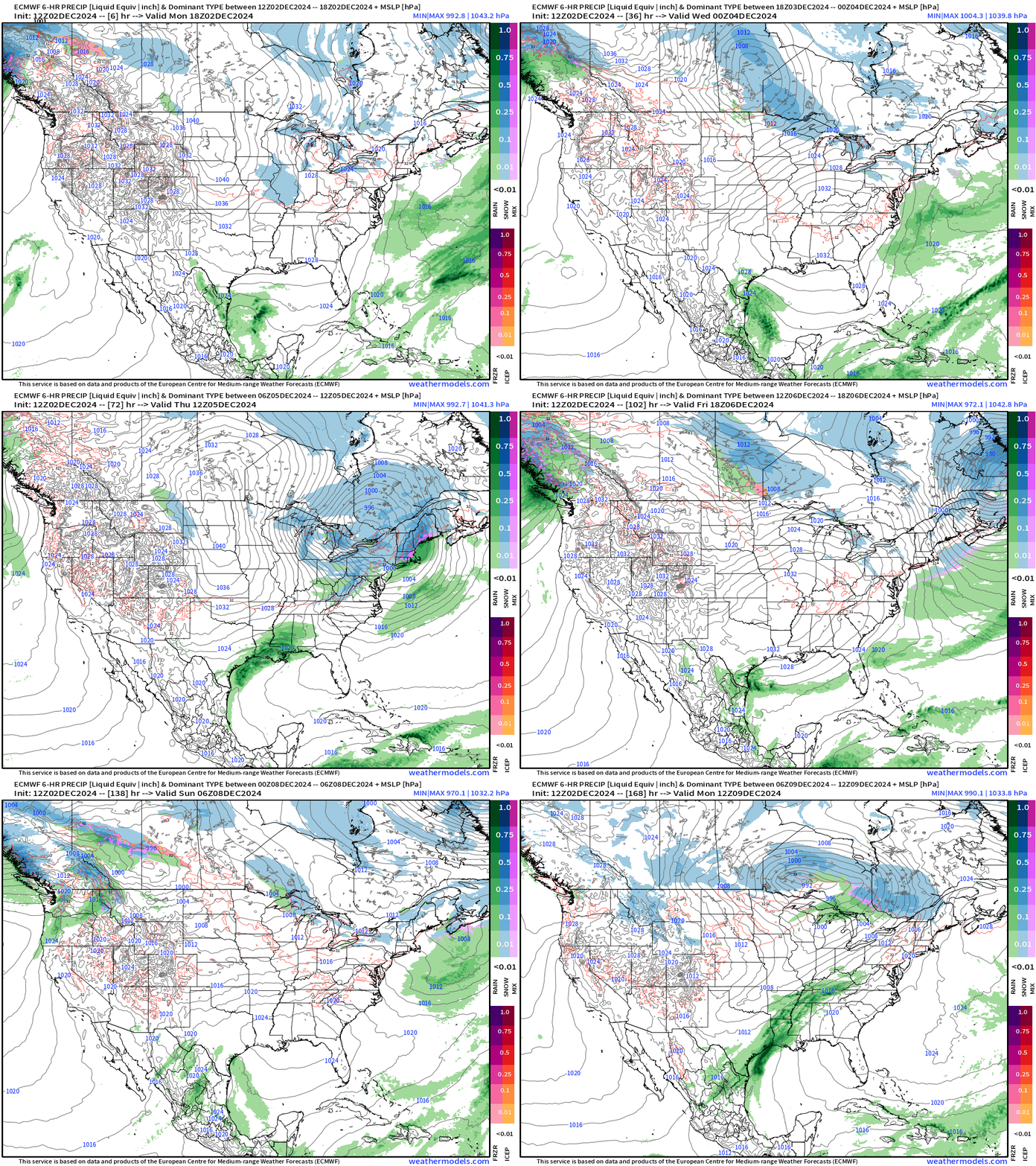
A Nor’easter intensifies into Canada on Thursday, just missing on a favorable track to bury New England in snow. Instead, more cold air and gusty winds until relief early next week from the Canadian Arctic pattern.
Low Temperatures on Tuesday
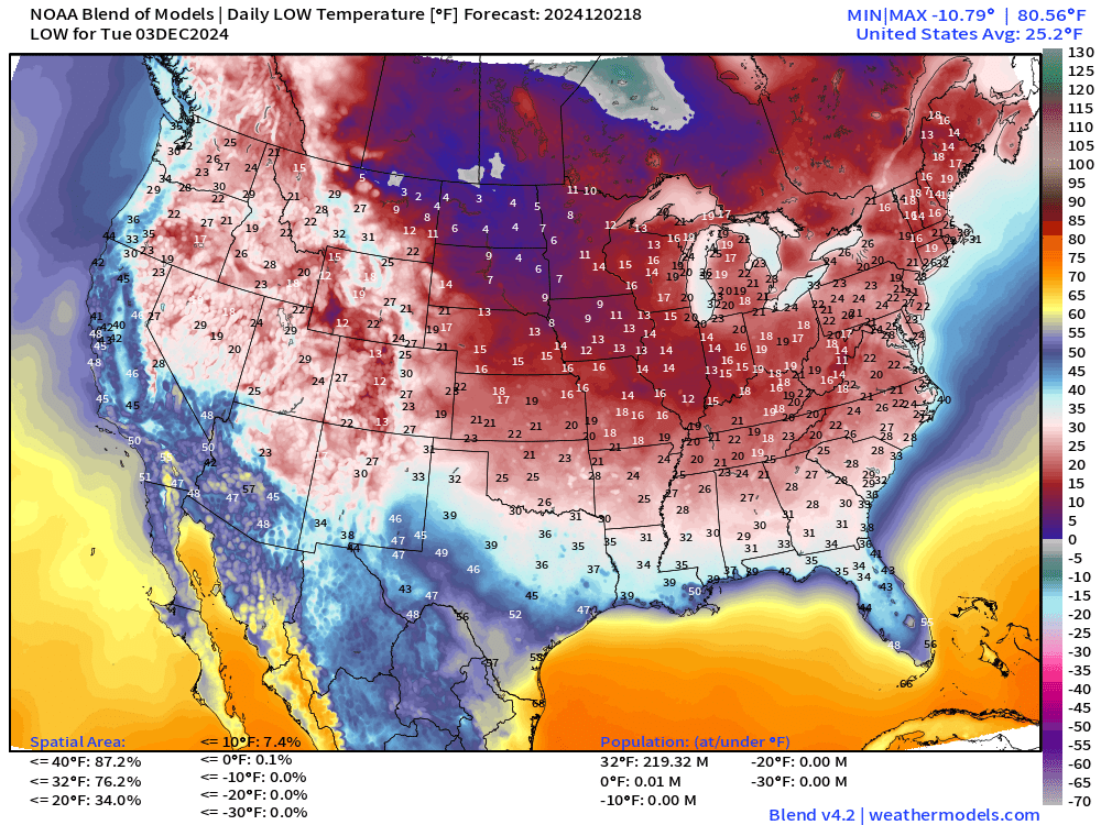
76% of the Lower 48 Area is below freezing.
High Temperatures on Tuesday
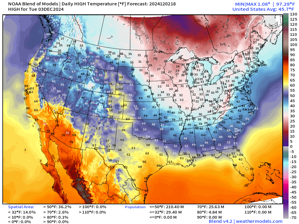
A chilly day even into the Southeast with Atlanta in the mid-40s. Even Florida down to Orlando only in the mid-60s.
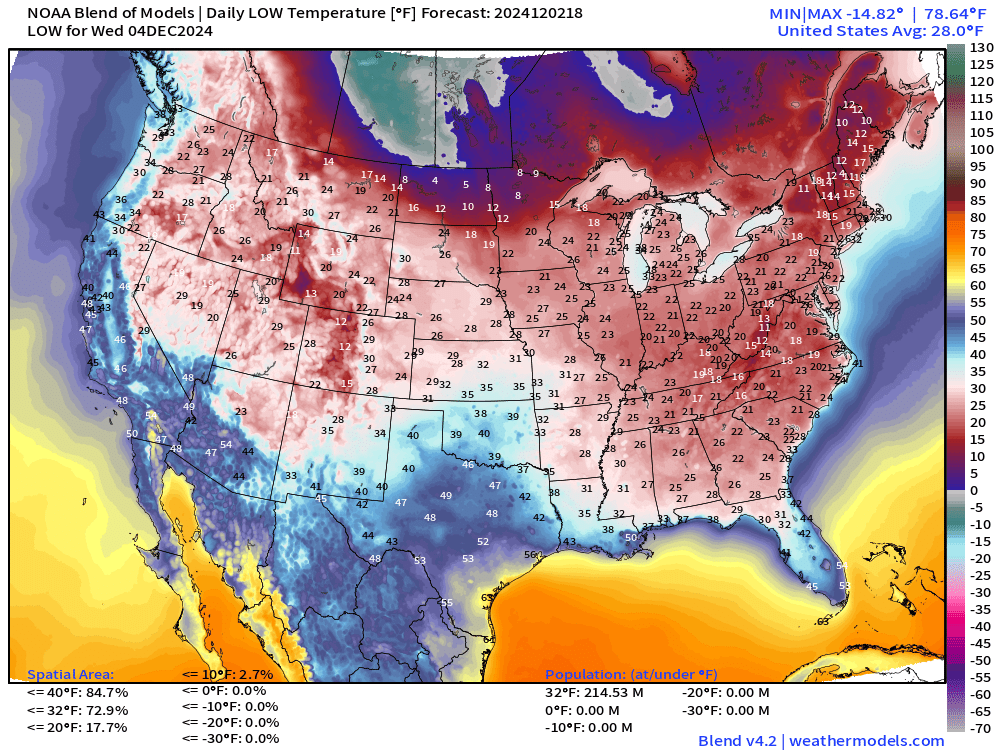
Low Temperatures on Wednesday
Snowfall Forecasts
15-day Ensemble Median Snowfall
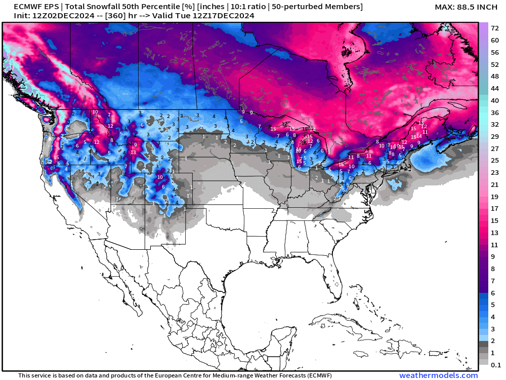
A lot of Pacific moisture up and over the ridge across the Western U.S. and Canada will come down into the Northeast and Ontario/Quebec with significant snowpack gains.
Western U.S. will see snow again as the pattern shifts finally in 8-10 days.
15-day Ensemble % chance of at least 6-inches of snowfall
Not seeing a significant storm signal through 2-weeks as of yet for 6-inches of widespread snowfall across the Lower 48 aside from Lake Effect.
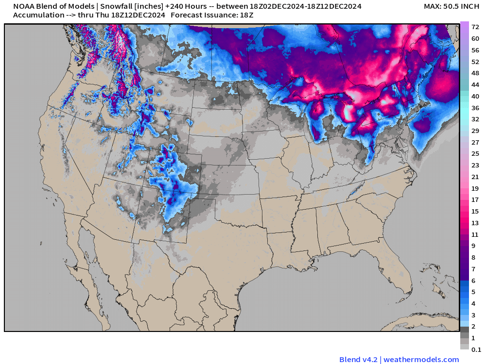
Blend of Models — 10 day snowfall totals
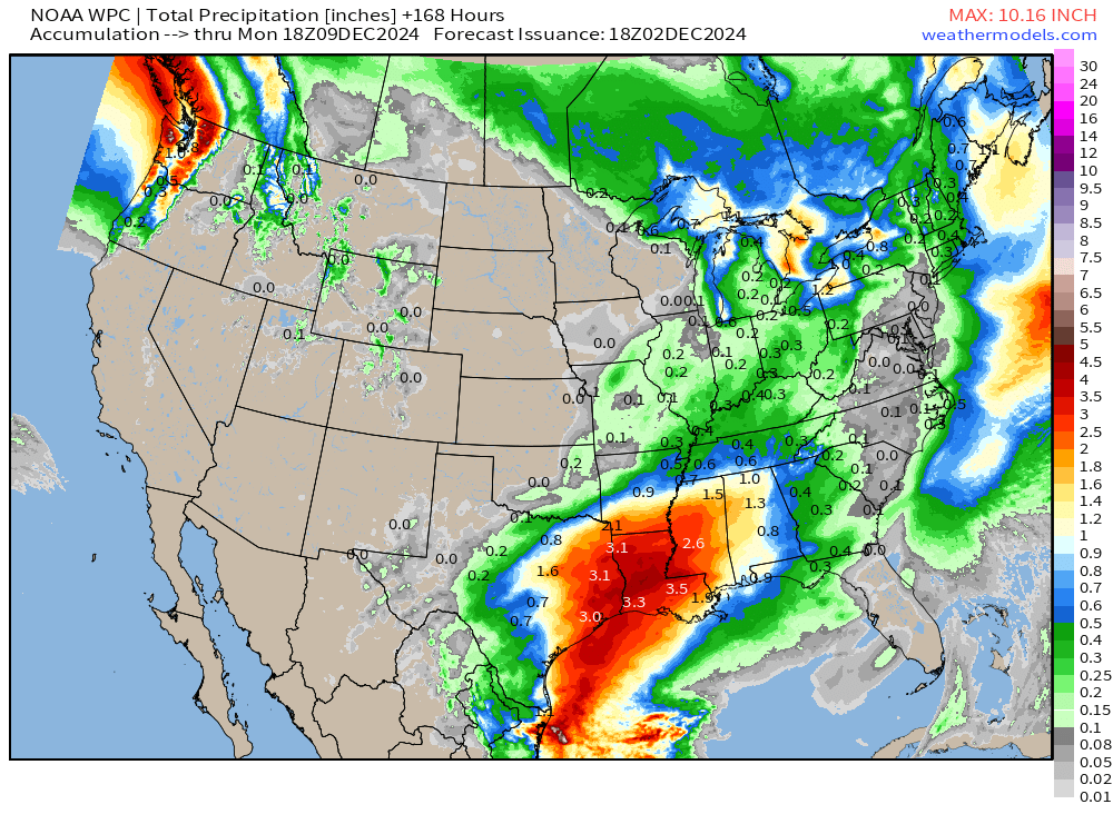
Total Precipitation next 7-Days | NOAA WPC
Total Precipitation Next 10-Days | ECMWF 12z EPS Median
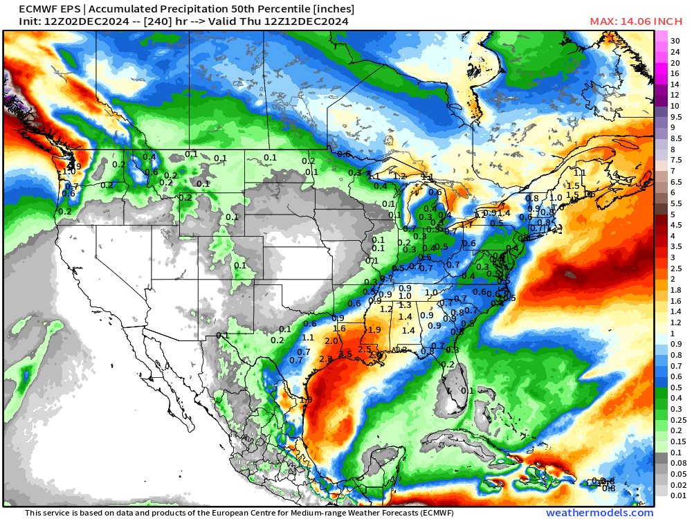
California is dry (!) for next 10-days.
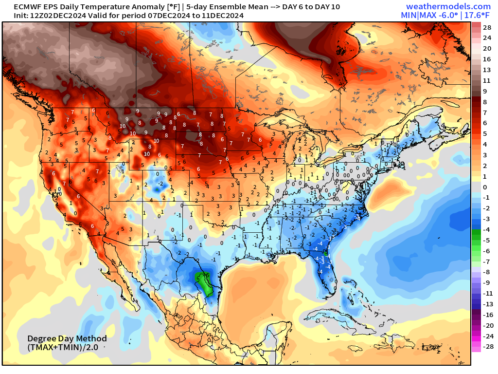
EPS 12z | 5-Day Chunk Temperature Anomaly
Days 1-5: December 2 - December 6
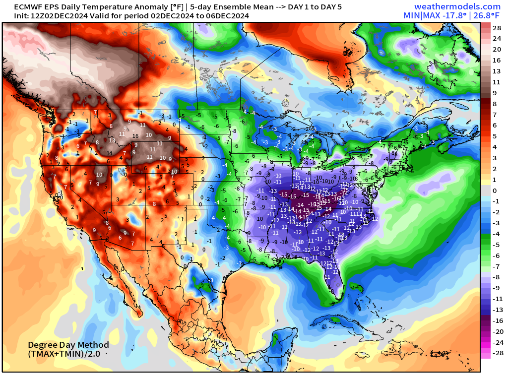
A 5-day temperature anomaly of -15°F centered right over the Ohio Valley.
Days 6-10: December 7 - December 11
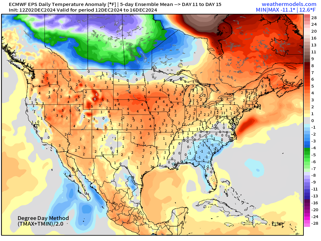
Days 11-15: December 12 - December 16
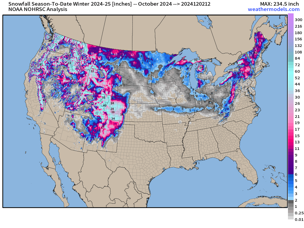
Snowfall Analysis | October 1, 2024 — today
Snowfall Last 7-Days
Maps sourced from weathermodels.com designed and innovated by yours truly! I actually create all of my content from scratch.
- Milepost
- 448 · laid 2024-12-02T21:15:50.189000Z
- Source
- https://weather.substack.com/p/december-2-2024-monday-weather-update
- Digest
- 1930bba74cafcff07d496cd2ced8c6a853acad1f64290c78db664d265b79c7b3
- Machine
- JSON