November 29, 2024 Black Friday Weather Update
Canadian Arctic flow into Northeast US will be long-lasting and exceptional
November 2024 was the 8th-warmest November in the 131-year national record (1895–2025), at 45.1°F against a 1991–2020 normal of 43.0°F (+2.2°F).
November 2024 was the 13th-wettest November in the 131-year national record (1895–2025), at 3.0in against a 1991–2020 normal of 2.3in (+0.8in).
NOAA/NCEI Climate at a Glance, contiguous United States. This is the observed record for the month, not a score of anything said in this piece — the forecast ledger begins 2026-08-17 and cannot reach earlier posts.

Friday Headlines
Lake Effect snow machine is dialed up to maximum with snowfall rates 2-4” per hour now piling up past 2-feet along Lake Erie.
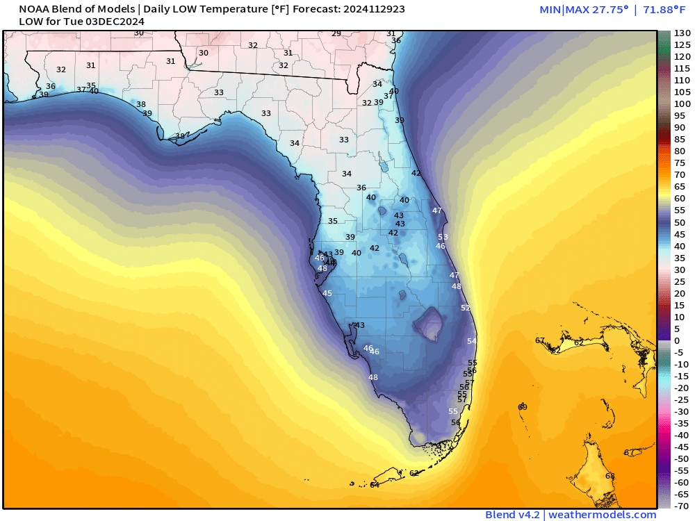
Cold air behind an Arctic front with strong high pressure settles into the Southeast into next week with cold mornings Mon/Tues/Wed into central Florida
Overall below normal temperatures for next 2-weeks in the Northeast.
I will have an op-ed in a newspaper published online Sunday [6 AM] with thoughts about U.S. weather forecasting in a second Trump administration.
Current 10% coupon for Annual Subscription [through November 30]. $5/month or $50/year through December 31.
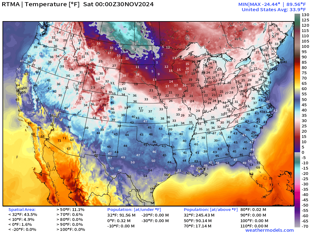
7 PM ET Temperatures across the Lower 48
Patch of -20s in Canada and below zero °F in North Dakota
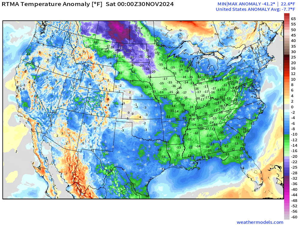
Temperature Anomaly
Overall the Lower 48 is -7.7°F (below normal)
Lake Effect Snow Machine | Next 48-hours | HRRR
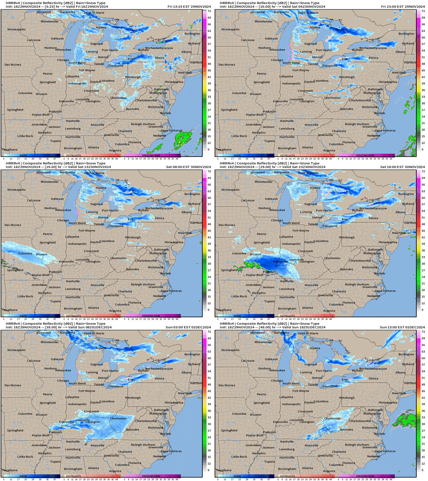
A small disturbance heads into the Ohio Valley and could drop a few inches of snow across Kentucky into Sunday.
San Francisco 49ers at Buffalo Bills (8 PM)
If the Lake Ontario snow band veers with the wind to the north closer to Buffalo — since Orchard Park is several miles south of KBUF — then we are looking at 2-3 feet of snow at the stadium by Sunday evening.
Up to 4-5 feet along Lake Erie around Dunkirk.
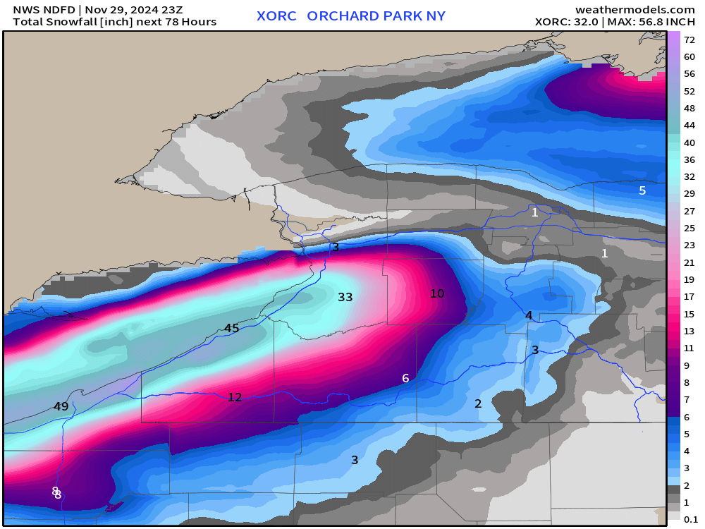
6-feet likely around Watertown, NY on the Tug Hill Plateau through Monday evening. Probably will still be snowing, too.
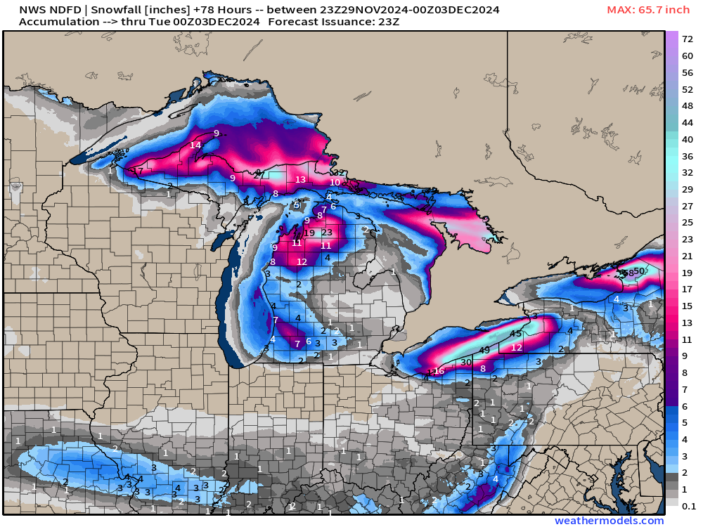
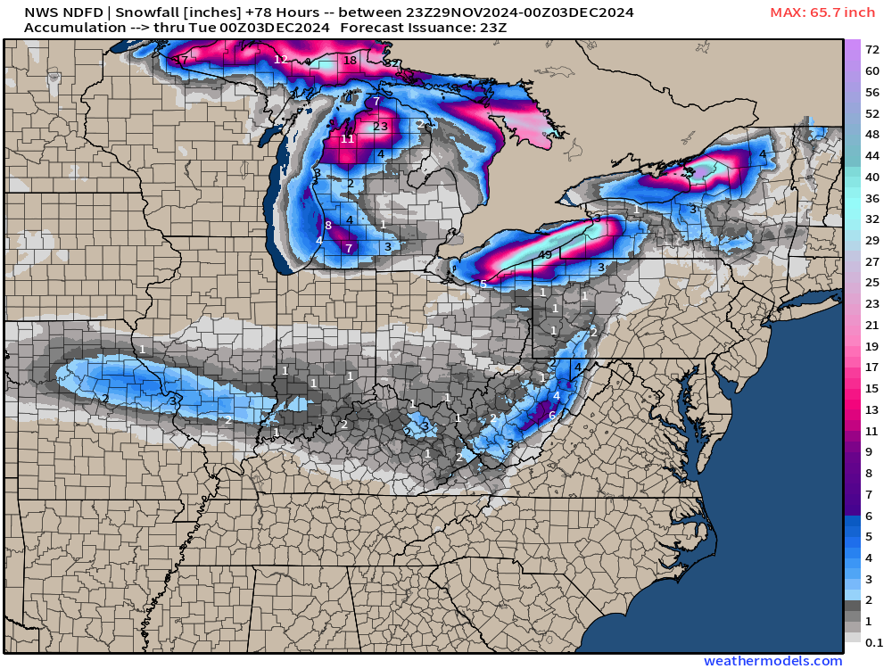
Next 15-Days Temperature Anomaly [°F]
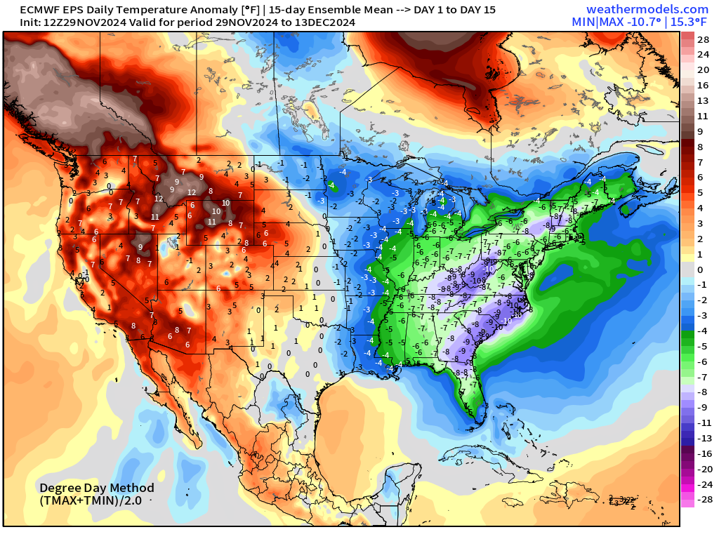
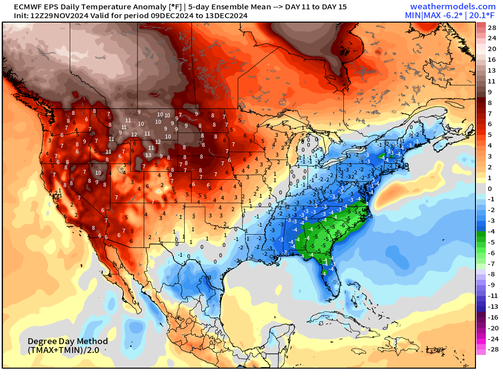
The overall temperature anomaly for 15-days is quite significant — and will make up half of the month of December at this point. -7 to -10°F from Ohio Valley into the Southeast. And, this is an ensemble mean, so probably more extreme cold.
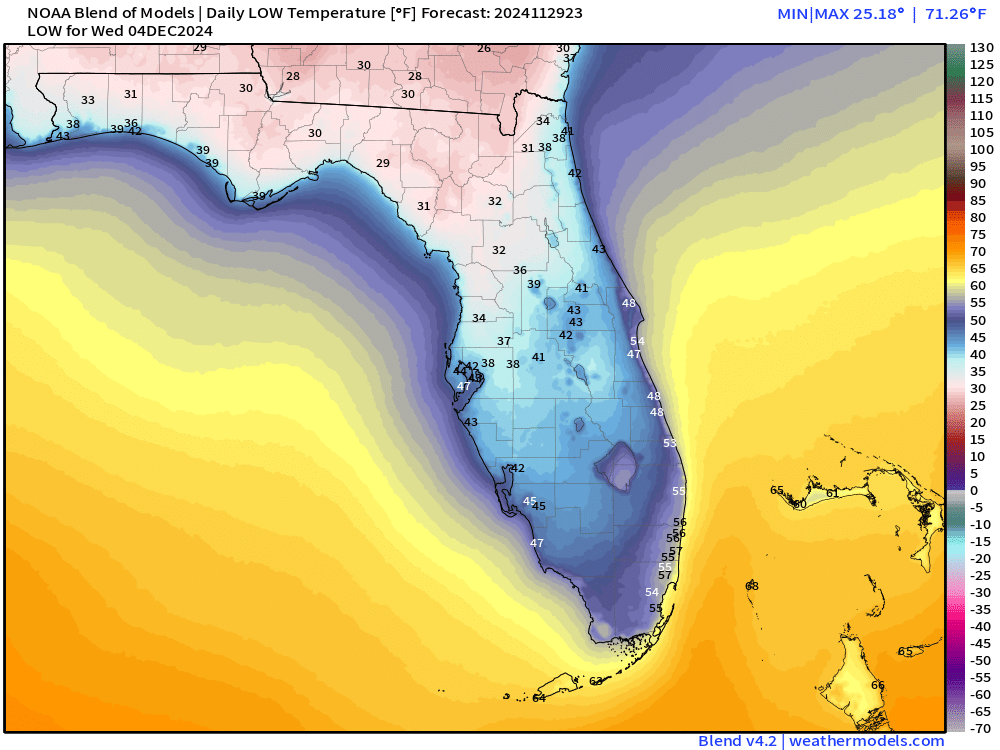
Cold Mornings in Florida: Tuesday and Wednesday
Upper-Level Pattern | ECMWF 12z | Next 10-days
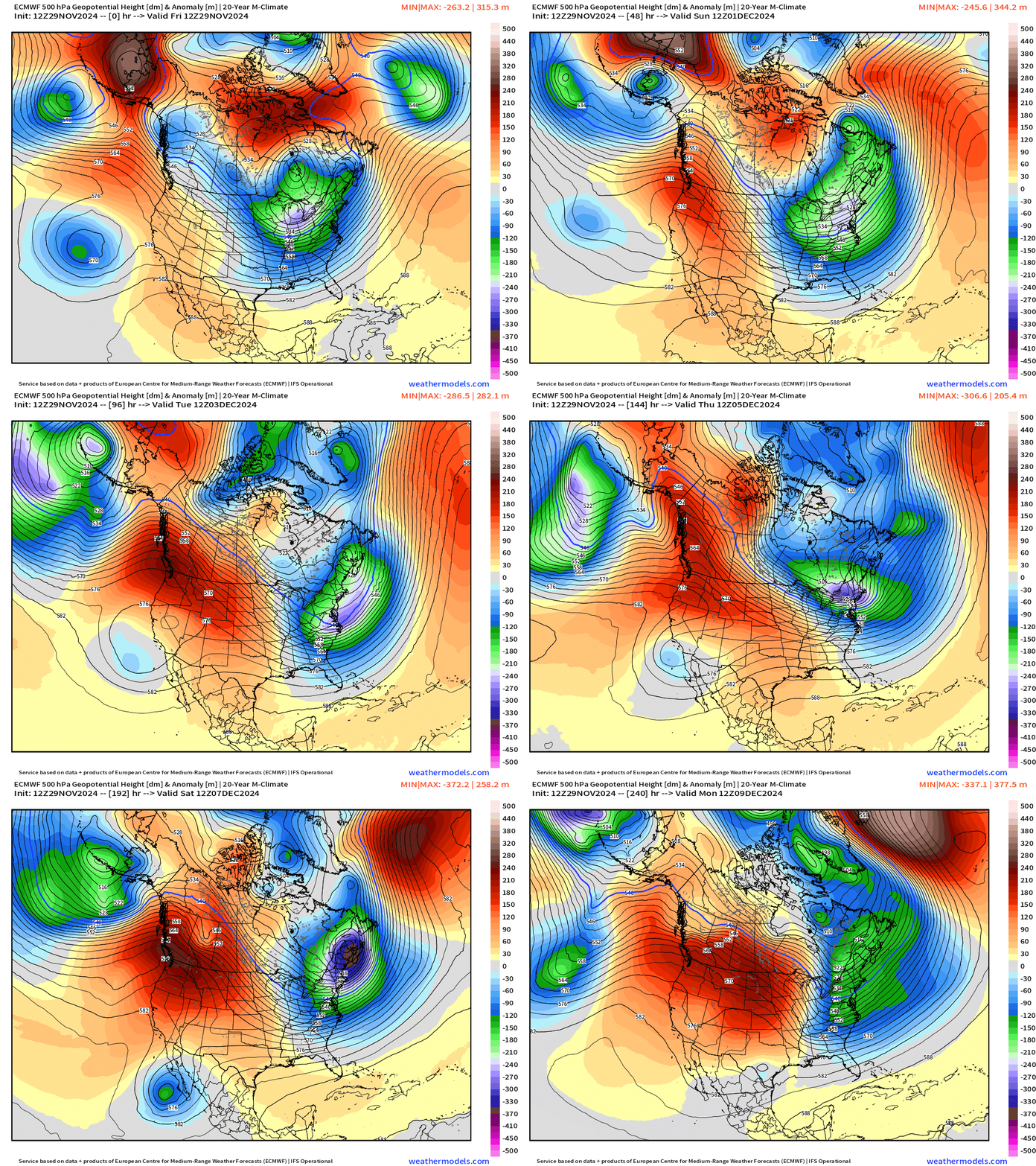
Animation from ECMWF HRES 12z — evolution of the upper-level height field anomalies. The Western ridge continues to be reinforced as a block from the upstream very active North Pacific storm track sending storms into the Bering Sea.
The resulting downstream trough over the Northeast repeats for the next 10-days.
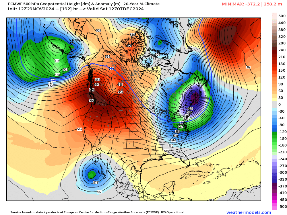
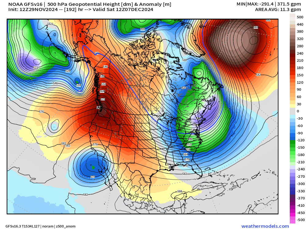
Day 8 Height Anomaly | Next Saturday December 7, 2024
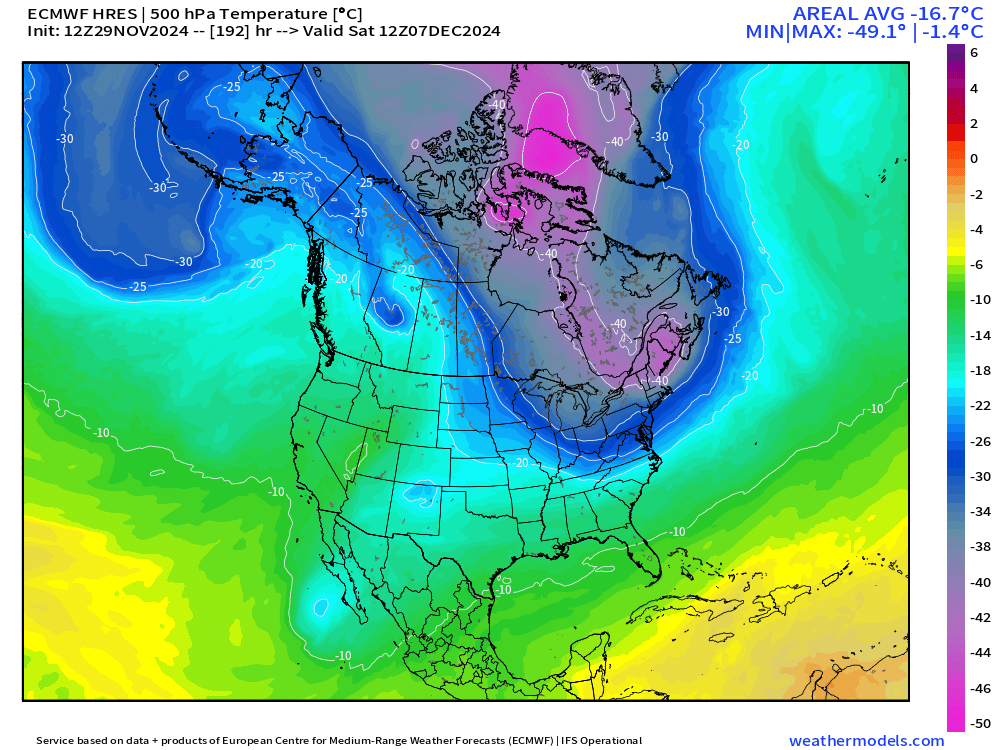
500 hPa Temperature
Cool demonstration of the connection to the tropospheric Polar Vortex anchored over Greenland extending with a hook into New England with -40°C temps into New England albeit at 500 hPa. That’s extremely cold for early December even in Siberia.
GFS 8-Day Height Anomaly Comparison
ECMWF AIFS 8-Day Height Anomaly Comparison
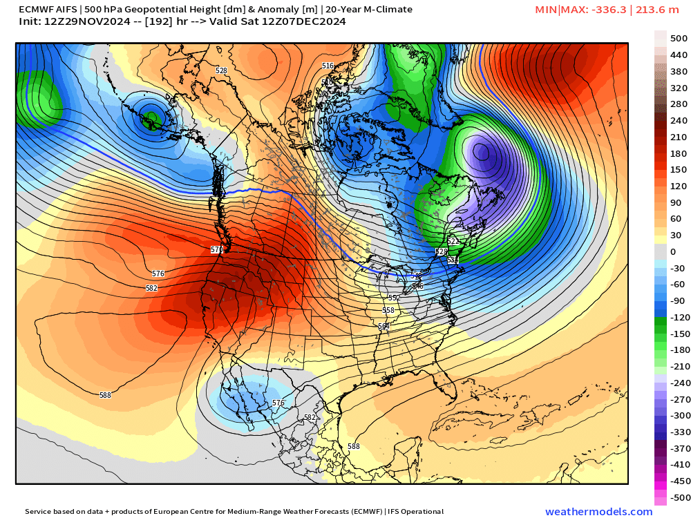
Pattern seems highly predictable with agreement among the models through Day 8 at least.
To continue supporting Weather Trader into the Winter 2024-25, please consider subscribing or upgrading to an annual commitment with 10% off incentive through November 30.
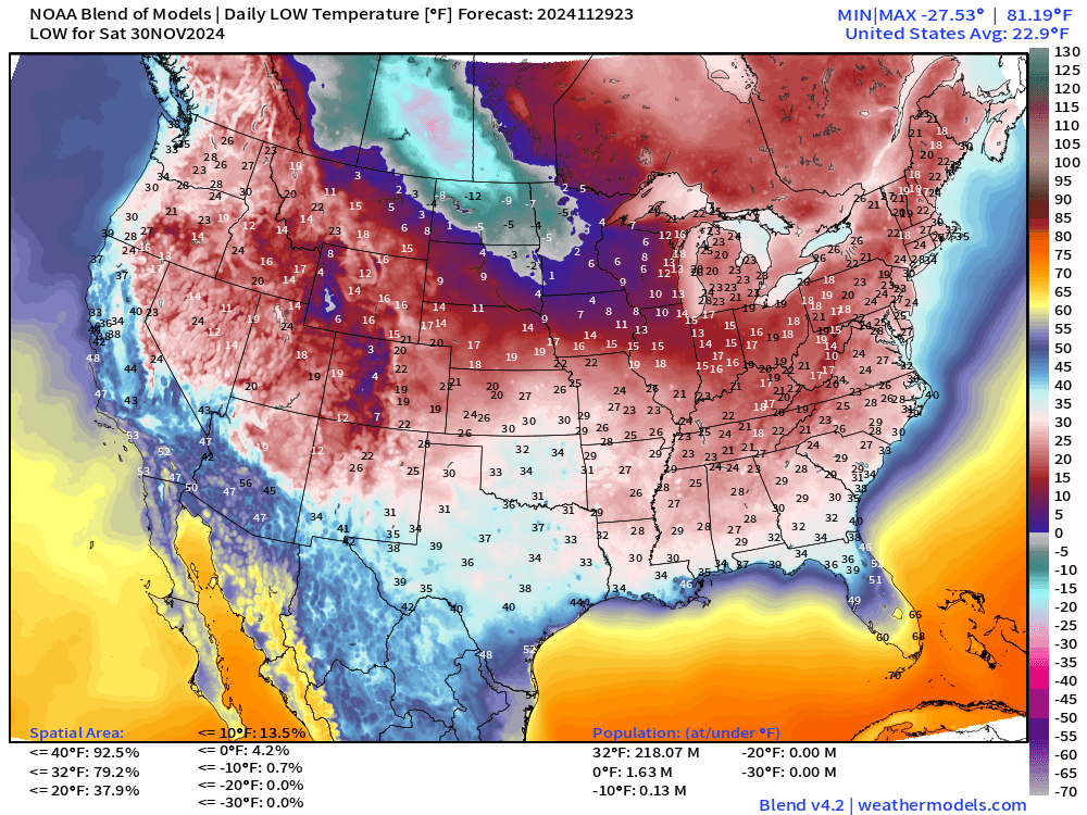
Low Temperatures on Saturday
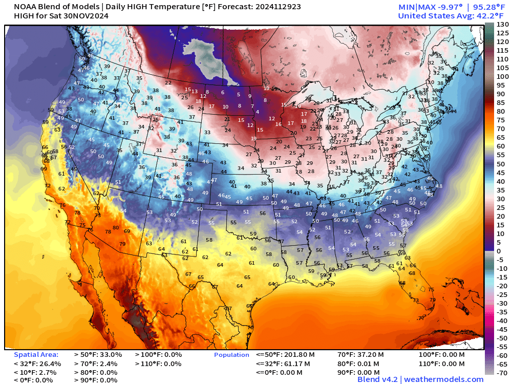
High Temperatures on Saturday
High Temperatures on Sunday
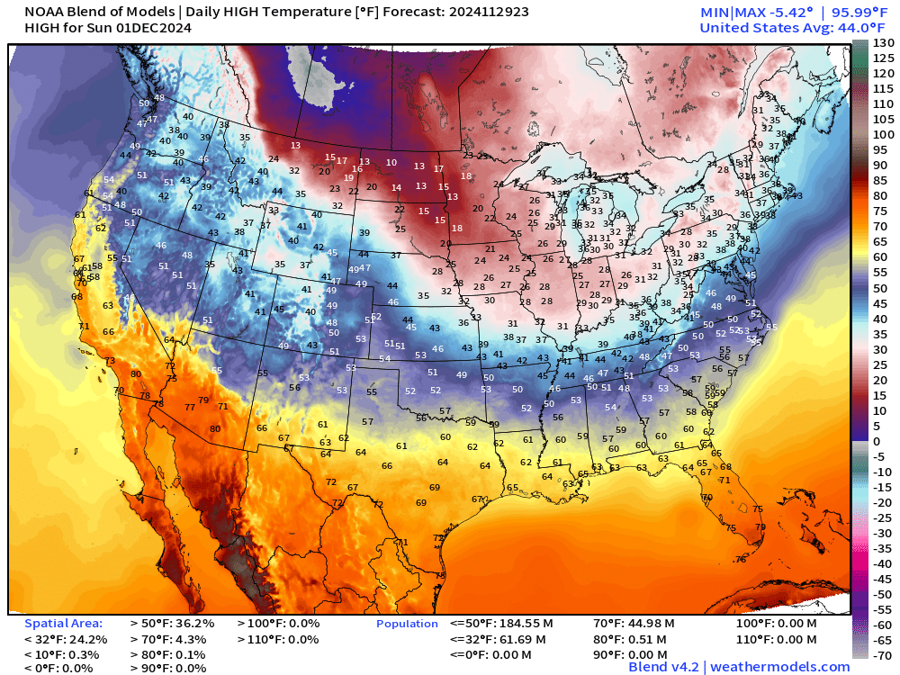
Snowfall Forecasts
15-day Ensemble Median Snowfall | Lake Effect!
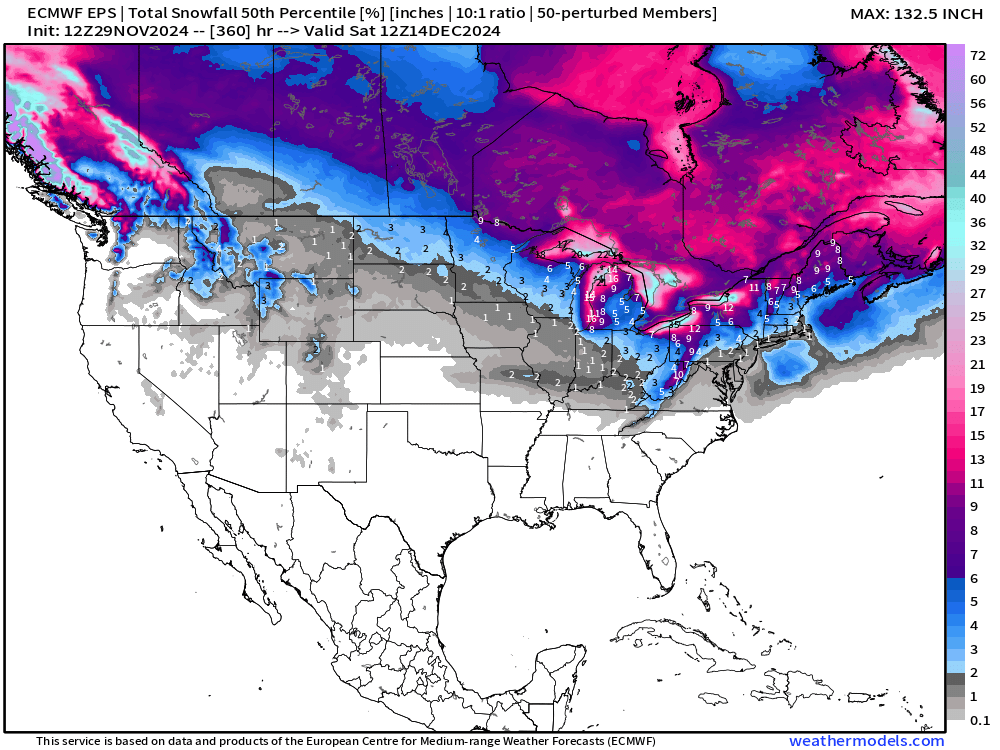
No snow to speak of across the Western U.S. through 15-days except for the northern Rockies, but very little. The only snow show in town at this point is the Lake Effect.
15-day Ensemble % chance of at least 6-inches of snowfall
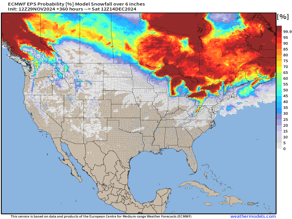
No significant signal for a winter storm or Nor’easter through December 14.
Blend of Models — 7 day snowfall totals
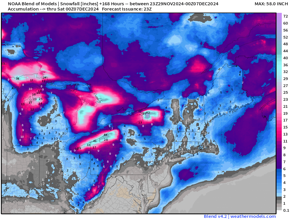
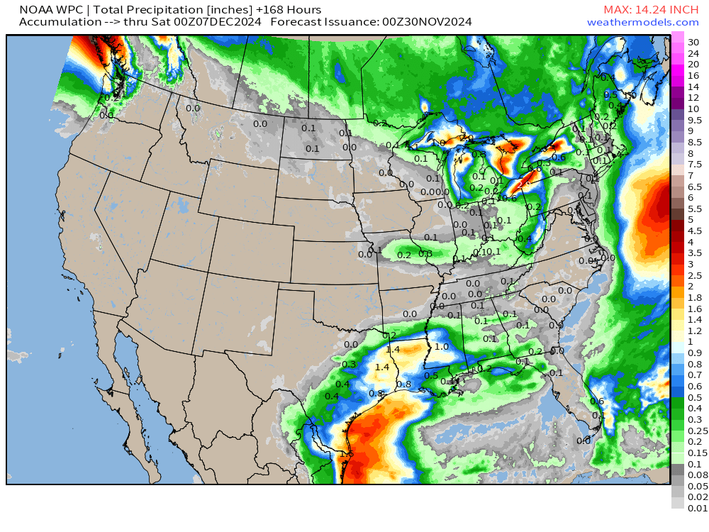
Total Precipitation next 7-Days | NOAA WPC
Total Precipitation Next 15-Days | ECMWF 12z EPS Median
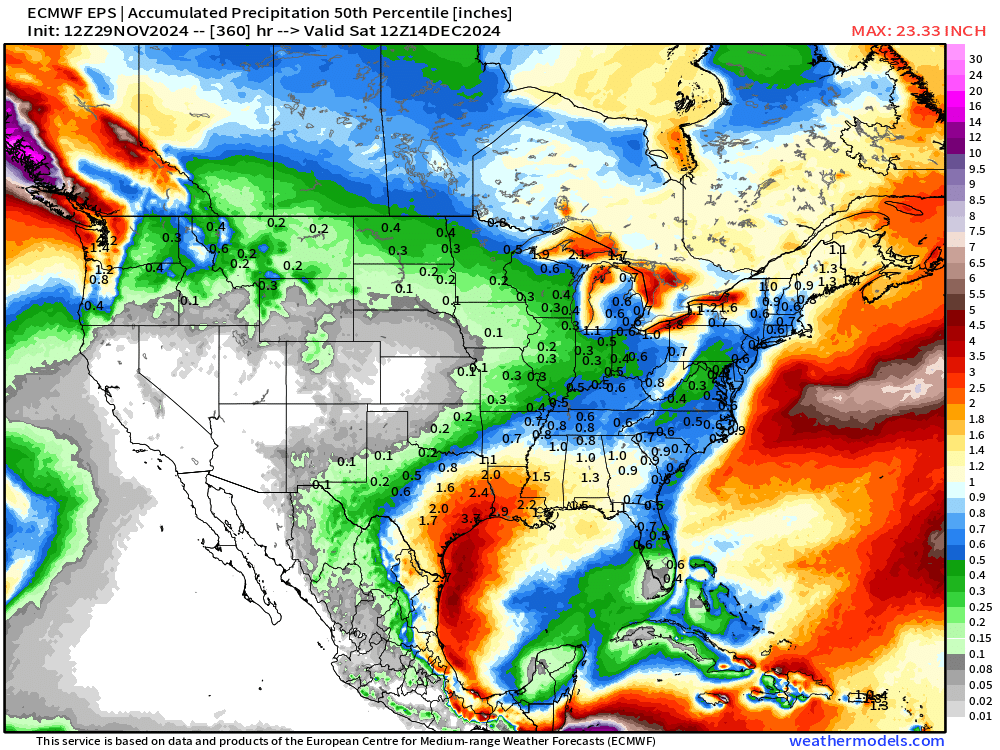
California is dry (!) for next 2-weeks.
EPS 12z | 5-Day Chunk Temperature Anomaly
Days 1-5: November 29 - December 3
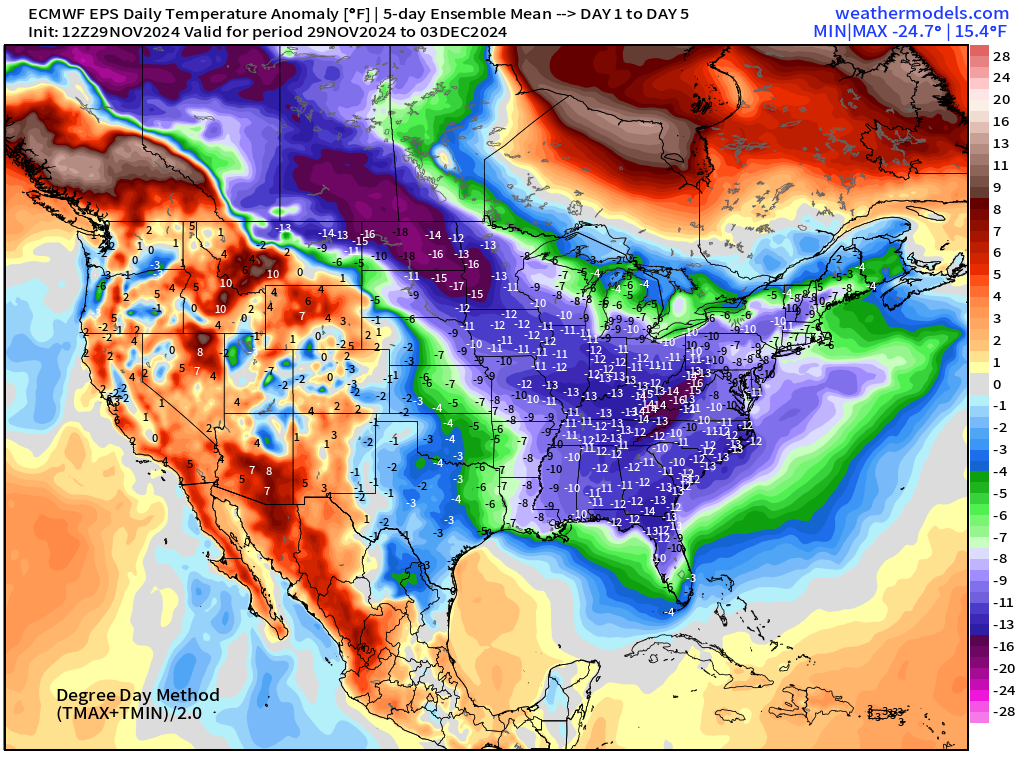
Very impressive 5-day average temperature anomaly!
Days 6-10: December 4 - December 8
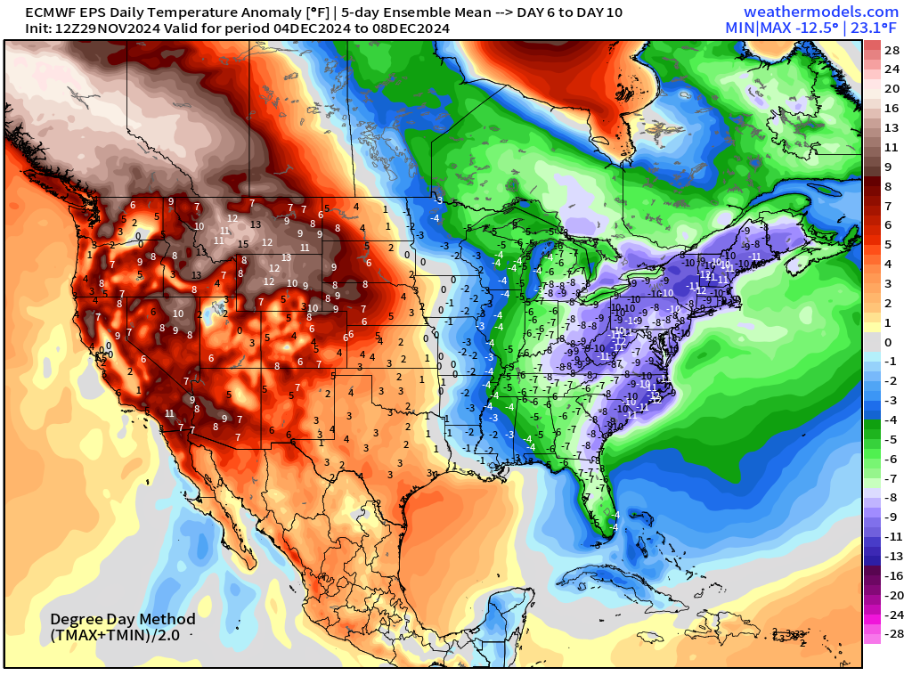
Days 11-15: December 9 - December 13
Snowfall Analysis | October 1, 2024 — today
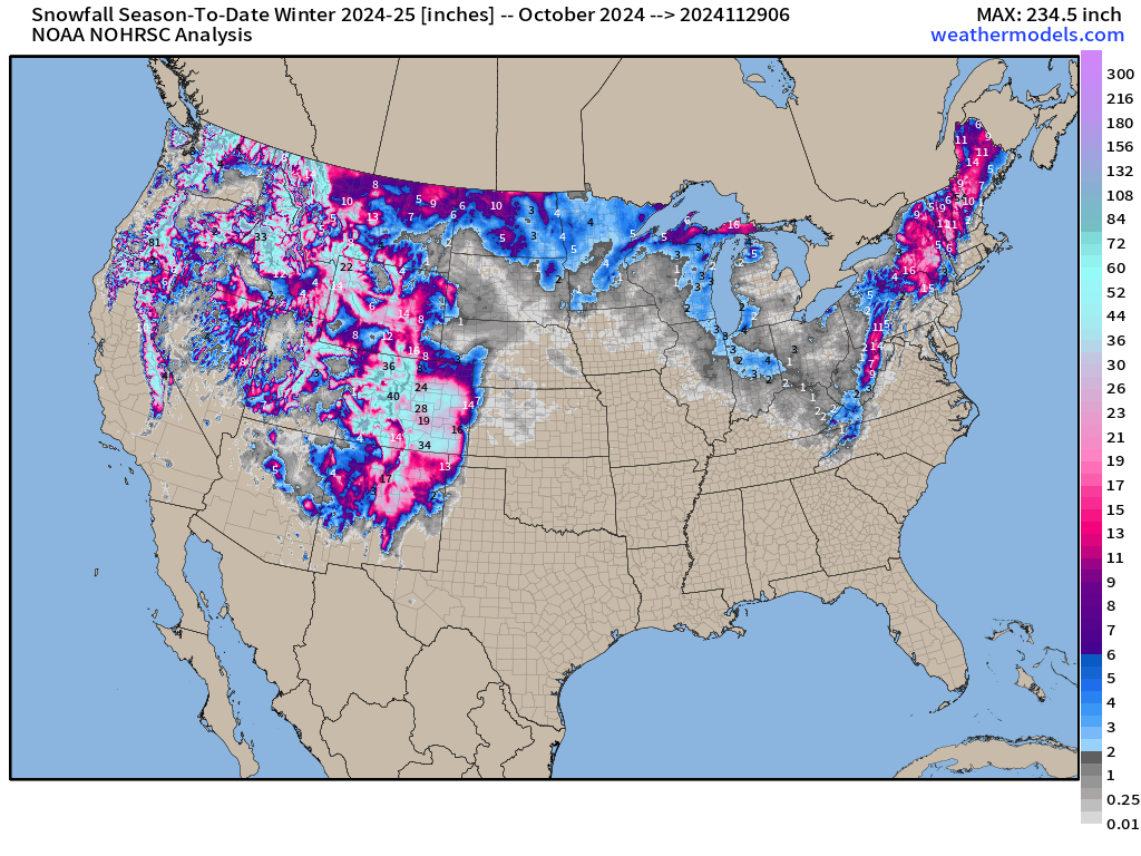
Curious if all that snow in New York actually was recorded yesterday and today.
Maps sourced from weathermodels.com designed and innovated by yours truly! I actually create all of my content from scratch.
- Milepost
- 446 · laid 2024-11-30T01:12:32.269000Z
- Source
- https://weather.substack.com/p/november-29-2024-black-friday-weather
- Digest
- 748746c802ebb7ff40e6012f8a05821113858b14e3852d5c4dd7563e59b9ba1d
- Machine
- JSON