November 21, 2024 Thursday Winter Weather Update
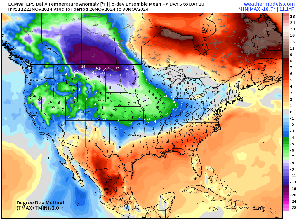
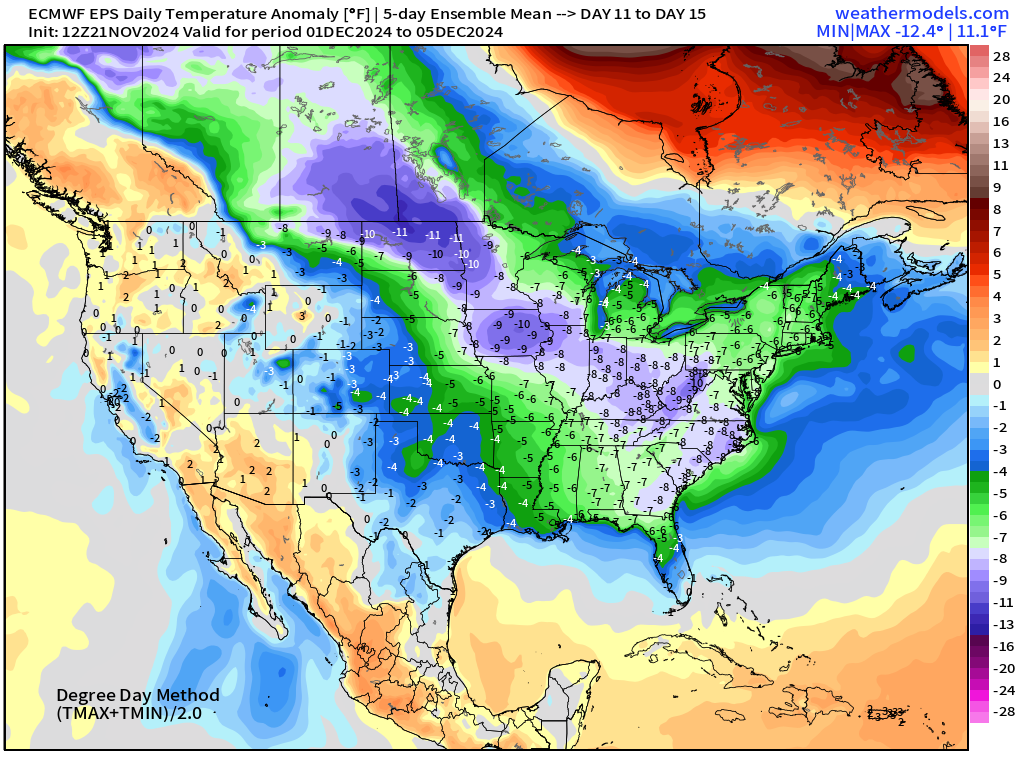
Much colder air on the way into December
November 2024 was the 8th-warmest November in the 131-year national record (1895–2025), at 45.1°F against a 1991–2020 normal of 43.0°F (+2.2°F).
November 2024 was the 13th-wettest November in the 131-year national record (1895–2025), at 3.0in against a 1991–2020 normal of 2.3in (+0.8in).
NOAA/NCEI Climate at a Glance, contiguous United States. This is the observed record for the month, not a score of anything said in this piece — the forecast ledger begins 2026-08-17 and cannot reach earlier posts.

Thursday Headlines
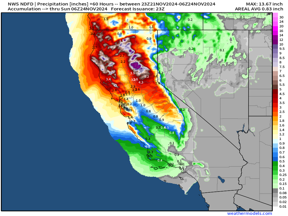
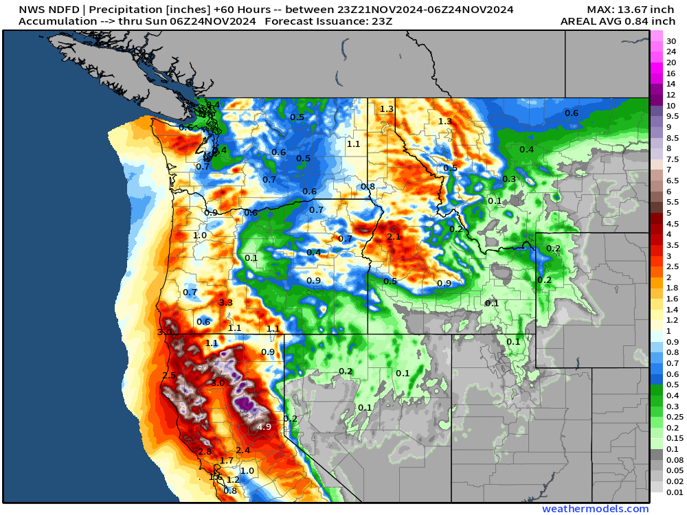
Thursday — Friday: 2 ongoing storms on each coast: (a) atmospheric river w/yet another bomb cyclone in California/Oregon/Washington (b) Mid-Atlantic and Northeast low pressure looping with significant snowfall.
We are flipping to full-tilt winter = much colder conditions across the Lower 48 with significant snowfall threats. I am watching various ensemble and A.I. models to determine how cold it could get in early December.
Thursday Evening Across the Lower 48
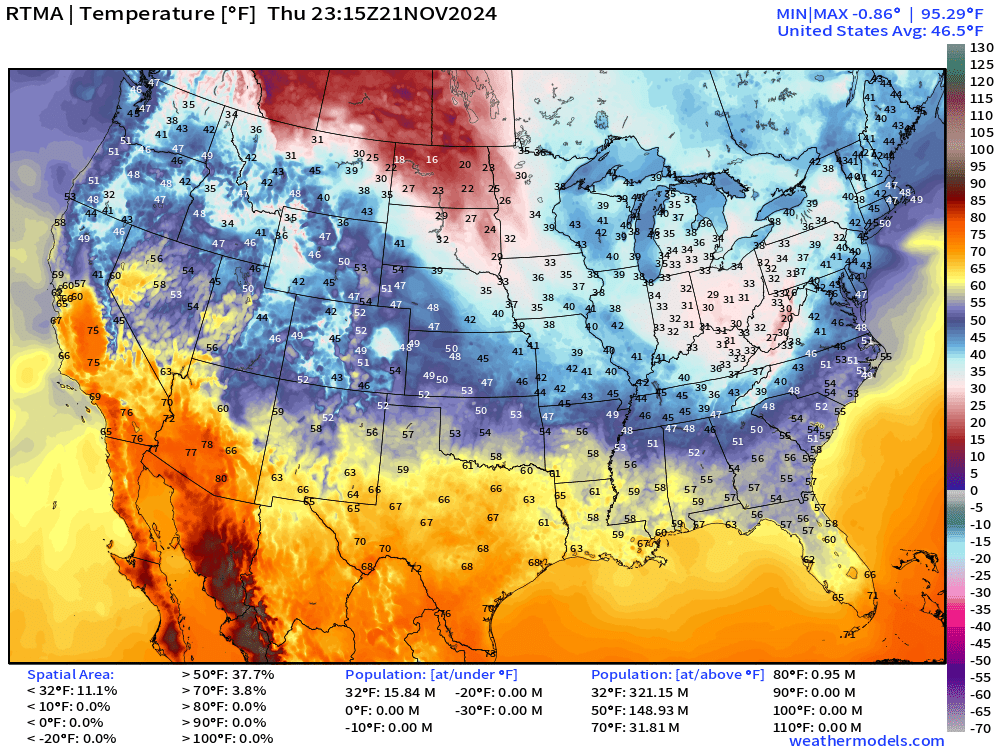
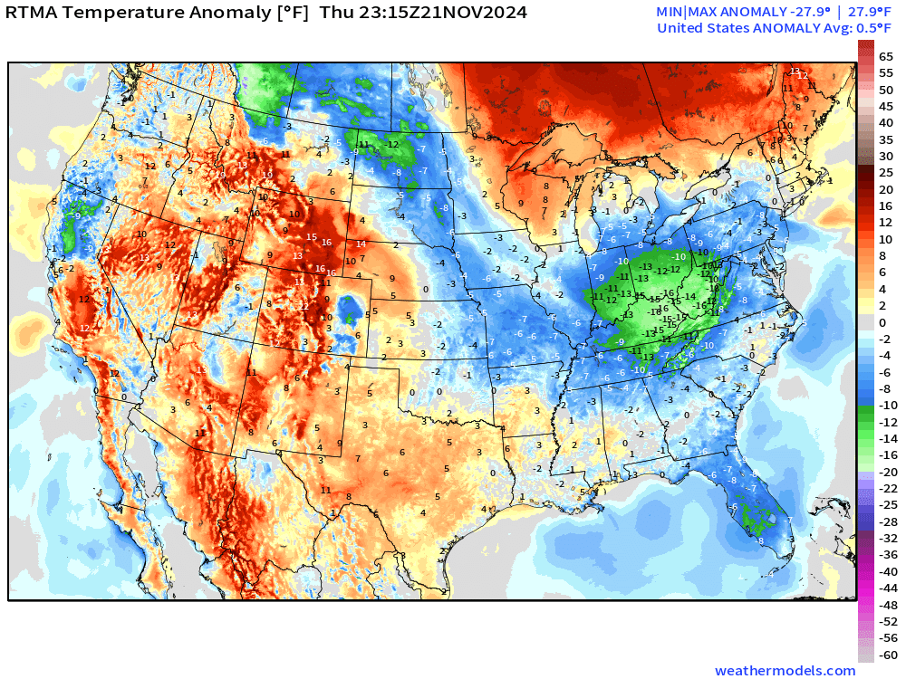
Ongoing storm has lowered temperatures dynamically into the 20s and lower-30s across the eastern Great Lakes and Ohio Valley. You can see the cold pool in the anomaly map — plenty cold enough for snowfall.
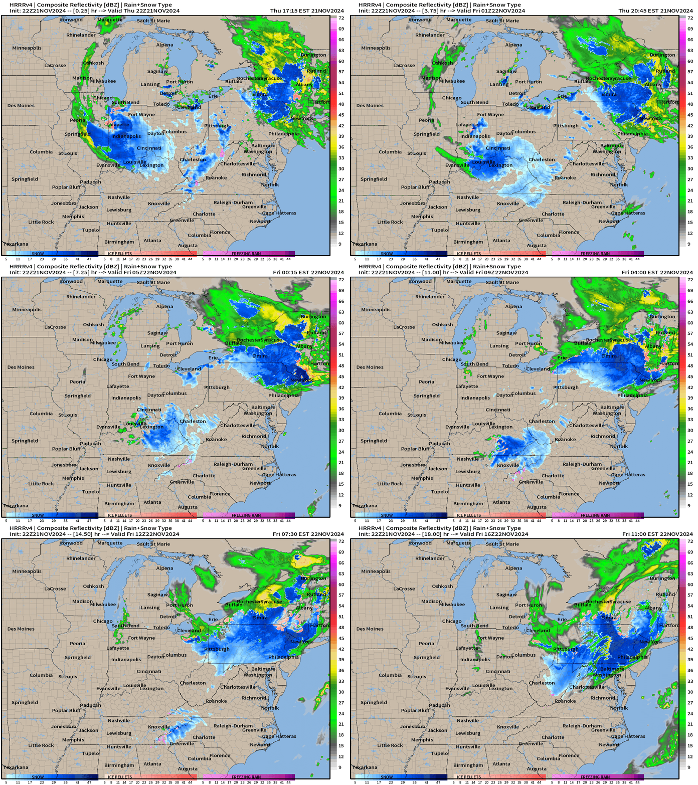
HRRR over next 18-hours into early afternoon on Friday shows heavy snowfall continuing to wrap around the center of low pressure just west of New York City.
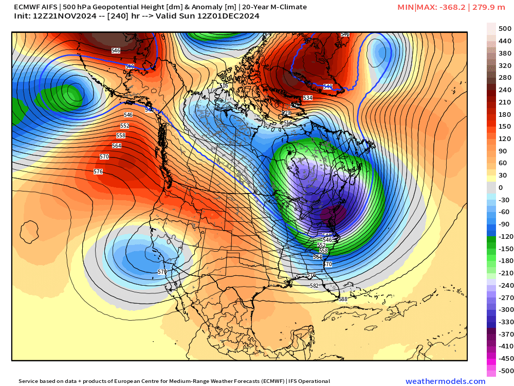
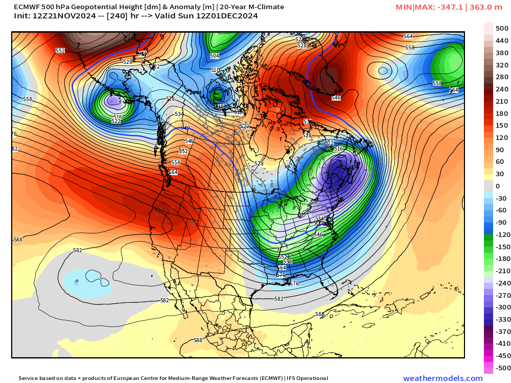
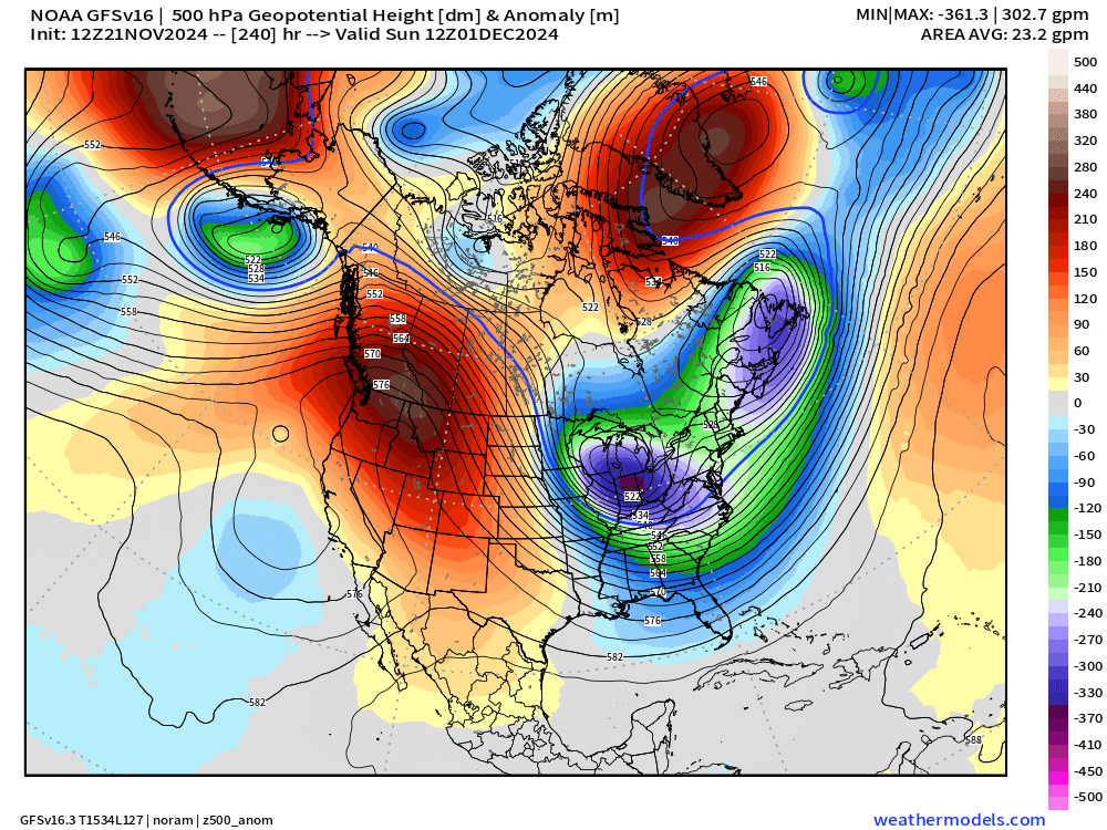
Day 10 Upper Level Pattern
Main question is how much Arctic air can dump onto the Lower 48 east of the Rockies to spur heating demand. LNG markets are betting on the outcome of various forecasts over the next few days.
ECMWF AIFS 12z
EPS Ensemble Mean 12z
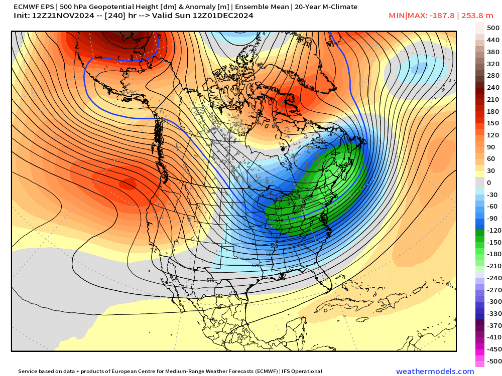
Comparing the AIFS and ensemble mean just with a quick eyeball glance suggests that sure, the AIFS could be a member of the ensemble mean, just washed out or smoothed.
Looking at the ECMWF HRES 12z, similar story as AIFS with more highly detailed trough. That’s typical of looking at the ensemble means vs. the individual members or a deterministic forecast.
The ensemble mean is averaging 51 similar forecasts at Day 10 but small deviations in time and space reduce the amplitude of the upper-level wave pattern and therefore reduce / spread out the lowest geopotential height centers.
ECMWF 12z HRES
Finally as an independent option, we can look at the GFS 12z deterministic and see a similar pattern. That should indicate agreement in the general “cold shot” thesis.
Turns out that 5-day skill is insanely high right now. That doesn’t mean that Day 7 or 10 is also high, but it could — more on that later.
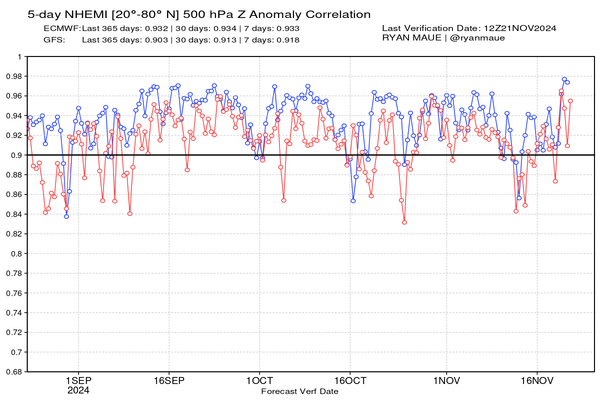
ECMWF HRES 12z at 0.98 is outrageous, some of the best forecasts ever produced.
To continue supporting Weather Trader into the Winter 2024-25, please consider subscribing or upgrading to an annual commitment with 10% off incentive through November 30.
ECMWF 18z | 48-Hour Precipitation Type
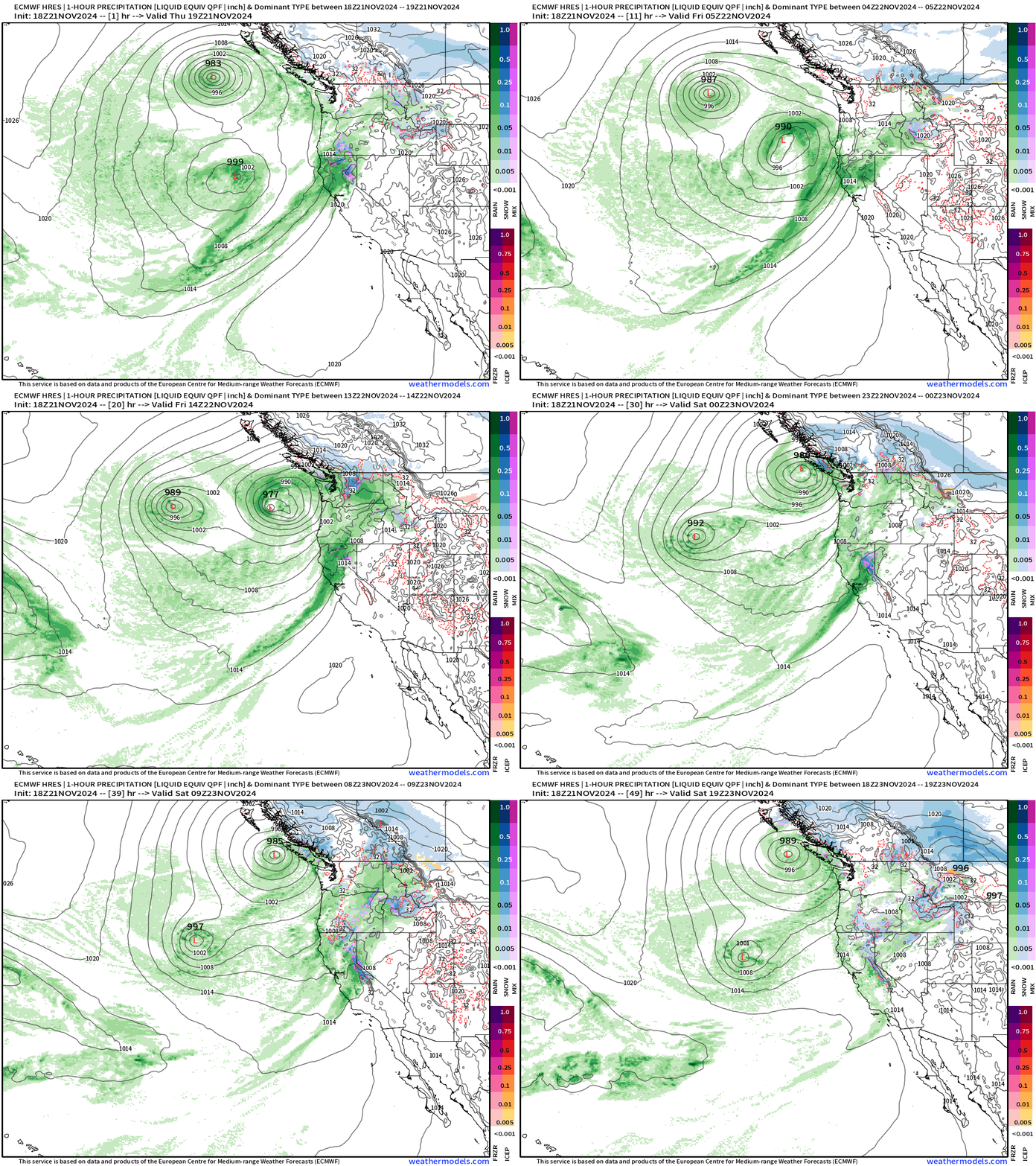
Bomb cyclone #2 is looping its way into the Pacific Northwest offshore Washington with continued “atmospheric river” flood of moisture on shore, eventually extending southward into Central California, and even SoCal.
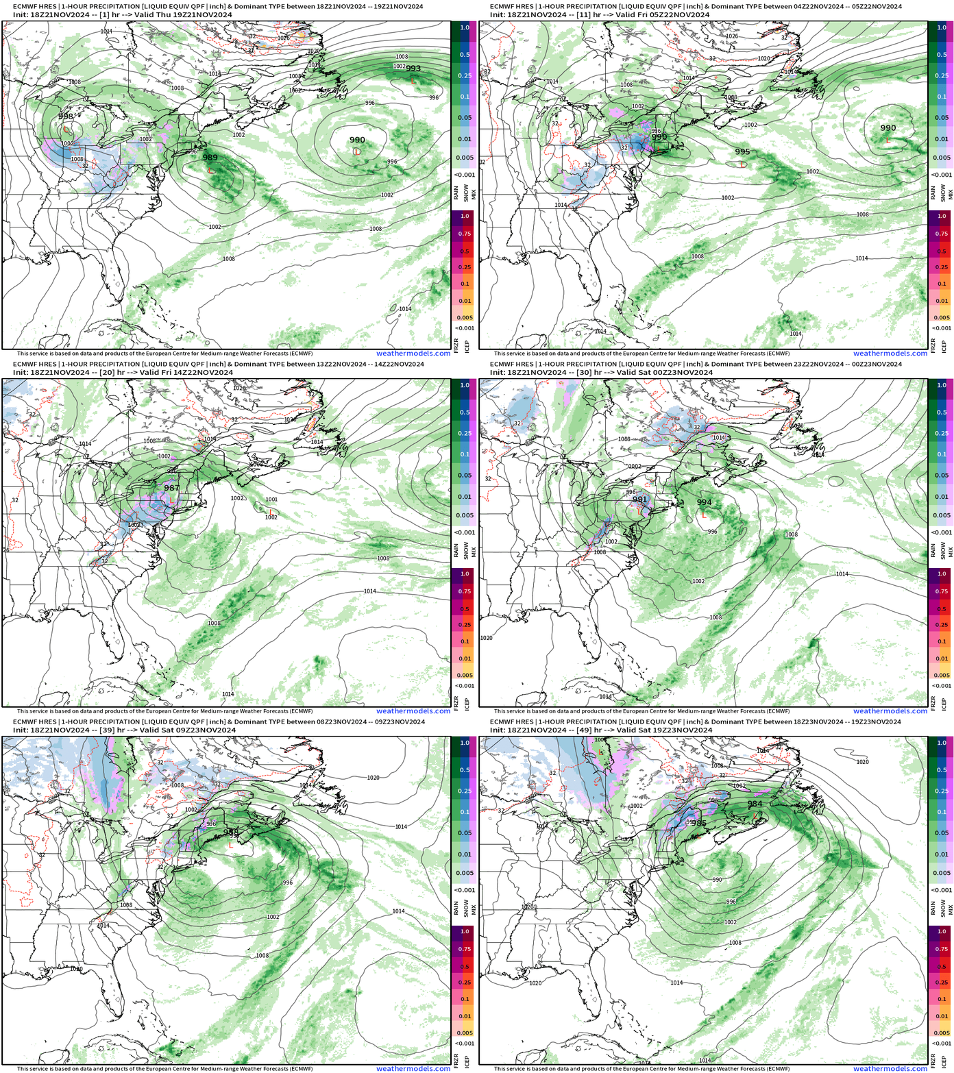
Not a bomb cyclone, but plenty of moisture with a low that drops into the mid-980s doing a counter-clockwise track loop around New York City.
In another few weeks, the cold air in place north of the system in Canada would be blockbuster snowfall amounts for all of New England. Is this a sign of what’s to come this winter?
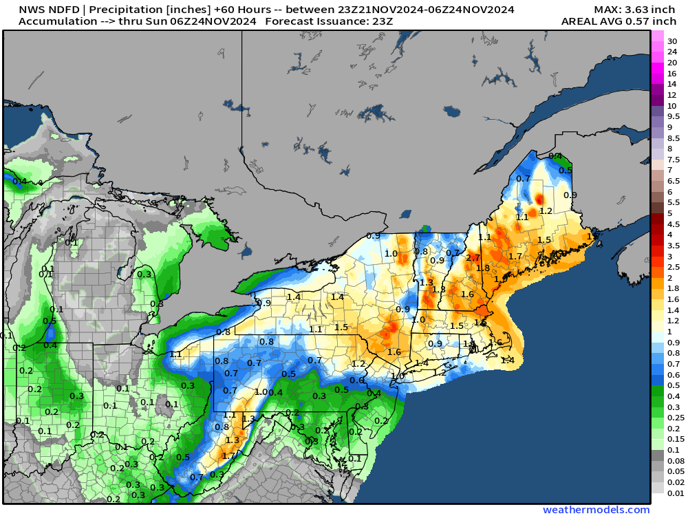
Precipitation Totals From NWS | Next 60-hours
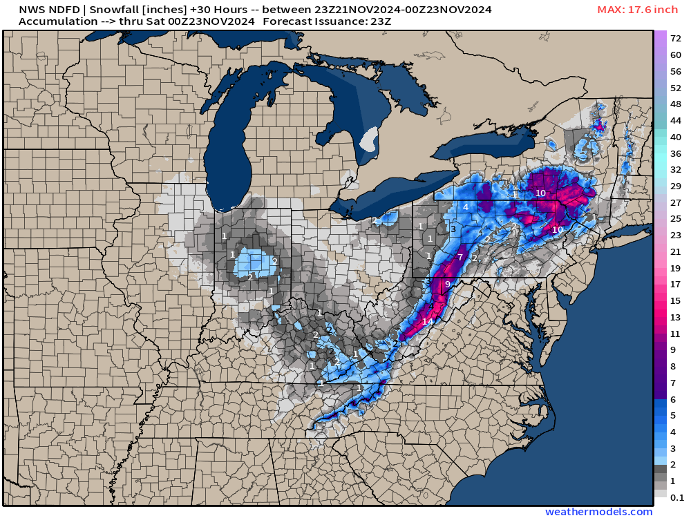
Snowfall from NWS next 30-hours
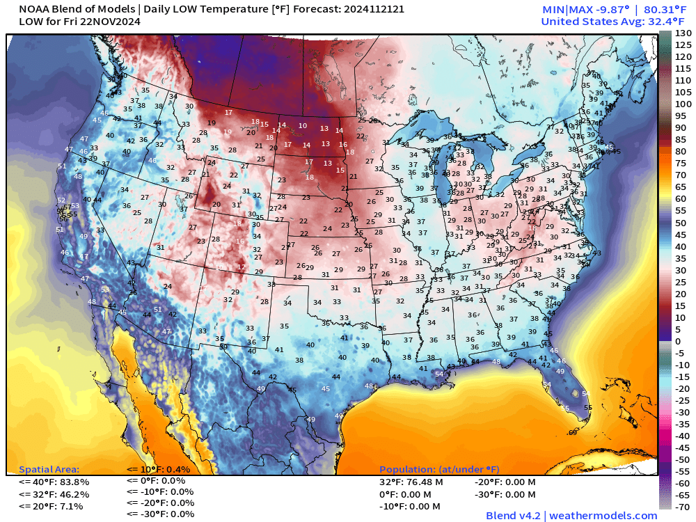
Low Temperatures on Friday
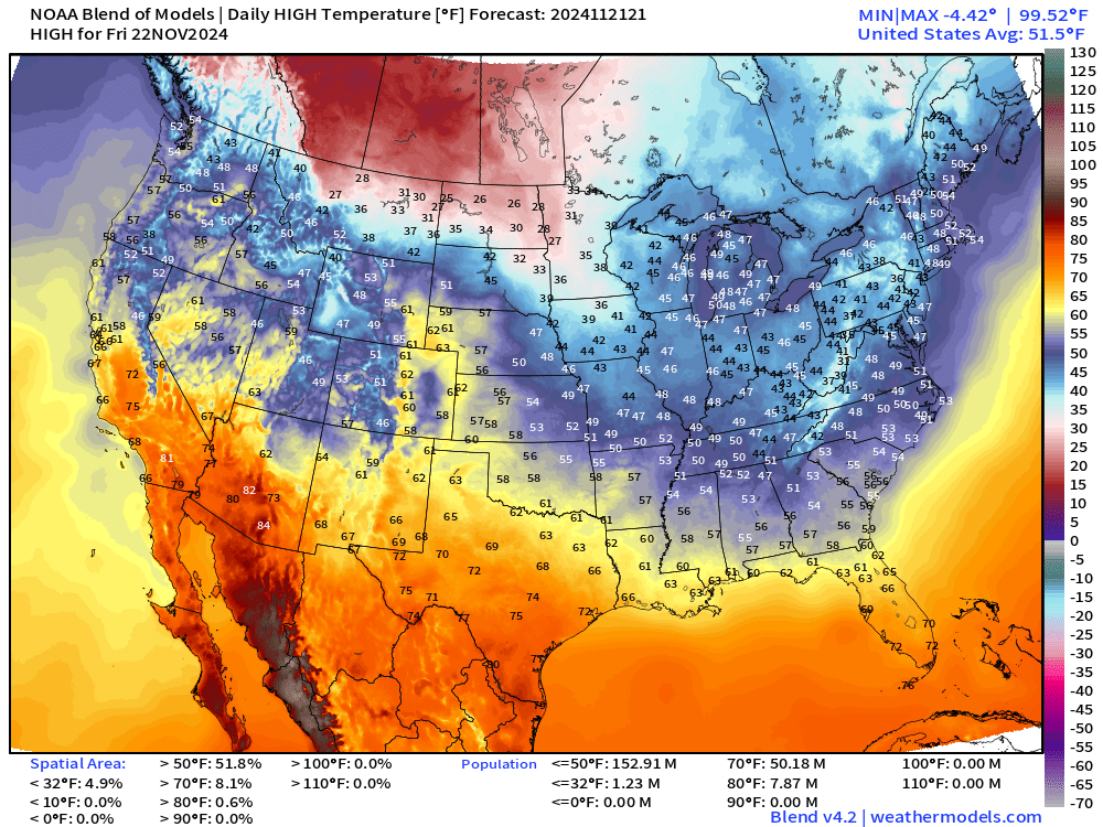
High Temperatures on Friday
Snowfall Forecasts
ECMWF 12z | 10-day Ensemble Median Snowfall
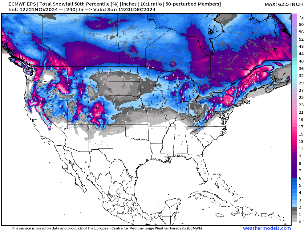
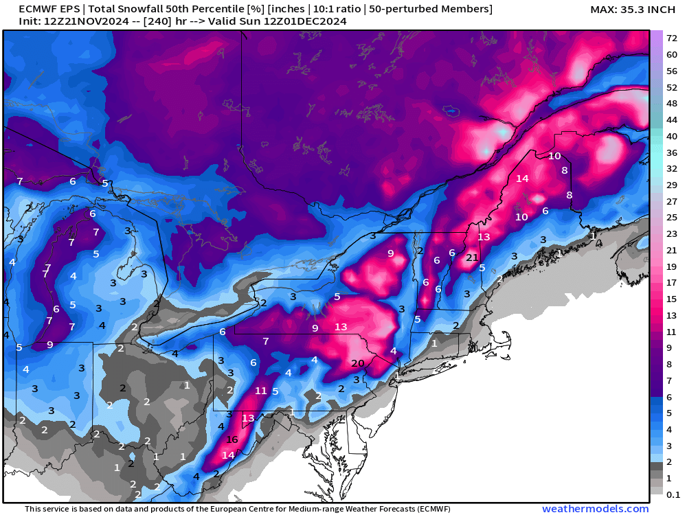
NOAA Blend of Models 7-day Snowfall Accumulation
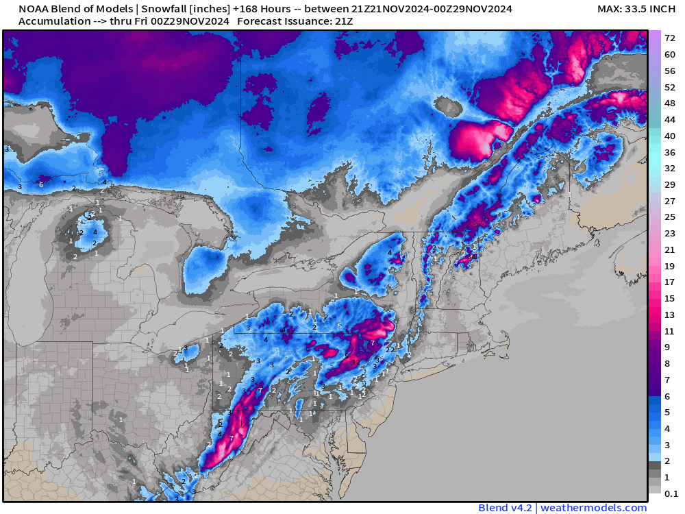
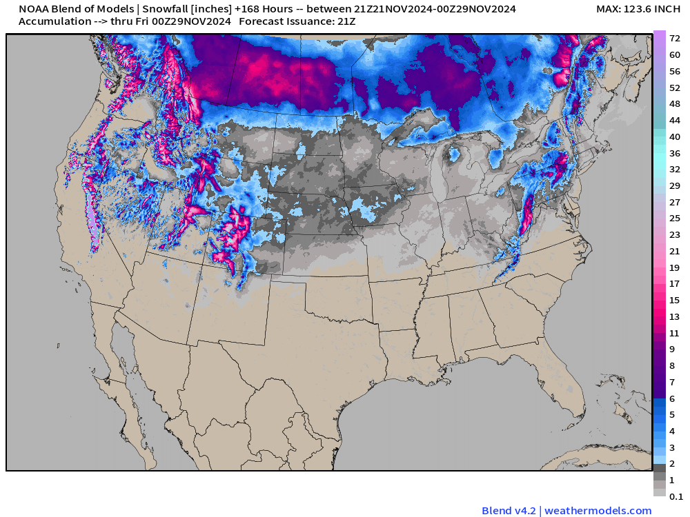
Quick peek at the Blend of Models showing the “ensemble” smoothing.
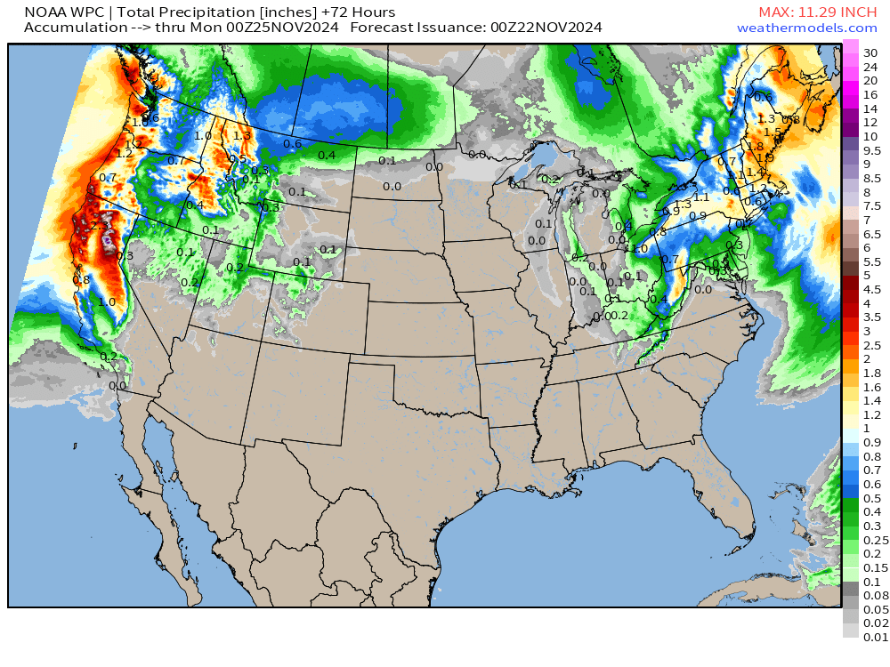
Total Precipitation next 3-7-Days | NOAA WPC
Next 72-hours
Day 4 | Monday November 25
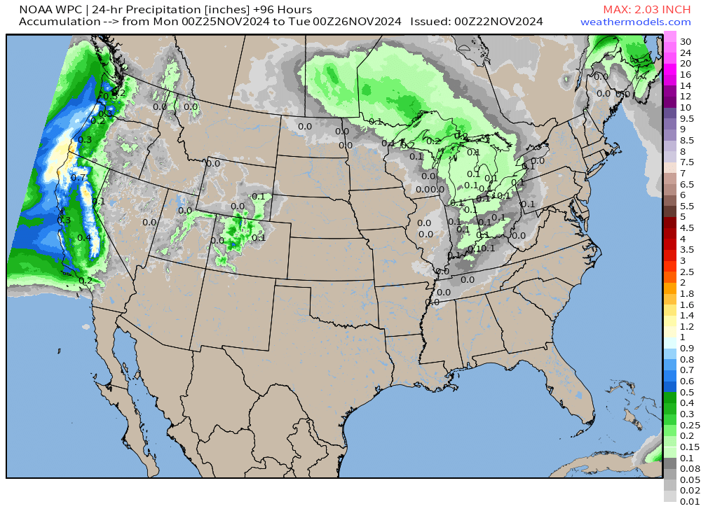
Day 5 | Tuesday November 26
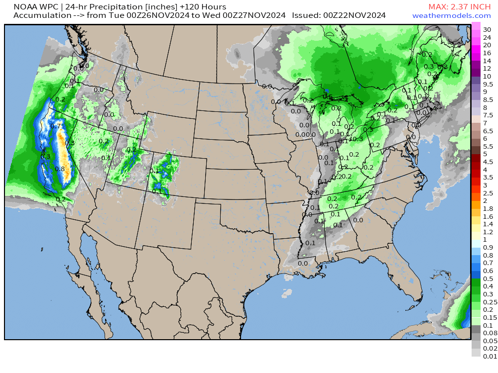
Day 6 | Wednesday November 27
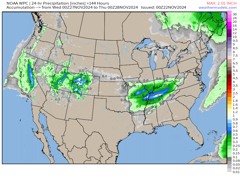
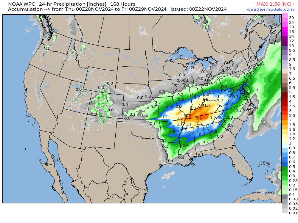
Day 7 | Thursday November 28 | Thanksgiving
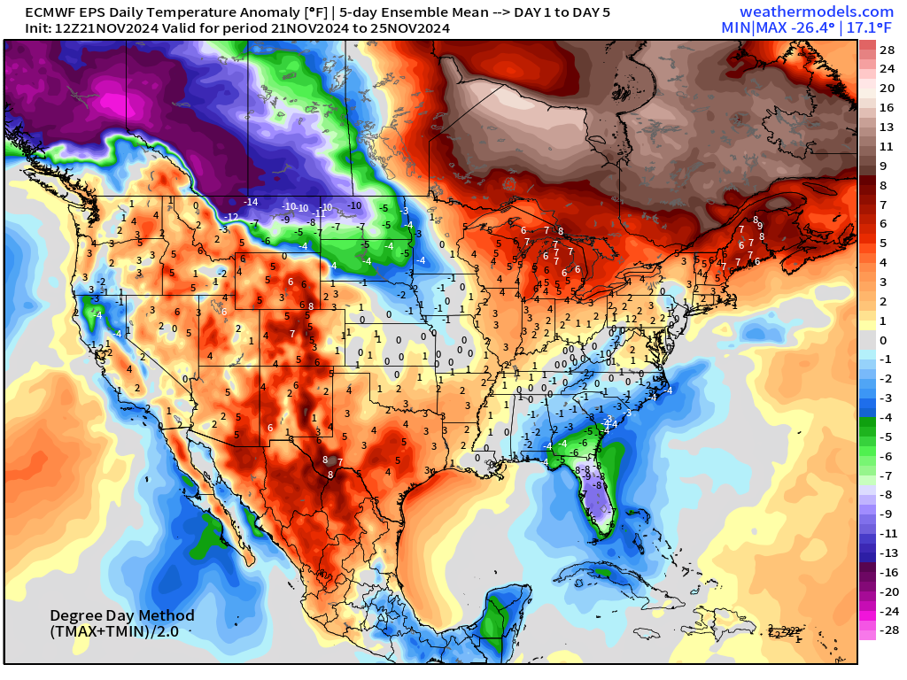
EPS | 5-day Temperature Anomaly
Days 1-5: November 21 - November 25
Days 6-10: November 26 - November 30
Days 11-15: December 1 - December 5
Maps sourced from weathermodels.com designed and innovated by yours truly! I actually create all of my content from scratch.
- Milepost
- 440 · laid 2024-11-22T00:56:07.897000Z
- Source
- https://weather.substack.com/p/november-21-2024-thursday-winter
- Digest
- 5bdee92112e4609701e13ecb54eceb073e9f223ff9e6557df119d6ef2868a04c
- Machine
- JSON