Watching Gulf of Mexico disturbance next week
Caribbean gyre could spin up into a tropical storm
June 2021 was the warmest June in the 132-year national record (1895–2026), at 72.6°F against a 1991–2020 normal of 69.5°F (+3.1°F).
June 2021 was the 66th-wettest June in the 132-year national record (1895–2026), at 3.0in against a 1991–2020 normal of 3.1in (-0.1in).
NOAA/NCEI Climate at a Glance, contiguous United States. This is the observed record for the month, not a score of anything said in this piece — the forecast ledger begins 2026-08-17 and cannot reach earlier posts.
The entire global tropics remain typically quiet for the second week of June. The Eastern Pacific hurricane season has not taken off as in previous years likely a result of the lingering La Nina climate signals. Looking into the far tropical Atlantic — still too chilly and early for storm development — there is a Saharan dust layer heading west across the ocean, but it is not the most dense or intense. It remains to be seen what survives the trip into the Caribbean and United States but perhaps some light haze.

Map: +5 days ECMWF CAMS Dust forecast (WeatherModels.com)
NHC Tropical Weather Outlook (TWO)
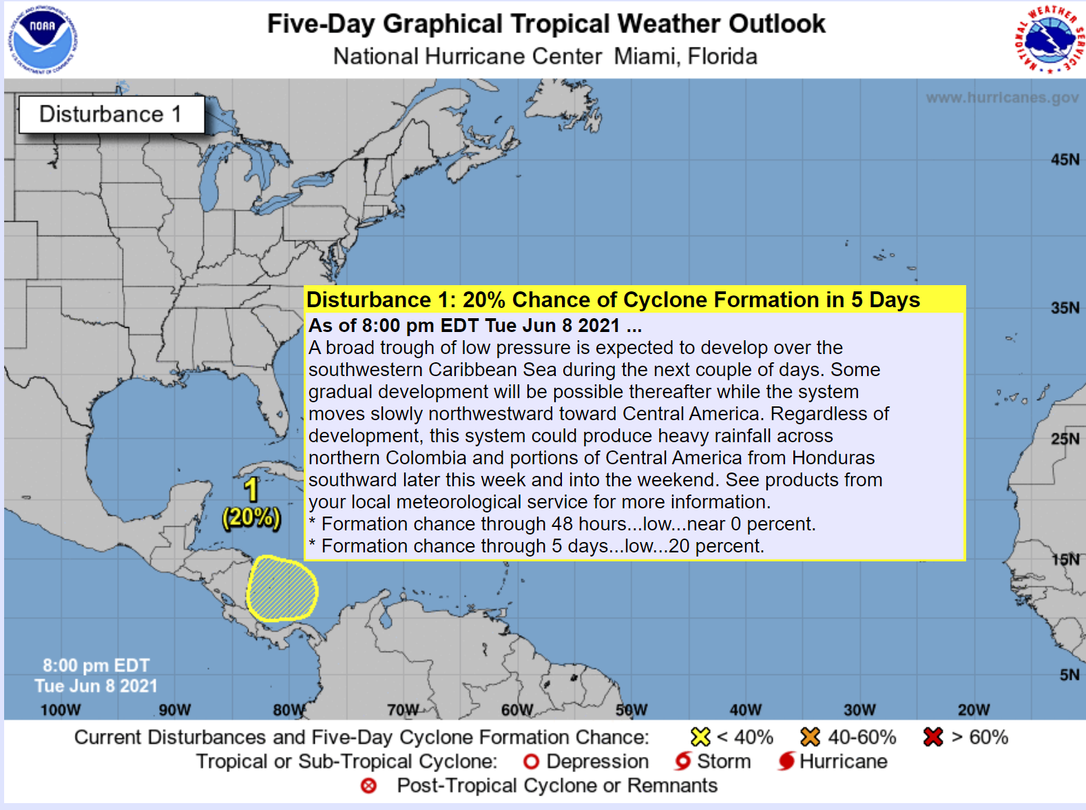
The National Hurricane Center (NHC) issues outlooks multiple times per day in order to diagnose and follow areas of interest. A Low Chance of development (20%) is hatched in yellow across the far southern Caribbean in 5-days. This is part of a larger Caribbean gyre circulation that often develops in mid-June and can spawn many tropical cyclones more often in the Eastern Pacific.
Next week Gulf of Mexico disturbance
Global weather models (ECMWF, GFS) and their ensembles have been keying in upon the southern Gulf of Mexico eventually developing a weak area of low pressure into perhaps a tropical storm, or in the case of the ECMWF, a powerful hurricane. All of this is in the 5-10 day range — so very low confidence in any particular solution. But, it is important to watch model trends e.g. is this solution becoming more or less likely as the days go on.

The ECMWF EPS tropical storm (> 34-knots) probability is in the 20-25% range over the central, western Gulf of Mexico, which is not too bad for Days 8-10. That is higher than climatology — or what would be expected in any given 3-day period in mid-June.

The 10-day ECMWF HRES [9-km] — is just one of 52 potential solutions (2% weight) — from the 12z Tuesday June 8th update — shows a 985 hPa hurricane, which is darn impressive. The wind shear relaxes enough and the upper-level winds enable ventilation and increased outflow. While this solution is the most extreme currently on the board, it shows the top-end potential for the upcoming gyre circulation / pattern.
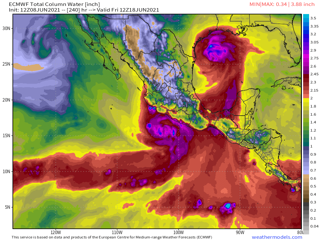
There would likely be an Eastern Pacific companion tropical storm which boatloads of deep tropical moisture along the 100W longitude axis.
The next Atlantic named storm is Bill — but would not arrive until next week, at the earliest.
- Milepost
- 44 · laid 2021-06-09T03:31:31.544000Z
- Source
- https://weather.substack.com/p/watching-gulf-of-mexico-disturbance
- Digest
- d4499f89295e9348a44362ea261daba71891a9d161375ca30a7b7a61a21b74fe
- Machine
- JSON