October 31, 2024 Halloween Weather Update
NHC up to 60% tropical development in Caribbean
November 2024 was the 8th-warmest November in the 131-year national record (1895–2025), at 45.1°F against a 1991–2020 normal of 43.0°F (+2.2°F).
November 2024 was the 13th-wettest November in the 131-year national record (1895–2025), at 3.0in against a 1991–2020 normal of 2.3in (+0.8in).
NOAA/NCEI Climate at a Glance, contiguous United States. This is the observed record for the month, not a score of anything said in this piece — the forecast ledger begins 2026-08-17 and cannot reach earlier posts.

Winter Weather Updates to start tomorrow on November 1, 2024
More active weather pattern for the next 2-weeks as a series of troughs and storm systems tap into Gulf of Mexico moisture to inundate the central U.S. with boatloads of rain.
Watching the Caribbean and Gulf of Mexico for potential tropical storm activity (Patty) with the ECMWF HRES and ensembles showing a strong signal for something to develop by next weekend. NHC is at 60% chance of development, up from 40% yesterday.
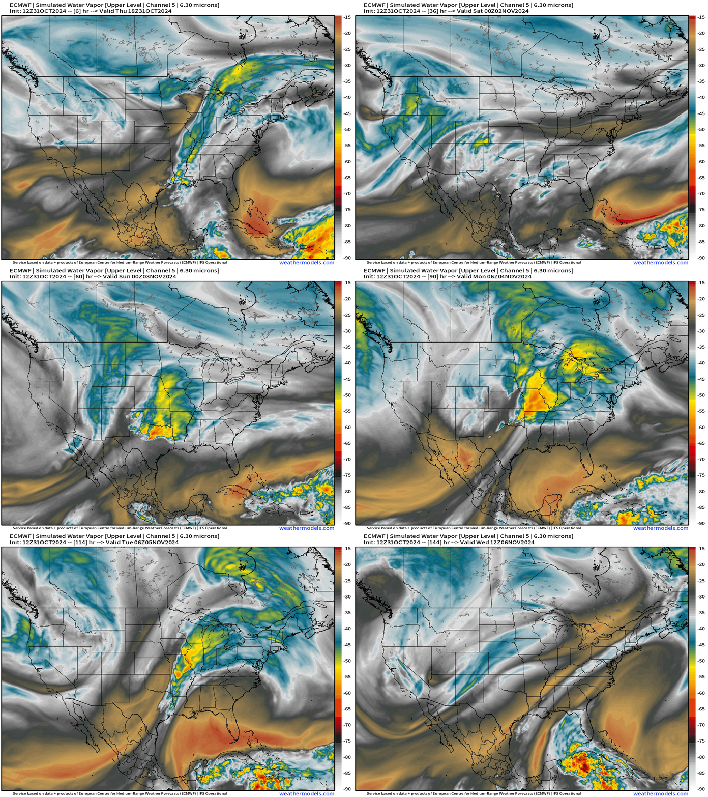
Unfortunately the episodes of heavy rain do not really make it to the Southeast before fizzling out. Hopefully into next week, chances of rain will increase higher than 0.
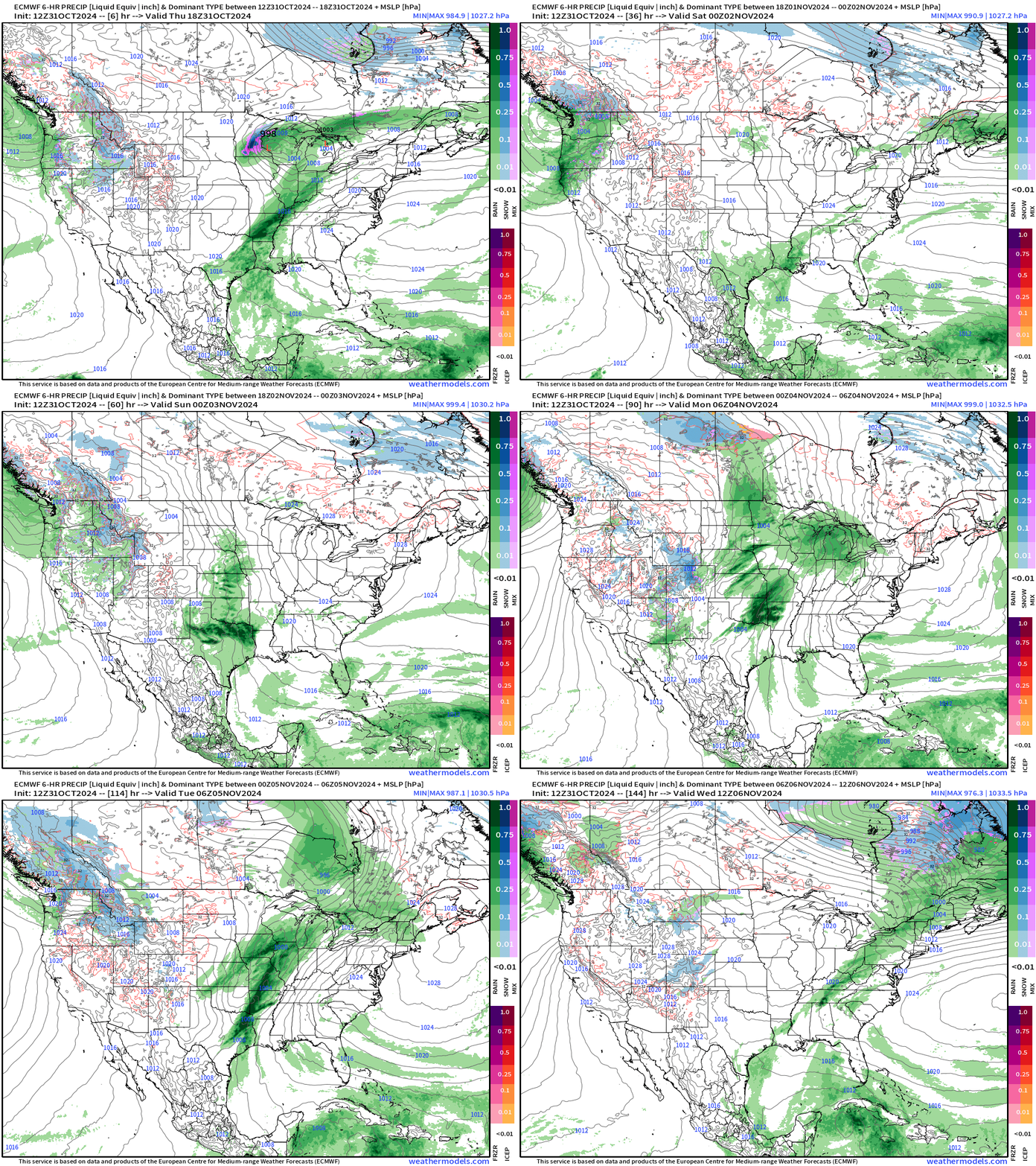
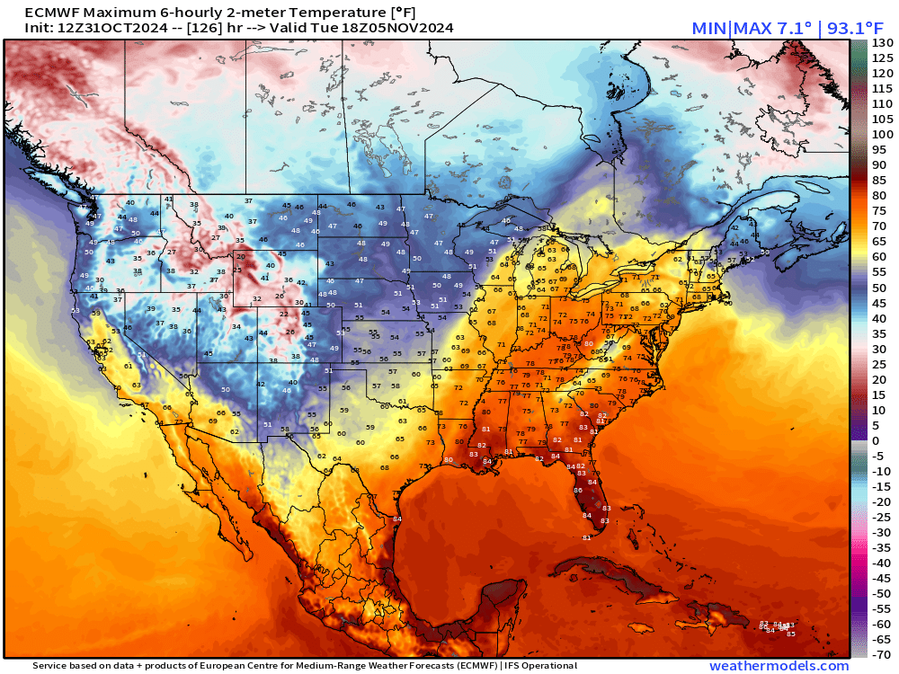
Election Day Forecast | Tuesday November 5th
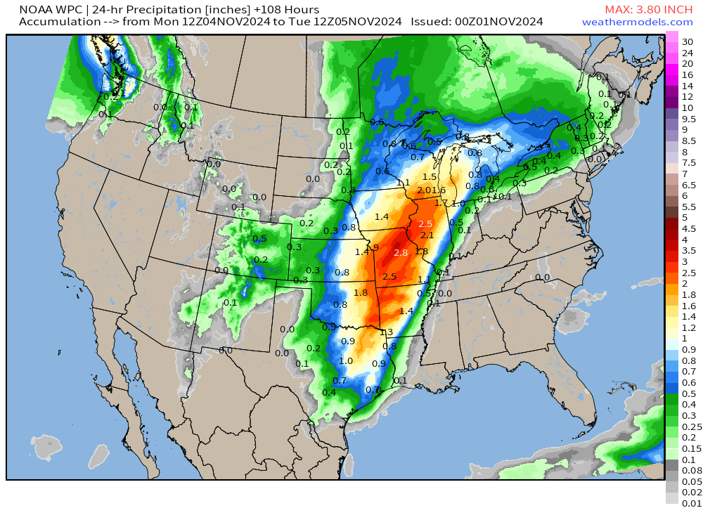
Strong cold front and heavy rain in the morning on Tuesday from Michigan through St. Louis down to Houston, but it fizzles out later in the day as the front moves east.
Wisconsin and Michigan seem to be the most impacted states by weather among the “swing states” in the Blue Wall.
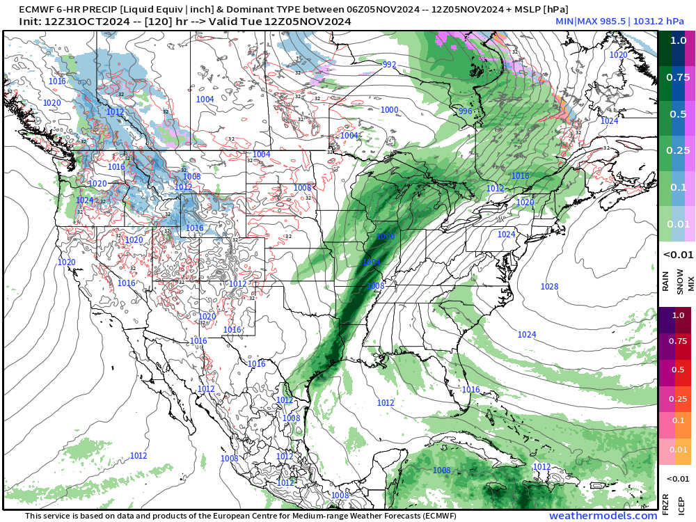
The temperatures will be very warm up to 25°F above normal on Tuesday.
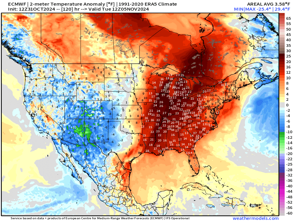
Actual highs in the 60s in the Great Lakes and 70s in the Ohio Valley.
ECMWF AIFS 12z | Next 10-days | Height Anomaly
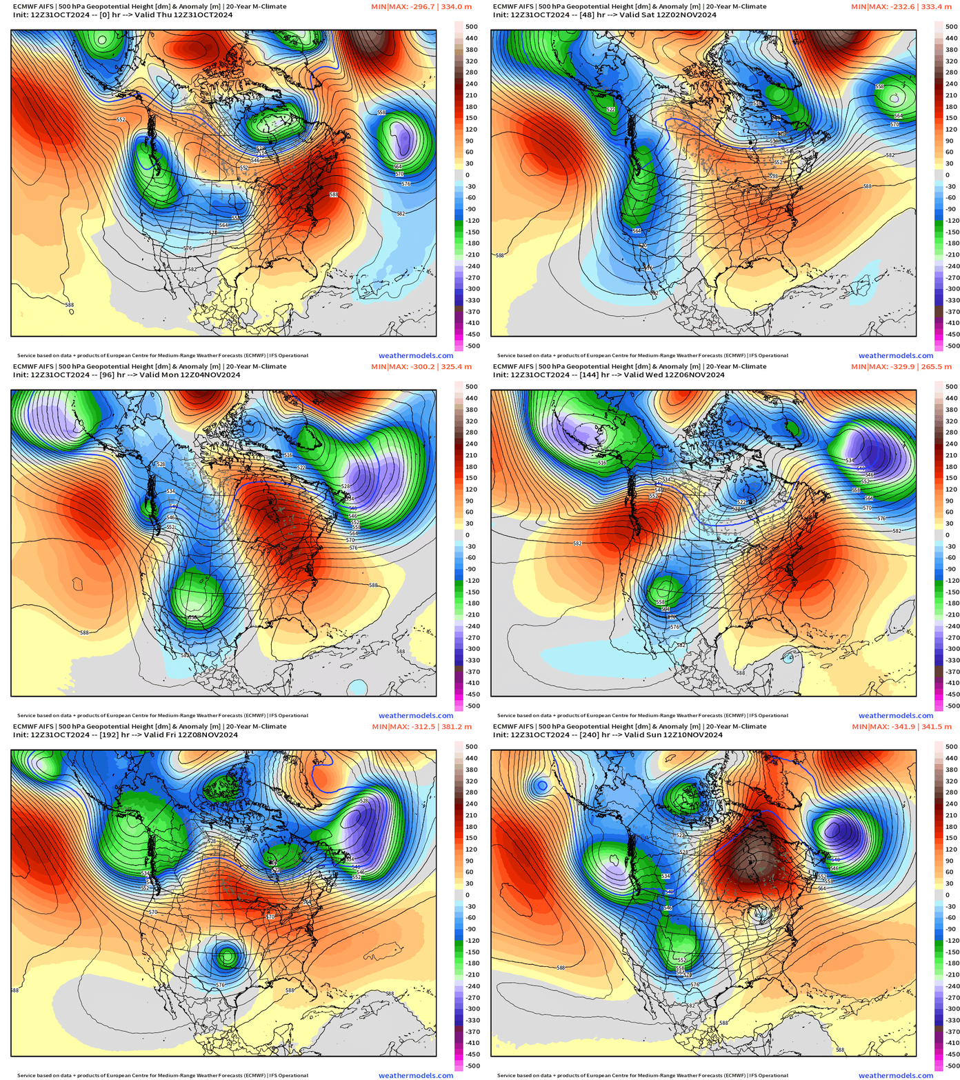
Trough after trough parade into the Western U.S. through the next 10-days with more in the pipeline. That’s a very snowy and cool/cold pattern for the West.
New and Renewal Subscribers [2025] can upgrade to Annual for 10% off through October 31.
Atlantic Tropical Update
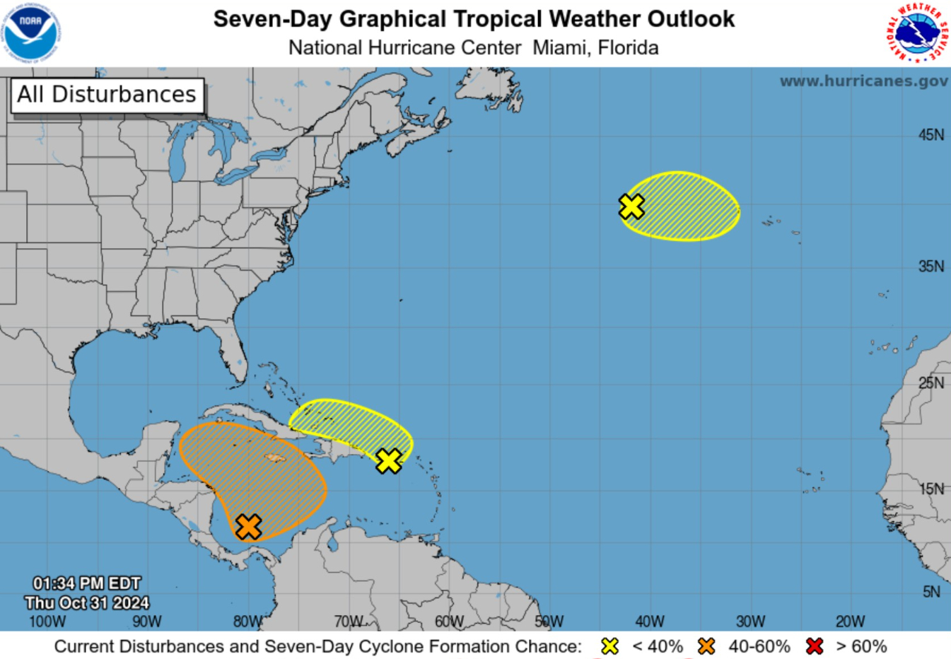
60% chance of Tropical Cyclone development according to NHC in the next 7-days. That is up from 40% yesterday. The other two yellow areas are low chance but could spin-up briefly if convection persists. There are quite a few (small) swirls in the Atlantic right now.
Atlantic IR Satellite Image
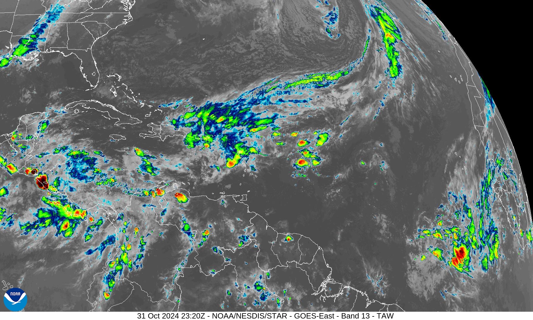
General showers scattered across the Caribbean and across the Antilles. We don’t look to the coast of Africa any longer for tropical waves.
ECMWF Integrated Vapor Transport
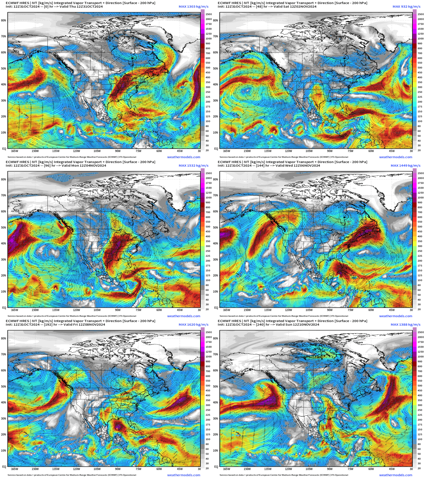
A new development with the ECMWF HRES 10 day forecast is the closing off of an area of low pressure along the eastern periphery of a southern Caribbean gyre. That system develops into a weak tropical storm before heading into the Gulf of Mexico where it meets hostile upper level wind shear.
However, the strong ridge across the Eastern U.S. means boatloads of moisture streaming north into the central U.S. and any tropical storm (Patty) would just add to the rainfall totals in the following week.
GFS 18z Vorticity | Next 7-days
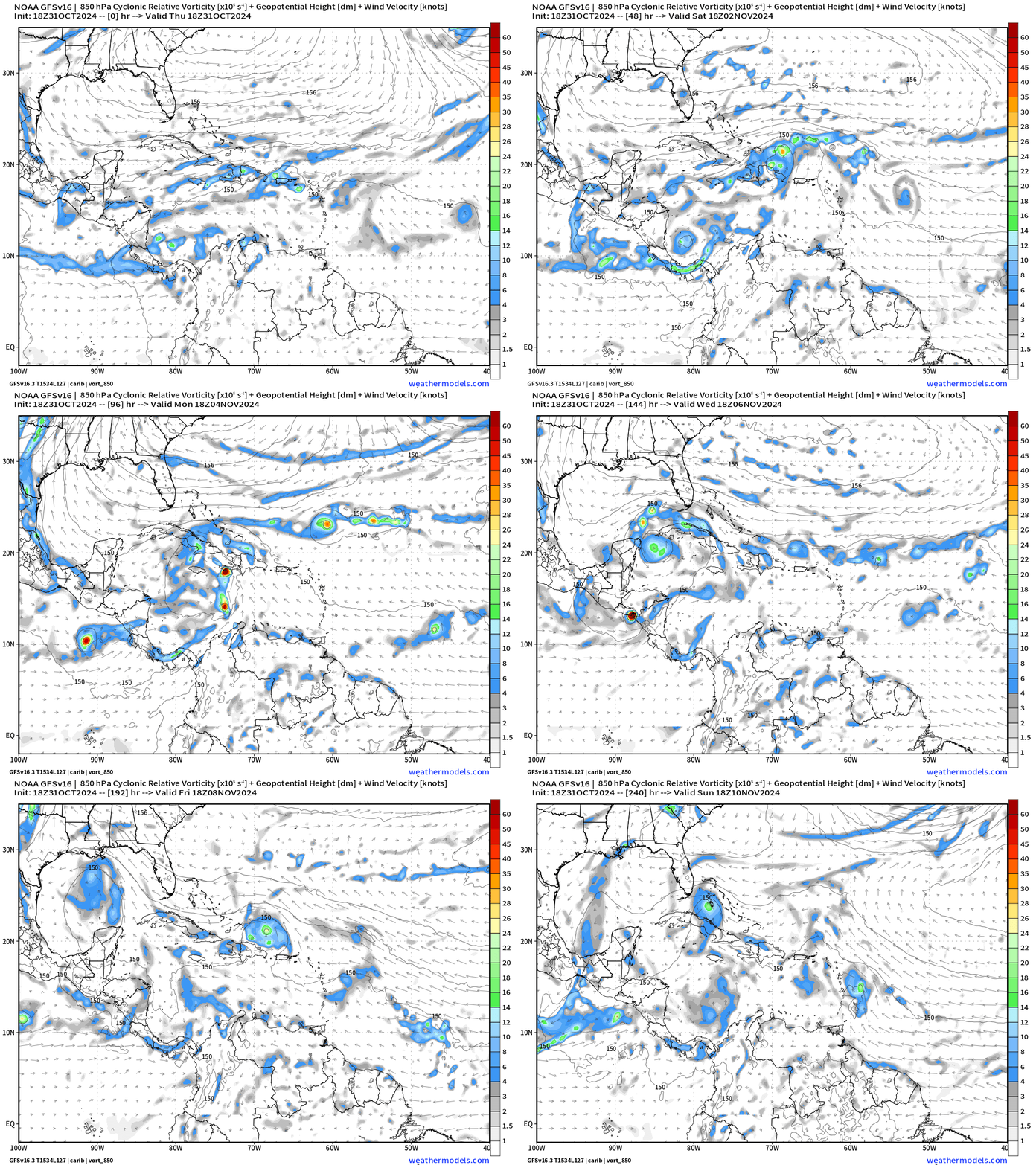
I can count 4 swirls that could be classified as weak tropical systems across the Eastern Pacific and Caribbean. GFS has given up on a powerful hurricane that it consistently developed over the past week.
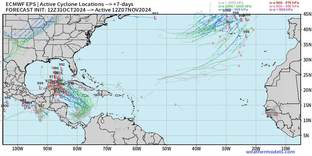
ECMWF EPS Forecast Active Tracks
Day 4: November 4
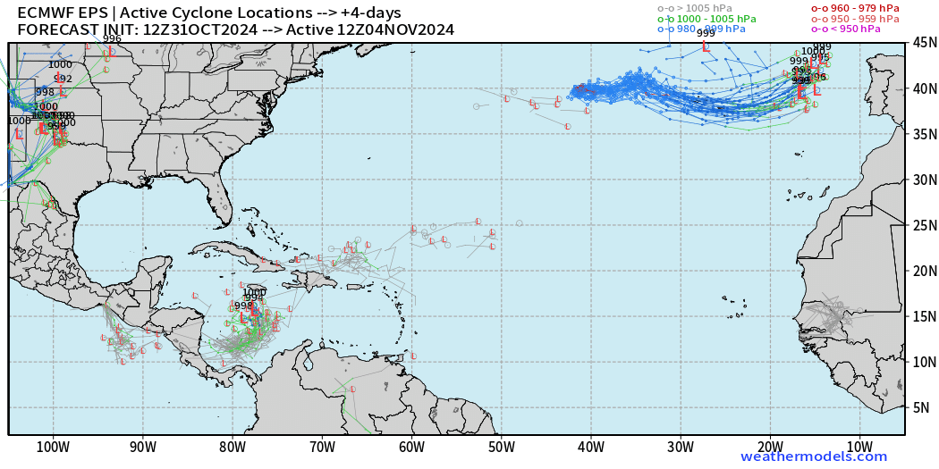
A few areas of low pressure that can be tracked south of Jamaica.
Day7: November 6
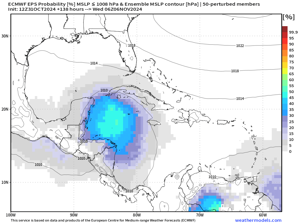
By Day 7, high probability of a named tropical cyclone (TS Patty) up to hurricane strength just east of the Yucatan Peninsula.
Day 10: November 10
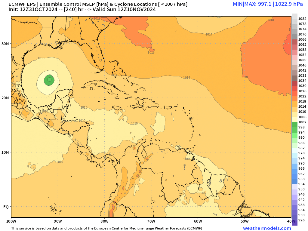
The ECMWF 12z Control has a 997 mb low in the Gulf of Mexico. The other ensembles show some tracks continuing — including hurricanes. However, it is still highly unusual and rare to have such a powerful storm in the hostile Gulf of Mexico into mid-November.
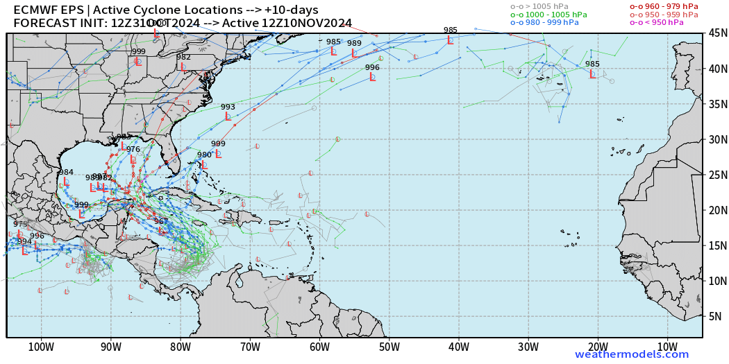
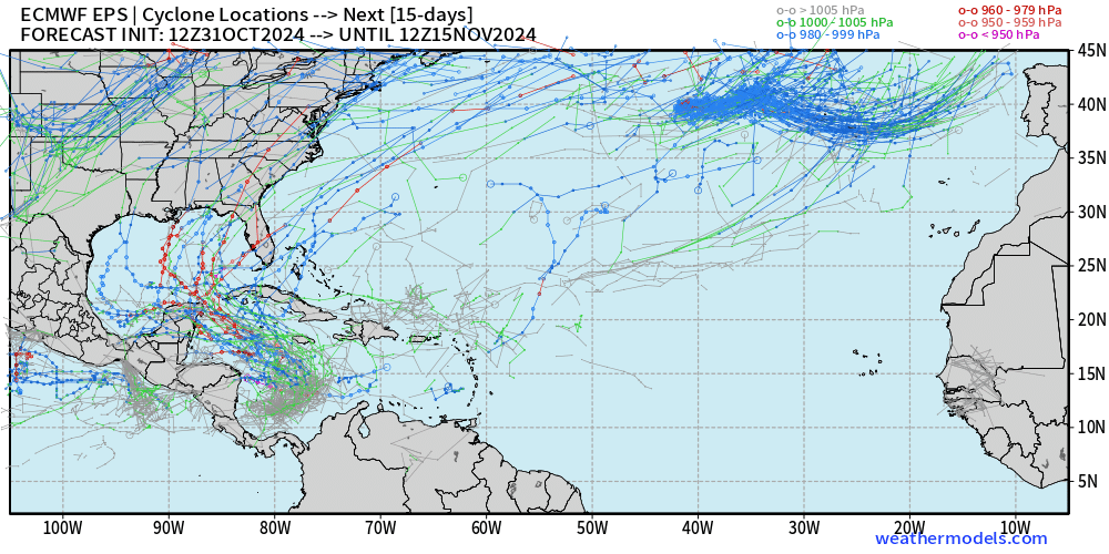
Still betting on a weak outcome in line with climatology, but there is a potential and plausible scenario of a powerful hurricane forming in the western Caribbean and heading WNW into the Gulf of Mexico — but the upper-level winds would be hostile.
Low Temperatures on Wednesday
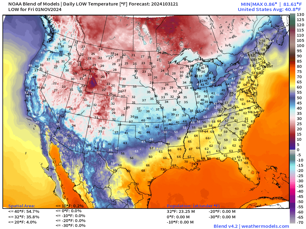
Much colder air moves into the upper-Midwest to start November.
High Temperatures on Wednesday
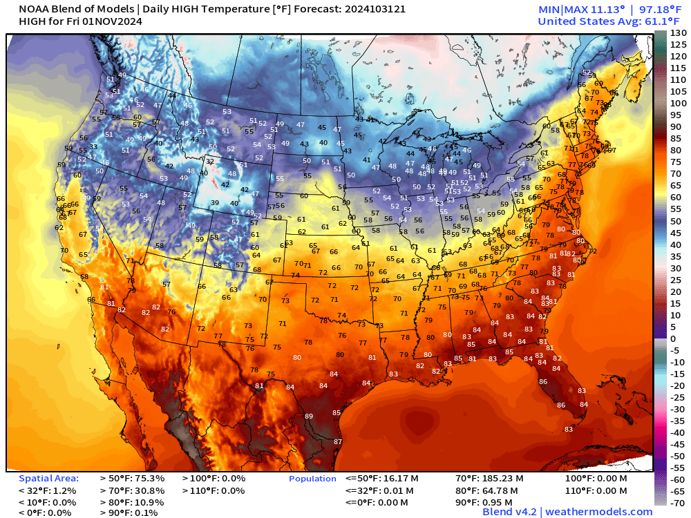
Still 185 million Americans at/above 70°F to start November.
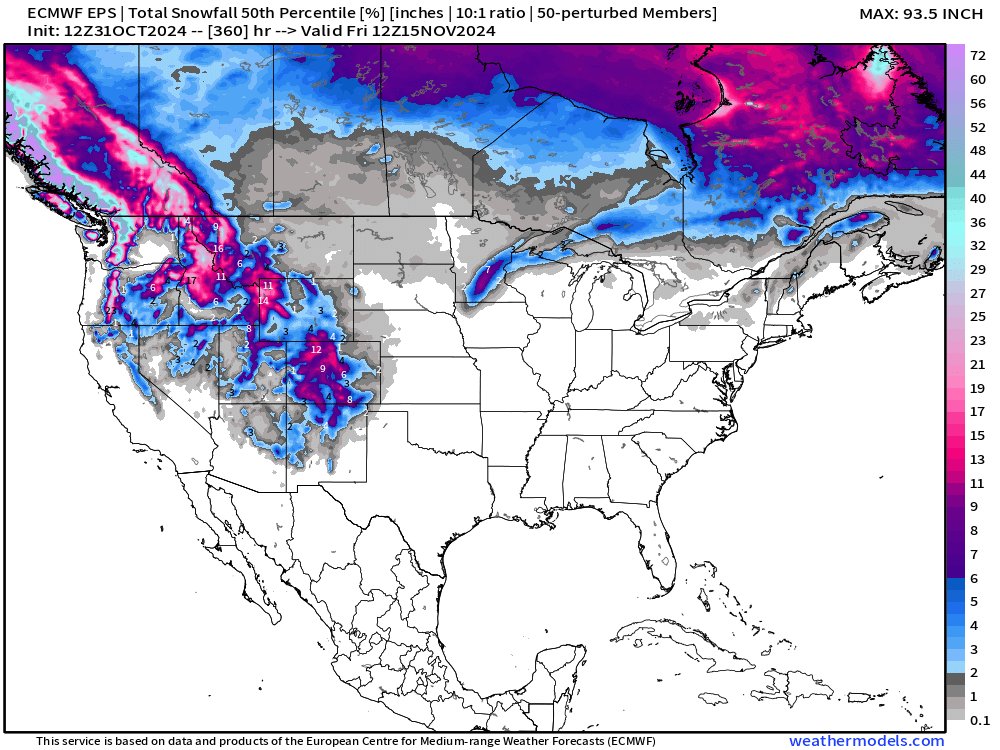
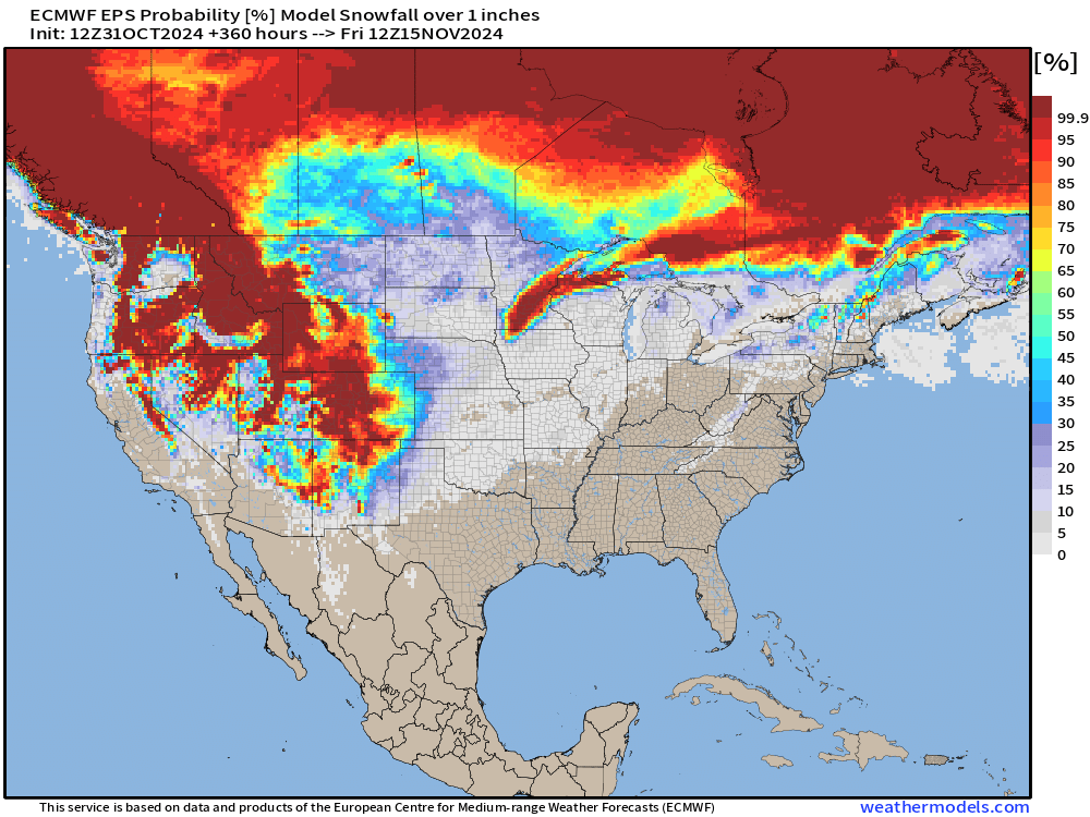
Snowfall
15-day Ensemble Median Snowfall Forecast
Probability of 1” snowfall through 15-days
Total Rainfall next 7-Days | NOAA WPC
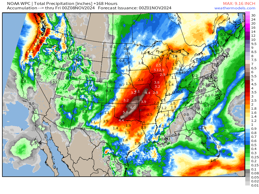
Total of 5-7” across OKC with large area of 2-4” from Michigan to north Texas.
2-4” of rain from Monday into Tuesday across the Mississippi Valley.
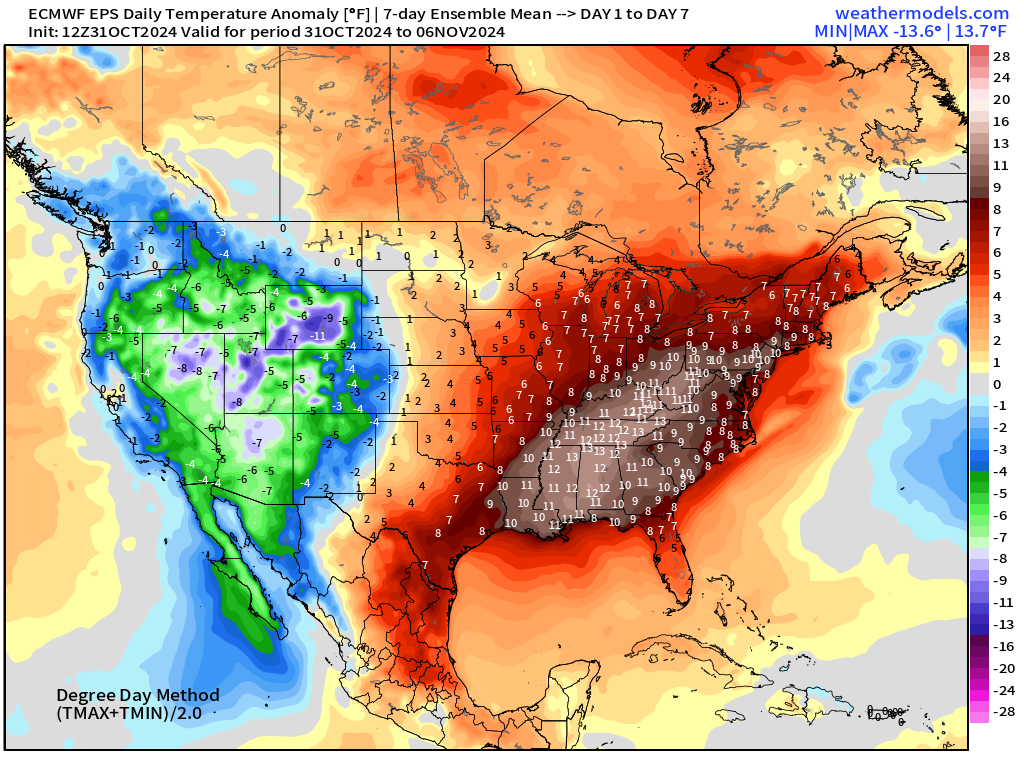
EPS | Weekly Temperature Anomaly
Week 1: October 31- November 6
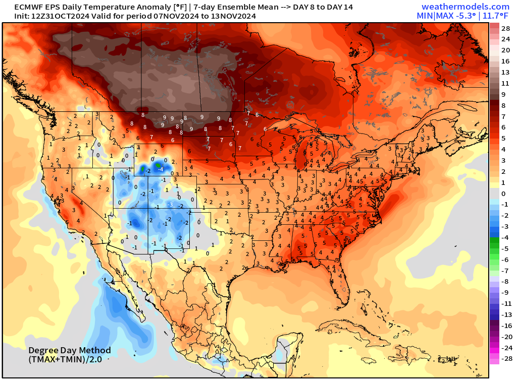
Week 2: November 7 - November 13
Coming soon: Weather in My Backyard or Parking Lot @ Snowfall dot Earth
Maps sourced from weathermodels.com designed and innovated by yours truly! I actually create all of my content from scratch.
- Milepost
- 424 · laid 2024-11-01T00:01:27.676000Z
- Source
- https://weather.substack.com/p/october-31-2024-halloween-weather
- Digest
- 12e15d5e64f4f164b042ee7aba7dbada6c1ce11b9f5f78559c7488bb3fae61f7
- Machine
- JSON