October 30, 2024 Wednesday Tropical Update
NHC remains at 40% in 7-days with Caribbean disturbance
October 2024 was the 2nd-warmest October in the 131-year national record (1895–2025), at 58.9°F against a 1991–2020 normal of 54.5°F (+4.4°F).
October 2024 was the 3rd-driest October in the 131-year national record (1895–2025), at 1.0in against a 1991–2020 normal of 2.5in (-1.5in).
NOAA/NCEI Climate at a Glance, contiguous United States. This is the observed record for the month, not a score of anything said in this piece — the forecast ledger begins 2026-08-17 and cannot reach earlier posts.

Atlantic Tropical Update
Not much has changed in the past few days with the outlook in the western Caribbean with a potential tropical system — next name is Patty. News media articles have come and gone over the weekend warning (alarming) about potential hurricanes for the Gulf of Mexico, but nothing has developed, so far. And, the timeline for this has shifted onward now into November.
The development changes are largely based upon model output perhaps with too much emphasis on the GFS, which has spun up multiple hurricanes in recent forecast cycles, only to lose them subsequently. Way too many false alarms!
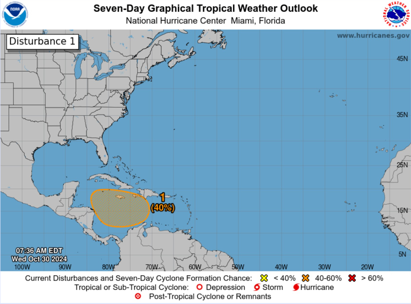
40% chance of Tropical Cyclone development according to NHC in the next 7-days. No change over the past 3-days with the outlook.
Atlantic Satellite Imagery
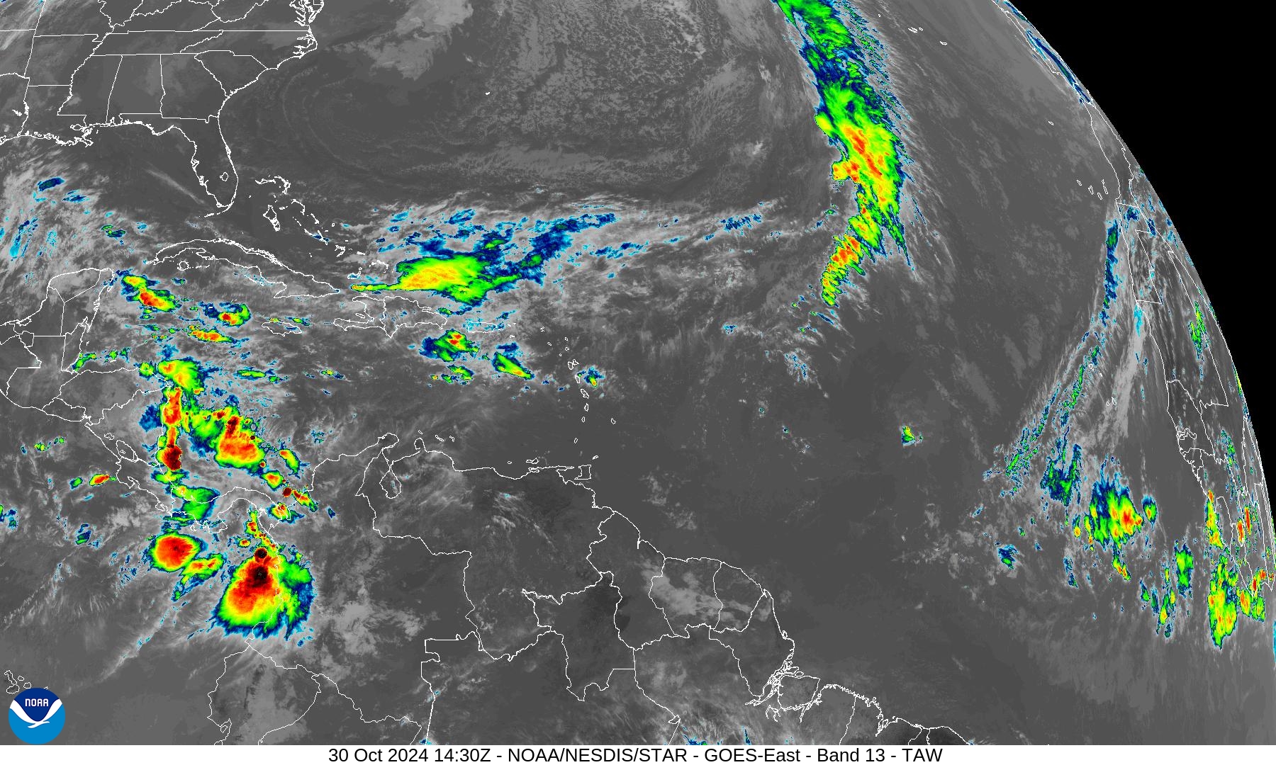
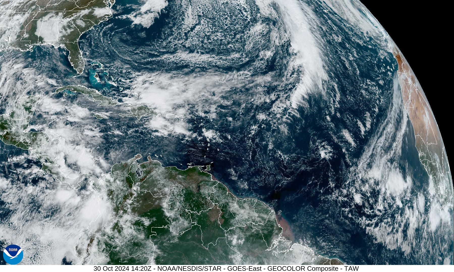
No organized convection, only scattered storms across Central America.
ECMWF Integrated Vapor Transport | 00z | 10 Days
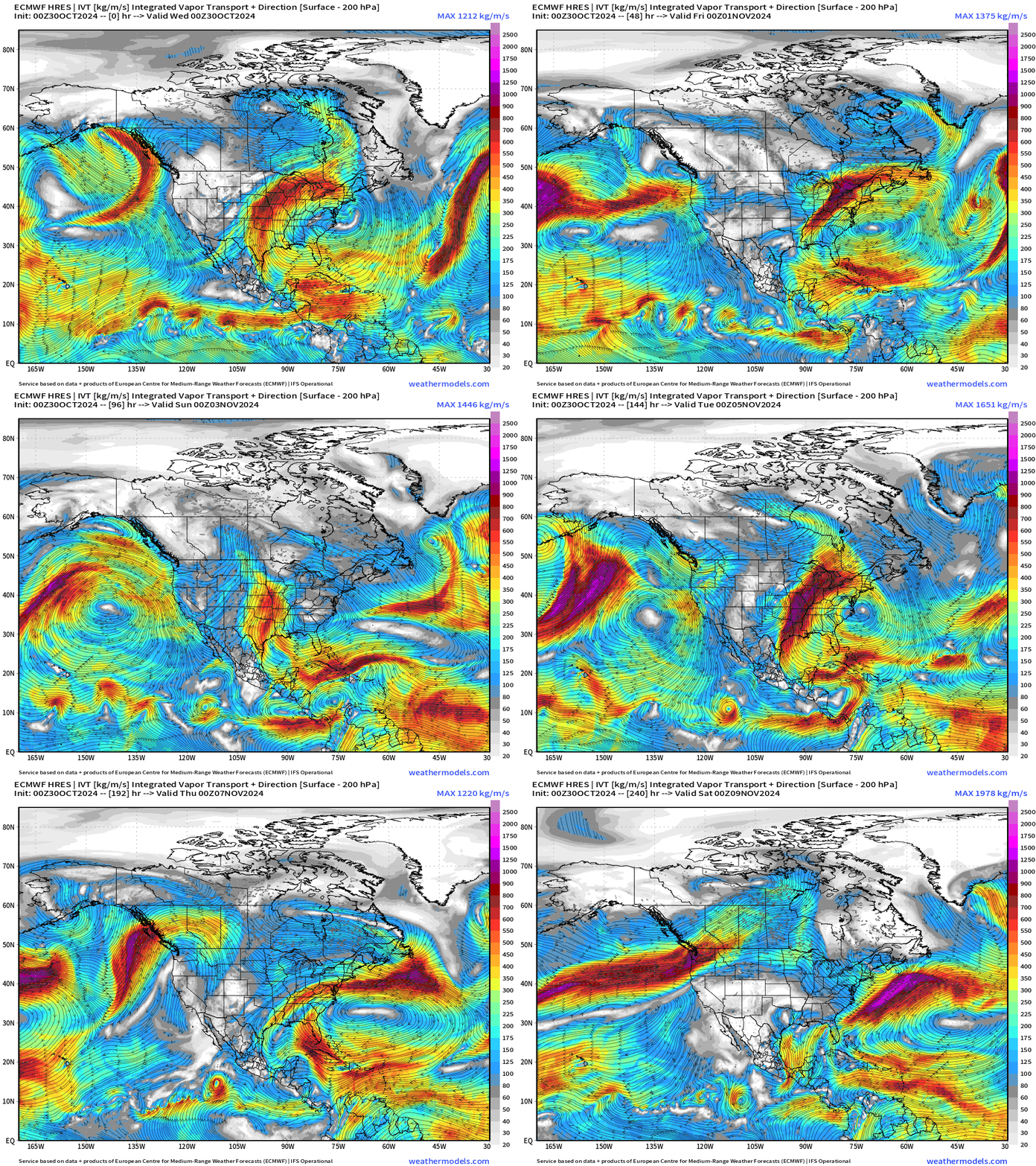
Not seeing anything swirling in the 10-days HRES forecast but surges of moisture on an axis through 20°N just north of Hispaniola.
GFS 06z Vorticity | Next 15-days
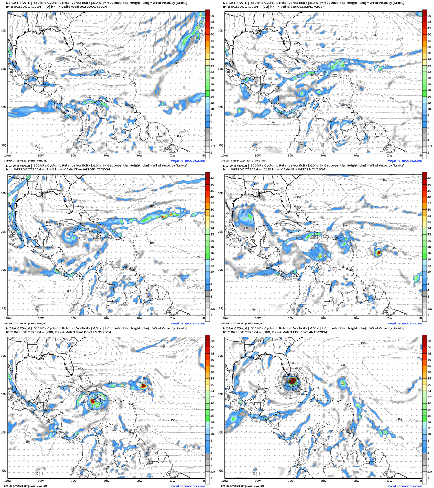
The GFS forecast is spin-up and hurricane happy with multiple cyclonic vorticity centers in the 15-day forecast. This is repeated cycle after cycle with different locations and tracks.
Again, I don’t put my stock at all in these forecasts and you should not either. I don’t know the model deficiency that creates this storms, but it’s been a chronic problem for the past 1-2 weeks.
ECMWF EPS Forecast Active Tracks
Day 7: November 6
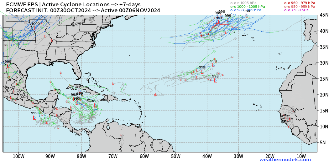
Some circulations in the ensembles at Day 7, but only 4/51 at/below 1000 mb
Day 9: November 8
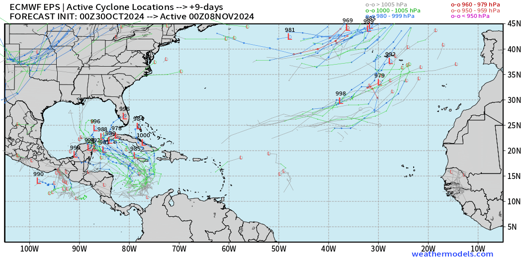
10/51 ensembles at this juncture - Day 9 with the storm tracker, and we can see from a snapshot at Day 10 with normalized anomalies that a strong hurricane would be an outlier solution. Instead, there are mostly a weak surface signals.
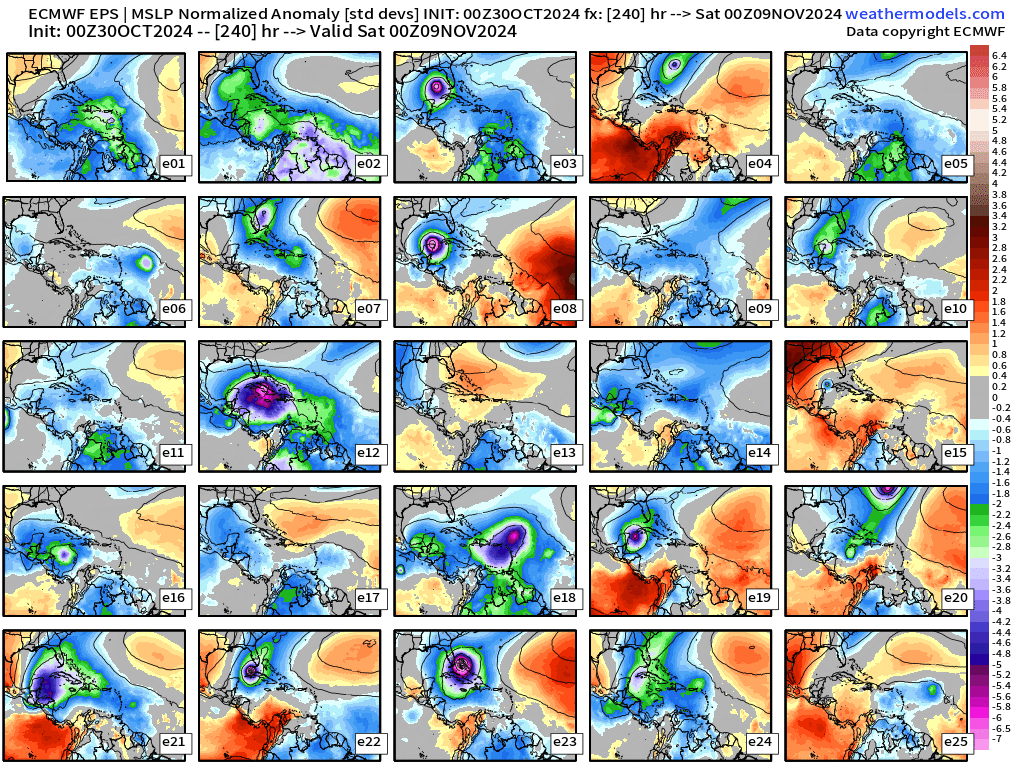
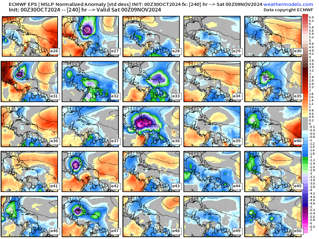
Day 11: November 10
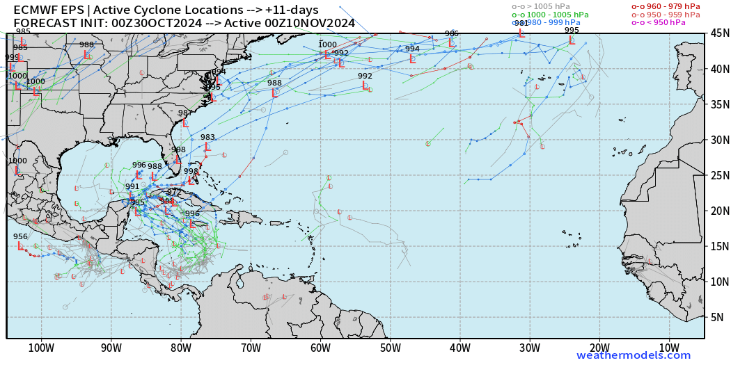
The trend compared to the previous 12z forecast is considerably less aggressive on members blowing up major hurricanes. The overall % count is probably around climatology for the Caribbean during a 2-week period from Oct 27-Nov 10, so I am not overly concerned.
Day 15: All Tracks November 14
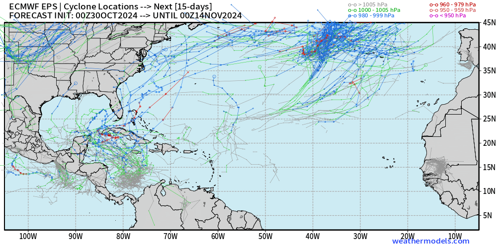
Again, it is rare for a tropical system to enter the Gulf of Mexico in November. We should be skeptical of model solutions that buck climatology!
Typhoon Kong-Rey

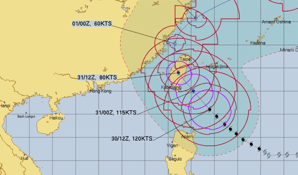
Kong-Rey has begun to weaken due to an eyewall replacement cycle. The very large “truck tire” eye is maintaining its mostly clear state.
On the approach to Taiwan, Kong-Rey should continue to weaken and probably will be 100-105 knots at landfall (Category 3).
Coming soon: Weather in My Backyard or Parking Lot @ Snowfall dot Earth
Maps sourced from weathermodels.com designed and innovated by yours truly! I actually create all of my content from scratch.
- Milepost
- 423 · laid 2024-10-30T15:32:58.066000Z
- Source
- https://weather.substack.com/p/october-30-2024-wednesday-tropical
- Digest
- 26a5b4a3906b296388a1637a4e1134aea3842b1af2cb8c500ad57ddd3479eea6
- Machine
- JSON