Oct 16, 2024 Wednesday Weather Update
Atlantic tropics winding down for October as Invest 94L struggles with dry air
October 2024 was the 2nd-warmest October in the 131-year national record (1895–2025), at 58.9°F against a 1991–2020 normal of 54.5°F (+4.4°F).
October 2024 was the 3rd-driest October in the 131-year national record (1895–2025), at 1.0in against a 1991–2020 normal of 2.5in (-1.5in).
NOAA/NCEI Climate at a Glance, contiguous United States. This is the observed record for the month, not a score of anything said in this piece — the forecast ledger begins 2026-08-17 and cannot reach earlier posts.

Chilly Wednesday morning!
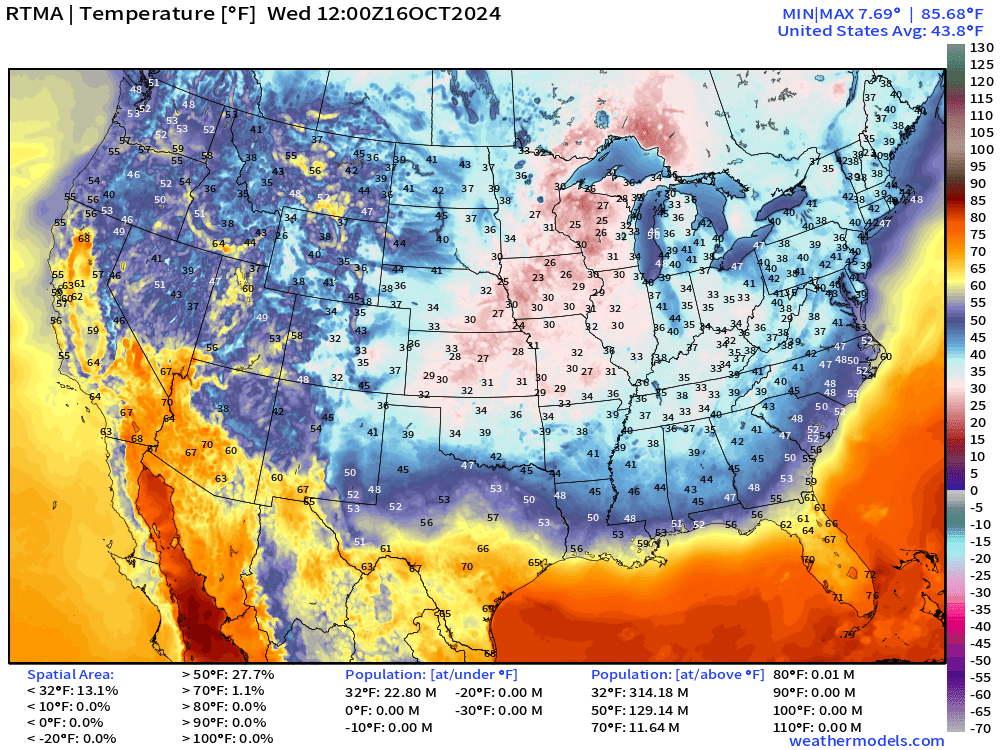
Temperatures into the mid-20s across the Midwest and near/below freezing into Oklahoma and North Georgia. This polar vortex related Arctic blast is unusually strong for mid-October, and hopefully means more cold weather and snowfall on the way for this winter.
8 AM ET Temperatures and Analysis Fields
About 13% of the Lower 48 was at/below freezing = 23 million Americans.
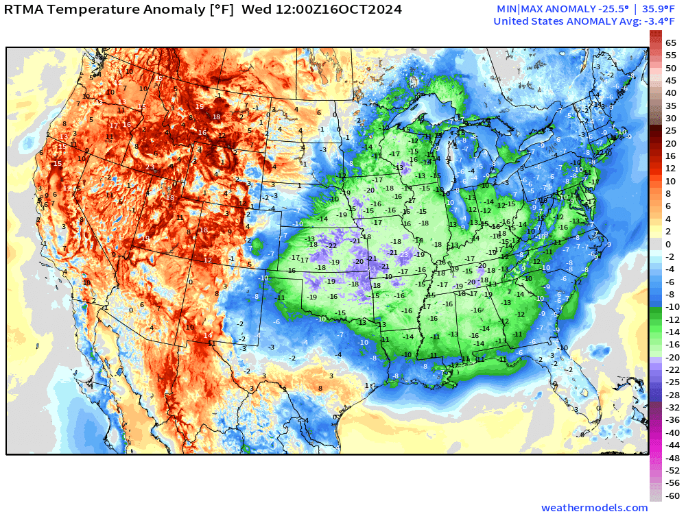
Compared to the 30-year climatology (1991-2020) temperatures were widespread 15°F to 20°F below normal east of the Mississippi.
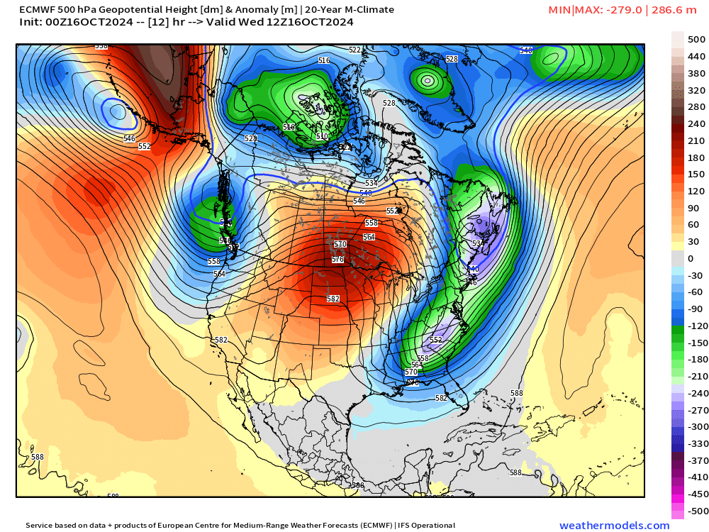
A trough has dug into the Southeast but will quickly move out as ridging and much warmer weather replaces this Arctic air mass. However, the moderation process will not be in one day as the length of day and mid-October sunshine will require some time.
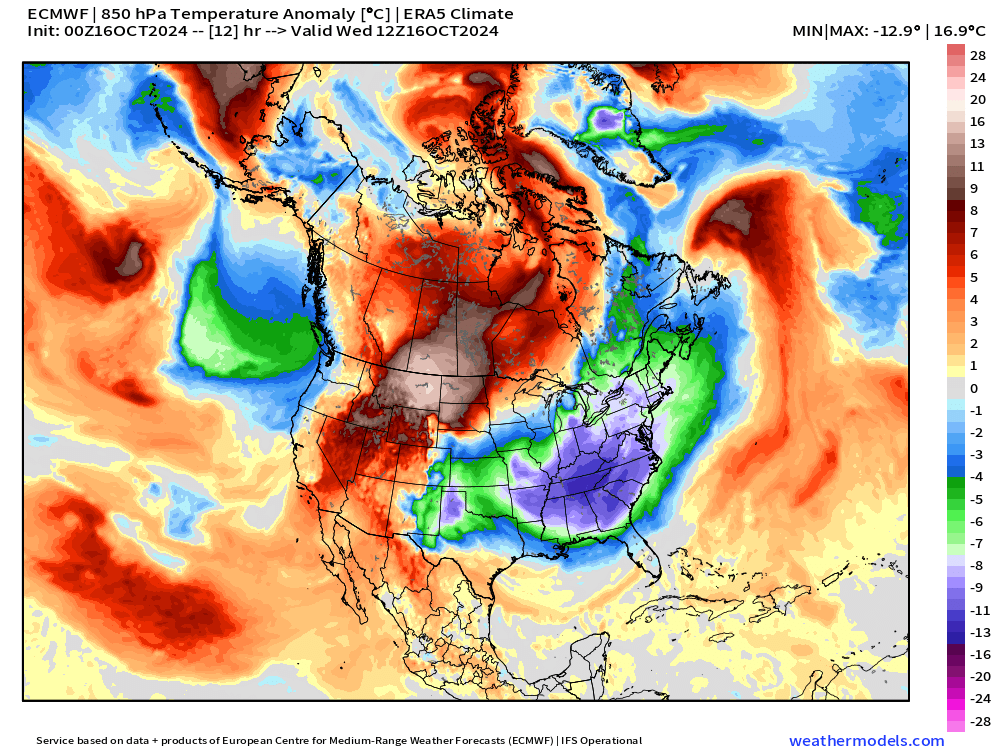
Usually show this 850 mb temperature anomaly map for tracking the polar vortex in winter and look for the “Barney” purples for the coldest Arctic air. We have -10°C anomaly over the Southeast, which is rather impressive.
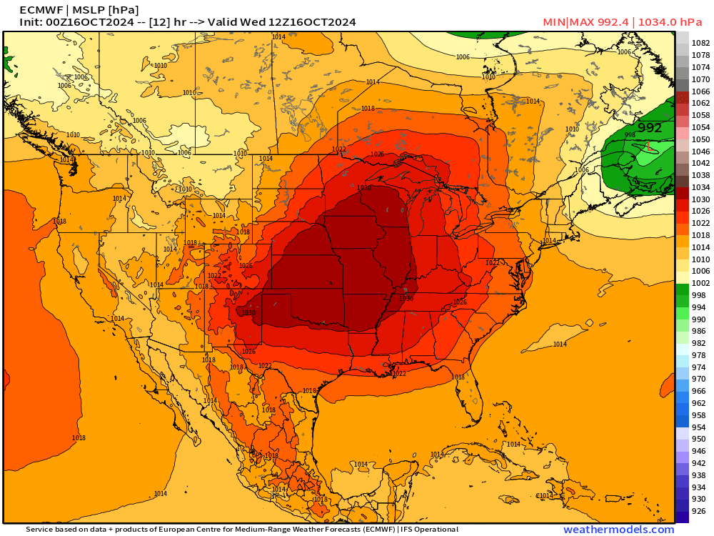
Strong 1034 mb High Pressure in charge this morning.
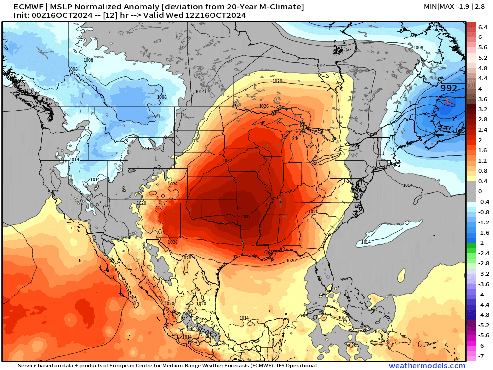
Compared to historical climatology, the MSLP is almost 3 standard deviations stronger than normal.
High Temperatures on Wednesday
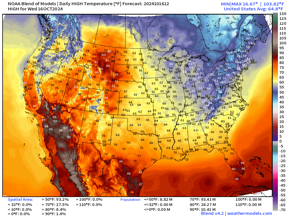
10 Million still at/above 90°F but chilly across the Great Lakes and Northeast. I’ll take the low-60s in Atlanta with the warm sunshine. Just perfect.
7-Day Precipitation Type
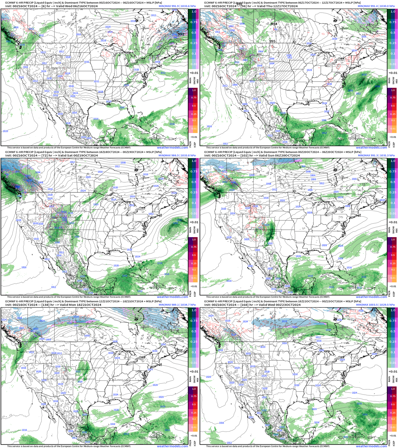
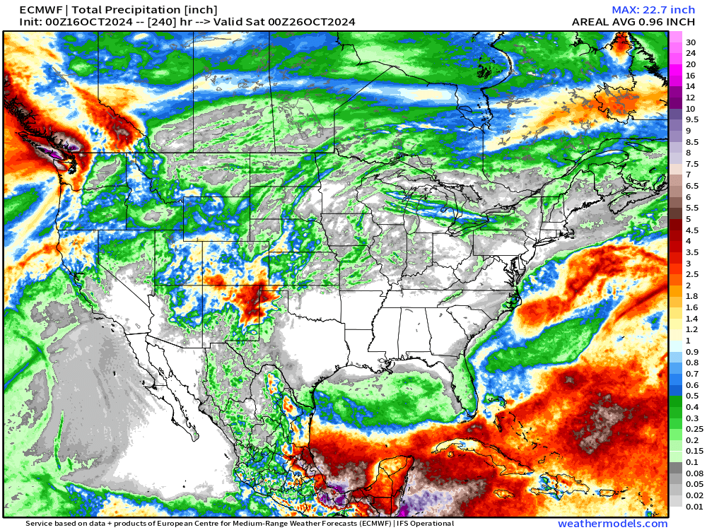
The main story is dry weather across much of the eastern Lower 48 with high pressure remaining in charge for the next 7-days.
A powerful atmospheric river will impact the Pacific Northwest — more on that.
Tropical moisture associated with two waves will largely remain south of the Gulf of Mexico, cleaned out by the Arctic front.
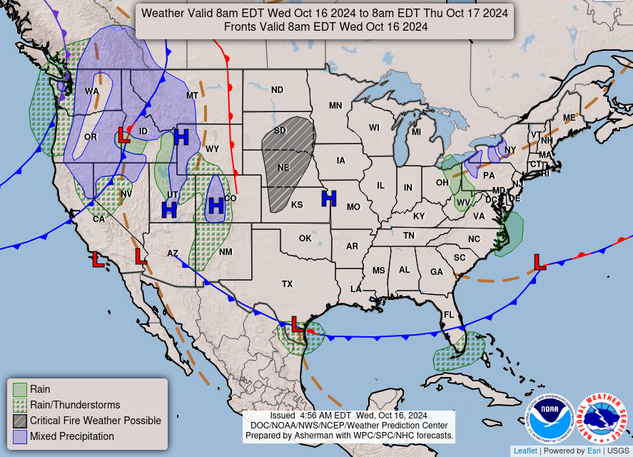
NWS WPC morning surface analysis
Pacific Northwest Atmospheric River
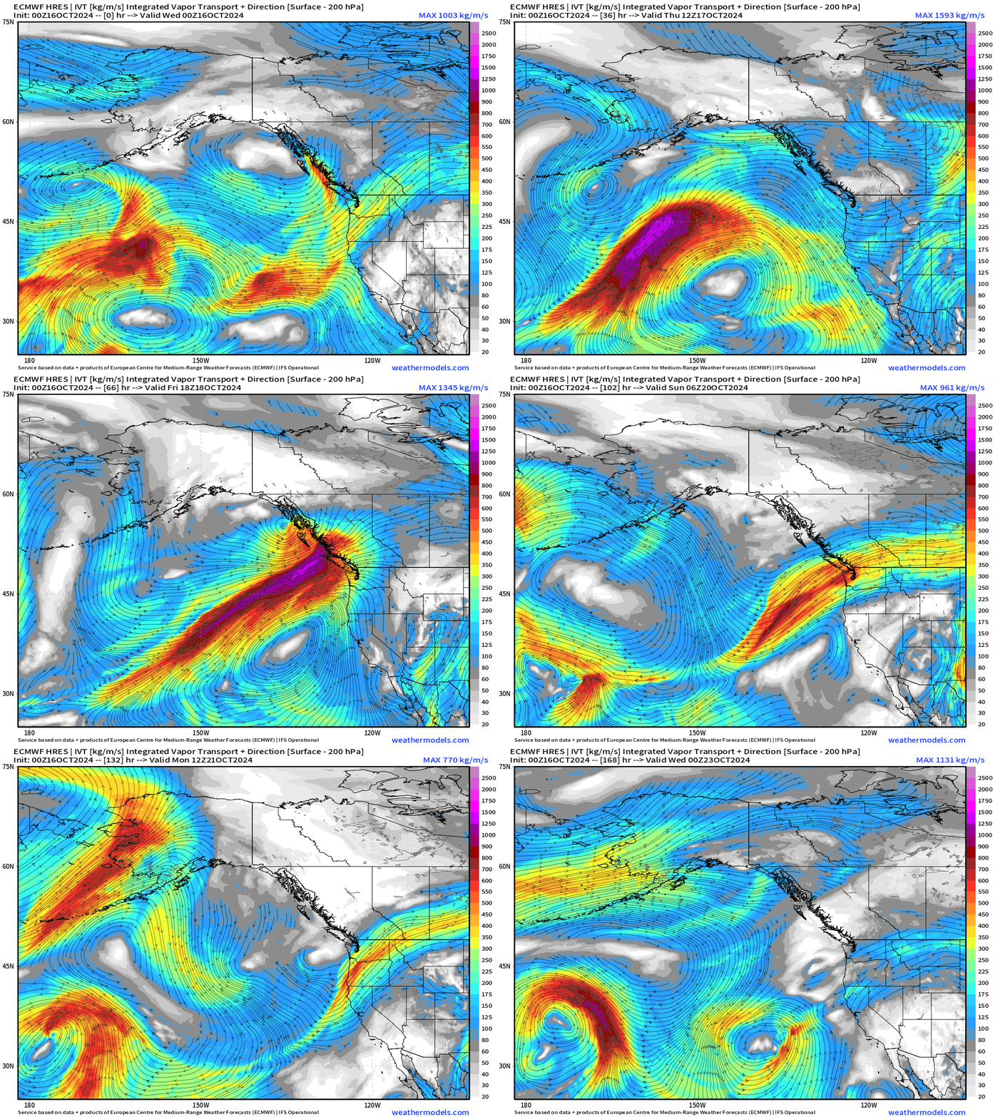
A typical storm system tracks into the Gulf of Alaska and directs a rather strong atmospheric river into the mountains of the Pacific NW.
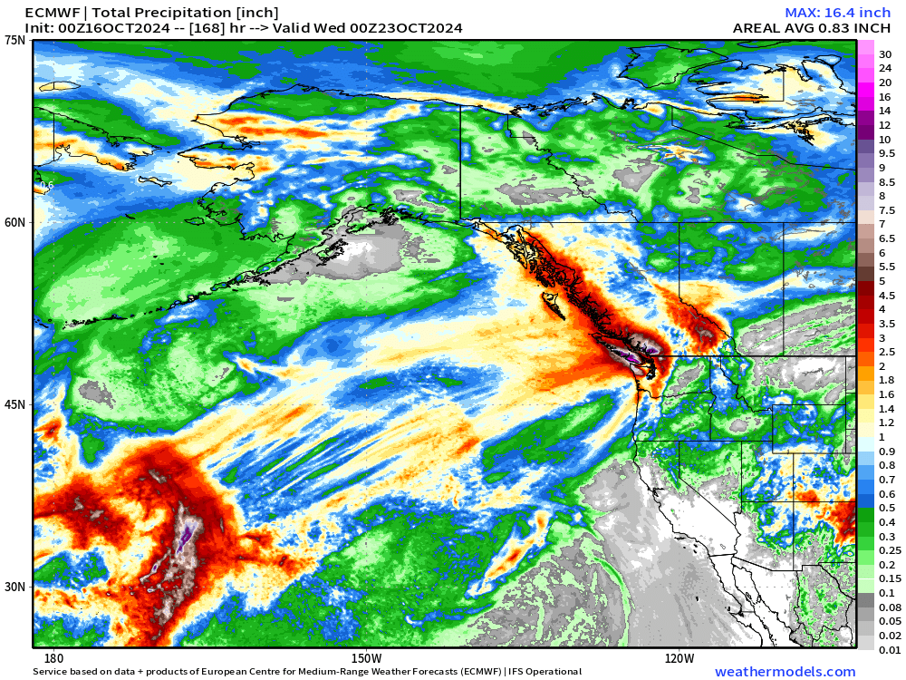
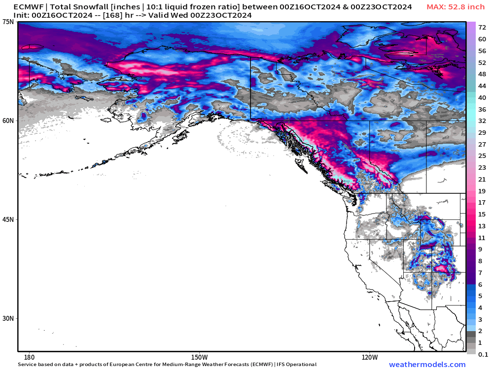
The rainfall + snowfall will be very heavy as the mountains wring out the oceanic moisture.
Plenty of snowfall for British Columbia.
Tropical Update
Invest 94L | 40% Chance According to NHC
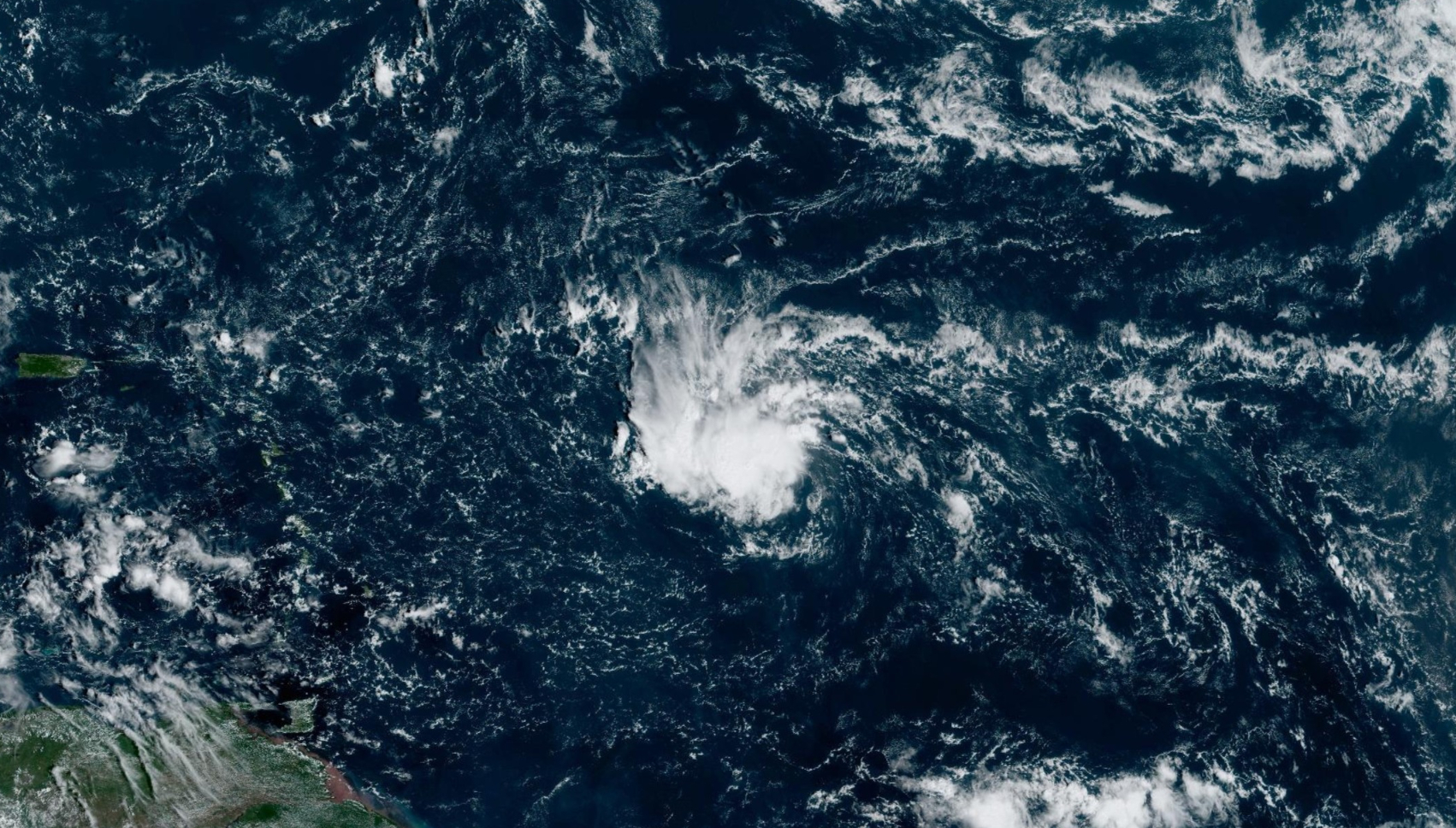
Dry air is hindering the development of the wave, but a more moist environment in a few days could allow a brief TD or TS level organization.
ECMWF Integrated Vapor Transport
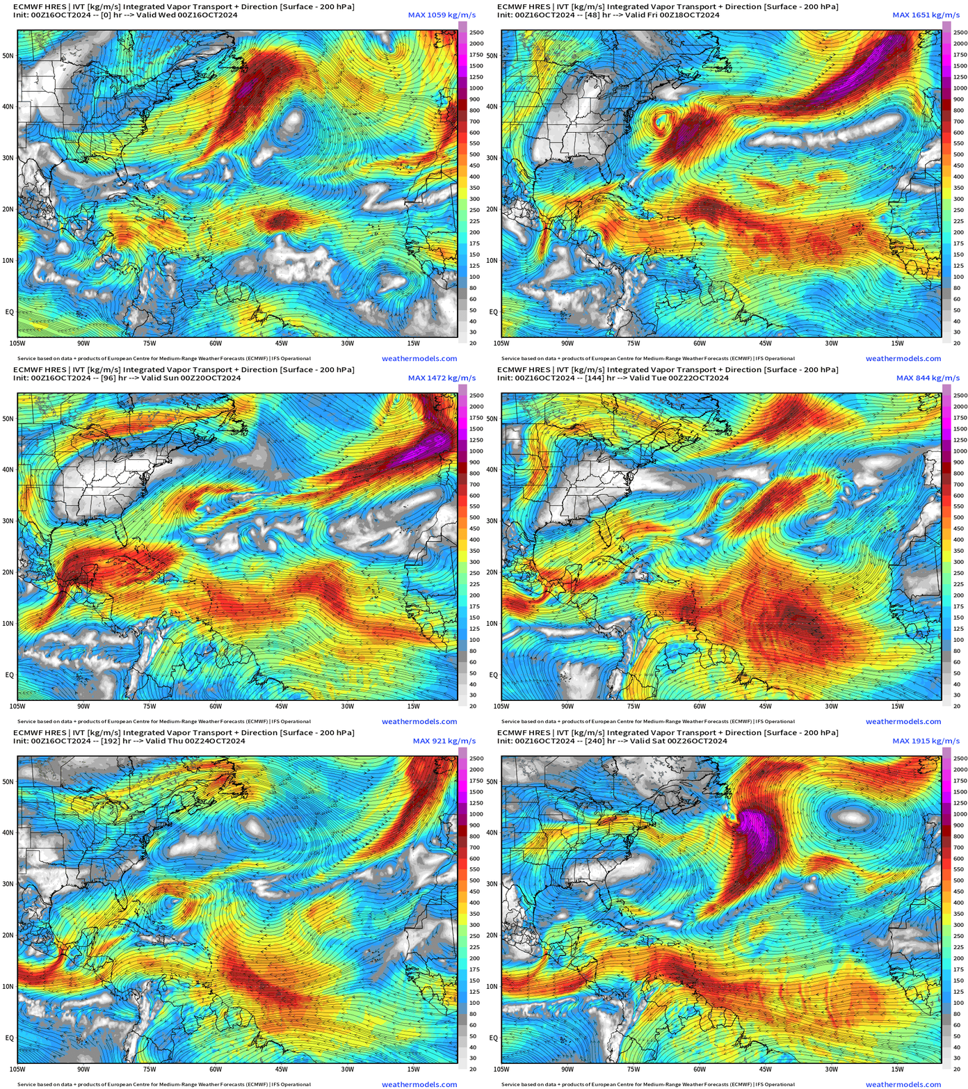
ECMWF HRES does not develop Invest 94L. No other storms in the pipeline through 10-days, and likely much longer.
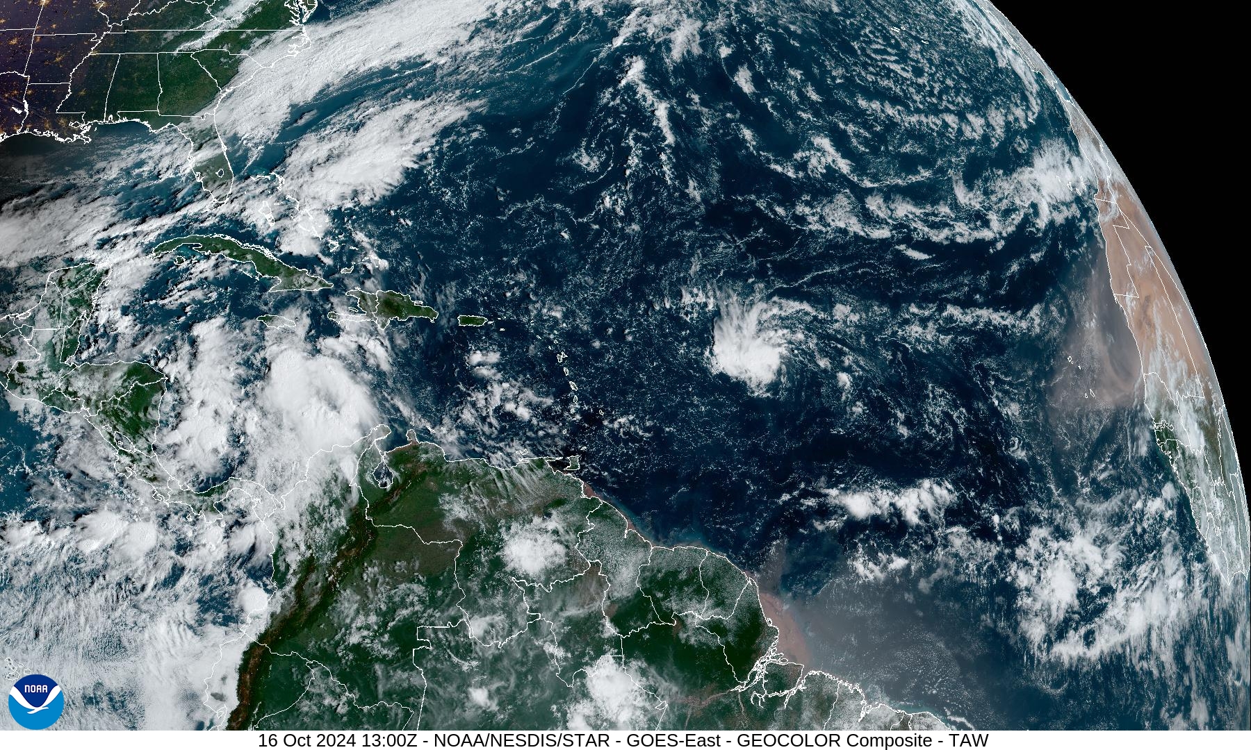
Atlantic Satellite
Invest 94L does have a nice area of cloud cover and looks promising, but is not as strong as it looks. Interesting to see a burst of African dust coming off the continent again. I wonder if the current Atlantic dry air is related to African continental dry air.
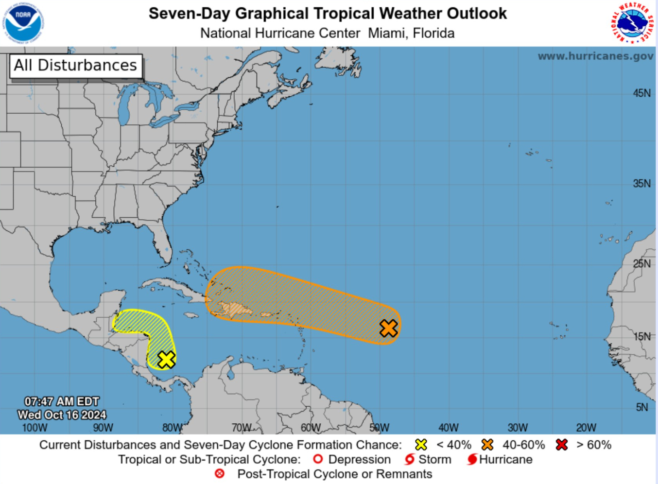
NHC 7-day Outlook
Invest 94L still could become short-lived Tropical Storm Nadine [40% chance]. The other area near Central America is at 20% and not likely to become a storm, however it will produce flooding rains.
Snowfall
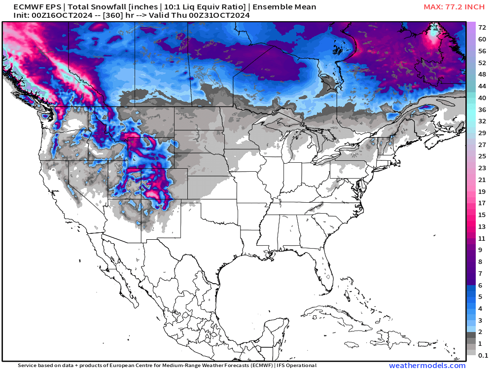
15-day Ensemble Mean Snowfall Forecast
Probability of 0.10” snowfall through 15-days
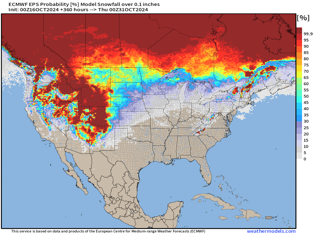
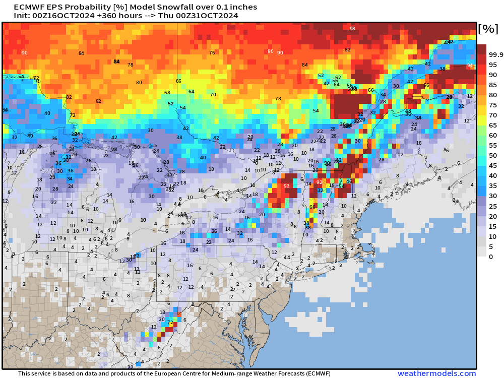
Much of the mountain west will see snowfall in the next 2-weeks as well as most of Canada through the rest of October.
Low Temperatures on Thursday
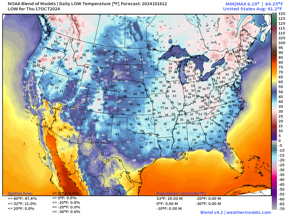
Still quite chilly across the Eastern U.S. in the 30s or colder across almost half of the lower 48 by real estate.
High Temperatures on Thursday
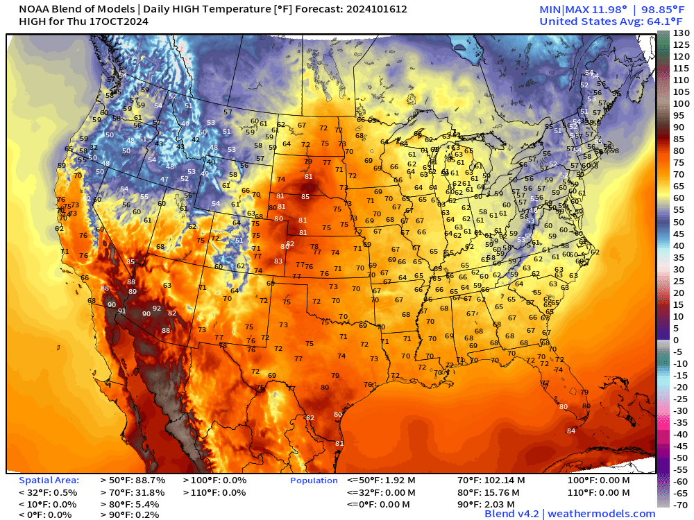
Comfortable across the central U.S. with 70s pushing again into the Dakotas. 60s in the Great Lakes will feel much better after this Arctic blast.
ECMWF EPS Active Tracks
Day 7: October 23
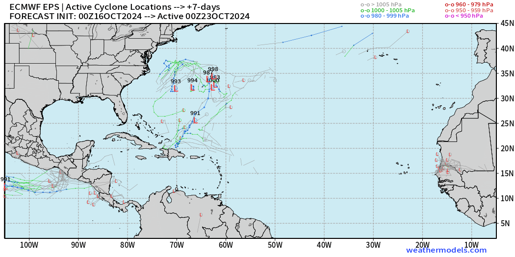
Very little tropical activity signals.
Day 15: October 31 All Tracks
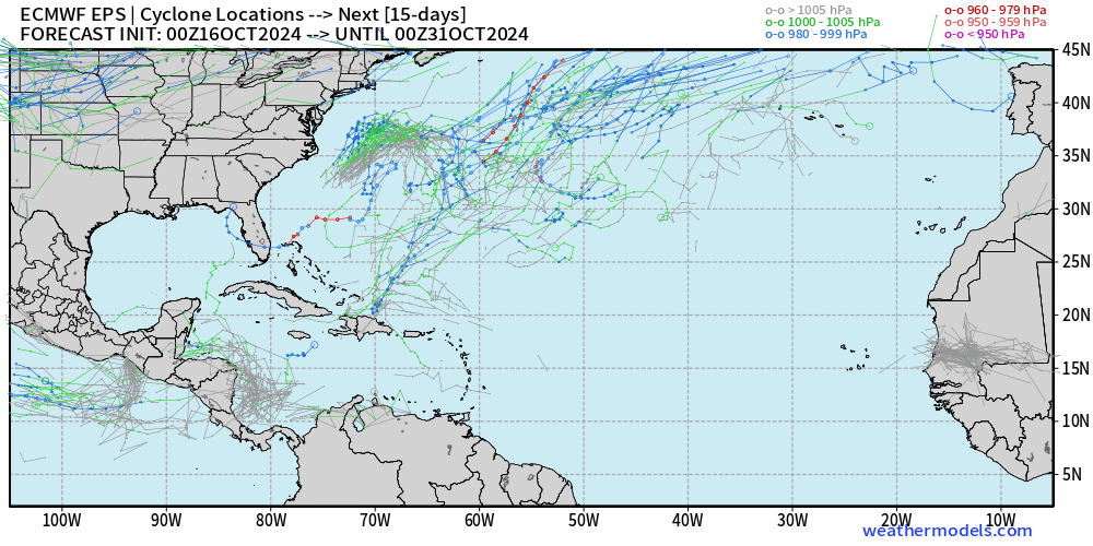
Perhaps Invest 94L develops into Nadine, briefly, but not seeing much else in the tropics. Those tracks in the subtropics around Bermuda are likely not tropical. That will put a cork in October!
Total Rainfall next 7-Days | NOAA WPC
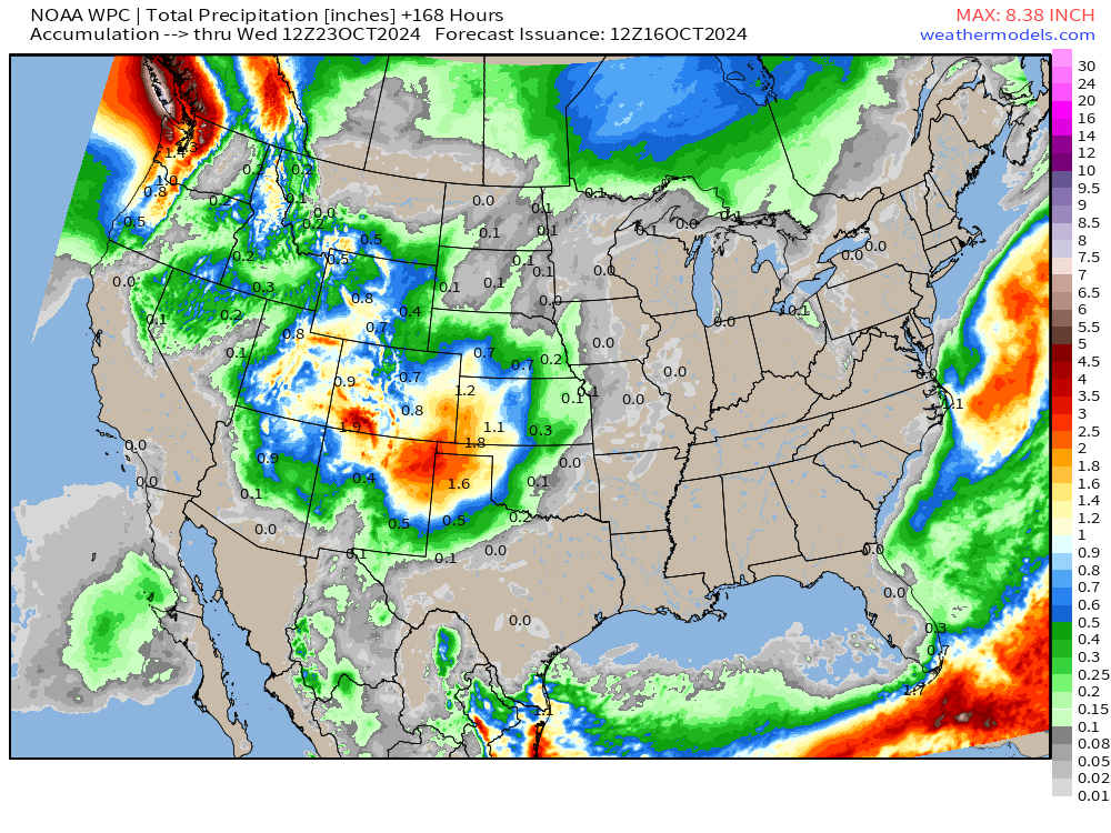
Total Rainfall next 10-days | ECMWF 00z
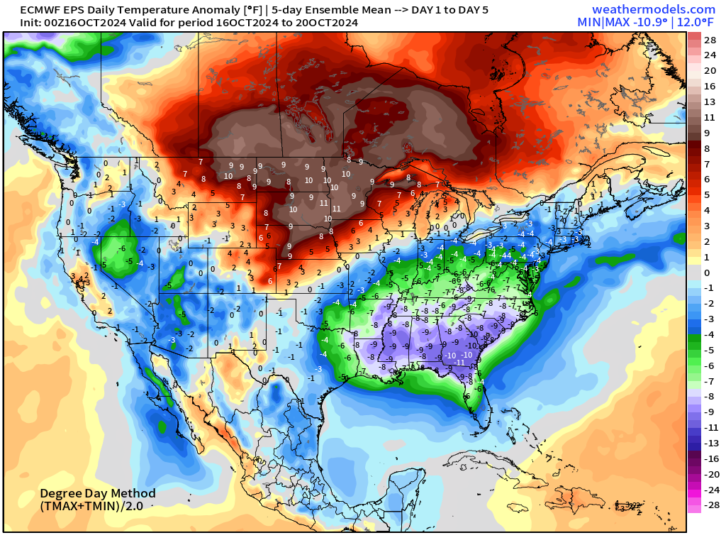
EPS 5-Day Chunk Temperature Anomaly
October 16-20
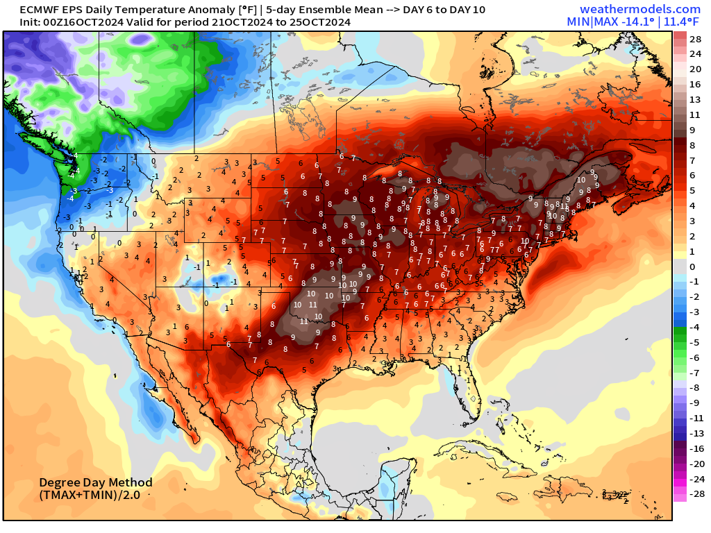
October 21-25
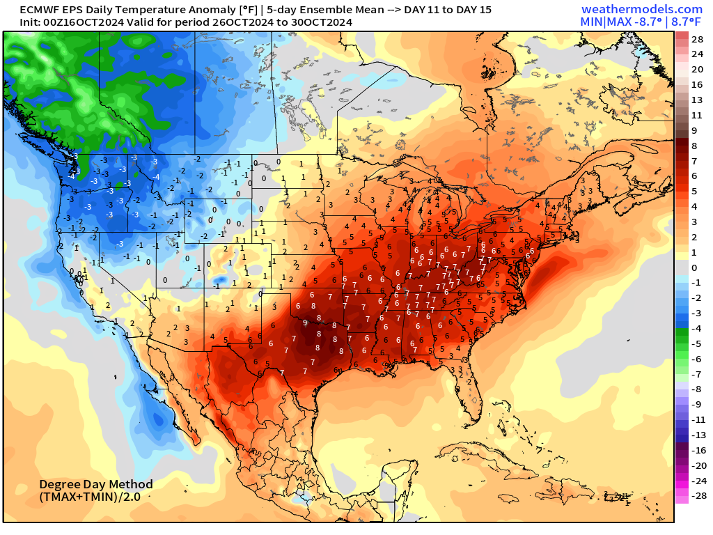
October 26-30
Coming soon: Weather in My Backyard
Maps sourced from weathermodels.com designed and innovated by yours truly! I actually create all of my content from scratch.
- Milepost
- 415 · laid 2024-10-16T14:13:24.557000Z
- Source
- https://weather.substack.com/p/oct-16-2024-wednesday-weather-update
- Digest
- 2c63da2562c1e0c09207b3592c307362be8f5404d5db7570872bccd0febb9f6f
- Machine
- JSON