Oct 5, 2024 Forecasting Major Hurricane Milton
Milton expected to rapidly intensify and slam into Florida by Wednesday
October 2024 was the 2nd-warmest October in the 131-year national record (1895–2025), at 58.9°F against a 1991–2020 normal of 54.5°F (+4.4°F).
October 2024 was the 3rd-driest October in the 131-year national record (1895–2025), at 1.0in against a 1991–2020 normal of 2.5in (-1.5in).
NOAA/NCEI Climate at a Glance, contiguous United States. This is the observed record for the month, not a score of anything said in this piece — the forecast ledger begins 2026-08-17 and cannot reach earlier posts.

Headlines for Saturday
Tropical Storm Milton [14L] designated earlier this afternoon after satellite data indicated a robust circulation over the Bay of Campeche. The timeline for Milton’s development and likely rapid intensification seemed to move up today as the convection persisted overnight along the coast of Mexico. Unfortunately, all indications are for a major hurricane by Tuesday, and then landfall about 36-hours later centered upon Tampa Bay.
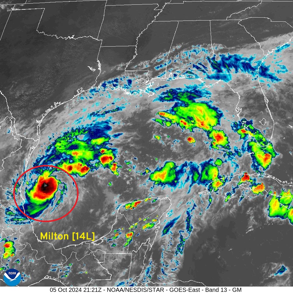
IR Satellite 5:21 PM ET Hurricane Kirk and Tropical Storm Leslie well out to sea. Kirk will affect UK/Europe in some capacity later next week as a post-tropical storm. And, another wave following could become Nadine in ~1 week. Hopefully that’s the end of this unusual flurry of activity in the Atlantic.
Track of Milton
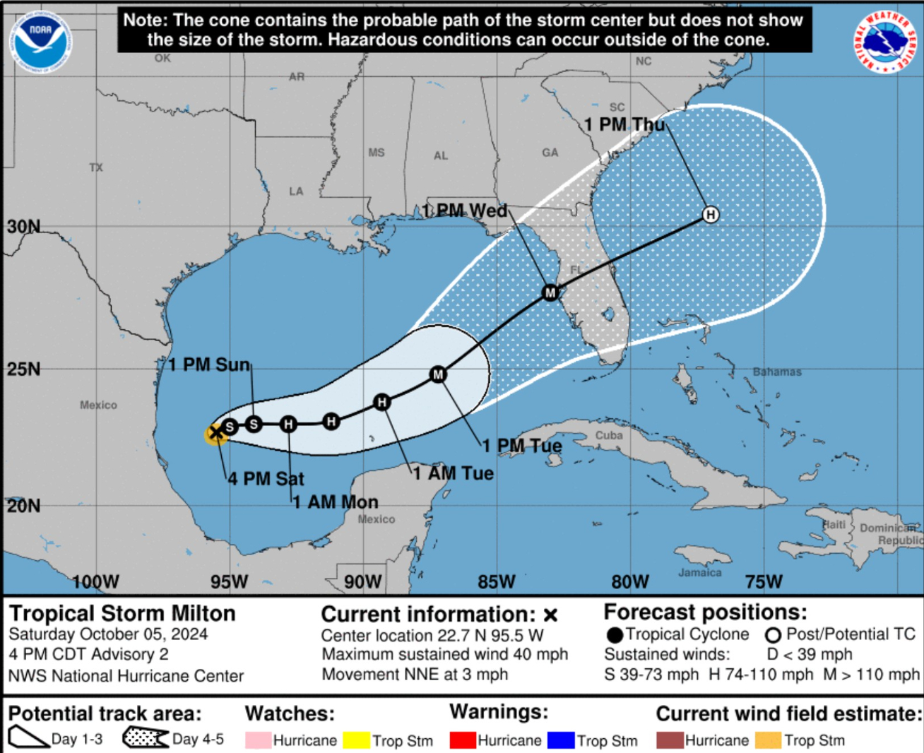
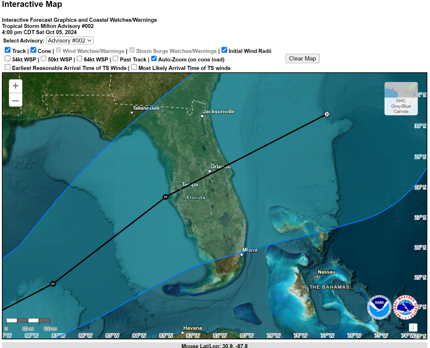
The 5 pm ET NHC track update is centered right on Tampa and Orlando with a major hurricane point right off Tampa Bay.
Obviously this is a difficult situation w/terrible scenario unfolding of the track shifts to the north, which is unfortunately more likely than not.
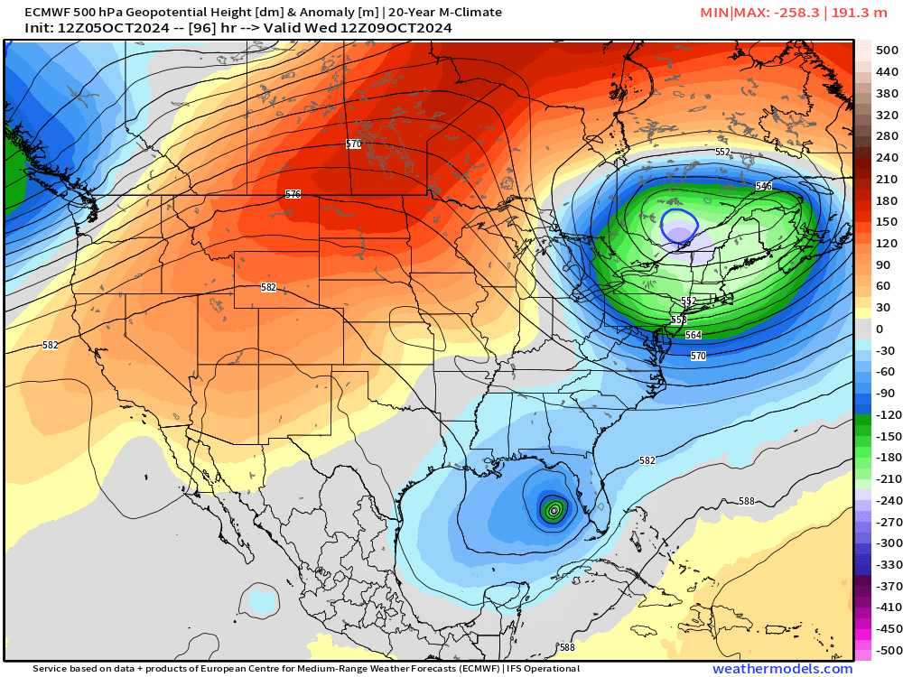
Trough over the Northeast digs quite impressively w/sub-5400 m heights at 500 mb (snow level) by Wednesday.
This will provide the weakness on Tuesday for Milton to move more northward and then eastward across the Florida peninsula.
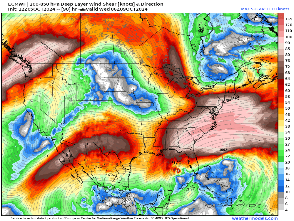
Wind shear forecast mainly indicates speed shear from west to east across the Southeast U.S. w/Milton in a favorable location for enhanced upper-level anticyclonic ventilation. It’s hopeful the trough does force dry mid-level air into the western Gulf of Mexico, and combine with the shear to at least spur an eyewall replacement cycle or diminish the storm’s intensity prior to landfall.
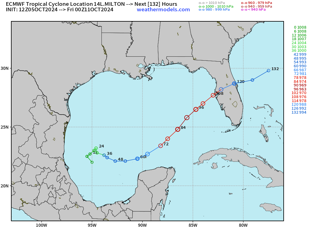
ECMWF 12z MSLP and Track
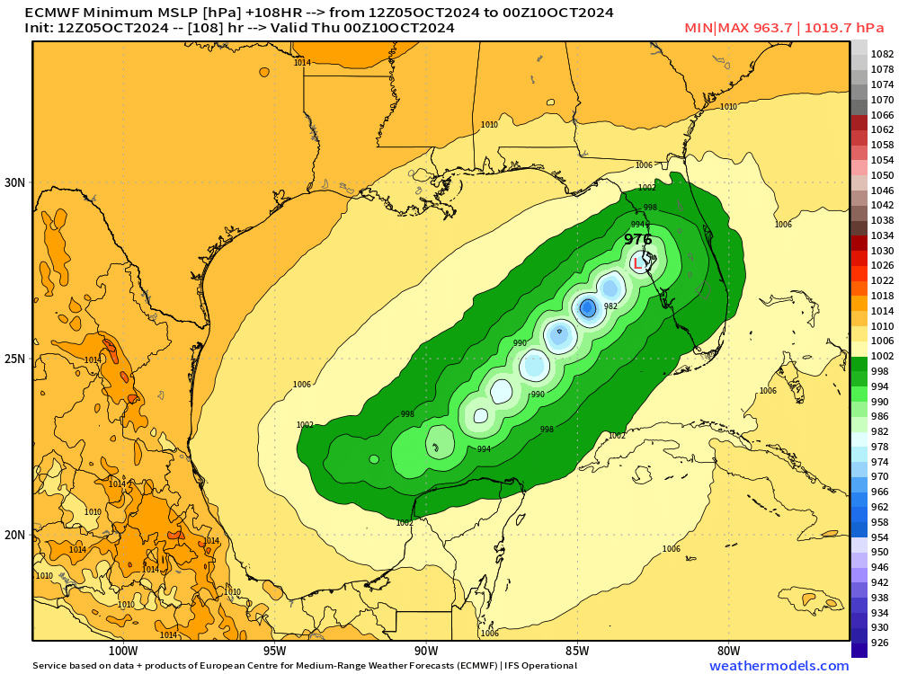
For reference, the HRES 12z track is right into Tampa Bay from the WSW with minimum pressure along the route at 963 mb. However, I think this is too weak especially with major hurricane expected prior to 72-hours.
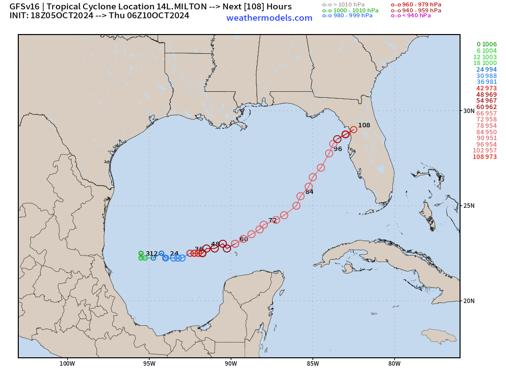
GFS 18z updated with a more intense Milton at 950 mb w/an unfortunate track up the coast with a right turn into Cedar Key that would force surge into Tampa Bay.
Intensity of Milton
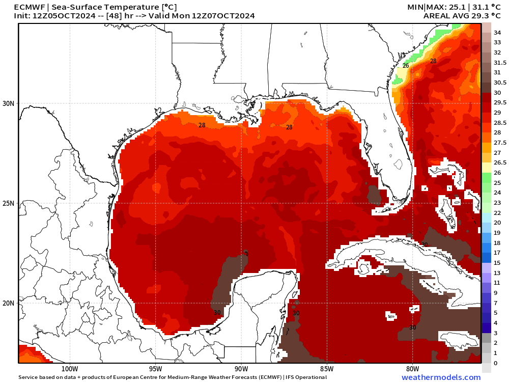
SSTs are very warm in the Gulf of Mexico in the 28°C to 29°C range w/warmer eddy features along the way that can turbo-charge Milton rapidly.
NHC discussion highlights the favorable upper-level atmospheric and oceanic conditions for rapid intensification.
Milton is within favorable atmospheric and oceanic conditions for strengthening.

The scatterometer data indicated that the radius of maximum was around 20 n mi, and with the expected low vertical wind shear conditions, steady to rapid strengthening appears likely during the next few days.

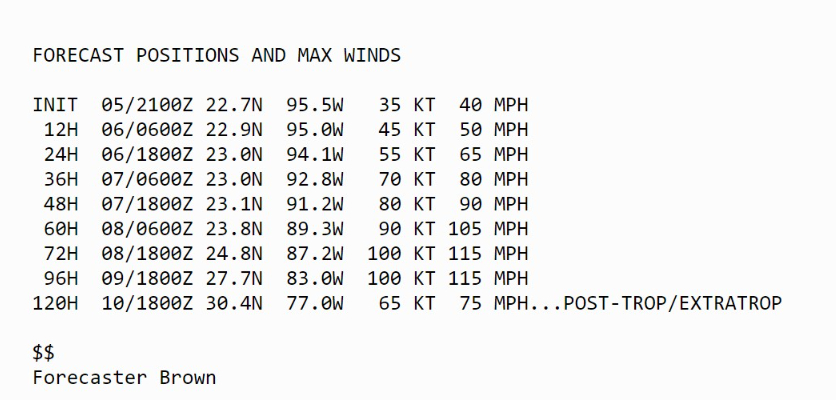
The official intensity forecasts calls for Milton to become a hurricane in about 36 hours, and a major hurricane by 72 hours.  The regional hurricane models continue to be quite aggressive in intensifying Milton.

For now, the NHC intensity forecast is near the multi-model consensus aids, but upward adjustments could be required if the dynamical hurricane models continue their trends.
NHC is understandably conservative with the intensity but it’s probably a done deal to major status (Category 3 100 knots) and then higher to 115-knots (Category 4). Preparations should be made for a major hurricane regardless.
Wind Gusts Impacts
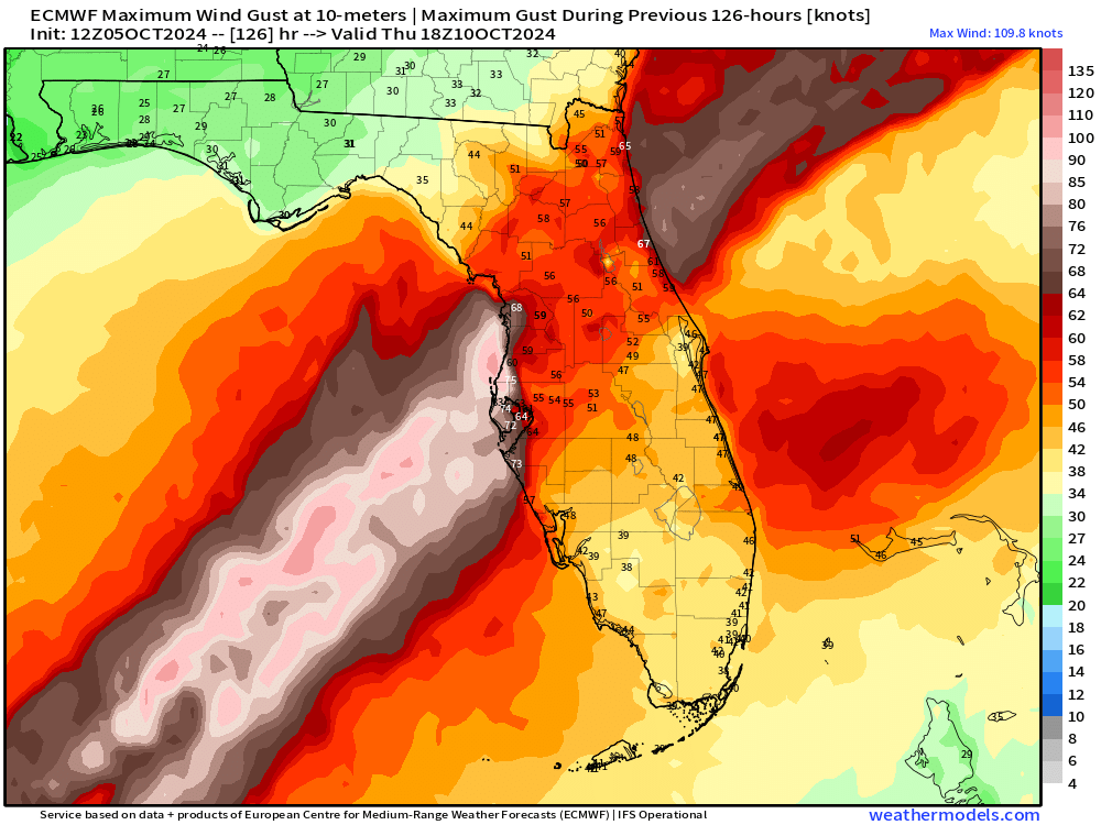
Wind gusts > 80-100 mph would directly impact the coast over a wide swath > 100-miles and then extend inland in the 40-60 mph range including Orlando to Daytona and Jacksonville. The eventual track will determine the worst wind gusts and rainfall with tight gradient north/south determining damages.
Rainfall Impacts
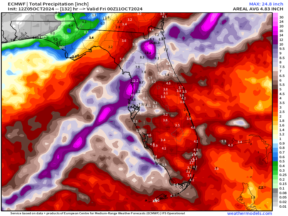
Rainfall from relatively fast moving Milton once it reaches the Florida peninsula still in the 10-15 inches range for the maximum with widespread coverage across Florida ahead of time.
ECMWF 12z Integrated Vapor Transport (IVT)
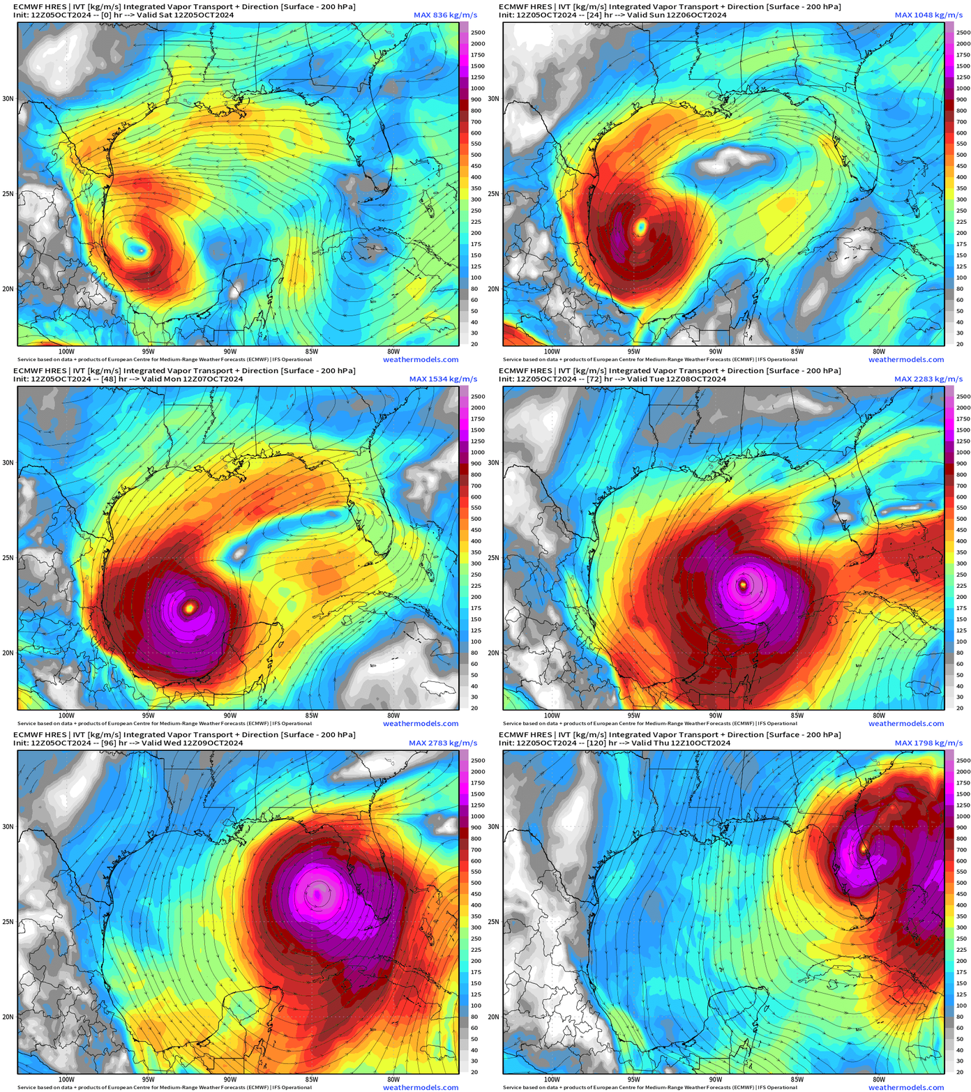
Weather Trader is a reader supported daily newsletter to keep you updated on extreme weather around the U.S. and world. Please consider upgrading to a paid subscription to receive all updates to your email or click on the Substack App. Yearly subs or upgrades can use this coupon for 20% off:
Atlantic GeoColor Satellite
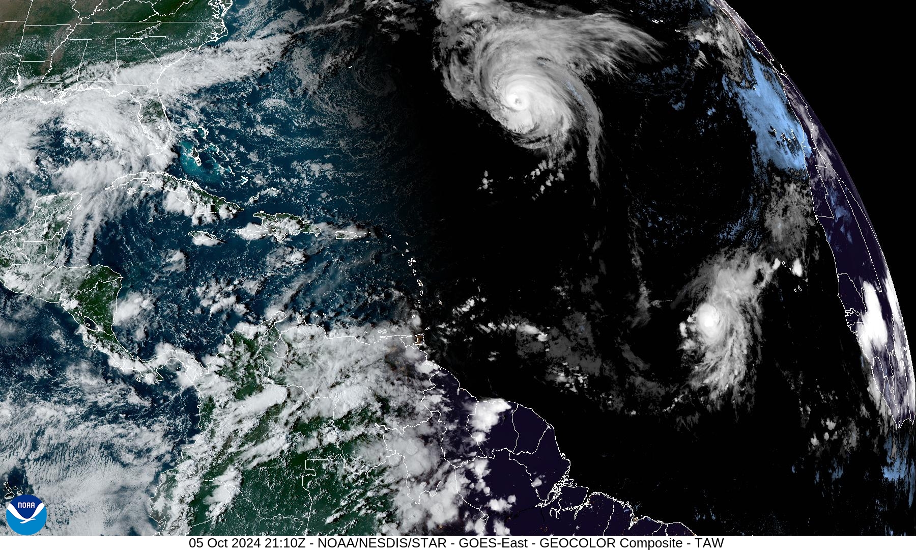
Hurricane Kirk continues to gain latitude and separating more distance from Hurricane Leslie.
NHC 7-Day Outlook
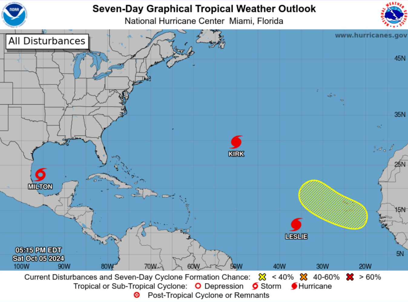
One more area off Africa down the road (30%) would become Nadine.
NWS WPC | 7 Days Total Precipitation
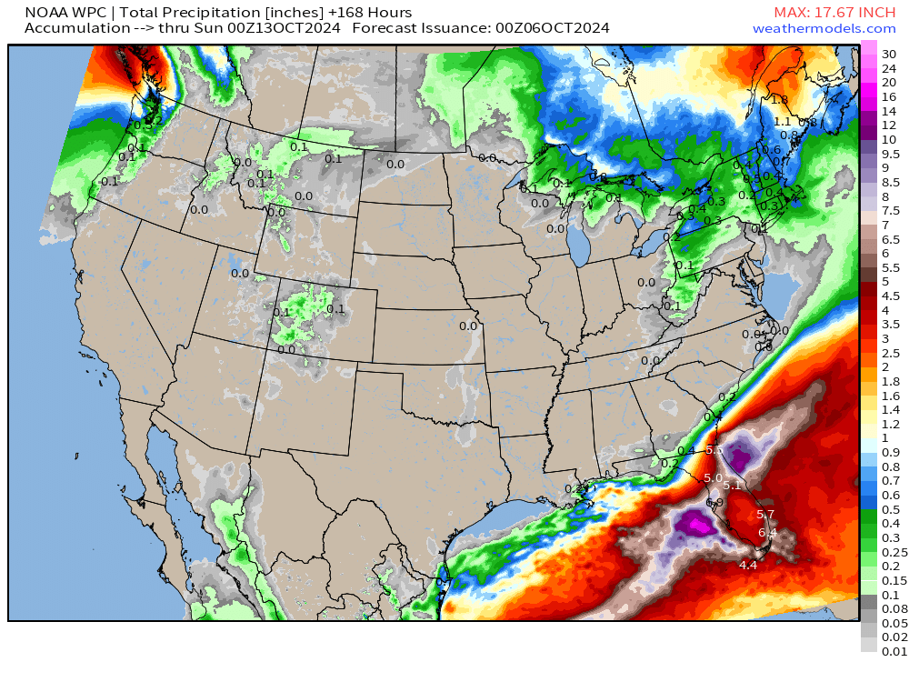
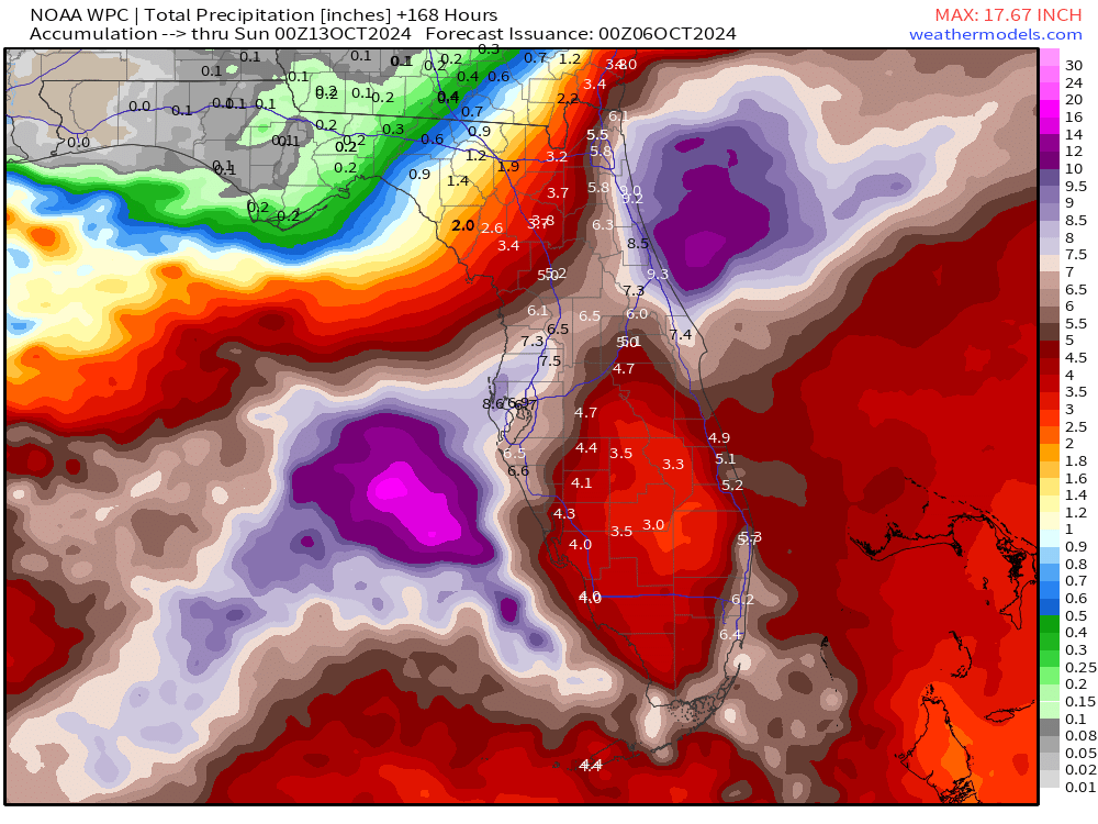
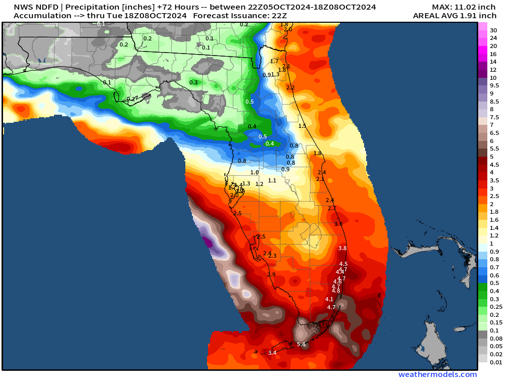
The rainfall with Milton will be added to what’s falling before landfall mainly in South Florida.
NWS Next 3-Days Precipitation
Coming soon: Weather in My Backyard
Maps sourced from weathermodels.com designed and innovated by yours truly! I actually create all of my content from scratch.
- Milepost
- 406 · laid 2024-10-05T22:50:09.556000Z
- Source
- https://weather.substack.com/p/oct-5-2024-forecasting-major-hurricane
- Digest
- 3ee52ae3b4f4a67e6b1f11e5e05da1b8764f94f107cbbe175476b36c65c5a3c8
- Machine
- JSON