Sept 29, 2024 Sunday Tropical Update
Atlantic remains active with another Caribbean threat brewing
September 2024 was the 2nd-warmest September in the 131-year national record (1895–2025), at 68.6°F against a 1991–2020 normal of 66.0°F (+2.7°F).
September 2024 was the 44th-driest September in the 131-year national record (1895–2025), at 2.3in against a 1991–2020 normal of 2.6in (-0.3in).
NOAA/NCEI Climate at a Glance, contiguous United States. This is the observed record for the month, not a score of anything said in this piece — the forecast ledger begins 2026-08-17 and cannot reach earlier posts.

New Tropical Depression 12 to become powerful Hurricane Kirk but not affect land
Gulf of Mexico gyre reforms and could spawn a tropical storm on the Atlantic side while another Eastern Pacific hurricane parallels Mexico coast — hitting the repeat button, but hopefully the wind shear in the Gulf of Mexico holds back cyclogenesis enough until a cold front wipes the slate clean
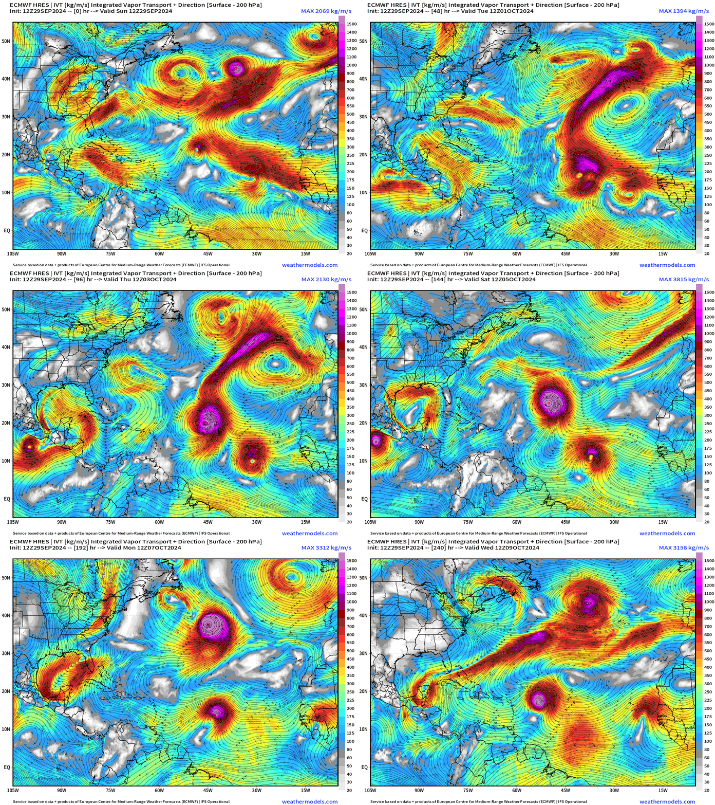
Another healthy tropical wave is behind Kirk and would become Leslie and head westward at lower latitude to near the Lesser Antilles in 10-days. There is ensemble and AI support for this wave to develop into a hurricane
Atlantic Night GeoColor Satellite
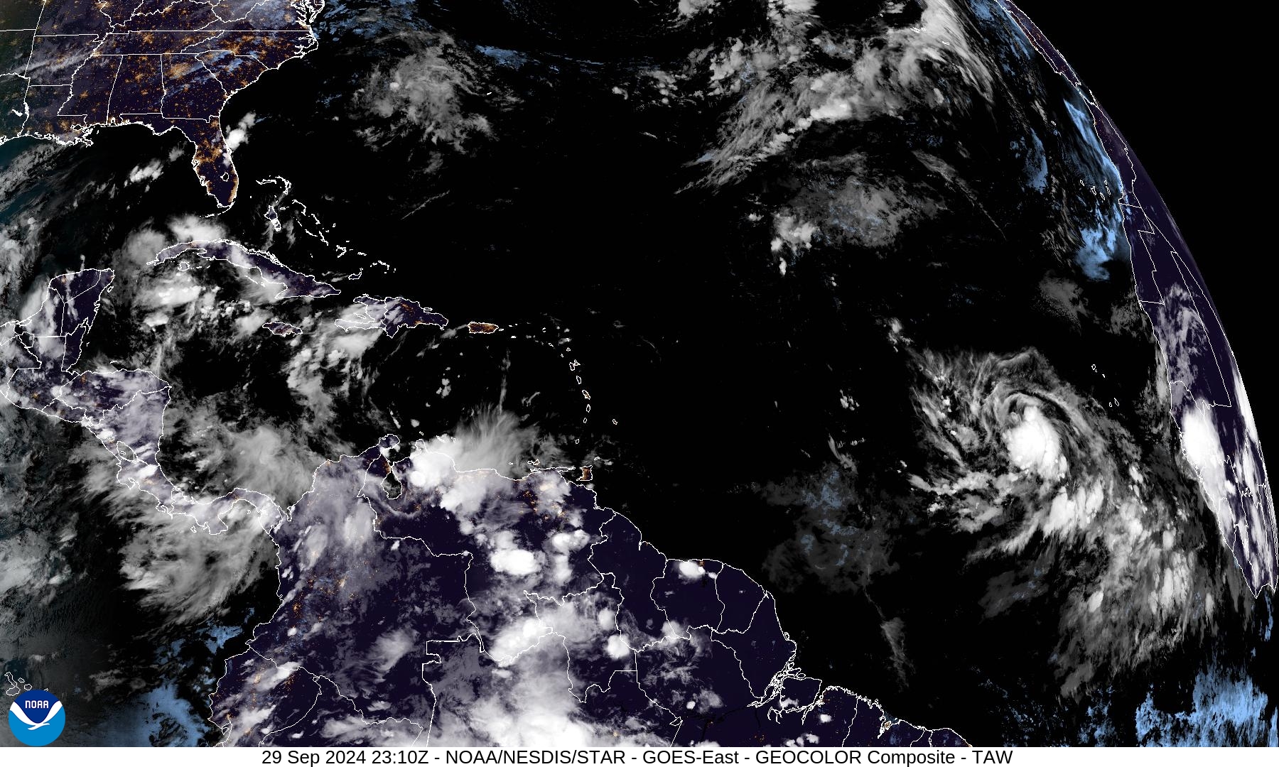
A bit unusual to see deep convection in the tropical Atlantic where Cape Verde hurricanes are formed. But we have a quite large system with Kirk (12L). It will head quickly to the WNW and then out to sea only mixing fish.
NHC 7-Day Outlook
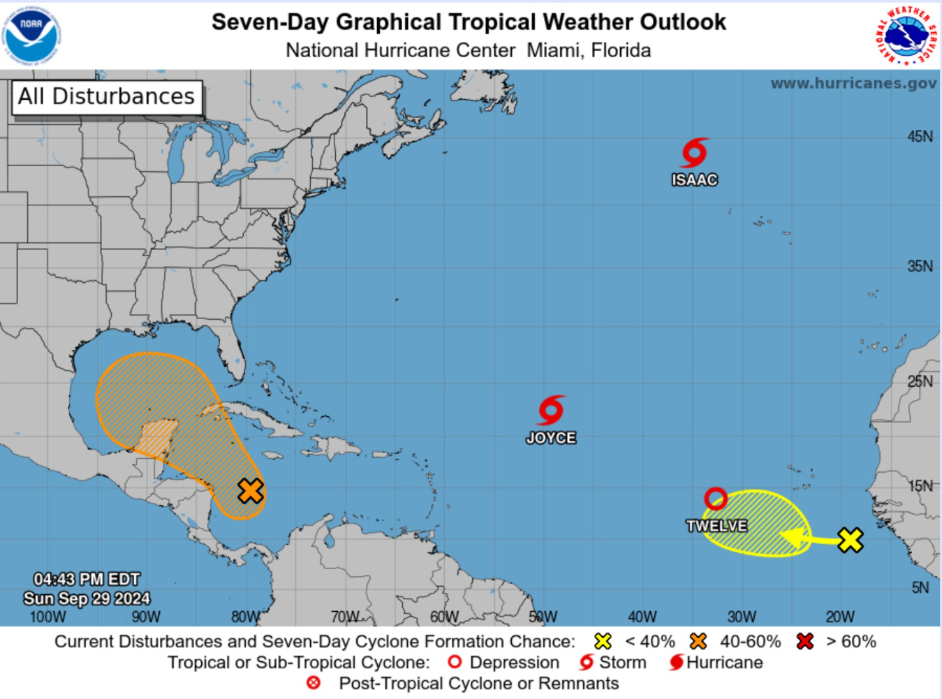
TS Joyce is weakening and will soon dissipate. Former Category 2 Hurricane Isaac is at high latitude and moving over cooler water, and will soon transition into a post-tropical system.
The area of interest hatched yellow behind Kirk (12L) will become Leslie down the road.
Tropical Storm —> Major Hurricane Kirk (12L)
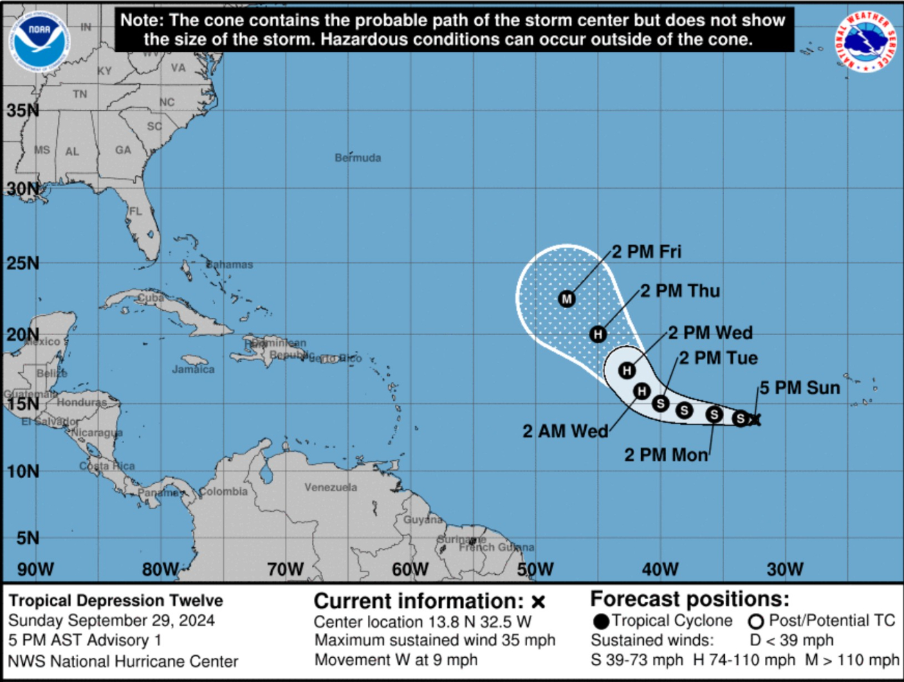
Good conditions for Kirk to become a major and contribute boatloads of ACE to the 2024 seasonal tally.
Gulf of Mexico Gyre
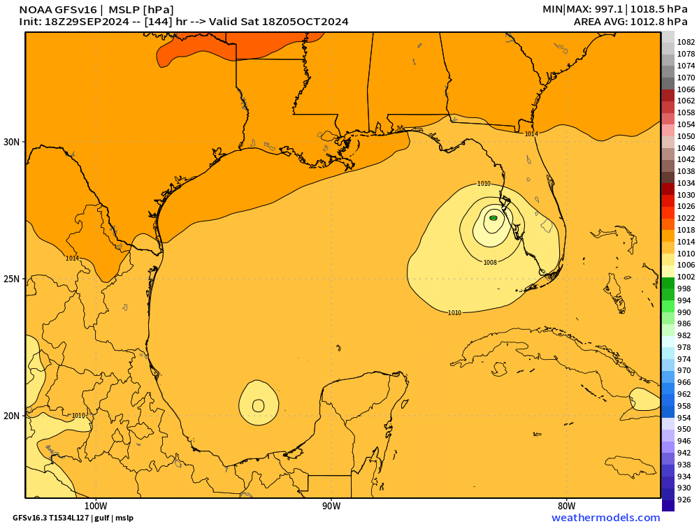
NHC at 50% chance of development into mid-week for Gulf of Mexico disturbance.
GFS 18z created a ribbon of vorticity that broke down into at least two areas that could be named tropical storms.
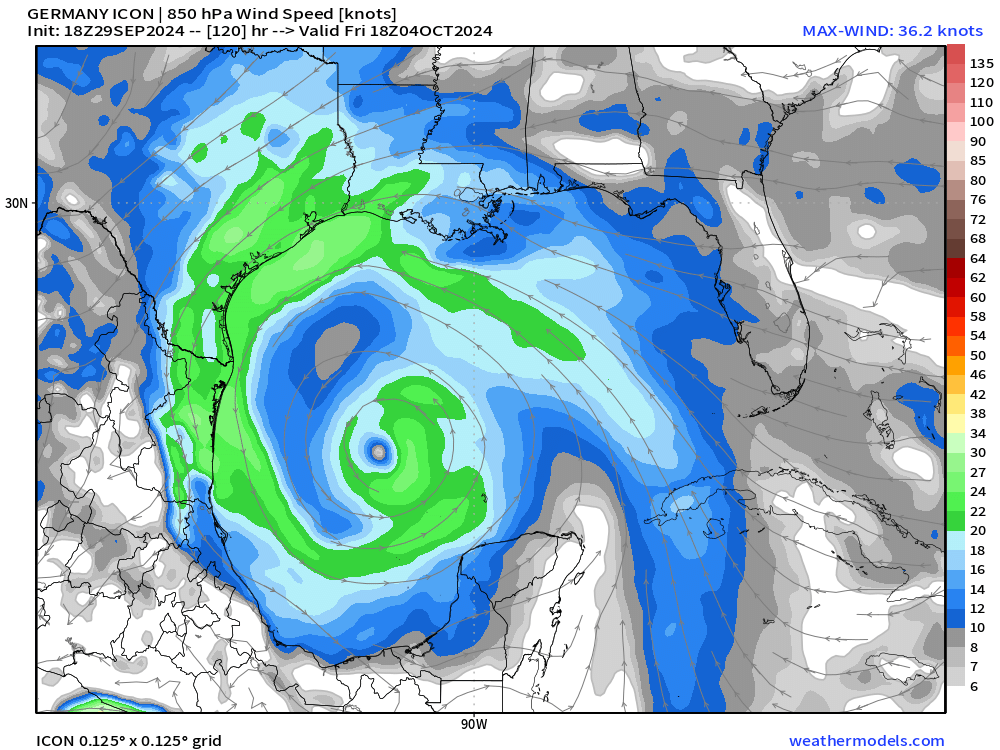
ICON 18z has one large gyre in the SW Gulf of Mexico. Clearly uncertainty about the development pathway here unlike Hurricane Helene, which was a blaring alarm with the upper-level pattern.
Next 10-days Upper-Level Pattern
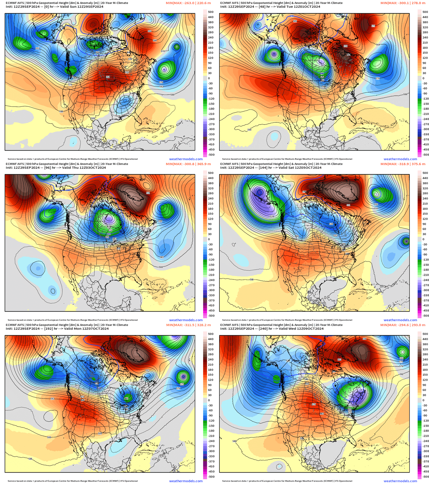
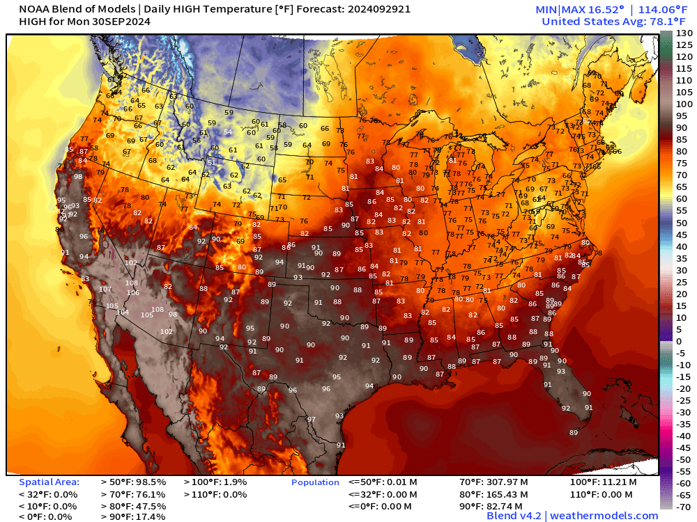
Amazing ridge for the western U.S. with early autumn heat continuing.
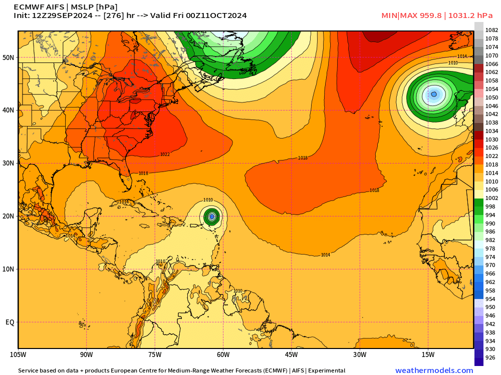
ECMWF AIFS 12z did not develop significantly the Gulf of Mexico system but does bring Leslie close to the Lesser Antilles in 12-days — long range.
This would be a threat to the Caribbean and perhaps Bermuda. So far, not seeing signs of it continuing further west and affecting the USA. However, this is long-range, and much to be determined in the week ahead.
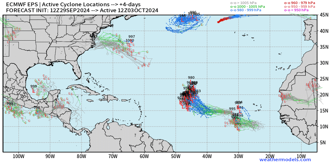
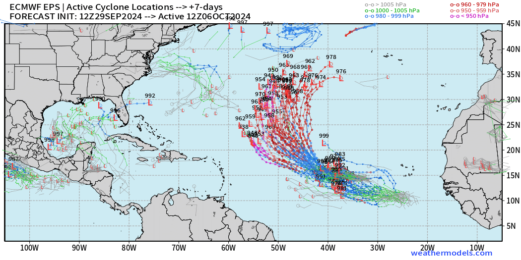
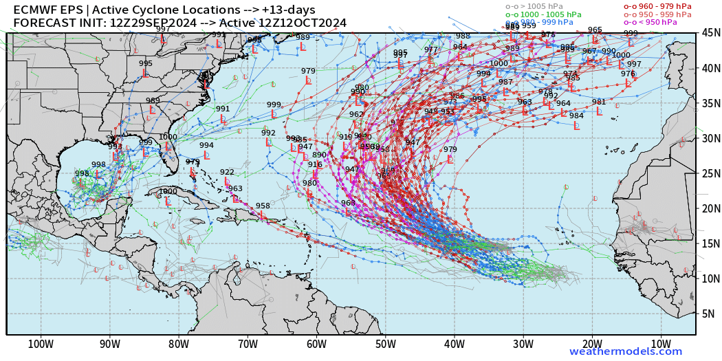
ECMWF 12z Tropical Cyclone Tracks
Day 4: October 3
Not too ambitious with the Gulf of Mexico although there may be a circulation with enough convection that yields classification in the subsequent few days. Kirk and Leslie underway.
Day 7: October 6
Major Hurricane Kirk is heading into the central North Atlantic with Leslie well behind at lower latitude.
Day 13: All Tracks October 12
Good news is only a few serious contenders in the Gulf of Mexico, and only 2-3 members bring Leslie westward into the Bahamas. We’ll watch that very closely because there are many members with Category 5 intensity.
Precipitation Analysis Last 5-days
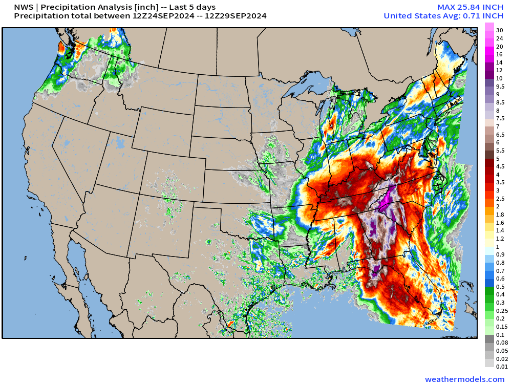
Combination of upper-level low + Predecessor Rain Event (PRE) + Hurricane Helene left a trail of devastation with enormous flooding especially in higher elevations of Georgia, SC, NC, and Tennessee. Heavy rain also extended throughout the Ohio River Valley. Total across the Lower 48 east of the Mississippi > 40 Trillion gallons over the past 5-days.
20 Trillion gallons on FL, GA, SC, NC, and TN
NOAA WPC 7-day Precipitation Forecast
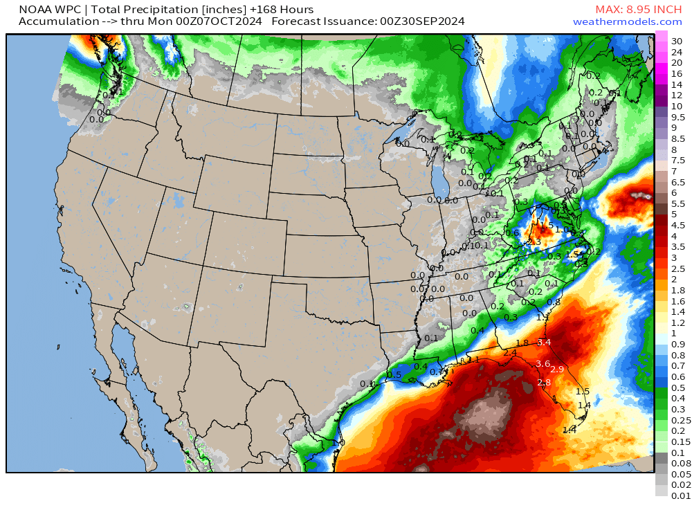
Florida to be the worst location for rainfall in the coming 7-days.
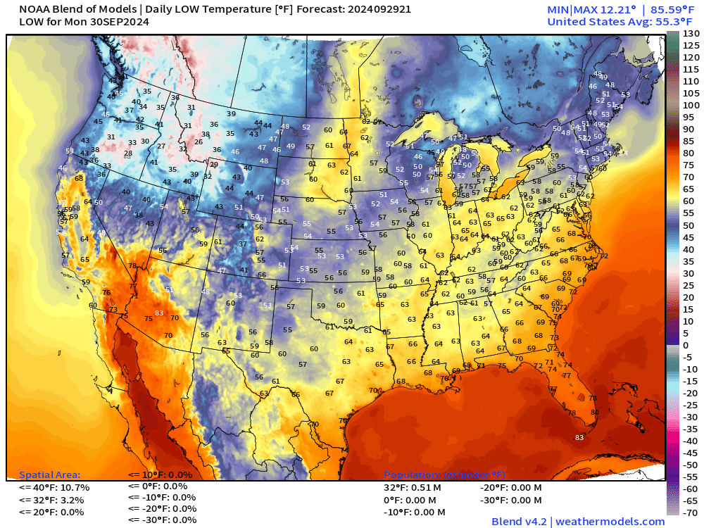
Low Temperatures on Monday September 30
High Temperatures on Monday September 30
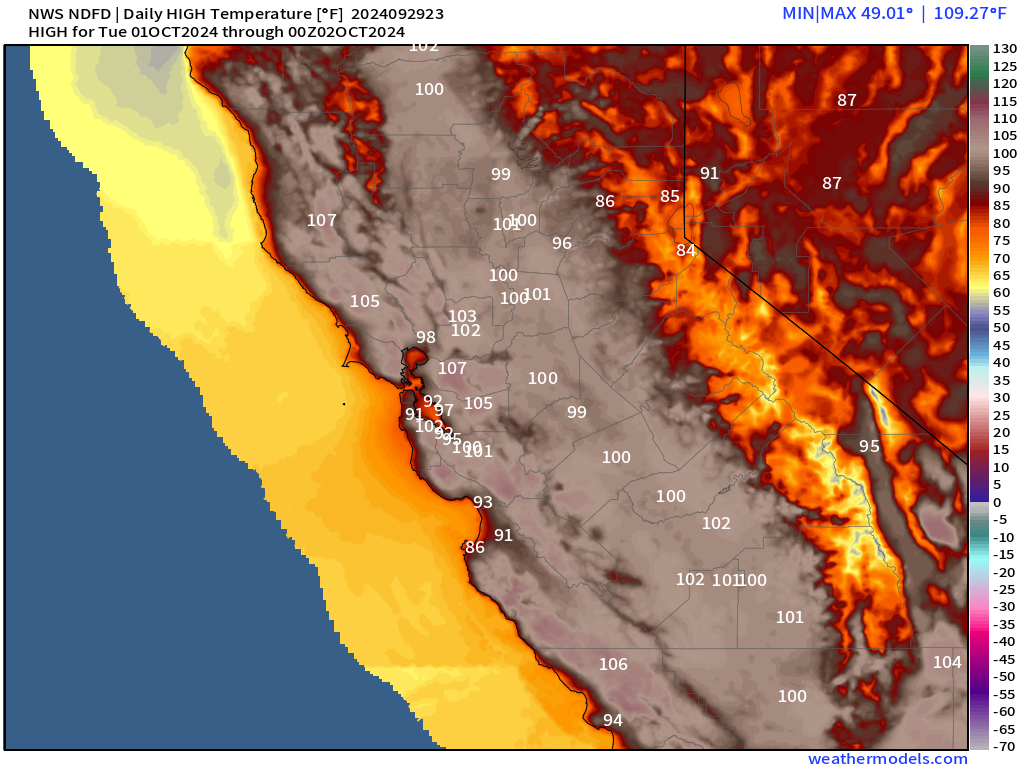
Then, 90°F+ in San Francisco on Tuesday with 100s in the Bay Area.
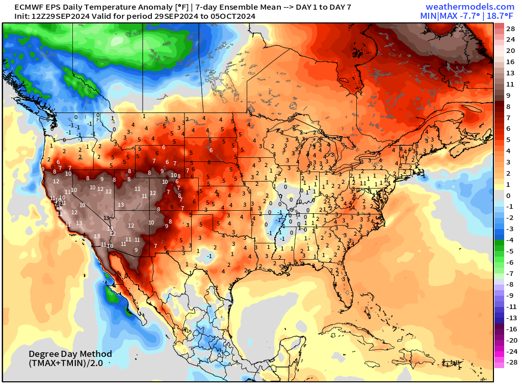
EPS 2-Week Temperature Anomaly
Week 1: Sept 29 - Oct 5
Week 2: Oct 6 - Oct 12
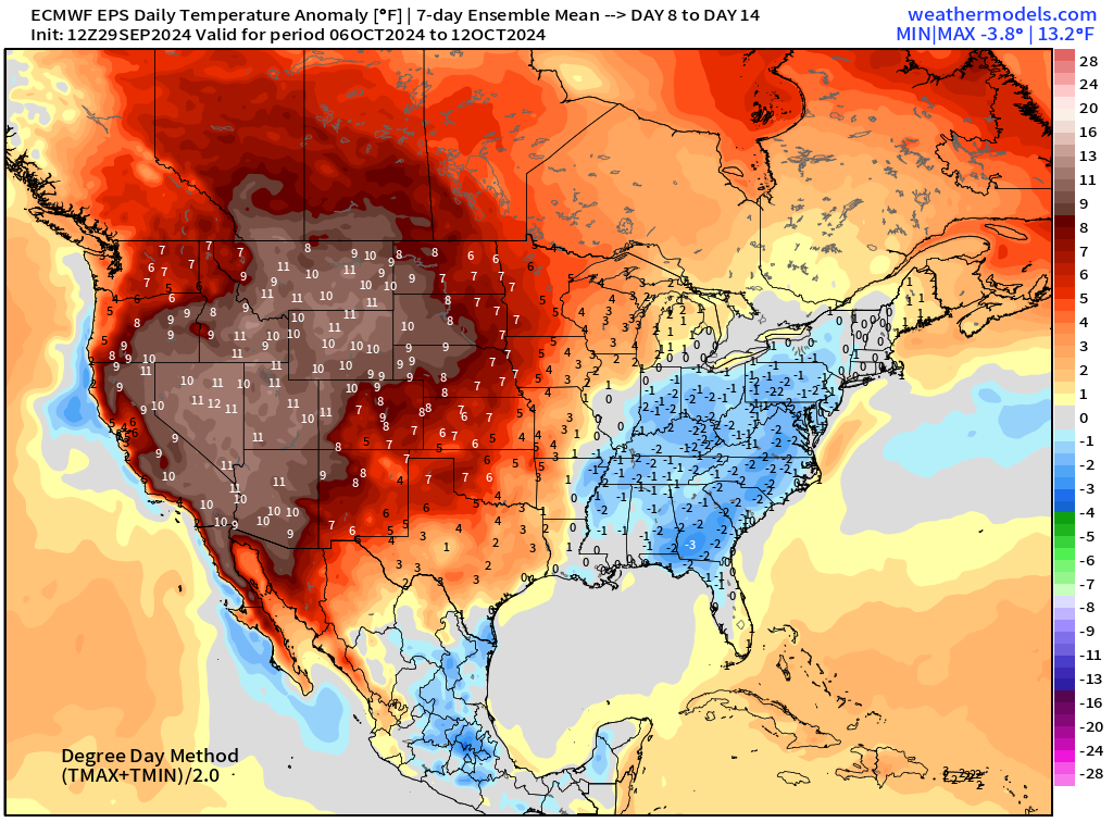
Hot out west.
Coming soon: Weather in My Backyard
Maps sourced from weathermodels.com designed and innovated by yours truly! I actually create all of my content from scratch.
- Milepost
- 401 · laid 2024-09-29T23:50:58.254000Z
- Source
- https://weather.substack.com/p/sept-29-2024-sunday-tropical-update
- Digest
- 0fbc85939397d9f6aa381c1970663de67ef2d03c4bf133d104e7ee6d526be958
- Machine
- JSON