Sept 25, 2024 Historic Hurricane Helene
Major damage expected throughout Georgia as Helene plows inland
September 2024 was the 2nd-warmest September in the 131-year national record (1895–2025), at 68.6°F against a 1991–2020 normal of 66.0°F (+2.7°F).
September 2024 was the 44th-driest September in the 131-year national record (1895–2025), at 2.3in against a 1991–2020 normal of 2.6in (-0.3in).
NOAA/NCEI Climate at a Glance, contiguous United States. This is the observed record for the month, not a score of anything said in this piece — the forecast ledger begins 2026-08-17 and cannot reach earlier posts.

Major Hurricane Helene forecast to landfall Florida panhandle coast on Thursday
Rapid intensification likely with Mesoscale Model Solutions at Category 5 pressures. However, large wind field may keep lower by 1 category (not meaningful for impacts)
Inland wind and flooding threat into Georgia and South Carolina through Friday potentially affecting Atlanta
Atlantic tropics remain active for the next 2-weeks into early October.
Hurricane Helene
Upgraded at 11 AM EDT: 979 mb w/80 mph winds (Category 1)
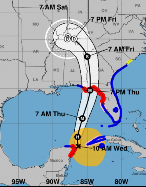
The track is a MAJOR Hurricane into Tallahassee along the western side of Georgia. However, the worst impacts will be on the eastern/right side of the storm, and that includes all of Georgia.
New Cone
The old cone only shows the uncertainty in the track points w/concentric circles spread along each 24-hour point based upon climatology (last 5-years 2/3 errors).
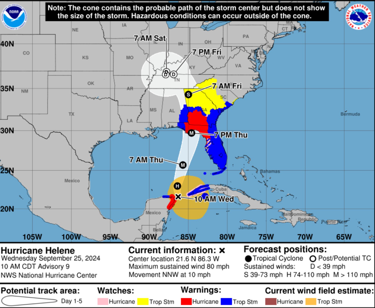
The better way — especially with Helene — to evaluate impacts is to plot the Hurricane Watches/Warnings on top of the cone.
Hurricane warnings into southern Georgia to about Columbus and near Macon.
I expect those Hurricane Warnings to expand to Atlanta metro.
Current Visible Satellite: 1:07 PM EDT
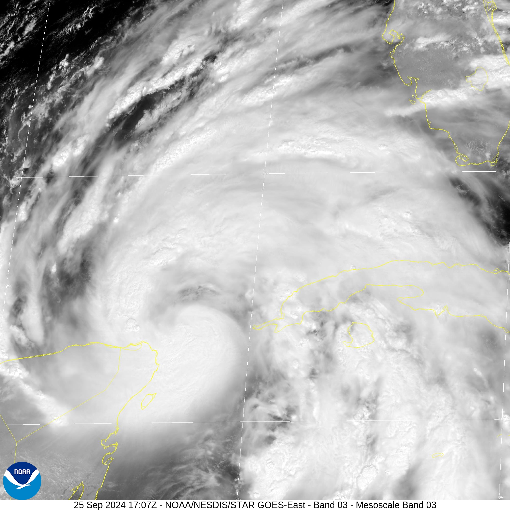
The inner-core looks to be forming a hook just east of the Yucatan Peninsula where the eye will likely form.
We’re expecting rapid intensification to Category 3+ in the next 12-24 hours as the core moves over the very warm Gulf of Mexico Loop Current.
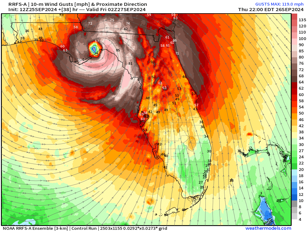
Landfall late Thursday
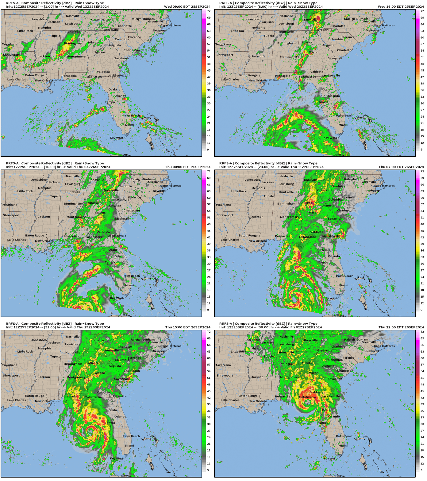
RRFS-A is doing very well with the track matching NHC. The impacts can therefore be skillfully modeled w/eye going over Tallahassee with wind gusts over 100 mph in the Florida Big Bend and Capital Region. Yikes!
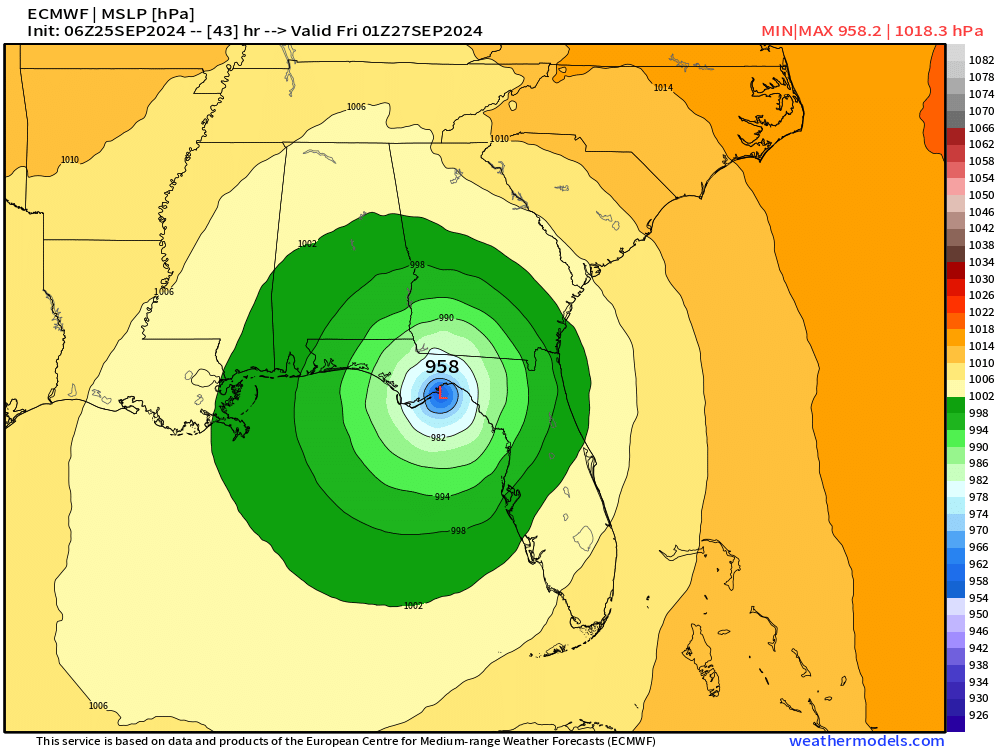
ECMWF landfall at 958 mb — Major Hurricane with enormous size
NHC 11 AM Advisory | Very Large Hurricane Helene
Helene is expected to move through/over an environment of relatively low shear, strong upper-level divergence, and SST of 29-31 degrees Celsius, all of which should foster additional strengthening.

Rapid Intensification (RI) indices indicate a high chance of RI during the next 24 hours, and as a result the NHC intensity forecast shows Helene becoming a major hurricane by Thursday morning.

There is still some uncertainty on exactly how strong Helene will get, and upward adjustments to the forecast intensity could be required in subsequent advisories if Helene rapidly intensifies more than forecast.
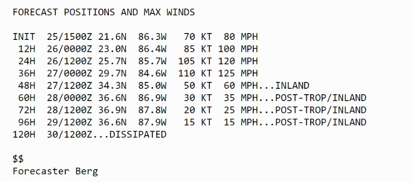
Update on intensity from NHC shows 105-knots in 24-hours — that’s from Cat 1 to almost Major in a very rapid intensification burst. I would take the over on this intensity forecast, unfortunately, based upon the guidance. NHC maximum is at 110-knots but expect this to increase to Category 4 or 5 by later this evening.
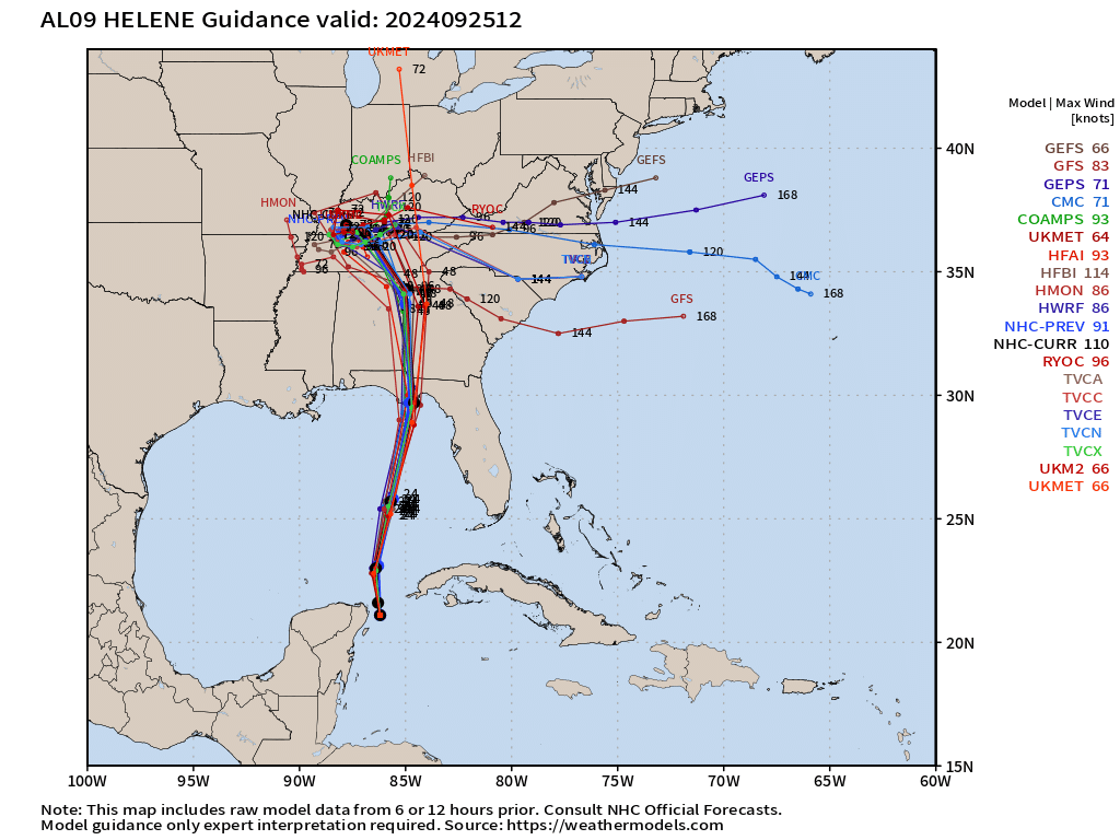
ATCF Track Spaghetti
Storm Surge Forecast
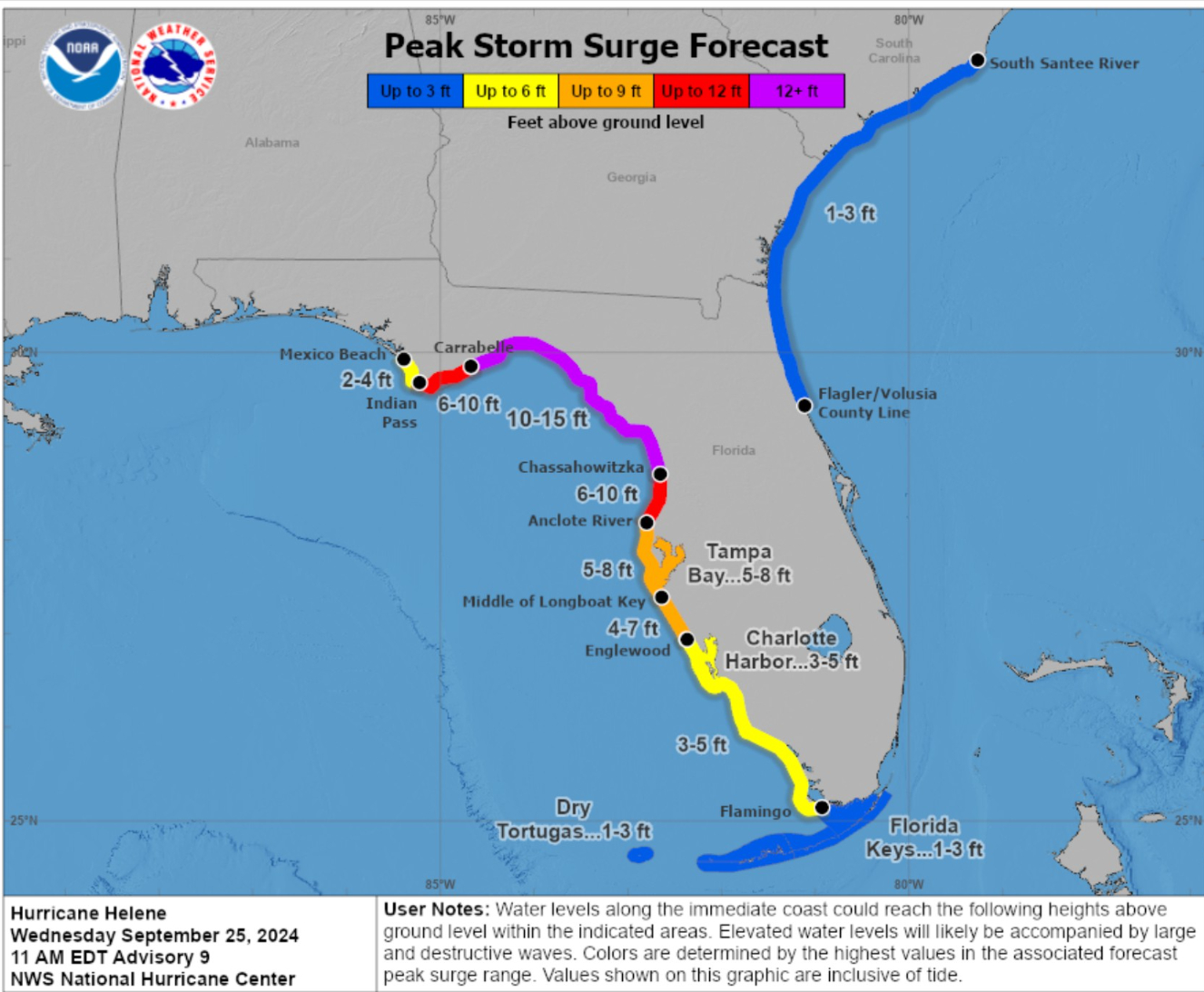
We’ll be closely watching these Peak Storm Surge Forecast numbers up the coast as the shape of the Big Bend will shoal/focus the water much higher than even indicated at 10-15 feet, if history is a guide.
RRFS-A Simulated Radar next 38-hours
Note that heavy rainfall will occur all across Georgia well prior to landfall as a stream of tropical moisture floods northward.
Inland Wind Threat
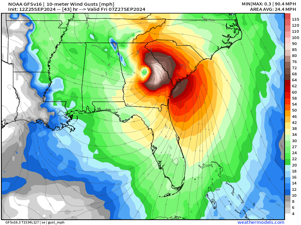
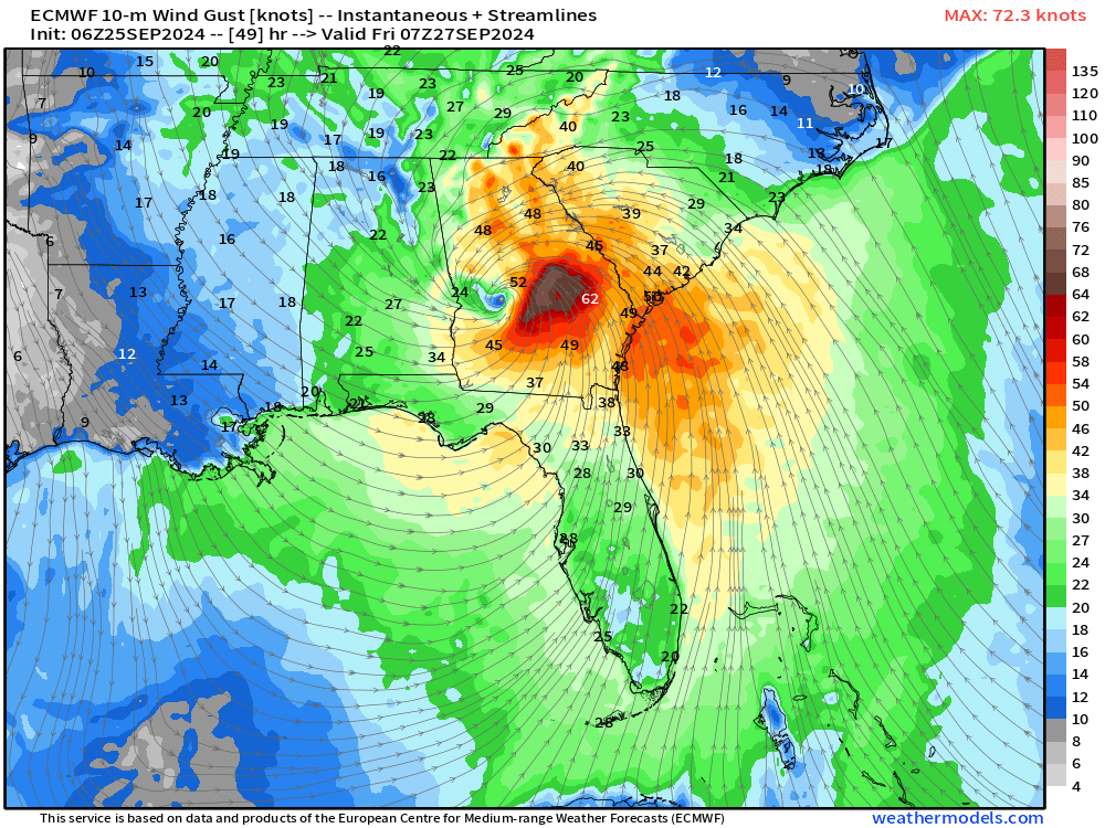
The global models tend to underestimate the maximum wind speed gusts of tropical systems past landfall. But I’m showing GFS and ECMWF to highlight the large coverage and inland penetration of hurricane force gusts. ECMWF has 72-mph maximum as the eye makes its way into central Georgia, while GFS is at 90 mph.
We’ll get better wind gust information once Helene moves within the HRRR domain.
Obvious extreme wind damage threat throughout Georgia with Atlanta metro under threat of hurricane force gusts.
Next 10-day Upper Level Pattern | North America
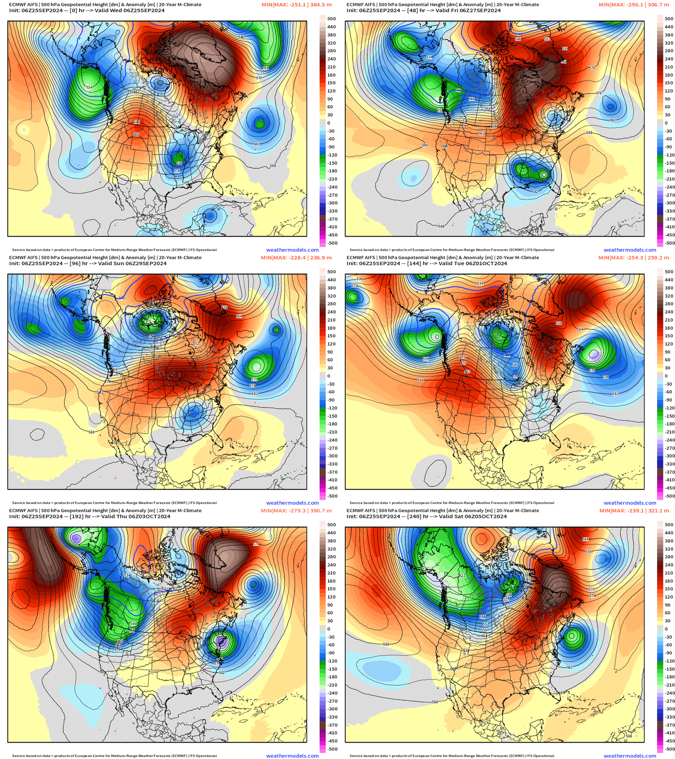
Helene merges with a cut-off low and trough that comes out of the Midwest into mid-Mississippi Valley. The remnants of Helene will be dragged westward (retrograde) likely adding to inland rain/flooding impacts across the Southeast into Tennessee.
NHC 7-day Outlook
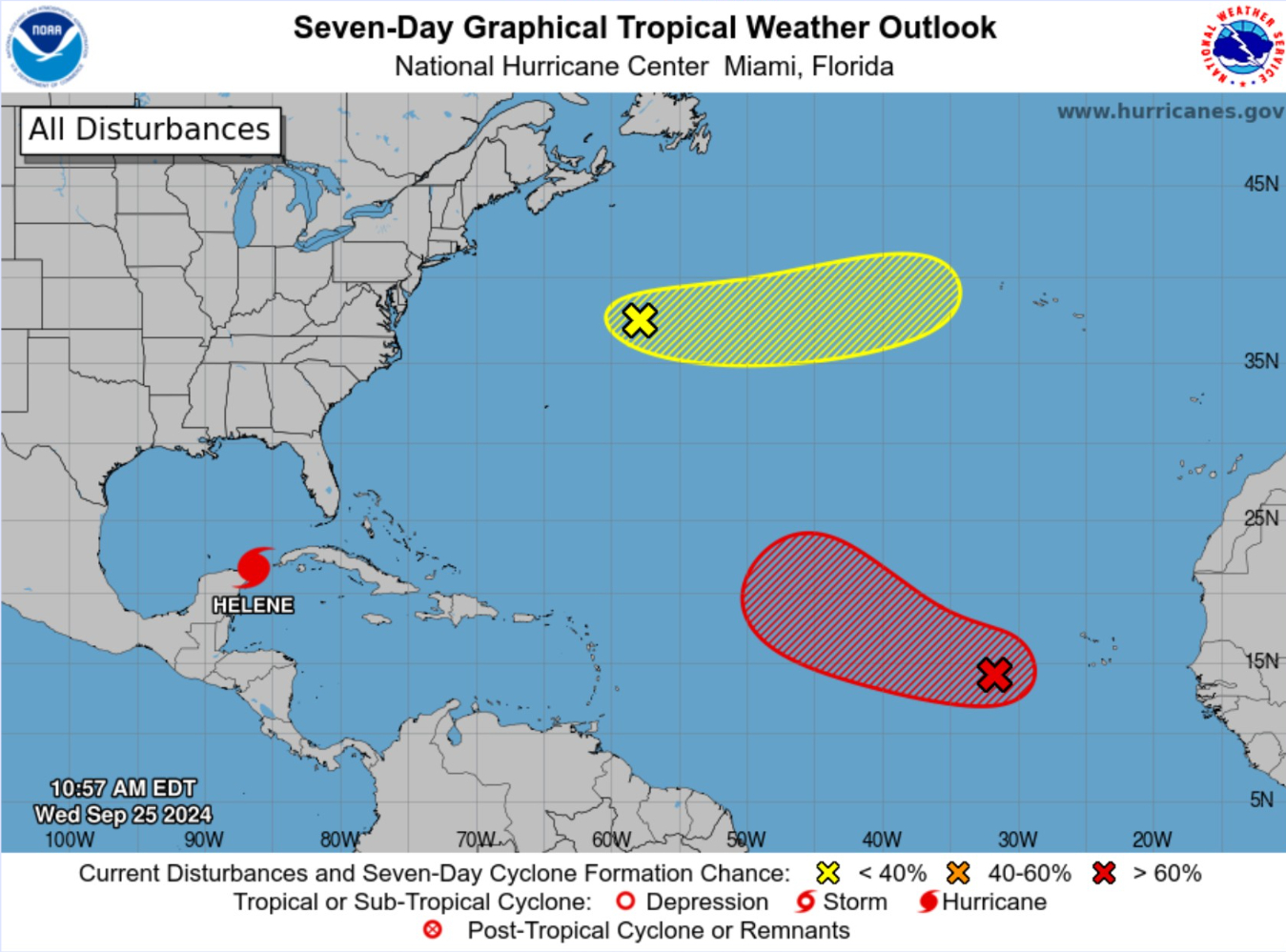
The next system will develop out in the open Atlantic in 4-6 days and become Isaac (10L) without affecting land.
Atlantic and Pacific Satellite
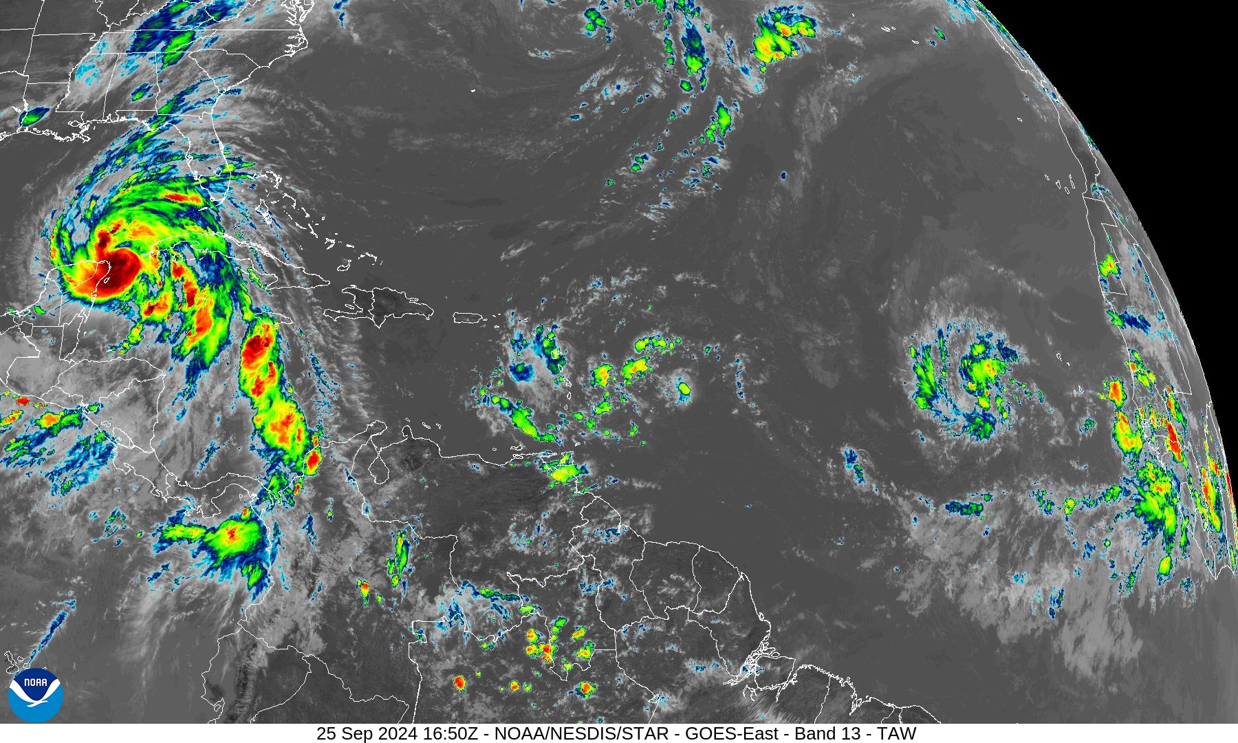
Cape Verde tropical wave showing signs of organization and a depression will likely form
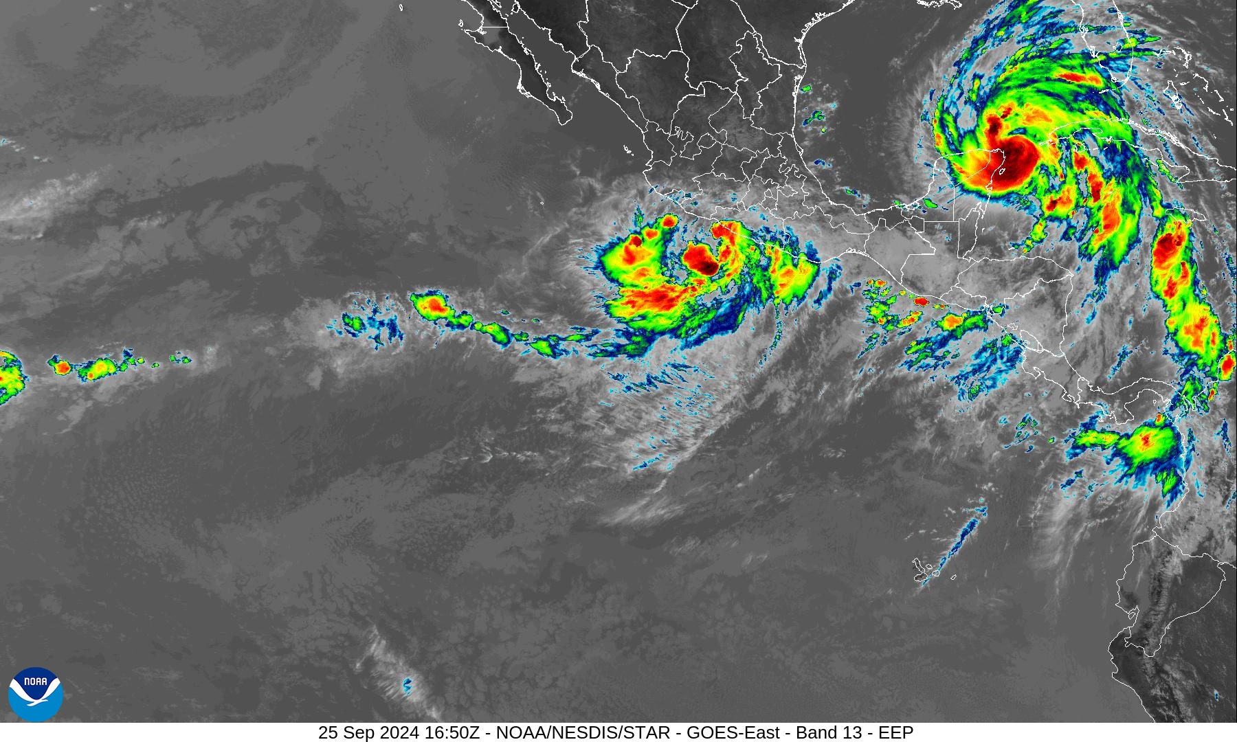
The remnants of John have combined with a new area of low pressure —> Kristy is on the way very soon w/landfall near where John came ashore yesterday.
ECMWF EPS Cyclone Tracks
Day 3.5: September 28
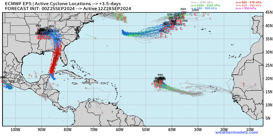
Isaac should be named by Friday.
Day 7: October 2
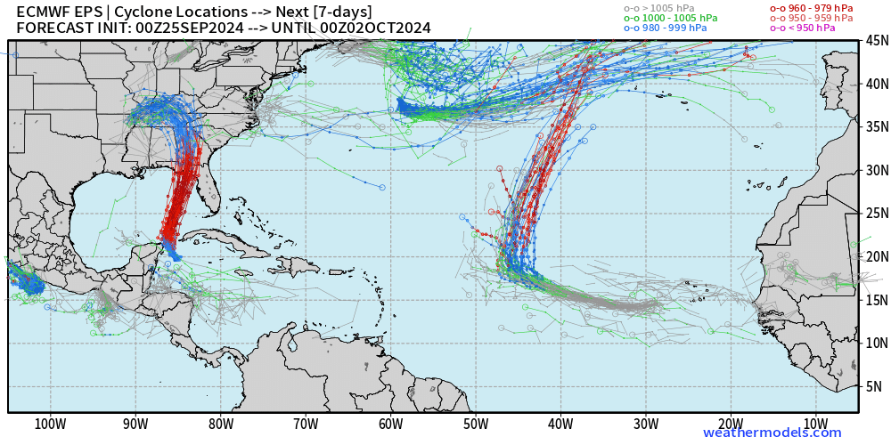
The next Cape Verde hurricane should safely turn north out-to-sea by the end of the month — named Isaac (10L)
Day 14 Active Tracks: October 9
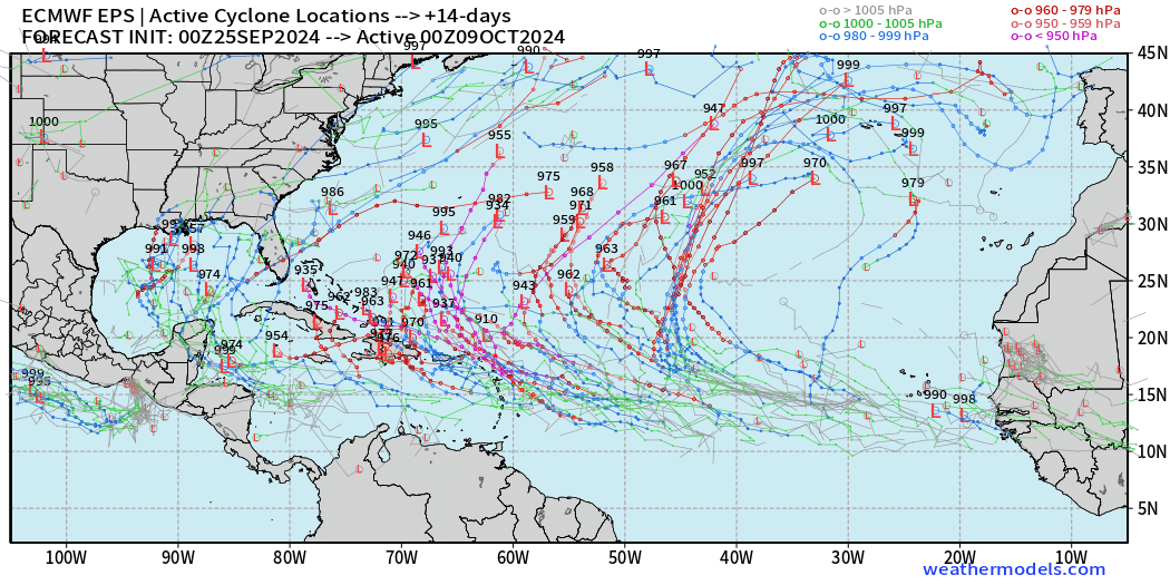
This looks like what was advertised as a hyperactive 2024 season — lit up basin from Gulf of Mexico (again) into a spot east of the Bahamas with exceptional intensity (910 mb) shown from members.
Total Rainfall next 7-Days | NOAA WPC
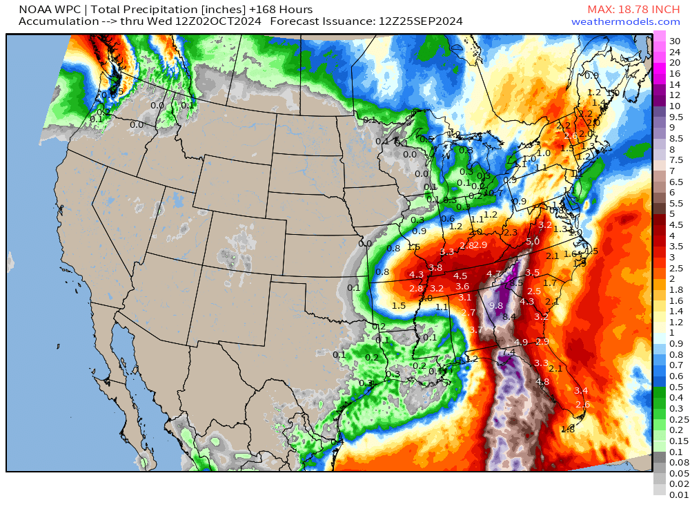
Enormous rainfall potential from Helene
Next 7-days: Florida + Georgia = 11 Trillion gallons. Add in 3T in Tennessee, 2T in Kentucky, and 4T in North and South Carolina each — more than 25 Trillion gallons on the way.
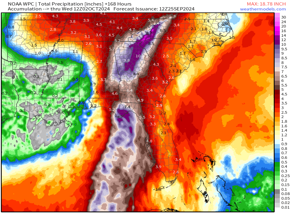
10-inches + across much of north Georgia. Yikes!
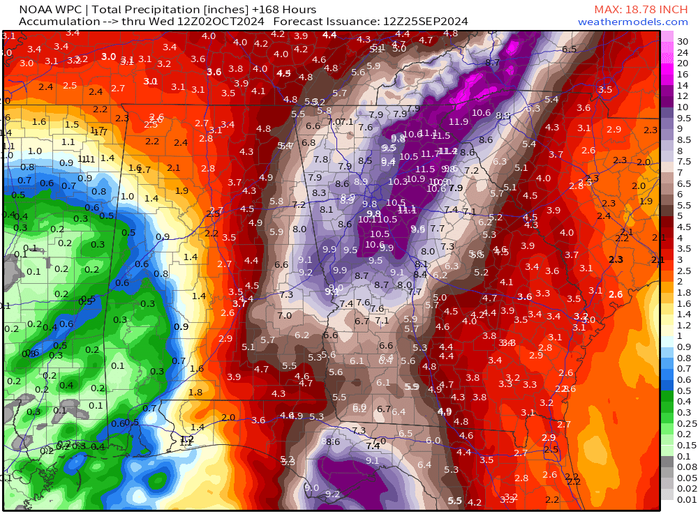
10 inches of rainfall into North Georgia and the mountains of NC/TN.
The combination of trough + Helene will mean extremely heavy rainfall for the Southeast U.S. and that’s not a problem for Georgia, which needs it desperately. We can do without the extreme winds.
Coming soon: Weather in My Backyard
Maps sourced from weathermodels.com designed and innovated by yours truly! I actually create all of my content from scratch.
- Milepost
- 398 · laid 2024-09-25T17:20:58.852000Z
- Source
- https://weather.substack.com/p/sept-25-2024-historic-hurricane-helene
- Digest
- 6c31246b21d54c035be8bfdb5a796f9addf9fb5b9e4f57aea529db13413c9aae
- Machine
- JSON