Sept 24, 2024 Tropical Storm Helene Forecast to Rapidly Intensify
Helene likely to landfall as a major hurricane along Florida panhandle coast
September 2024 was the 2nd-warmest September in the 131-year national record (1895–2025), at 68.6°F against a 1991–2020 normal of 66.0°F (+2.7°F).
September 2024 was the 44th-driest September in the 131-year national record (1895–2025), at 2.3in against a 1991–2020 normal of 2.6in (-0.3in).
NOAA/NCEI Climate at a Glance, contiguous United States. This is the observed record for the month, not a score of anything said in this piece — the forecast ledger begins 2026-08-17 and cannot reach earlier posts.

Major Hurricane Helene forecast to landfall Florida panhandle coast on Thursday
Mesoscale Model Solutions are with Category 5 pressures, insane
Inland wind and flooding threat into Georgia and South Carolina into Friday potentially affecting Atlanta
Atlantic tropics remain active for the next 2-weeks into early October.
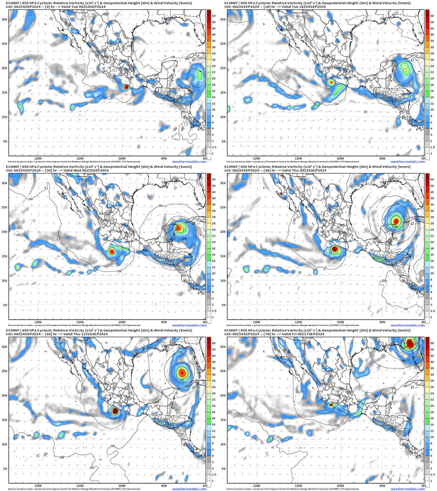
Hurricane John comes back around
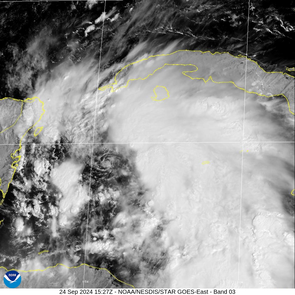
The low-level circulation of Helene is exposed to the southwest as wind shear continues to hold back the development process. However, that heavy band of convection isn’t going away.
NHC 11 AM Advisory | Very Large Helene
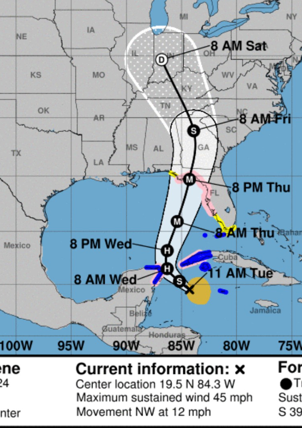
Helene's forecast radii are at the 90th percentile of hurricane size at similar latitudes. Due to the forecast large size of this system, storm surge, wind, and rainfall impacts will extend well away from the center, particularly on the east side. In addition, the fast forward speed while it crosses the coast will likely result in farther inland penetration of strong winds over parts of the southeastern United States after landfall.
The (near) landfall intensity is still Major (M) at 100-knots but could be higher, unfortunately into the Florida Gulf Coast just south of Tallahassee into Wakulla County. Storm surge along the west coast of Florida into the Big Bend will be unbelievable and damaging a la Dennis (2004).
Interesting that the track forecast is west of the 06z models including GFS and DWD ICON favoring more so the ECMWF 06z. I would not be surprised to see an eastward shift in the guidance, but the lack of low-level circulation until recently (or perhaps it is gone again) means we can’t solidify the track quite yet.
NHC Intensity Discussion
Update on intensity from NHC shows 100-knots in 48-hours — that’s from TS to Major in very rapid intensification burst. I would take the over on this intensity forecast, unfortunately, based upon the guidance.
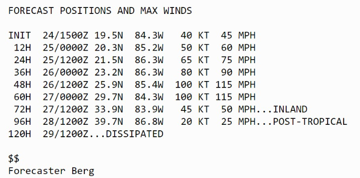
We STILL need to be aware of a slight deviation of track to the east bringing hurricane force winds and damaging storm surge into Tampa Bay. Helene will be VERY large.
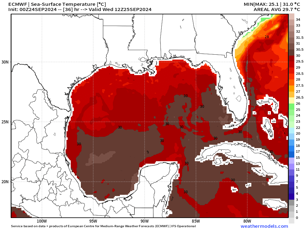
Ocean Heat Content and SST
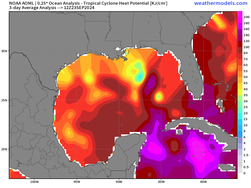
The oceanic heat reservoir is still available although a cold-eddy has emerged into the path of Helene. However, that is only relative to the enormous heat content around it, which should not inhibit the rapid intensification especially with upper-layer mixing.
SSTs are 29.5-30°C and plenty sufficient for 170-knot maximum potential intensity.
ATCF Track Spaghetti
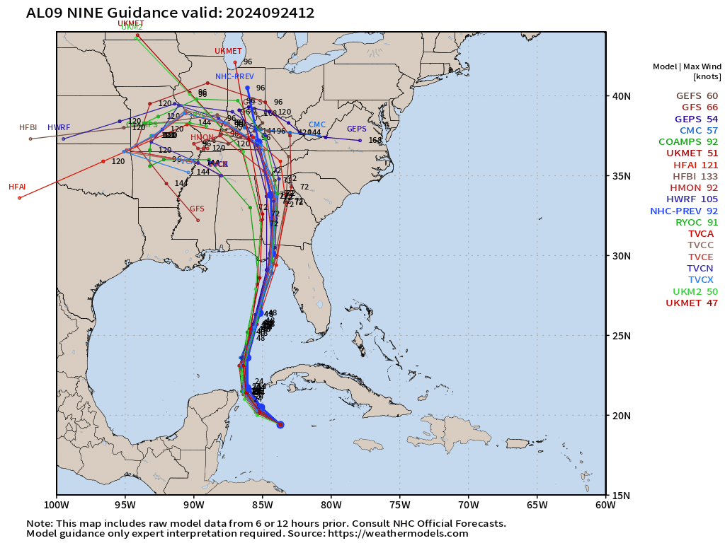
I’m a bit confused why the ATCF tracker shows GFS west of where my maps have the landfall. Perhaps is a storm tracker difference that I’m not aware of within the ATCF code. Nevertheless, I think there’s room for an eastward adjustment to the track.
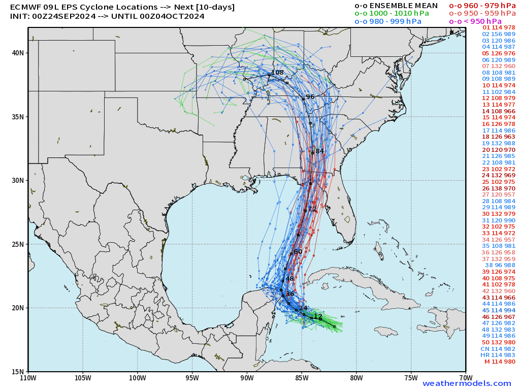
EPS ensemble tracks | 00z
Perhaps NHC’s consensus highly weights the EPS ensemble mean, which lies very close to the NHC track. Strong / deeper lows are to the east of the mean.
Storm Surge Forecast
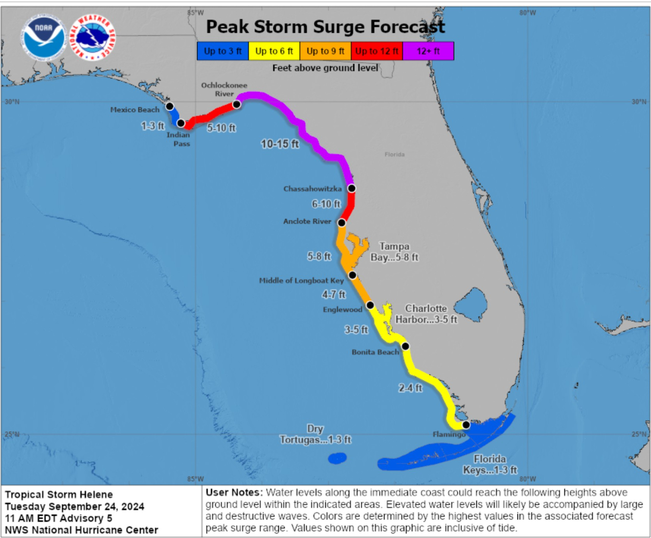
We’ll be closely watching these Peak Storm Surge Forecast numbers up the coast as the shape of the Big Bend will shoal/focus the water much higher than even indicated at 10-15 feet, if history is a guide.
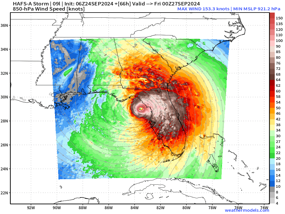
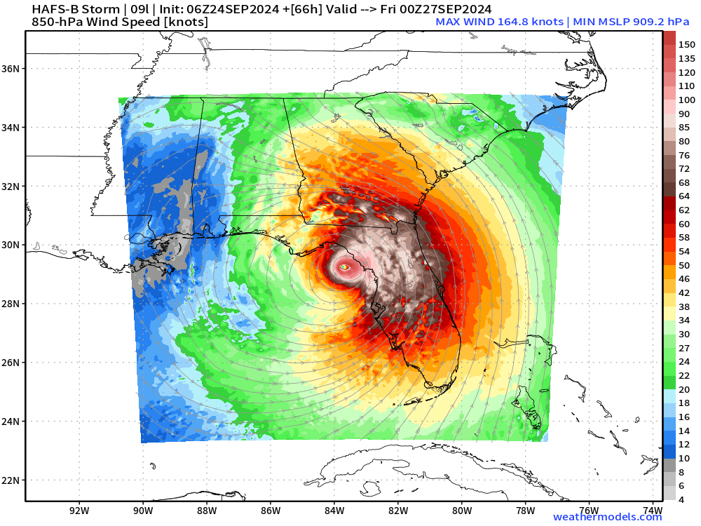
HAFS Extreme Solutions
HAFS A and B are still going bonkers Category 5 solution.
I am still alarmed by these outcomes, but they lie outside the NHC intensity forecast. That doesn’t mean they are per se wrong, just not the favored scenario especially with the large size of Helene and the so-far unsettled inner-core.
I would discount these for now if you see them on social media.
Inland Wind Threat
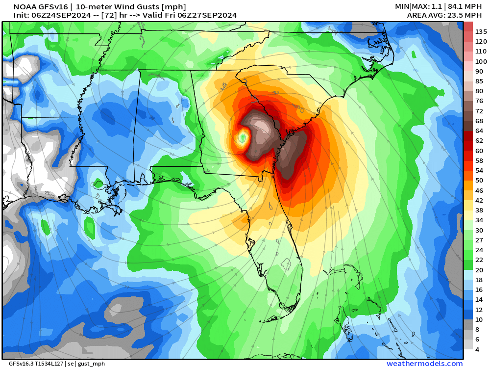
Wind gusts 60-90 mph could reach well into central Georgia and South Carolina on Friday. A wobble to the west could devastate Atlanta. I do not want that.
Next 10-day Upper Level Pattern | North America
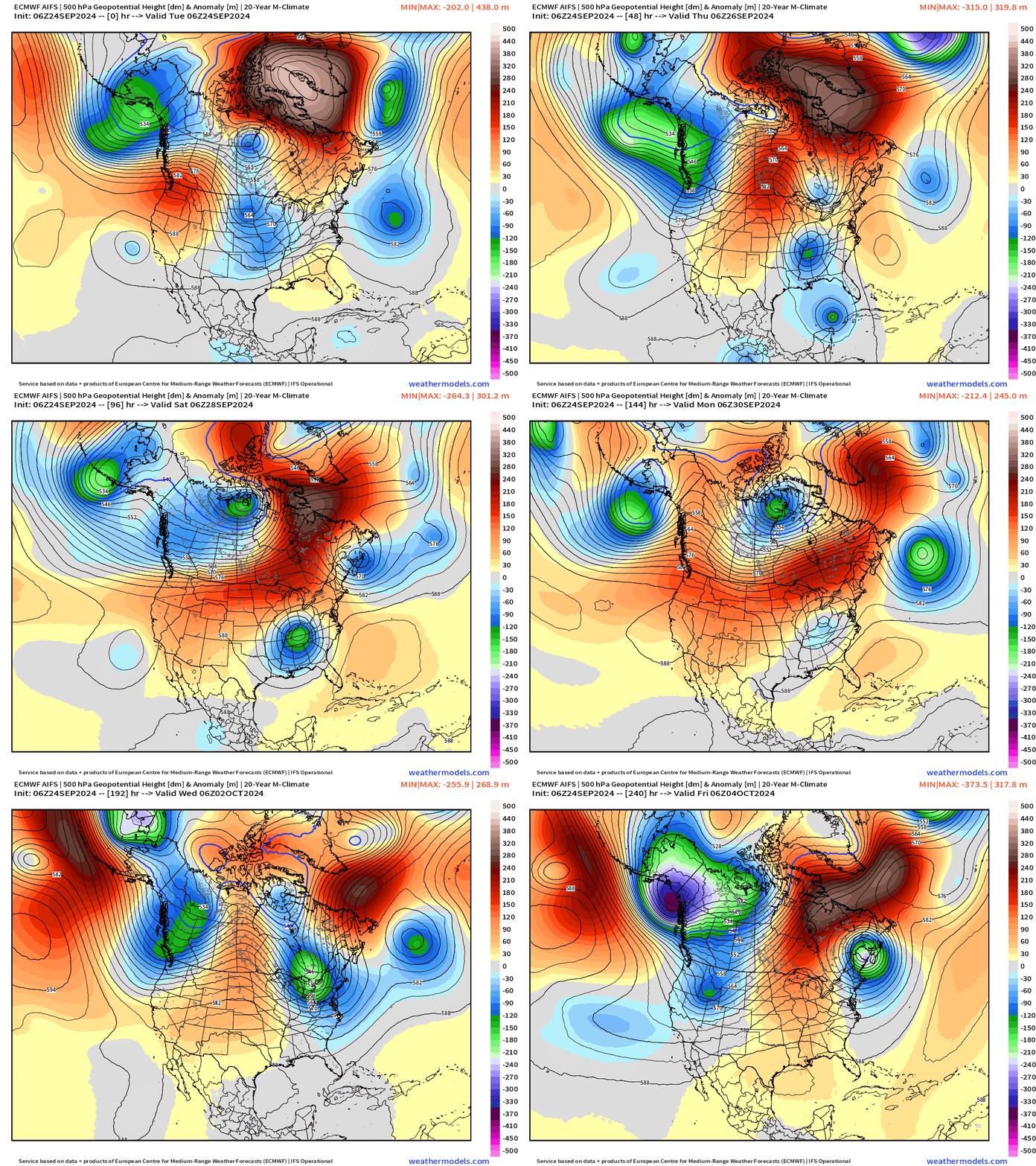
Helene merges with a cut-off low and trough that comes out of the Midwest into mid-Mississippi Valley. The remnants of Helene will be dragged westward (retrograde) likely adding to inland rain/flooding impacts across the Southeast into Tennessee.
NHC 7-day Outlook
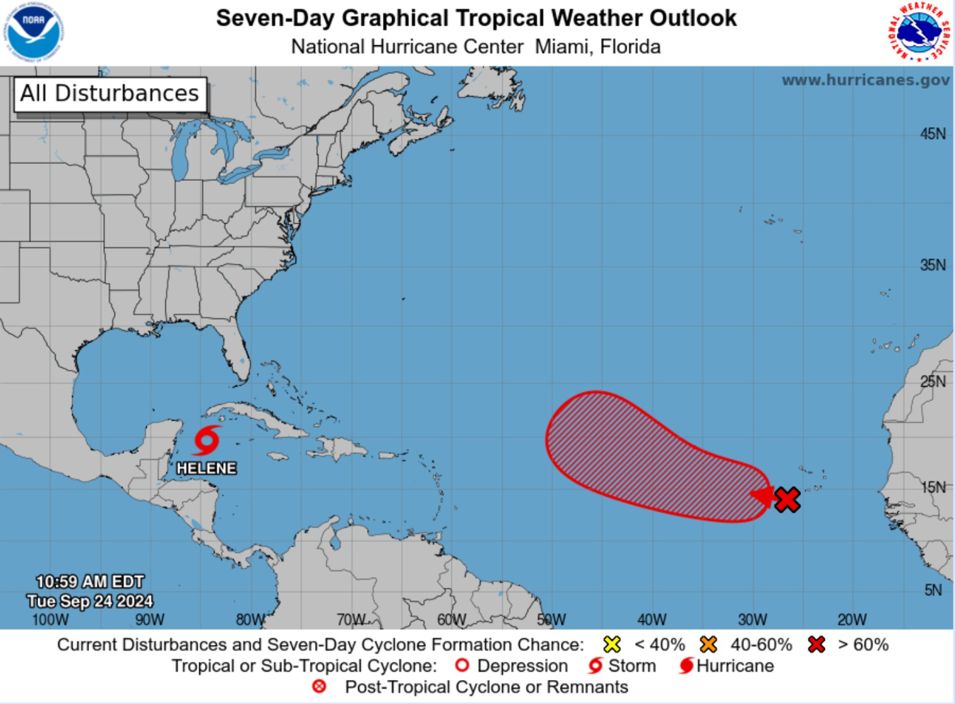
The next system will develop out in the open Atlantic in 4-6 days and become Isaac (10L) without affecting land.
Atlantic Satellite
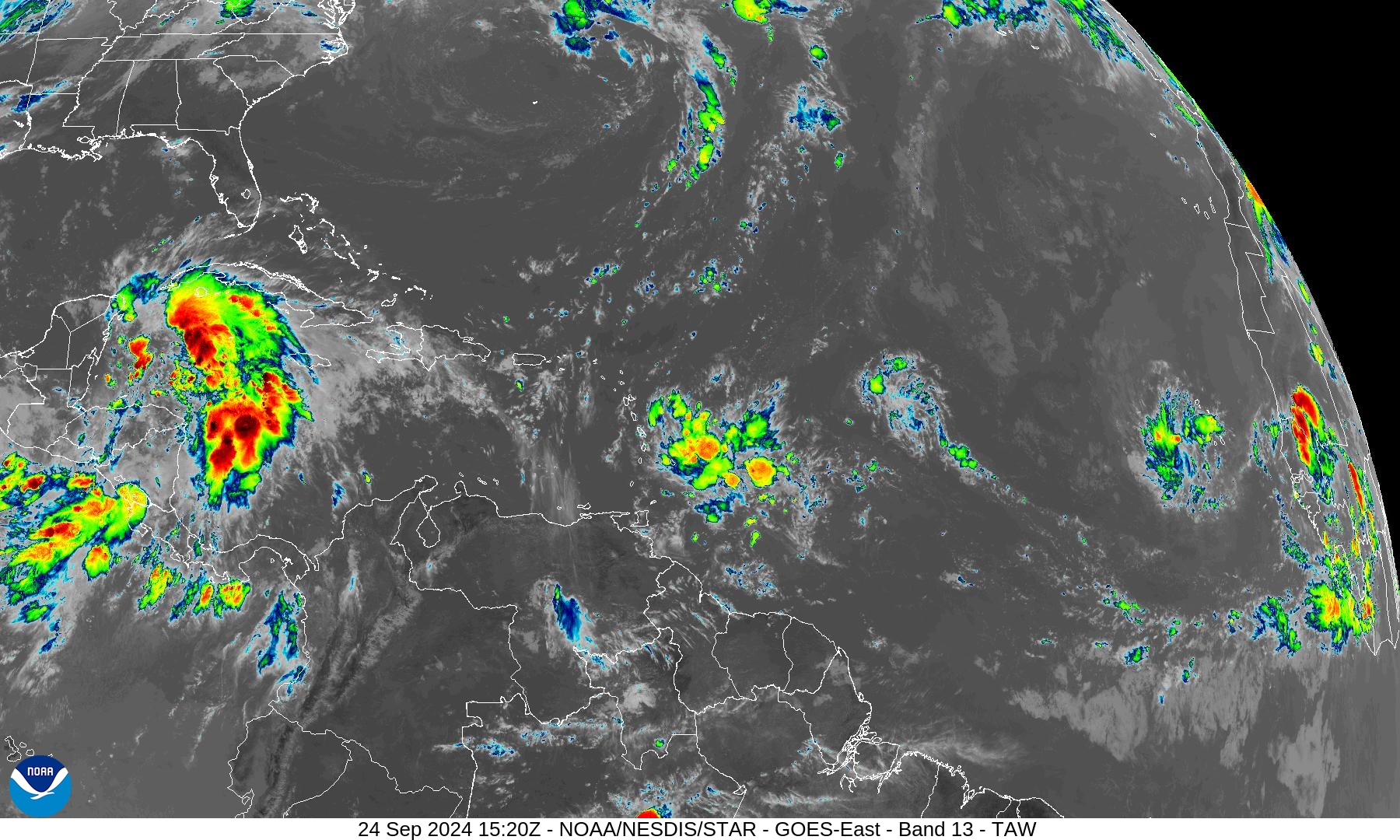
Convection within upper-level wind shear continues in the Western Caribbean. Still waiting for the far tropical Atlantic see convection organize into the next system.
ECMWF EPS Cyclone Tracks
Day 3.75: September 27
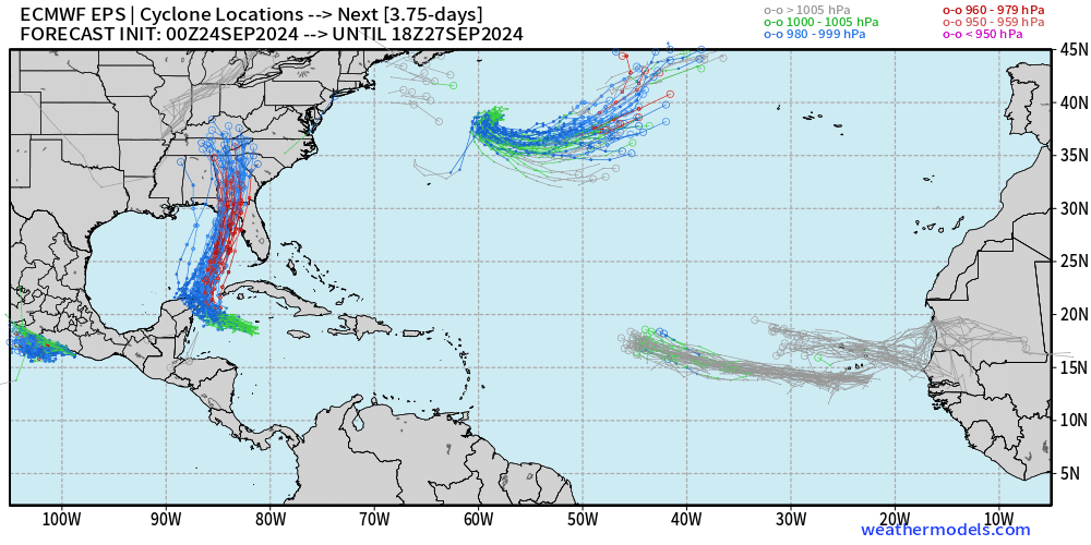
Helene is well depicted. 2 waves at much weaker intensity are heading WNW into the central tropical Atlantic.
Day 7: October 1
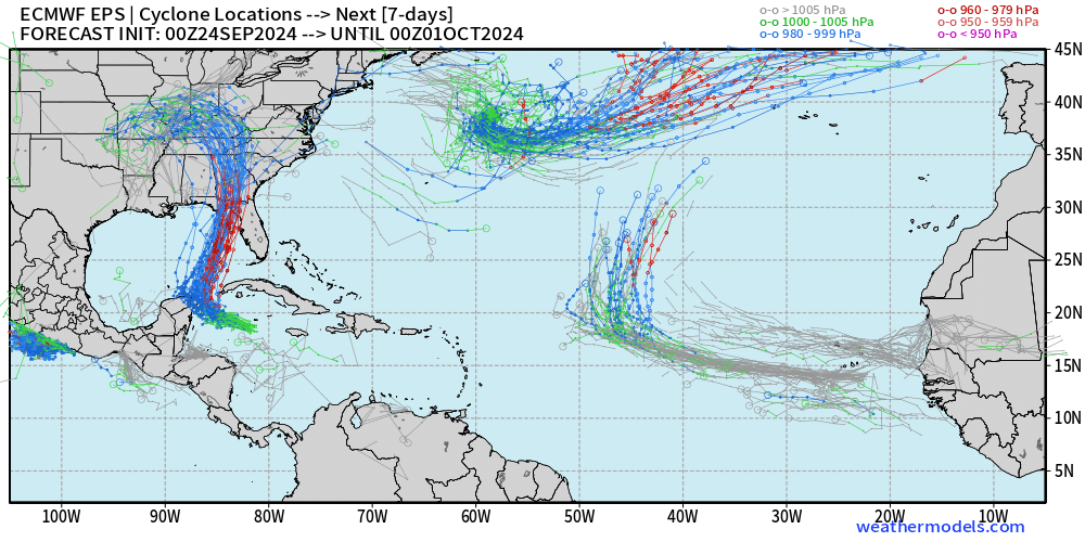
The next Cape Verde hurricane should safely turn north out-to-sea by the end of the month — named Isaac (10L)
Day 15 Active Tracks: October 9
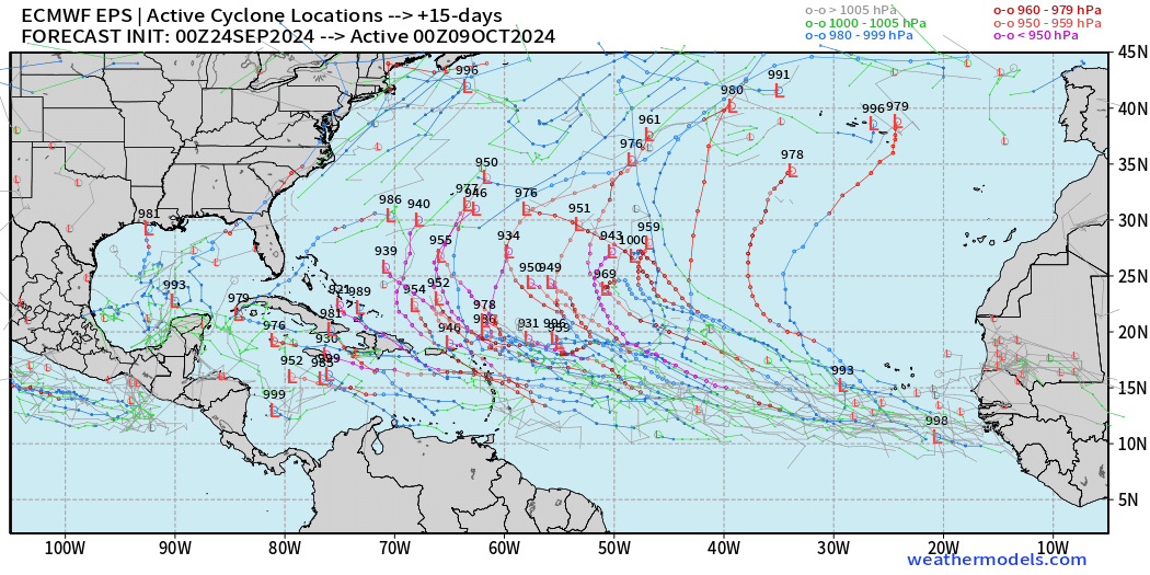
Another system could become a major hurricane after Isaac with the Atlantic lit up w/activity. This looks like what was advertised as a hyperactive 2024 season
Total Rainfall next 7-Days | NOAA WPC
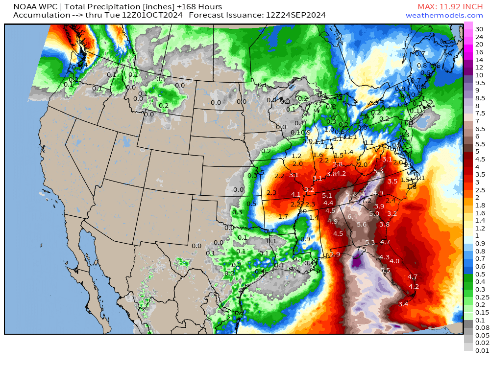
6-8 inches of rainfall into North Georgia and the mountains of NC/TN.
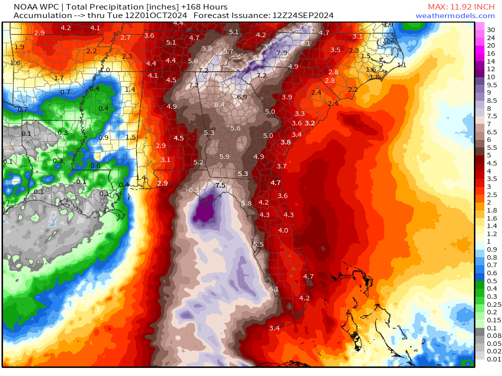
The combination of trough + Helene will mean extremely heavy rainfall for the Southeast U.S. and that’s not a problem for Georgia, which needs it desperately. We can do without the extreme winds.
ECMWF 10-Days IVT
Atlantic is quite complicated for the next 7-10 days into early October.
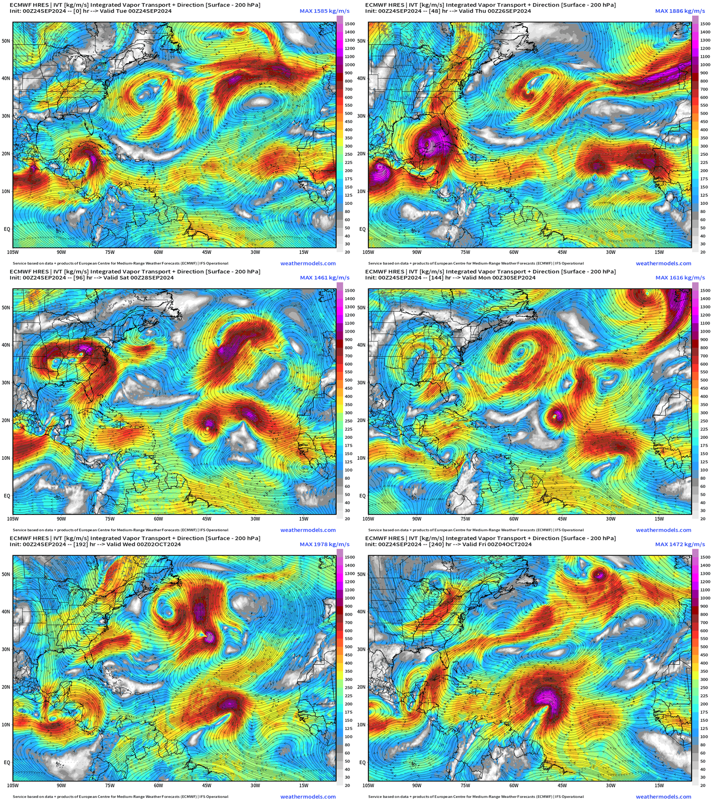
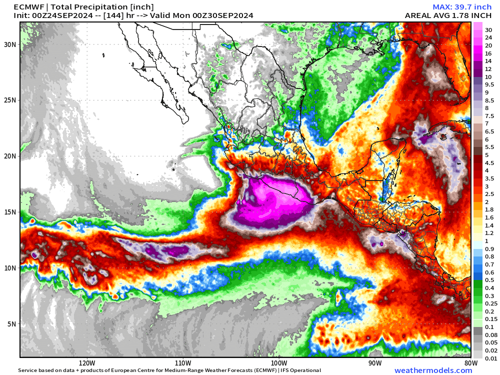
Interesting to see John come around for another pass at the coast of Mexico again as a hurricane, perhaps major.
Total rainfall up to 40-inches along the coastline with the extended impacts of John.
Coming soon: Weather in My Backyard
Maps sourced from weathermodels.com designed and innovated by yours truly! I actually create all of my content from scratch.
- Milepost
- 397 · laid 2024-09-24T15:48:27.235000Z
- Source
- https://weather.substack.com/p/sept-24-2024-tropical-storm-helene
- Digest
- e5ae41de62ba8fd972c1937e6a70756de10e90ebde122d8a625d6640868e91d3
- Machine
- JSON