August 11, 2024 Sunday Tropical Update
Sprawling Invest 98L nearing tropical depression status in next 36-48 hours
August 2024 was the 16th-warmest August in the 132-year national record (1895–2026), at 74.0°F against a 1991–2020 normal of 73.1°F (+1.0°F).
August 2024 was the 44th-driest August in the 132-year national record (1895–2026), at 2.5in against a 1991–2020 normal of 2.7in (-0.2in).
NOAA/NCEI Climate at a Glance, contiguous United States. This is the observed record for the month, not a score of anything said in this piece — the forecast ledger begins 2026-08-17 and cannot reach earlier posts.

Headline for Sunday
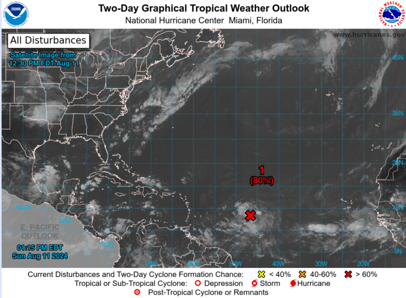
Invest 98L continues to slowly organize 1,000 miles east of the Lesser Antilles.
NHC chance at development into a tropical depression or storms is 80% in next 48-hours and 90% in next 7-days.
When 98L becomes Ernesto (05L) determines the impacts to populated areas of the Lesser and Great Antilles including Puerto Rico in 3-days.
Ernesto will then turn north to potentially threaten Bermuda late this coming week.
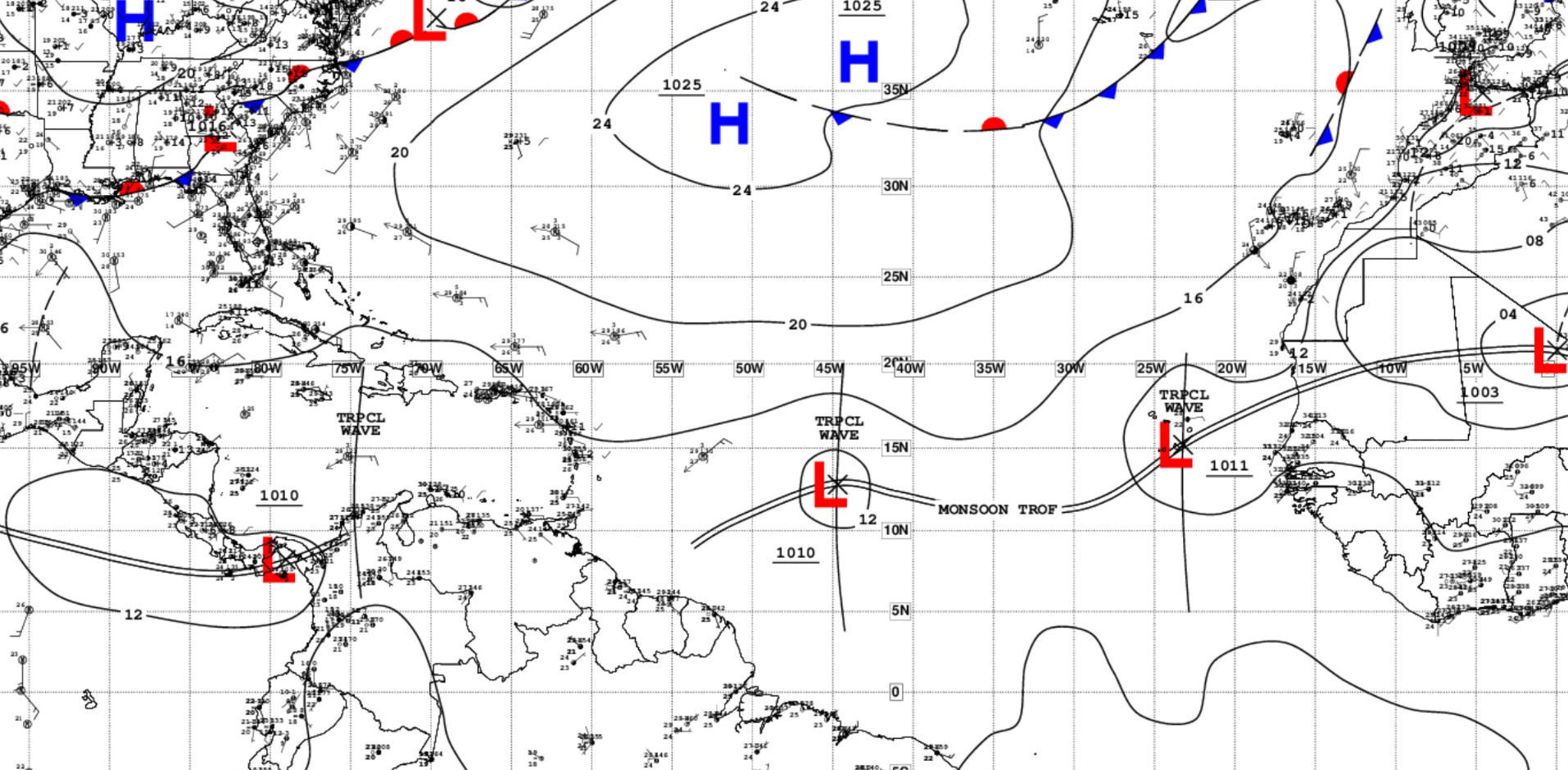
...TROPICAL WAVES... [NHC Surface Analysis 12z] in addition to Invest 98L [1010 mb]

An eastern Atlantic tropical wave is near 23W from 21N southward
through a broad 1011 mb low over the Cabo Verde Islands. It is
moving west around 5 kt. Scattered moderate convection is seen
from 08N to 12N between the Guinea-Sierra Leone coast and 24W.

A central Caribbean tropical wave is near 75W from near the
Windward Passage southward into northern Colombia, and moving west
around 10 kt. Widely scattered moderate convection is present
south of Jamaica and Hispaniola from 14N to 17N between 68W and
80W.
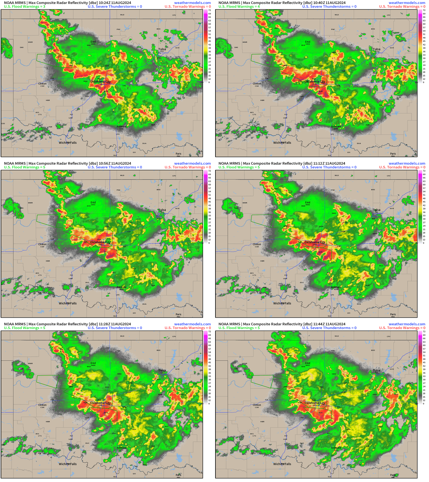
Oklahoma City Rainfall | 7th Wettest Day on Record (1890-2024)
Over 6.5” of rain fell in OKC and across central OK from a slow-moving complex of thunderstorms that fed off a pool of high precipitable water air stuck over the southern Plains. Radar from 6:45 AM CT showed the training effect of the highly electric storms that led to flooding.
Atlantic IR Satellite | 3:50 PM ET
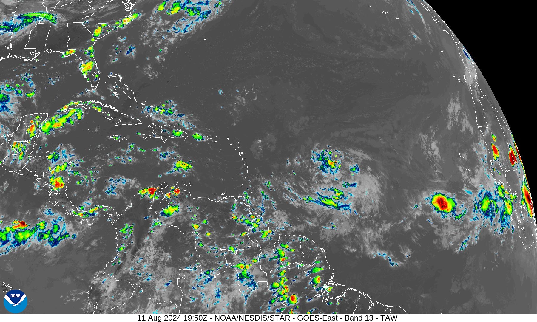
Invest 98L has some thunderstorm activity but it’s sparse. The environment is rather dry with the African dust layers continuing to parade through the Atlantic tropics.
Invest 98L Model Spaghetti
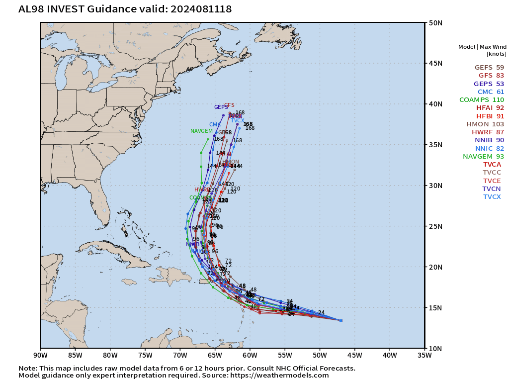
The 12z models are complete with all guidance showing the same scenario of eventual WNW to NW motion through the northern Leeward Islands to Puerto Rico in next 48-72 hours, and then a right turn to the north threatening Bermuda in 5-6 days.
ECMWF HRES 12z
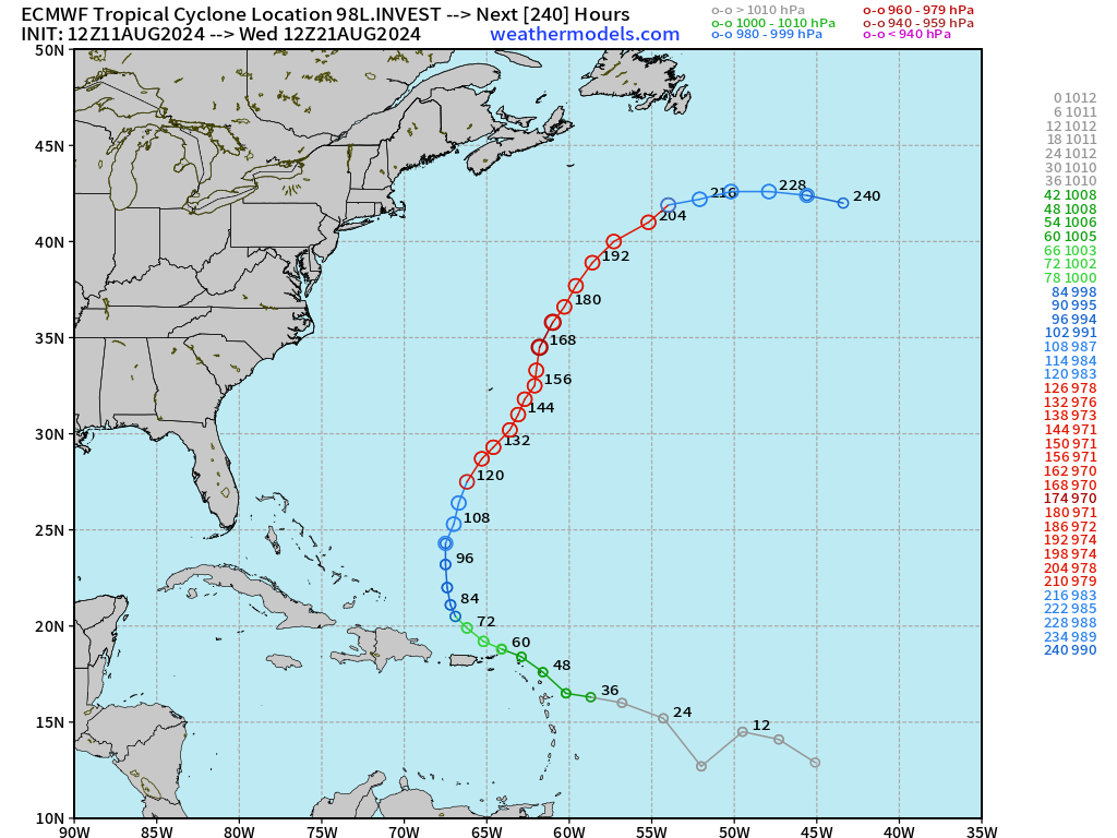
The track of Hurricane Ernesto goes to the east of Bermuda with HRES 12z. However, it will be a very large major hurricane so a slight deviation to the west would put the island under worse impacts.
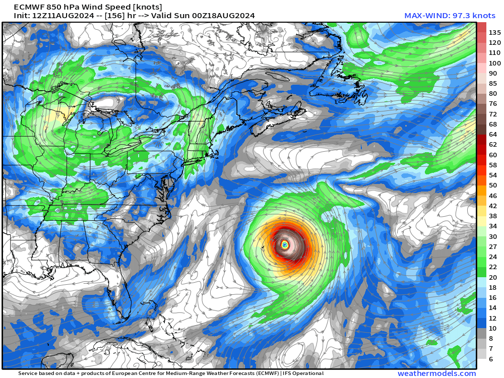
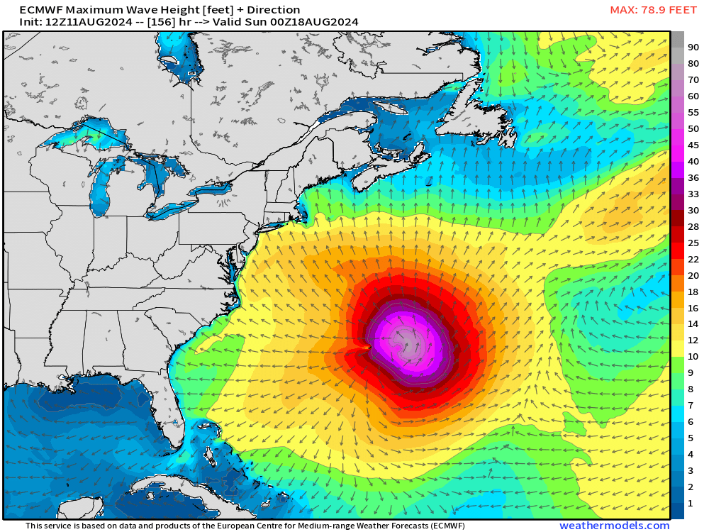
The East Coast of the U.S. will see large swell and waves, of course.
Maximum Wave Height late Saturday
Highs on Monday
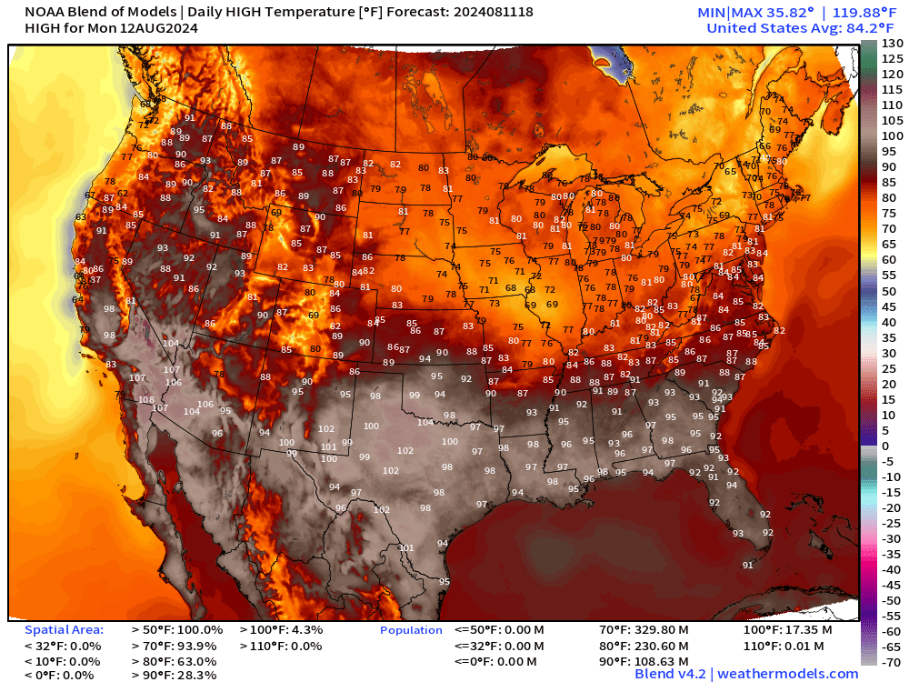
Lowe 48 average high temperature 84°F with 108 Million at/above 90°F
Weather on Monday
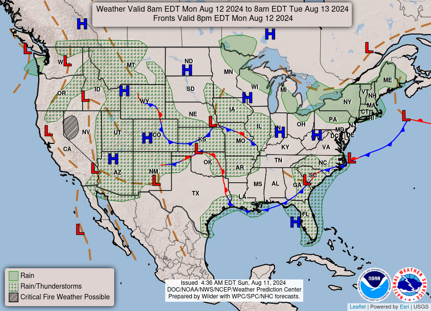
Frontal positions at 8 pm Monday show several boundaries with scattered showers and storms typical of mid-August. Hopefully you get a free drink for your garden or lawn.
Total Rainfall next 36-hours
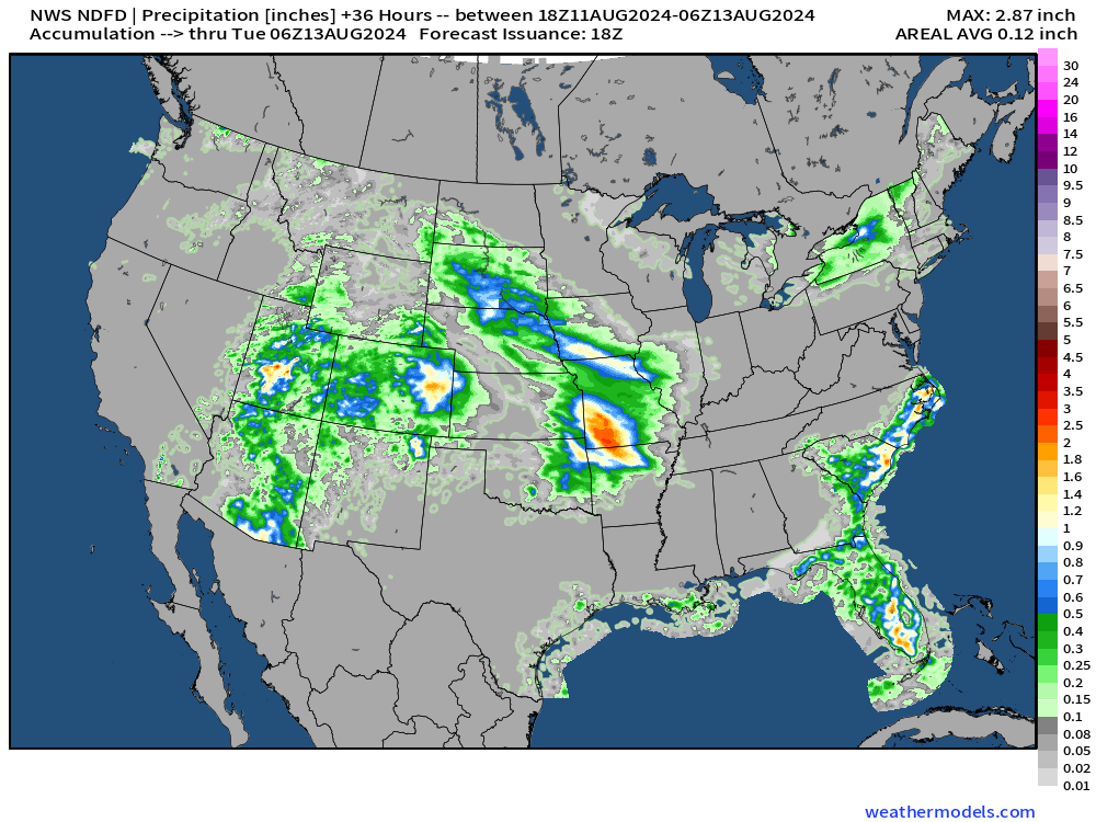
Heaviest rain through late Monday looks to be in southern Missouri and over Utah and Colorado.
HRRR 18z Accumulated Precipitation | Next 48-hours
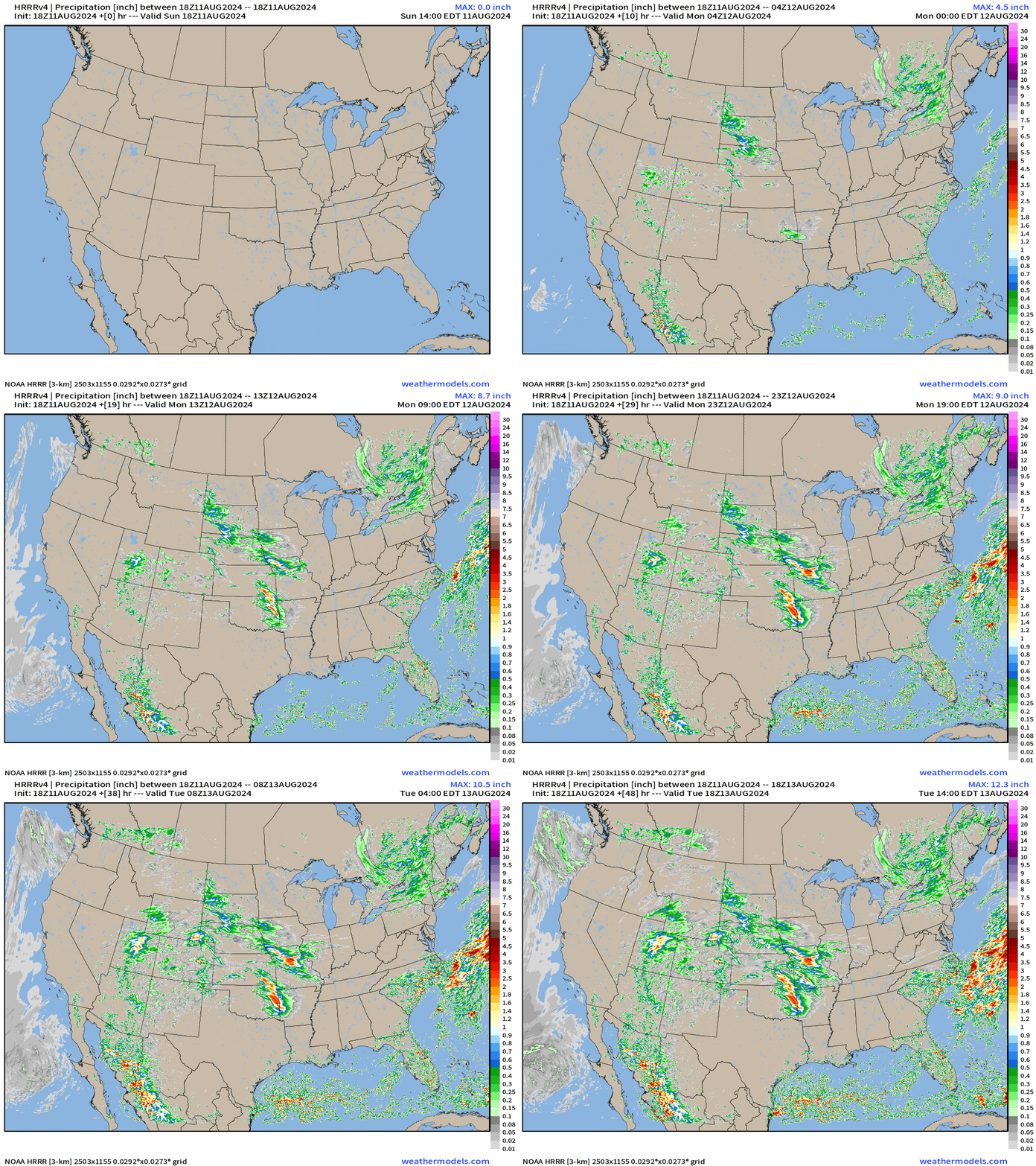
A bit different look at the accumulation of rain from HRRR through next 48-hours with the tracks of storms/complexes leaving a footprint behind.
Ensembles 12z | Tropical Storm and Hurricane Tracks
Note: these are trajectories from 51 different solutions of a weather model. Of course there will not be dozens of hurricanes all at once, but think of these like spaghetti.
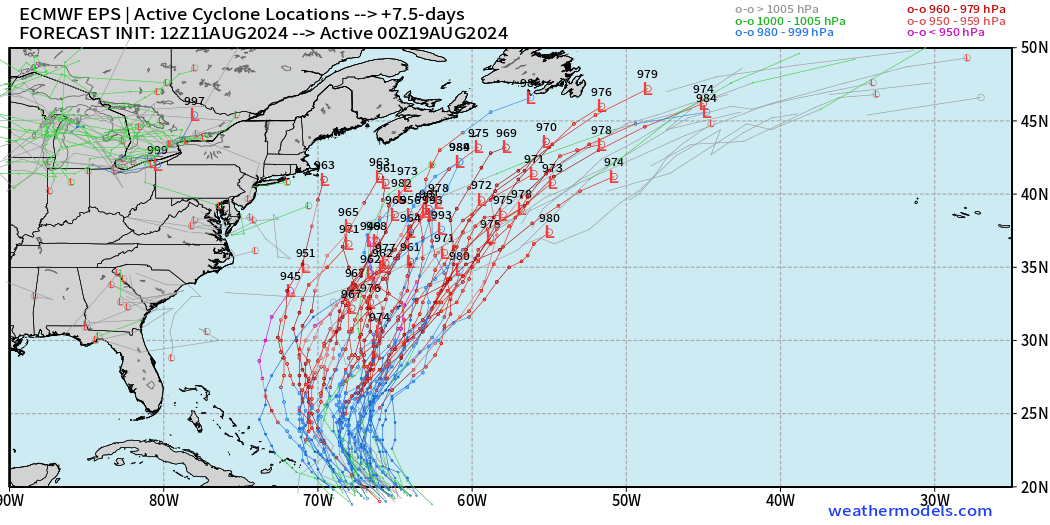
Active Cyclone Locations at Day 7.5 (late Sunday)
We will need to watch the western edge of the ensemble envelope for members that could brush Cape Cod and head into Nova Scotia. However, those solutions are few < 5%.
Same forecast: the best solution / option remains —> development in the NE Caribbean or N/NE of Puerto Rico of a major hurricane that recurves into the open Atlantic.
Thank you to Subscribers and Supporters!
Maps sourced from weathermodels.com designed and innovated by yours truly! I actually create all of my content from scratch.
- Milepost
- 366 · laid 2024-08-11T20:25:56.649000Z
- Source
- https://weather.substack.com/p/august-11-2024-sunday-tropical-update
- Digest
- 88b0c50e4178084ea06e5749745494fe975e0b86db3644efcca8ff4d4149aeb4
- Machine
- JSON