August 5, 2024 Monday Tropical Update Hurricane Debby Deluge
Boatloads of rainfall all week for the Southeast US from meandering Debby
August 2024 was the 16th-warmest August in the 132-year national record (1895–2026), at 74.0°F against a 1991–2020 normal of 73.1°F (+1.0°F).
August 2024 was the 44th-driest August in the 132-year national record (1895–2026), at 2.5in against a 1991–2020 normal of 2.7in (-0.2in).
NOAA/NCEI Climate at a Glance, contiguous United States. This is the observed record for the month, not a score of anything said in this piece — the forecast ledger begins 2026-08-17 and cannot reach earlier posts.

Headline for Monday afternoon
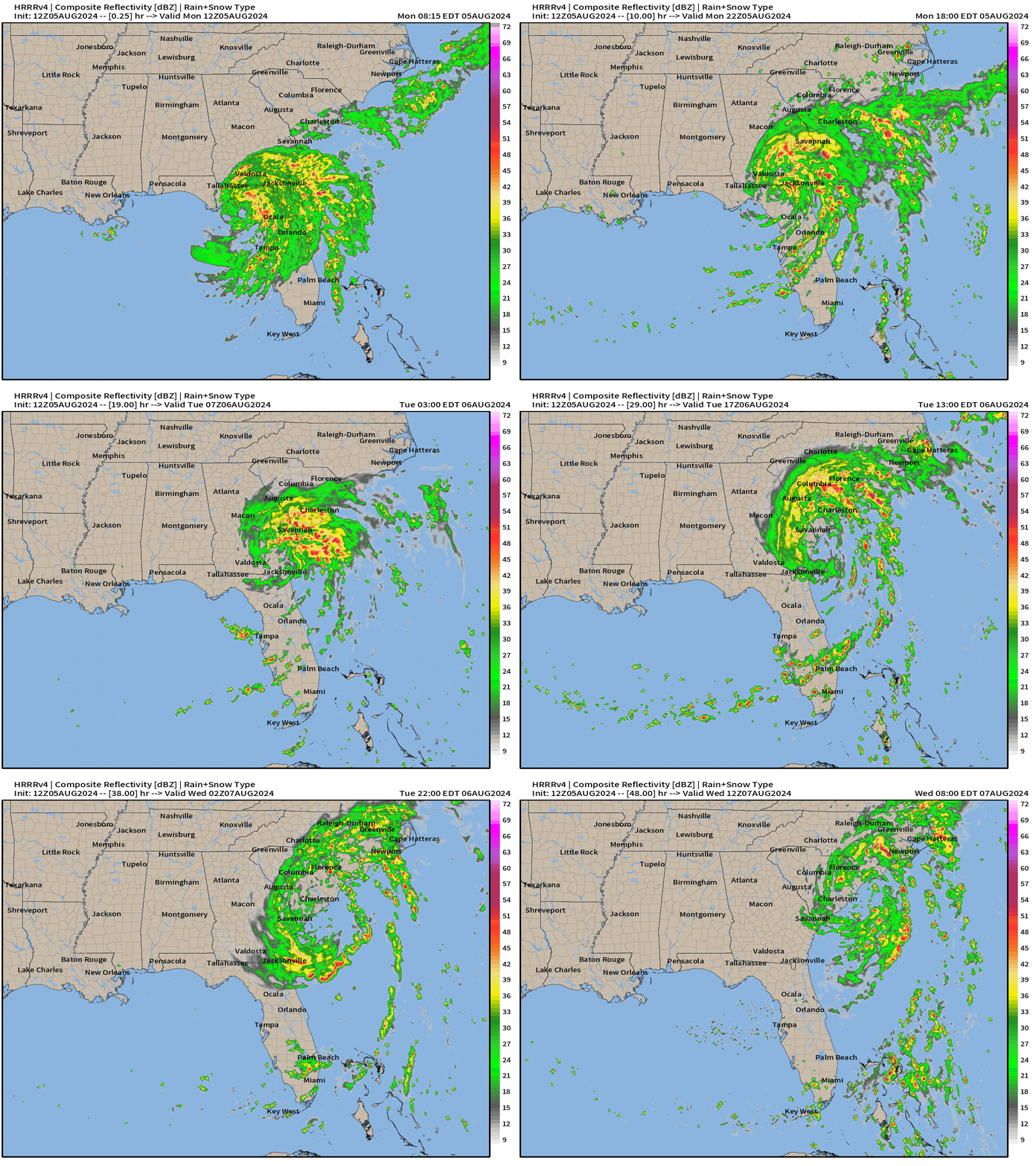
Category 1 Hurricane Debby made landfall earlier this morning around 7 AM ET in the same counties as Idalia missing Tallahassee to the east. Debby is slowing making its way through north Florida along Interstate 10 eventually into SE Georgia.
Thankfully Debby ran out of real estate over the warm waters of the Gulf of Mexico otherwise it would have had no trouble becoming a major hurricane.
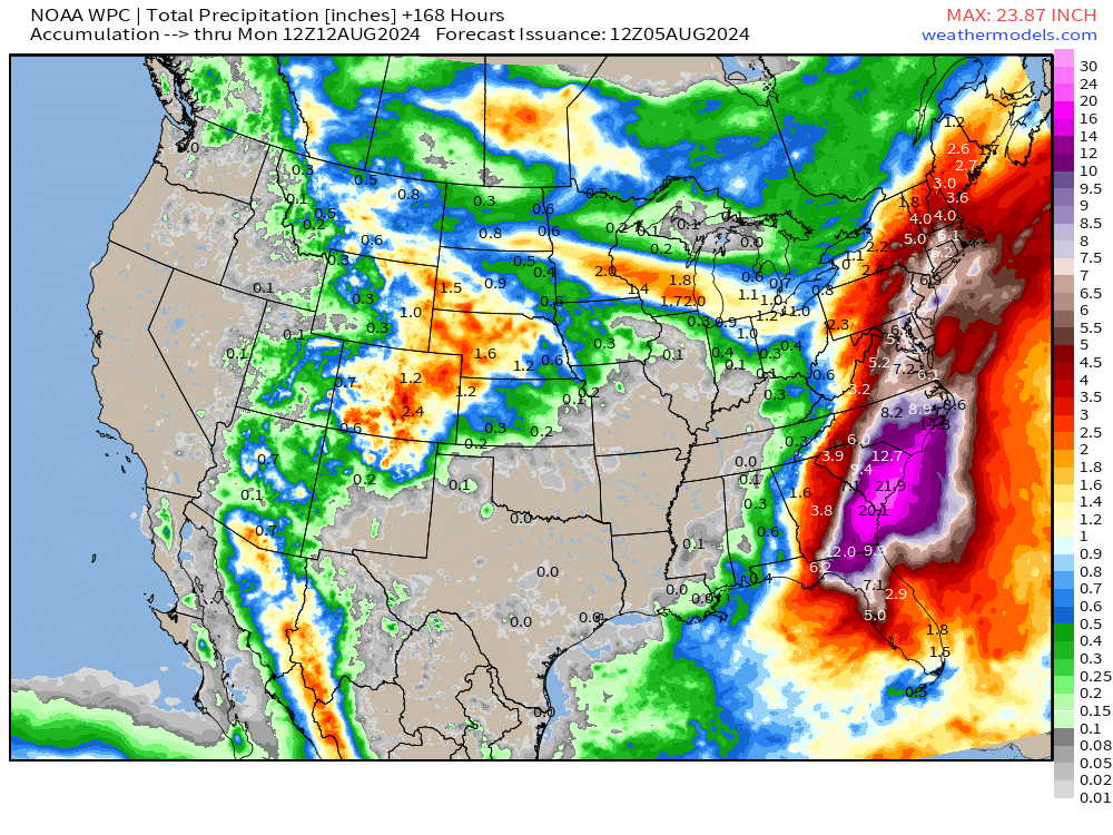
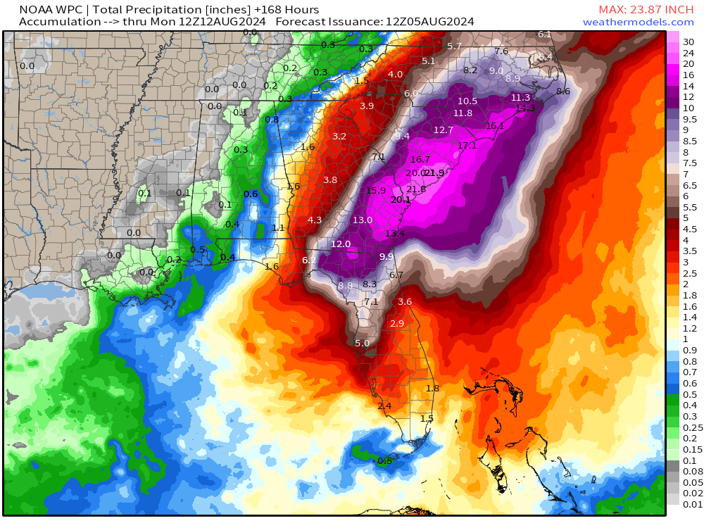
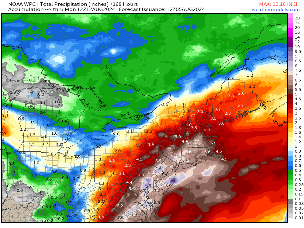
The story for the next several days: heavy rain — historic amounts.
Debby's center made landfall in the Florida Big Bend region earlier
today around 1100 UTC with an estimated intensity of 70 kt.
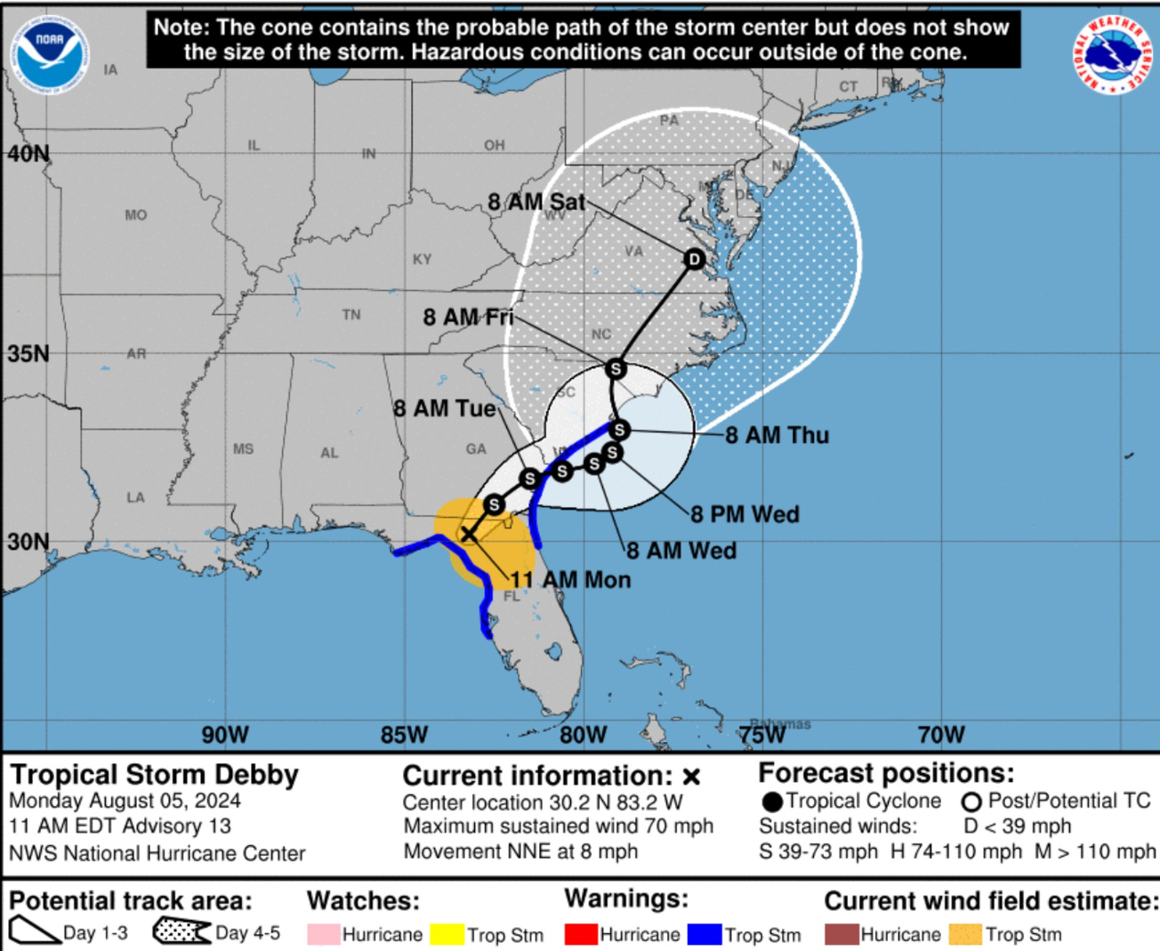
Potentially historic heavy rainfall across southeast Georgia and
the coastal plain of South Carolina through Saturday morning will
likely result in areas of catastrophic flooding. Heavy rainfall will
likely result in considerable flooding impacts from portions of
central and northern Florida and across portions of central and
northeast North Carolina through Saturday morning.
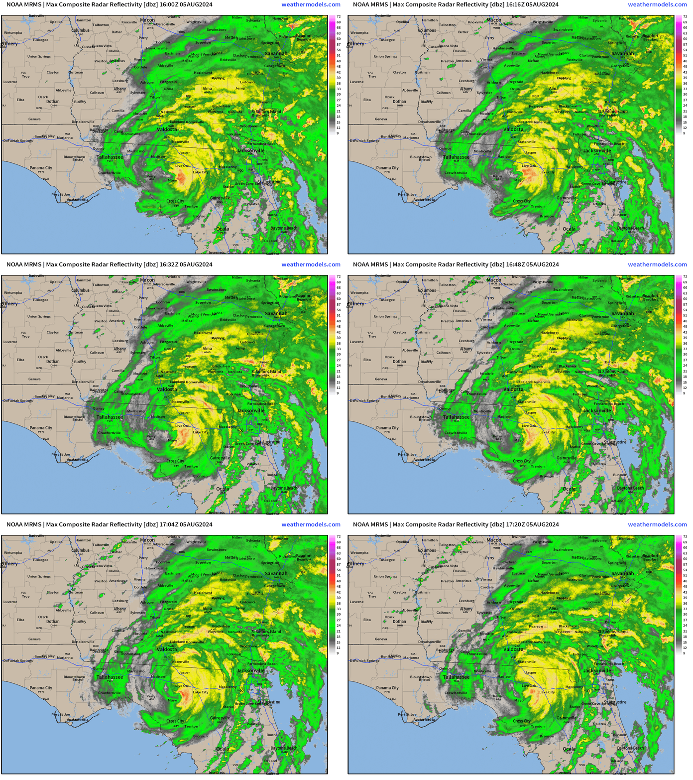
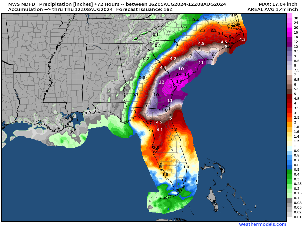
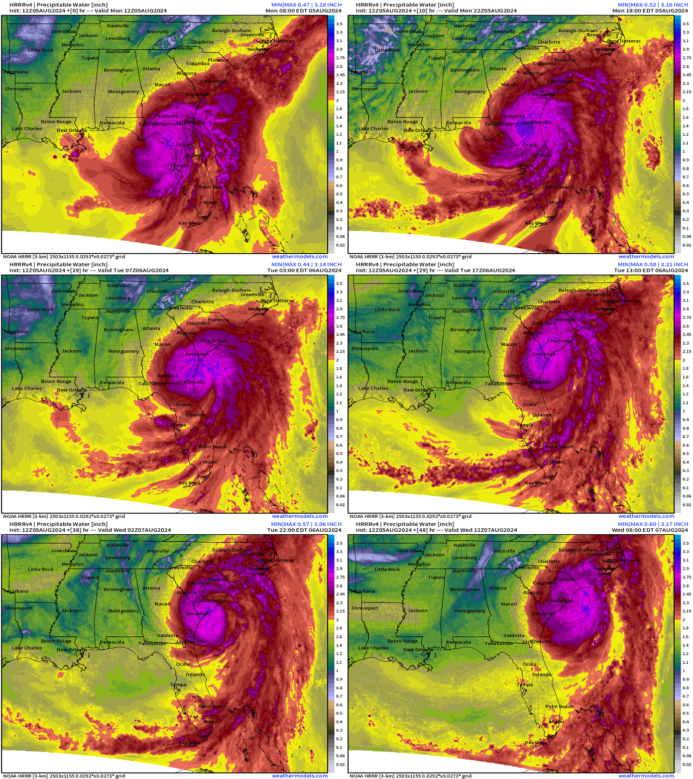
The track of Debby off the South Carolina coast means a constant fire hose of moisture from the very warm Atlantic Gulf Stream onto the coastline and inland of South Carolina and Georgia and eventually North Carolinas
NWS has maximum of 17-inches of rain but it could certainly be higher if Debby intensifies MORE over water.
This is VERY similar to the atmospheric setup from Harvey in Houston. The shape of the coast and the orientation of the feeder bands from the very warm Atlantic.
Trillions to come: more than 42 Trillions to go — meaning upwards of 50 Trillion total!
Georgia: 7 Trillion, Florida: 5T, South Carolina: 6.5T, North Carolina: 7T, Virginia: 3.5T
New York: 3T, Maryland, Massachusetts, New Jersey: 1T
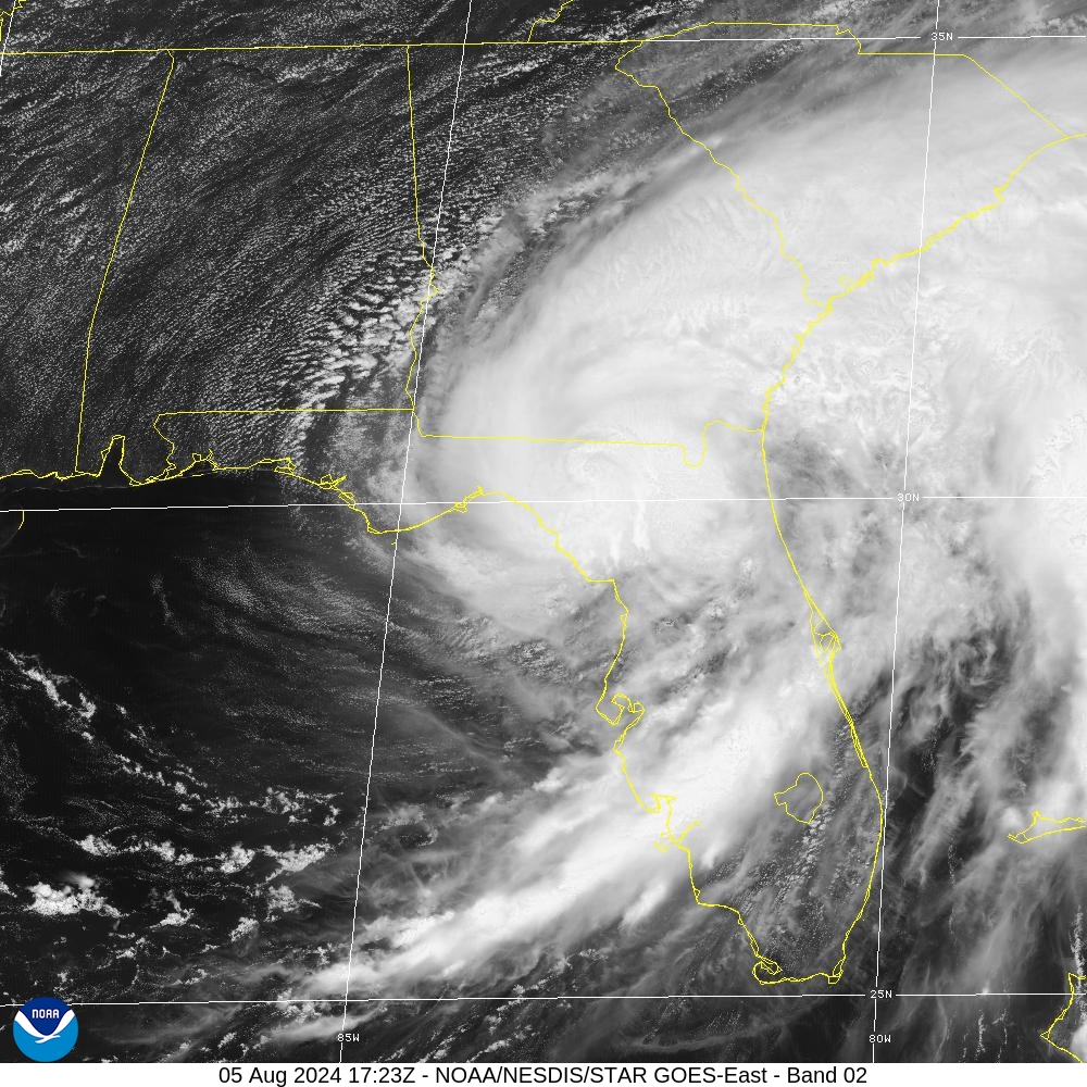
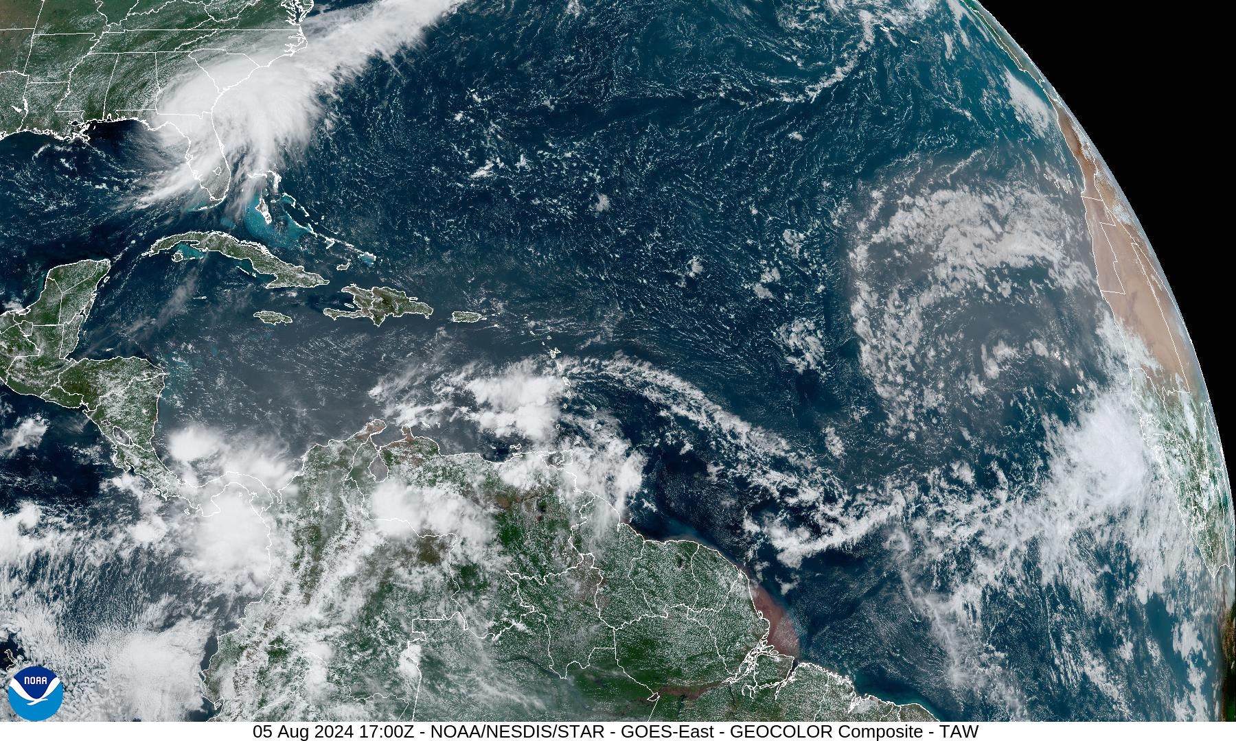
Satellite imagery 1:23 PM ET
HRRR 12z | 48 hour model simulation
ECMWF 12z HRES Model Solution | Next 7-days
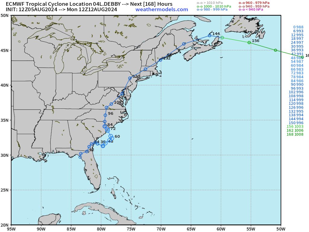
Debby heads over Washington D.C, then visits NYC, and New England by this weekend!
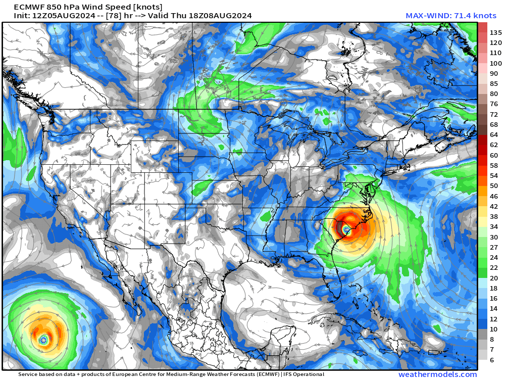
Where is Debby going? Back out over the Atlantic for a spell, and then back inland to South Carolina. There is less uncertainty about this scenario than previous days.
NOAA WPC Rainfall | Next 7-Days
Storm Tracks from the EPS 00z ensembles
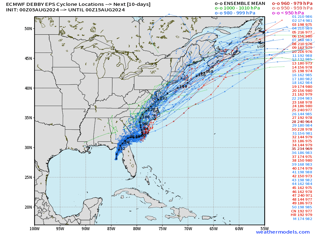
The previous ensembles at 00z show the bending track and eventual trajectory into the mid-Atlantic or offshore New England. The track past Day 3-4 has a wider uncertainty radius.
Eastern Pacific | Carlotta, Daniel, Emilia, Fabio
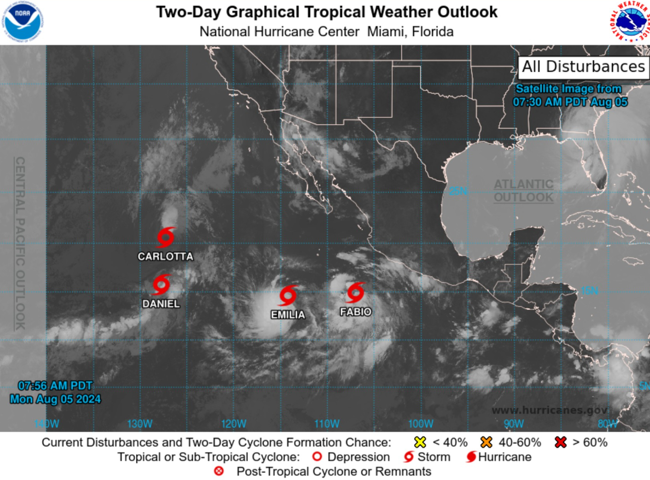
There’s a party going on in the Eastern Pacific with 4 systems under advisory.
Fabio will gobble up Emilia after a little tango. Carlotta is weakening but the circulation will pull Daniel north. None of these systems are remarkable nor will impact land. Just interesting to watch!
Down the Pike | Next Tropical Wave
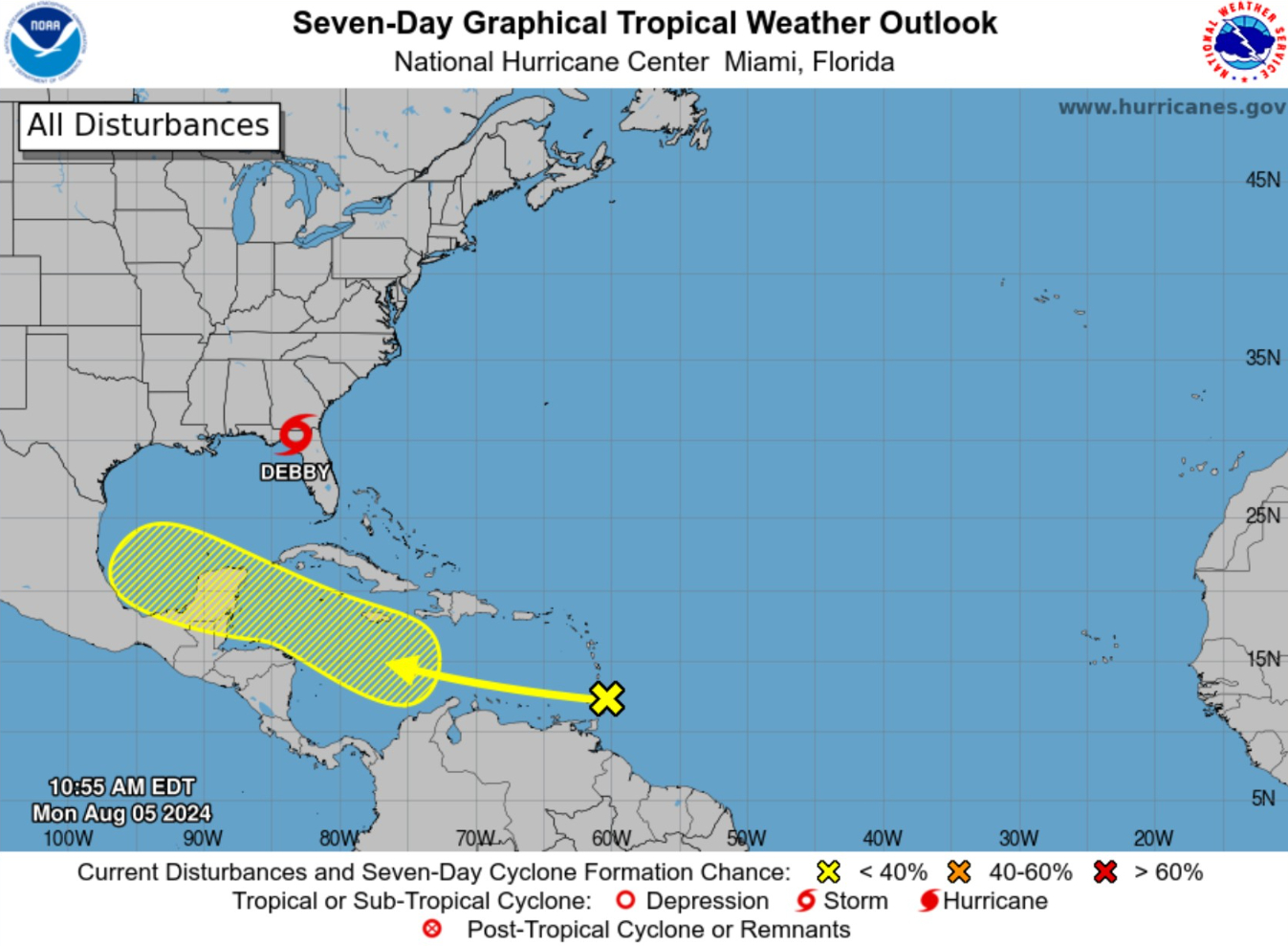
The wave into the Caribbean in next 5-7 days has a 30% chance of development.
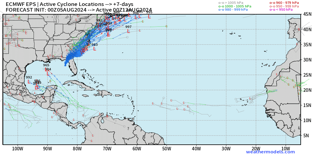
Active system potential at Day 12
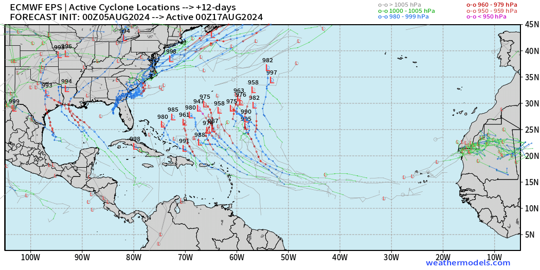
Many ensembles out of 51 show a Cape Verde style system by the 17th of August with major hurricane potential.
Active system potential at Day 15
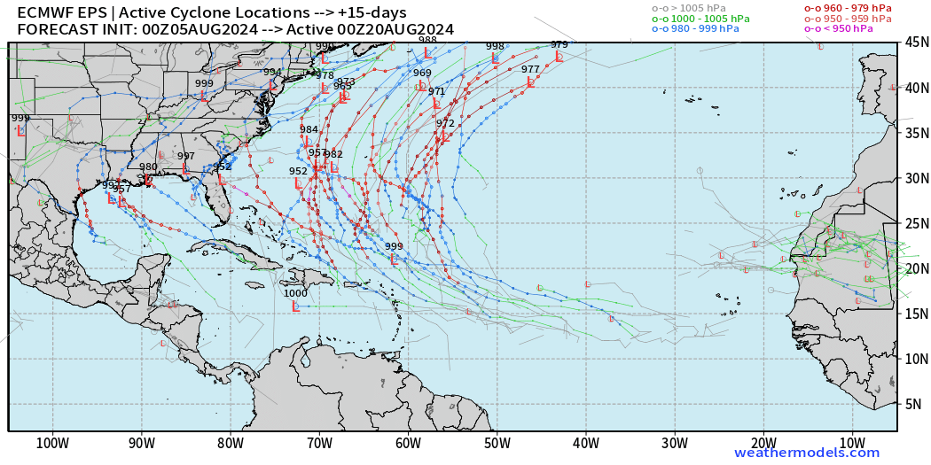
And, then where does this system go? This looks like an active period to watch!
Thank you to Subscribers and Supporters!
Maps sourced from weathermodels.com designed and innovated by yours truly! I actually create all of my content from scratch.
- Milepost
- 360 · laid 2024-08-05T17:58:41.667000Z
- Source
- https://weather.substack.com/p/august-5-2024-monday-tropical-update
- Digest
- eb33401c0fa8f450838a32800a12ab544c47382ca4c537fc7e129f89740146e8
- Machine
- JSON