August 4, 2024 Sunday Tropical Update on Debby
Forecast to become a strong Category 1 hurricane prior to Florida landfall
August 2024 was the 16th-warmest August in the 132-year national record (1895–2026), at 74.0°F against a 1991–2020 normal of 73.1°F (+1.0°F).
August 2024 was the 44th-driest August in the 132-year national record (1895–2026), at 2.5in against a 1991–2020 normal of 2.7in (-0.2in).
NOAA/NCEI Climate at a Glance, contiguous United States. This is the observed record for the month, not a score of anything said in this piece — the forecast ledger begins 2026-08-17 and cannot reach earlier posts.

Headline for Sunday morning
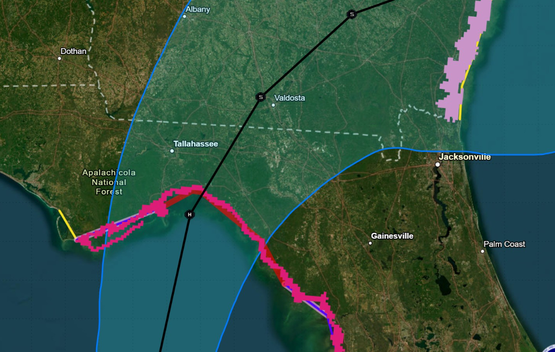
Tropical Storm Debby is nearing hurricane strength and is likely to rapidly intensify into almost a Category 2 Hurricane prior to landfall in Florida’s panhandle in the Big Bend area — southeast of Tallahassee. However, Florida's capital city needs to be on high alert for the exact track of Debby — as the western eyewall could cause huge problems with trees (Hermine 2016).
Debby likely to rapidly intensify

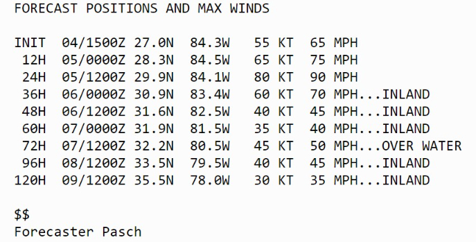
Hurricane Debby in 12-hours. 80-knots at landfall (at least) is just under Category 2 [83 knots]
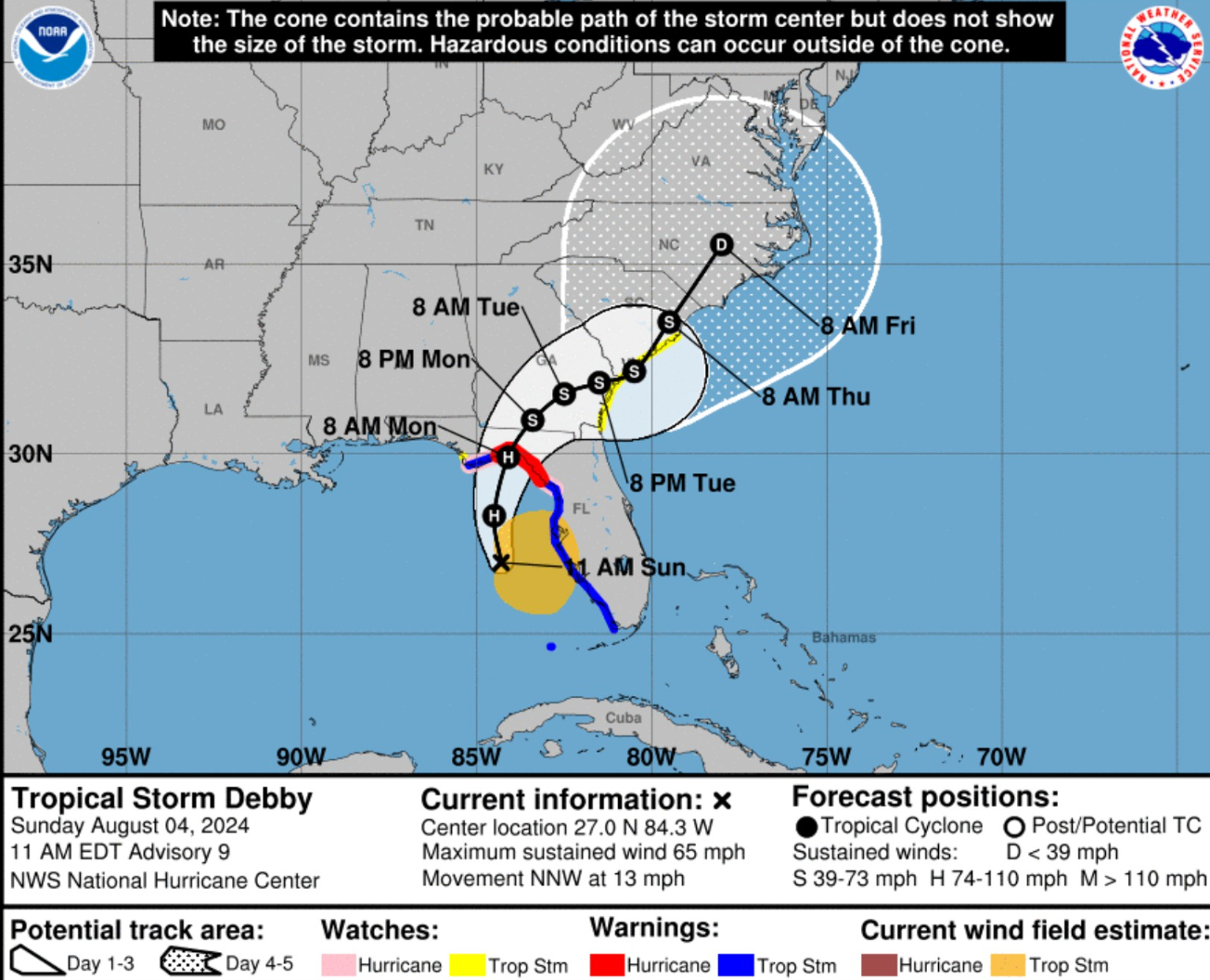
Track of Debby will slow to a crawl through Thursday and Friday = Enormous rainfall totals and risk of extreme flooding especially in SE Georgia and near-coastal South Carolina
Debby will be moving over very warm waters and in a low-vertical shear environment prior to landfall.

Therefore significant strengthening is likely through tonight, especially if the cyclone forms a well-defined inner core The official forecast is near the high side of the objective guidance and calls for the system to become a hurricane within 12 hours.
Tropical Storm Debby continues over the VERY warm ocean waters of the Eastern Gulf of Mexico and heading northward into a favorable atmospheric environment for intensification. Rapid intensification is poorly forecast by our models, so we shall just watch and hope for the best up until landfall in Florida on Monday.
The track of Debby indicates landfall in the Big Bend of Florida just east of Tallahassee on Monday afternoon. Then the forward motion decreases to a crawl. By next Thursday, we could be looking at impacts to South Carolina — could be serious depending upon how much time Debby stays over the warm Gulf Stream waters to rejuvenate.
The intensity forecast is now 80-knots or high end Category 1-hurricane at landfall. There is uncertainty — and this could go higher if Debby intensifies faster or the pressure drops more than expected. I’d now go with8 5-knots as the higher end of potential intensity in the 24 hours of development over the warm Gulf of Mexico.
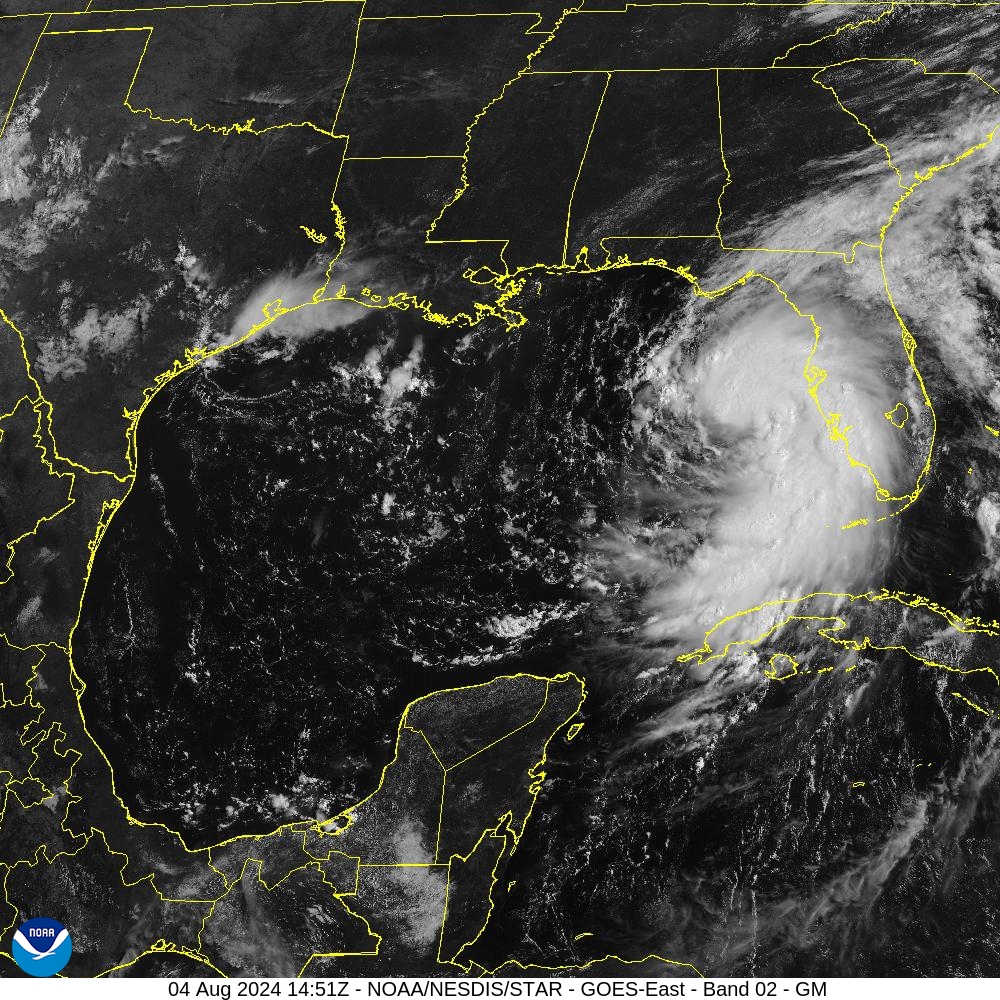
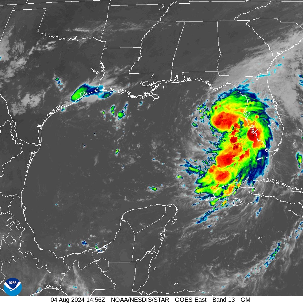
Satellite imagery 11 AM
Debby is taking on a “hurricane look”
HRRR 12z | 48 hour model simulation
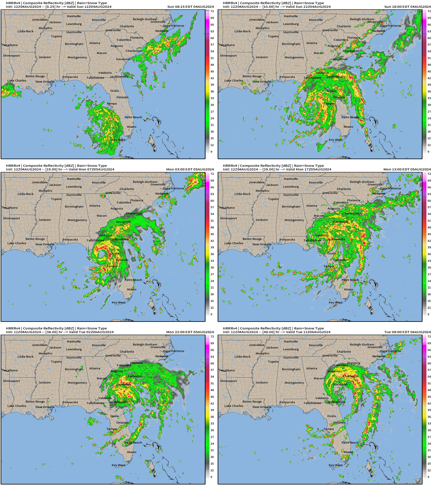
By Tuesday morning, Debby will likely still be in Georgia but a firehose of moisture will continue from the Atlantic into the Georgia and South Carolina coastlines.
Storm Surge Impacts
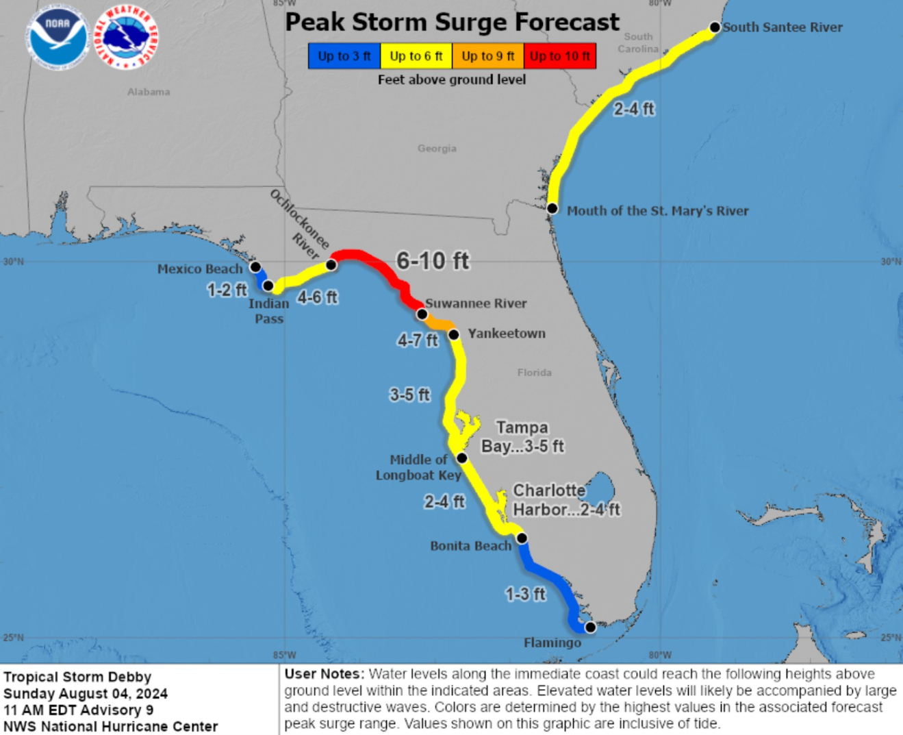
The shape of the Florida coastline means the water can easily pile up as it is pushed onshore northward into the Big Bend. Now 6-10 feet of maximum surge!
NWS Rainfall | Next 72-hours
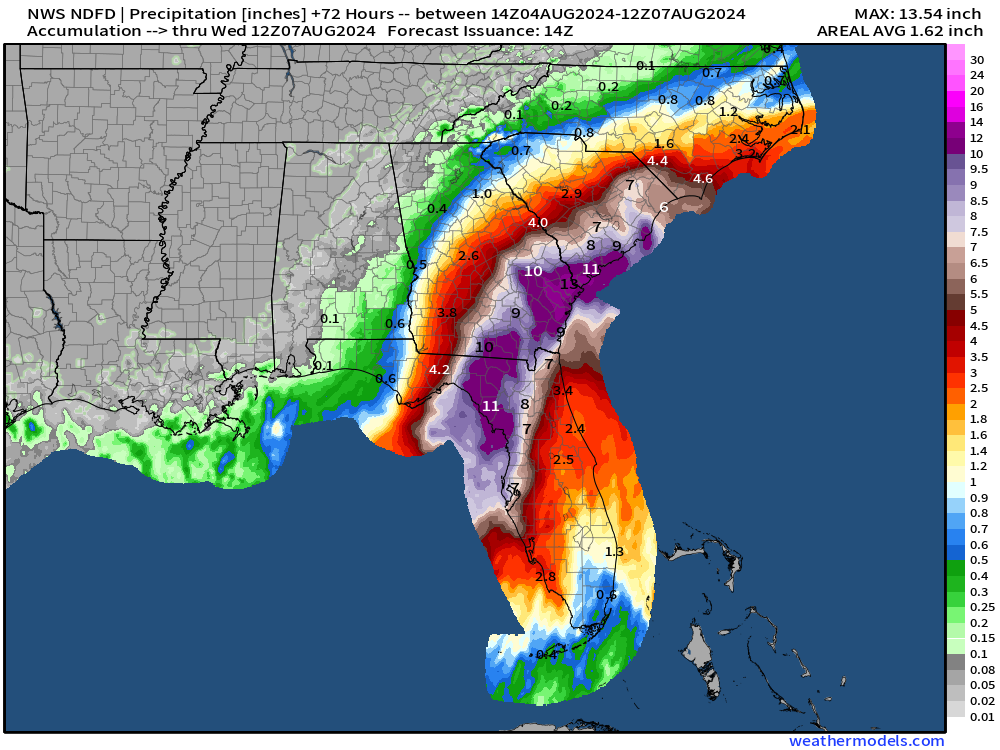
This cuts off at Wednesday 8 AM ET but already a large swath of 10-inches+ rainfall along and east of the center of Debby.
HRRR Wind Gust potential
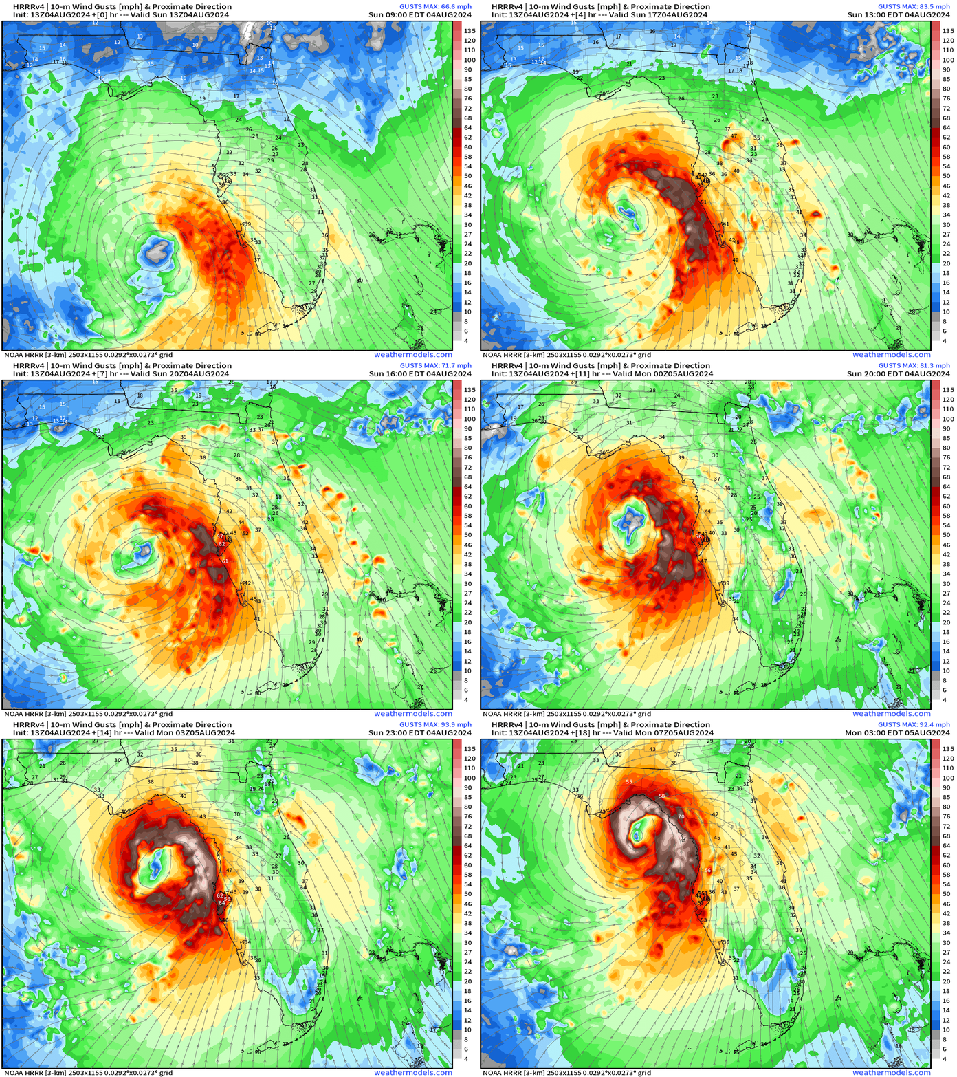
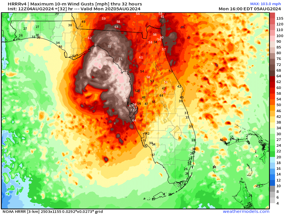
There will be gusts 65-90 mph around the “eye” of Debby.
Note that Tallahassee would be the major population center affected — but this is highly dependent upon the landfall location of Debby’s small core (eye).
ECMWF 00z HRES Model Solution | Next 8-days
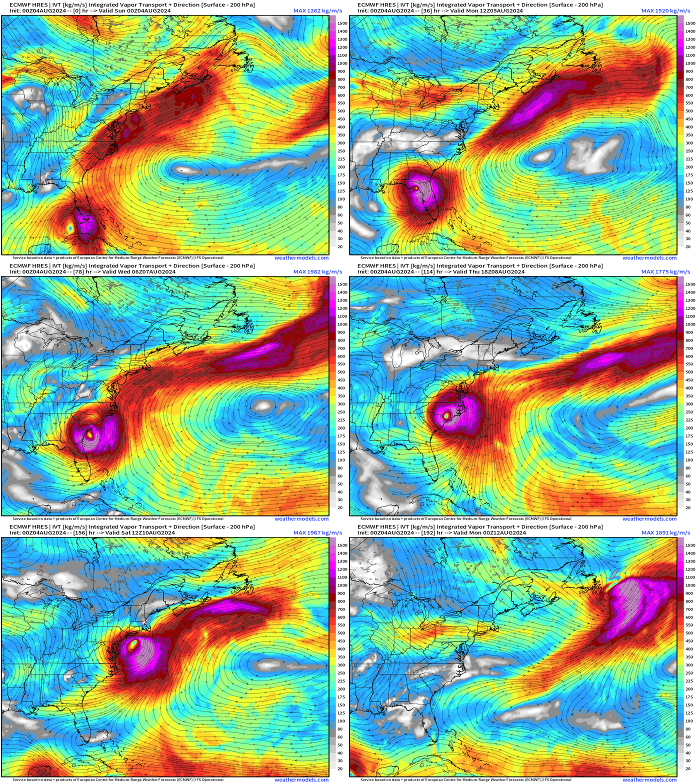
Where will Debby go next week?
Huge uncertainty STILL remains with Debby’s interaction with an upper-level trough coming into the Eastern United States.
Worst impacts for wind / rain would require Debby to step out into the Atlantic Ocean over the warm Gulf Stream waters and reintensify. Some models have a big hurricane for the Carolinas — in that scenario.
Debby could also drift/meander over land before heading northward into the mid-Atlantic. That would limit the wind issues but continue to dump boatloads of rainfall.
NOAA WPC Rainfall | Next 7-Days
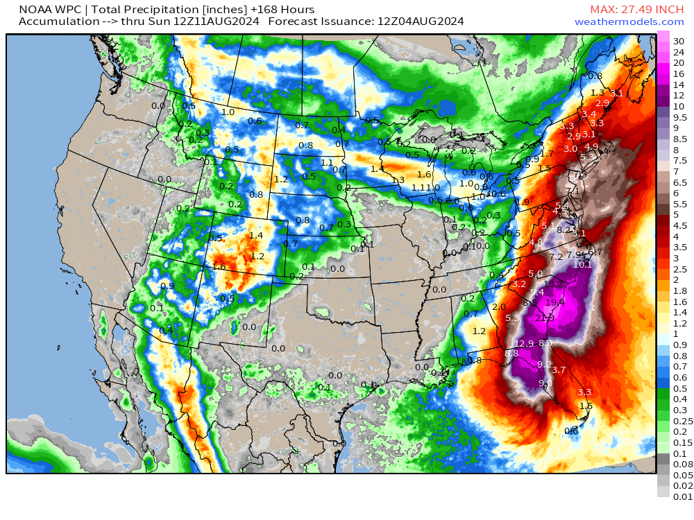
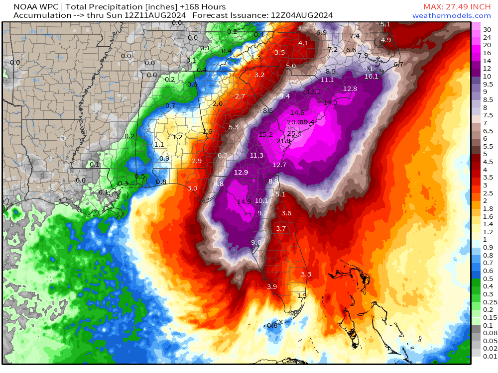
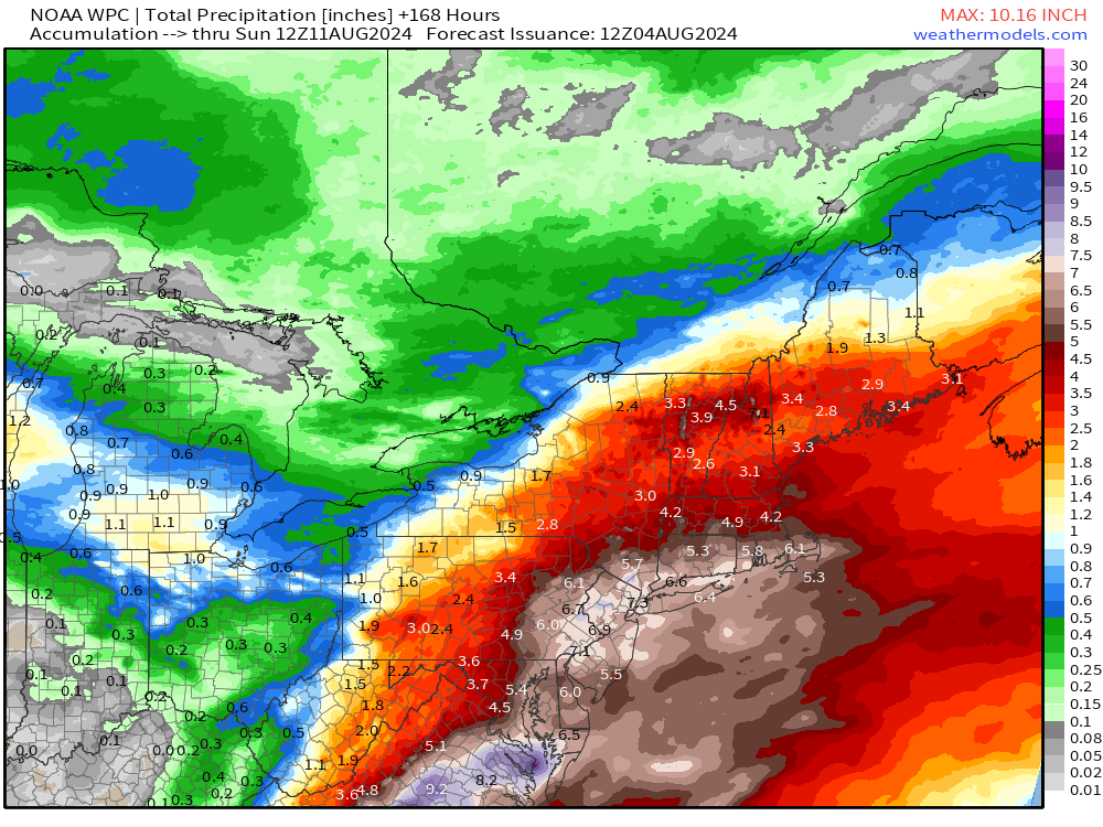
That rainfall will add up to 40-trillion gallons across the Eastern United States — but we need to also consider significant impacts even in the mid-Atlantic to NYC and New England with interaction between Debby (remnants) and the upper-level trough or cold front.
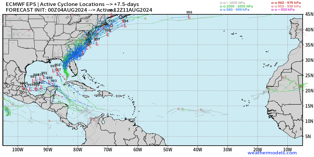
Storm Tracks from the EPS 00z ensembles
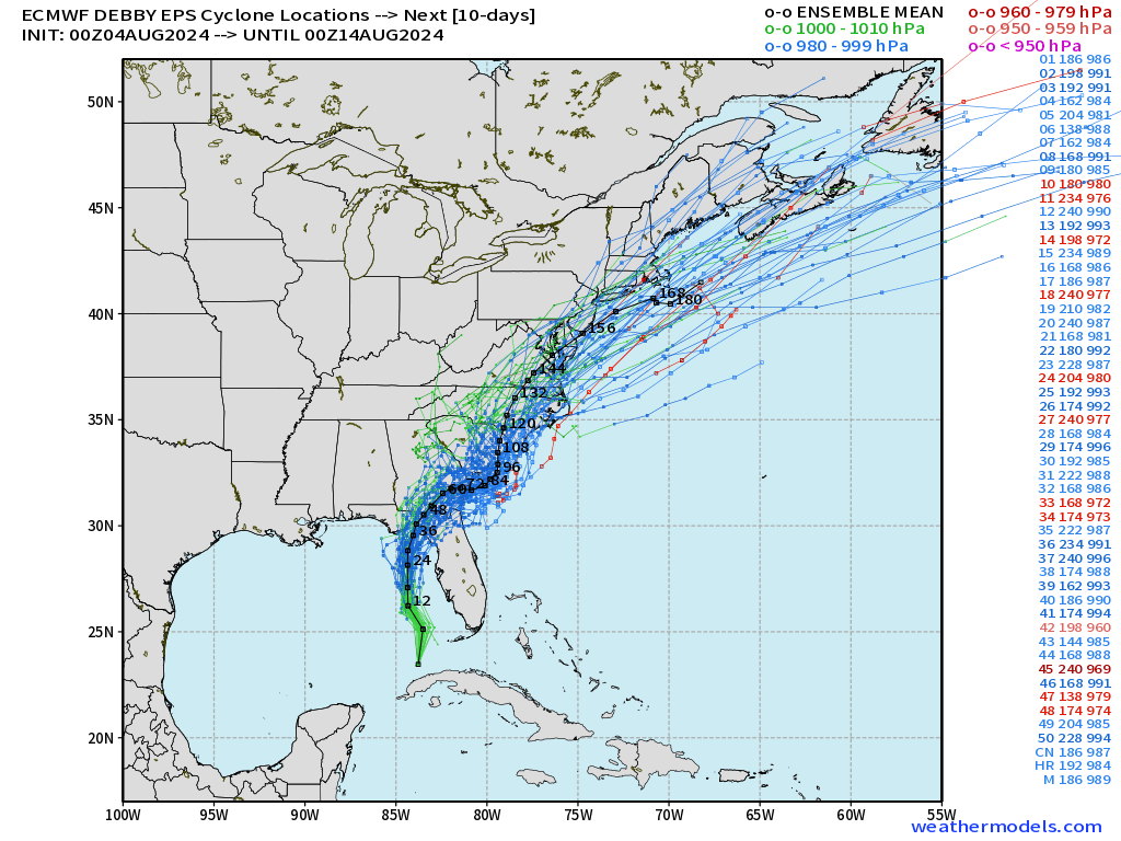
I think there’s a good signal for a northward movement after Day 4-5 into the Carolinas — but Debby could spend 12-24 hours over the very warm Gulf Stream and ramp back up — or recharge its enormous rainfall machine. We need to remember Florence!
Eastern Pacific | Carlotta, Daniel, Five 05E, Invest 96E
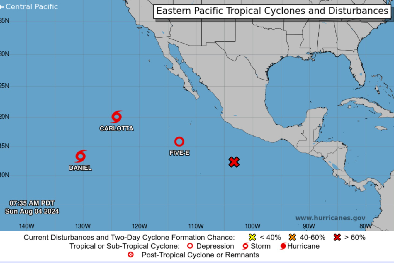
There’s a party going on in the Eastern Pacific with 3 systems under advisory and a fourth on the way (Invest 96E).
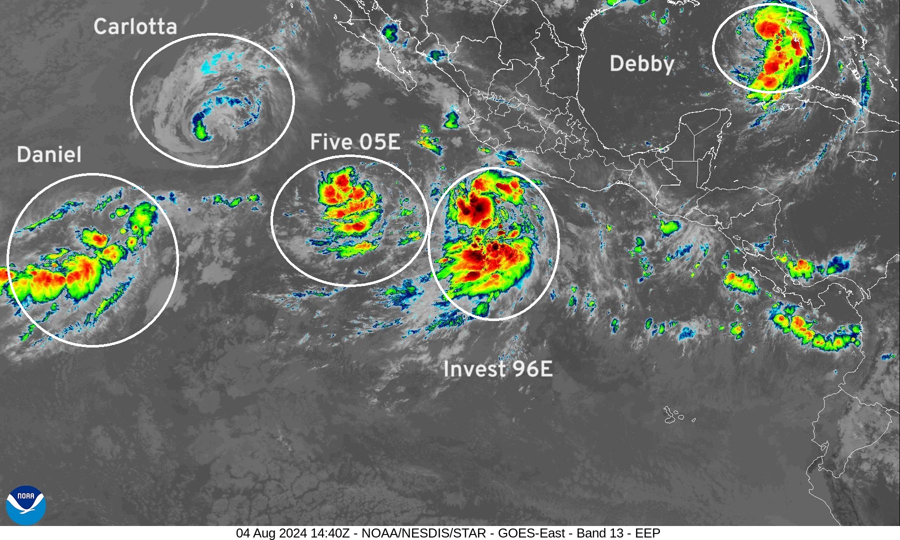
Invest 96E (Fabio) will gobble up Five 05E (Emilia) after a little tango. Carlotta is weakening but the circulation will pull Daniel north. None of these systems are remarkable nor will impact land. Just interesting to watch!
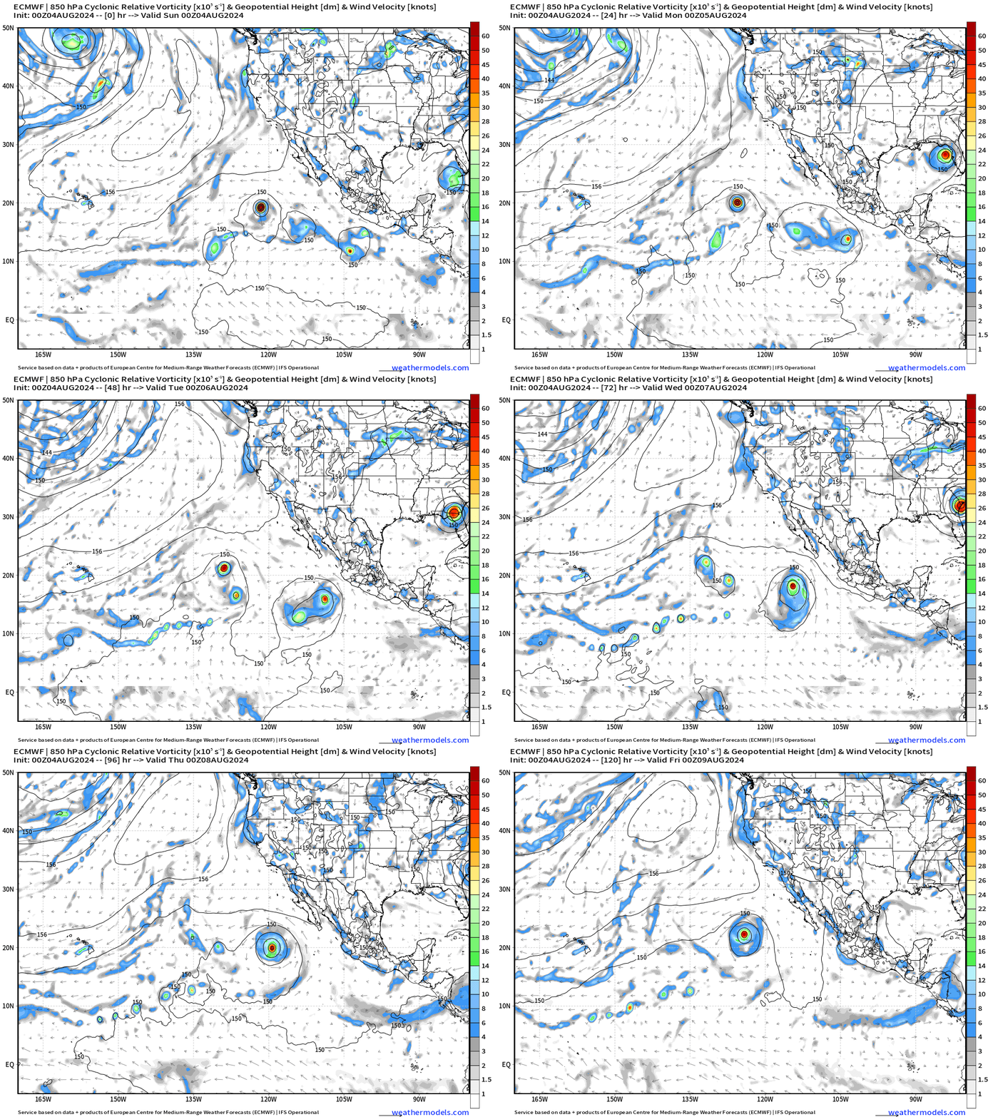
Down the Pike | Next Tropical Wave
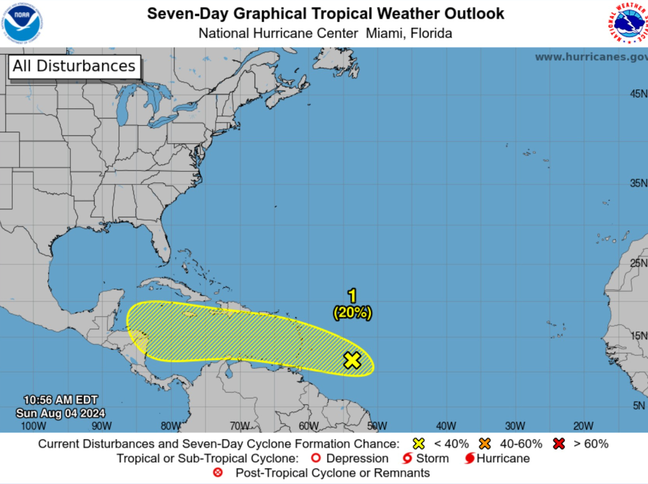
Need to watch this tropical wave that arrives in a more favorable environment in the SW Caribbean by Thurs/Friday.
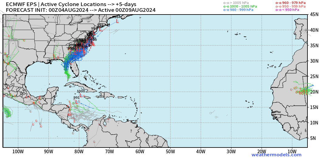
And, then potential development in the Gulf of Mexico. Low chance (20%) but that’s how all of these systems start out in the ensembles! Then, even more [potential] tropical activity in the following week into mid-August.
Thank you to Subscribers and Supporters!
Maps sourced from weathermodels.com designed and innovated by yours truly! I actually create all of my content from scratch.
- Milepost
- 359 · laid 2024-08-04T15:21:57.059000Z
- Source
- https://weather.substack.com/p/august-4-2024-sunday-tropical-update
- Digest
- 735da65523e5ce07fff271b163c7faa1fb96d3fed7b2a61806a3d3cdd6fe9e33
- Machine
- JSON