July 28, 2020 Tropical Update
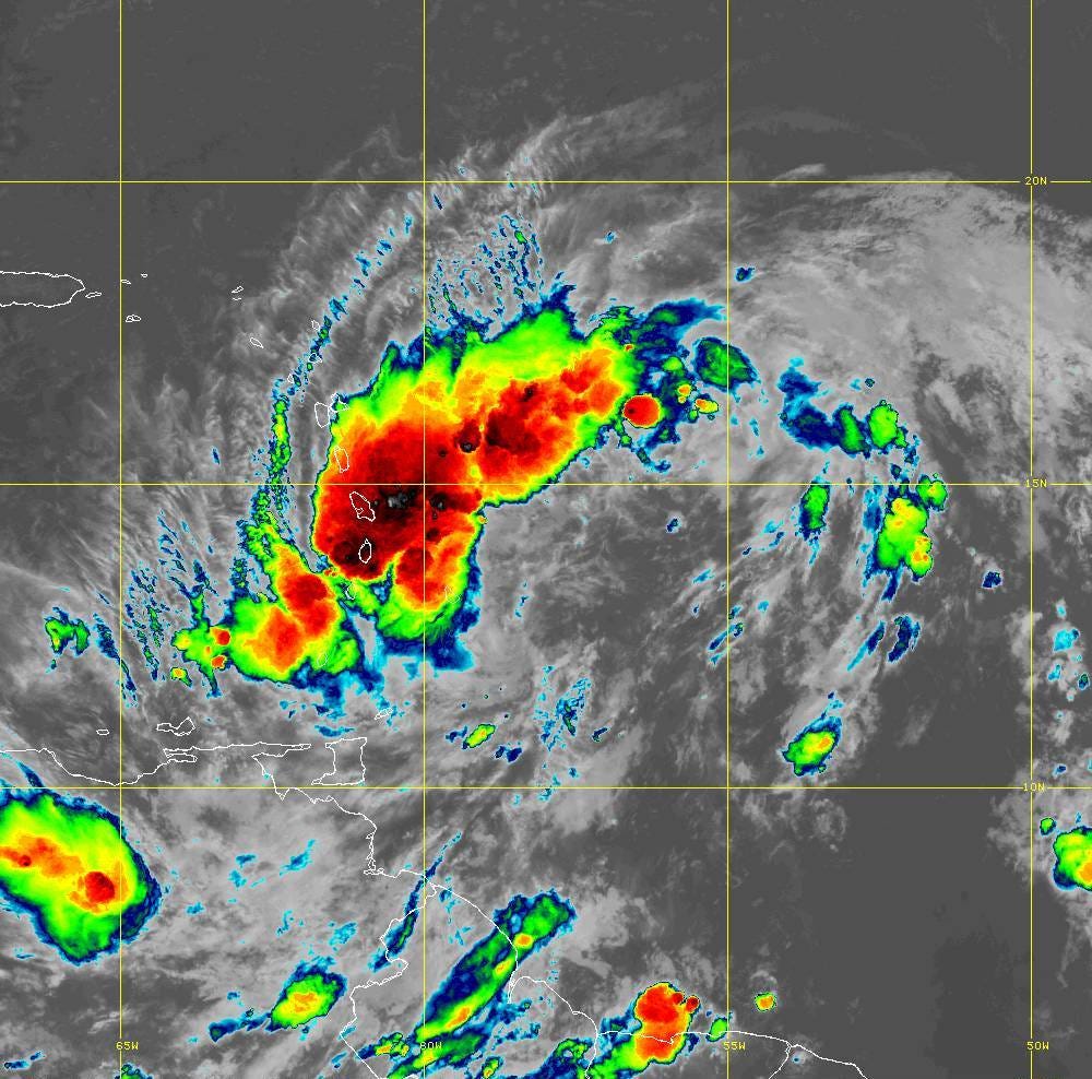
Potential Tropical Cyclone 09L still disorganized
July 2020 was the 15th-warmest July in the 132-year national record (1895–2026), at 75.6°F against a 1991–2020 normal of 74.4°F (+1.2°F).
July 2020 was the 44th-wettest July in the 132-year national record (1895–2026), at 2.9in against a 1991–2020 normal of 2.9in (+0.1in).
NOAA/NCEI Climate at a Glance, contiguous United States. This is the observed record for the month, not a score of anything said in this piece — the forecast ledger begins 2026-08-17 and cannot reach earlier posts.
The proto-storm (Isaias) is screaming WNW at 25 mph and is in a state of disarray with a large curved convective band ahead of the poorly defined surface circulation. According to new rules, the National Hurricane Center (NHC) is issuing advisories on the system since it is forecast to become a tropical storm or hurricane to affect land within the next 48-horus. This 2017 policy change allows NHC to provide warnings and a suite of other products as with PTC 09L.
Curiously, Isaias replaces Ike from 2008 on the Atlantic storm list since the 2014 season stopped with Hanna. The list repeats every 6-years and each name is reused unless the storm is retired.
The NHC forecast guidance is to the left of the global model envelope but most consistent with the ECMWF weighted consensus. The intensity and track are closely related as the steering currents operate on a certain depth of the atmosphere according to the central pressure, size, and convective asymmetry. Suffice it to say that the weather models do not handle this interplay very well.

The GFS model is getting an upgrade soon perhaps in early 2021 and a parallel or experimental feed of data is running in near real-time. This model has consistently been intensifying 09L into a powerful hurricane east of Florida. This demonstrates that a more intense storm will have a northward component of motion while the weaker solution models (e.g. ECMWF) will cause a more westward drift into the Florida Keys neck of the woods. This westward track would also include a lot of land interaction.

- Milepost
- 35 · laid 2020-07-29T02:12:14.047000Z
- Source
- https://weather.substack.com/p/july-28-2020-tropical-update
- Digest
- f3bcbc1cf5ed4628ecd54dbc608f48ddb5c93dae681a081939fe392ee76d340a
- Machine
- JSON