July 17, 2024 Wednesday Update: Final Day of Extreme Heat
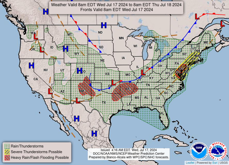
Canadian cool front eventually stalls out across Southeast
July 2024 was the 12th-warmest July in the 132-year national record (1895–2026), at 75.7°F against a 1991–2020 normal of 74.4°F (+1.3°F).
July 2024 was the 21st-wettest July in the 132-year national record (1895–2026), at 3.1in against a 1991–2020 normal of 2.9in (+0.2in).
NOAA/NCEI Climate at a Glance, contiguous United States. This is the observed record for the month, not a score of anything said in this piece — the forecast ledger begins 2026-08-17 and cannot reach earlier posts.

Wednesday Headlines
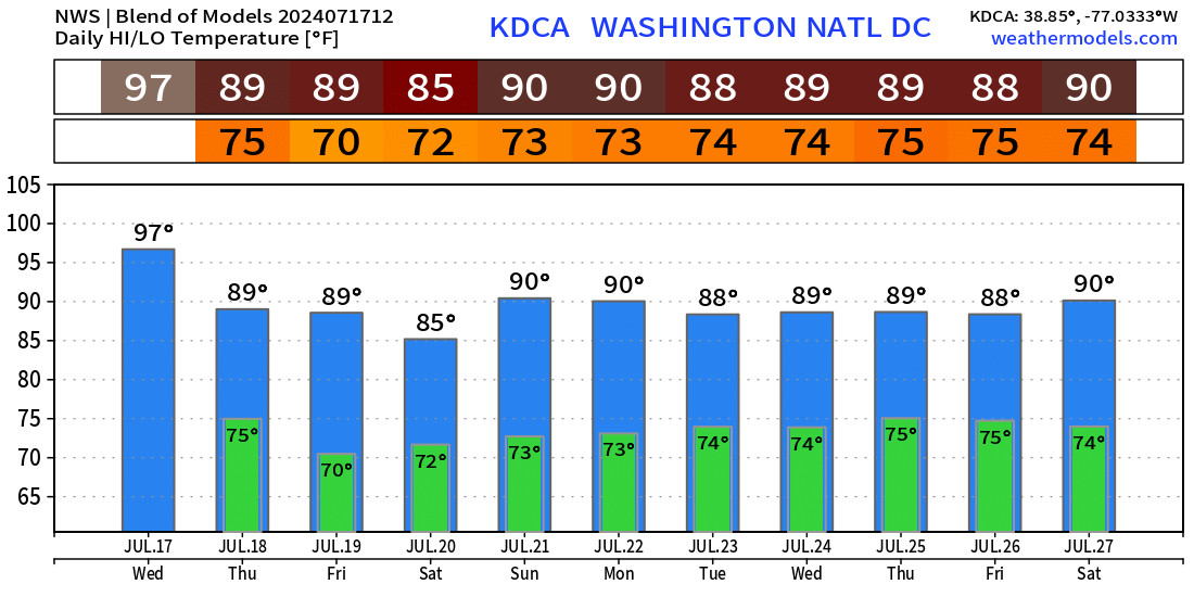
Final day of extreme heat along the east coast / mid-Atlantic including Washington D.C. which hit 104°F on Tuesday. Back to seasonal / normal or slightly cooler than normal temperatures.
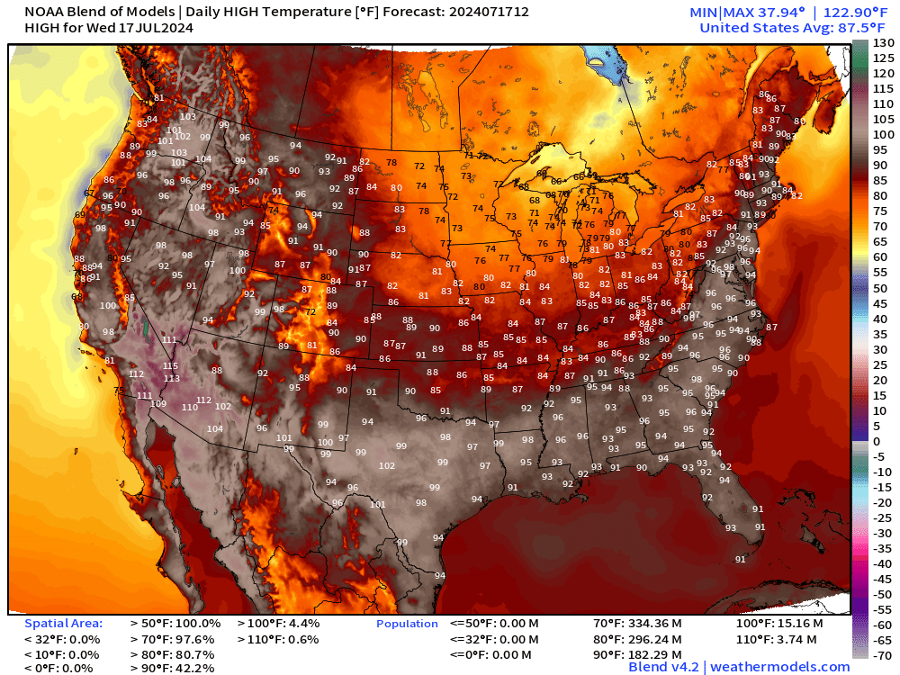
70s in the upper-Midwest including Minneapolis. Stunning weather ahead for the next 7-10 days, or longer across the Great Lakes.
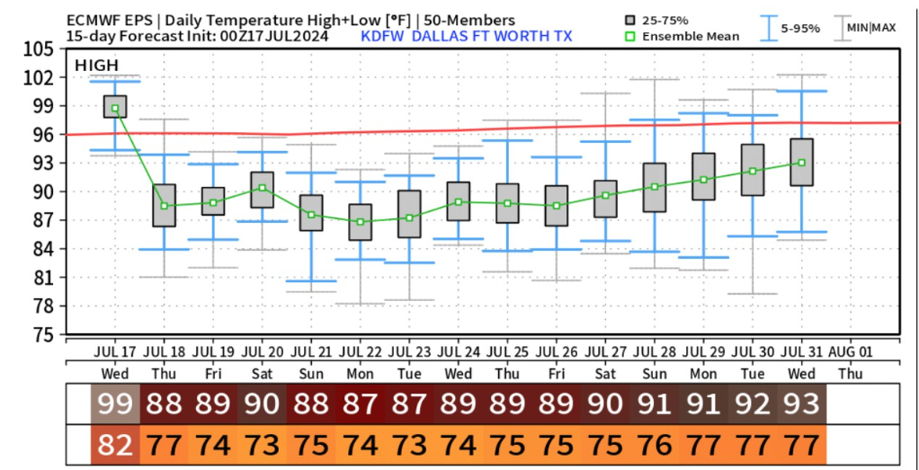
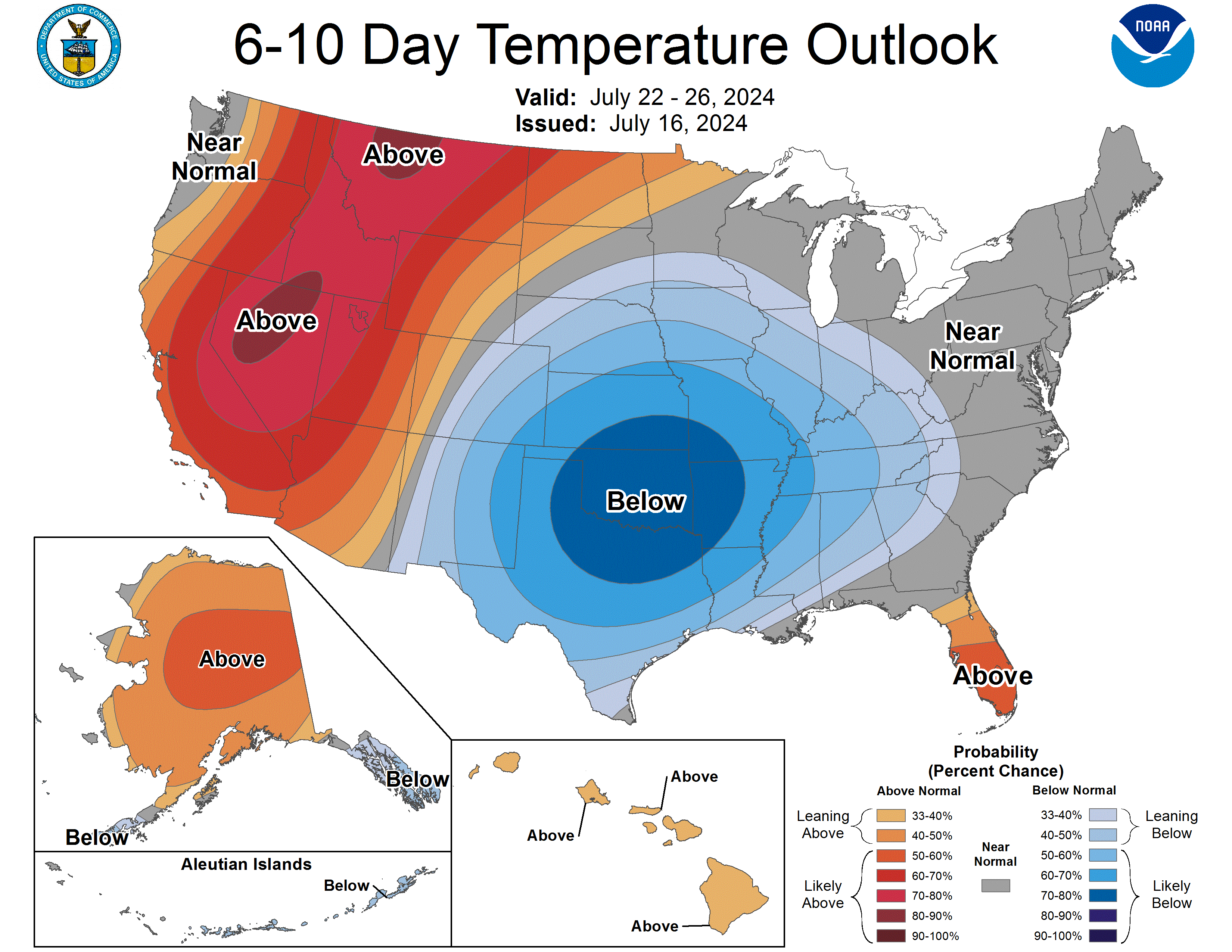
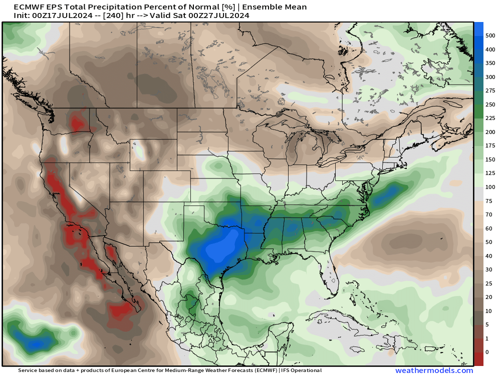
Long duration cool period across the central U.S. including Texas. Temperatures in Dallas will be comfortably in the upper-80s with lows in the mid-70s instead of 100s. Amazing!
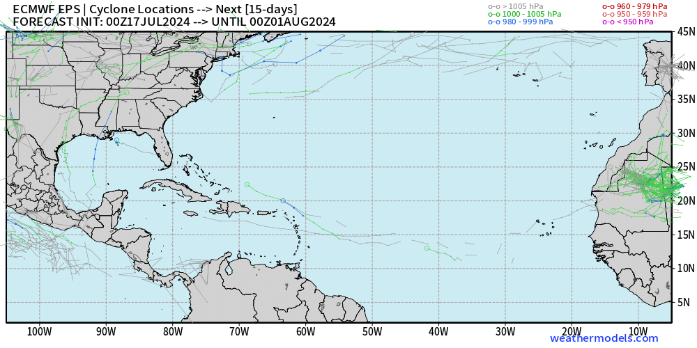
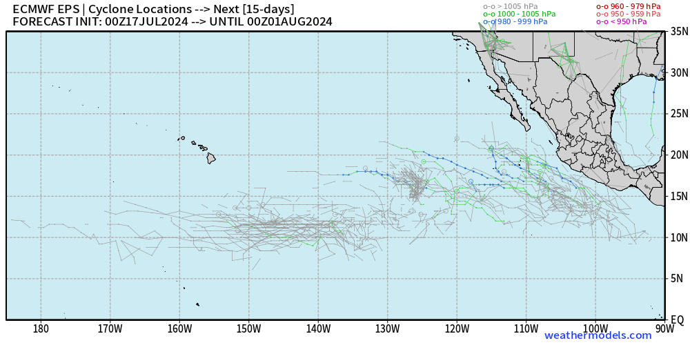
Atlantic Tropics remain dead through the remainder of July 2024. The ECMWF ensembles do show some stray tracks, but nothing imminent or strong signals of tropical cyclone genesis. Not much going on in the Eastern Pacific without a hurricane through end of July? Looks like it.
Wednesday’s Weather
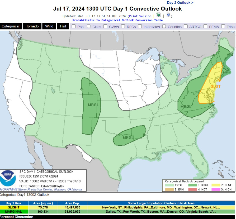
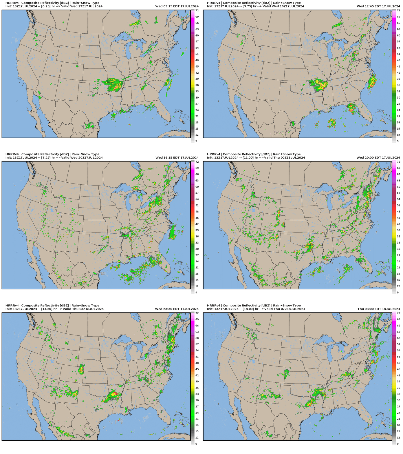
   ...THERE IS A SLIGHT RISK OF SEVERE THUNDERSTORMS OVER PARTS OF THE
   MID-ATLANTIC INTO CENTRAL/SOUTHERN NEW ENGLAND...

   ...SUMMARY...
   Damaging thunderstorm gusts appear most likely and concentrated
   today over parts of the Mid-Atlantic into central/southern New
   England.
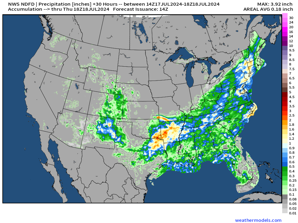
Rainfall next 30-hours
HRRR 18-hour Forecast Simulation
Thursday and Friday High Temperatures
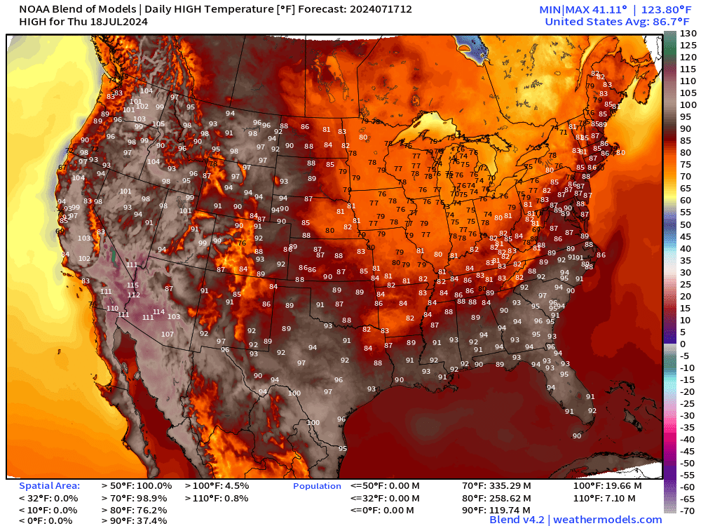
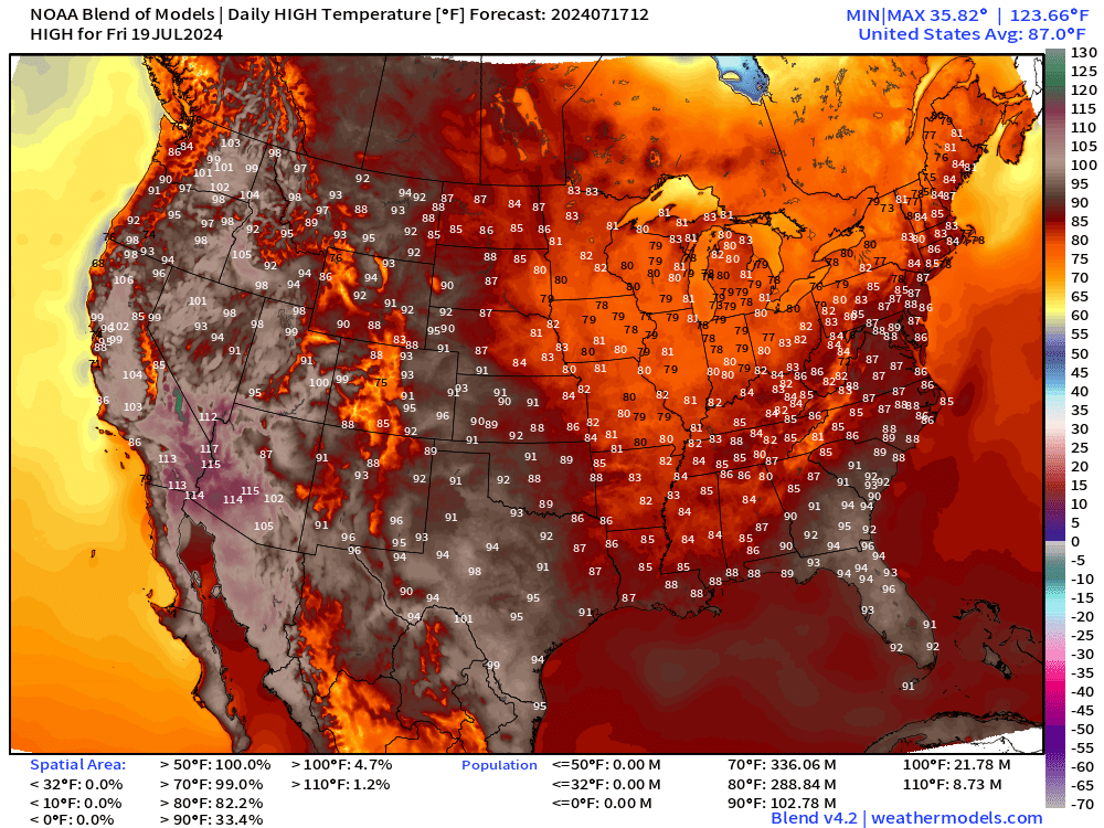
The cold front continues slowly into the Southeast and cools temperatures significantly with unsettled weather = pop-up showers & cloud debris keeping hundreds of millions of Americans much cooler than usual for mid-July.
Atlantic Basin Satellite Imagery
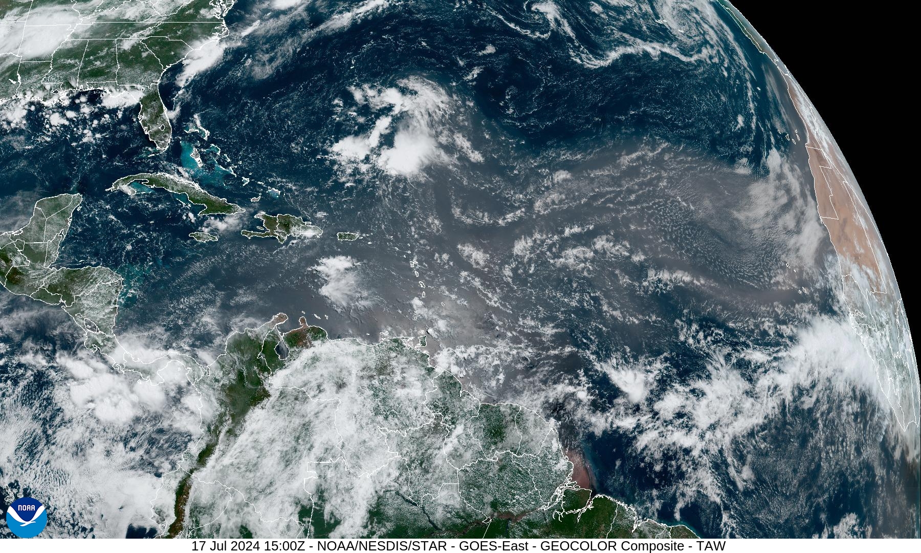
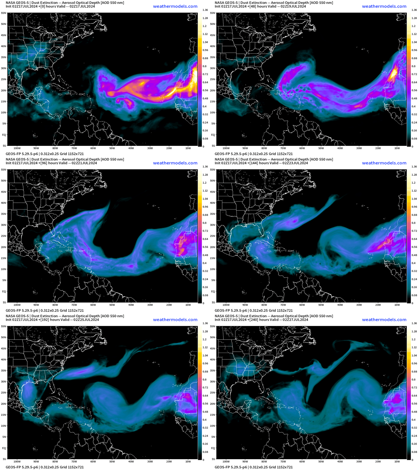
Nothing brewing in the Atlantic tropics — suppressed by African dust layers.
NASA GEOS5 Dust Forecast | Next 10-Days
NWS WPC 7-Day Precipitation Forecast | Watering Needs
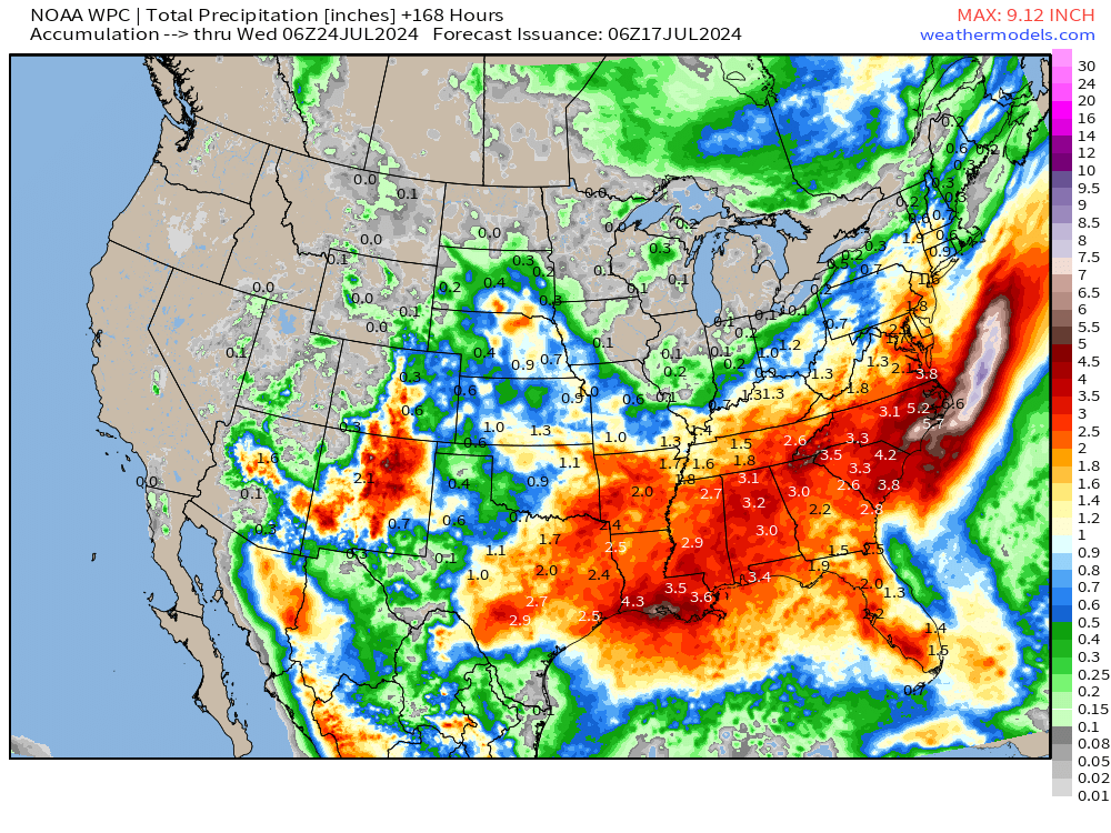
7-day rainfall amounts continue to increase from Texas into the Carolinas. I’ll take 3-inches of rainfall in Atlanta for my grass.
10-Day Precipitation Anomaly (%)
Weekly Temperature Anomaly
EPS Week 1: July 17-23, 2024
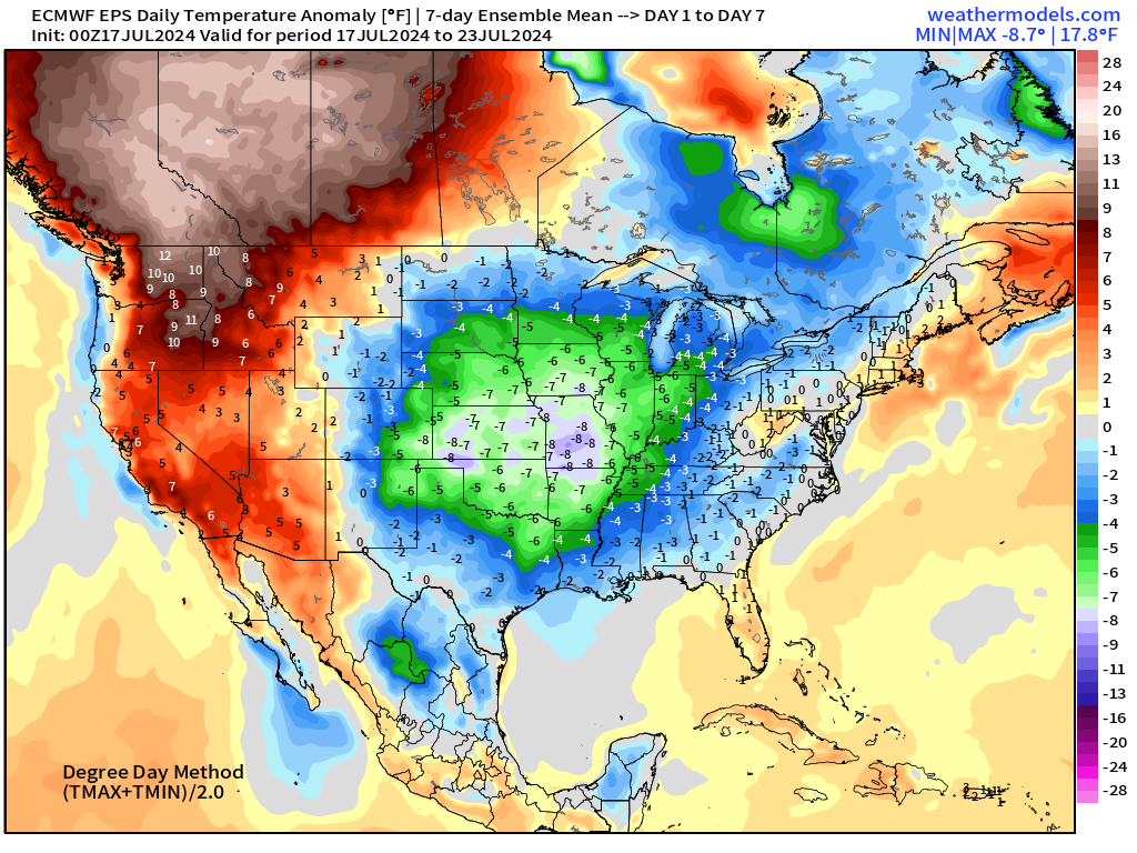
Exceptional heat over Pacific NW and western Canada.
Look at the huge below normal area over the Plains!
EPS Week 2: July 23-29, 2024
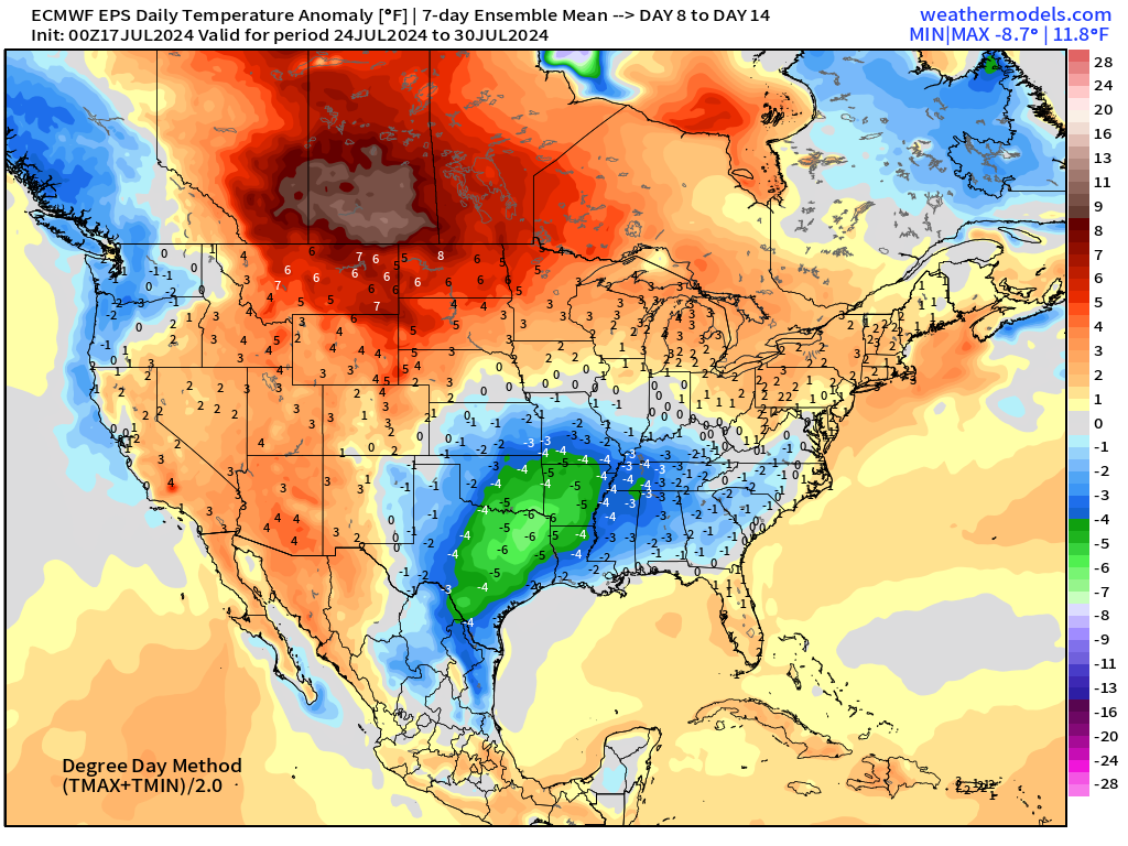
The hottest weather remains centered over southern Canada.
Thank you to Subscribers and Supporters!
Maps sourced from weathermodels.com designed and innovated by yours truly! I actually create all of my content from scratch.
- Milepost
- 344 · laid 2024-07-17T15:28:15.447000Z
- Source
- https://weather.substack.com/p/july-17-2024-wednesday-update-final
- Digest
- 5a85d54908841be8d842ef9132cf3bb6e98bb7eea93bb215b92cab0a216572a0
- Machine
- JSON