July 16, 2024 Tuesday Update: One More Day of Extreme Heat
Canadian cold front delivers relief to 150 million Americans
July 2024 was the 12th-warmest July in the 132-year national record (1895–2026), at 75.7°F against a 1991–2020 normal of 74.4°F (+1.3°F).
July 2024 was the 21st-wettest July in the 132-year national record (1895–2026), at 3.1in against a 1991–2020 normal of 2.9in (+0.2in).
NOAA/NCEI Climate at a Glance, contiguous United States. This is the observed record for the month, not a score of anything said in this piece — the forecast ledger begins 2026-08-17 and cannot reach earlier posts.

Tuesday Headlines
Still very hot across the Lower 48 with > 220 million Americans at least 90°F and almost 42 Million at/above 100°F including Washington D.C. to Baltimore and Philadelphia. Brutal / excessive heat for one more day before relief arrives with a cold front from the Great Lakes courtesy of our Canadian friends.
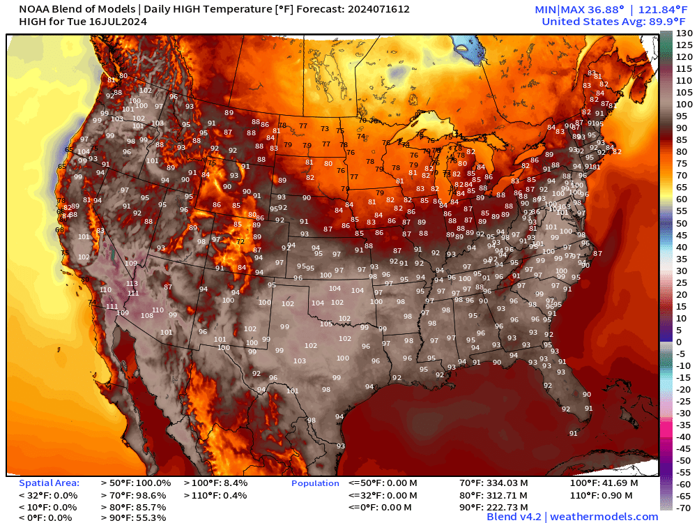
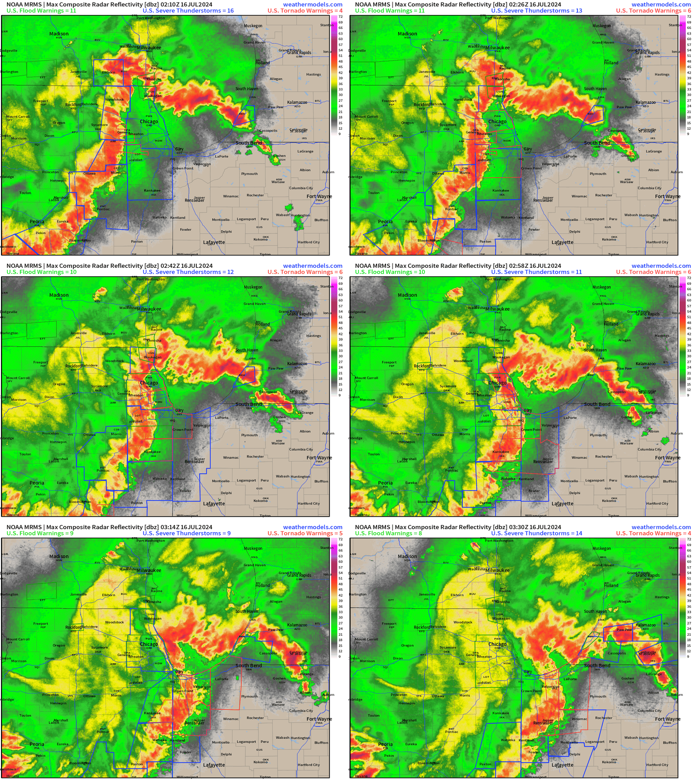
Tuesday High Temperatures Thunderstorm complex plowed through Chicagoland with 75 mph to 100 mph wind gusts with many (dozen+) embedded tornadoes in QCLS along the outflow boundary. Nasty derecho but well predicted by the mesoscale models (HRRR, RRFS) providing 12-24 hours of awareness.
Atlantic Tropics remain dead through the remainder of July 2024. Ensembles are not showing even a hint of tropical development anywhere.
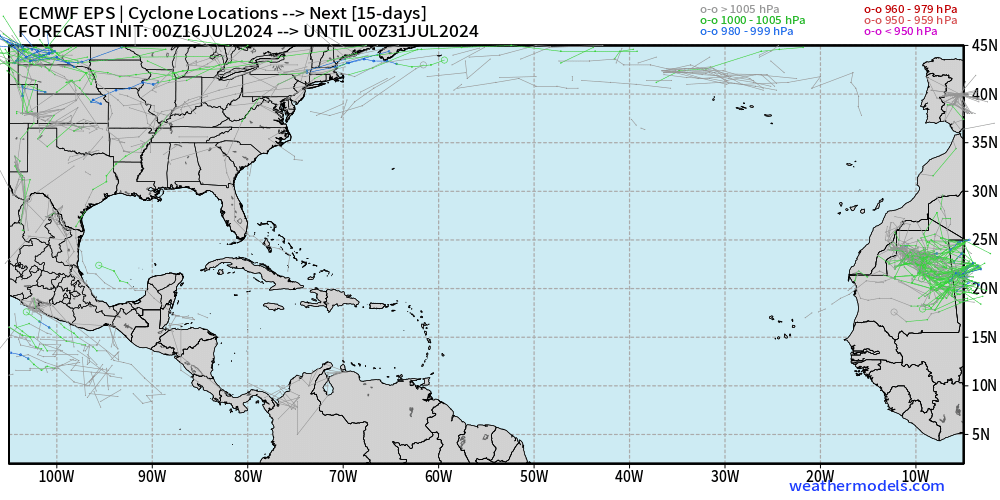
ECMWF 00z Ensemble Tracks | 51-members through 15-days
Tuesday’s Weather
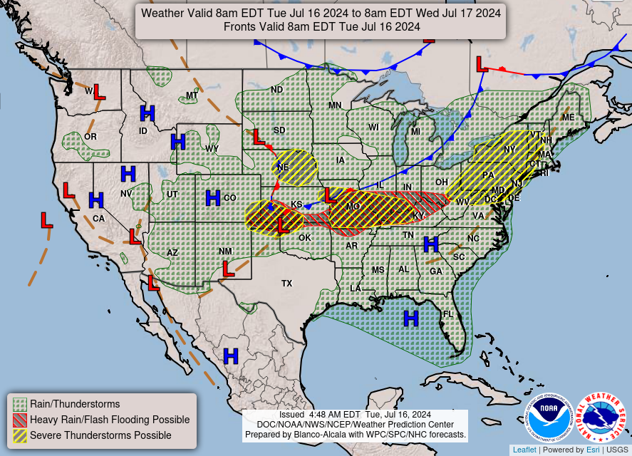
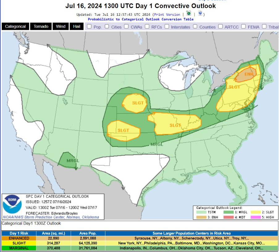
Enhanced Risk of Severe Storms over New England and slight chance along cold front into the Central Plains.
...THERE IS AN ENHANCED RISK OF SEVERE THUNDERSTORMS OVER PARTS OF CENTRAL/NORTHERN NEW YORK AND SOUTHERN VERMONT...

...THERE IS A SLIGHT RISK OF SEVERE THUNDERSTORMS ELSEWHERE OVER MUCH OF THE NORTHEAST...AS WELL AS PARTS OF:  CENTRAL PLAINS...SOUTH-CENTRAL HIGH PLAINS...OZARKS...AND LOWER MISSOURI/OHIO VALLEY REGIONS..

...SUMMARY...

Strong to severe thunderstorms are possible from the central Plains to the Northeast.  Greatest severe-thunderstorm threats within that are over parts of the central Plains and upper Ohio Valley to parts of the northern Mid-Atlantic and western New England.
Rainfall next 30-hours
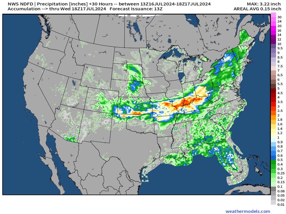
Up to an inch across northern Illinois into Southern Michigan, more in thunderstorm complex into Tuesday morning
HRRR 18-hour Forecast Simulation
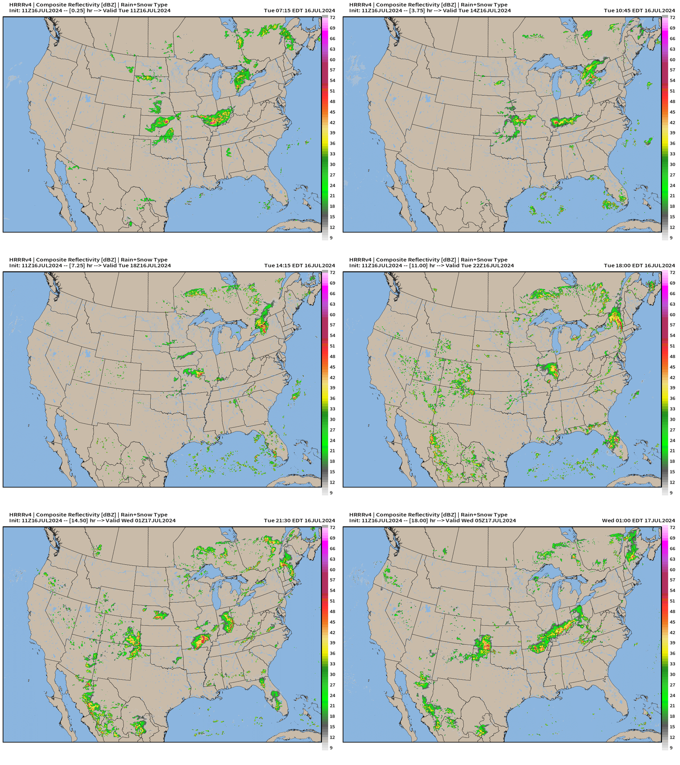
Again, widely scattered showers and storms across the Great Basin.
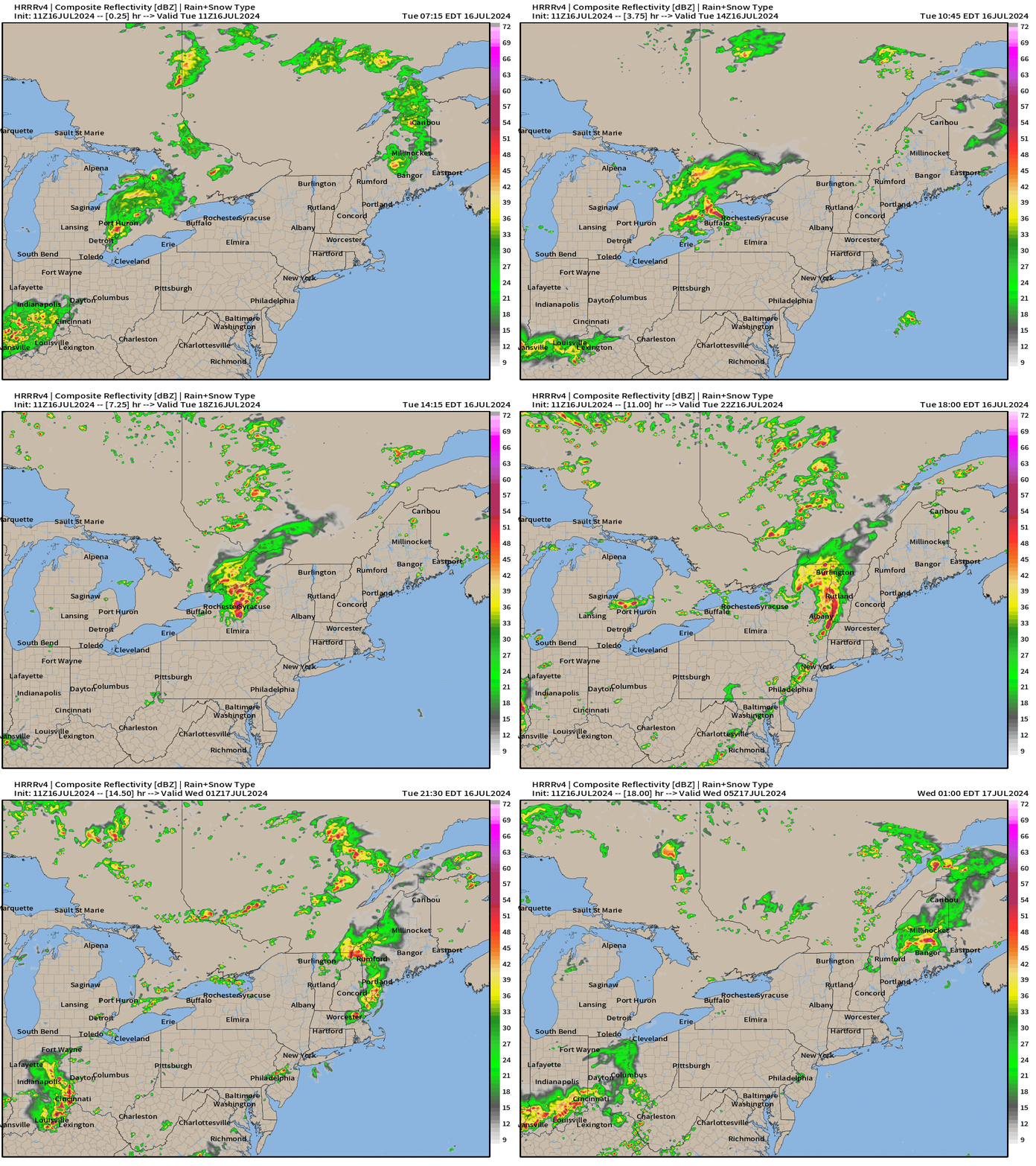
Squall line through northern New York could be quite damaging with gusty winds or embedded swirls. Albany will see the line by this evening. Not expecting much to hold together for Boston.
Wednesday and Thursday High Temperatures
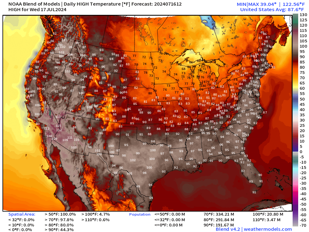
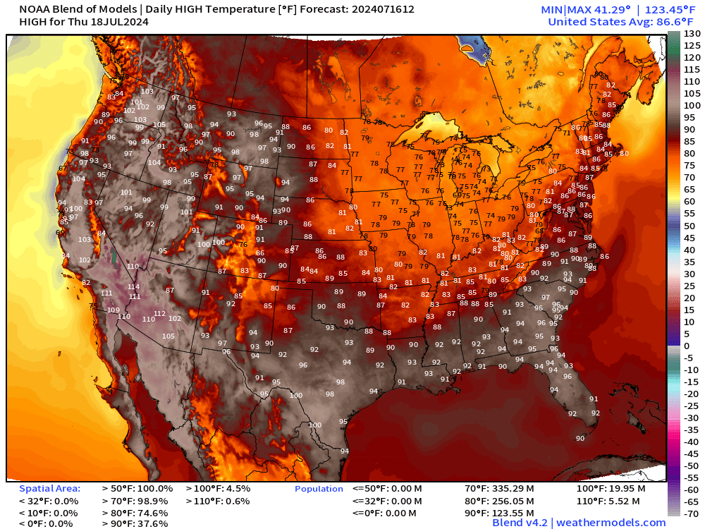
Look at that large area of 70s from the Midwest into the Ohio Valley by Thursday. The 90s are eroded significantly.
Atlantic Basin Satellite Imagery
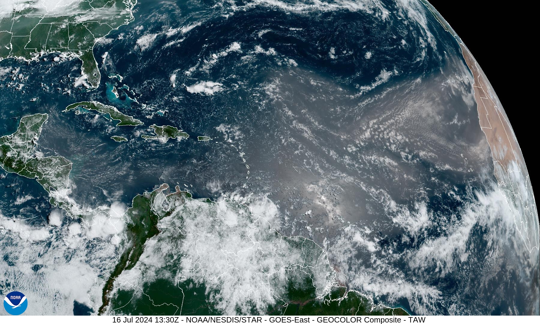
Nothing brewing in the Atlantic tropics — suppressed by African dust layers.
NASA GEOS5 Dust Analysis
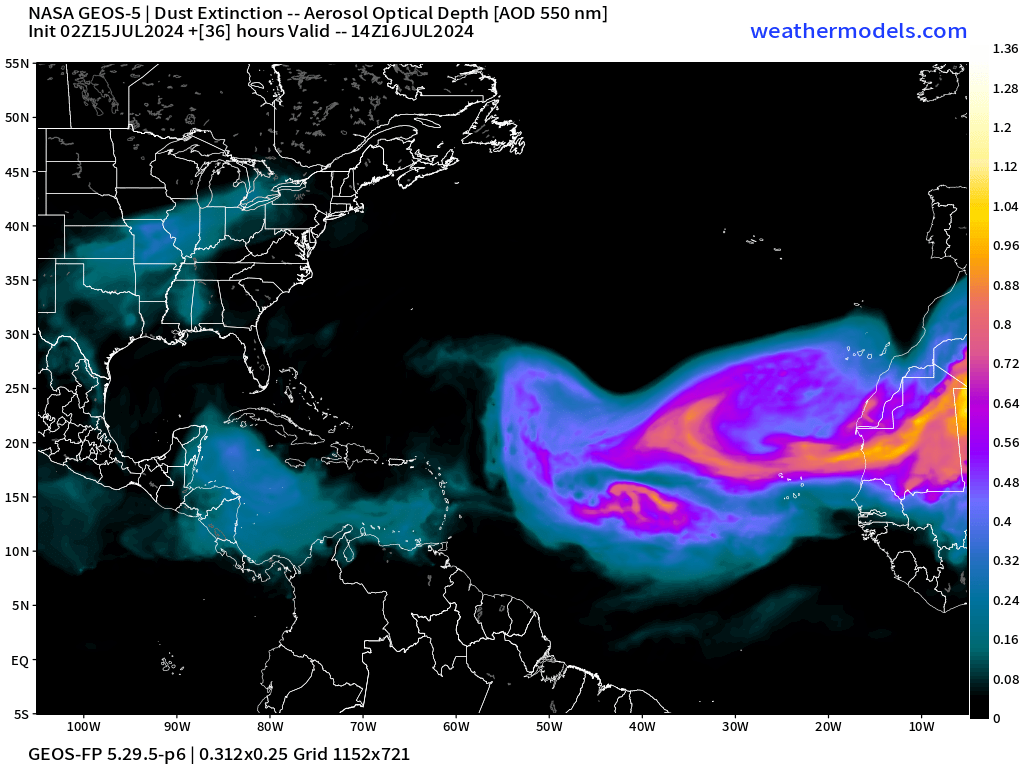
NASA GEOS5 model valid for this morning shows a massive plume of Saharan dust coming across the central and eastern Atlantic.
Next 10-days Upper-Level Weather Pattern | ECMWF AIFS
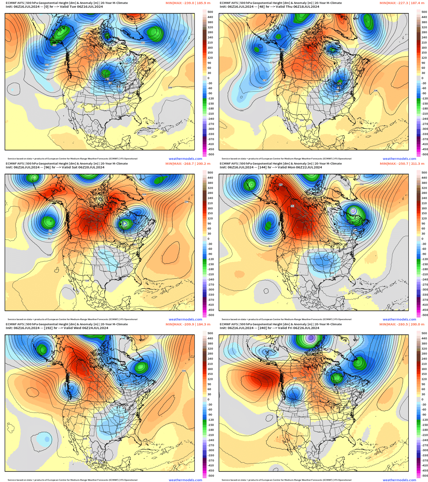
The trough or cut-off low forecast to form in the southern Mississippi Valley will provide cooler air but also plenty of instability and lift for scattered showers and storms. We’ll enter a noticeably wet pattern — excellent news from Texas to the Southeast.
NWS WPC 7-Day Precipitation Forecast | Watering Needs
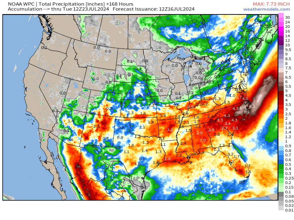
7-day rainfall amounts are bountiful from Texas into the Carolinas. However, a dry hole opens up over Iowa, Minnesota, Wisconsin and Michigan. Cooler — but no rainfall.
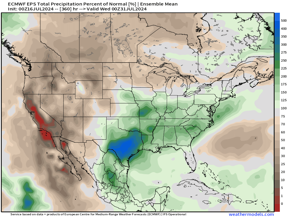
15-Day Precipitation Anomaly (%)
Weekly Temperature Anomaly
EPS Week 1: July 16-22, 2024
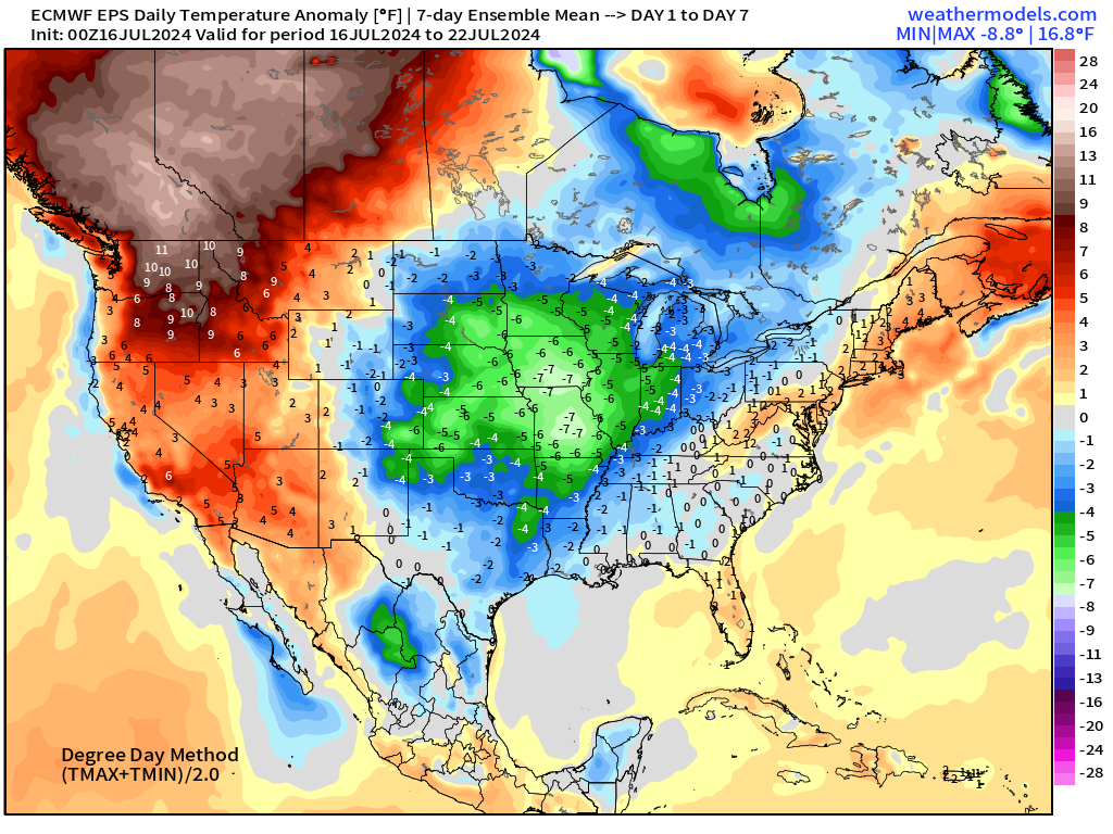
Exceptional heat over Pacific NW and western Canada.
Look at the huge below normal area over the Plains! Relief.
EPS Week 2: July 22-28, 2024
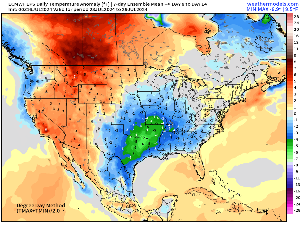
Overall cooler than normal through 4th week of July. No complaints.
Thank you to Subscribers and Supporters!
Maps sourced from weathermodels.com designed and innovated by yours truly! I actually create all of my content from scratch.
- Milepost
- 343 · laid 2024-07-16T14:03:07.367000Z
- Source
- https://weather.substack.com/p/july-16-2024-tuesday-update-one-more
- Digest
- 8fa5f233bcb31f97e49e7f0a3417c53ef9bb2ef11c046685997ecf66fdfd5156
- Machine
- JSON