July 9, 2024 Tuesday Weather Update
Beryl remnants drenching Great Lakes as July heat continues
July 2024 was the 12th-warmest July in the 132-year national record (1895–2026), at 75.7°F against a 1991–2020 normal of 74.4°F (+1.3°F).
July 2024 was the 21st-wettest July in the 132-year national record (1895–2026), at 3.1in against a 1991–2020 normal of 2.9in (+0.2in).
NOAA/NCEI Climate at a Glance, contiguous United States. This is the observed record for the month, not a score of anything said in this piece — the forecast ledger begins 2026-08-17 and cannot reach earlier posts.

Tuesday Headlines
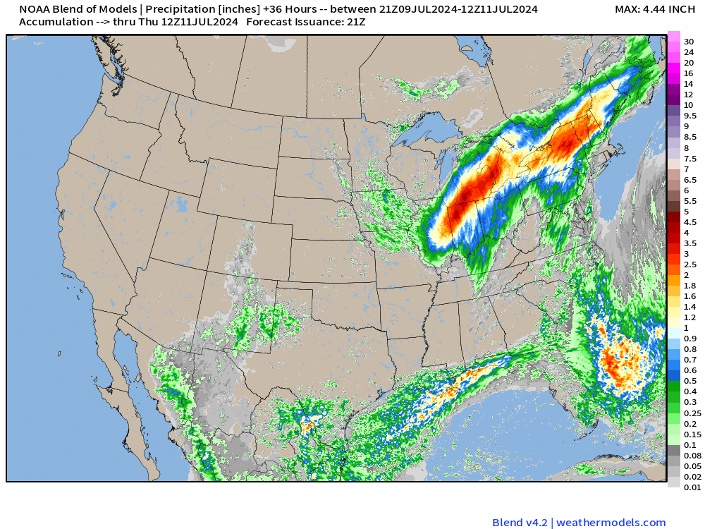
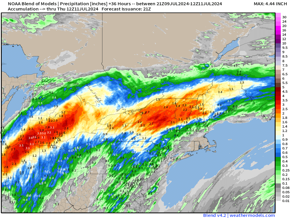
Remnants of Beryl heading into the Great Lakes with heavy rainfall.
Heat Wave Across the Western U.S. continues with 110s and 120s from Las Vegas to Phoenix and Death Valley (hottest near 130°F)
Colorado State (CSU) tropical weather forecasting operation headed by Dr. Klotzbach raises Atlantic seasonal forecast to 25 named storms.
Heavy rainfall over the next 36-hours from the remnants of Hurricane Beryl
Colorado State University (CSU) hurricane season forecast (July 9 update)
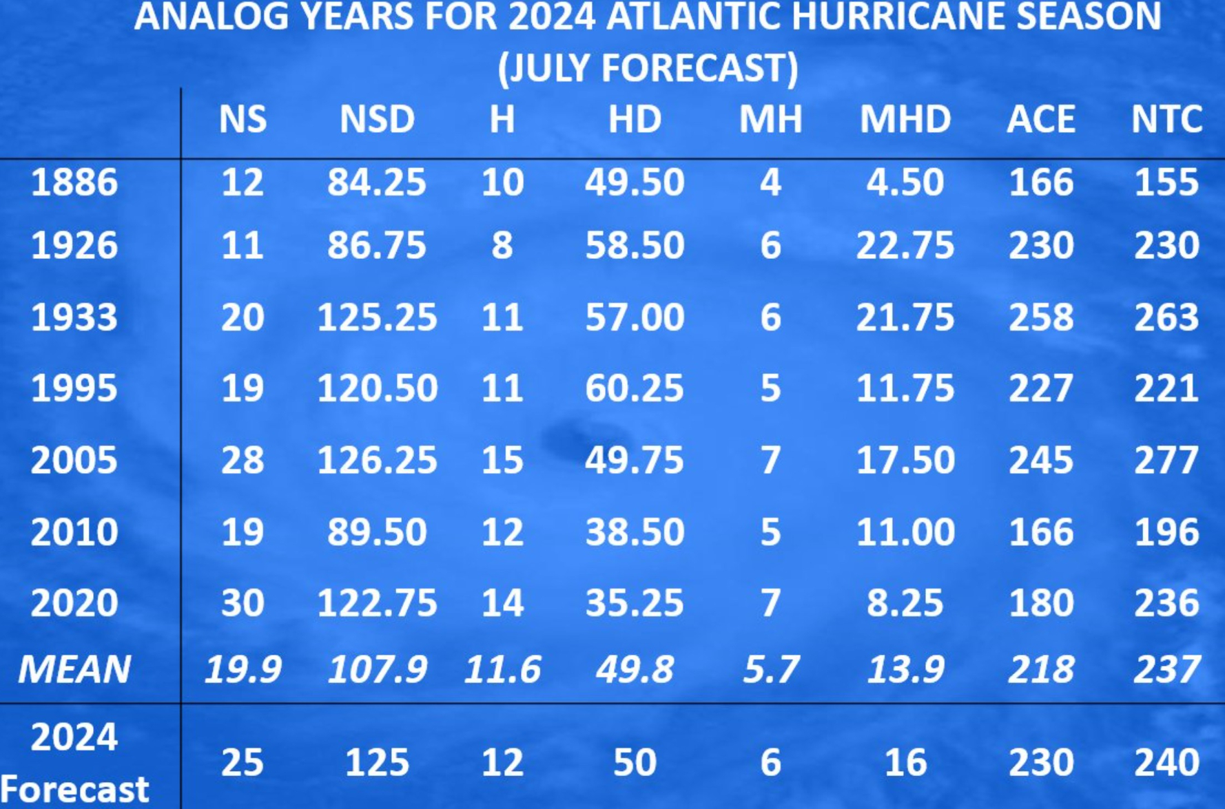
The analog years in the mix include the most active seasons from the past 140-years including 1926, 1933, 1995, 2005, 2010, and 2020.
25 named storms, 12 hurricanes, and 6 major hurricanes — ACE = 230 is a very active season.
From Phil Klotzbach X:
One reason for very active Atlantic #hurricane season forecast from CSU is significant potential for #LaNina development. La Nina typically increases Atlantic hurricane activity via decreases in Caribbean/tropical Atlantic vertical wind shear.
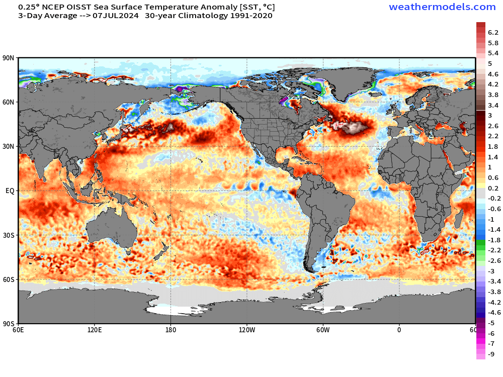
Also, much above normal Sea Surface Temperatures (SST) continue in the Atlantic, so any systems that do develop will stand a better chance of intensifying to tropical storms and hurricanes.
My take:
Hard to disagree with the diagnosis and reasoning from the CSU forecast. However, I feel there’s the potential [1 in 3] for “busting” like 2007 where we did have Dean and Felix (Cat 5s) but otherwise a quiet season overall. The developing La Nina is “weird” with the rest of the tropics completely devoid of tropical storm activity.
I don’t think Beryl is a harbinger of the season ahead on its own, but certainly a positive signal to expect similar long-track, Cape Verde type hurricanes from strong tropical waves. However, we won’t see much more activity in July with unfavorable MJO and sub-seasonal forcing. The fork in the road is early August.
Ensemble Tracks Next 15-days
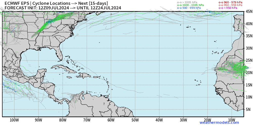
The ECMWF ensemble (12z) model tracks for tropical cyclones is blank for the next 15-days — until July 24. The background environmental conditions are hostile with wind shear, dry air, dust, and high pressure dominating the Atlantic tropics.
Atlantic Basin GeoColor Satellite Imagery
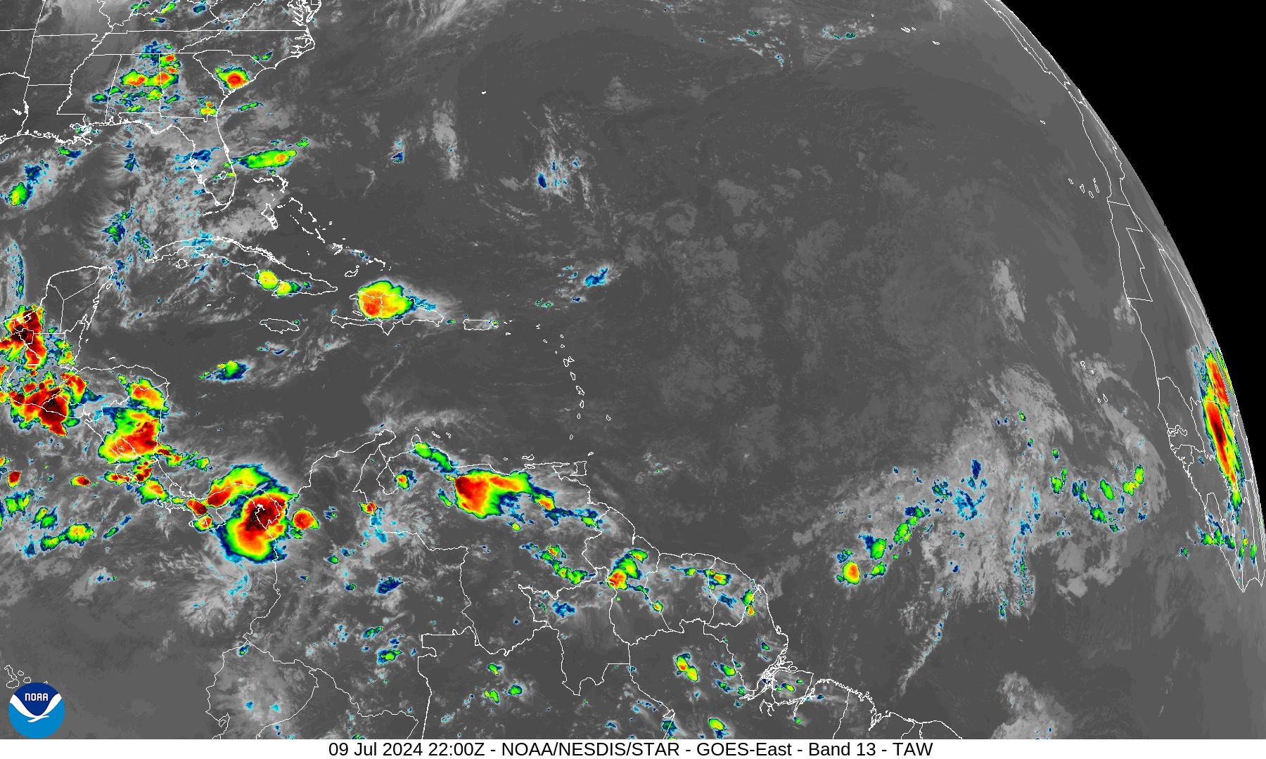
Very little convection observed over open waters of the Tropical Atlantic.
NASA GEOS5 Dust Forecast | Next 10-days
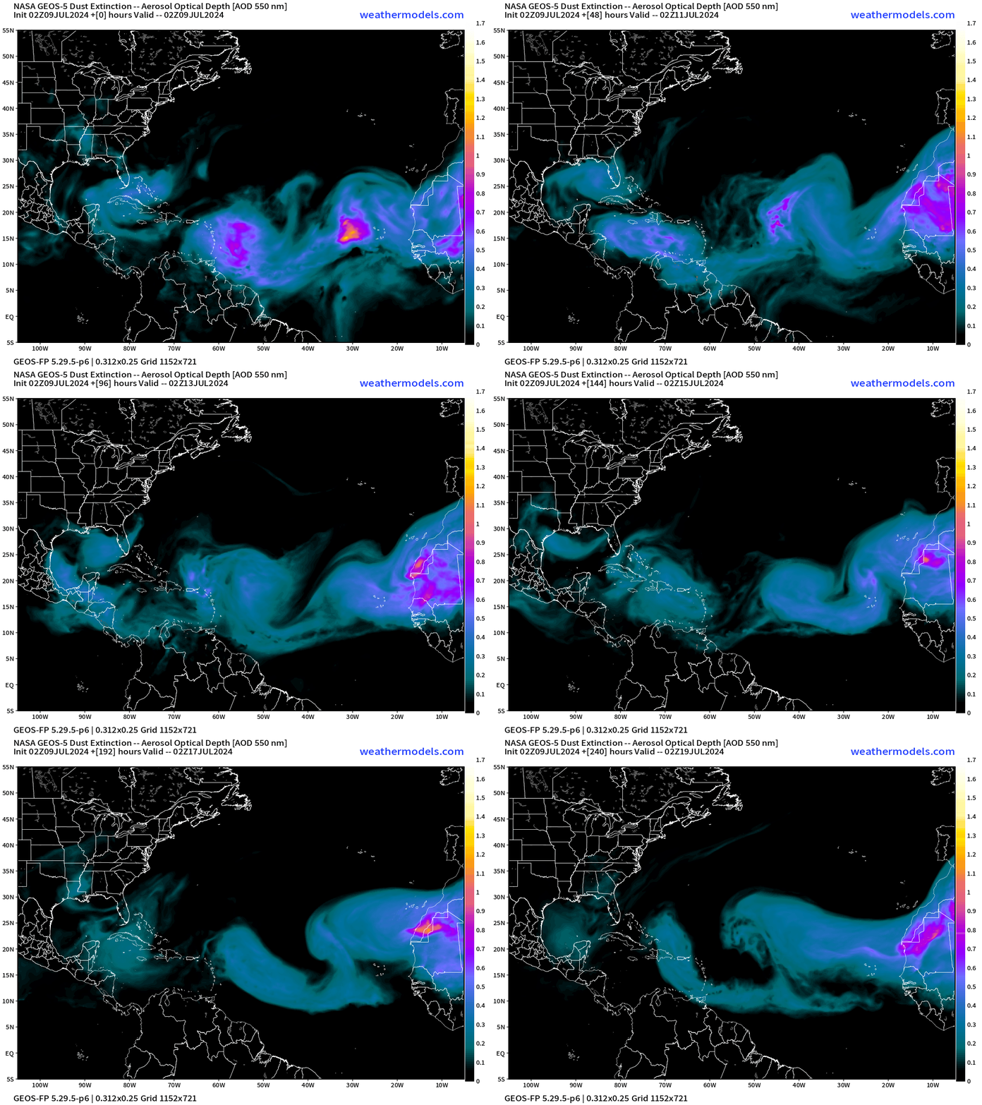
NASA GEOS5 model forecast shows multiple plumes of dust coming across the Atlantic into the Caribbean and Gulf of Mexico.
Next 10-days Upper-Level Weather Pattern | ECMWF AIFS
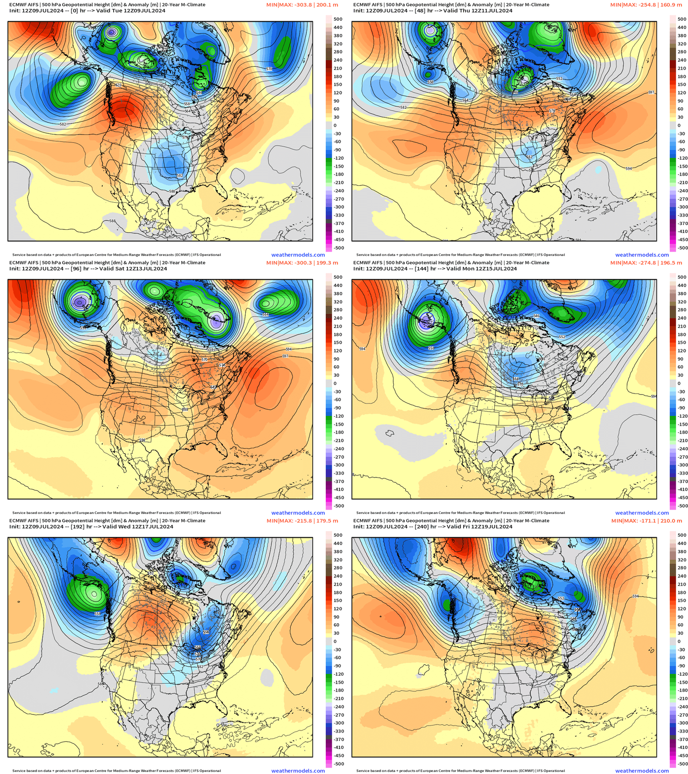
A ridge develops into the weekend across the Northeast, but finally is broken down by a more amplified upper-level pattern across the northern tier of states.
NWS WPC 7-Day Precipitation Forecast | Watering Needs
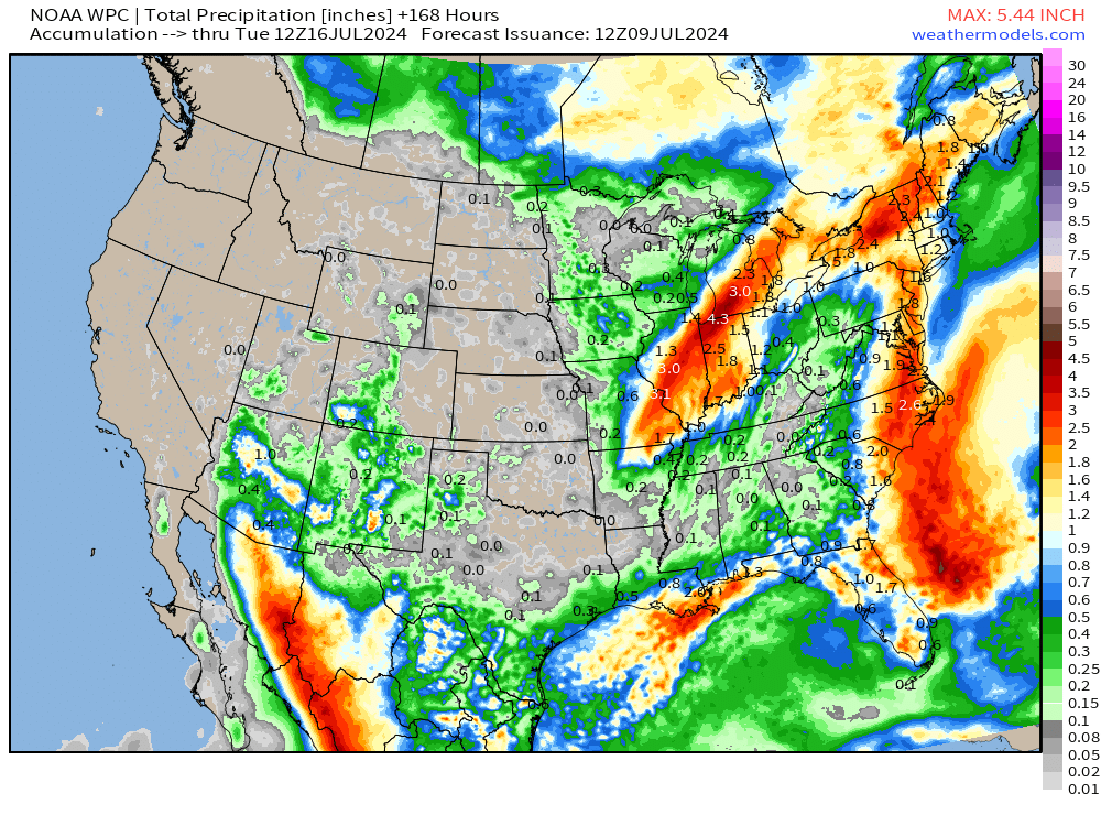
Some monsoon moisture creeping into the Southwest U.S. hopefully knocking down the brutal temperatures at least in Phoenix. Once the remnants of Beryl exit into Canada, dryer weather takes hold over much of the Lower 48 heading into middle July.
Tuesday High Temperatures
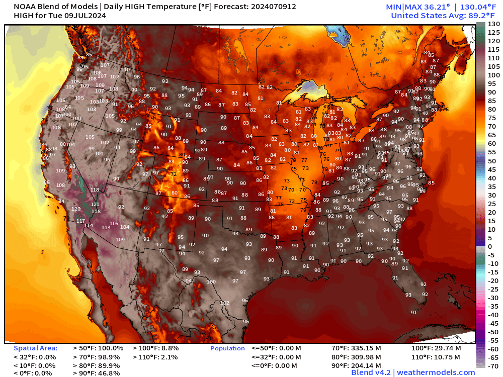
Lower 48 Average: 89.2°F | 204 Million at/above 90°F | 29.7 M at/above 100°F
Wednesday High Temperatures & Weather
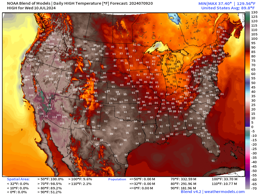
Lower 48 Average: 89.8°F | 182 Million at/above 90°F | 33.7 M at/above 100°F
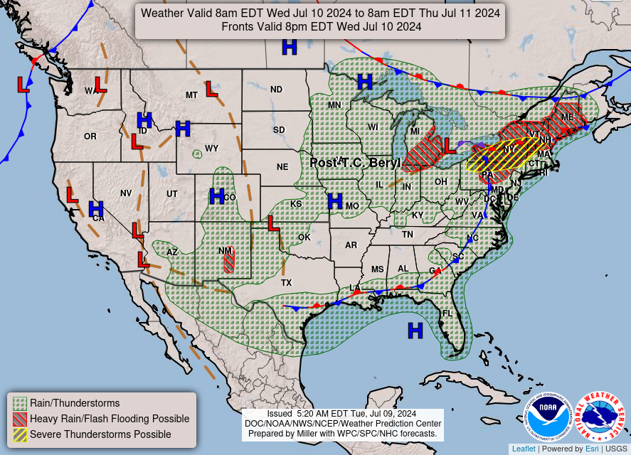
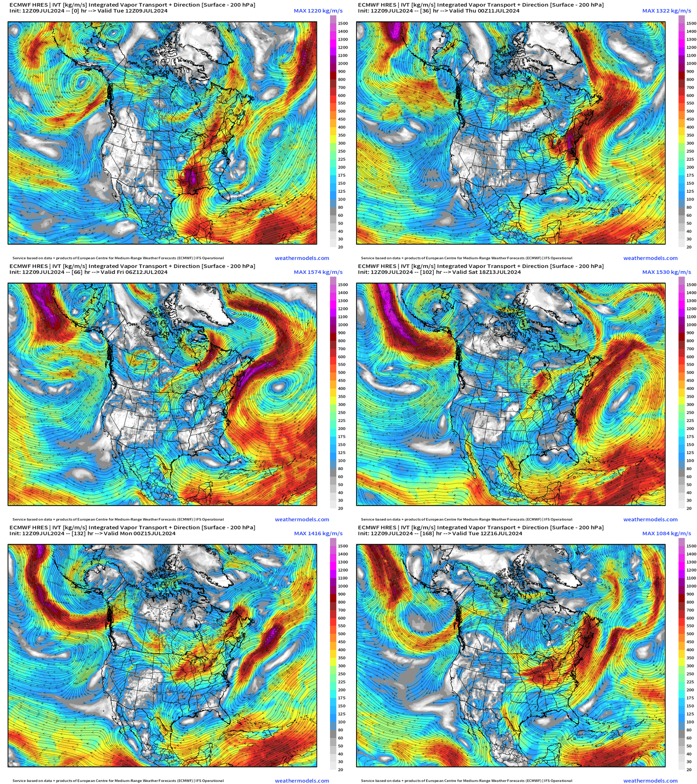
Next 7-Days Weather Systems | ECMWF HRES
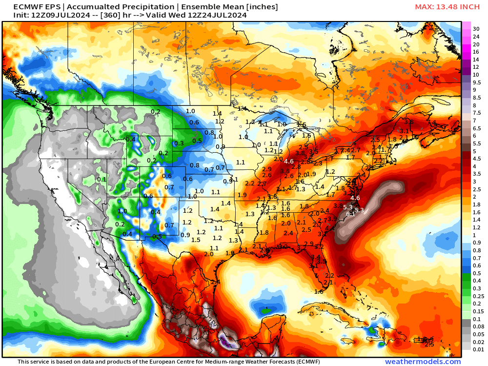
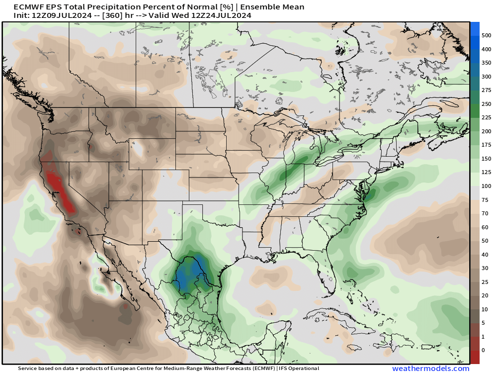
15-Day Precipitation and Anomaly (%)
Weekly Temperature Anomaly
EPS Week 1: July 9-15, 2024
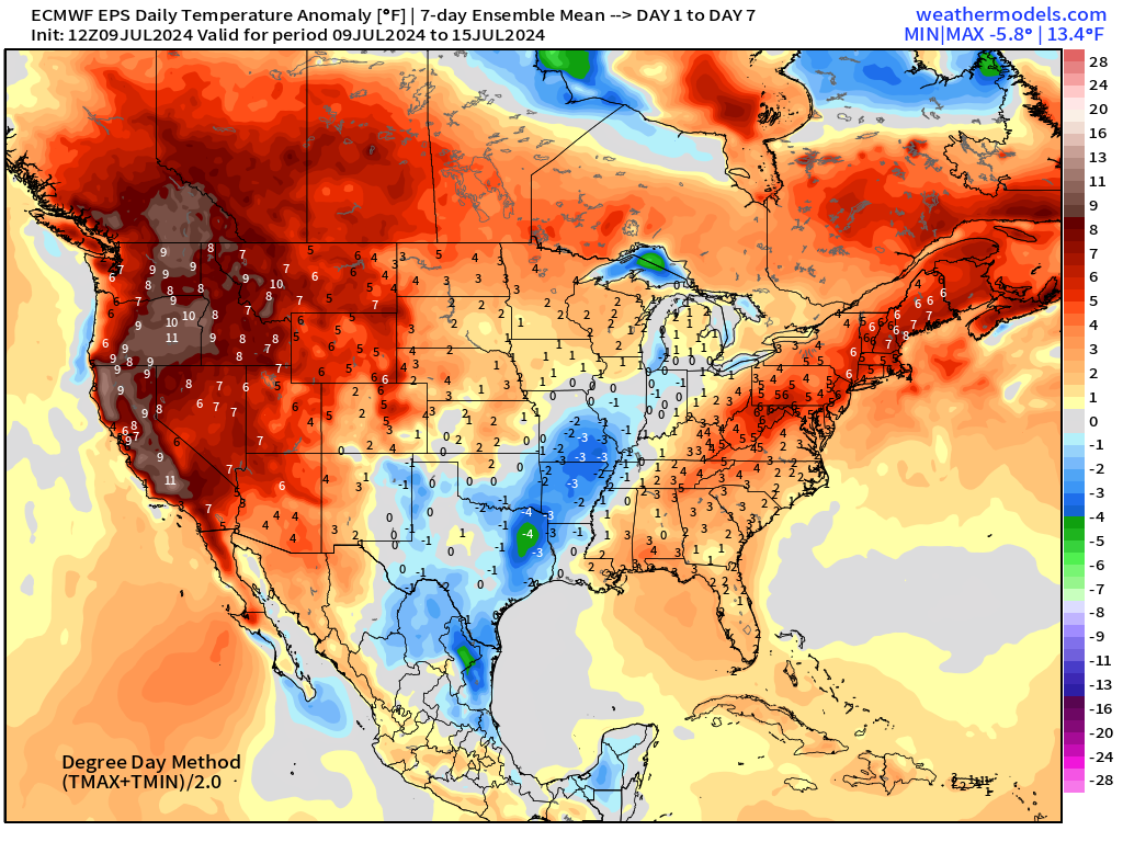
Major heat wave conditions continue across the Western U.S. including California with anomaly > 10°F
EPS Week 2: July 16-22, 2024
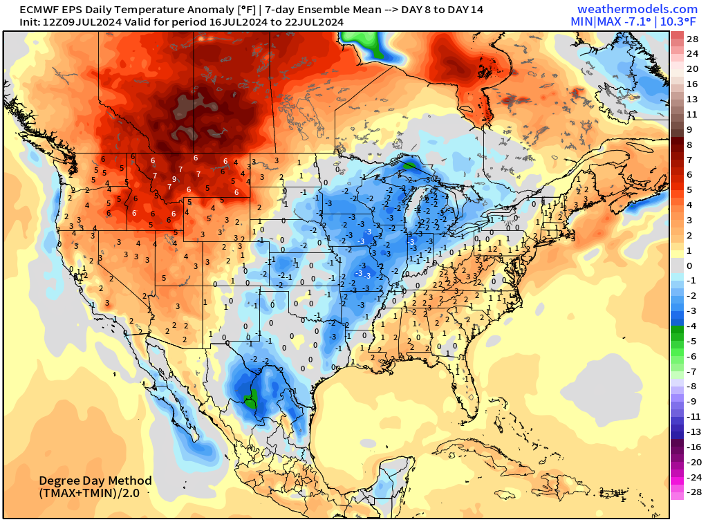
The central U.S. and Great Lakes a bit cooler than normal probably meaning a trough and wetter weather.
Thank you to Subscribers and Supporters!
Maps sourced from weathermodels.com designed and innovated by yours truly! I actually create all of my content from scratch.
- Milepost
- 338 · laid 2024-07-09T22:25:03.867000Z
- Source
- https://weather.substack.com/p/july-9-2024-tuesday-weather-update
- Digest
- 1f000921ac02f8d3e5cb7117ffcc832419bade99118deb2592507b6dbccfbe23
- Machine
- JSON