July 8, 2024 Monday Weather Update
Tropics go quiet as Lower 48 broils in extreme summer heat
July 2024 was the 12th-warmest July in the 132-year national record (1895–2026), at 75.7°F against a 1991–2020 normal of 74.4°F (+1.3°F).
July 2024 was the 21st-wettest July in the 132-year national record (1895–2026), at 3.1in against a 1991–2020 normal of 2.9in (+0.2in).
NOAA/NCEI Climate at a Glance, contiguous United States. This is the observed record for the month, not a score of anything said in this piece — the forecast ledger begins 2026-08-17 and cannot reach earlier posts.

Monday Headlines
Beryl made landfall in Texas south of Houston knocking out power with hurricane-force wind gusts.
Heat Wave Across the Western U.S. continues with Death Valley going to 131°F by Wednesday
Filling up the emails with Lower 48 content as the tropics will go dormant for the next 2-weeks, or perhaps longer
Beryl’s large eye made Landfall this morning with 70-knots winds and 979 mb central pressure near Matagorda, Texas between Corpus Christi and Houston between 2-4 AM.
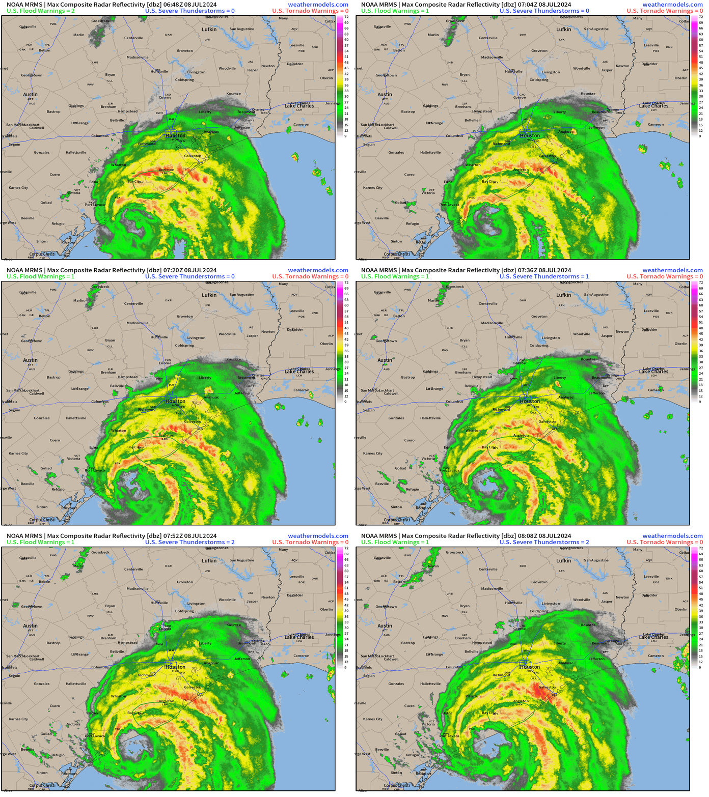
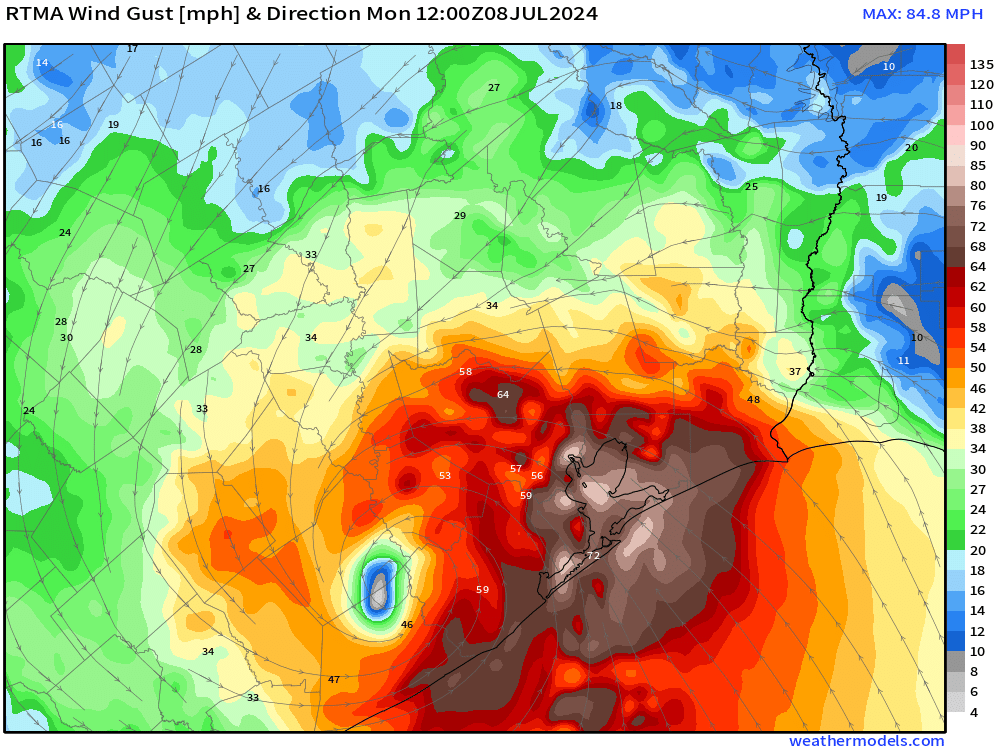
Wind gusts pushed above hurricane force across Houston metro — much stronger than expected. Gusts in the mid-80s mph at Houston Hobby!
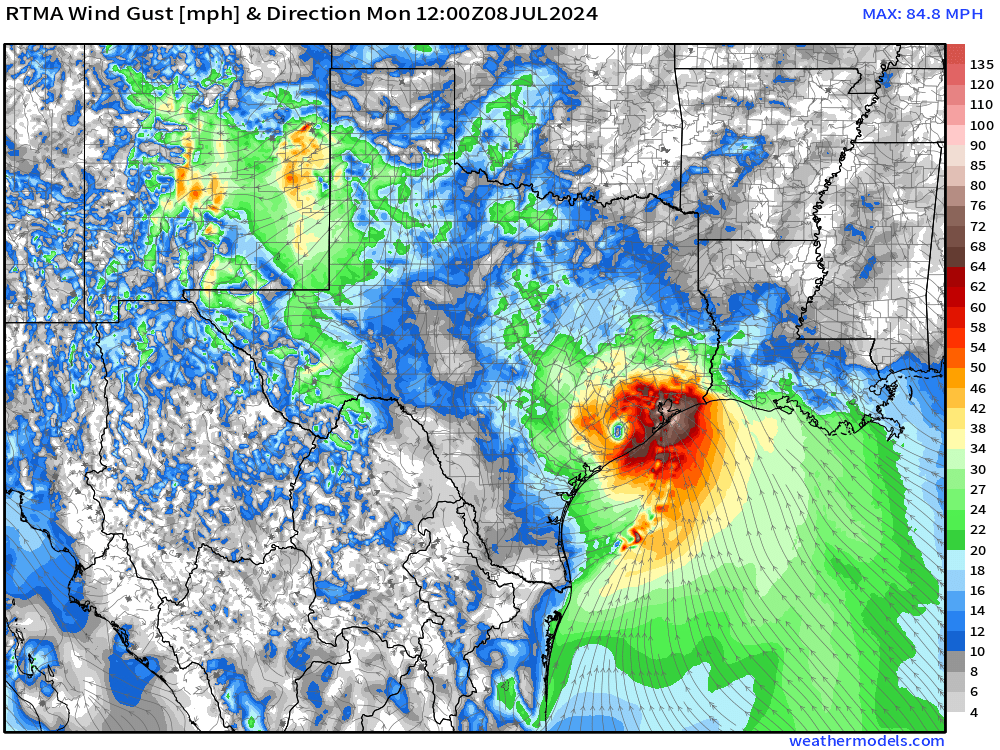
The strongest gusts were in the spiral bands coming off the Gulf of Mexico. Beryl was poised to rapidly intensify with favorable upper-level conditions + very warm ocean waters. Thankfully, Beryl ran out of ocean runway or the pressure would have continued to drop.
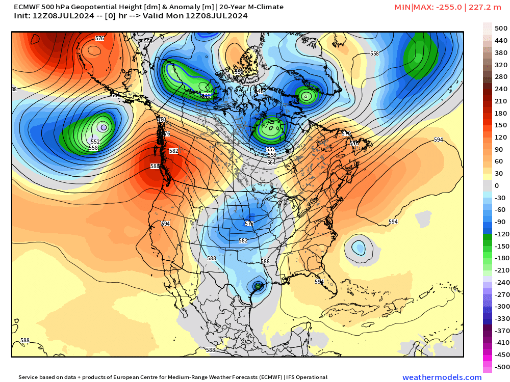
Beryl is a really nice looking former hurricane over East Texas. The rainfall and cloud cover is combining with a trough allowing the northward movement.
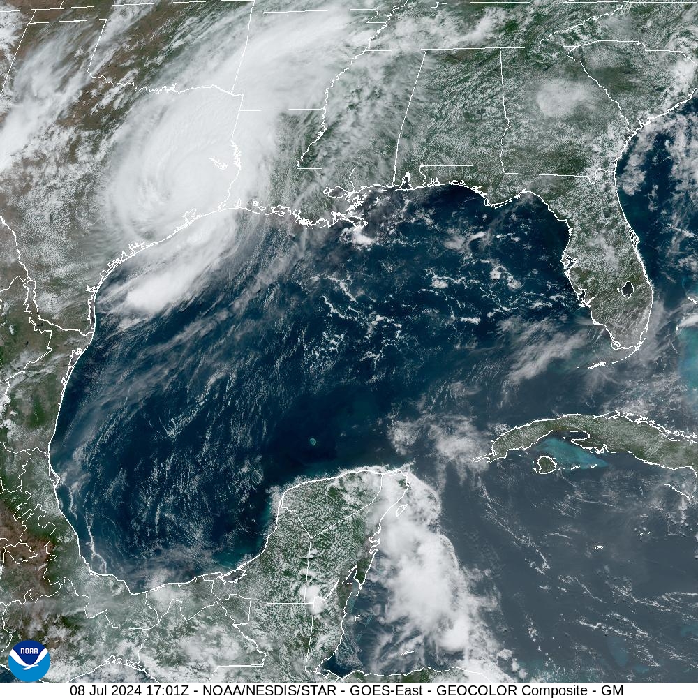
This trough provided the weakness in the continental ridge to allow Beryl to escape northward. Tropical storms and hurricanes do not want to be in the tropics at all, as they find better dynamical balance at higher latitudes where background pressure is lower, like themselves.
Ensemble Tracks Next 15-days
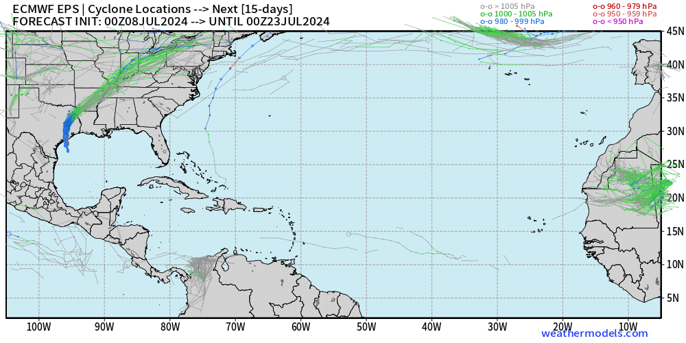
The ECMWF ensemble (00z) model tracks for tropical cyclones is almost entirely blank for the next 15-days — until July 23. The background environmental conditions are hostile with wind shear, dry air, dust, and high pressure dominating the Atlantic tropics.
Atlantic Basin GeoColor Satellite Imagery
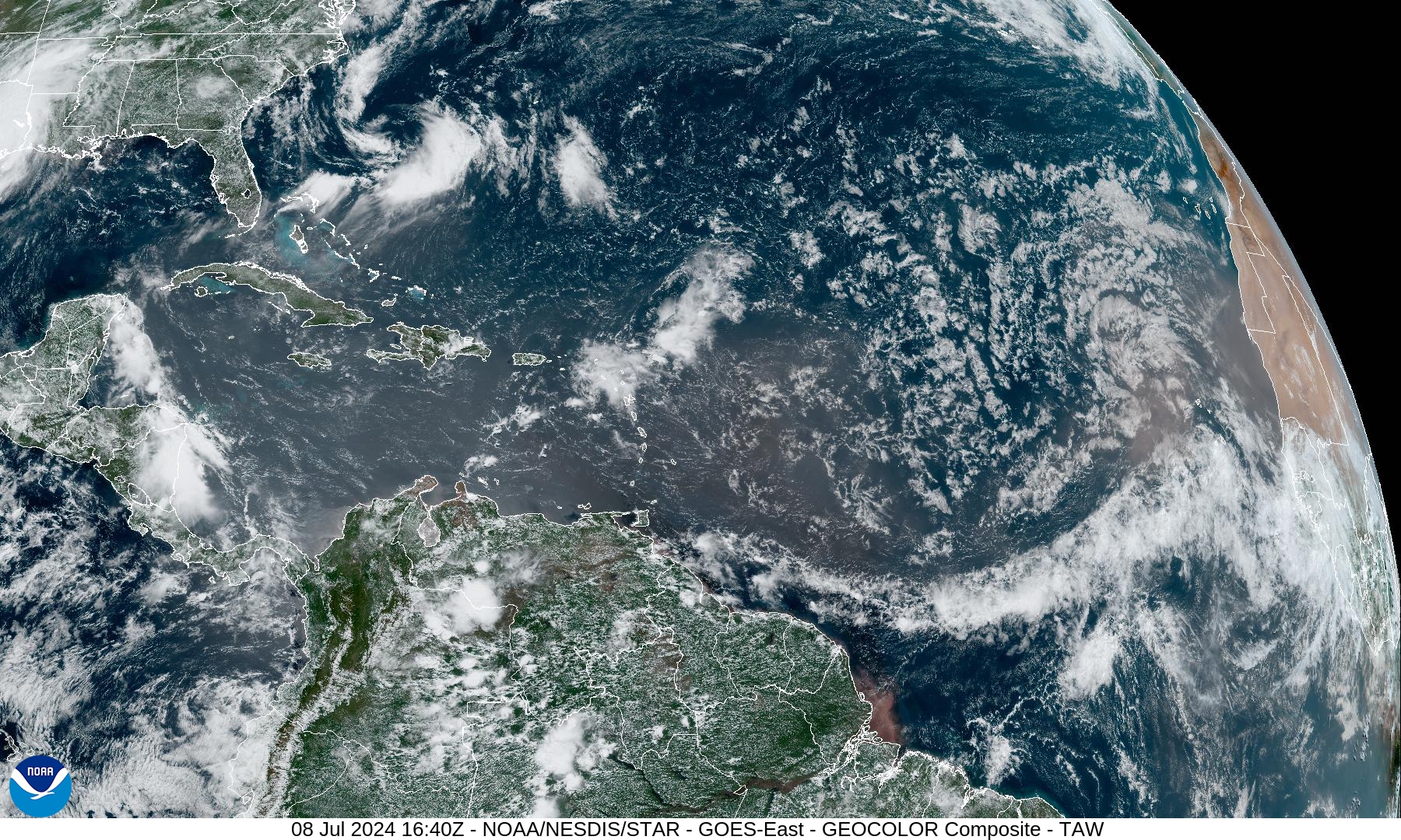
3 distinct bursts of Saharan Air Layers laden with dust are crossing the Atlantic. Tropical waves and thunderstorms stand no chance in this environment.
NASA GEOS5 Dust Analysis
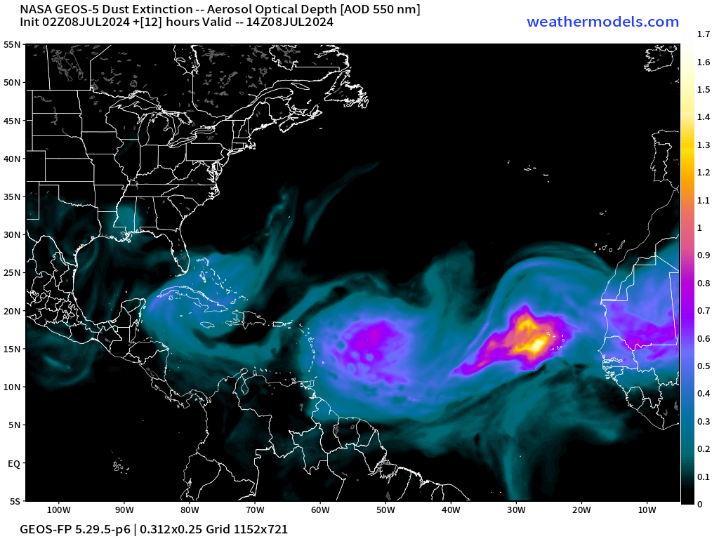
NASA GEOS5 model analysis shows a massive dust plume coming across the Atlantic.
Next 10-days Upper-Level Weather Pattern | ECMWF AIFS
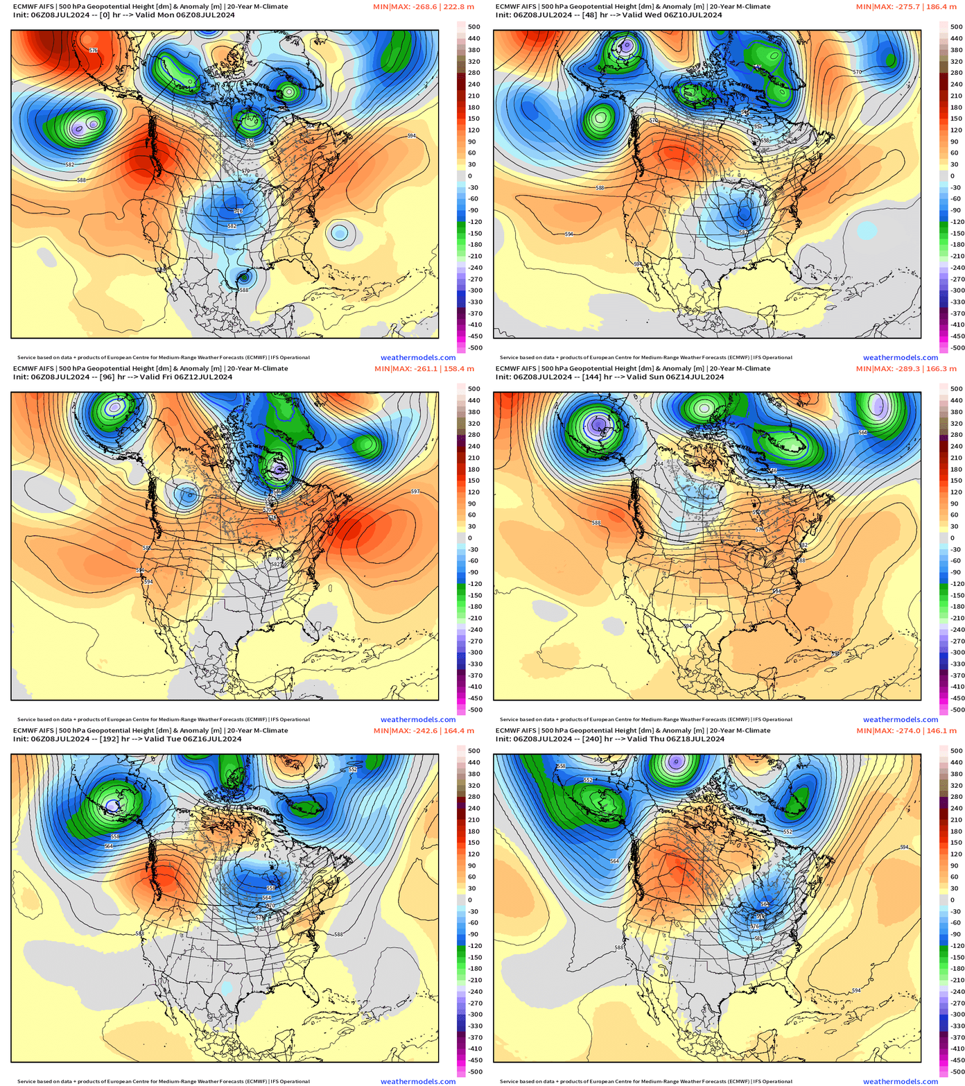
Looking at the breakdown of the western ridge in 7-8 days with overall heights lowering across the Lower 48 with a more amplified pattern into mid-July. Beryl’s moisture will be quite welcome for lucky customers from Texas to the Great Lakes.
NWS WPC 7-Day Precipitation Forecast | Watering Needs
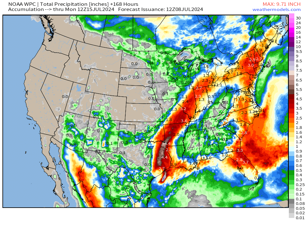
Unfortunately, not much rainfall west of the Mississippi or in the corn growing regions of Iowa and the central Plains.
Monday High Temperatures & Weather
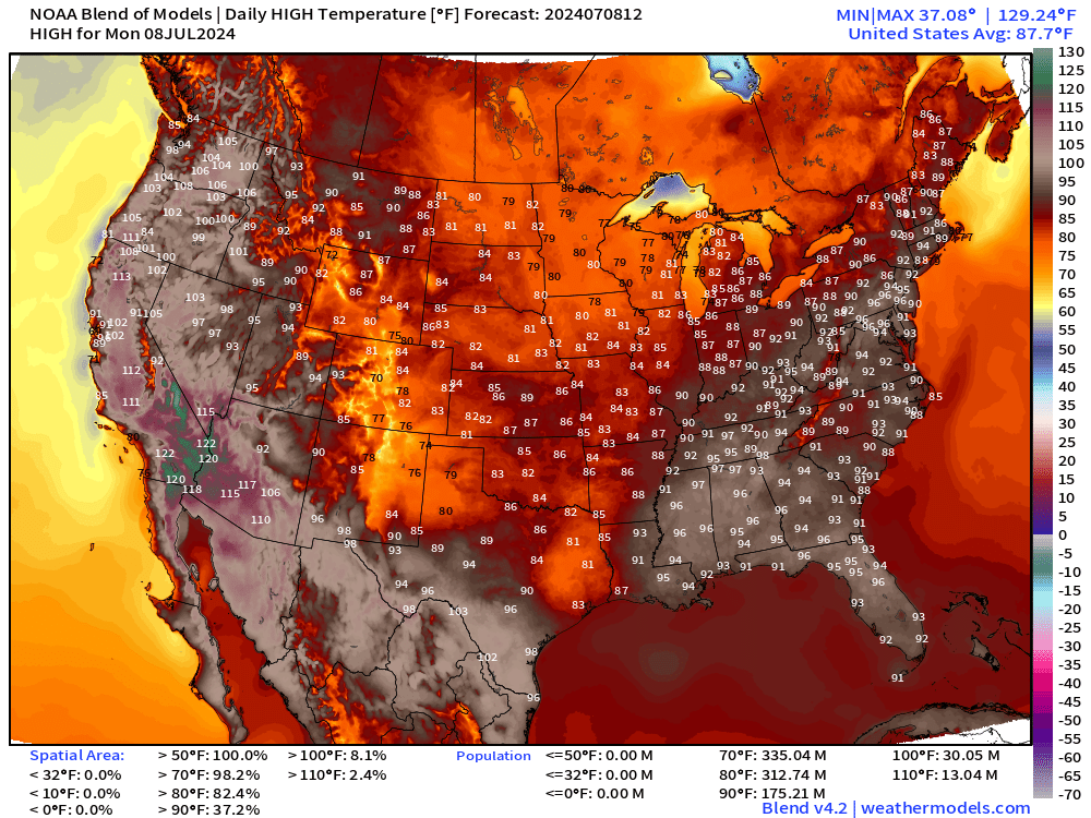
Lower 48 Average: 87.7°F | 175 Million at/above 90°F | 30.0M at/above 100°F
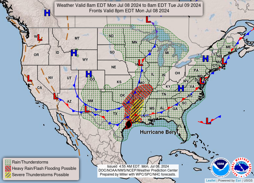
Next 7-Days Weather Systems | ECMWF HRES
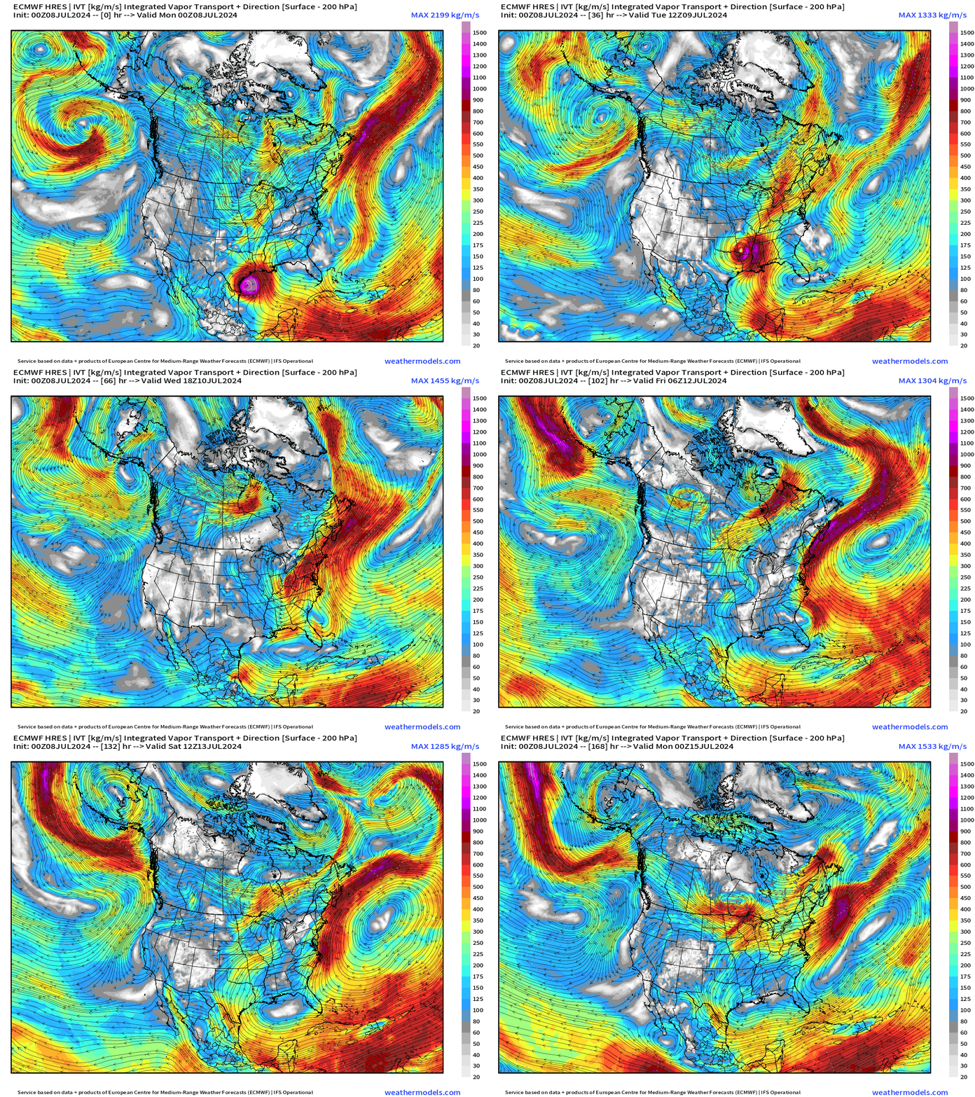
The moisture with Beryl combines with a frontal system over the Northeast providing significant rainfall. The Integrated Vapor Transport does not show much coming out of the tropics into the Gulf or the southern U.S. after Beryl.
10-Day Precipitation and Anomaly (%)
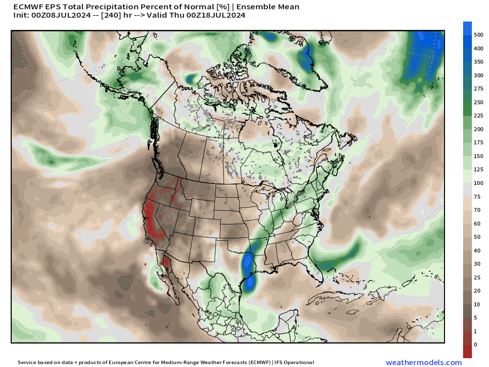
Aside from Beryl — bone dry. So, in a way, probably lucky we had the weather pattern to provide the tropical moisture for the Lower 48.
Weekly Temperature Anomaly
EPS Week 1: July 8-14, 2024
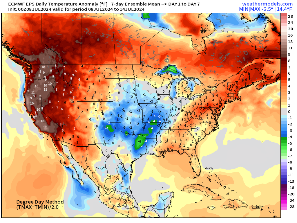
Major heat wave conditions continue across the Western U.S. with anomaly > 10°F
EPS Week 2: July 15-21, 2024
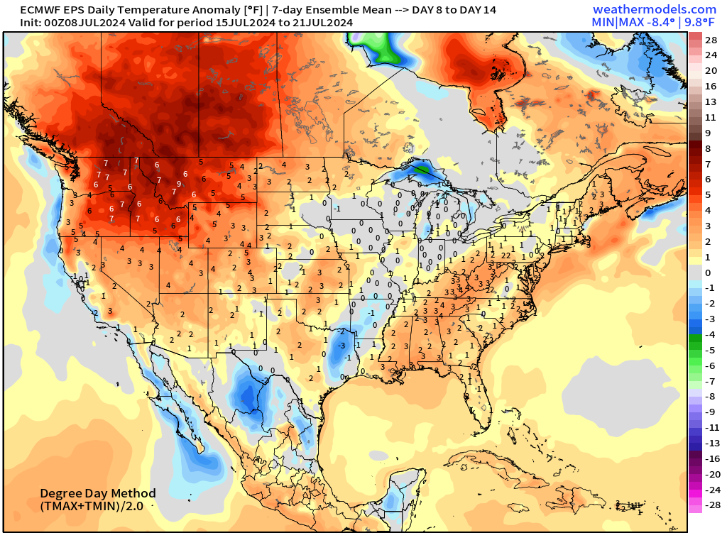
The heat tempers somewhat into the third week of July. Thankfully not any colossal heat domes setting up across the Eastern U.S.
Thank you to Subscribers and Supporters!
Maps sourced from weathermodels.com designed and innovated by yours truly! I actually create all of my content from scratch.
- Milepost
- 337 · laid 2024-07-08T17:38:49.739000Z
- Source
- https://weather.substack.com/p/july-8-2024-monday-weather-update
- Digest
- cf856c11c2995b26539bf8bf4fc5f56f9b25c732a81306eab019ff619413d412
- Machine
- JSON