June 29, 2024 Tropical Update: Hurricane Beryl
Forecast to become a major hurricane in the Caribbean
June 2024 was the 2nd-warmest June in the 132-year national record (1895–2026), at 71.8°F against a 1991–2020 normal of 69.5°F (+2.3°F).
June 2024 was the 41st-driest June in the 132-year national record (1895–2026), at 2.8in against a 1991–2020 normal of 3.1in (-0.3in).
NOAA/NCEI Climate at a Glance, contiguous United States. This is the observed record for the month, not a score of anything said in this piece — the forecast ledger begins 2026-08-17 and cannot reach earlier posts.

Most recent NHC (5 pm) forecast rapidly intensifies Beryl (02L) into a major hurricane prior to arrival in the islands. Hurricane watches have already been issued for the Windward Islands. The NHC forecast closely follows the ECMWF mean through Day 5 as well as GFS. The track forecast may be of higher certainty that usual.
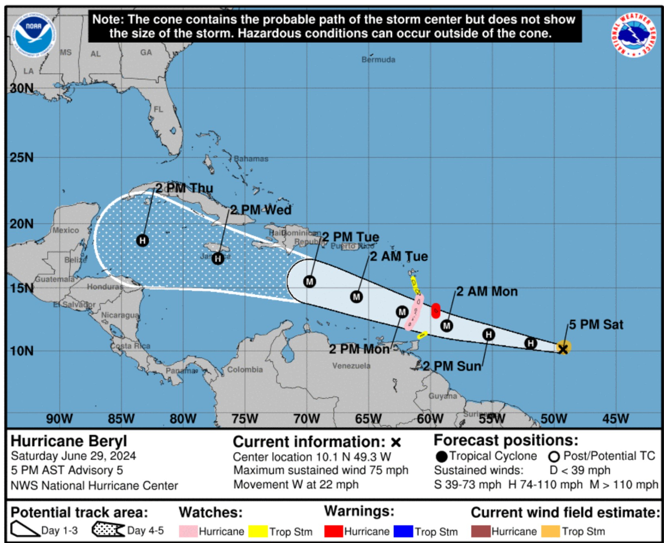
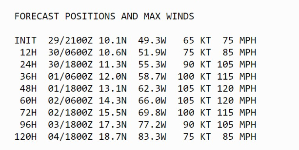
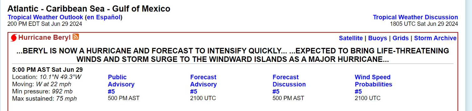
ECMWF Ensemble Envelope of Solutions (12Z) through 10-days
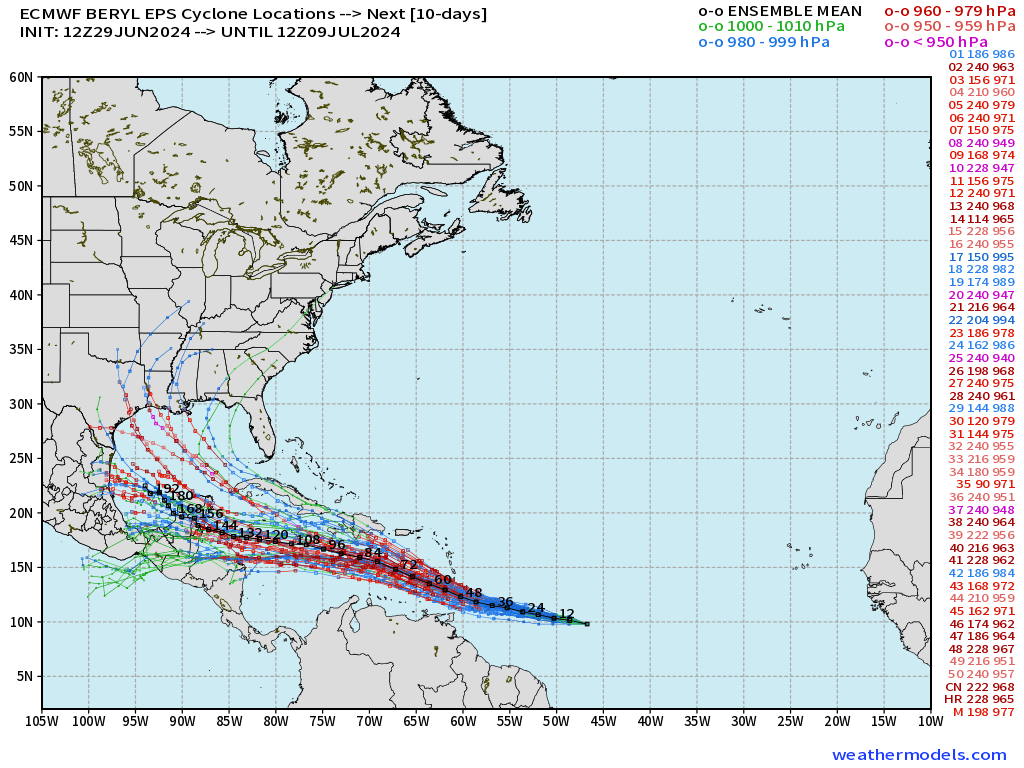
The vast majority of solutions head westward into the Yucatan peninsula. However, there are many (~10) that are on the right side of the forecast envelope and head into the Gulf of Mexico. However, that’s at Days 7-10, so that spread is expected with longer-range forecasts.
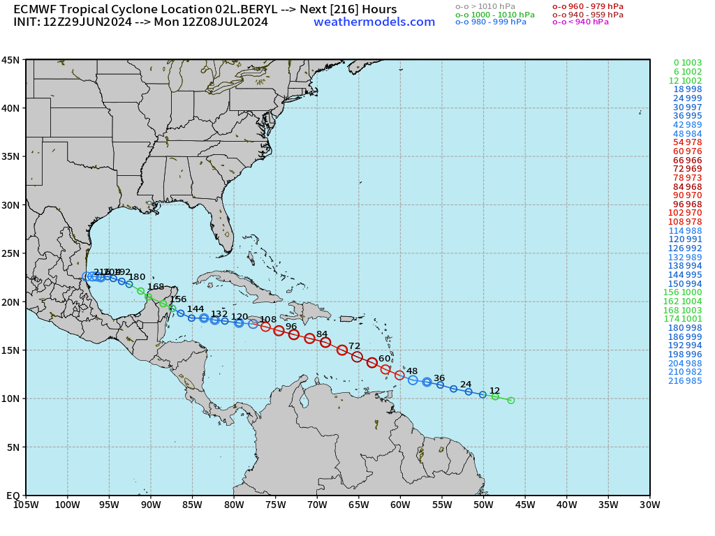
ECMWF HRES 12z is near or just south of Jamaica in the central Caribbean assuring a Central America landfall in 6-7 days. The minimum pressure is down to 966 mb w/ECMWF HRES suggesting a major hurricane, at least in the eastern Caribbean.
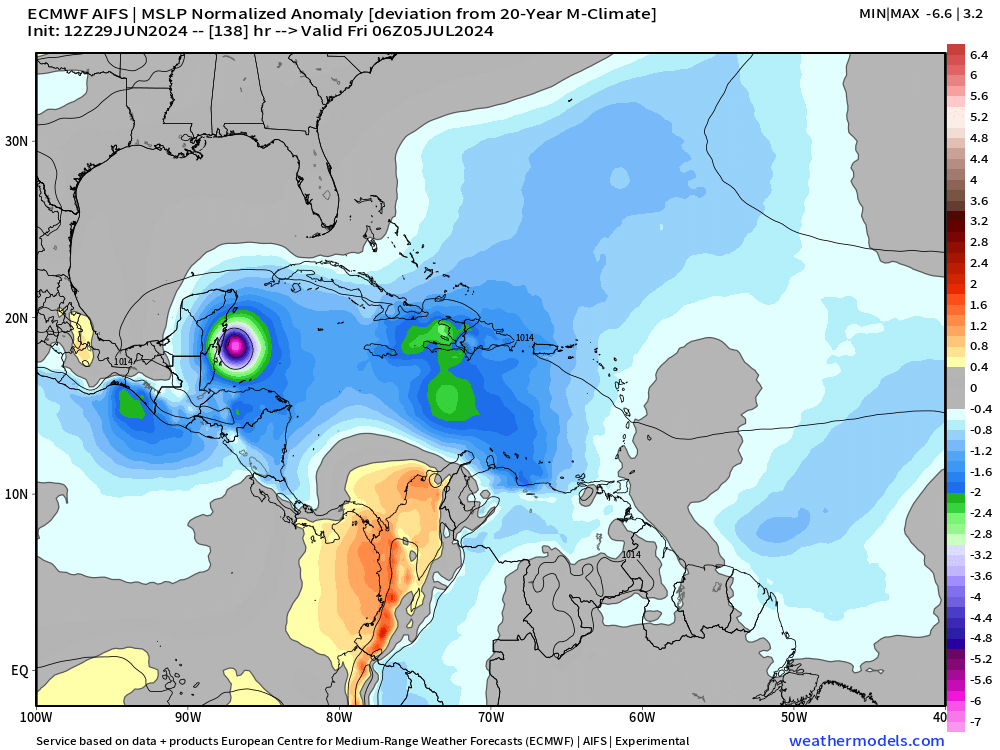
ECMWF AIFS (12z) is on top of HRES (12z) but at a lower/weaker intensity because of the coarseness of the model.
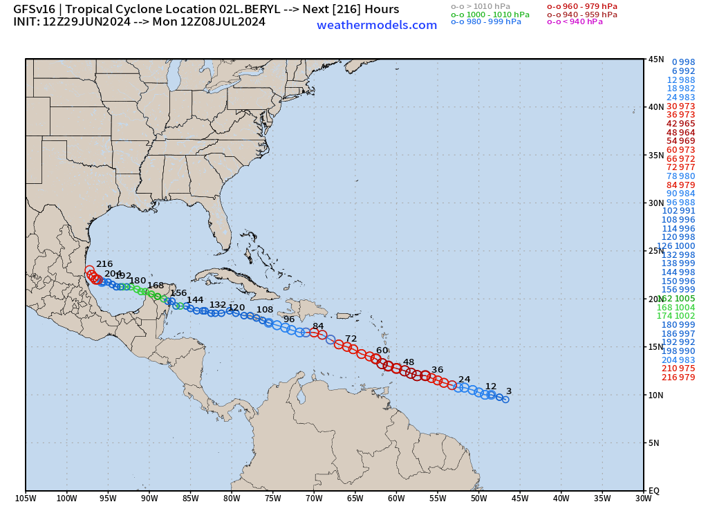
GFS 12z: also into the 960s on a similar track as ECMWF 12z.
Basin Wide IR Satellite Imagery
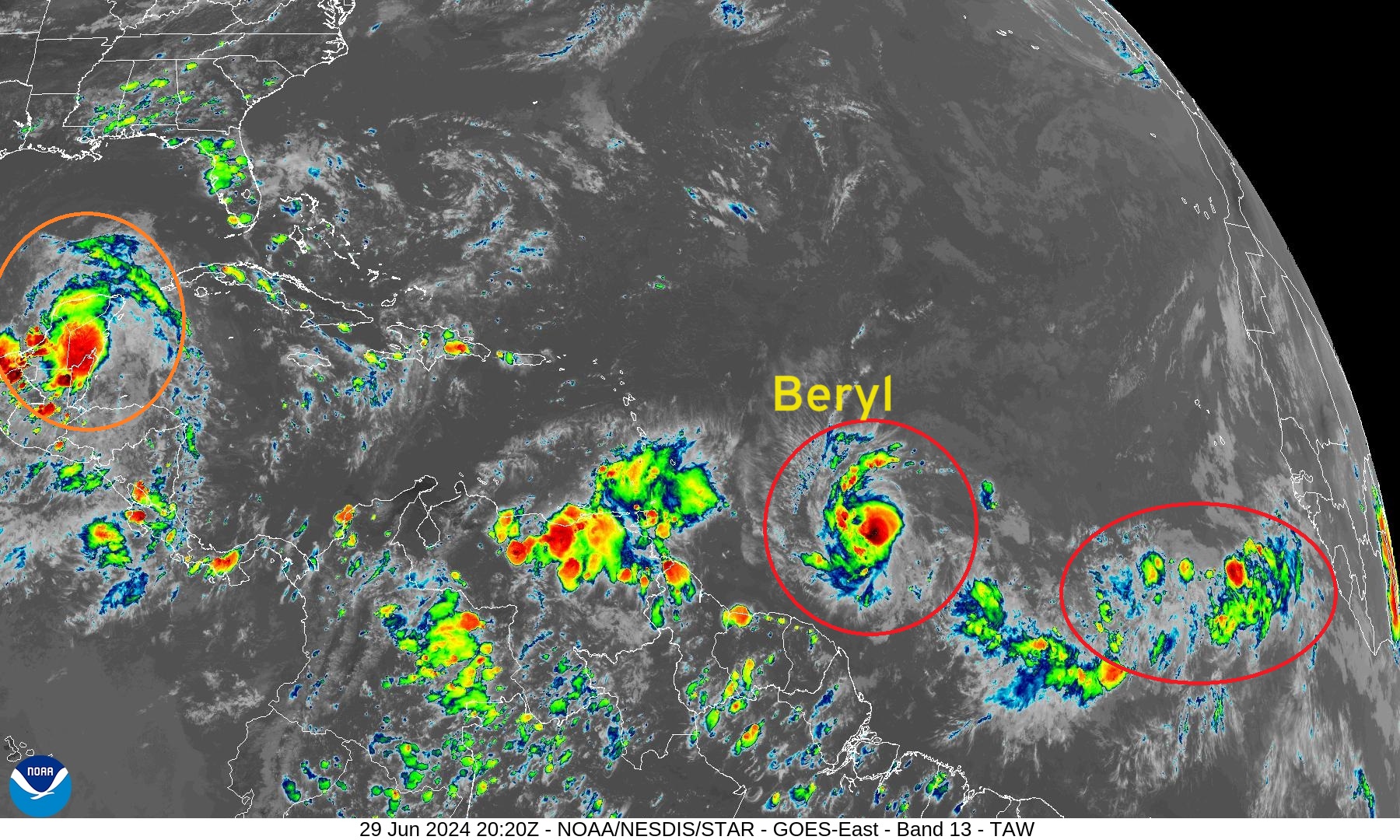
Nearly Hurricane Beryl (02L) Zoom IR Satellite
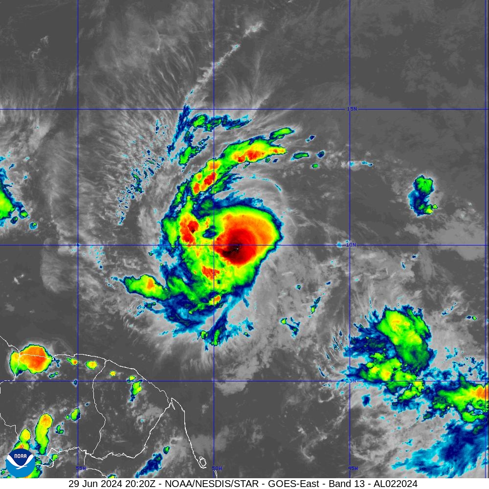
I’m a bit skeptical of the bullish rapid intensification forecasts for Beryl in the face of wind shear and environmental dry air. However, if this convection can burst again overnight, then we’ll have a hurricane in 12-24 hours, and a strong enough vortex to overcome the negative, slight wind shear. Beryl is also booking to the west > 20 knots.
7-Day Tropical Weather Outlook
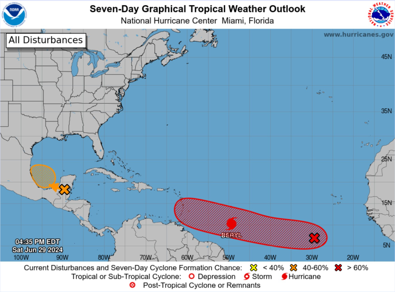
Still a 50% chance of development with the wave in the southern Gulf of Mexico (Invest 94L)
The next system is behind Beryl and looks likely to become a depression in a few days (70%).
Eastern Pacific Tropical Weather Outlook
No activity expected in the next 48-hours or 7-days, or who knows how long — but the rest of June looks quiet.
Western Pacific Tropical Weather Outlook
No development expected in the next 48-hours to 7-days
Thank you to Subscribers and Supporters!
The investment in my research and development will pay off as A.I. enabled weather forecasts become a normal and indispensable part of our weather forecasting enterprise.
Maps sourced from weathermodels.com designed and innovated by yours truly! I actually create all of my content from scratch.
- Milepost
- 328 · laid 2024-06-29T20:43:34.822000Z
- Source
- https://weather.substack.com/p/june-29-2024-tropical-update-nearly
- Digest
- 40218e2b2d1c80bb6c944889009ef7d7fc8195a0545dd40ff8094829be611e63
- Machine
- JSON