June 28, 2024 Tropical Update: Tropical Depression 02L
Forecast to become a powerful hurricane in the Caribbean
June 2024 was the 2nd-warmest June in the 132-year national record (1895–2026), at 71.8°F against a 1991–2020 normal of 69.5°F (+2.3°F).
June 2024 was the 41st-driest June in the 132-year national record (1895–2026), at 2.8in against a 1991–2020 normal of 3.1in (-0.3in).
NOAA/NCEI Climate at a Glance, contiguous United States. This is the observed record for the month, not a score of anything said in this piece — the forecast ledger begins 2026-08-17 and cannot reach earlier posts.

Tropical Depression 02L advisories underway — next name is Beryl.
The 5-day forecast cone heads to Jamaica as a Category 2+ hurricane.
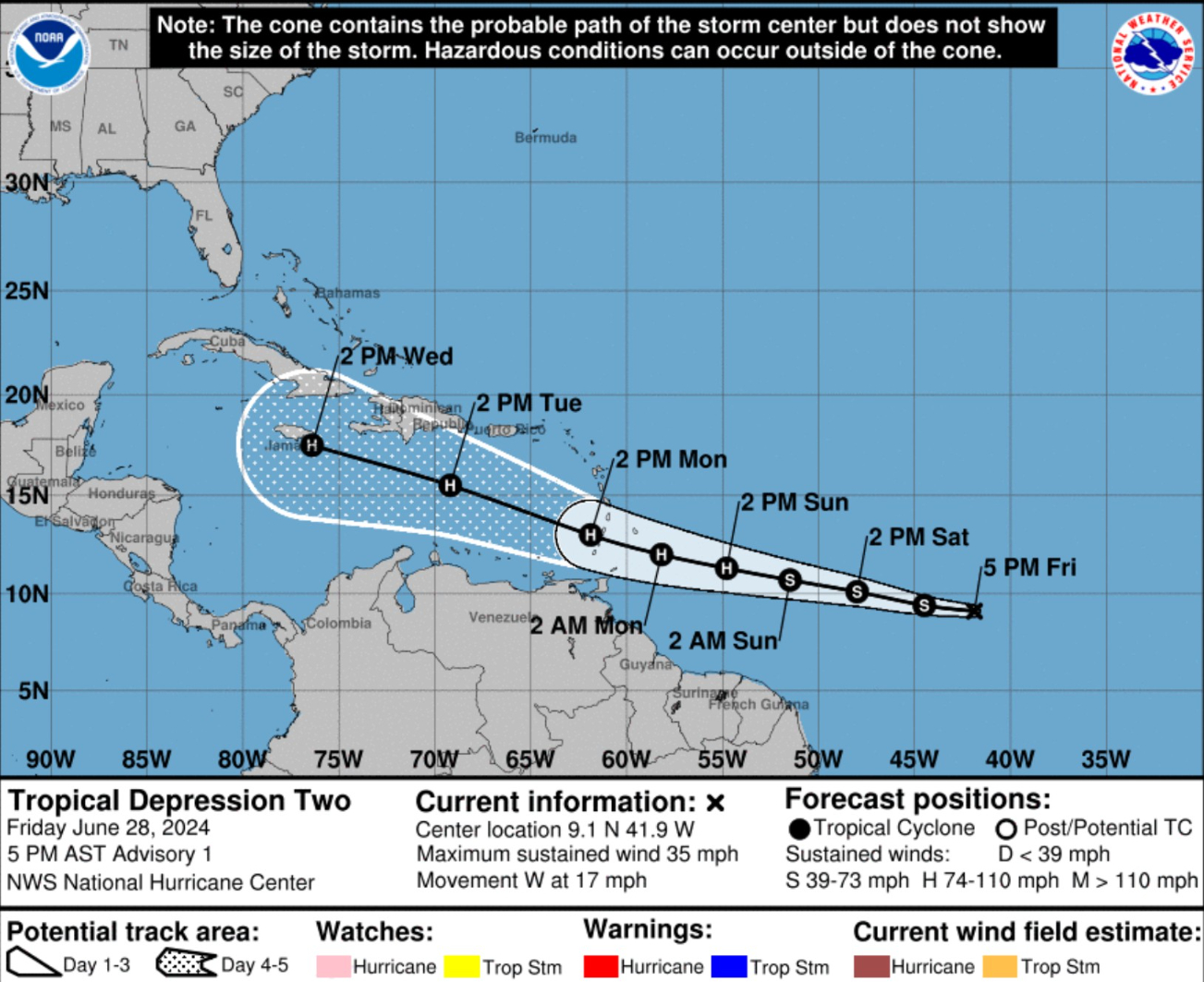
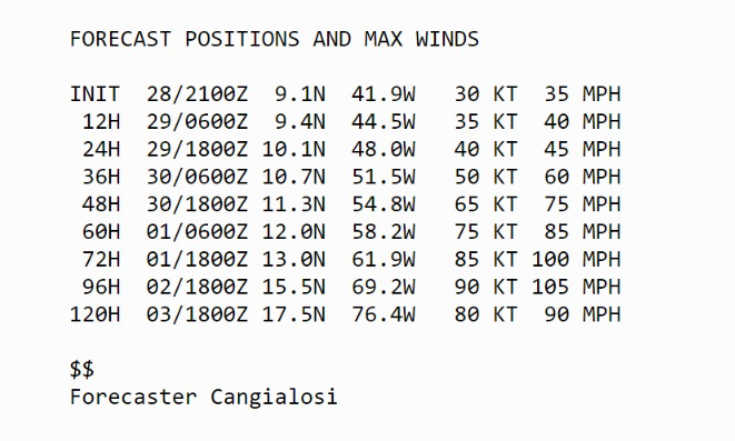
Many models go into the Yucatan or Honduras, but it is too soon to discount a more northly track that aims for the Gulf of Mexico. Hopefully soon we can eliminate that scenario.
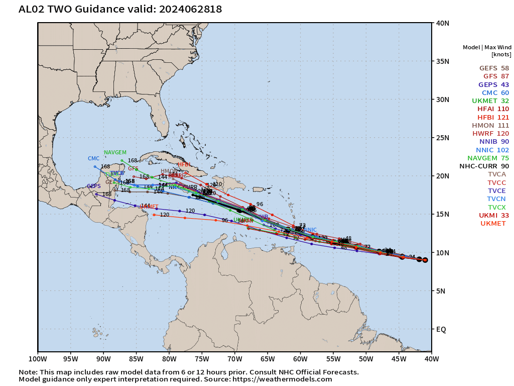
ECMWF Ensemble Envelope of Solutions (12Z) through 180-hours
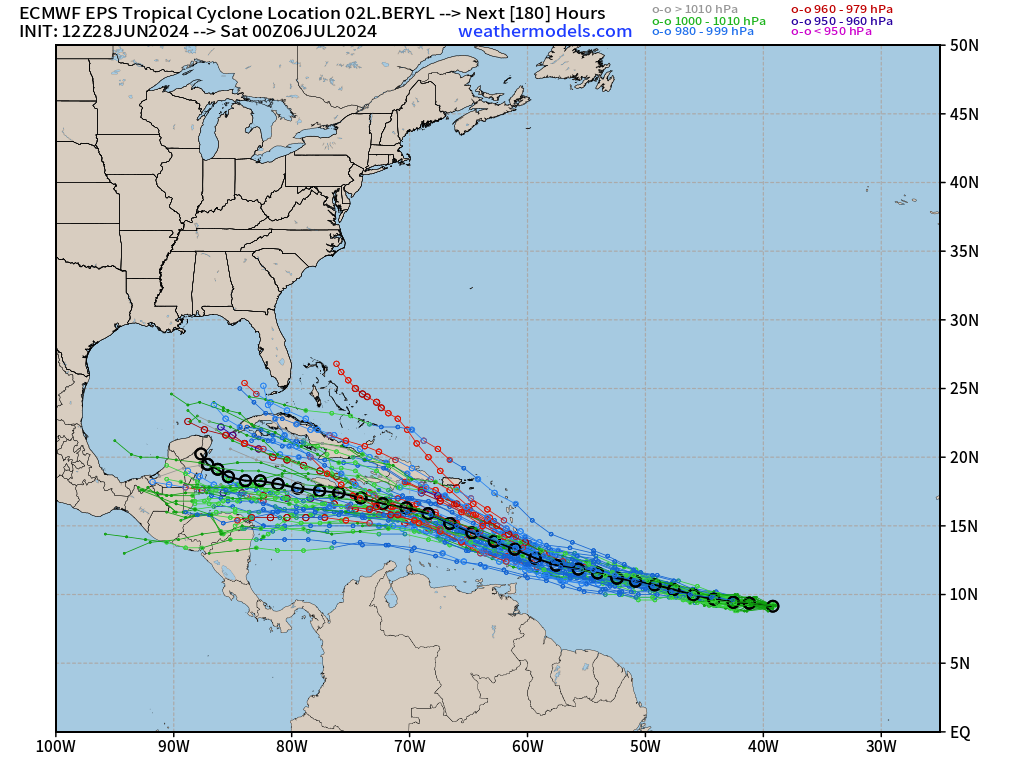
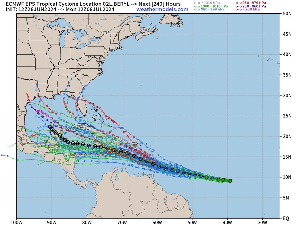
And through 10-days
The solutions on the right of the ensemble mean are more akin to the GFS. We don’t have a preference for either scenario at this time, so the Gulf of Mexico is still in play — until we say otherwise.
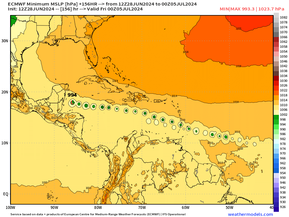
ECMWF HRES 12z is south of Jamaica in the central Caribbean assuring a Central America landfall in 6-7 days by next Thursday.
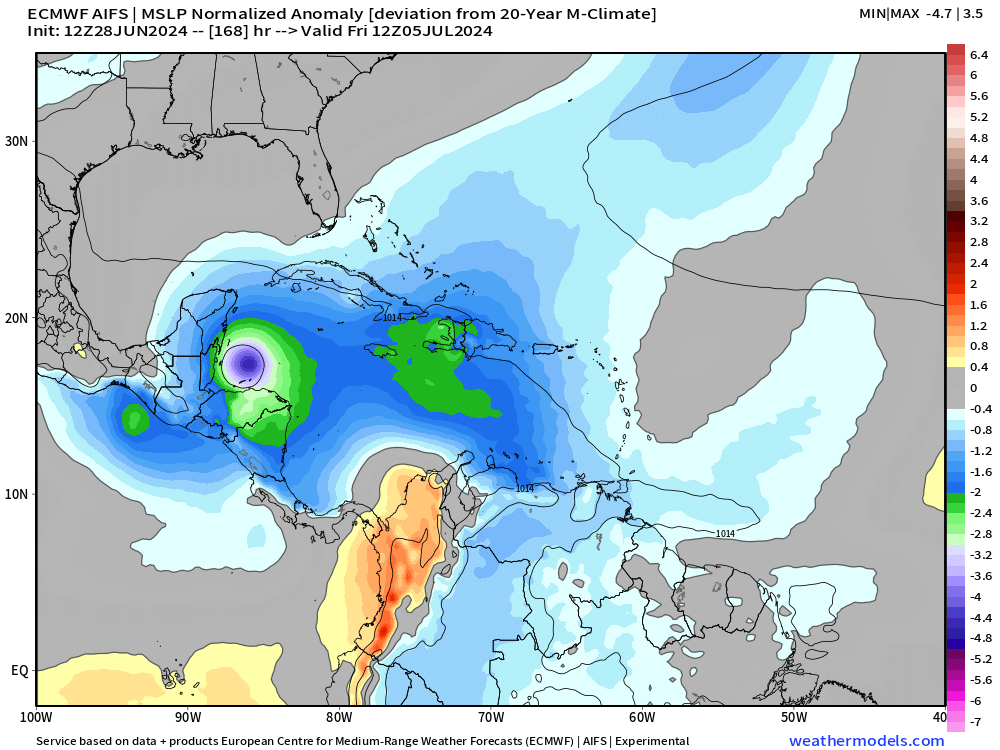
ECMWF AIFS (12z) is on top of HRES (12z) but at a lower/weaker intensity because of the coarseness of the model.
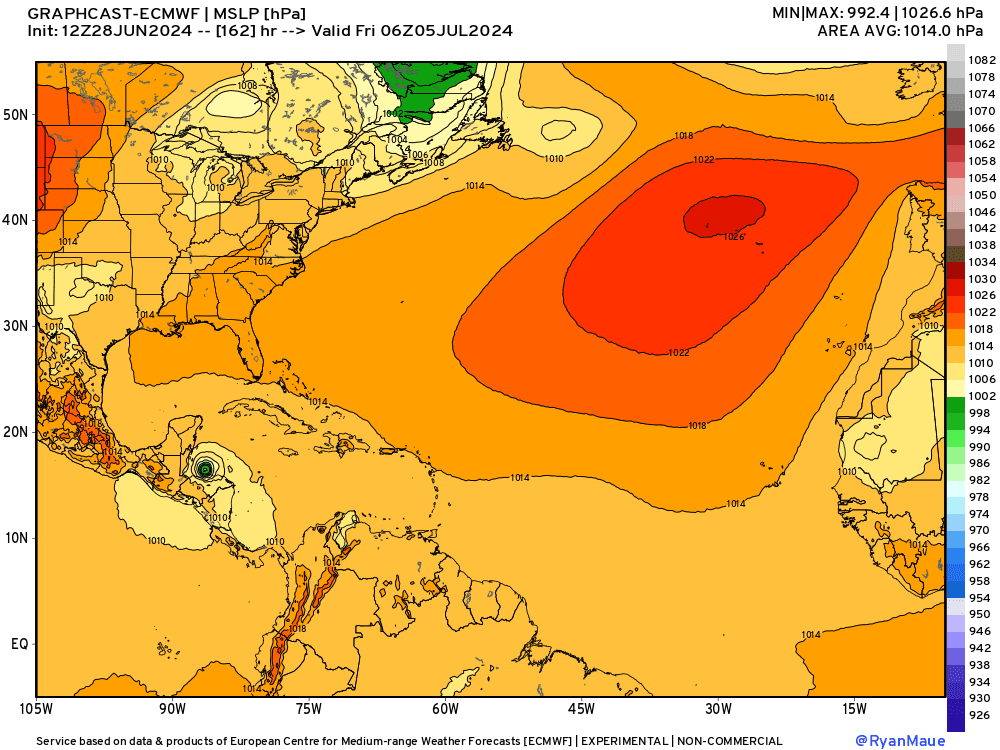
GraphCast-ECMWF 12z (0.25°) is more intense at 992 mb into the Yucatan in 6-7 days.
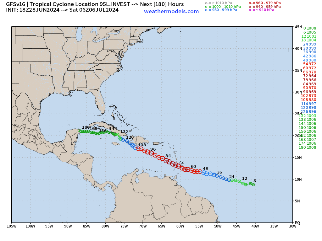
GFS 18z: is more intense with Beryl — and perhaps feels the ridge less allowing a more northerly track around Jamaica.
Weather Trader is a reader-supported, daily newsletter. To receive new posts and support our R&D, consider becoming a free or paid subscriber.
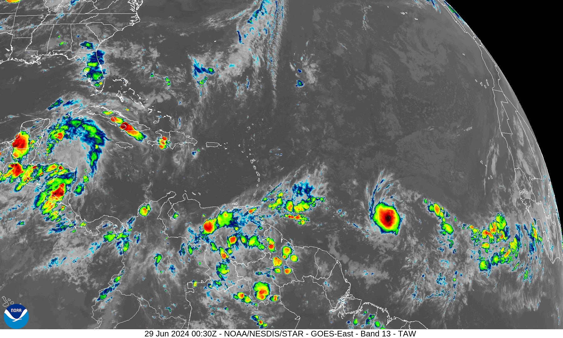
Basin Wide IR Satellite Imagery
Tropical Depression 02L Zoom IR Satellite
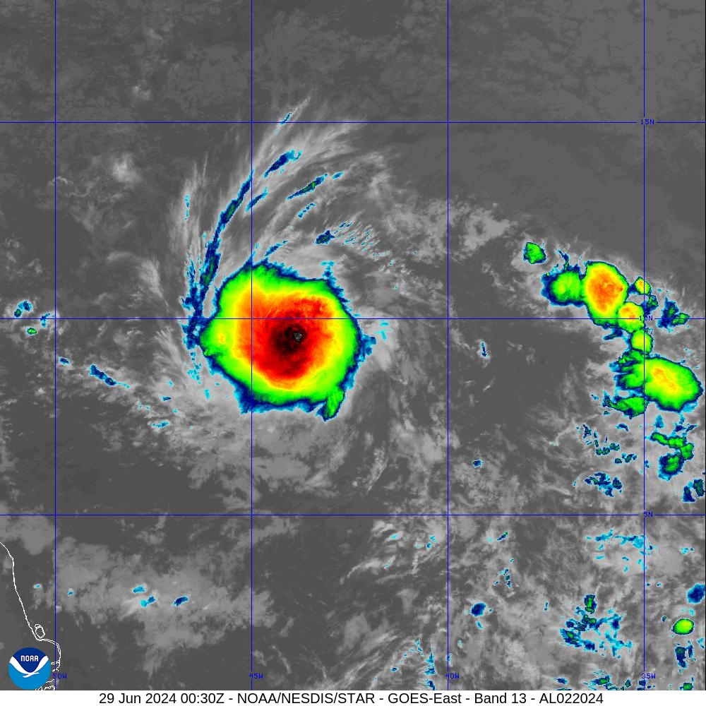
Nice convective blow-up with 02L against easterly wind shear displacing the thunderstorms to the east of the center. Intensification will be slow but steady as 02L steams westward.
Eastern Pacific Tropical Weather Outlook
No activity expected in the next 48-hours or 7-days, or who knows how long — but the rest of June looks quiet.
Western Pacific Tropical Weather Outlook
No development expected in the next 48-hours to 7-days
Thank you to Subscribers and Supporters!
The investment in my research and development will pay off as A.I. enabled weather forecasts become a normal and indispensable part of our weather forecasting enterprise.
Maps sourced from weathermodels.com designed and innovated by yours truly! I actually create all of my content from scratch.
- Milepost
- 327 · laid 2024-06-29T00:55:01.173000Z
- Source
- https://weather.substack.com/p/june-28-2024-tropical-update-tropical
- Digest
- 244563d6c411c55a66a847f34ea63e5334d590eb0a5293dbace30d6768299ad5
- Machine
- JSON