June 25, 2024 Tropical Update
Ensembles show likely tropical storm in 7-10 days
June 2024 was the 2nd-warmest June in the 132-year national record (1895–2026), at 71.8°F against a 1991–2020 normal of 69.5°F (+2.3°F).
June 2024 was the 41st-driest June in the 132-year national record (1895–2026), at 2.8in against a 1991–2020 normal of 3.1in (-0.3in).
NOAA/NCEI Climate at a Glance, contiguous United States. This is the observed record for the month, not a score of anything said in this piece — the forecast ledger begins 2026-08-17 and cannot reach earlier posts.

Headlines for Tuesday
Tropical across the globe remain quiet but some indication of the deep tropics awakening for the season with tropical waves lining up within the more favorable environment of early July.
Mesoscale convective complex moving across the Great Lakes this morning will continue into Indiana and Ohio mainly at below severe limits providing beneficial rainfall
Typical summer heat continues across the Lower 48 with ridging across much of the country except for a trough over the Northeast.
ECMWF 10-day Integrated Vapor Transport Analysis & Forecast
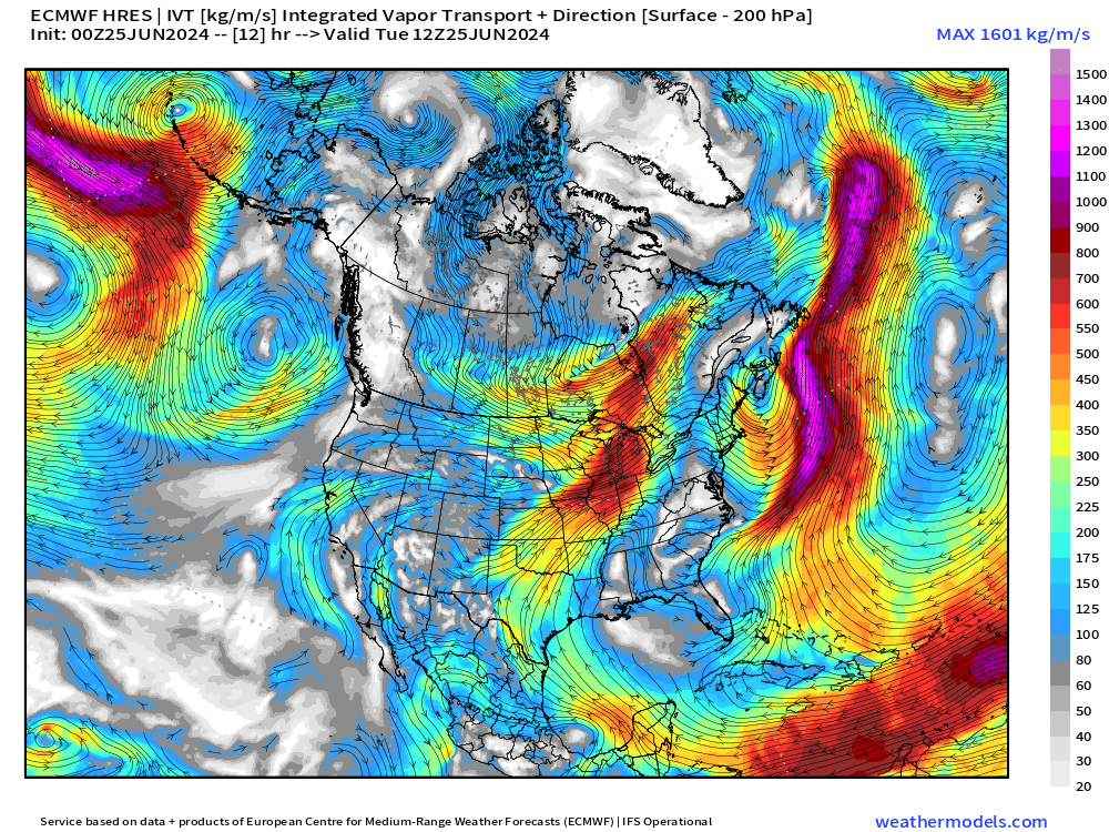
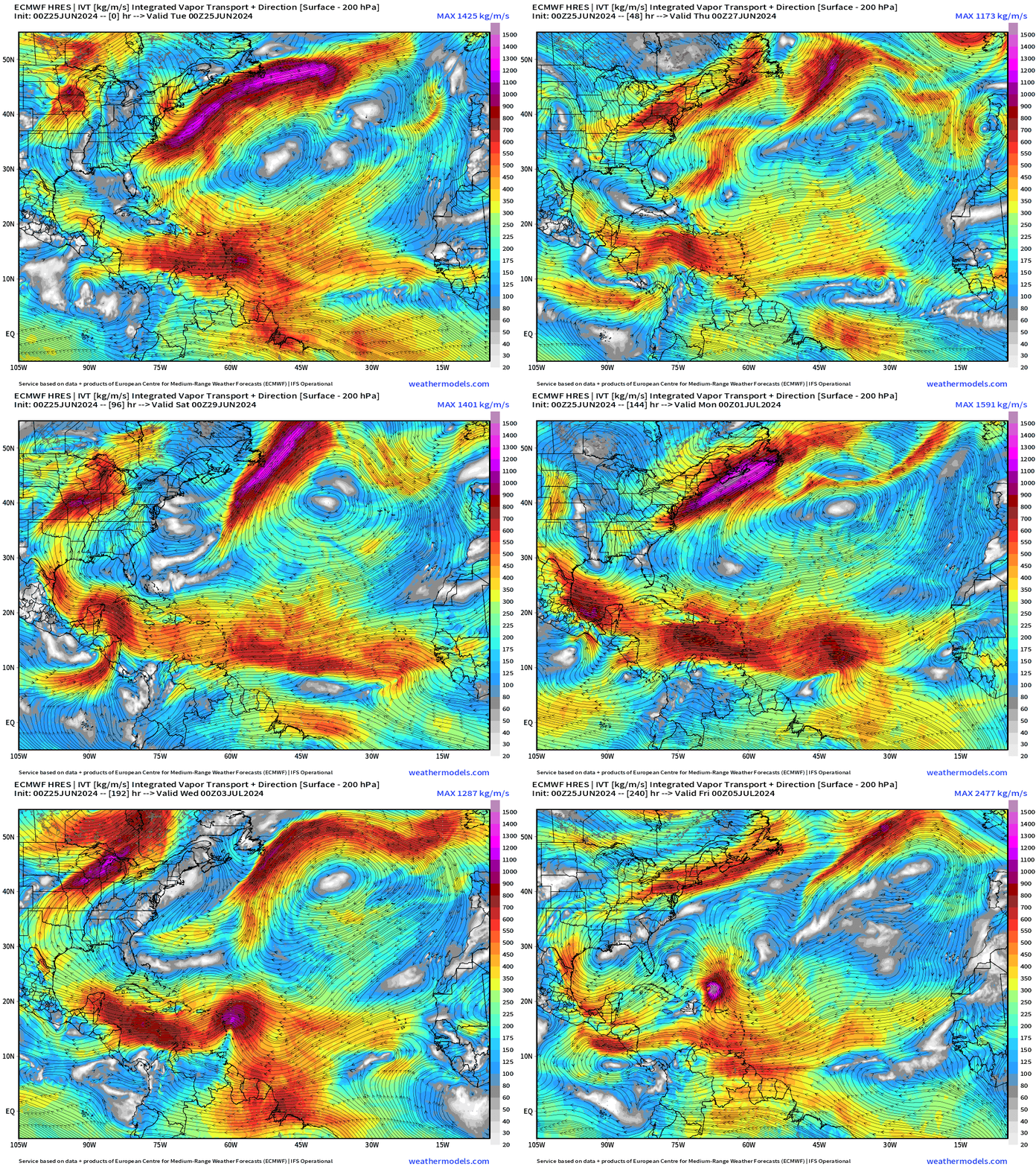
My favorite animation to show the evolution of tropical features including tropical waves. The potential tropical wave to develop — as shown in ensembles — reaches the Greater Antilles in the 8-10 day time frame as a likely tropical storm or hurricane.
NOAA GFS 8-day Precipitable Water Forecast
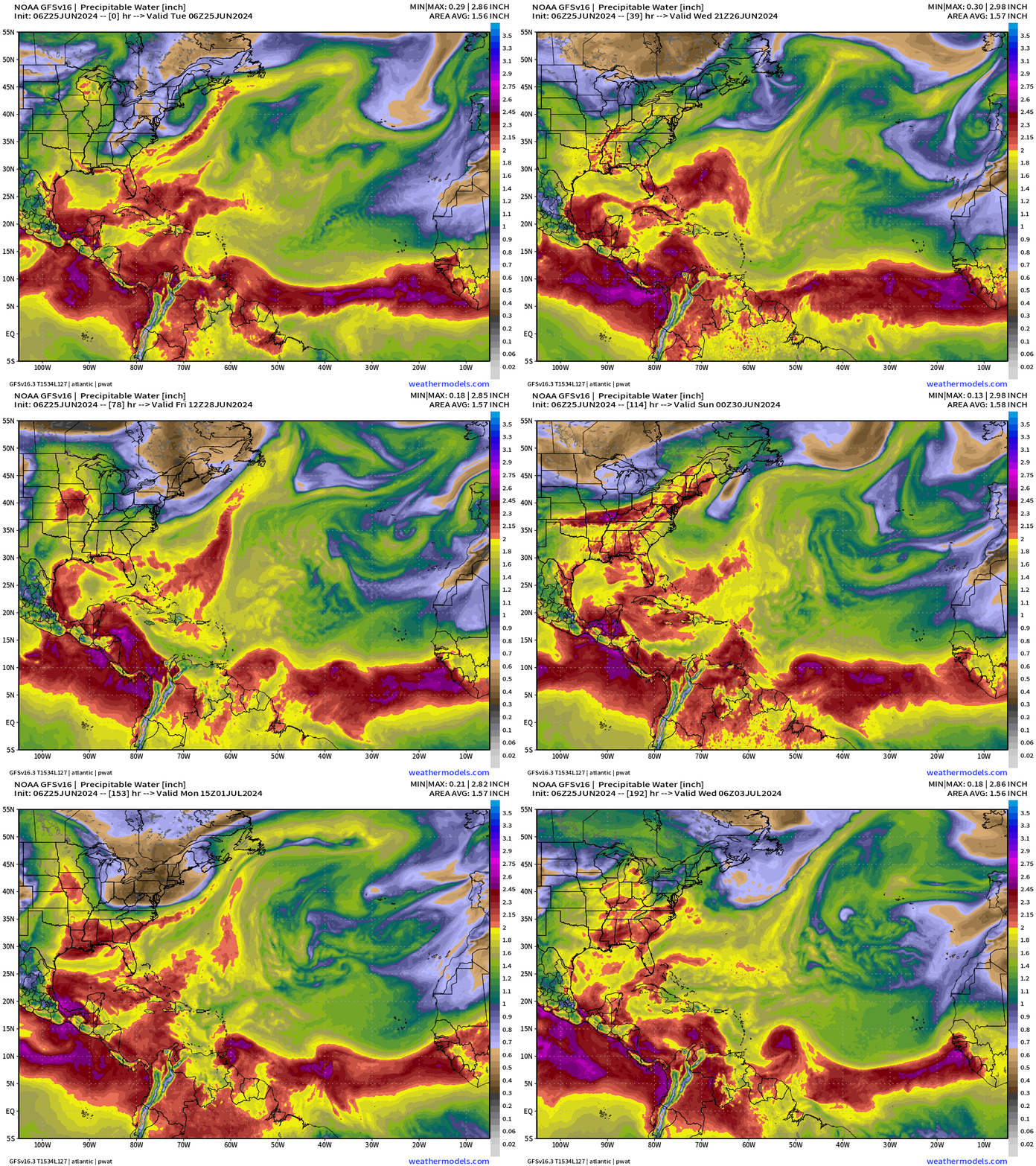
The tropical waves show up nicely in the GFS model precipitable water forecast. I usually don’t show GFS but I think it’s a good idea to demonstrate consistency among the global models.
Synoptic Analysis [June 25, 2024 06Z]
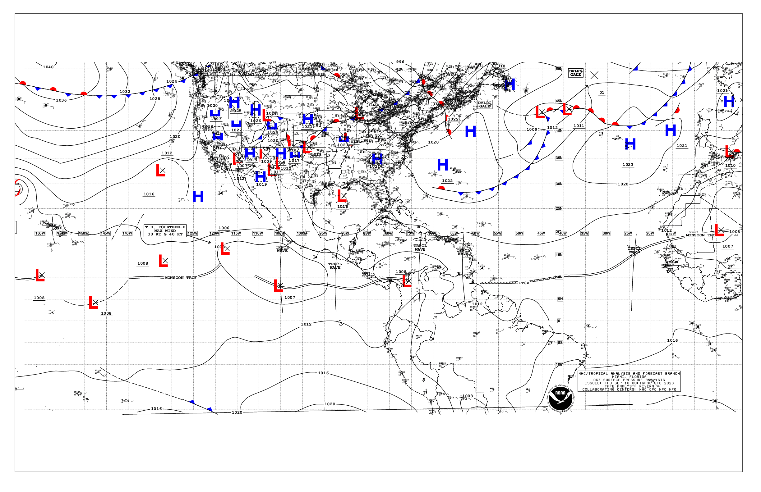
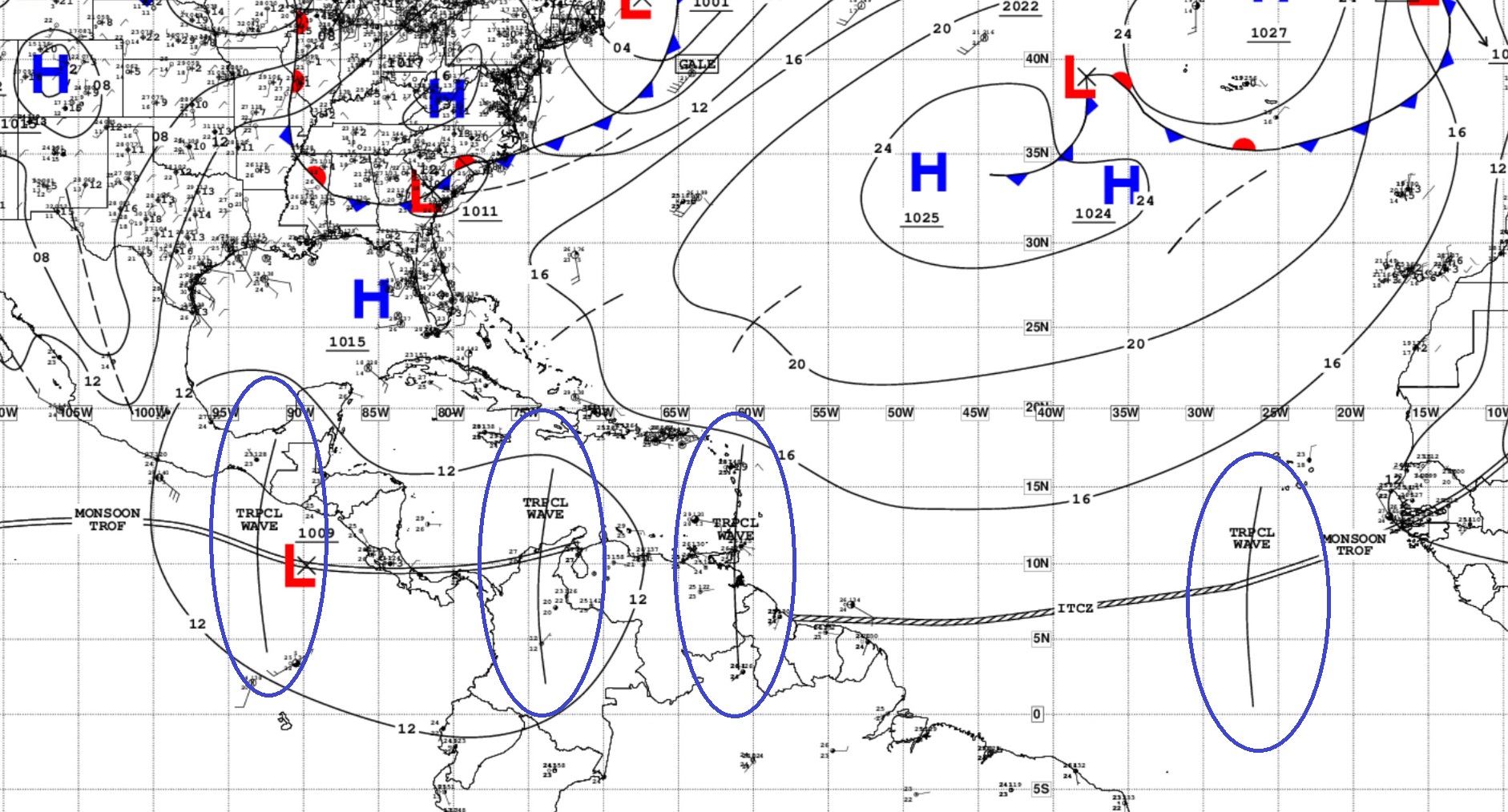
3 TROPICAL WAVES

An eastern Atlantic tropical wave is along 27W, south of 15N, moving W at 10 kt. Scattered moderate convection is noted from 5N to 10N and between 20W and 30W.

An eastern Caribbean tropical wave is along 62W, south of 18N, moving W at around 10 kt. This wave is the combination of 2 waves depicted in the previous map. Scattered moderate convection prevails S of 14N between 60W-65W.

A central Caribbean tropical wave is along 74W, south of 16N, moving westward at 10 kt. The wave axis is enhancing the storm activity over Colombia.
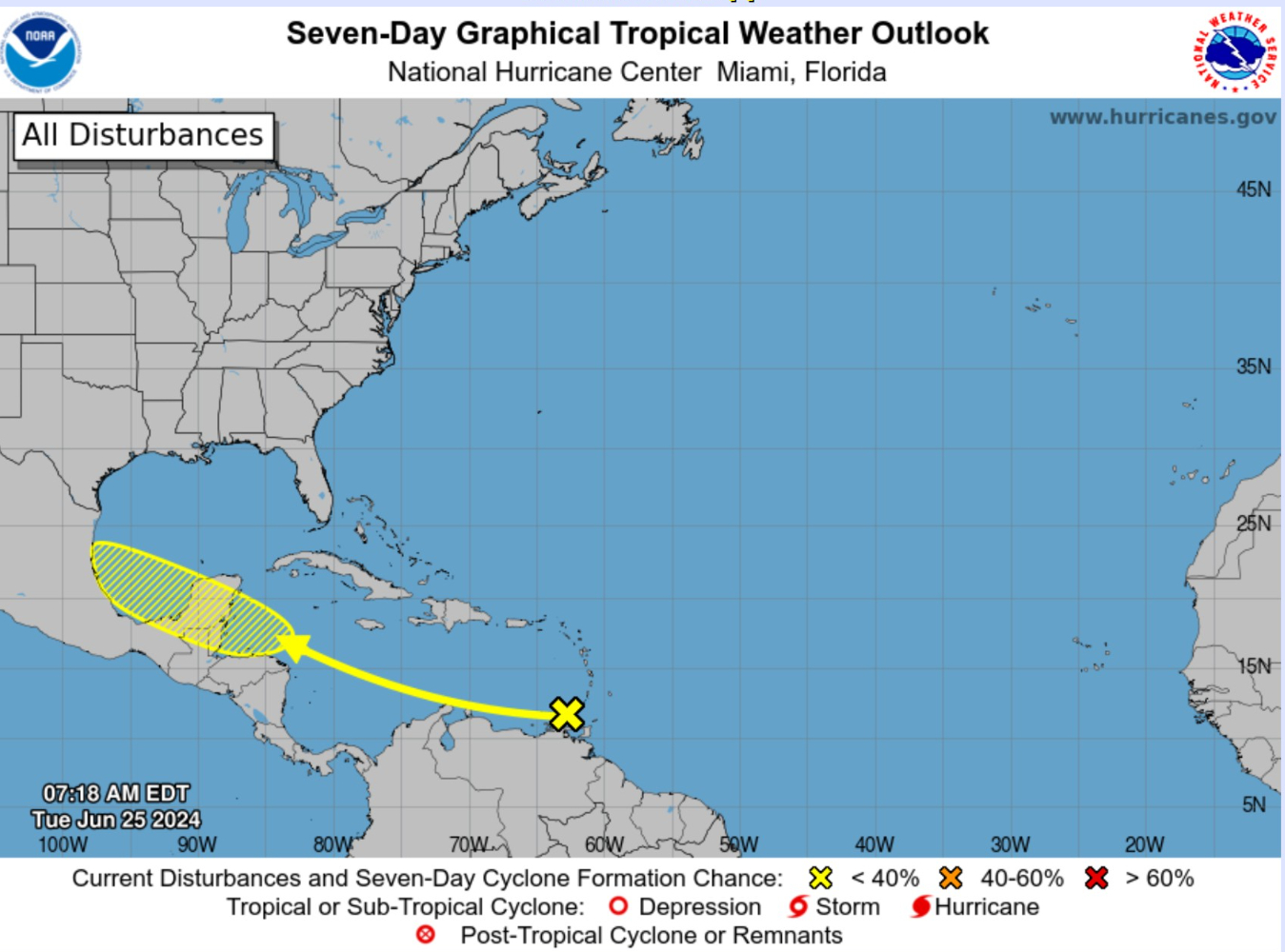
1. Western Caribbean/Southwestern Gulf of Mexico: [20%]

A westward-moving tropical wave located over the southeastern Caribbean Sea is producing disorganized showers and thunderstorms. Environmental conditions appear conducive for slow development once the wave reaches the western Caribbean late this week.

* Formation chance through 48 hours...low...near 0 percent.
* Formation chance through 7 days...low...20 percent.
NHC Outlook: No other areas of interest in the Tropical Atlantic for the next 7-days
Basin Wide GeoColor Satellite Imagery
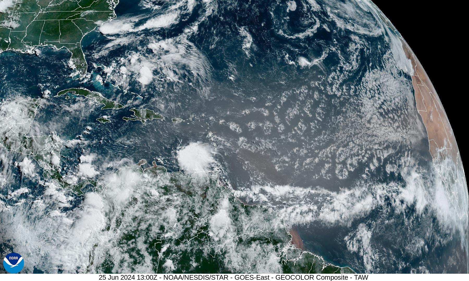
The tropical wave in the SE Caribbean is showing nice convective activity but won’t develop until it reaches the Yucatan or southern Gulf of Mexico — if at all.
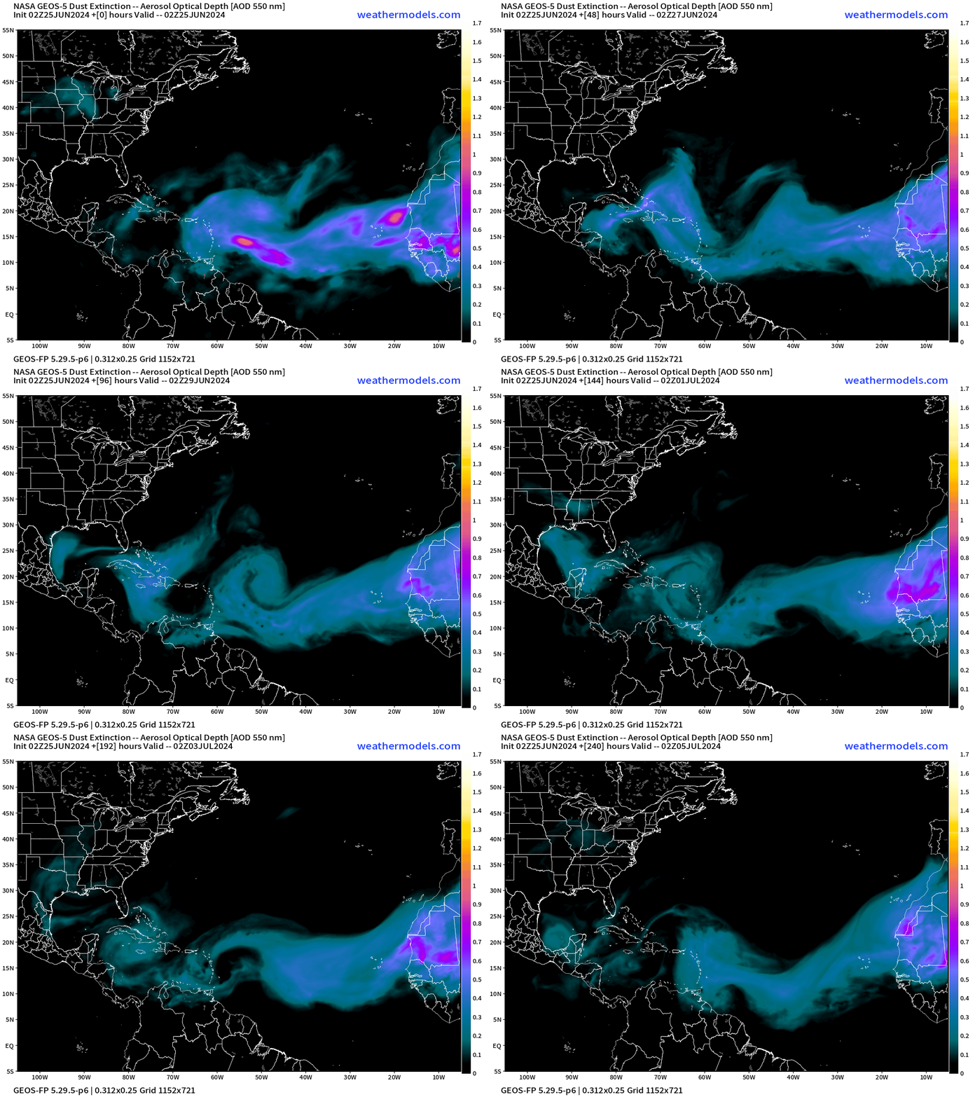
Saharan Air Layer | African Dust Forecast Next 10-days
Next 15-Days EPS Ensemble Tropical Storm Tracks
Active TCs at Days 7, 10, and 14 [Spaghetti]
These maps show the ensemble tracks from 51 versions of the ECMWF model — solutions to show uncertainty or variability in medium and longer range forecasts. This does not mean there are 20 tropical storms at the same time.
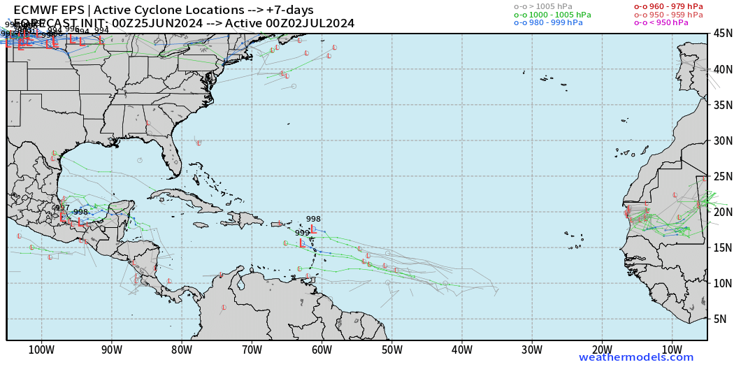
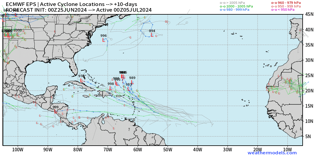
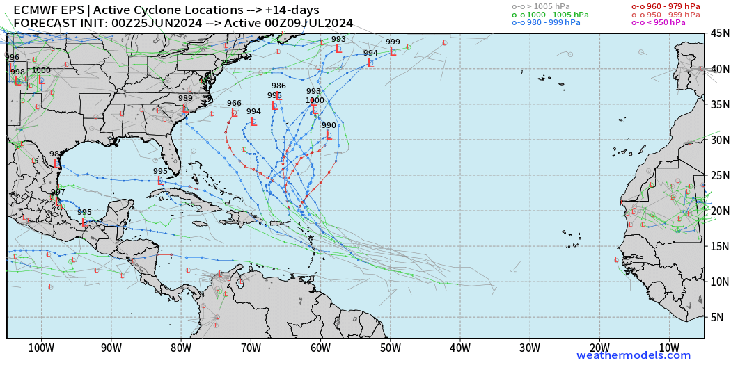
Looks like a recurving hurricane!
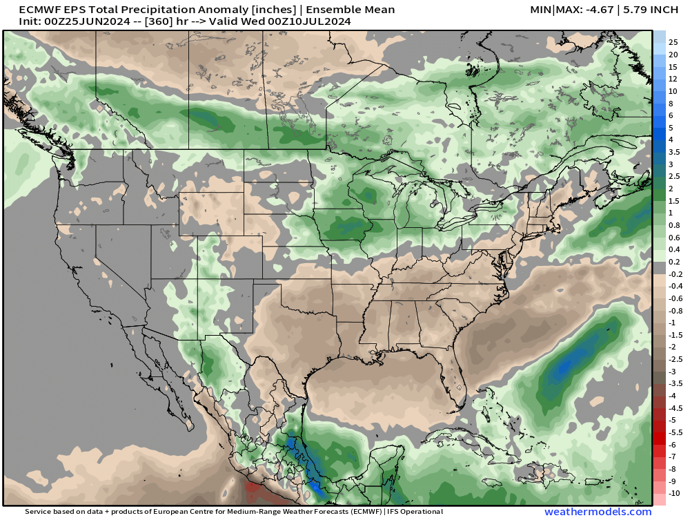
Precipitation Anomaly Next 15-days [inches]
Tuesday High Temperatures and Weather
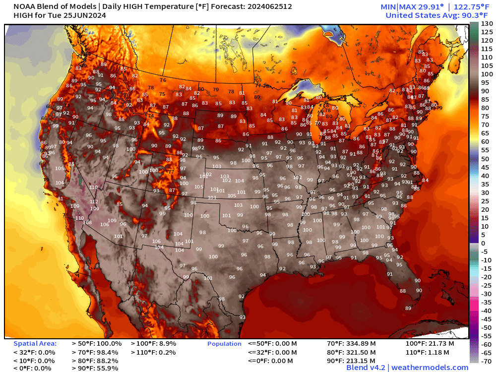
Nationwide average high temperature at 90.3°F with 56% of the Lower 48 at/above 90°F including 213 Million Population.
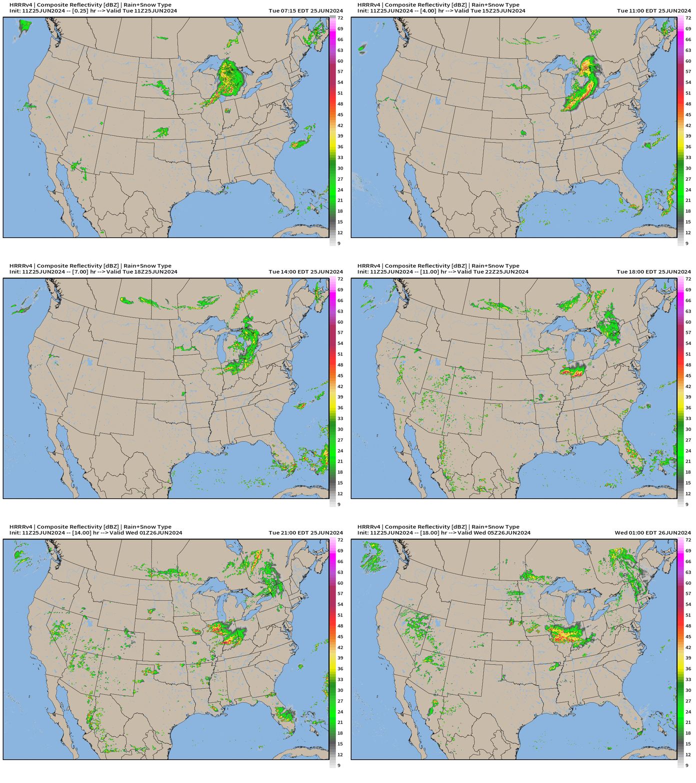
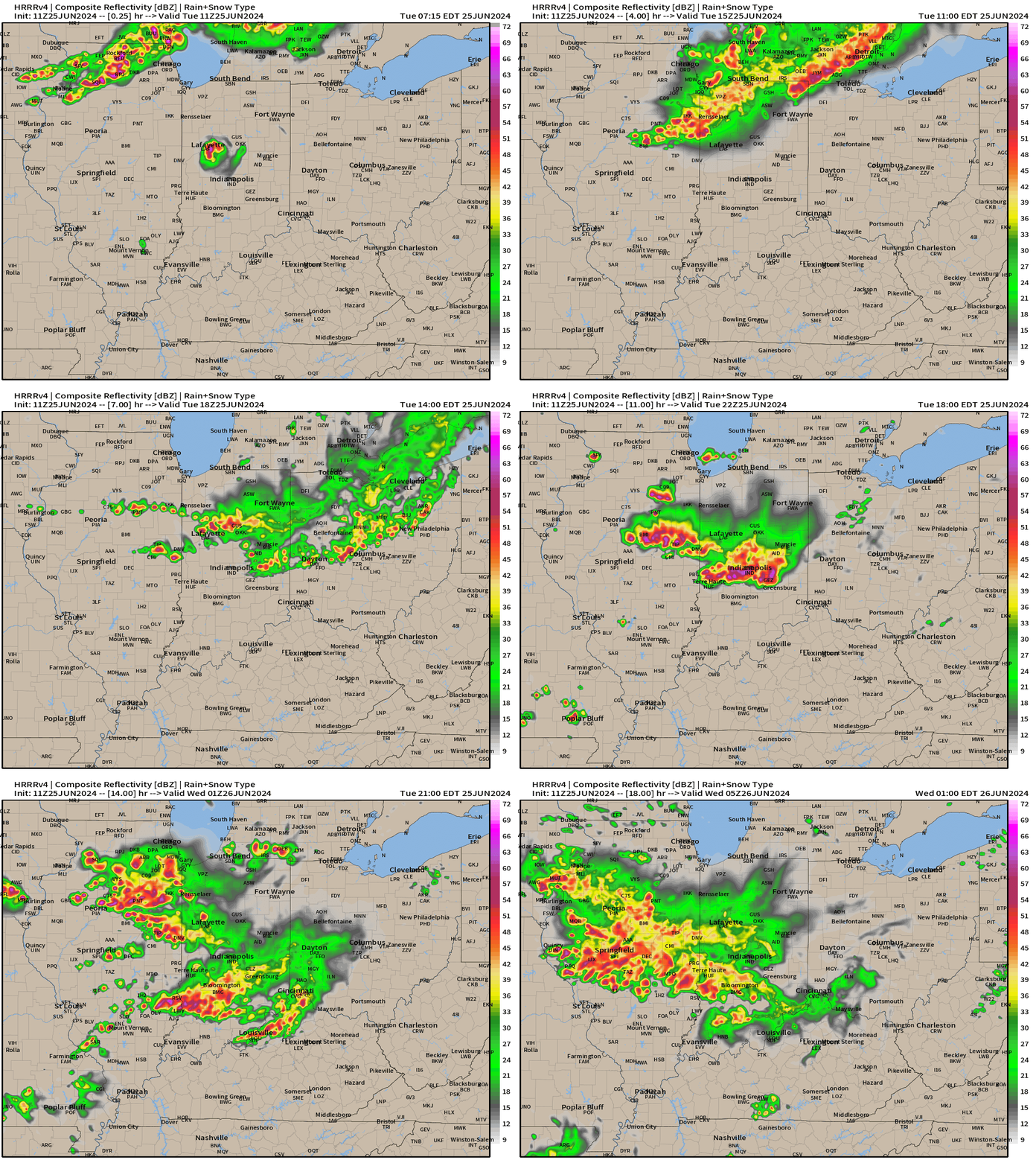
NWS Precipitation Next 24-hours
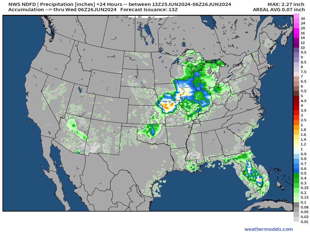
NOAA Blend of Models Precipitation Next 7-days
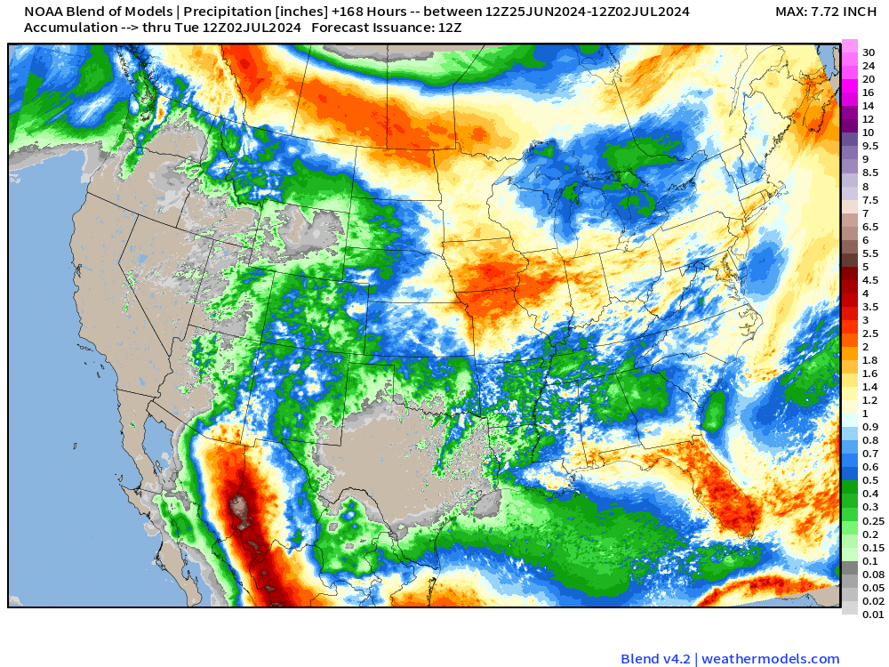
A Texas sized dry spell has opened up with a huge rainfall hole — continues for at least another week. Otherwise, significant and beneficial rainfall across the northern tier of states into the corn belt.
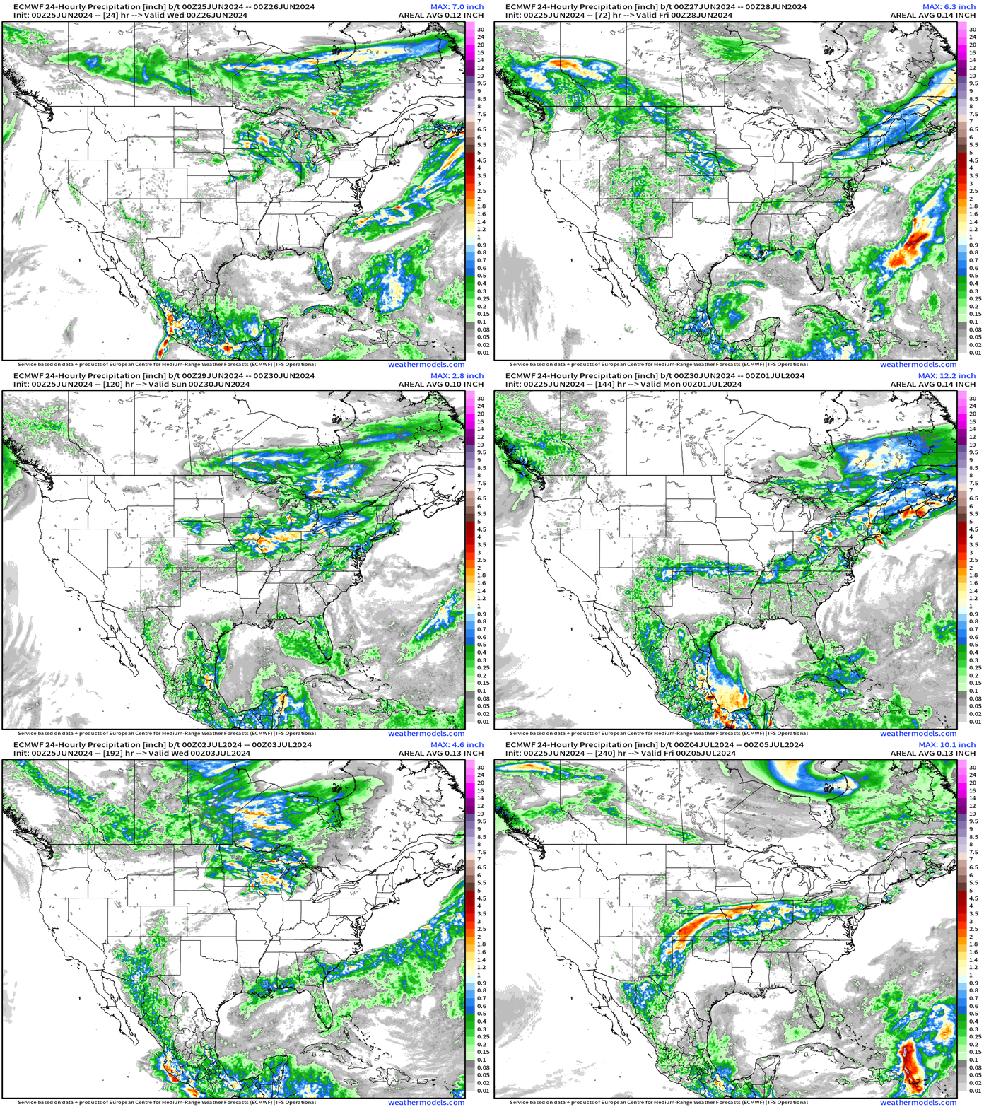
ECMWF Daily Precipitation | Next 10-days
Eastern Pacific Tropical Weather Outlook
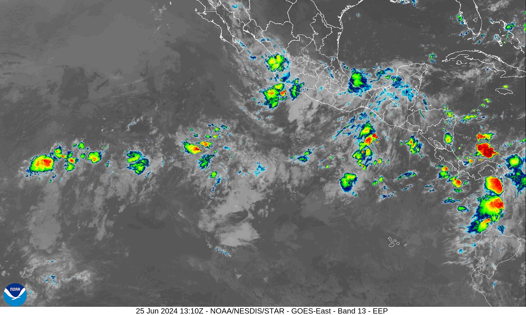
No activity expected in the next 48-hours or 7-days, or who knows how long — but the rest of June looks quiet.
Western Pacific Tropical Weather Outlook
Ghost town — No Suspect Areas areas of interest during the next 48-hours to 7-days from JTWC.
1. WESTERN NORTH PACIFIC AREA (180 TO MALAY PENINSULA):
   A. TROPICAL CYCLONE SUMMARY: NONE.
   B. TROPICAL DISTURBANCE SUMMARY: NONE.
   C. SUBTROPICAL SYSTEM SUMMARY: NONE.
Thank you to Subscribers and Supporters!
The investment in my research and development will pay off as A.I. enabled weather forecasts become a normal and indispensable part of our weather forecasting enterprise.
Maps sourced from weathermodels.com designed and innovated by yours truly! I actually create all of my content from scratch.
- Milepost
- 322 · laid 2024-06-25T13:48:34.747000Z
- Source
- https://weather.substack.com/p/june-25-2024-tropical-update
- Digest
- 3597b5fc72be5bf645d1157dd60737b057a2d9be054e8ba83472508f6c339aef
- Machine
- JSON