June 23, 2024 Tropics Quiet
Hot summer weather continues across Lower 48
June 2024 was the 2nd-warmest June in the 132-year national record (1895–2026), at 71.8°F against a 1991–2020 normal of 69.5°F (+2.3°F).
June 2024 was the 41st-driest June in the 132-year national record (1895–2026), at 2.8in against a 1991–2020 normal of 3.1in (-0.3in).
NOAA/NCEI Climate at a Glance, contiguous United States. This is the observed record for the month, not a score of anything said in this piece — the forecast ledger begins 2026-08-17 and cannot reach earlier posts.

Headlines for Sunday
Huge rainfall totals over the past week across South Dakota and southern Minnesota including Sioux Falls.
Invest 93L has not developed and now won’t prior to its landfall in Mexico. No other activity expected during the next 7-days, but perhaps some action in 10-15 days in the far Atlantic with ECMWF EPS ensembles showing a few genesis events.
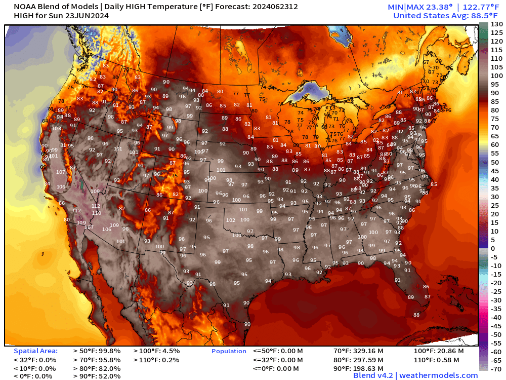
No surprise that typical summertime heat has settled across a large fraction of the Lower 48 with 90s and 100s spreading from Texas into the Mid-Atlantic. The only relief will be temporary cool-downs from Canadian cold fronts / troughs or scattered daytime thunderstorms.
ECMWF 10-day Integrated Vapor Transport Forecast
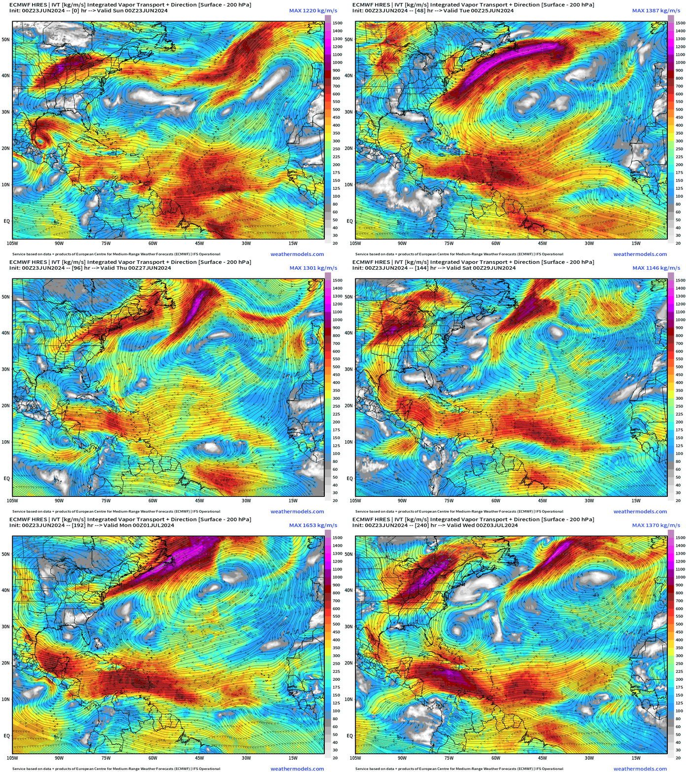
My favorite animation to show the evolution of tropical features including tropical waves. Not seeing anything spinning in the tropics over the next 10-days.
Observed Rainfall during the past 7-days
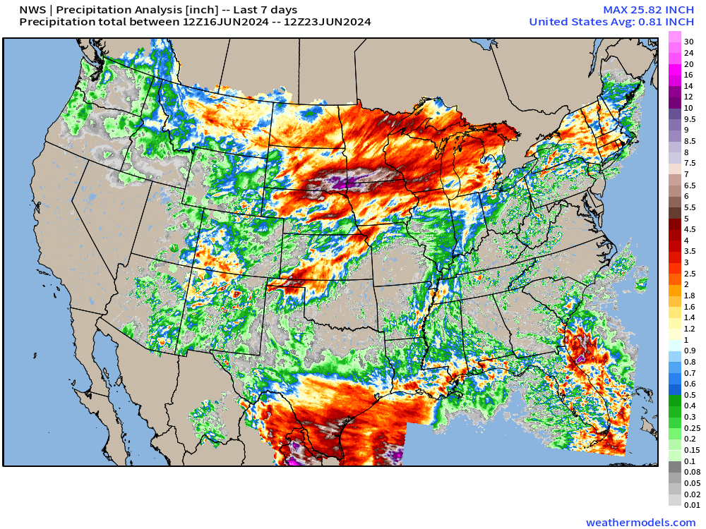
Largest totals with Alberto and the Caribbean Gyre system — now ending.
And, around the “heat dome” a “ring of fire” developed with excessive rain in the Midwest.
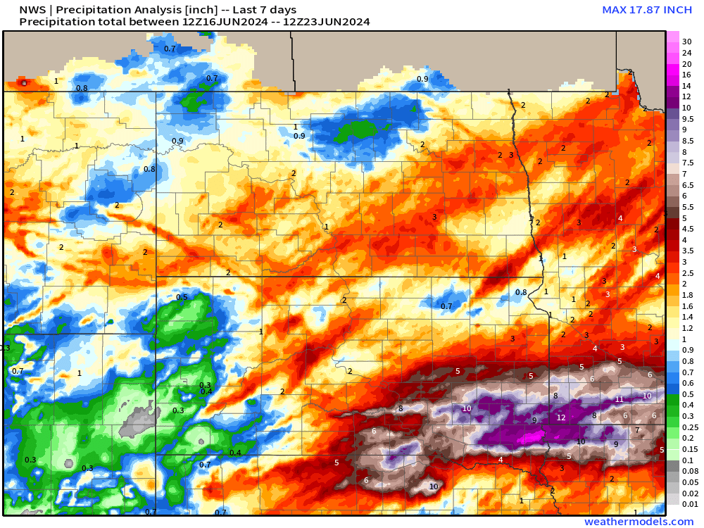
12-18” of rainfall observed in SE South Dakota over the past week.
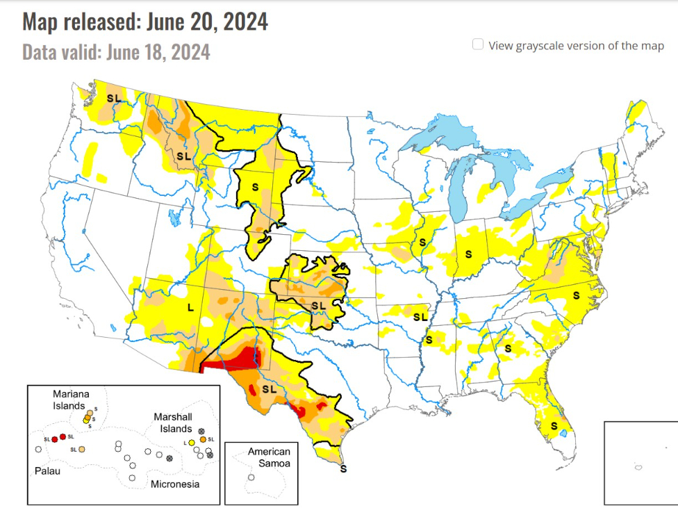
The drought monitor is picking up on abnormal dryness creeping up in the Ohio Valley and Southeast.
Synoptic Analysis [June 23, 2024 06Z]
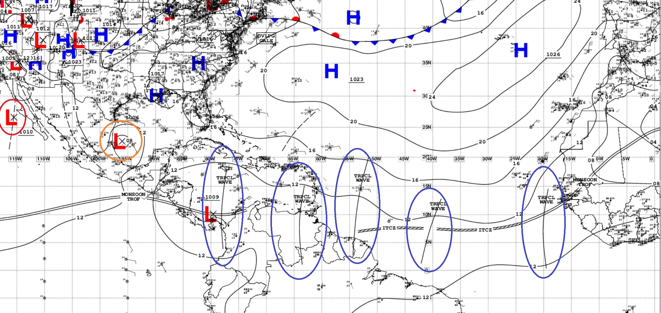
5 TROPICAL WAVES...

An eastern Atlantic tropical wave axis along 20W, south of 17N, is moving westward at 10-15 kt. Scattered showers are noted near the wave's axis.

A central Atlantic tropical wave axis along 40W, south of 13N, is moving westward at 15 kt. Scattered moderate convection is noted from 4N to 10N and between 37W and 45W.

Another central Atlantic tropical wave is along 54W, south of 20N, moving westward near 15 kt. A few showers are noted near the wave's axis.

An eastern Caribbean tropical wave is along 64W, south of 15N, moving westward at 10-15 kt. The wave is enhancing the storm activity over eastern Venezuela.

A western Caribbean tropical wave is along 78W, south of 18N, moving westward at 10-15 kt. The wave is enhancing convective activity S of 11N.
Invest 93L in the Southern Gulf of Mexico does not have an organized circulation that will warrant upgrade to a tropical depression before it moves inland into Mexico. The main threat remains heavy rain — welcome to typically dry/arid areas.
No other areas of interest in the Tropical Atlantic
Basin Wide GeoColor Satellite Imagery
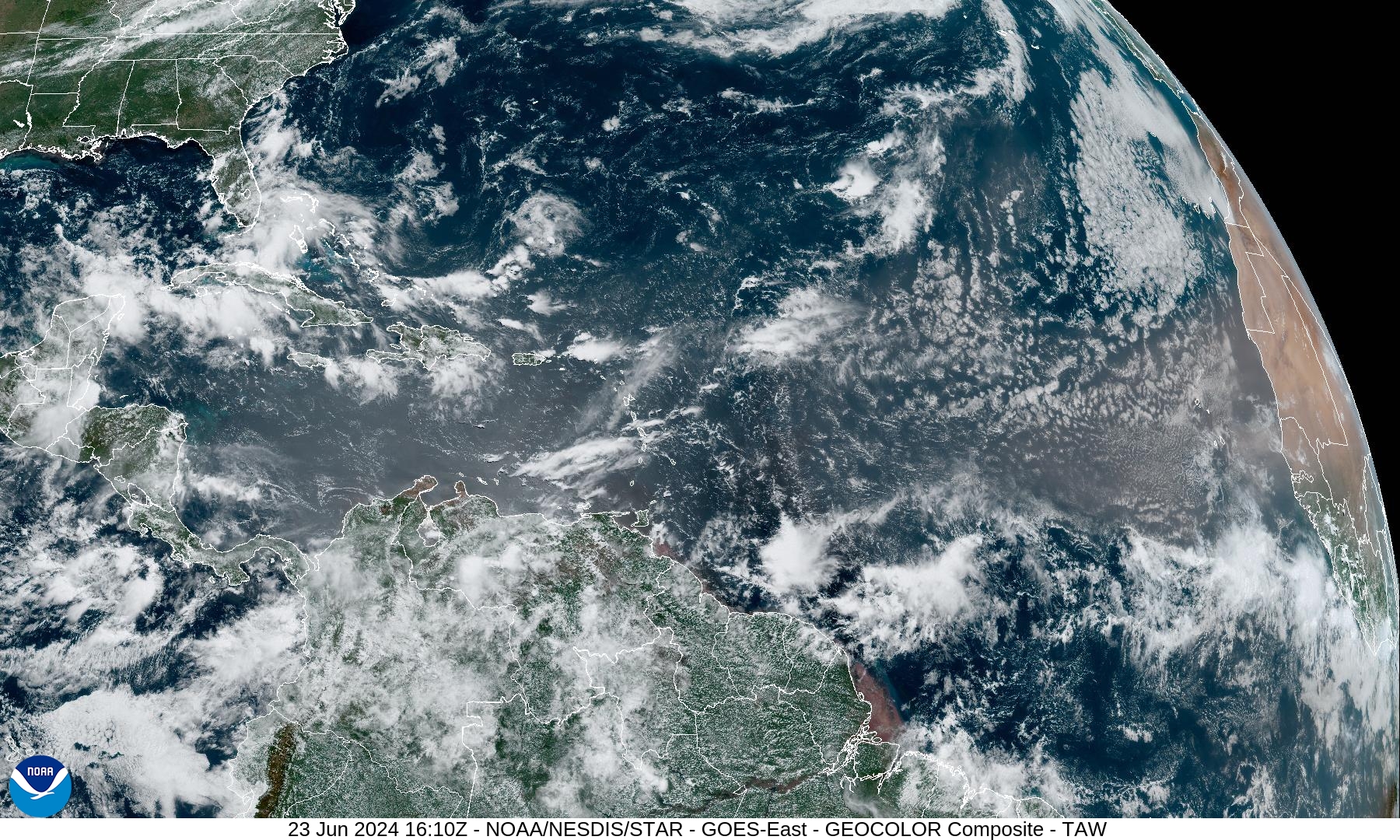
Saharan dust layer coming off Africa yet again. Otherwise, scattered convection with tropical waves.
Next 15-Days EPS Ensemble Tropical Storm Tracks
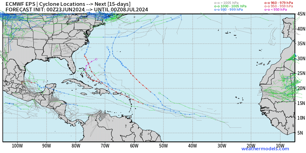
A few more tropical waves developing into powerful hurricanes in the collection of ensembles … out of 51 there are a few that do create significant systems. However, nothing imminent.
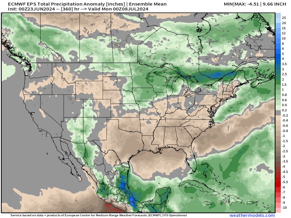
Precipitation Anomaly Next 15-days [inch]
Sunday High Temperatures and Weather
Almost 200 million at/above 90°F
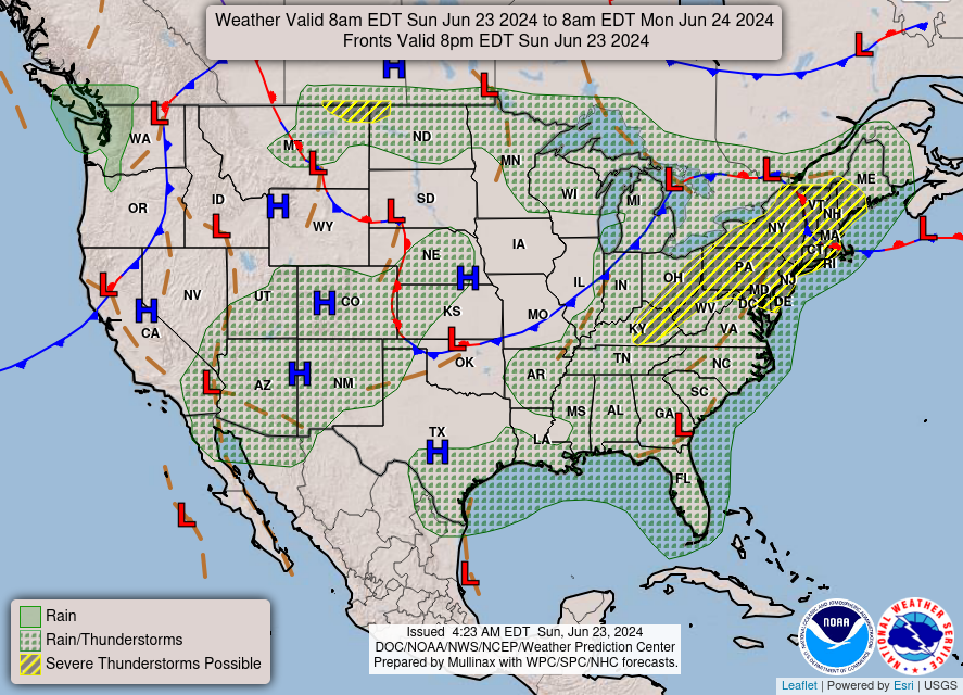
Scattered thunderstorms that could be severe in the Northeast including the chance of tornadoes.
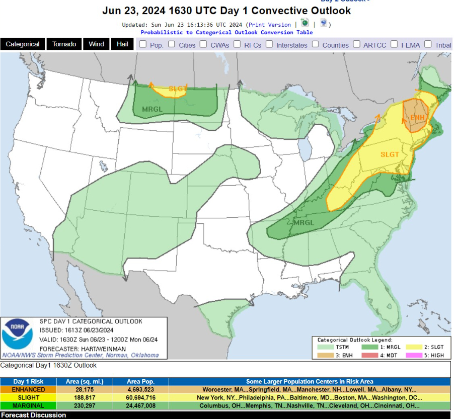
...THERE IS AN ENHANCED RISK OF SEVERE THUNDERSTORMS THIS AFTERNOON ACROSS PORTIONS OF EASTERN NEW YORK...VERMONT...NEW HAMPSHIRE...MASSACHUSETTS...AND WESTERN MAINE....

...THERE IS A SLIGHT RISK OF SEVERE THUNDERSTORMS THIS EVENING OVER PARTS OF NORTHEAST MONTANA AND NORTHWEST NORTH DAKOTA...

...SUMMARY...
Scattered damaging winds and a few tornadoes are likely across parts of the Northeast and New England, with additional severe storms expected across the Ohio Valley, Mid-Atlantic region, as well as the Northern High Plains.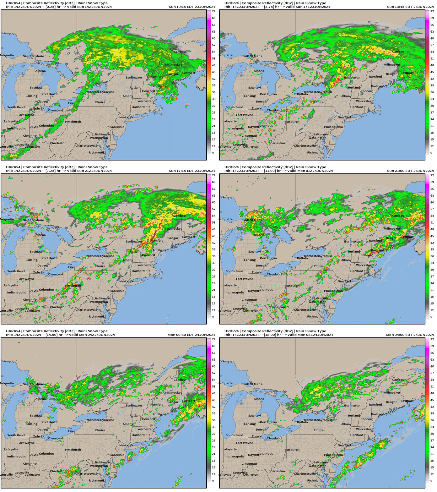
The HRRR simulated radar from 14z does show a broken line of scattered thunderstorms, but not as intense or ominous as the SPC outlook suggests. We’ll watch the radar later.
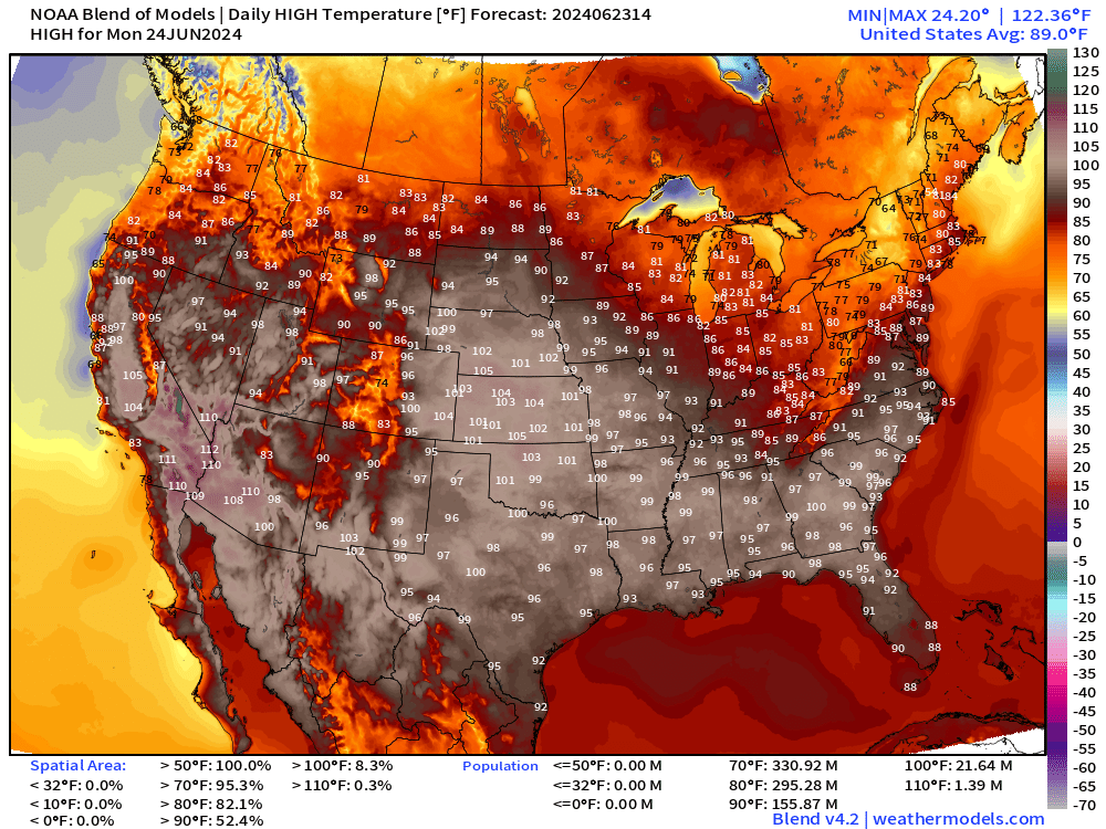
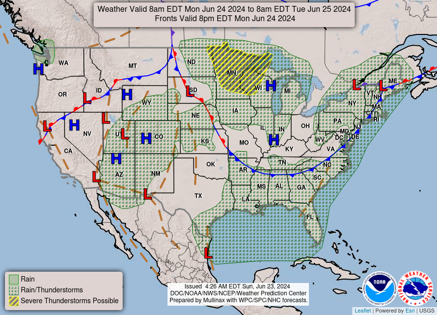
Monday High Temperatures and Weather
Nationwide average high temperature at 89°F with 52% of the Lower 48 at/above 90°F.
NOAA WPC Precipitation Next 7-days
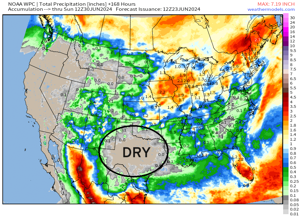
A Texas sized dry spell has opened up with a huge rainfall hole
Eastern Pacific Tropical Weather Outlook
No activity expected in the next 48-hours or 7-days, or who knows how long — but the rest of June looks quiet.
Western Pacific Tropical Weather Outlook
Ghost town — No Suspect Areas areas of interest during the next 48-hours to 7-days from JTWC.
1. WESTERN NORTH PACIFIC AREA (180 TO MALAY PENINSULA):
   A. TROPICAL CYCLONE SUMMARY: NONE.
   B. TROPICAL DISTURBANCE SUMMARY: NONE.
   C. SUBTROPICAL SYSTEM SUMMARY: NONE.
Thank you to Subscribers and Supporters!
The investment in my research and development will pay off as A.I. enabled weather forecasts become a normal and indispensable part of our weather forecasting enterprise.
Maps sourced from weathermodels.com designed and innovated by yours truly! I actually create all of my content from scratch.
- Milepost
- 320 · laid 2024-06-23T16:51:30.120000Z
- Source
- https://weather.substack.com/p/june-23-2024-tropics-quiet
- Digest
- cac9b0e7d10c9b270e7d6854600c5de54d7b6aaf0dc2ff9709e53a0df72342a5
- Machine
- JSON