June 20, 2024 Heat Wave Continues
Summer begins with building extreme heat
June 2024 was the 2nd-warmest June in the 132-year national record (1895–2026), at 71.8°F against a 1991–2020 normal of 69.5°F (+2.3°F).
June 2024 was the 41st-driest June in the 132-year national record (1895–2026), at 2.8in against a 1991–2020 normal of 3.1in (-0.3in).
NOAA/NCEI Climate at a Glance, contiguous United States. This is the observed record for the month, not a score of anything said in this piece — the forecast ledger begins 2026-08-17 and cannot reach earlier posts.

A massive heat dome was anchored over the Northeast U.S. but will finally give way to cooler air across New England with a cold front. Temperatures in the 90s in Boston will give way to 70s and 80s into Sunday.
The ridge backs up into the Ohio Valley and eventually rebuilds across the Central U.S. once the tropical moisture plume from the Central American Gyre runs its course.
Invest 92L into the Southeast U.S. may trigger tropical depression or weak tropical storm warnings, but convection is weak, as dry air and high background pressure inhibits further rapid development.
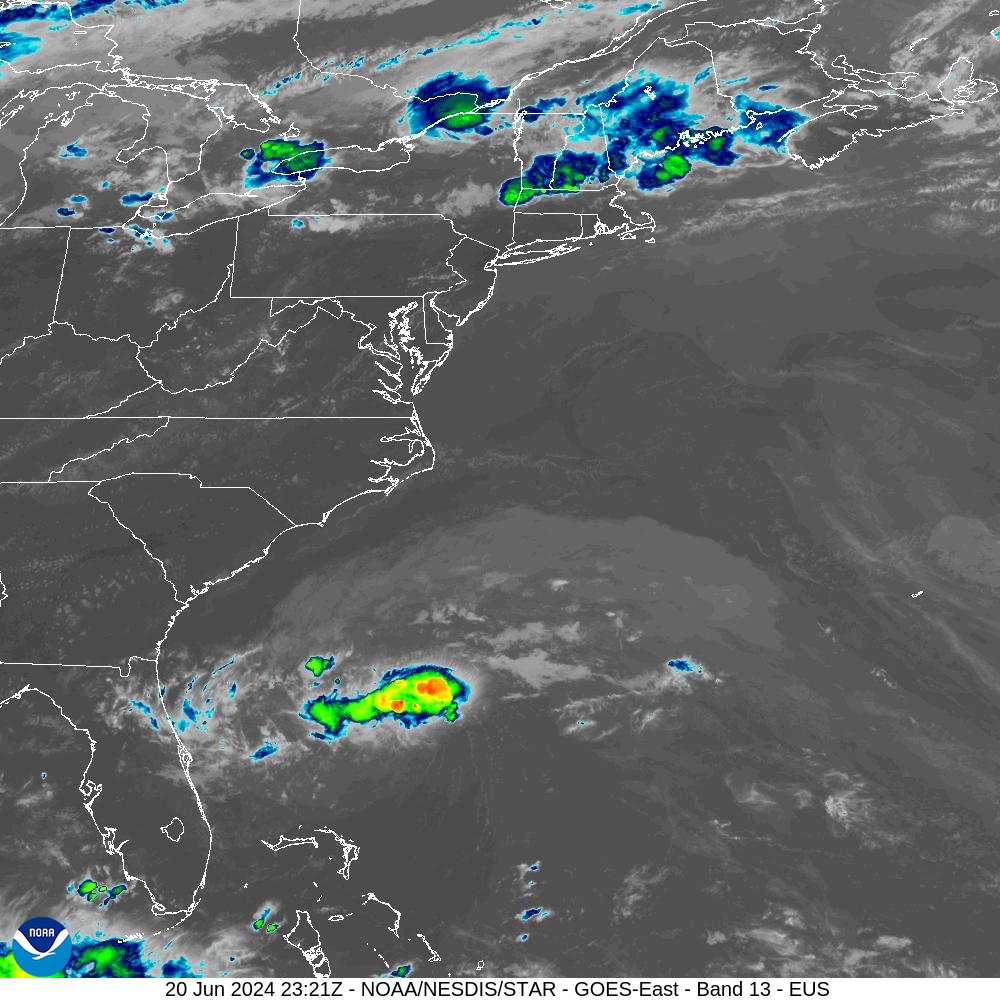
Another system in the southern Gulf of Mexico looks to be a repeat of Alberto — great news for northern Mexico with welcome rainfall. The moisture then moves into the U.S. Southwest for a bit of monsoonal flow. NHC is at 50% chance of storm development.
Next 8-days High Temperatures | Heat Wave
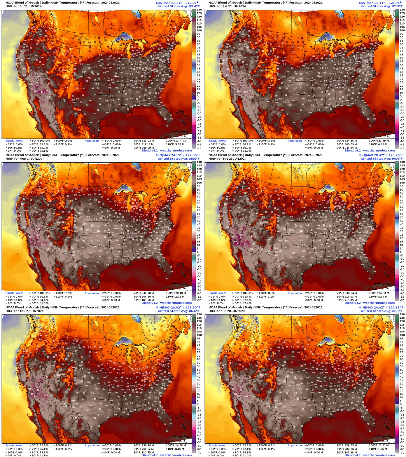
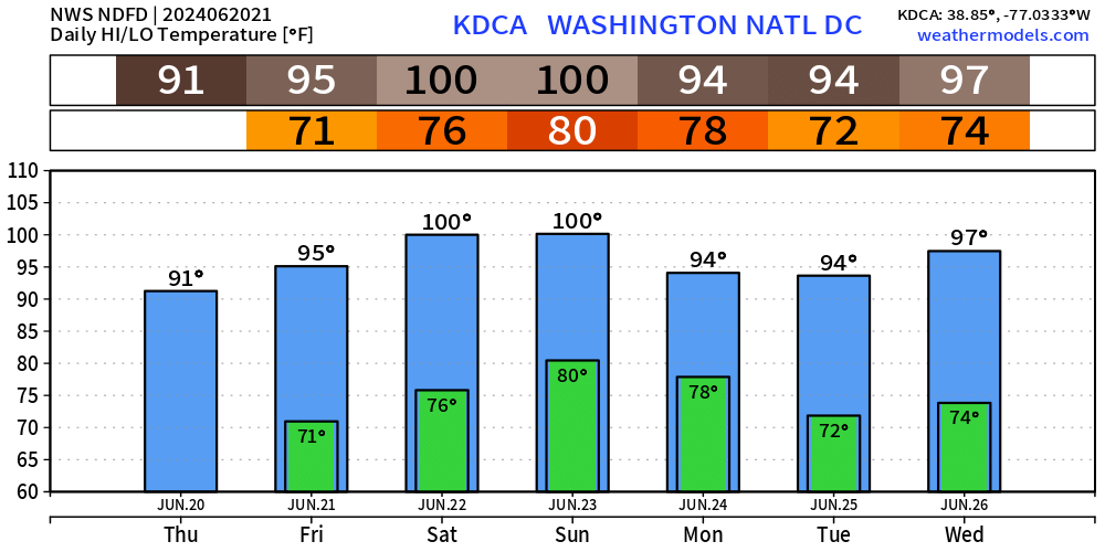
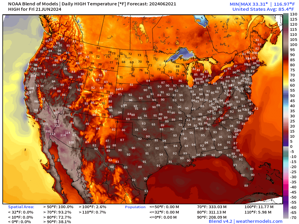
Blend of models forecast highs for the next 8-days does show relief for the Great Lakes and Northeast with cold fronts / troughs from Canada. However, no such luck for Nashville, Atlanta, Washington D.C. or St Louis until later next week.
Next 7-days look brutal for most of the Lower 48 population.
Heat Wave Cities
Nashville: pushing 100°F by early next week
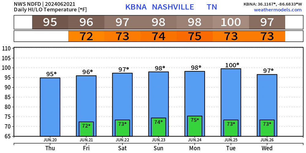
Washington DC: two 100°F on Saturday-Sunday
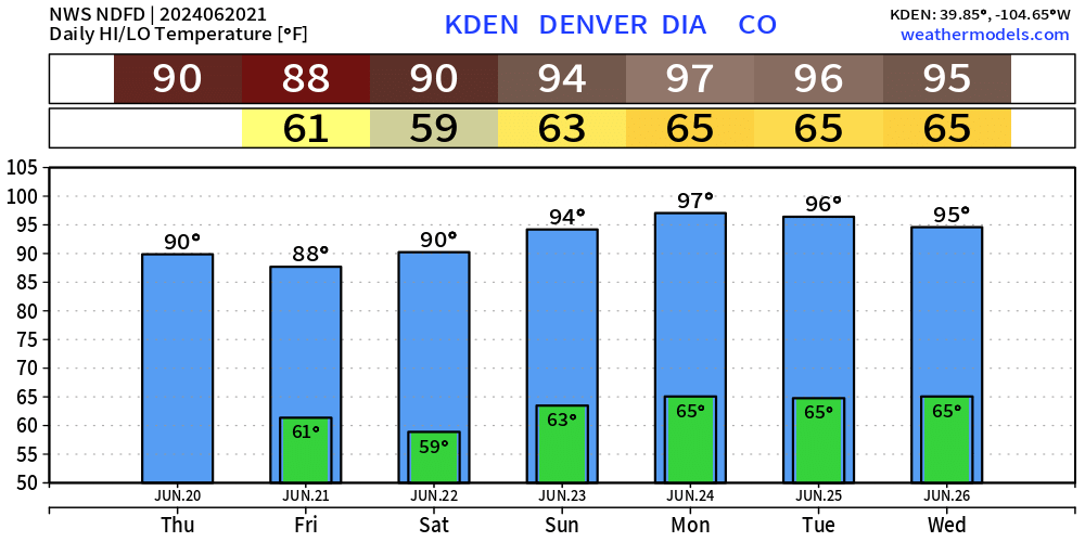
Denver: cool nights in the 60s look nice
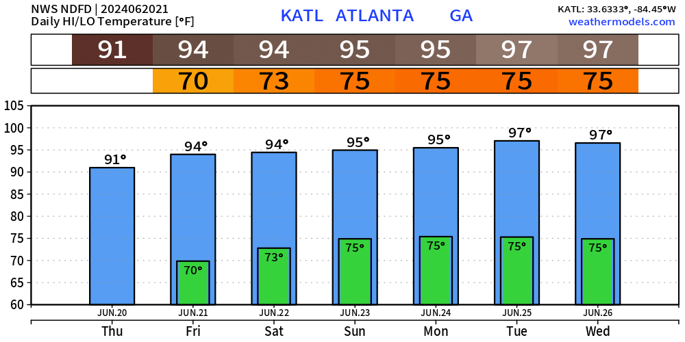
Atlanta: 97/75 for early next week is not going to be pleasant.
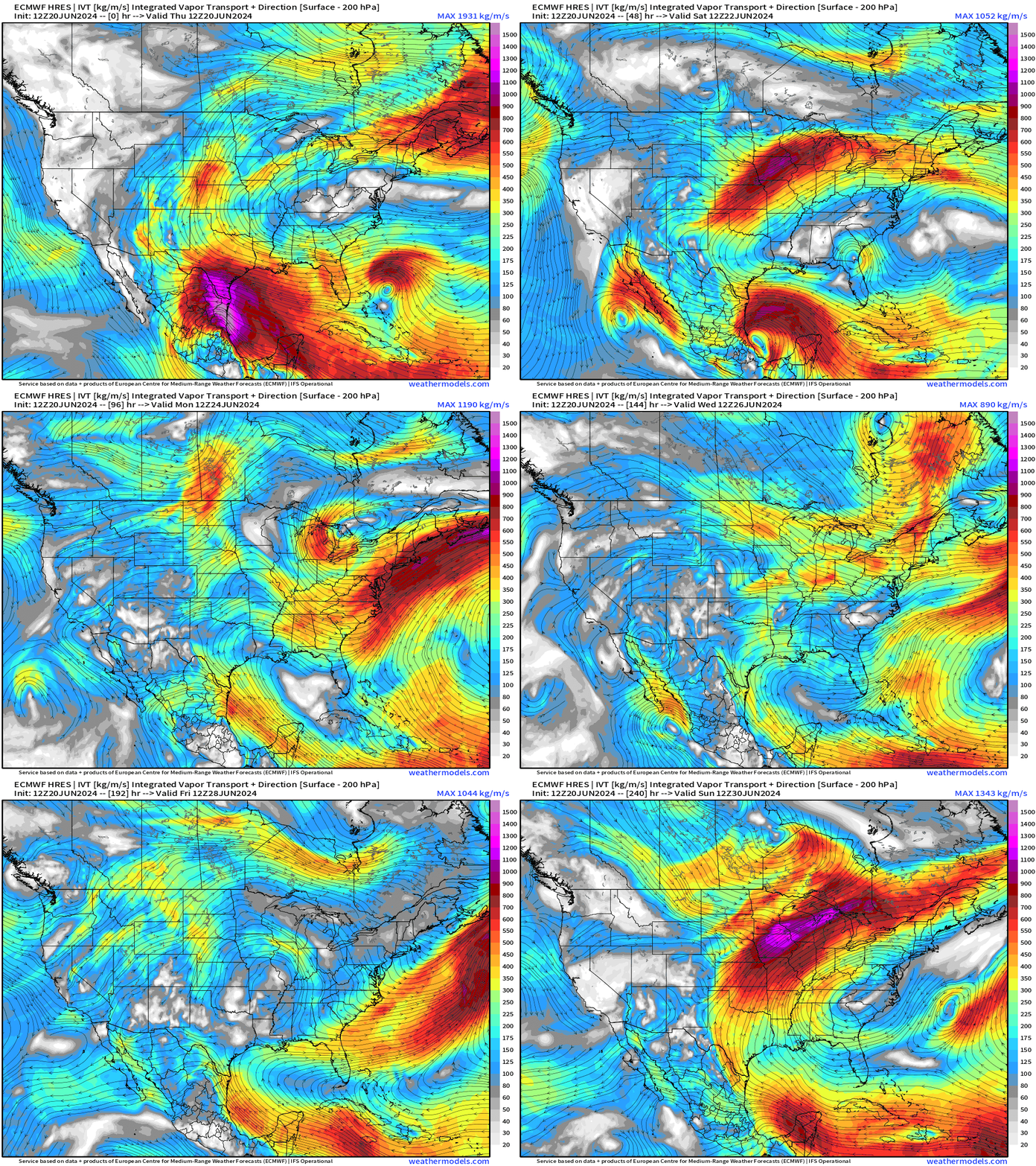
Next 10-days Upper-Level Weather Pattern | ECMWF AIFS
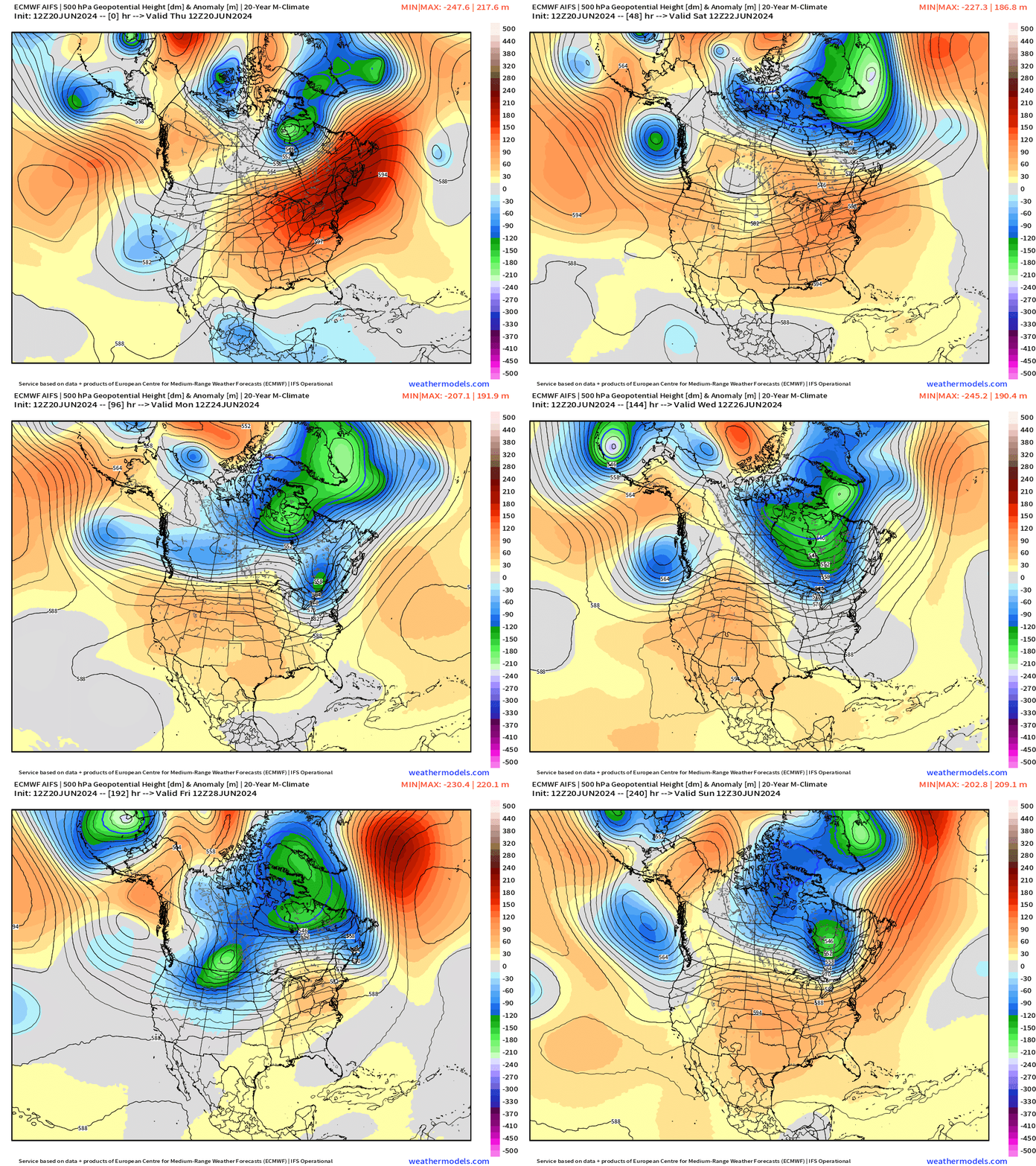
The ridge breaks down over the Mid-Atlantic and Northeast over the next 5-day into early next week with welcome Canadian troughs and cooler air for the Great Lakes and Northeast.
The ridge / heat dome builds over the central U.S. and Texas into next weekend.
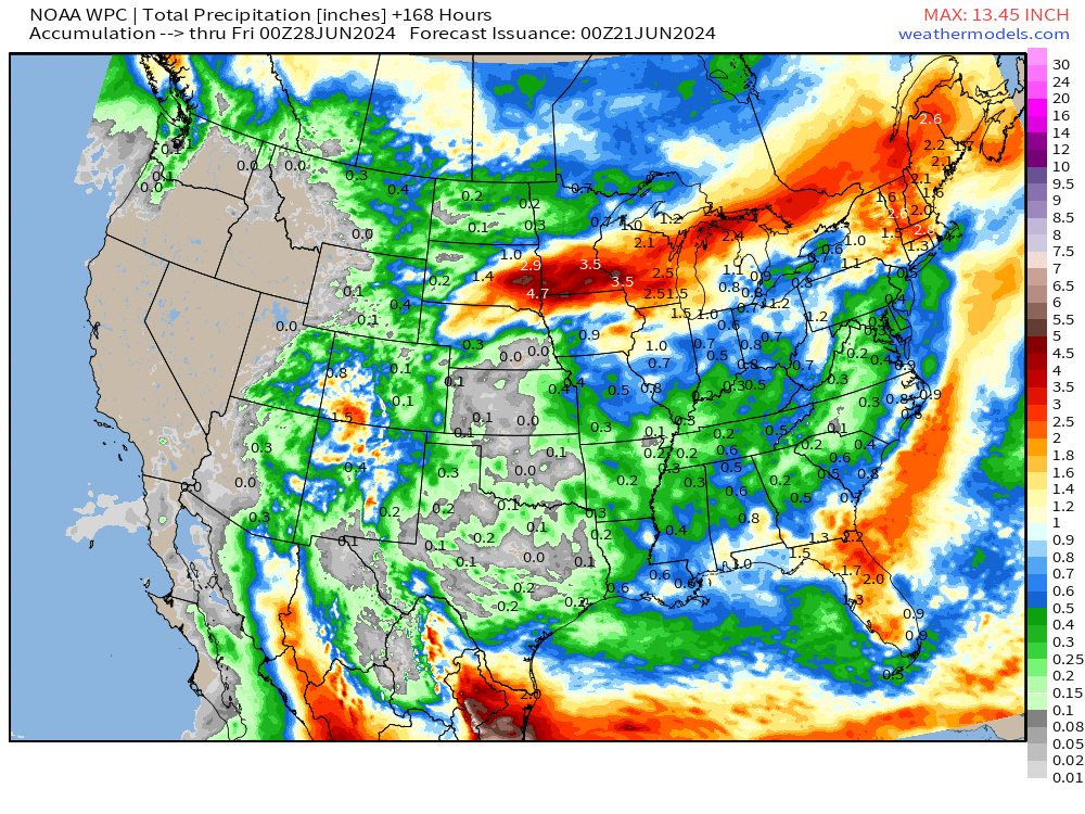
NWS WPC 7-Day Precipitation Forecast | Watering Needs
Friday Low & High Temperatures & Weather
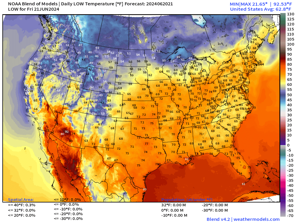
Lower 48 Average: 85.4°F | 208 Million at/above 90°F | 11.8M at/above 100°F
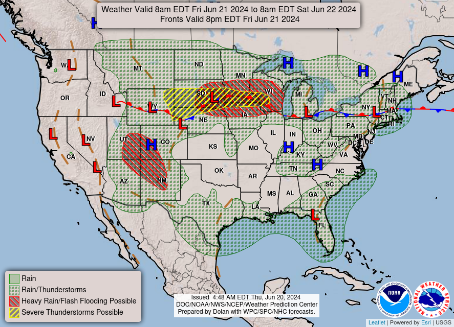
Next 8-Days Weather Systems | ECMWF HRES
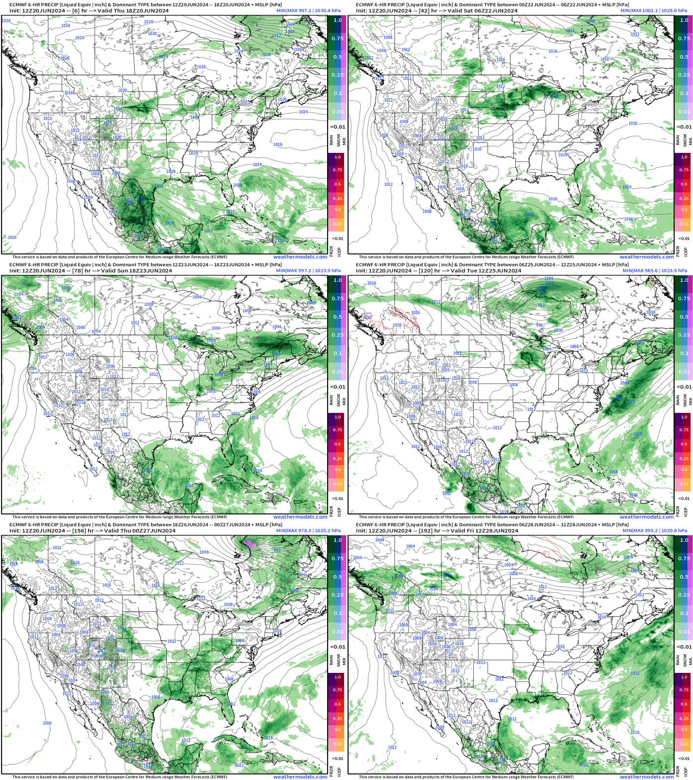
Invest 92L doesn’t show much from a precipitation perspective, but could provide enough humidity and instability to fire daytime thunderstorms with the seabreeze in Florida and Georgia.
10-Day Precipitation and Anomaly (%)
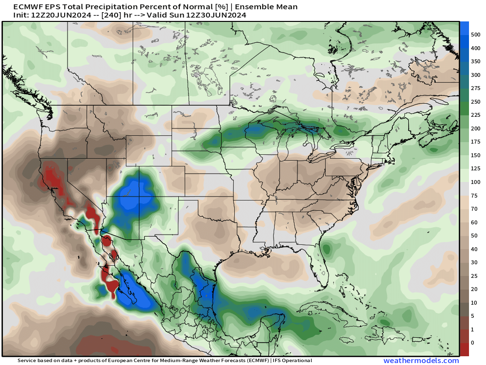
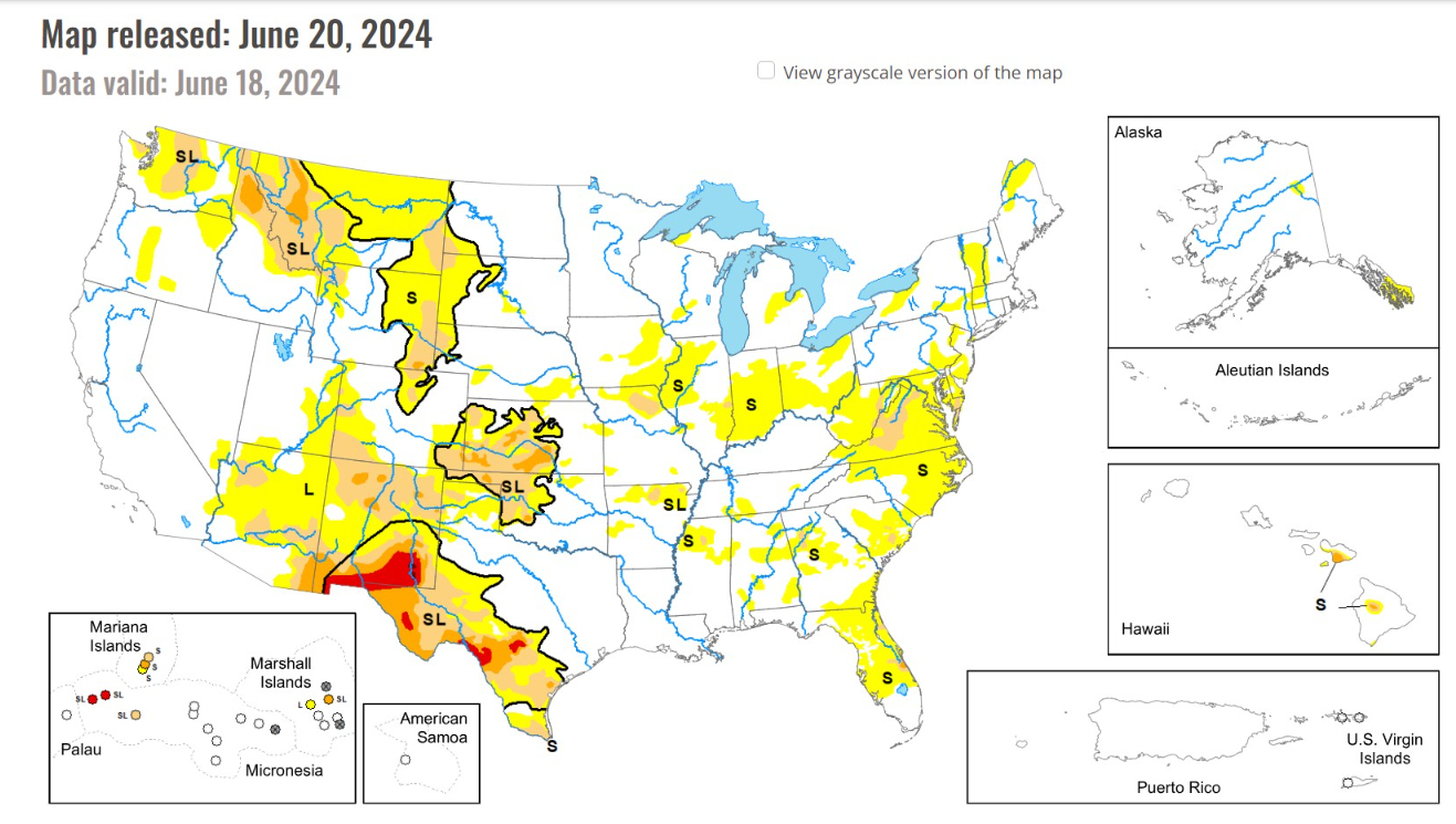
Significant rainfall problems over the next 10-days with the heat dome over the Southeast and Mid-Atlantic.
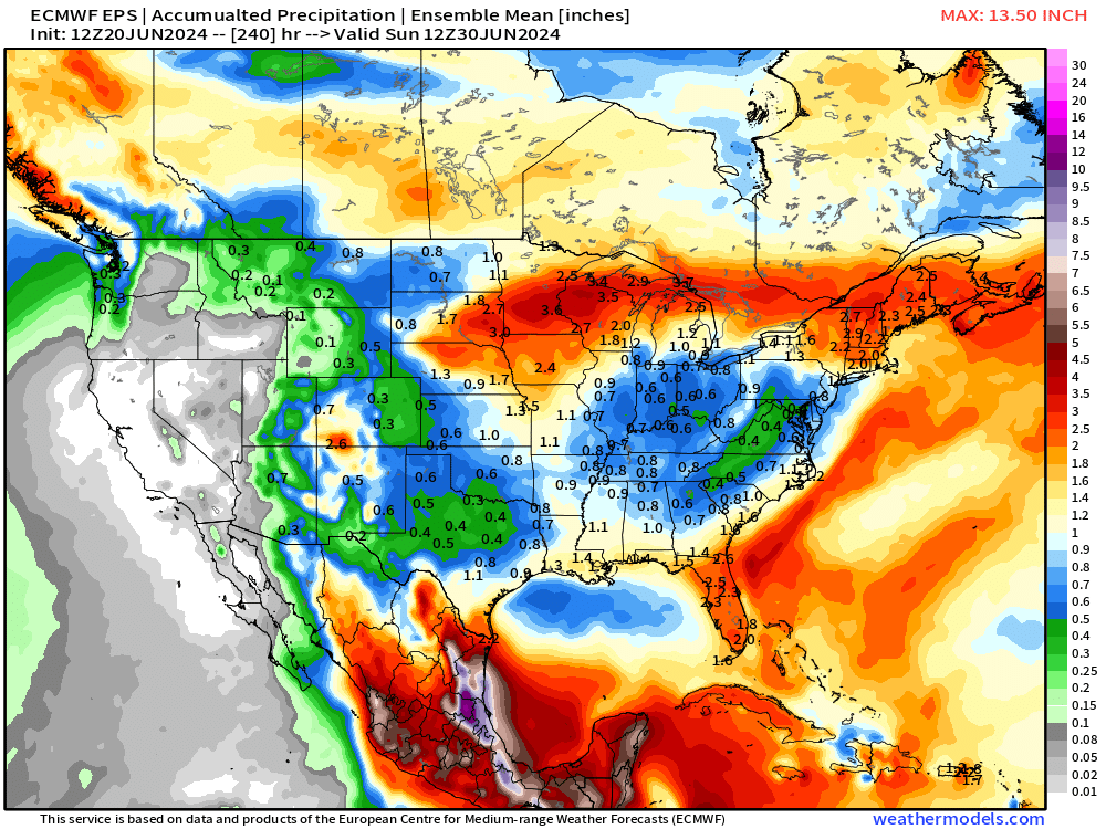
Actual precipitation from EPS mean is < 1-inch over a large area centered upon the Ohio Valley including Nashville, Atlanta, and Washington D.C.
More rain around the heat dome as a “ring of fire” scenario could build with MCS developing
Weekly Temperature Anomaly
EPS Week 1: June 20-26, 2024
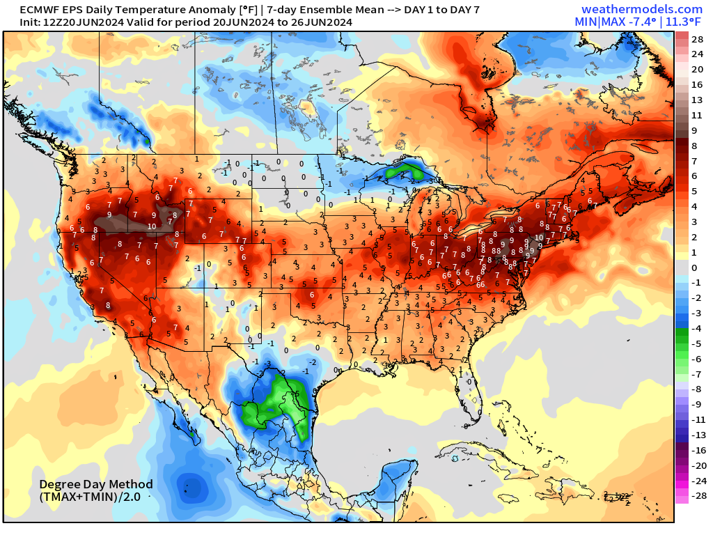
Heat wave conditions continue across the Ohio Valley and Mid-Atlantic for the next week. Cooler/wet shows up in northern Mexico with clouds/rain from Alberto.
EPS Week 2: June 27 - July 3, 2024
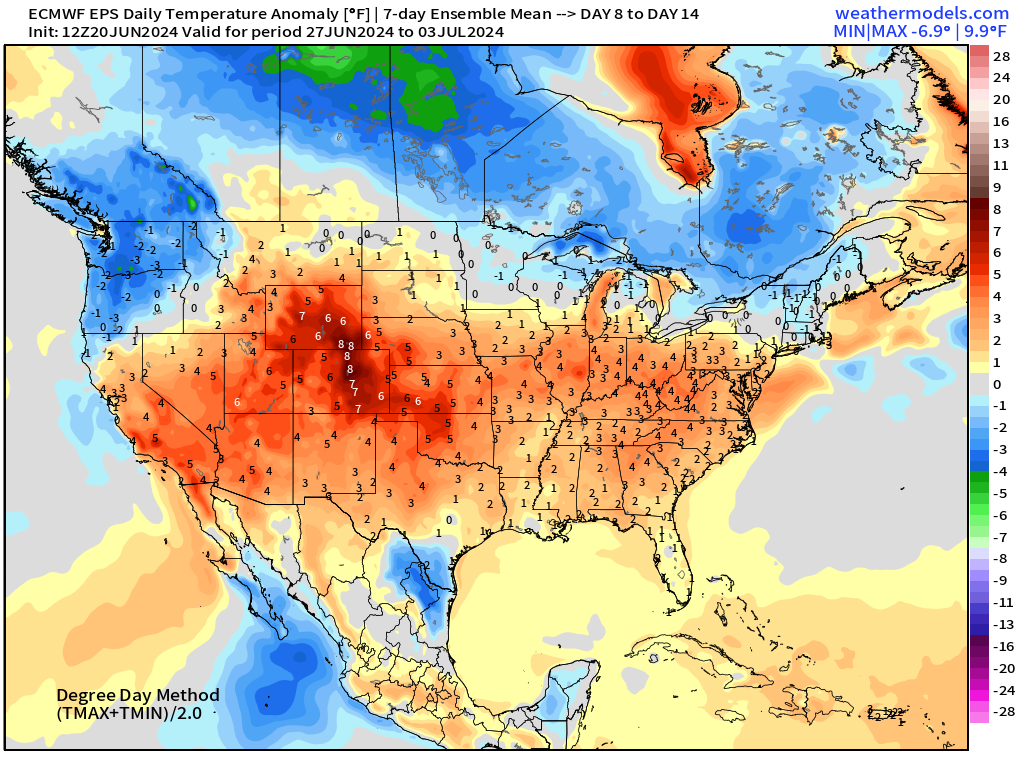
Week 2 heat backs off in the Great Lakes and Northeast. The most anomalous compared to normal is centered upon Denver into early July.
Thank you to Subscribers and Supporters!
Maps sourced from weathermodels.com designed and innovated by yours truly! I actually create all of my content from scratch.
- Milepost
- 318 · laid 2024-06-20T23:31:23.585000Z
- Source
- https://weather.substack.com/p/june-20-2024-heat-wave-continues
- Digest
- c1c9e181c5a1fbd997bf8fa52bc1d2932da56d5794f3071154f7a6f5f2dcea00
- Machine
- JSON