June 13, 2024 Northeast Heat Dome
Temperatures well into the 90s and 100s from Great Lakes to Mid-Atlantic
June 2024 was the 2nd-warmest June in the 132-year national record (1895–2026), at 71.8°F against a 1991–2020 normal of 69.5°F (+2.3°F).
June 2024 was the 41st-driest June in the 132-year national record (1895–2026), at 2.8in against a 1991–2020 normal of 3.1in (-0.3in).
NOAA/NCEI Climate at a Glance, contiguous United States. This is the observed record for the month, not a score of anything said in this piece — the forecast ledger begins 2026-08-17 and cannot reach earlier posts.

Please see Tropical Update (June 13th) for details about 90L and next system to watch in the southern Gulf of Mexico.
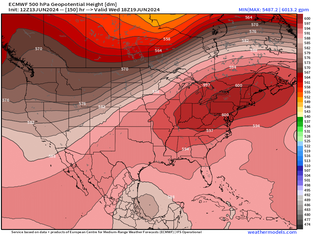
An intense ridge of high pressure or “heat dome” will intensify and settle over the Northeast U.S. with 500 hPa heights > 6000 m centered upon Pennsylvania on Wednesday.
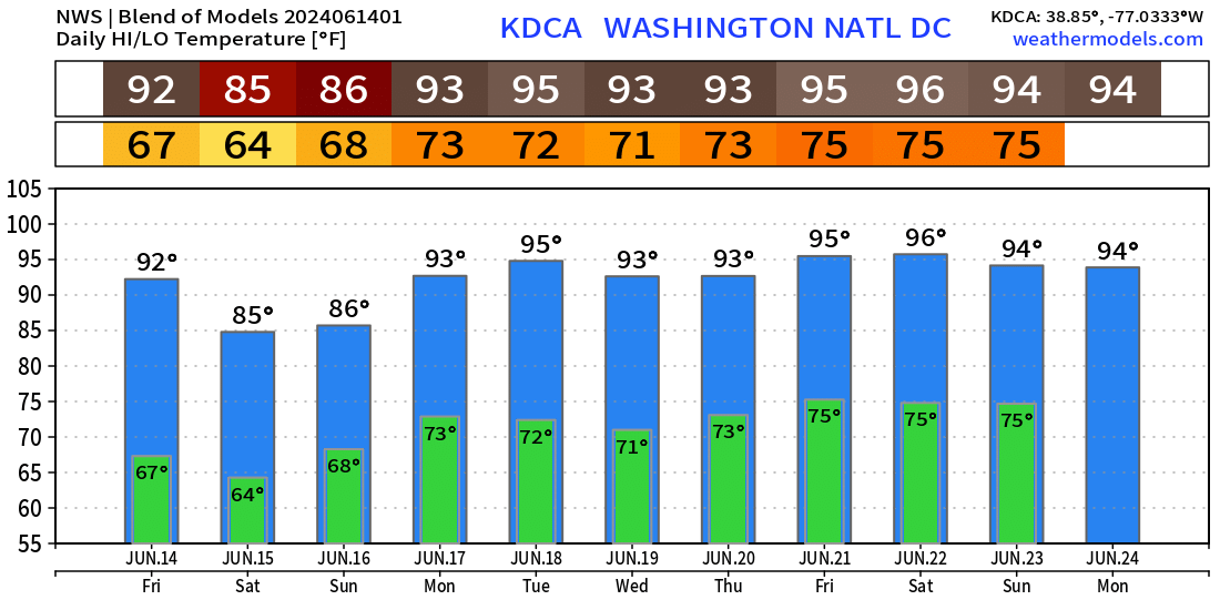
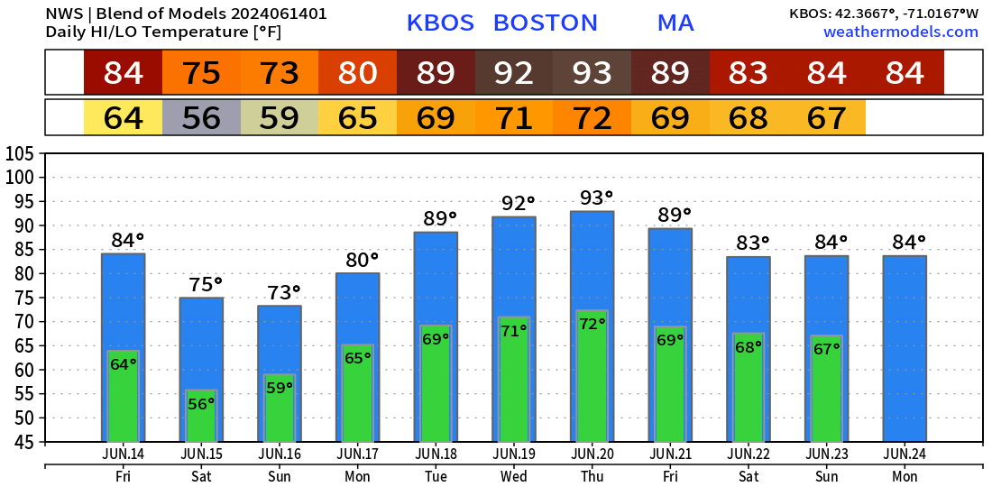
Sinking air and clear skies will allow temperatures to soar into the 90s and possibly 100s from Chicago to Maine from Sunday to Wednesday of next week.
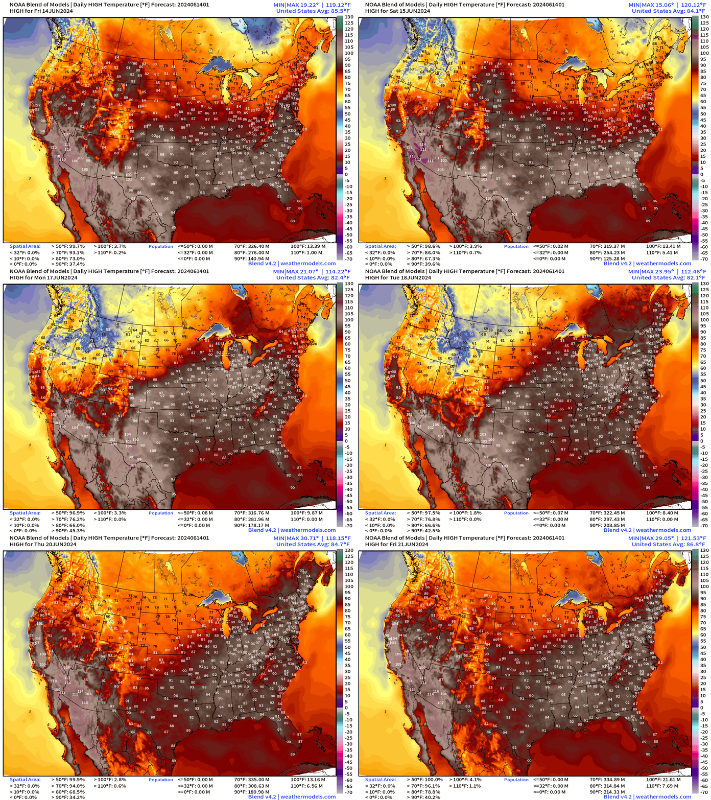
Heat Wave Cities
Detroit
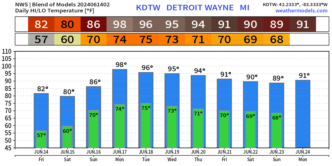
Washington D.C.
Boston
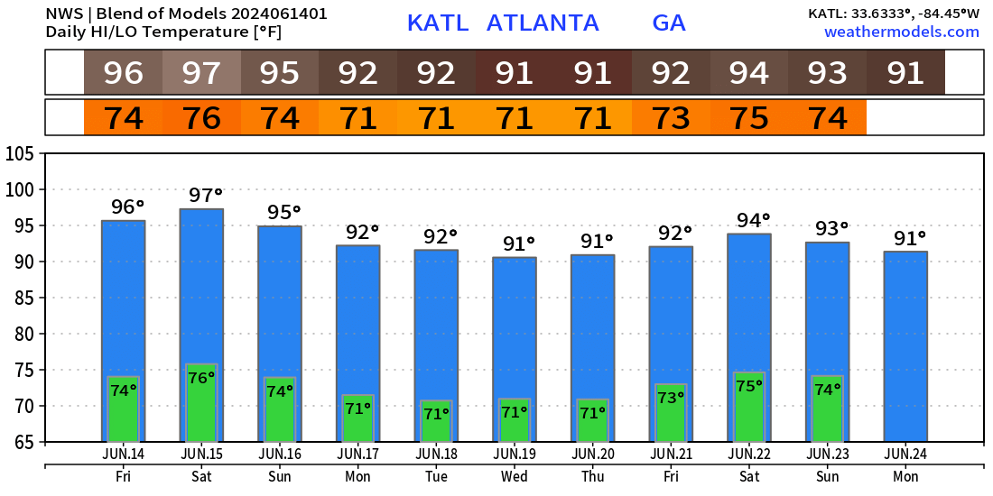
Atlanta
Next 10-days Upper-Level Weather Pattern | ECMWF AIFS
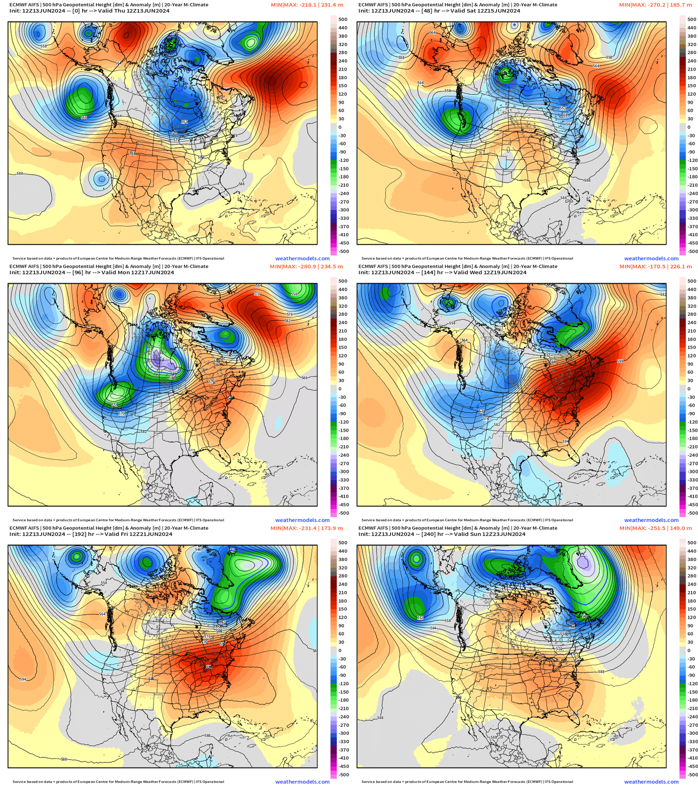
The ridge builds across the mid-Atlantic and Northeast in response to troughing out west with the Pacific NW cooling down significantly.
By next weekend, the ridge flattens and weakens somewhat meaning the end to the extreme heat.
NWS WPC 7-Day Precipitation Forecast | Watering Needs
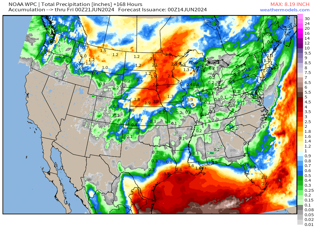
The Gulf Coast will be the focus of the heaviest rainfall with the entire basin from Texas to Florida seeing significant rainfall. Beneficial rains on the periphery or west side of the “heat dome” in Nebraska, Iowa, and Minnesota.
Bone dry elsewhere in the southeast including Atlanta and the Carolinas as temperatures soar into the 90s.
Friday High Temperatures & Weather
Lower 48 Average: 85.1°F | 140 Million at/above 90°F
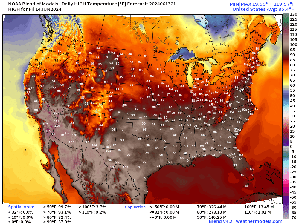
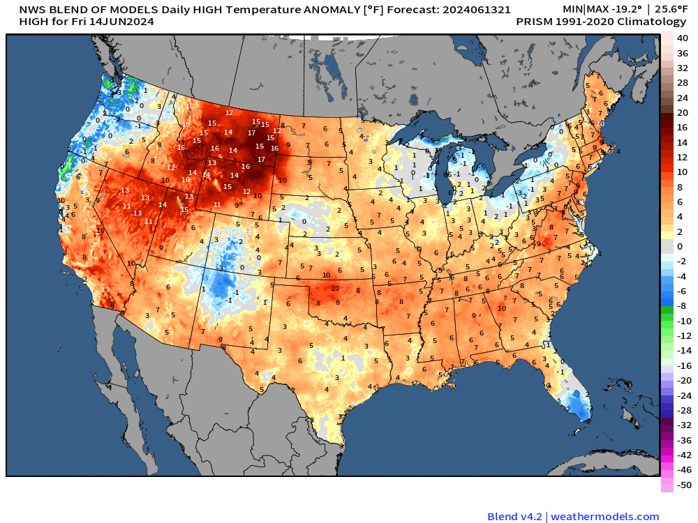
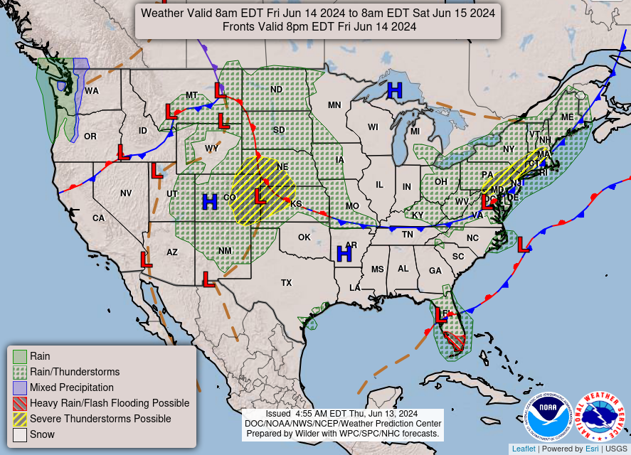
Still raining in Florida on Friday!
Next 8-Days Weather Systems | ECMWF HRES
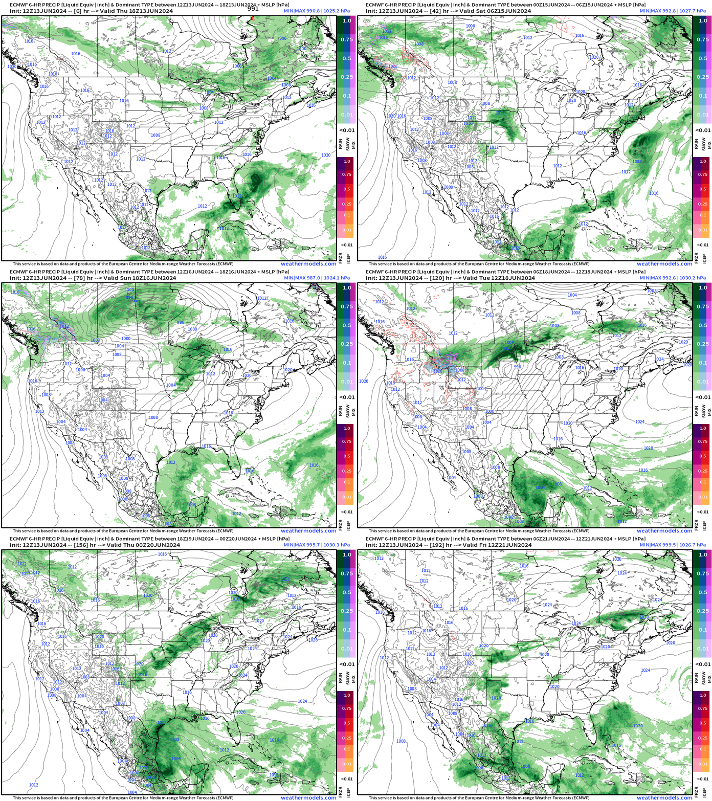
The next tropical system to potentially become Alberto — assuming we can entirely write off Invest 90L tomorrow — is in the southern Gulf of Mexico as part of the Central American gyre.
15-Day Precipitation and Anomaly (%)
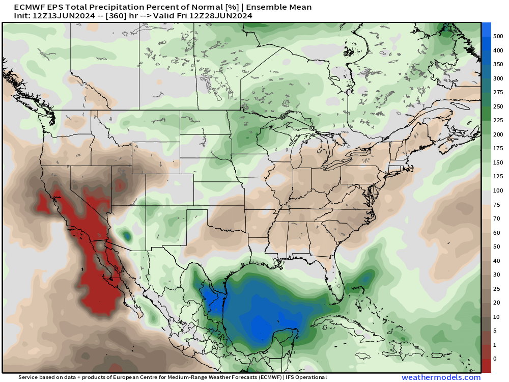
The Gulf of Mexico with much above average precipitation as tropical moisture streams in from the Caribbean tropics. Overall, dry across the eastern U.S. and of course no significant precipitation out west.
Weekly Temperature Anomaly
EPS Week 1: June 13-19, 2024
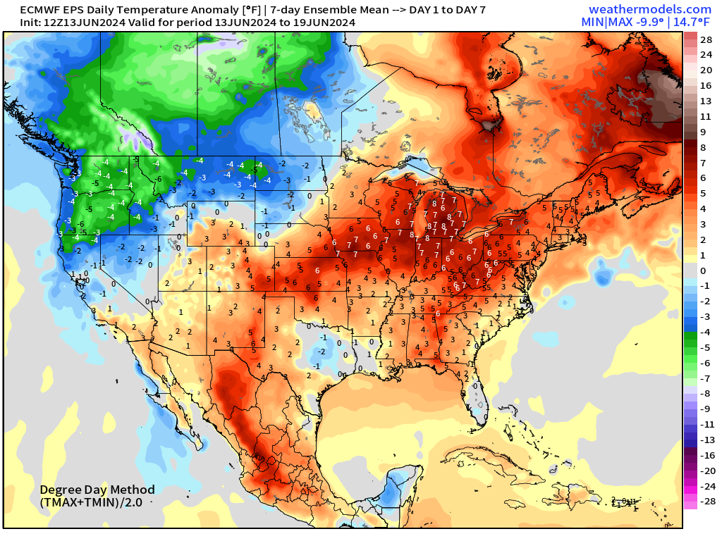
EPS Week 2: June 20-26, 2024
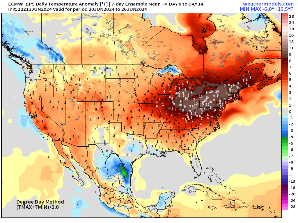
Week 2 anomaly of +10F centered upon the eastern Great Lakes!
Thank you to Subscribers and Supporters!
Maps sourced from weathermodels.com designed and innovated by yours truly! I actually create all of my content from scratch.
- Milepost
- 310 · laid 2024-06-14T03:20:09.971000Z
- Source
- https://weather.substack.com/p/june-13-2024-northeast-heat-dome
- Digest
- eb4eb3b5d1e559dfbe9f86fbe052dd67c4beb9c113768c1f637ee2b939fe2007
- Machine
- JSON