June 11, 2024 Tropical Update: Invest 90L in Gulf of Mexico
NHC watching system that could become Alberto
June 2024 was the 2nd-warmest June in the 132-year national record (1895–2026), at 71.8°F against a 1991–2020 normal of 69.5°F (+2.3°F).
June 2024 was the 41st-driest June in the 132-year national record (1895–2026), at 2.8in against a 1991–2020 normal of 3.1in (-0.3in).
NOAA/NCEI Climate at a Glance, contiguous United States. This is the observed record for the month, not a score of anything said in this piece — the forecast ledger begins 2026-08-17 and cannot reach earlier posts.

The investment in my research and development will pay off as A.I. enabled weather forecasts become a normal and indispensable part of our weather forecasting enterprise.
Area off SE USA coast could see a hybrid or tropical storm development by this weekend —> Alberto with NHC at 20% chance
Vorticity in the Eastern Pacific south of Mexico could make landfall and enter southern Gulf of Mexico in 7-8 days
Enormous rainfall totals for Florida and then Texas by Day 10
Invest 90L Designated
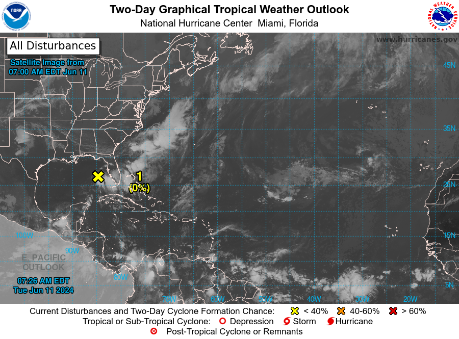
A trough of low pressure over the eastern Gulf of Mexico is producing a large area of disorganized showers and thunderstorms.

This system is expected to move northeastward across Florida during the next day or so and offshore of the U.S. Southeast coast later this week.

Environmental conditions are expected to be generally unfavorable, although some slow development is possible when the system is offshore of the U.S. Southeast coast.  Regardless of development, heavy rainfall is expected across portions of Florida during the next few days.

* Formation chance through 48 hours...low...near 0 percent.
* Formation chance through 7 days...low...20 percent.
The chance at development is 20% in the next 7-days as the environmental conditions e.g. wind shear and cooler ocean temperatures away from the Gulf Stream.
However, models have indicated vorticity and convection necessary for a tropical designation or perhaps a hybrid system. The window for development is rather large but until we see a surface low, Invest 90L will not become Alberto.
Integrated Vapor Transport
The atmospheric river diagnostic called Integrated Vapor Transport (IVT) works nicely in the tropics to highlight the convergence of deep tropical moisture into plumes across the Gulf of Mexico into Florida.
Next 10-days from ECMWF of IVT:
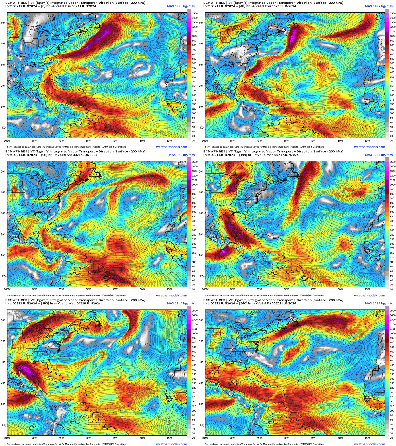
Watching the development of 2 tropical systems — could be 3 depending upon the survival of the vorticity across Mexico from the Gulf of Tehuantepec to the Bay of Campeche.
Off the FL/SE USA coast with intensification as it heads NE into the Atlantic before reaching Newfoundland in 7-8 days.
Caribbean gyre may spin up a tropical system in the Eastern Pacific and then bring into the southern Gulf of Mexico.
There is significant uncertainty in this scenario as the forecasting of tropical convection and tropical storm genesis is tricky business!
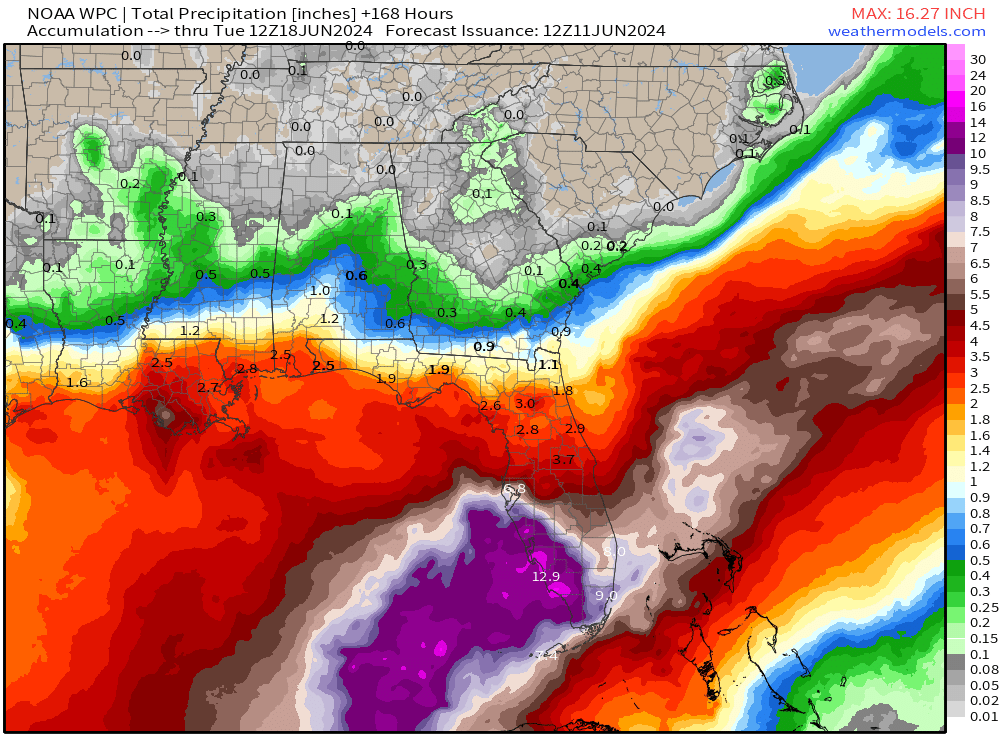
The moisture feed out the Caribbean into the Gulf of Mexico and over Florida will lead to total precipitation for the next 7-days is 9-13 inches and higher across South Florida. NOAA WPC:
Atlantic Basin Tropical Weather Outlook
Synoptic Analysis
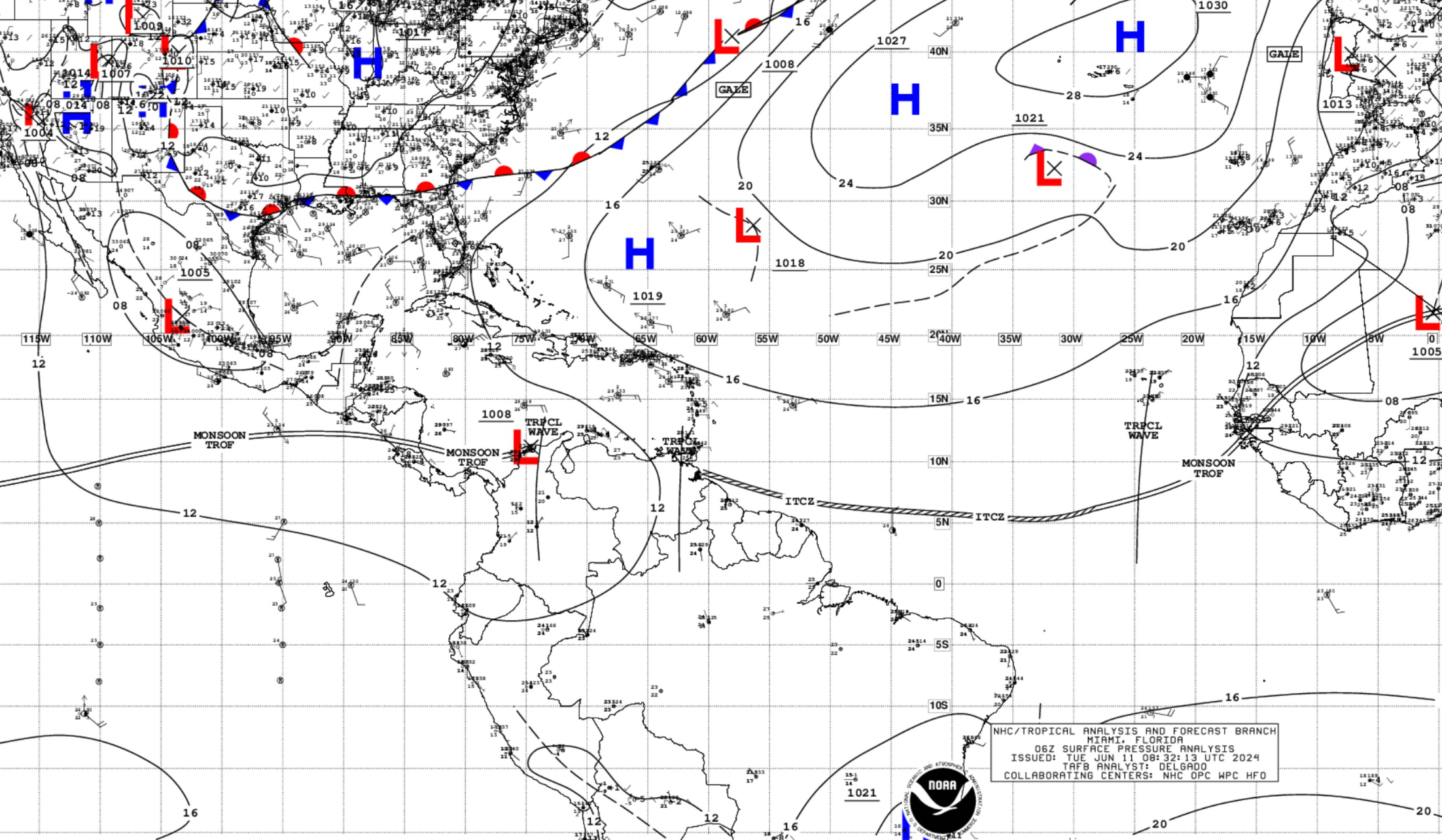
...TROPICAL WAVES...

A tropical wave in the eastern Atlantic extends from 02N to 17N
with axis near 24W, moving westward at 5-10 kt. There is no
convection associated with this wave.

A tropical wave is moving across the E Caribbean S of 13N with
axis near 62W, moving westward at 10-15 kt. Scattered showers and
isolated thunderstorms are ongoing over the SE Caribbean S of 16N
between the Lesser Antilles and 68W.

A tropical wave is in the south-central Caribbean Sea along 74W,
south of 14N, and moving westward at 10-15 kt. Numerous moderate
to strong convection is S of 13N between 73W and 79W.
Basin Wide GeoColor Satellite Imagery
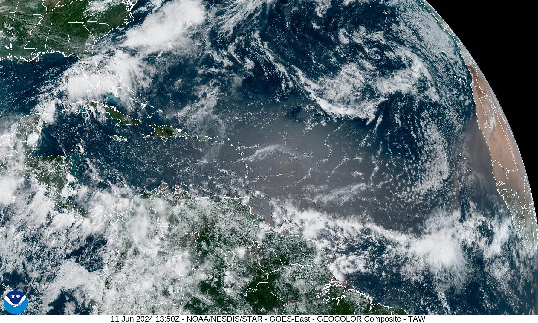
Note the sand/dust in the tropical Atlantic with another SAL coming off Africa — reference NASA GEOS5 dust extinction.
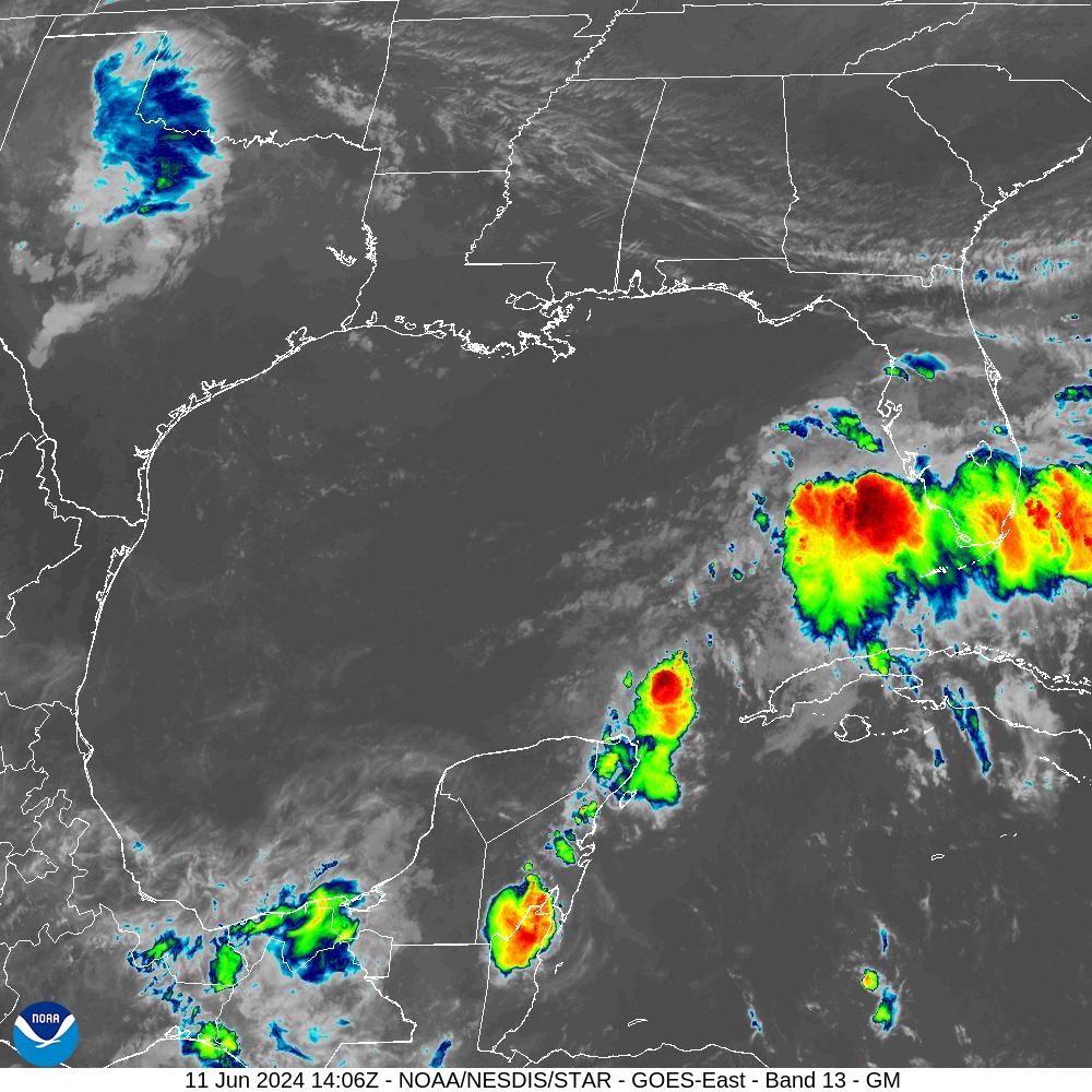
Gulf of Mexico — Finally some convection!
Saharan Dust Layer
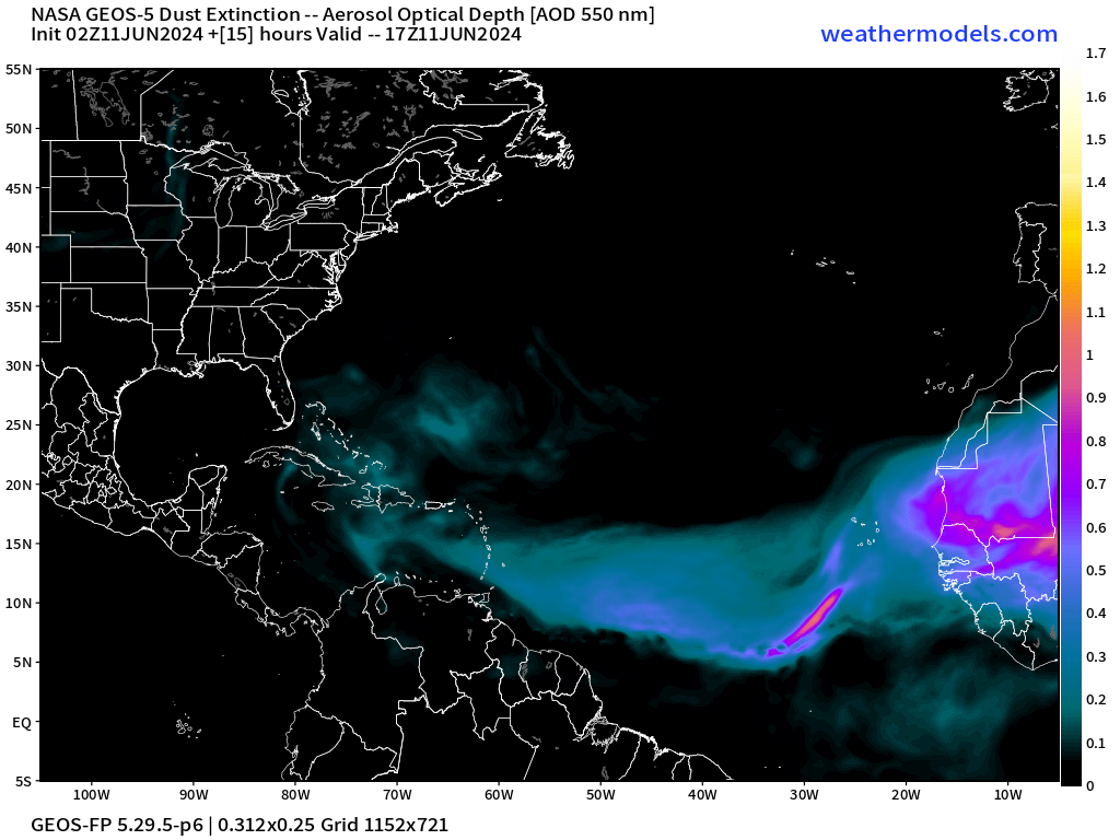
A plume of dust has emerged off Africa into the Main Development Region suppressing convection and putting a lid on any further tropical storm development — typical for mid-June. Another SAL on the way … more intense.
Precipitation Anomaly Next 10-days [inches]
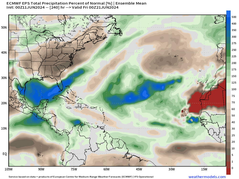
The Gulf of Mexico is the focus of exceptional rainfall over the next 10-days associated with tropical moisture feed (atmospheric river). Also, the Pacific gets into the action with heavy rain affecting Mexico and Central America — desperately needed for drought relief.
[Convection or heavy rain and storms occur in paths or tracks with or w/o organized tropical cyclones. Where it rains is the obvious footprint or evidence of where ascent, instability, and potential for development could/might occur in a 10-day period from a weather model. This is an easy way to eyeball where/if TCs will occur.]
Next 12-Days | Atlantic EPS Cyclone Tracks
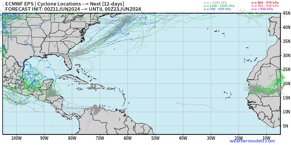
Many ensemble members [majority] now show the development of a tropical system in the Caribbean gyre in the 10 day time frame — on the Eastern Pacific or Bay of Campeche.
Potential Alberto is off the U.S. Southeast coast — Invest 90L
Eastern Pacific Tropical Weather Outlook
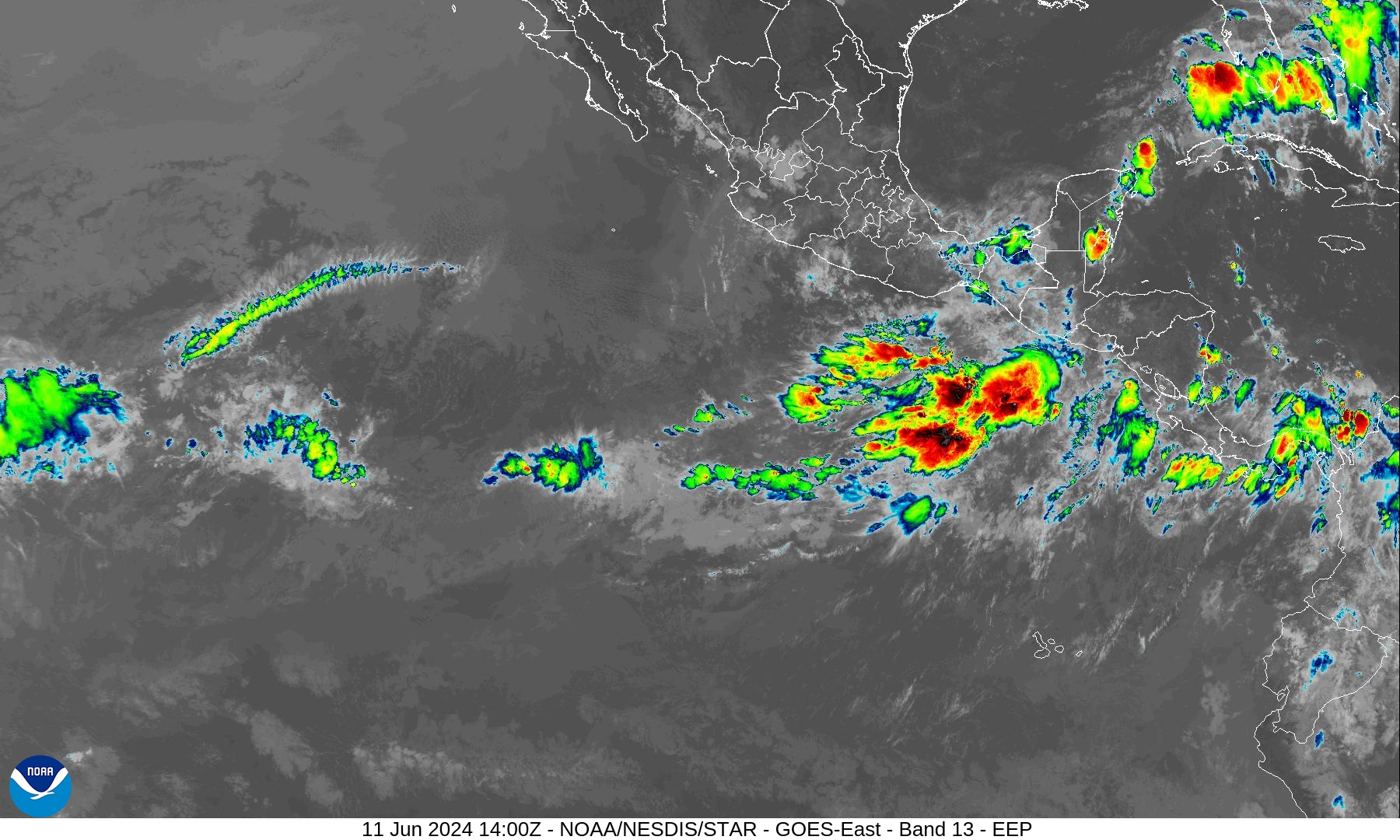
New note: Potential close-to-land development in the Gulf of Tehuantepec by next weekend according to ECMWF IFS.
NHC does not have any areas of interest in the Tropical Weather Outlook through 48-hours and 7-days — June 17.
June can be quiet busy in the Eastern Pacific as the Caribbean gyre spawns vorticity + tropical waves reach the very warm waters west of Central America.
ECMWF HRES 10-Day Storm Tracks
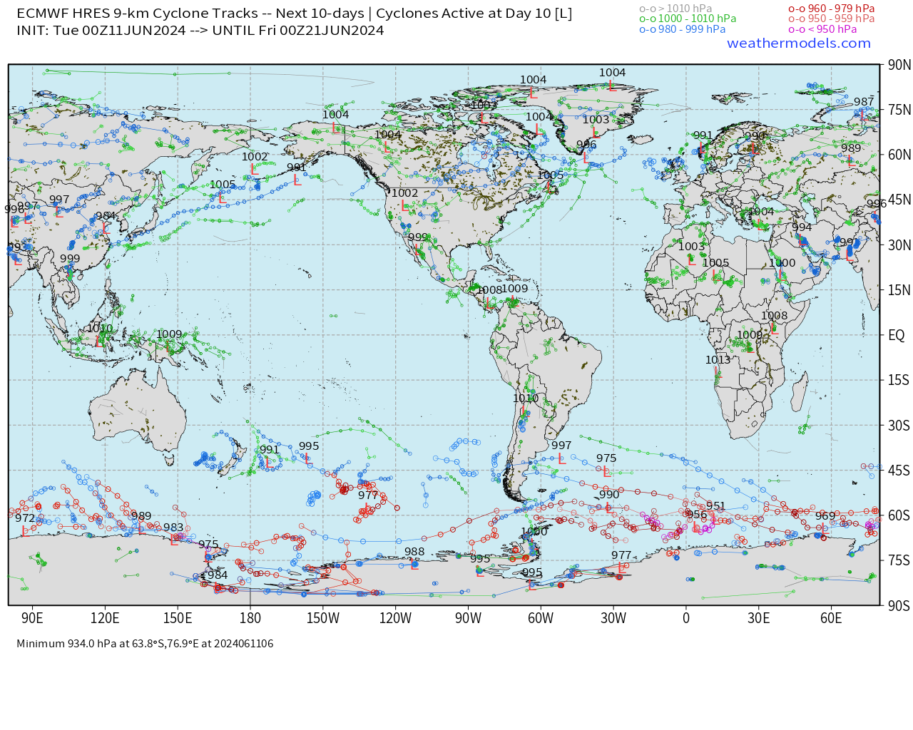
Watching Central America including the EPAC/Gulf of Mexico for close-to-land developments in the Caribbean Gyre.
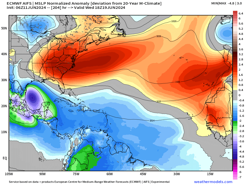
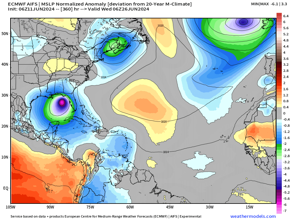
ECMWF AIFS 15-Day Storm Tracks
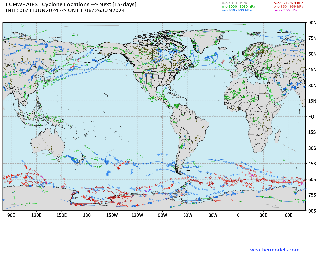
U.S. East coast potential storm candidate —> Alberto
Gulf of Mexico? 2 systems — Day 9 and Day 15
Western Pacific Tropical Weather Outlook
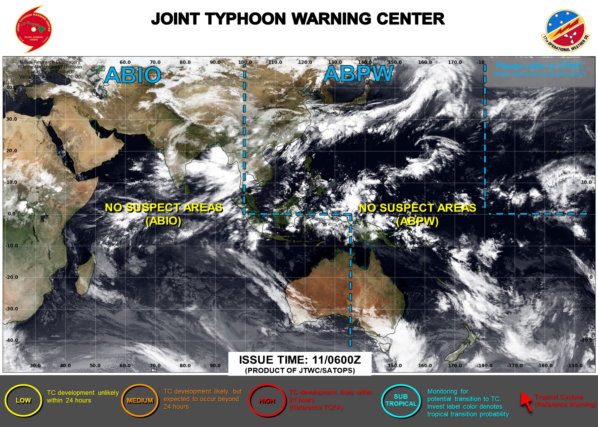
Ghost town — No Suspect Areas areas of interest during the next 48-hours to 7-days from JTWC.
ECMWF EPS ensembles not even showing a hint of TC genesis for next 10-days.
Thank you to Subscribers and Supporters! Welcome to June 2024 and Atlantic Hurricane Season.
Maps sourced from weathermodels.com designed and innovated by yours truly! I actually create all of my content from scratch.
- Milepost
- 307 · laid 2024-06-11T14:25:28.217000Z
- Source
- https://weather.substack.com/p/june-11-2024-tropical-update-invest
- Digest
- 7340d1356f8eaf5fe20f1e55b64603f7188acecfdbb2ec1bf229f6436c29a4a3
- Machine
- JSON